12th May 2018 - Hard Tarn to Helvellyn
Walk Details
Distance walked: 10.3 miles
Total ascent: 3589 ft
OS map used: OL5 - The English Lakes, Northeastern area
Time taken: 6.5 hrs
Route description: Patterdale-Grisedale Bridge-Grisedale-Ruthwaite Lodge-Ruthwaite Cove-Hard Tarn-Nethermost Pike-Helvellyn-Swirral Edge-Catstycam-Red Tarn-Birkhouse Moor-Hole in the Wall-Grisedale-Grisedale Bridge-Patterdale
I'd been thinking about doing this walk in the Lakes for the past few weeks and I was just waiting for the right day for it. Although the bank holiday was fine, I thought that it was too warm for the amount of ascent that was involved. Today was perfect, lots of sunshine, a cooling breeze and great visibility for taking in the views. The Wainwrights of Nethermost Pike, Catstycam and Birkhouse Moor counted towards my second round but the highlight of the day was visiting Hard Tarn in Ruthwaite Cove and Nethermost Pike's east ridge. It was a way up onto the Helvellyn range that I'd never tried before and would thoroughly recommend it. It is pathless though, so you have to comfortable with getting off the beaten trail.
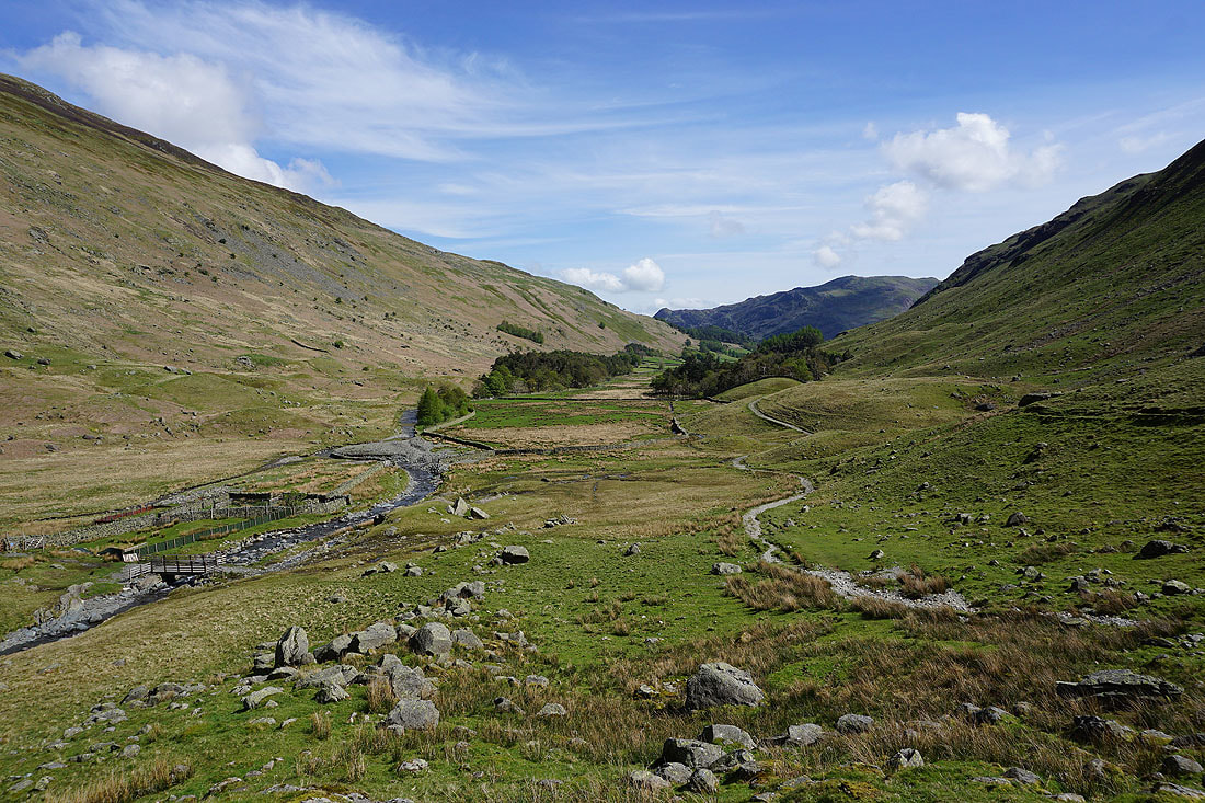
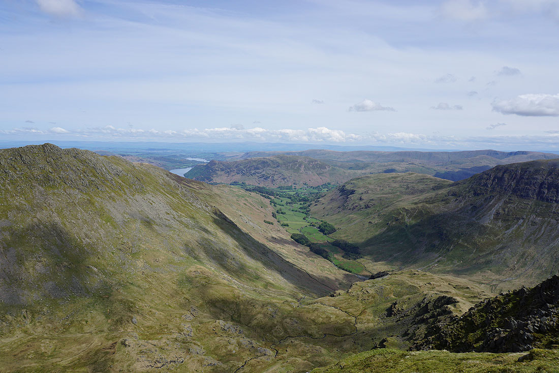
From the car park in Patterdale I followed the main road north towards Glenridding before leaving it at Grisedale Bridge for the road up into Grisedale. At its end I carried on along the bridleway on the south side of the valley to eventually reach the climbing hut of Ruthwaite Lodge. This is where my route became pathless. I followed the beck that runs down by Ruthwaite Lodge up into Ruthwaite Cove and where it branched I took the right hand one up into the northern part of the cove, where Hard Tarn is located. The shelf that it's sat on is given away by a curtain of grey rock. After having my lunch by the tarn I made my way east across the fellside to get onto Nethermost Pike's east ridge, which I then climbed up to reach the summit of Nethermost Pike. Next stop was Helvellyn to the north and after descending Swirral Edge I made my way to the top of Catstycam. I then made my way down to Red Tarn and across to Birkhouse Moor to bag that before retracing my steps to the Hole-in-the-Wall. The path from here took me down into Grisedale and the roads back to Patterdale.
Total ascent: 3589 ft
OS map used: OL5 - The English Lakes, Northeastern area
Time taken: 6.5 hrs
Route description: Patterdale-Grisedale Bridge-Grisedale-Ruthwaite Lodge-Ruthwaite Cove-Hard Tarn-Nethermost Pike-Helvellyn-Swirral Edge-Catstycam-Red Tarn-Birkhouse Moor-Hole in the Wall-Grisedale-Grisedale Bridge-Patterdale
I'd been thinking about doing this walk in the Lakes for the past few weeks and I was just waiting for the right day for it. Although the bank holiday was fine, I thought that it was too warm for the amount of ascent that was involved. Today was perfect, lots of sunshine, a cooling breeze and great visibility for taking in the views. The Wainwrights of Nethermost Pike, Catstycam and Birkhouse Moor counted towards my second round but the highlight of the day was visiting Hard Tarn in Ruthwaite Cove and Nethermost Pike's east ridge. It was a way up onto the Helvellyn range that I'd never tried before and would thoroughly recommend it. It is pathless though, so you have to comfortable with getting off the beaten trail.
From the car park in Patterdale I followed the main road north towards Glenridding before leaving it at Grisedale Bridge for the road up into Grisedale. At its end I carried on along the bridleway on the south side of the valley to eventually reach the climbing hut of Ruthwaite Lodge. This is where my route became pathless. I followed the beck that runs down by Ruthwaite Lodge up into Ruthwaite Cove and where it branched I took the right hand one up into the northern part of the cove, where Hard Tarn is located. The shelf that it's sat on is given away by a curtain of grey rock. After having my lunch by the tarn I made my way east across the fellside to get onto Nethermost Pike's east ridge, which I then climbed up to reach the summit of Nethermost Pike. Next stop was Helvellyn to the north and after descending Swirral Edge I made my way to the top of Catstycam. I then made my way down to Red Tarn and across to Birkhouse Moor to bag that before retracing my steps to the Hole-in-the-Wall. The path from here took me down into Grisedale and the roads back to Patterdale.
Route map
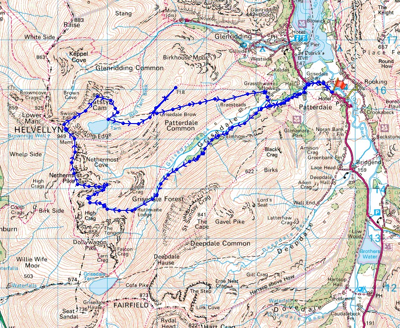
© Crown copyright. All rights reserved. License number PU 100034184.
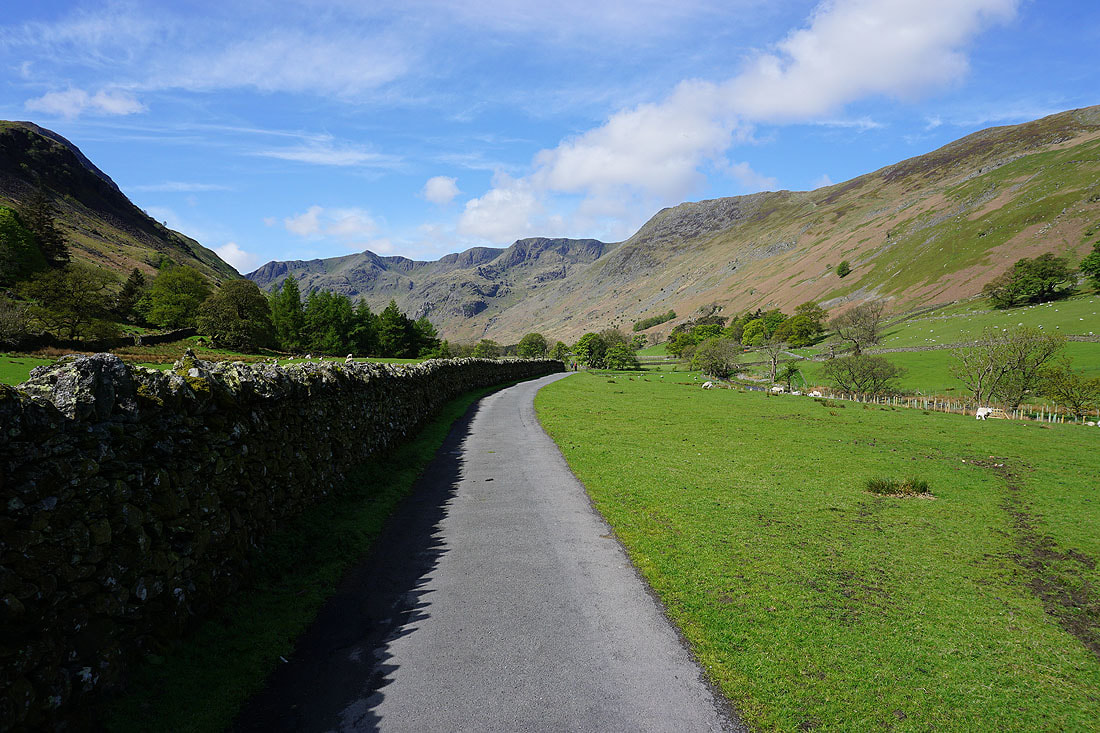
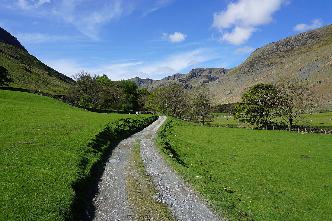
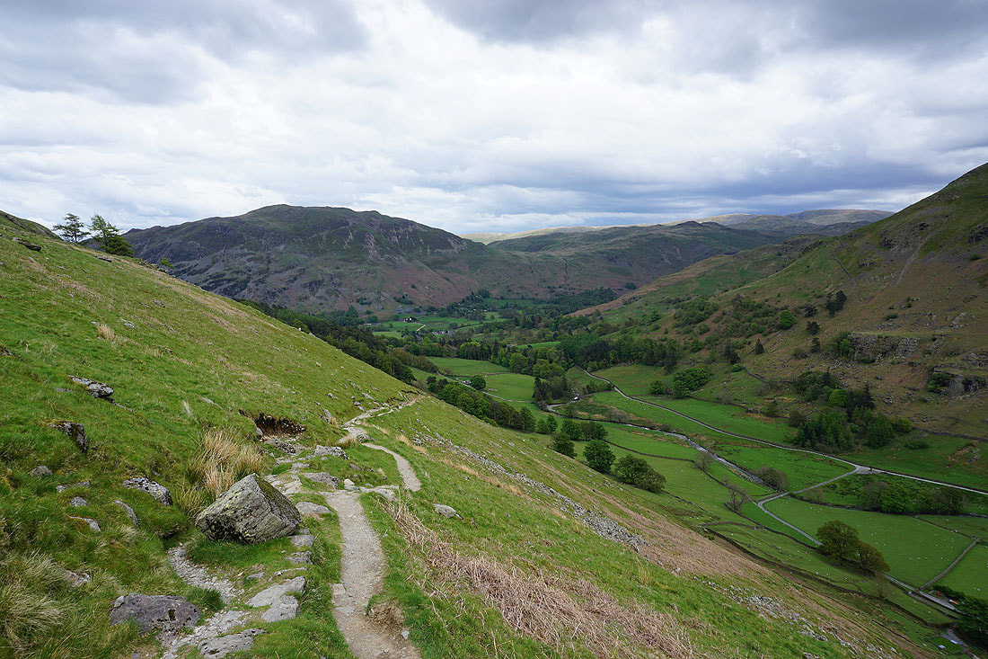
It's a glorious morning as I follow the bridleway up Grisedale from Patterdale....
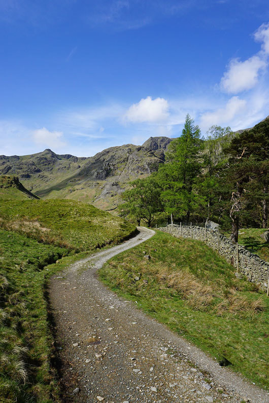
Looking back down the valley
The "peak" of Dollywagon Pike above Grisedale Beck
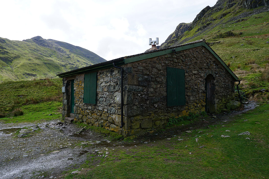
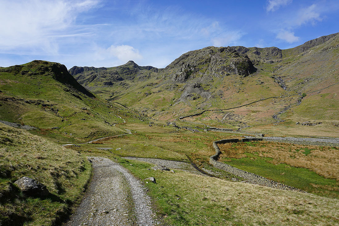
At the climbing hut of Ruthwaite Lodge. This is where I'll leave the bridleway behind and head up into Ruthwaite Cove, following the beck that runs down past the lodge.
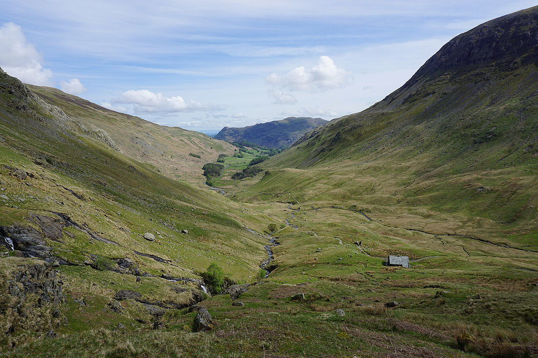
Looking down Grisedale to Place Fell..
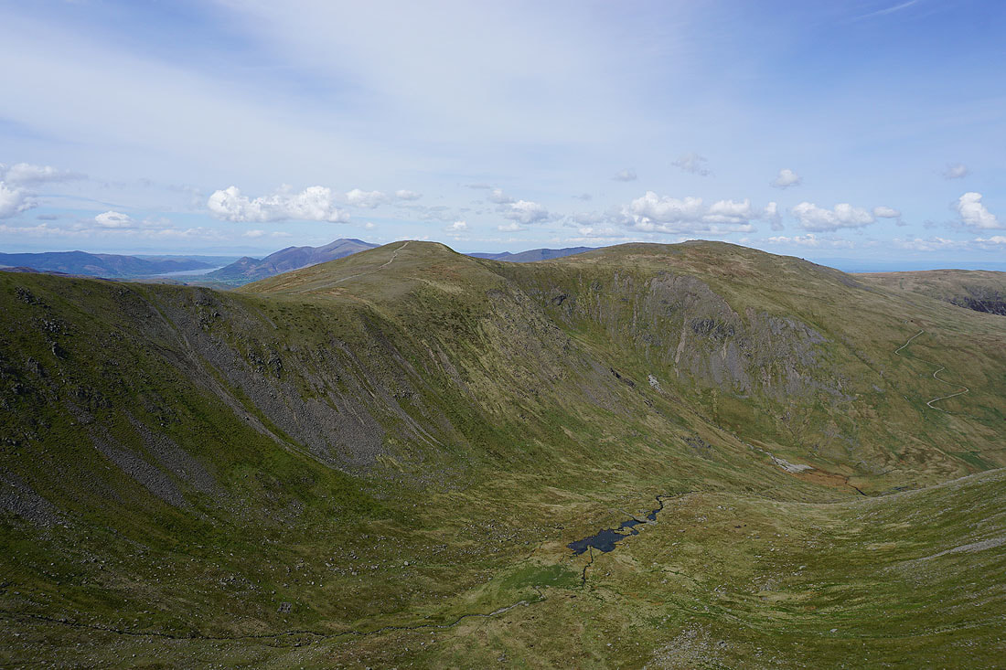
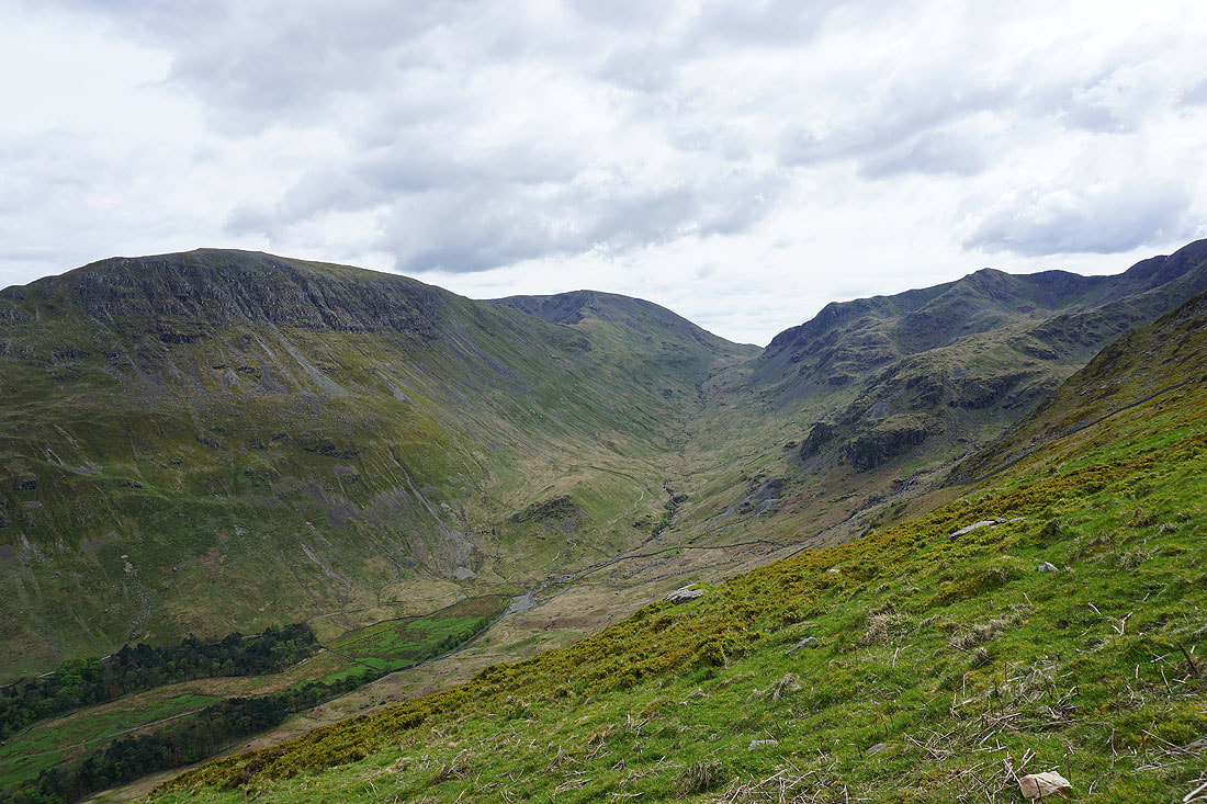
..as I reach Ruthwaite Cove. Fantastic scenery.
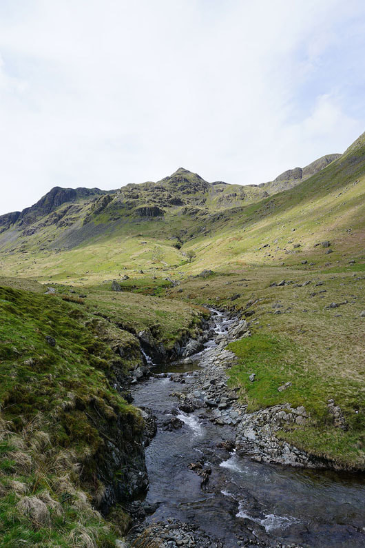
The southern branch of the beck has its source below the crags of Dollywagon Pike
St. Sunday Crag on the other side of Grisedale
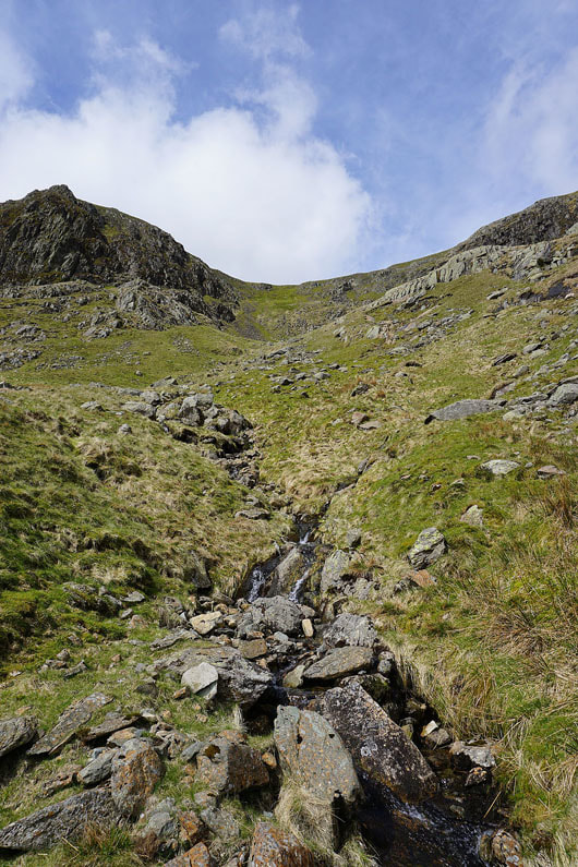
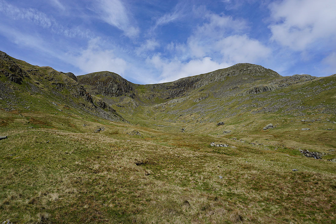
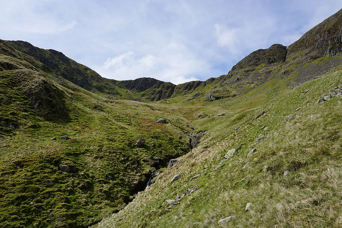
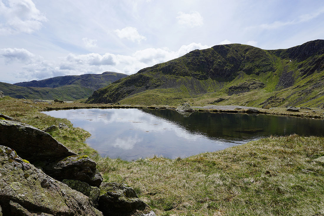
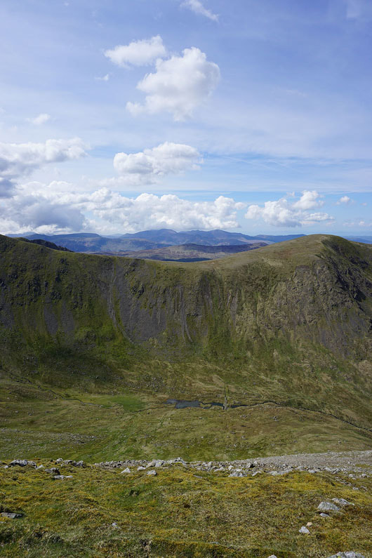
I'm following the northern branch of the beck up into the part of Ruthwaite Cove beneath Nethermost Pike
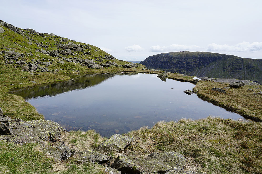
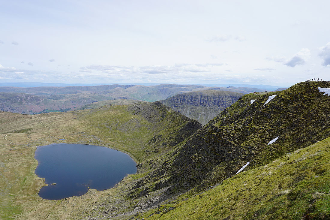
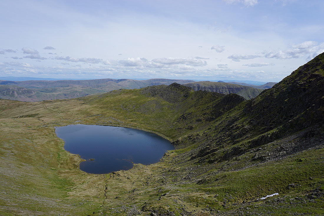
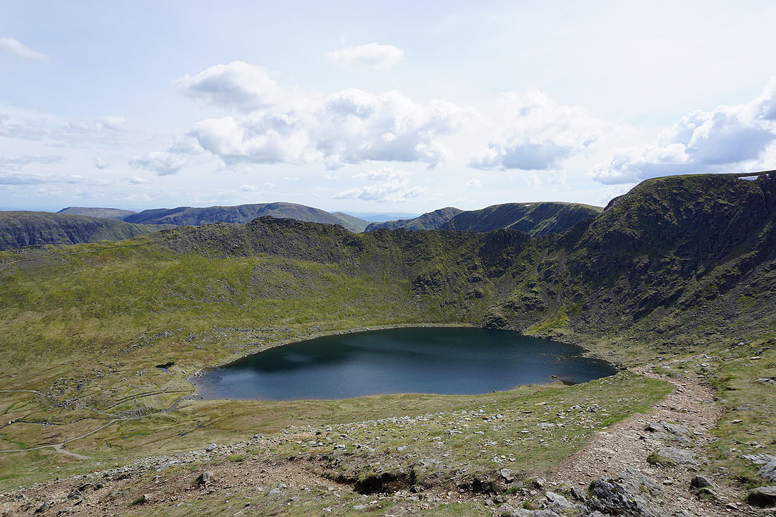
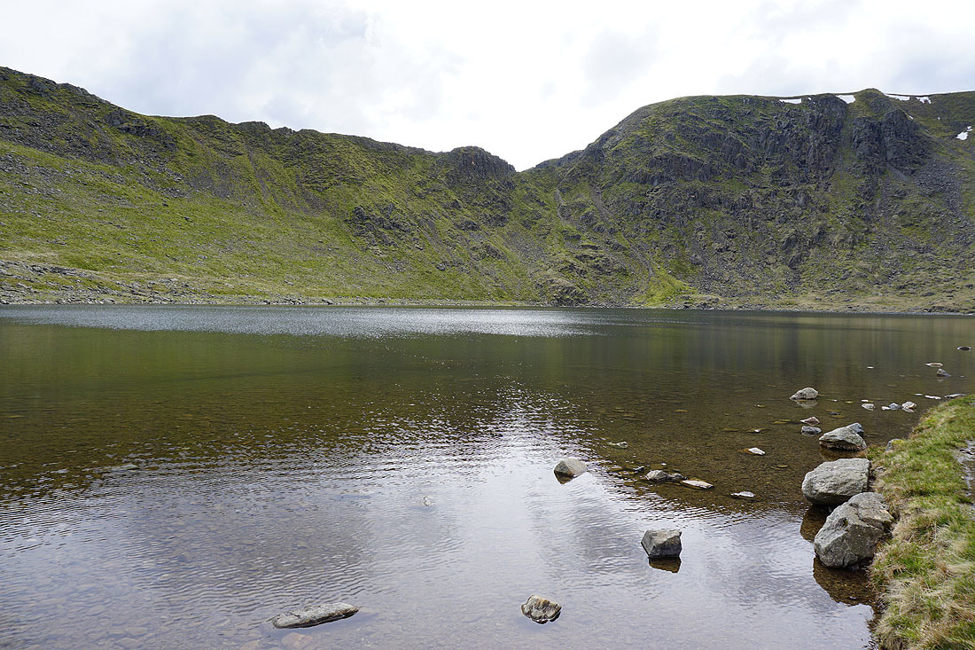
and that brought me to Hard Tarn. This shelf tarn is in a beautiful, secluded setting and surrounded by crags. So quiet too, especially compared to later when I joined the main path to Helvellyn. A good place to stop for lunch.
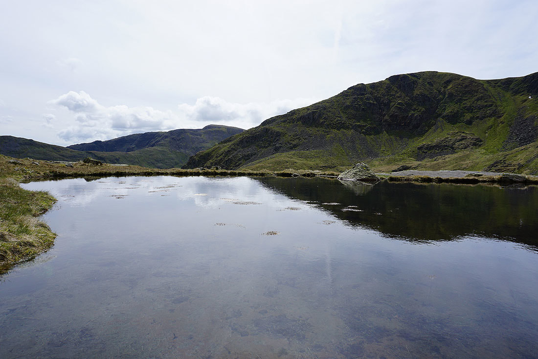
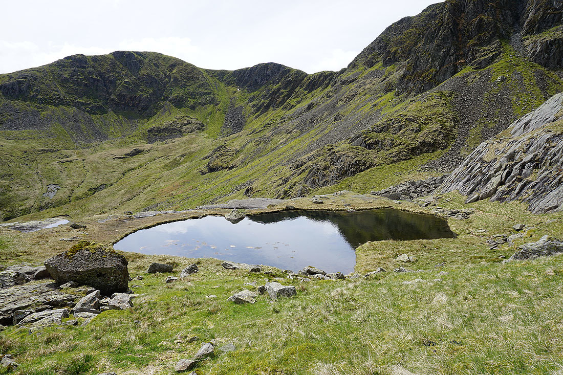
Up close to an almost mirror calm tarn
Reflected clouds and St. Sunday Crag
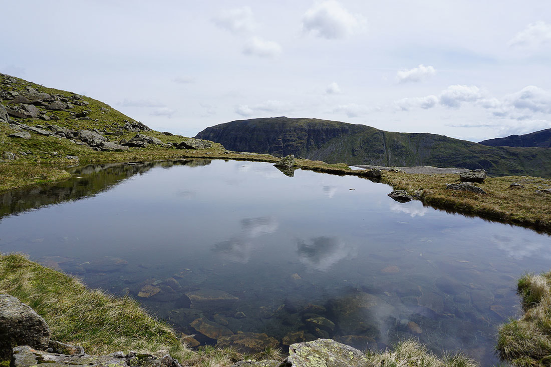
Fairfield and Dollywagon Pike
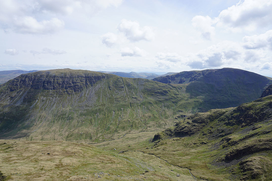
Dollywagon Pike, High Crag and Nethermost Crag
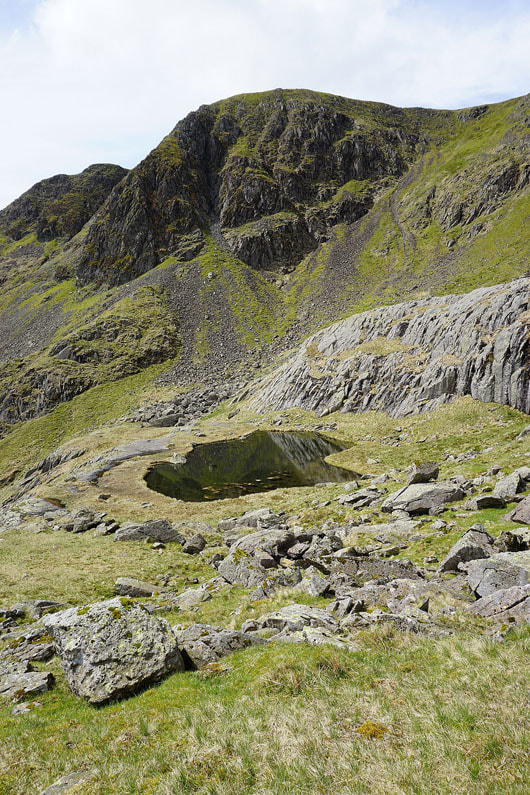
Hard Tarn below Nethermost Crag. I'm leaving the tarn behind for Nethermost Pike's east ridge.
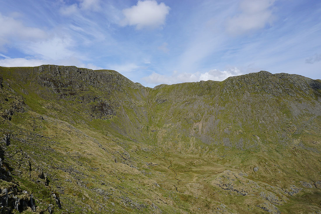
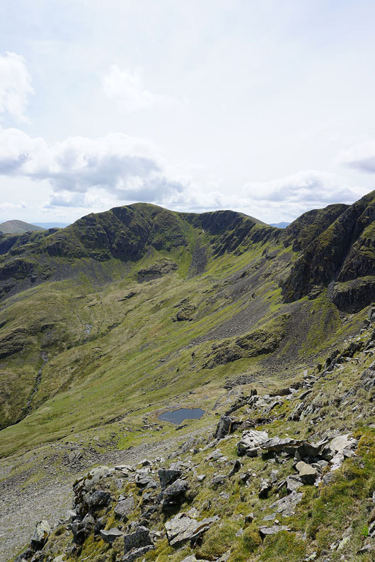
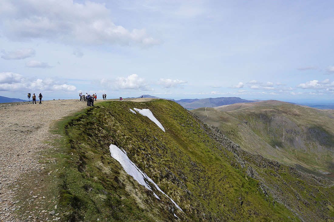
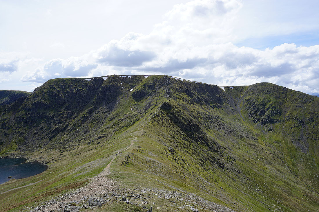
Onto Nethermost Pike's east ridge. Looking across Nethermost Cove to Helvellyn and Striding Edge.
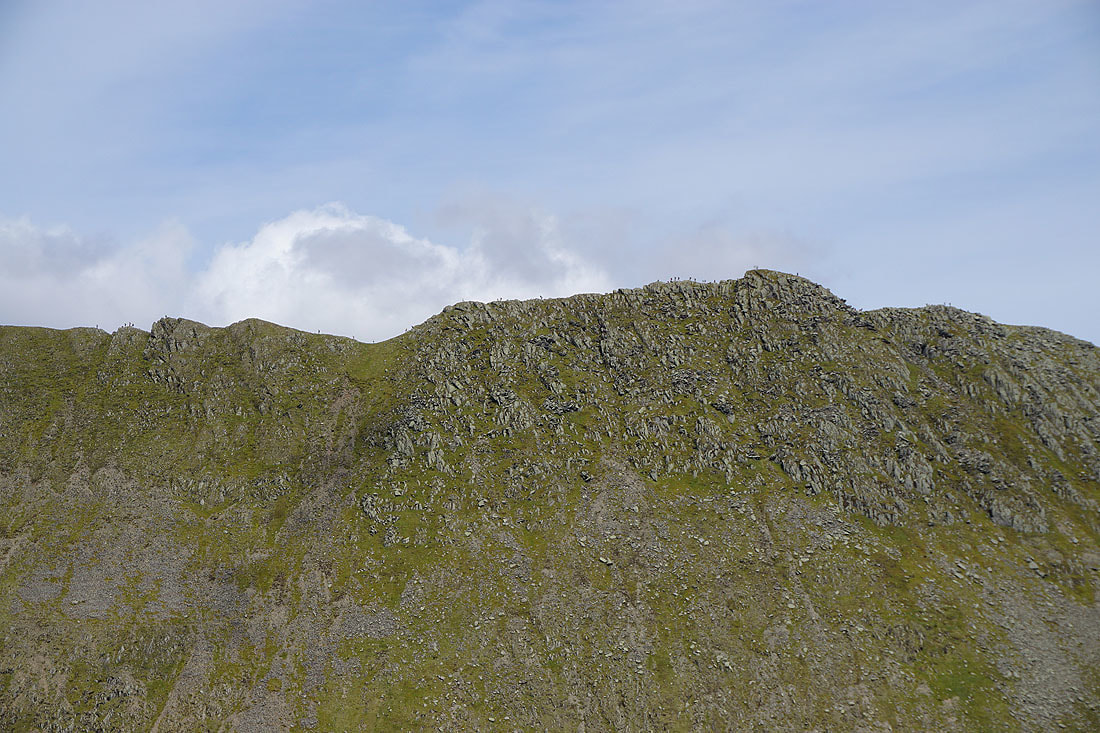
A zoom in on Striding Edge shows that it's quite popular today
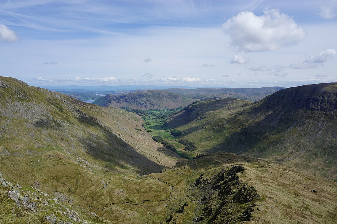
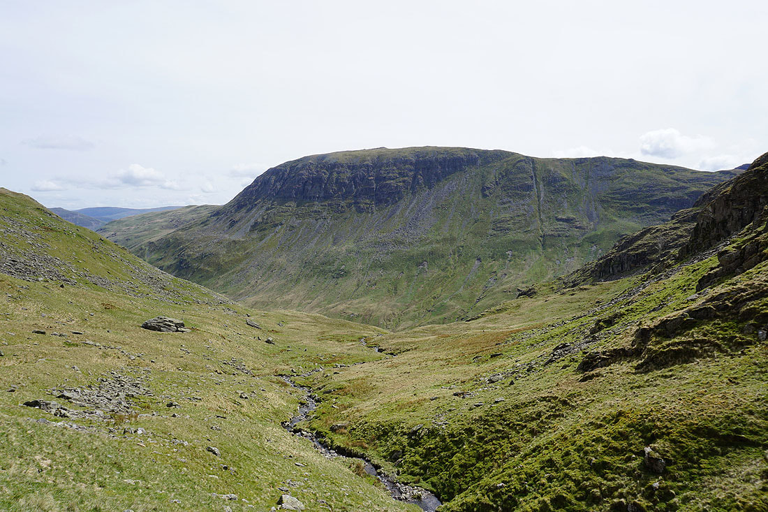
Looking down Grisedale to Place Fell
Dollywagon Pike above Hard Tarn
St. Sunday Crag and Fairfield
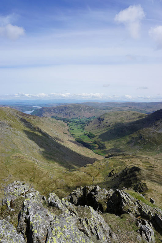
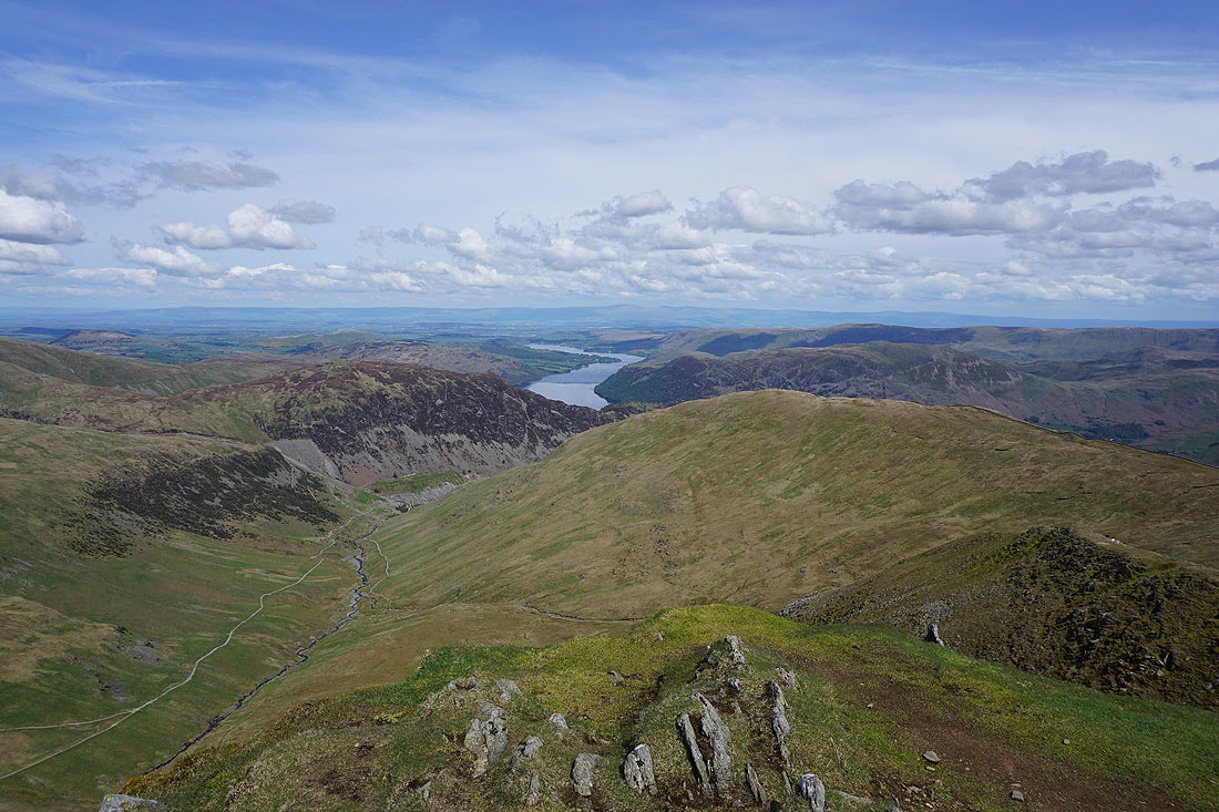
Can't resist taking in that view down Grisedale, and with great visibility today I can see all the way to the North Pennines..
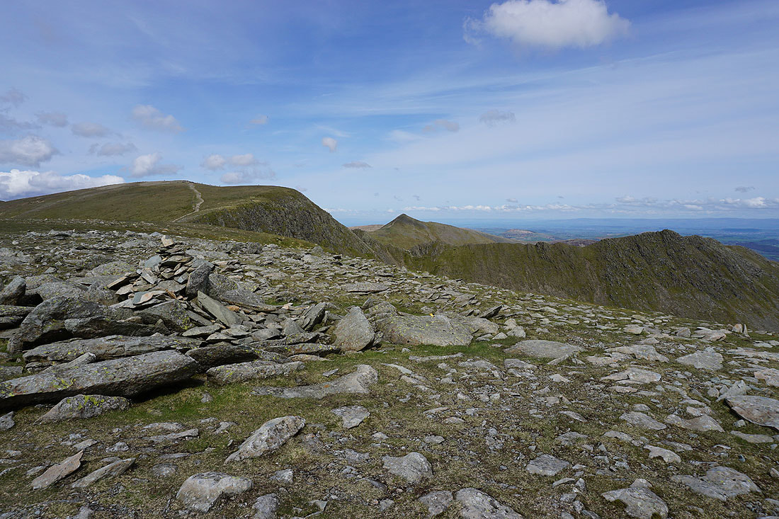
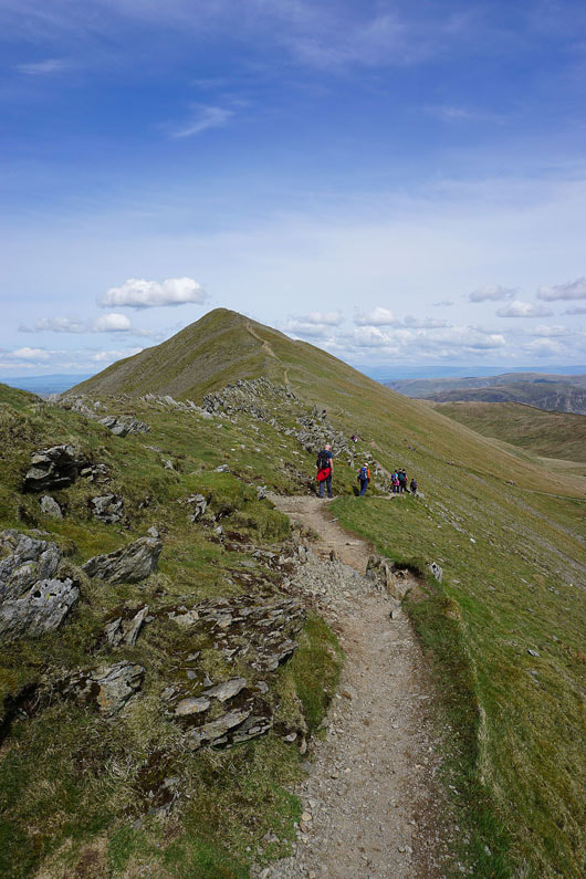
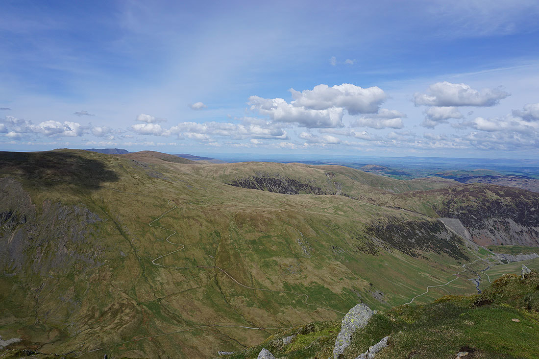
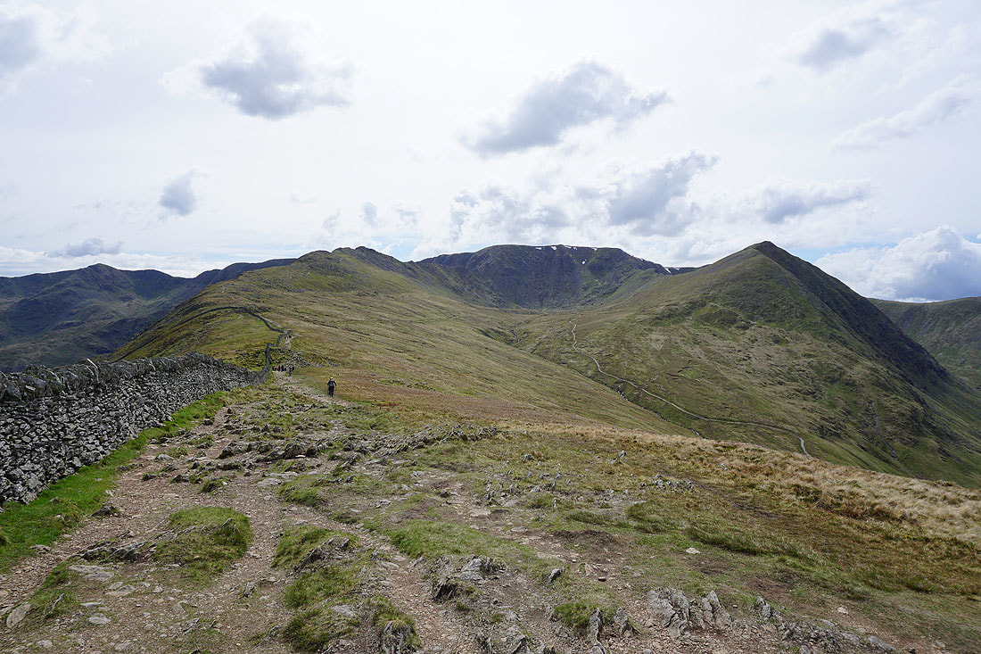
On the summit of Nethermost Pike. Helvellyn, Catstycam and Striding Edge.
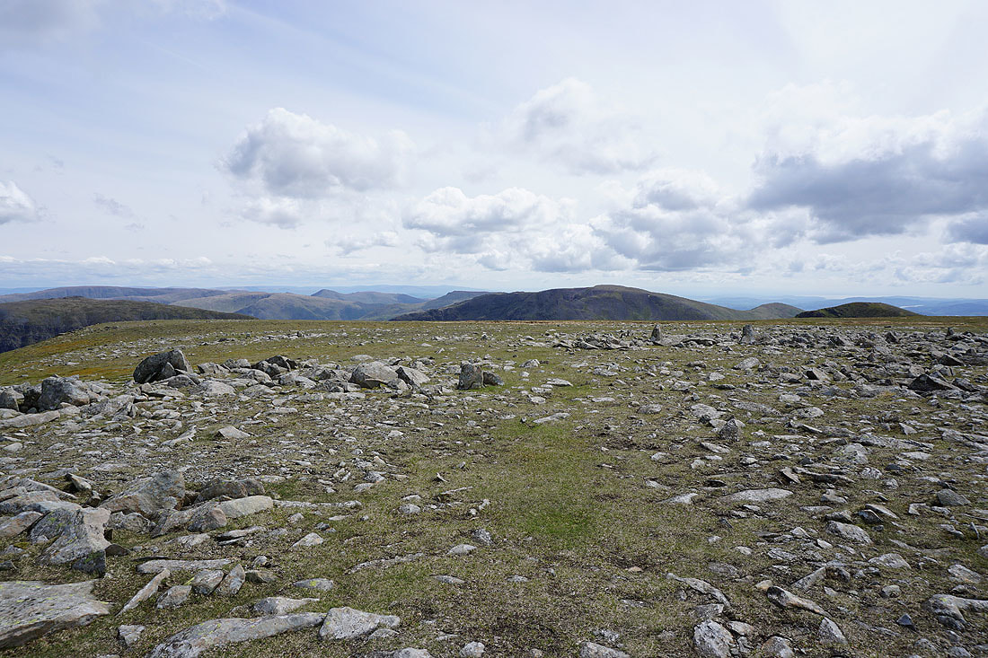
High Street, Caudale Moor and Fairfield
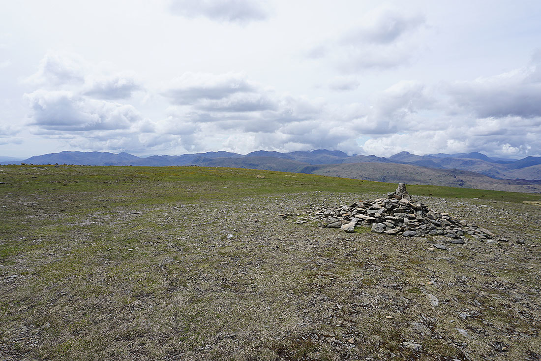
Looking west to the Coniston fells, Crinkle Crags, Bowfell, Scafell Pike (under cloud) and Great Gable
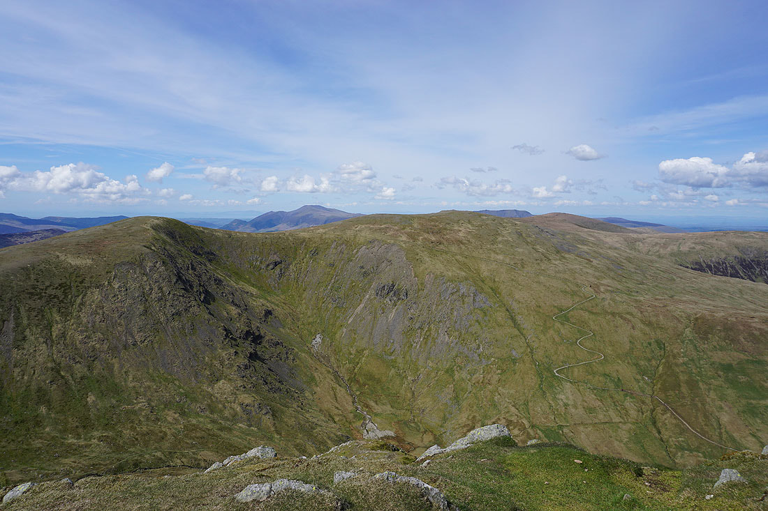
At Swallow Scarth between Nethermost Pike and Helvellyn. Looking across Nethermost Cove to St. Sunday Crag.
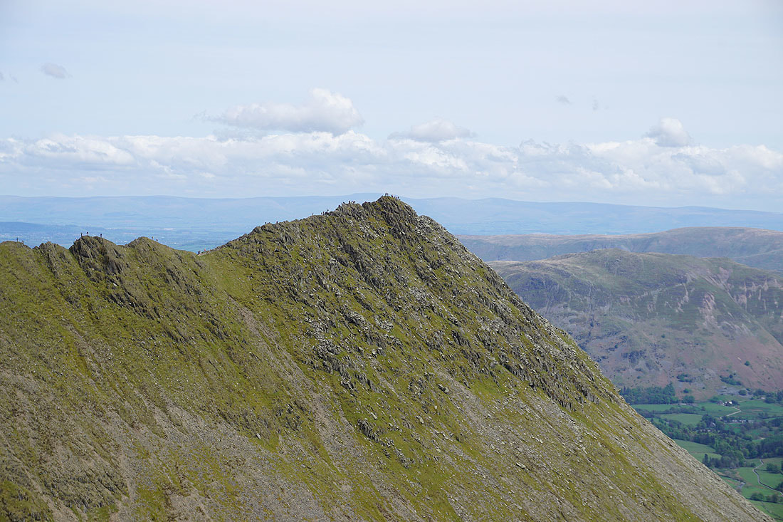
Zooming in on Striding Edge and High Spying How
The Coniston fells, Crinkle Crags, Bowfell, Scafell Pike, Great Gable and Pillar. More of the fells over there have cloud on them now.
On the summit of Helvellyn
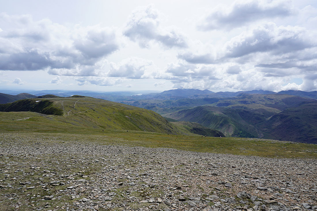
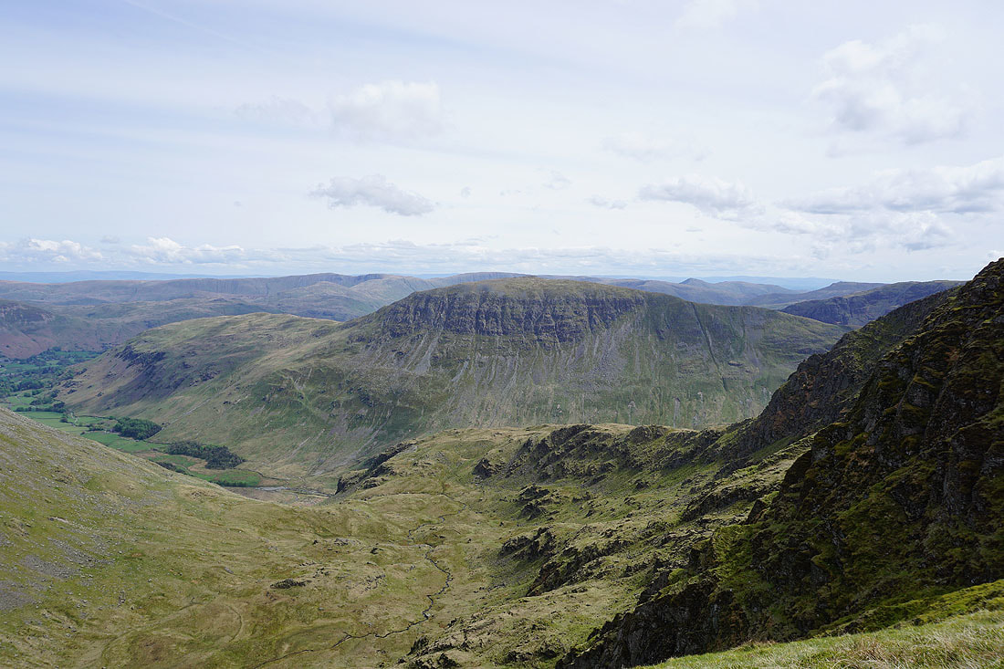
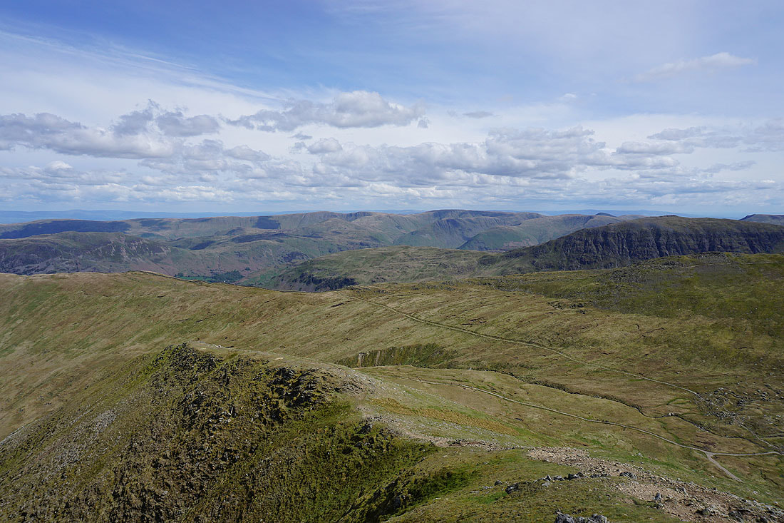
Looking south to Nethermost Pike, Coniston Water and the Coniston fells
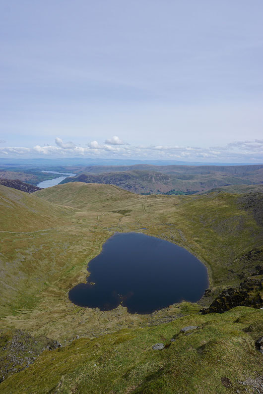
Red Tarn
Catstycam, Ullswater, Birkhouse Moor and Red Tarn with the North Pennines way in the distance
Red Tarn, Striding Edge, St. Sunday Crag and the far eastern fells
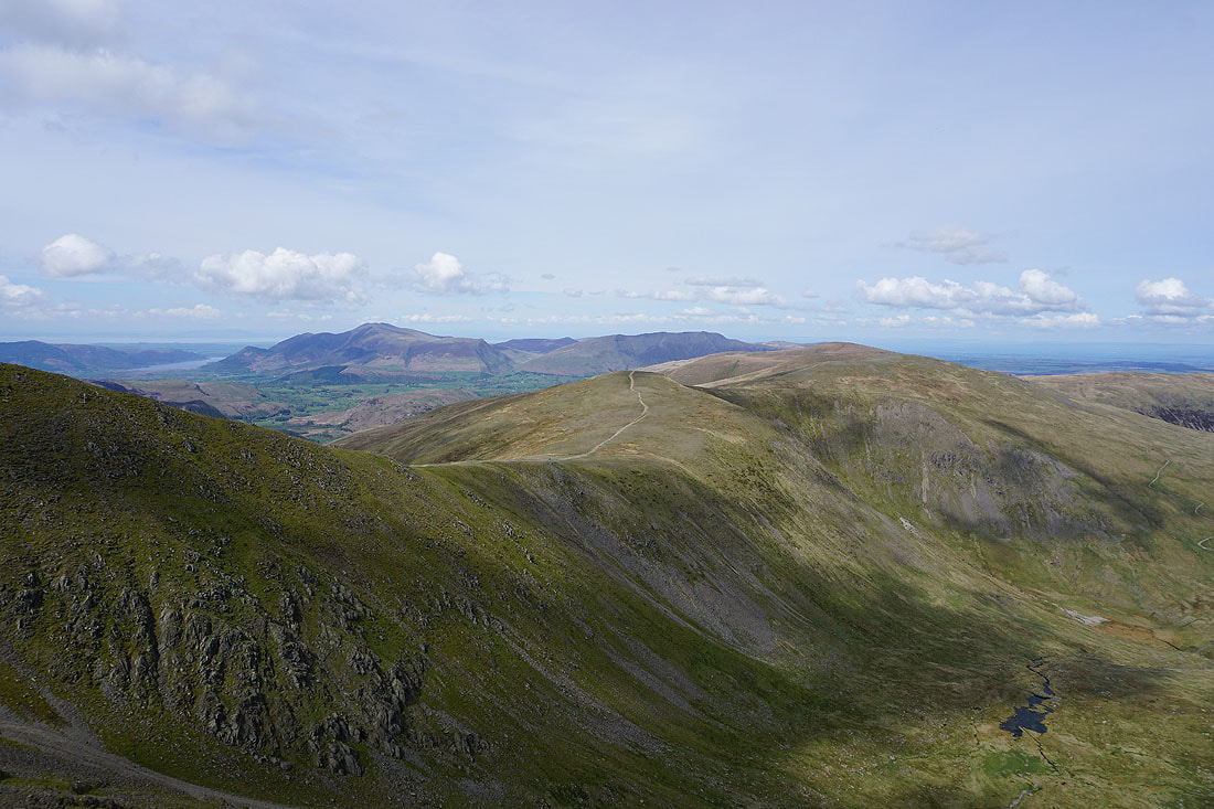
Looking north along the Dodds to Skiddaw and Blencathra
The northwestern fells, Helvellyn Lower Man and Skiddaw
Starting the descent of Swirral Edge
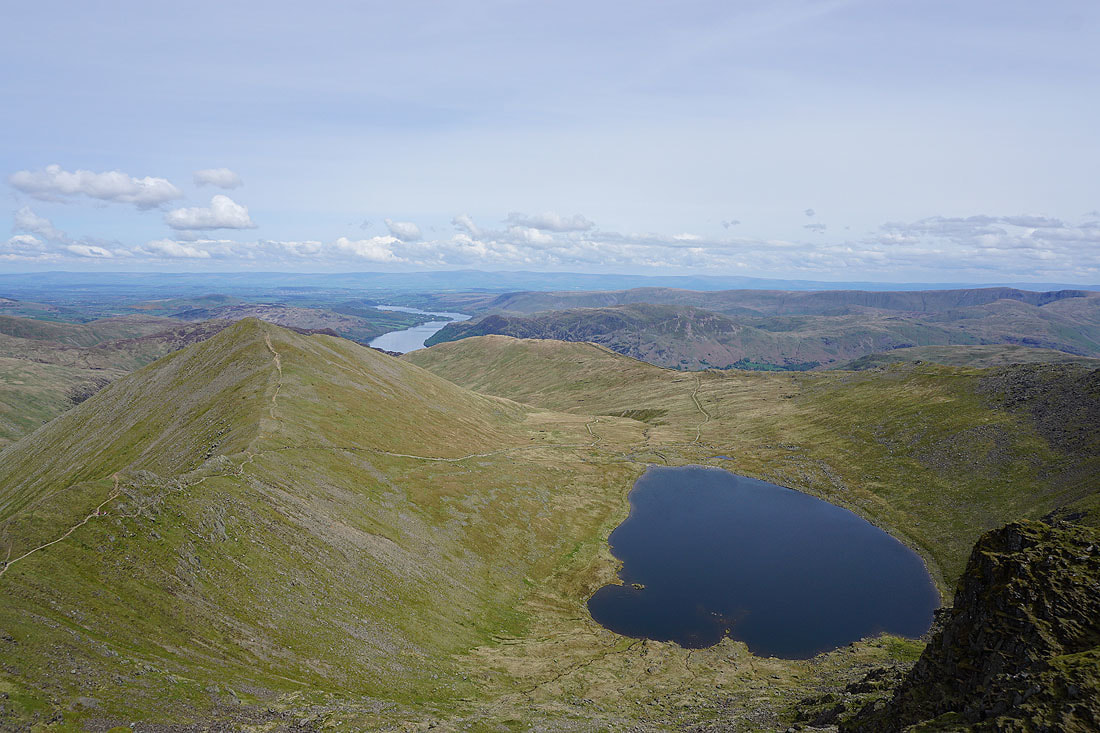
Red Tarn and Striding Edge from Swirral Edge
Looking across Brown Cove to Whiteside and Raise
Heading for Catstycam
Looking back to Helvellyn and Swirral Edge
On the summit of Catstycam. Looking east to Sheffield Pike, Ullswater, Place Fell, Loadpot Hill and Birkhouse Moor.
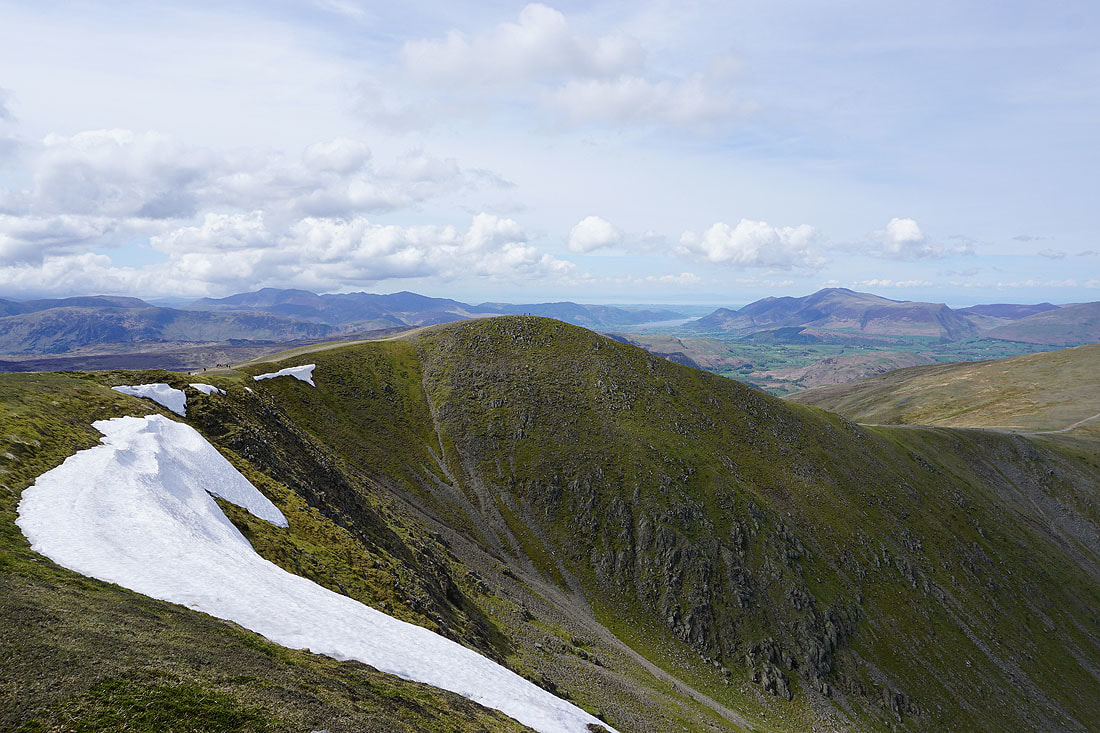
Whiteside, Skiddaw and Raise
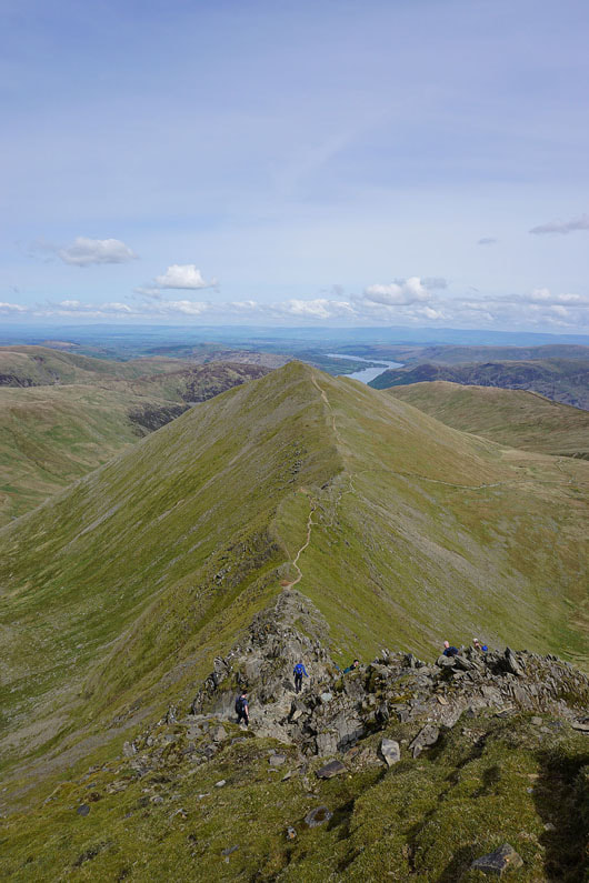
Striding Edge above Red Tarn
High Raise, High Street, other far eastern fells and St. Sunday Crag
Northwestern fells through the gap between Helvellyn Lower Man and Whiteside
Raise, Stybarrow Dodd and Green Side
By the shores of Red Tarn
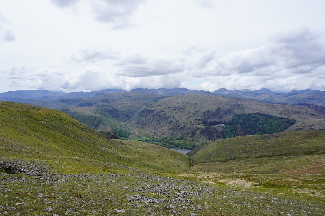
Heading for Birkhouse Moor
and having reached it, there's a fantastic view of Striding Edge, Helvellyn, Swirral Edge and Catstycam
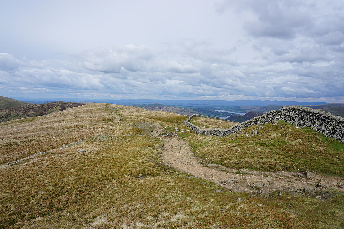
Birkhouse Moor
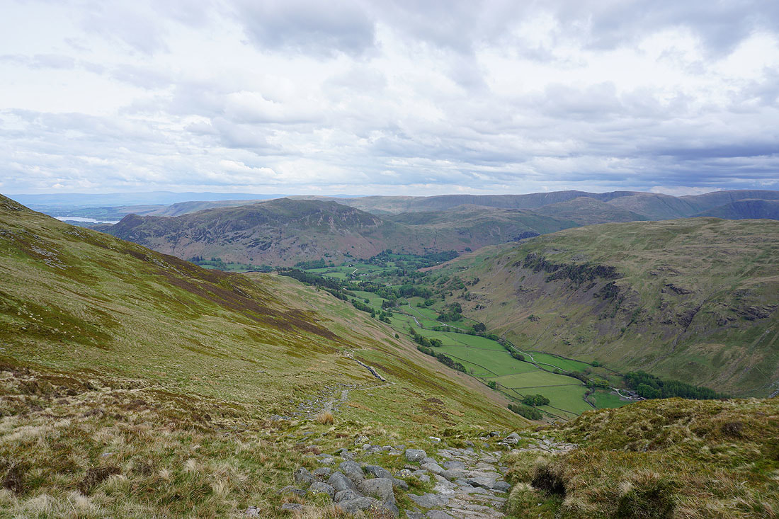
After returning to the Hole-in-the-wall I'm making my way down into Grisedale
St. Sunday Crag and Fairfield on the other side of the valley
The final descent back to Patterdale