Yorkshire Dales Walks
This page provides links to my walks done within the Yorkshire Dales National Park and any done in the surrounding areas just outside the park. Geographically speaking, I've taken the northern limit to be the Stainmore Gap which the A66 crosses, and the southern limit the Aire Gap taken by the A59. This includes the Howgill Fells, Mallerstang and the Leck and Middleton Fells. The decision was finally taken in early 2016 to extend the park boundaries to include these fells and took effect from August 2016. Also included is the Nidderdale AONB.
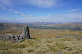
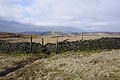
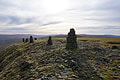
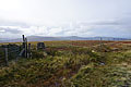
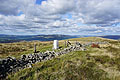
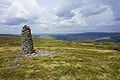
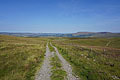
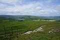
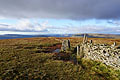
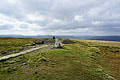
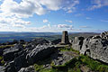
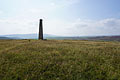
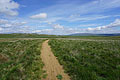
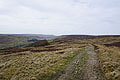
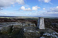
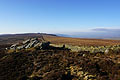
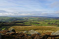
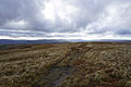
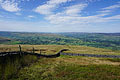
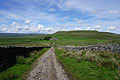
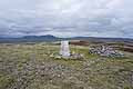
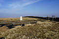
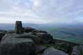
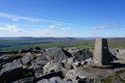
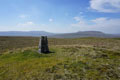
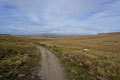
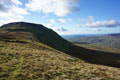
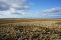
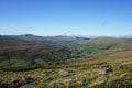
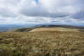
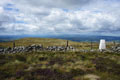
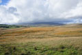
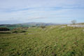
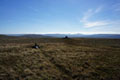
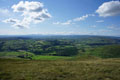
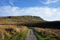
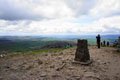
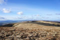
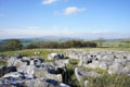
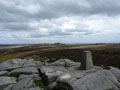
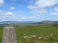
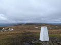
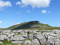
Just click on the photo or link to go to the report.
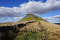
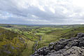
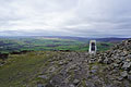
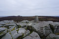
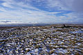
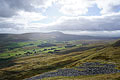
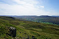
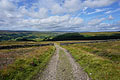
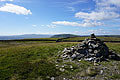
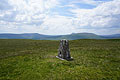
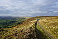
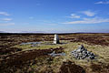
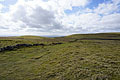
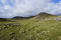
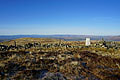
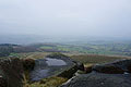
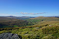
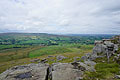
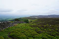
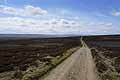
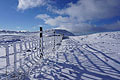
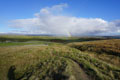
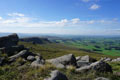
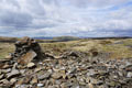
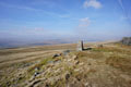
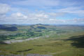
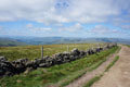
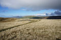
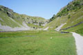
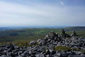
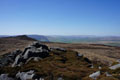
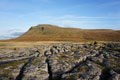
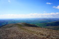
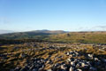
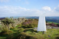
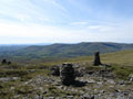
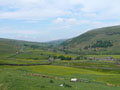
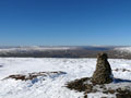
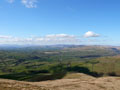
Just click on the photo or link to go to the report.
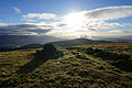
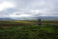
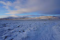
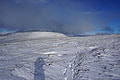
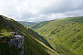
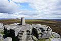
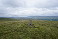
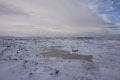
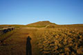
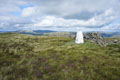
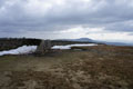
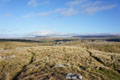
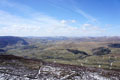
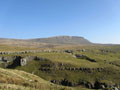
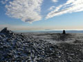
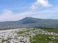
7th January 2024 - The Howgills (10.2 miles/ 2869 ft ascent)

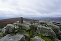
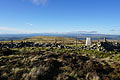
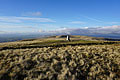
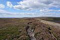
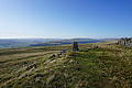
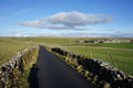
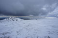
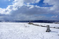
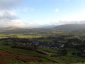
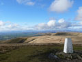
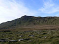
1st January 2024 - Plover Hill and Penyghent (9.7 miles/ 1917 ft ascent)
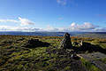
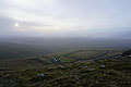
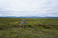
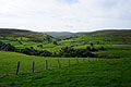
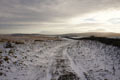
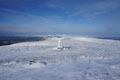
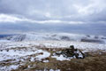
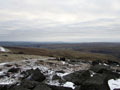
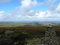
26th December 2023 - Great Knoutberry Hill (8.3 miles/ 1776 ft ascent)
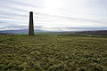
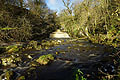
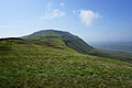
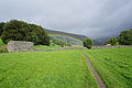
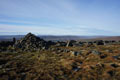
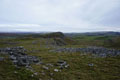
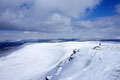
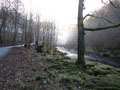
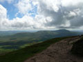
15th December 2023 - Simon's Seat and Pock Stones Moor (12.5 miles/ 2005 ft ascent)

1st December 2023 - Great Whernside (9.4 miles/ 2490 ft ascent)
25th November 2023 - Great Coum and Gragareth (9.1 miles/ 1446 ft ascent)
17th November 2023 - Capplestone Gate (8.3 miles/ 1242 ft ascent)
11th November 2023 - Middleton Fell (8.2 miles/ 1988 ft ascent)
5th November 2023 - Buckden Pike (6.9 miles/ 1812 ft ascent)

3rd November 2023 - Mill Gill Force and Thornton Rust Moor (10.4 miles/ 1509 ft ascent)
29th October 2023 - Grassington Moor (15.0 miles/ 2107 ft ascent)
22nd October 2023 - Whernside (12.2 miles/ 1838 ft ascent)
15th October 2023 - Ingleborough (10.0 miles/ 1987 ft ascent)
28th August 2023 - High Bishopside to Guise Cliff (15.2 miles/ 2937 ft ascent)
20th August 2023 - Around Colsterdale (12.8 miles/ 1960 ft ascent)
11th August 2023 - Street Gate to Littondale and back (11.1 miles/ 1608 ft ascent)
28th July 2023 - Brimham Moor to Birstwith and back (14.1 miles/ 1572 ft ascent)
4th July 2023 - Barden Fell (12.4 miles/ 1940 ft ascent)
24th June 2023 - Arnagill Moor and Pott Moor (12.9 miles/ 2053 ft ascent)

16th June 2023 - Kisdon Hill (10.7 miles/ 1780 ft ascent)
3rd June 2023 - The Howgills (12.5 miles/ 3256 ft ascent)
29th May 2023 - Cosh Knott to Horse Head Moor (14.6 miles/ 2637 ft ascent)

20th May 2023 - Dodd Fell Hill and Drumaldrace (14.0 miles/ 2176 ft ascent)
1st May 2023 - Smearsett Scar and Moughton (11.9 miles/ 1972 ft ascent)
15th April 2023 - Old Cote Moor Top (13.1 miles/ 2068 ft ascent)
8th April 2023 - Great Coum and Gragareth (14.1 miles/ 2274 ft ascent)
7th April 2023 - Plover Hill and Penyghent (11.6 miles/ 1965 ft ascent)
22nd March 2023 - Weets Top from Malham (9.6 miles/ 1687 ft ascent)
19th March 2023 - Lippersley Pike to Beamsley Beacon (12.6 miles/ 1887 ft ascent)
4th March 2023 - Fountains Fell (12.6 miles/ 1610 ft ascent)
12th February 2023 - Simon's Seat (15.0 miles/ 2737 ft ascent)
5th February 2023 - Wild Boar Fell (12.0 miles/ 2372 ft ascent)
15th January 2023 - Buckden Pike (8.4 miles/ 2141 ft ascent)

2nd January 2023 - Great Whernside (9.1 miles/ 1967 ft ascent)

24th December 2022 - Cracoe Fell (10.5 miles/ 1689 ft ascent)
11th December 2022 - Ingleborough (10.0 miles/ 2216 ft ascent)
3rd December 2022 - The Howgills (9.7 miles/ 3208 ft ascent)
27th November 2022 - Great Whernside (7.6 miles/ 1887 ft ascent)
20th November 2022 - Cotter Force and Shaw Gill Wood (10.1 miles/ 1113 ft ascent)
19th November 2022 - Penyghent and Plover Hill (9.7 miles/ 1917 ft ascent)
13th November 2022 - Ingleborough (12.0 miles/ 2660 ft ascent)
12th November 2022 - Grassington Moor and Capplestone Gate (14.7 miles/ 2122 ft ascent)

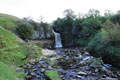
6th November 2022 - Cauldron Falls and Aysgarth Falls (10.1 miles/ 1482 ft ascent)

30th October 2022 - Scaleber Force and Catrigg Force (12.3 miles/ 2419 ft ascent)
22nd October 2022 - Brimham Rocks and Guise Cliff (12.6 miles/ 2134 ft ascent)
16th October 2022 - Great Knoutberry Hill (9.2 miles/ 1885 ft ascent)
2nd October 2022 - Whernside (13.3 miles/ 1847 ft ascent)
24th September 2022 - Conistone to Weets Top and back (13.5 miles/ 2249 ft ascent)
17th September 2022 - Gragareth (9.4 miles/ 1973 ft ascent)
16th September 2022 - Middleton Fell (13.7 miles/ 2375 ft ascent)
13th September 2022 - High Seat and Mallerstang Edge (11.3 miles/ 2070 ft ascent)
28th August 2022 - Oxnop Common and Tarn Seat (11.2 miles/ 1585 ft ascent)

13th August 2022 - Coverdale to Colsterdale and back (16.8 miles/ 2596 ft ascent)
24th July 2022 - Around Kirkby Malzeard Moor (16.3 miles/ 2119 ft ascent)
16th July 2022 - Bishopdale and Stake Fell (13.4 miles/ 1684 ft ascent)
9th July 2022 - Penyghent to Fountains Fell (13.9 miles/ 2720 ft ascent)
3rd July 2022 - Ribblesdale to Malhamdale and back (13.1 miles/ 2574 ft ascent)
25th June 2022 - Around Coverdale (13.7 miles/ 2251 ft ascent)
18th June 2022 - Addlebrough and Raydale (13.3 miles/ 2433 ft ascent)
2nd June 2022 - Horse Head Moor to Old Cote Moor Top (14.3 miles/ 1639 ft ascent)

17th April 2022 - Around Barden Moor (12.0 miles/ 1855 ft ascent)
9th April 2022 - Great Shunner Fell and Lovely Seat (13.3 miles/ 2432 ft ascent)
2nd April 2022 - Great Whernside (12.7 miles/ 2066 ft ascent)
1st April 2022 - Ingleborough (10.0 miles/ 1854 ft ascent)
26th March 2022 - Great Coum and Gragareth (14.9 miles/ 2548 ft ascent)
19th March 2022 - Whernside (12.0 miles/ 2305 ft ascent)
5th March 2022 - Aye Gill Pike (12.2 miles/ 1715 ft ascent)
27th February 2022 - Old Cote Moor Top (11.8 miles/ 1808 ft ascent)
26th February 2022 - High Bishopside to Heyshaw Moor (13.3 miles/ 2768 ft ascent)
6th February 2022 - Grassington Moor (12.6 miles/ 1768 ft ascent)
30th January 2022 - Beamsley Beacon to Lippersley Pike (10.6 miles/ 1567 ft ascent)
15th January 2022 - Great Haw to Thrope Edge (12.1 miles/ 2188 ft ascent)
9th January 2022 - Simon's Seat and Pock Stones Moor (6.3 miles/ 1256 ft ascent)
1st January 2022 - Conistone to Weets Top and back (12.5 miles/ 2051 ft ascent)

19th December 2021 - Great Whernside (10.6 miles/ 1906 ft ascent)
18th December 2021 - The Howgills (13.5 miles/ 3780 ft ascent)
5th December 2021 - Ingleborough (9.3 miles/ 2127 ft ascent)
21st November 2021 - Great Knoutberry Hill (8.3 miles/ 1776 ft ascent)

23rd October 2021 - Mill Gill Force and Ellerkin Scar (10.0 miles/ 1861 ft ascent)
16th October 2021 - Fountains Earth Moor and Pott Moor (11.6 miles/ 2015 ft ascent)
10th October 2021 - Plover Hill and Penyghent (9.4 miles/ 1880 ft ascent)
26th September 2021 - Street Gate to Littondale and back (12.0 miles/ 1754 ft ascent)
17th September 2021 - Buckden Pike (11.6 miles/ 2459 ft ascent)
16th September 2021 - Great Whernside (10.0 miles/ 2881 ft ascent)
5th September 2021 - Grassington Moor and Conistone Moor (15.4 miles/ 1970 ft ascent)
28th August 2021 - Penhill and Harland Hill (11.1 miles/ 2061 ft ascent)
9th August 2021 - Barden Fell (13.9 miles/ 1720 ft ascent)
25th July 2021 - Smearsett Scar to Penyghent (17.4 miles/ 3651 ft ascent)
19th July 2021 - Capplestone Gate (8.1 miles/ 1215 ft ascent)
17th July 2021 - Cosh Knott to Horse Head Moor (14.6 miles/ 2627 ft ascent)
16th July 2021 - Cracoe Fell (13.8 miles/ 2028 ft ascent)
28th June 2021 - Ingleborough (11.8 miles/ 2355 ft ascent)
5th June 2021 - Horse Head Moor to Old Cote Moor Top (14.3 miles/ 1639 ft ascent)
30th May 2021 - Fountains Fell (14.1 miles/ 2005 ft ascent)
22nd May 2021 - Braithwaite Moor and Guise Cliff (14.5 miles/ 2350 ft ascent)
9th May 2021 - The Nidderdale Edges and Fountains Earth Moor (12.6 miles/ 1935 ft ascent)
24th April 2021 - Rye Loaf Hill to Warrendale Knotts (11.4 miles/ 2174 ft ascent)
17th April 2021 - Boss Moor to Weets Top and back (13.4 miles/ 1992 ft ascent)
11th October 2020 - Wild Boar Fell (9.7 miles/ 2226 ft acsent)
4th October 2020 - Scaleber Force and Warrendale Knotts (12.8 miles/ 1960 ft ascent)
27th September 2020 - Gragareth (9.4 miles/ 1973 ft ascent)
18th September 2020 - Great Whernside (8.7 miles/ 1875 ft ascent)
17th September 2020 - The Howgills (14.4 miles/ 3985 ft ascent)
14th September 2020 - Plover Hill and Penyghent (11.4 miles/ 1965 ft ascent)
12th September 2020 - Grassington Moor and Capplestone Gate (13.8 miles/ 2225 ft ascent)
6th September 2020 - Barden Fell (15.9 miles/ 2215 ft ascent)
31st August 2020 - Lippersley Pike to Beamsley Beacon (9.5 miles/ 1229 ft ascent)
30th August 2020 - Dodd Fell Hill and Drumaldrace (14.2 miles/ 2277 ft ascent)
15th August 2020 - Ingleborough (10.7 miles/ 1901 ft ascent)
8th August 2020 - Addlebrough and Raydale (16.1 miles/ 2768 ft ascent)
19th July 2020 - Whernside (13.3 miles/ 1847 ft ascent)
12th July 2020 - Giggleswick Scar to Crummack Dale and back (16.2 miles/ 2484 ft ascent)
11th July 2020 - Around Barden Moor (13.6 miles/ 2002 ft ascent)
20th June 2020 - Boss Moor to Weets Top and back (13.4 miles/ 2061 ft ascent)
22nd March 2020 - Old Cote Moor Top (10.9 miles/ 1556 ft ascent)
21st March 2020 - The Nidderdale Edges (8.6 miles/ 1485 ft ascent)
16th March 2020 - Arncliffe to Malham Tarn and back (12.0 miles/ 1754 ft ascent)
8th March 2020 - Bewerley Moor and Guise Cliff (10.7 miles/ 1990 ft ascent)
1st March 2020 - Catrigg Force to Smearsett Scar (11.6 miles/ 2352 ft ascent)
23rd February 2020 - The Dales Way and Downs Pasture (11.5 miles/ 1439 ft ascent)
8th February 2020 - Malham Tarn to Ribblesdale and back (12.2 miles/ 2094 ft ascent)
25th January 2020 - Ashfold Side and Wath (8.9 miles/ 1786 ft ascent)
19th January 2020 - The Howgills (9.4 miles/ 2597 ft ascent)
12th January 2020 - Cracoe Fell (10.0 miles/ 1554 ft ascent)
31st December 2019 - Ingleborough (6.4 miles/ 1994 ft ascent)
30th December 2019 - Simon's Seat (7.2 miles/ 1350 ft ascent)
7th December 2019 - Hazlewood Moor and Beamsley Beacon (11.3 miles/ 2048 ft ascent)
1st December 2019 - Middleton Fell (7.5 miles/ 2127 ft ascent)
24th November 2019 - Beamsley Beacon (9.3 miles/ 1424 ft ascent)
10th November 2019 - Great Shunner Fell (12.9 miles/ 1912 ft ascent)
28th October 2019 - Great Knoutberry Hill (8.3 miles/ 1776 ft ascent)
27th October 2019 - Mill Gill Force and Ellerkin Scar (10.0 miles/ 1861 ft ascent)
12th October 2019 - Brimham Rocks and Guise Cliff (12.0 miles/ 2055 ft ascent)
5th October 2019 - Wharfedale Moors (15.3 miles/ 1941 ft ascent)
21st September 2019 - Grassington Moor and Capplestone Gate (13.6 miles/ 2453 ft ascent)
13th September 2019 - West Stones Dale and Robert's Seat (11.0 miles/ 1739 ft ascent)
12th September 2019 - Muker to Keld and back (5.6 miles/ 893 ft ascent)
11th September 2019 - Kisdon, Rogan's Seat and Gunnerside Gill (13.0 miles/ 2311 ft ascent)
10th September 2019 - Fremington Edge and Calver Hill (14.1 miles/ 2549 ft ascent)
8th September 2019 - Fountains Fell (13.4 miles/ 1983 ft ascent)
1st September 2019 - Simon's Seat (11.5 miles/ 1968 ft ascent)
24th August 2019 - Penhill from West Witton (10.5 miles/ 1933 ft ascent)
14th July 2019 - Coverdale and Great Roova Crags (10.3 miles/ 1655 ft ascent)
6th July 2019 - Great Whernside from Middlesmoor (17.1 miles/ 2631 ft ascent)

9th June 2019 - Bishopdale and Addlebrough (12.2 miles/ 1856 ft ascent)
1st June 2019 - Around Barden Moor (10.9 miles/ 1782 ft ascent)
25th May 2019 - Guise Cliff and the Nidderdale Way (9.9 miles/ 1578 ft ascent)
12th May 2019 - Raydale and Semer Water (10.0 miles/ 1631 ft ascent)
5th May 2019 - Moughton and Crummack Dale (9.9 miles/ 1579 ft ascent)
28th April 2019 - Thrope Edge and Fountains Earth Moor (11.4 miles/ 1958 ft ascent)

20th April 2019 - The Nidderdale Way and Dale Edge (11.0 miles/ 1909 ft ascent)
24th February 2019 - Buckden Pike (9.2 miles/ 2087 ft ascent)
2nd February 2019 - Ingleborough (10.2 miles/ 2820 ft ascent)
27th January 2019 - Airton to Weets Top and back (8.9 miles/ 1429 ft ascent)
20th January 2019 - Conistone to Weets Top and back (12.0 miles/ 1854 ft ascent)

1st January 2019 - Plover Hill and Penyghent (8.2 miles/ 1802 ft ascent)
24th December 2018 - Whernside (9.9 miles/ 1770 ft ascent)
9th December 2018 - Beamsley Beacon (11.3 miles/ 1539 ft ascent)
24th November 2018 - Simon's Seat (12.1 miles/ 1966 ft ascent)

18th November 2018 - Grassington Moor (12.2 miles/ 1638 ft ascent)

4th November 2018 - Catrigg Force and Scaleber Force (10.4 miles/ 2197 ft ascent)
28th October 2018 - Rylstone to Weets Top and back (13.4 miles/ 1573 ft ascent)
28th September 2018 - Great Whernside (11.9 miles/ 2331 ft ascent)
25th September 2018 - Cracoe Fell (9.8 miles/ 1545 ft ascent)
23rd September 2018 - Settle to Long Preston and back (11.3 miles/ 1584 ft ascent)
25th August 2018 - Ingleborough (13.6 miles/ 2916 ft ascent)
11th August 2018 - The Howgills (13.1 miles/ 3547 ft ascent)
8th July 2018 - Great Coum and Dentdale (10.0 miles/ 2089 ft ascent)
30th June 2018 - Great Shunner Fell (12.9 miles/ 1912 ft ascent)
10th June 2018 - Plover Hill and Penyghent (12.2 miles/ 1867 ft ascent)
27th May 2018 - Dodd Fell Hill and Drumaldrace (13.3 miles/ 2126 ft ascent)
19th May 2018 - Cosh Knott to Horse Head Moor (14.3 miles/ 2576 ft ascent)
7th May 2018 - Horse Head Moor and Birks Fell (13.2 miles/ 2753 ft ascent)
28th April 2018 - Fountains Fell (11.4 miles/ 1438 ft ascent)
11th March 2018 - Malham to Ribblesdale and back (11.3 miles/ 1877 ft ascent)
24th February 2018 - Capplestone Gate and the Dales Way (9.5 miles/ 1828 ft ascent)

28th December 2017 - Whernside (7.9 miles/ 1615 ft ascent)

27th December 2017 - Ingleborough (8.6 miles/ 2114 ft ascent)
9th December 2017 - Buckden Pike (6.6 miles/ 1908 ft ascent)
3rd December 2017 - Weets Top to Malham Cove (12.1 miles/ 1967 ft ascent)
1st December 2017 - The moors above Grassington (8.2 miles/ 1024 ft ascent)
19th November 2017 - Great Whernside (9.0 miles/ 2079 ft ascent)
12th November 2017 - Penyghent (8.2 miles/ 1802 ft ascent)
5th November 2017 - Ingleborough (10.0 miles/ 1987 ft ascent)
29th October 2017 - Gragareth (8.8 miles/ 1968 ft ascent)
27th October 2017 - Great Knoutberry Hill (8.3 miles/ 1776 ft ascent)
17th September 2017 - Cautley Spout and The Calf (11.3 miles/ 2824 ft ascent)
5th August 2017 - Middleton Fell (8.8 miles/ 2201 ft ascent)
16th July 2017 - Ingleborough (12.6 miles/ 2787 ft ascent)
8th July 2017 - Whernside (12.0 miles/ 2305 ft ascent)
4th June 2017 - Birks Fell and Littondale (12.5 miles/ 1536 ft ascent)
14th May 2017 - Aye Gill Pike (12.0 miles/ 1642 ft ascent)
8th April 2017 - Great Knoutberry Hill (8.6 miles/ 1853 ft ascent)
25th March 2017 - The Howgills (11.5 miles/ 2929 ft ascent)
4th March 2017 - Simon's Seat (9.6 miles/ 1967 ft ascent)
4th February 2017 - Penyghent (7.3 miles/ 1716 ft ascent)
14th January 2017 - Great Whernside (9.1 miles/ 1967 ft ascent)
2nd January 2017 - Buckden Pike (8.4 miles/ 2141 ft ascent)
28th December 2016 - Ingleborough (7.0 miles/ 2052 ft ascent)
17th December 2016 - Whernside (7.9 miles/ 1615 ft ascent)
4th December 2016 - Gragareth (9.4 miles/ 1975 ft ascent)
11th November 2016 - Malham to Ribblesdale and back (11.9 miles/ 2132 ft ascent)
17th October 2016 - Upper Ribblesdale (12.0 miles/ 1664 ft ascent)
9th October 2016 - Fountains Fell & Penyghent (12.4 miles/ 2500 ft ascent)
2nd October 2016 - The Howgills (14.3 miles/ 3134 ft ascent)
29th August 2016 - A circuit of Barden Moor (14.8 miles/ 2136 ft ascent)
30th July 2016 - Middleton Fell (13.8 miles/ 2370 ft ascent)
18th June 2016 - Old Cote Moor Top & Littondale (10.7 miles/ 1533 ft ascent)
22nd May 2016 - Oxenber Wood & Moughton (9.6 miles/ 1562 ft ascent)
25th March 2016 - Wild Boar Fell & Swarth Fell (8.5 miles/ 2020 ft ascent)
20th March 2016 - Whernside (13.3 miles/ 1847 ft ascent)
6th March 2016 - Ingleborough (9.8 miles/ 2150 ft ascent)
16th January 2016 - The Howgills (7.8 miles/ 2654 ft ascent)
13th December 2015 - Smearsett Scar (8.6 miles/ 1345 ft ascent)
12th November 2015 - Attermire Scar & Catrigg Force (7.3 miles/ 1868 ft ascent)
27th September 2015 - High Seat & Mallerstang Edge (11.3 miles/ 2070 ft ascent)
23rd August 2015 - The Delights of Malham (11.5 miles/ 1923 ft ascent)
8th August 2015 - Crag Hill, Great Coum & Gragareth (13.9 miles/ 2472 ft ascent)
25th July 2015 - The Howgills (9.6 miles/ 2998 ft ascent)
21st April 2015 - Simon's Seat (9.5 miles/ 1976 ft ascent)
7th April 2015 - Penyghent (8.2 miles/ 1802 ft ascent)
10th March 2015 - Great Whernside (7.4 miles/ 1856 ft ascent)
3rd February 2015 - Middleton Fell (7.5 miles/ 2127 ft ascent)
1st February 2015 - The Dales Way & the moors above Grassington (9.8 miles/ 1251 ft ascent)
19th January 2015 - Ingleborough (9.8 miles/ 2150 ft ascent)
8th January 2015 - Ingleton Falls (4.0 miles/ 924 ft ascent)
4th January 2015 - Smearsett Scar (7.7 miles/ 1526 ft ascent)
13th December 2014 - The Calf (8.5 miles/ 2559 ft ascent)
8th December 2014 -Around Malham (7.3 miles/ 1256 ft ascent)
3rd December 2014 - Whernside (7.7 miles/ 1608 ft ascent)
2nd December 2014 - Penyghent (5.7 miles/ 1601 ft ascent)
24th November 2014 - Ingleborough (7.0 miles/ 2052 ft ascent)
18th November 2014 - Crummack Dale & Norber (9.9 miles/ 1353 ft ascent)
16th October 2014 - By the Wharfe from Grassington (4.4 miles/ 428 ft ascent)
31st August 2014 - Cracoe Fell & Burnsall Fell (12.8 miles/ 2014 ft ascent)
24th August 2014 - Buckden Pike (10.5 miles/ 2044 ft ascent)
26th July 2014 - The Howgills (10.3 miles/ 2825 ft ascent)
14th June 2014 - Capplestone Gate & the Dales Way (9.3 miles/ 1683 ft ascent)

31st May 2014 - Across High Cote Moor & back (12.2 miles/ 1747 ft ascent)
23rd March 2014 - Aye Gill Pike & Dentdale (13.0 miles/ 1821 ft ascent)
16th February 2014 - Middleton Fell (7.5 miles/ 2127 ft ascent)
2nd February 2014 - Malham Moor & the Dales Way (11.0 miles/ 1520 ft ascent)
26th December 2013 - The Calf (7.9 miles/ 2521 ft ascent)
4th December 2013 - Giggleswick, Smearsett & Pot Scars (9.0 miles/ 1586 ft ascent)

30th November 2013 - Nine Standards Rigg (9.6 miles/ 1928 ft ascent)
10th October 2013 - Ingleton Falls (6.2 miles/ 1509 ft ascent)
26th August 2013 - Flasby Fell & Barden Moor (13.2 miles/ 2304 ft ascent)
10th August 2013 - Horse Head & Old Cote Moor Top (13.0 miles/ 2736 ft ascent)
2nd June 2013 - Penyghent & Plover Hill (8.2 miles/ 1802 ft ascent)
25th May 2013 - A Fairmile Circuit (9.6 miles/ 2998 ft ascent)
19th May 2013 - Janet's Foss, Gordale Scar & Malham Cove (10.5 miles/ 1423 ft ascent)
27th April 2013 - Old Cote Moor Top (10.7 miles/ 1501 ft ascent)
6th April 2013 - Simon's Seat & Trollers Gill (9.7 miles/ 2006 ft ascent)
3rd April 2013 - Buckden Pike (7.8 miles/ 1675 ft ascent)
31st March 2013 - A Weasdale Round (7.9 miles/ 1813 ft ascent)
29th March 2013 - Ingleborough (9.9 miles/ 2227 ft ascent)

17th February 2013 - Great Whernside (9.1 miles/ 2005 ft ascent)
2nd February 2013 - The Howgills (7.5 miles/ 2567 ft ascent)

6th November 2011 - Ingleborough (10.5 miles/ 2366 ft ascent)
6th November 2011 - Ingleborough (10.5 miles/ 2366 ft ascent)
22nd October 2011 - Attermire Scar and Catrigg Force (8.9 miles/ 1868 ft ascent)
4th September 2011 - A circuit of Barden Moor (11.9 miles/ 1865 ft ascent)
4th September 2011 - A circuit of Barden Moor (11.9 miles/ 1865 ft ascent)
24th August 2011 - Malham and Kilnsey Moors (11.2 miles/ 1846 ft ascent)
24th August 2011 - Malham and Kilnsey Moors (11.2 miles/ 1846 ft ascent)
30th July 2011 - Penyghent and Fountains Fell (12.4 miles/ 2485 ft ascent)
16th June 2011 - Simon's Seat (8.7 miles/ 1544 ft ascent)
16th June 2011 - Simon's Seat (8.7 miles/ 1544 ft ascent)
14th June 2011 - Baugh Fell (10.9 miles/ 2049 ft ascent)
2nd May 2011 - A Malham Circuit (10.3 miles/ 1826 ft ascent)
2nd May 2011 - A Malham Circuit (10.3 miles/ 1826 ft ascent)
24th April 2011 - Carlingill and The Calf (8.3 miles/ 2593 ft ascent)
17th April 2011 - Old Cote Moor Top (10.7 miles/ 1507 ft ascent)
3rd April 2011 - Trollers Gill (7.5 miles/ 1046 ft ascent)
1st April 2011 - Conistone Dib (7.8 miles/ 1123 ft ascent)
19th March 2011 - Middleton Fell (12.4 miles/ 2158 ft ascent)
6th March 2011 - Penyghent (9.0 miles/ 1915 ft ascent)
12th February 2011 - Cautley Spout and The Calf (10.5 miles/ 2643 ft ascent)
2nd January 2011 - Great Whernside (9.1 miles/ 2005 ft ascent)
31st December 2010 - Simon's Seat (7.5 miles/ 1484 ft ascent)
31st December 2010 - Simon's Seat (7.5 miles/ 1484 ft ascent)
28th November 2010 - Ingleborough (9.9 miles/ 2227 ft ascent)
28th November 2010 - Ingleborough (9.9 miles/ 2227 ft ascent)
7th November 2010 - The Howgills (11.9 miles/ 3060 ft ascent)
7th November 2010 - The Howgills (11.9 miles/ 3060 ft ascent)
12th September 2010 - Buckden Pike (7.8 miles/ 1675 ft ascent)
12th September 2010 - Buckden Pike (7.8 miles/ 1675 ft ascent)

4th September 2010 - Gragareth, Great Coum and Crag Hill (11.6 miles/ 2254 ft ascent)
22nd August 2010 - Whernside (12.8 miles/ 2502 ft ascent)
30th June 2010 - Fountains Fell (8.1 miles/ 1255 ft ascent)
30th June 2010 - Fountains Fell (8.1 miles/ 1255 ft ascent)
5th June 2010 - Great Shunner Fell and Lovely Seat (9.3 miles/ 2121 ft ascent)

31st May 2010 - Wild Boar Fell (8.7 miles/ 1940 ft ascent)
31st May 2010 - Wild Boar Fell (8.7 miles/ 1940 ft ascent)
11th April 2010 - Great Coum and Crag Hill (7.5 miles/ 1859 ft ascent)
10th April 2010 - Middleton Fell (12.4 miles/ 2158 ft ascent)
4th April 2010 - A walk in the northern Howgills (13.2 miles/ 2955 ft ascent)
4th April 2010 - A walk in the northern Howgills (13.2 miles/ 2955 ft ascent)
7th March 2010 - Buckden Pike and Great Whernside (13.4 miles/ 2584 ft ascent)
20th February 2010 - Ingleborough (10.8 miles/ 2362 ft ascent)
13th February 2010 - The Howgills (8.2 miles/ 2551 ft ascent)
13th February 2010 - The Howgills (8.2 miles/ 2551 ft ascent)
25th July 2009 - Penyghent (8.5 miles/ 1858 ft ascent)
29th March 2009 - The Howgills (8.4 miles/ 2910 ft ascent)
22nd February 2009 - Randygill Top and Green Bell (7.7 miles/ 1796 ft ascent)
24th August 2008 - Carlingill and The Calf (8.3 miles/ 2593 ft ascent)
8th June 2008 - Whernside (10.2 miles/ 1806 ft ascent)

17th February 2008 - The Howgills (6.3 miles/ 2566 ft ascent)
9th February 2008 - Wild Boar Fell (7.1 miles/ 1627 ft ascent)