10th March 2023 - Weets Hill
Walk Details
Distance walked: 10.2 miles
Total ascent: 1700 ft
OS map used: OL21 - South Pennines
Time taken: 6 hrs
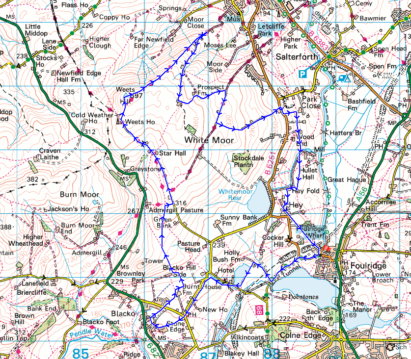
Route description: Foulridge-B6251-Reedymoor Lane-Slipper Hill-Barnoldswick Road-Great Stonedge Farm-Blacko-Beverley Road-Burnt House Farm-Blacko Hill Side Farm-Blacko Hill-Peel's House Farm-Gisburn Old Road-Weets House Farm-Weets Hill-Pendle Way-Folly Lane-Higher View Farm-Duck Pond Farm-Prospect House Farm-Lister Well Road-Lad Lowe Hill-Copy Nook-High Lane-Booth House Farm-Hey Fold-Hey-Foulridge
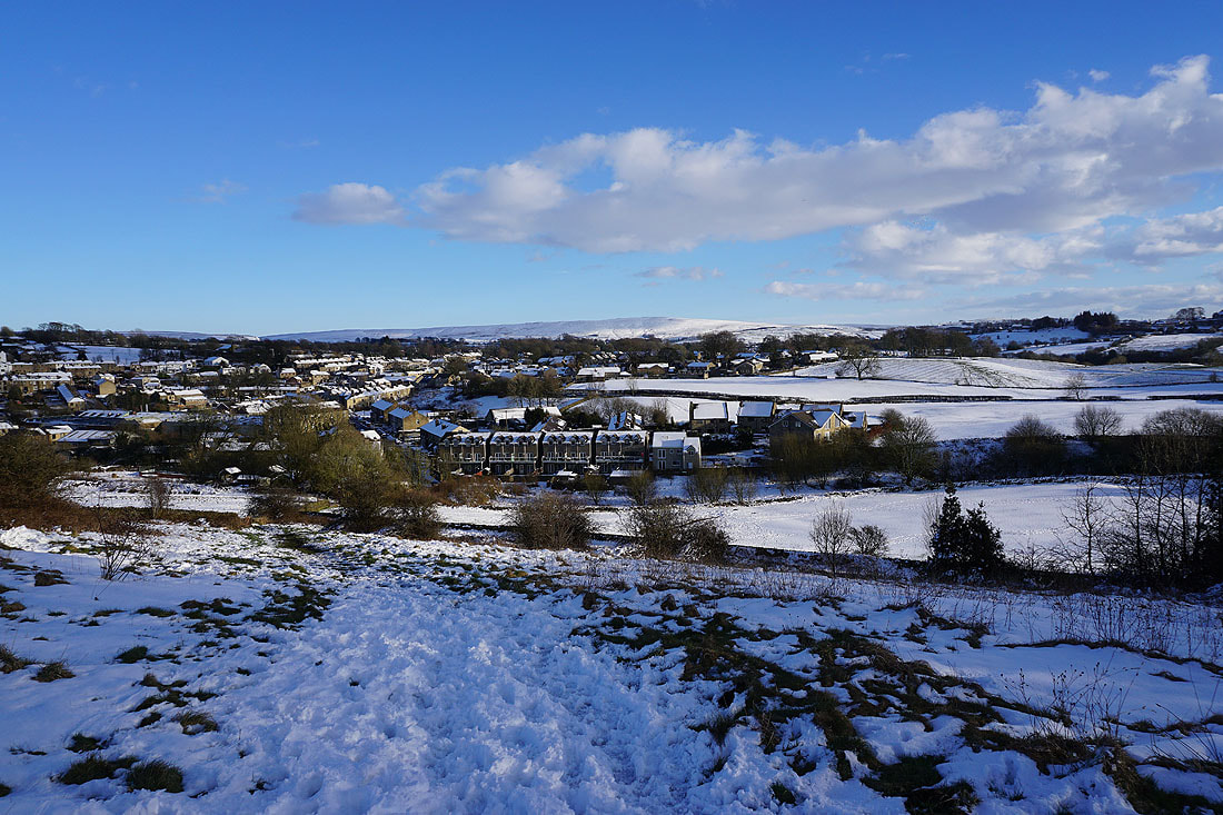
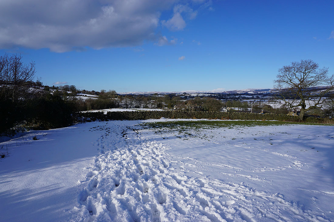
Despite my best efforts I didn't make it into work today. Heavy snow fell overnight, a mini "Beast from the East", and I was up very early to try and make it in for the start of my shift. After clearing the snow off my car, I attempted to make it up to the A56 but didn't get it very far as the most modest of hills caused my wheels to spin. A bit of time was spent trying to get somewhere but I soon realised that I'd be better off parking up and calling it a day. A day off work it is then, and if it brightens up a walk in the snow. The snow stopped and the skies cleared late in the morning so I decided to walk from home to Weets Hill. It was a beautiful afternoon for taking in the snow covered landscape, with lots of blue skies and sunshine, and a cold easterly wind. The strength of the wind when it was snowing last night was clear to see, some of the drifts were several feet deep, and then there were places where the ground was almost bare.
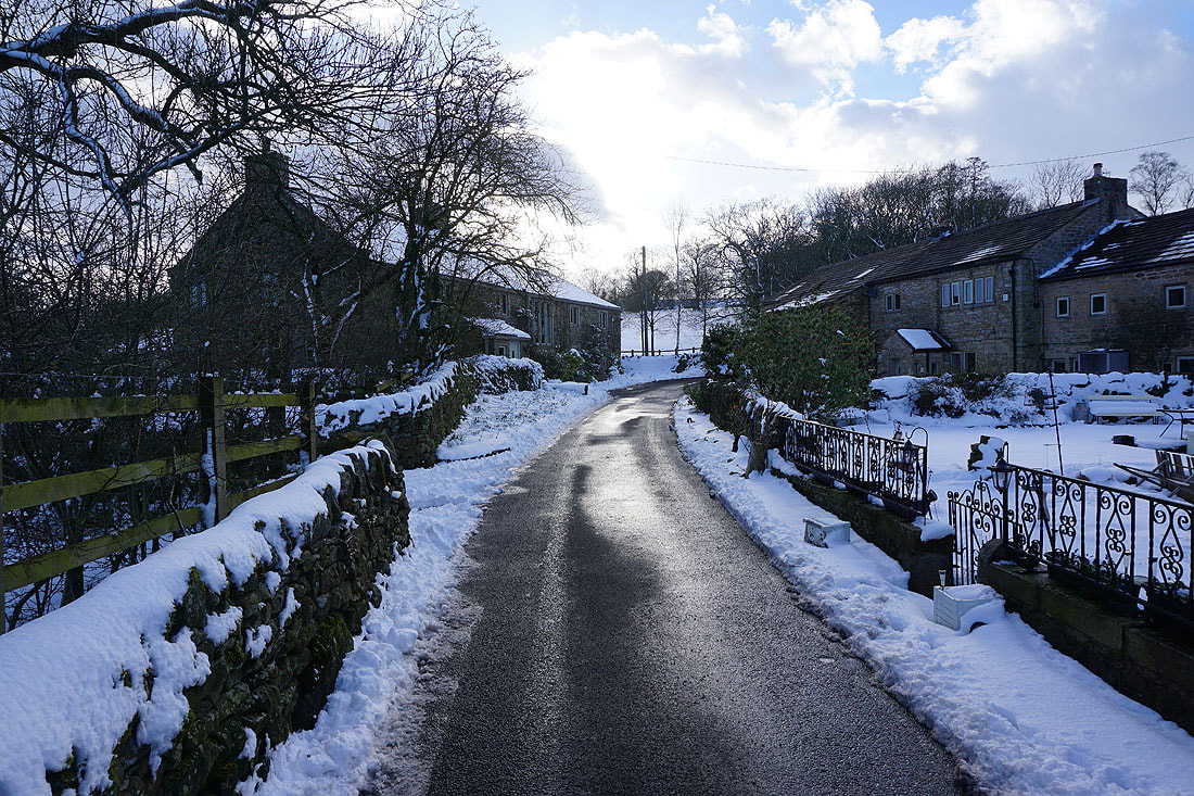
From where I live in Foulridge I walked up to and then west along the B6251, then along Reedymoor Lane to Foulridge Lower Reservoir. I then walked up the track to Sand Hall, took the footpath on the left past Slipper Hill Reservoir and to Slipper Hill, where I crossed the lane and took the footpath opposite past cottages and up the hillside to Barnoldswick Road. I then followed a footpath southwest by the road to reach Barnoldswick Road opposite The Cross Gaits Inn. I crossed the road and took the footpath opposite to Great Stonedge Farm, turned right, briefly followed a lane north, took a path straight on at a cottage, and then turned right to follow a footpath along the edge of a field to Beverley Road. After crossing Beverley Road I took the footpath opposite to and around Burnt House Farm and then a footpath on the left up to Blacko Hill Side Farm and up onto Blacko Hill. This footpath took me north across Blacko Hill to a bridleway on the right to reach Gisburn Old Road at Peel's House Farm, and I then walked up Gisburn Old Road to its top at Weets House Farm, and from there I took the path to the top of Weets Hill. After spending a bit of time taking in the view I followed the Pendle Way down to Folly Lane, then walked up Folly Lane to Higher View Farm, and from there, the bridleway up to Duck Pond Farm. I then took a footpath along the track to and past Prospect House Farm to Lister Well Road, which I walked up to take a footpath on the left along a track onto Lad Lowe Hill, and I then walked down this past Copy Nook to High Lane. I briefly walked south along High Lane to take the footpath on the other side of the road down to Booth House Farm, then followed a path south across fields, down to the bridge over County Brook and to County Brook Lane. I then briefly walked up County Brook Lane, took the footpath on the left and followed it over the little hill past Hullet Hall and then turned right and took the path to Hey Fold. From Hey Fold I then took a path south through Hey and to Whitemoor Road, where a path southeast down through fields to the end of Station Road in Foulridge saw me back home.
Total ascent: 1700 ft
OS map used: OL21 - South Pennines
Time taken: 6 hrs
Route description: Foulridge-B6251-Reedymoor Lane-Slipper Hill-Barnoldswick Road-Great Stonedge Farm-Blacko-Beverley Road-Burnt House Farm-Blacko Hill Side Farm-Blacko Hill-Peel's House Farm-Gisburn Old Road-Weets House Farm-Weets Hill-Pendle Way-Folly Lane-Higher View Farm-Duck Pond Farm-Prospect House Farm-Lister Well Road-Lad Lowe Hill-Copy Nook-High Lane-Booth House Farm-Hey Fold-Hey-Foulridge
Despite my best efforts I didn't make it into work today. Heavy snow fell overnight, a mini "Beast from the East", and I was up very early to try and make it in for the start of my shift. After clearing the snow off my car, I attempted to make it up to the A56 but didn't get it very far as the most modest of hills caused my wheels to spin. A bit of time was spent trying to get somewhere but I soon realised that I'd be better off parking up and calling it a day. A day off work it is then, and if it brightens up a walk in the snow. The snow stopped and the skies cleared late in the morning so I decided to walk from home to Weets Hill. It was a beautiful afternoon for taking in the snow covered landscape, with lots of blue skies and sunshine, and a cold easterly wind. The strength of the wind when it was snowing last night was clear to see, some of the drifts were several feet deep, and then there were places where the ground was almost bare.
From where I live in Foulridge I walked up to and then west along the B6251, then along Reedymoor Lane to Foulridge Lower Reservoir. I then walked up the track to Sand Hall, took the footpath on the left past Slipper Hill Reservoir and to Slipper Hill, where I crossed the lane and took the footpath opposite past cottages and up the hillside to Barnoldswick Road. I then followed a footpath southwest by the road to reach Barnoldswick Road opposite The Cross Gaits Inn. I crossed the road and took the footpath opposite to Great Stonedge Farm, turned right, briefly followed a lane north, took a path straight on at a cottage, and then turned right to follow a footpath along the edge of a field to Beverley Road. After crossing Beverley Road I took the footpath opposite to and around Burnt House Farm and then a footpath on the left up to Blacko Hill Side Farm and up onto Blacko Hill. This footpath took me north across Blacko Hill to a bridleway on the right to reach Gisburn Old Road at Peel's House Farm, and I then walked up Gisburn Old Road to its top at Weets House Farm, and from there I took the path to the top of Weets Hill. After spending a bit of time taking in the view I followed the Pendle Way down to Folly Lane, then walked up Folly Lane to Higher View Farm, and from there, the bridleway up to Duck Pond Farm. I then took a footpath along the track to and past Prospect House Farm to Lister Well Road, which I walked up to take a footpath on the left along a track onto Lad Lowe Hill, and I then walked down this past Copy Nook to High Lane. I briefly walked south along High Lane to take the footpath on the other side of the road down to Booth House Farm, then followed a path south across fields, down to the bridge over County Brook and to County Brook Lane. I then briefly walked up County Brook Lane, took the footpath on the left and followed it over the little hill past Hullet Hall and then turned right and took the path to Hey Fold. From Hey Fold I then took a path south through Hey and to Whitemoor Road, where a path southeast down through fields to the end of Station Road in Foulridge saw me back home.
Route map
© Crown copyright. All rights reserved. License number PU 100034184.
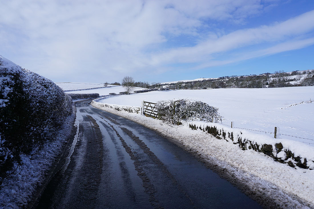
Leaving Foulridge on the B6251
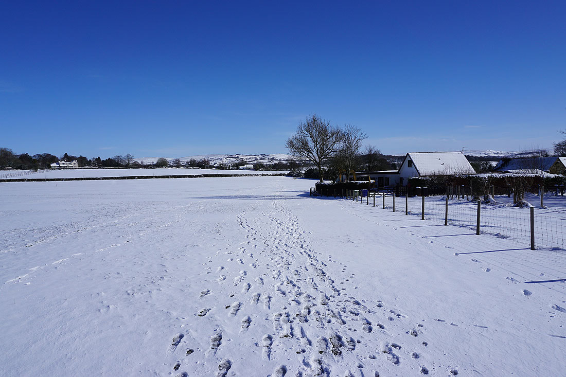
Sunshine and snow in Foulridge
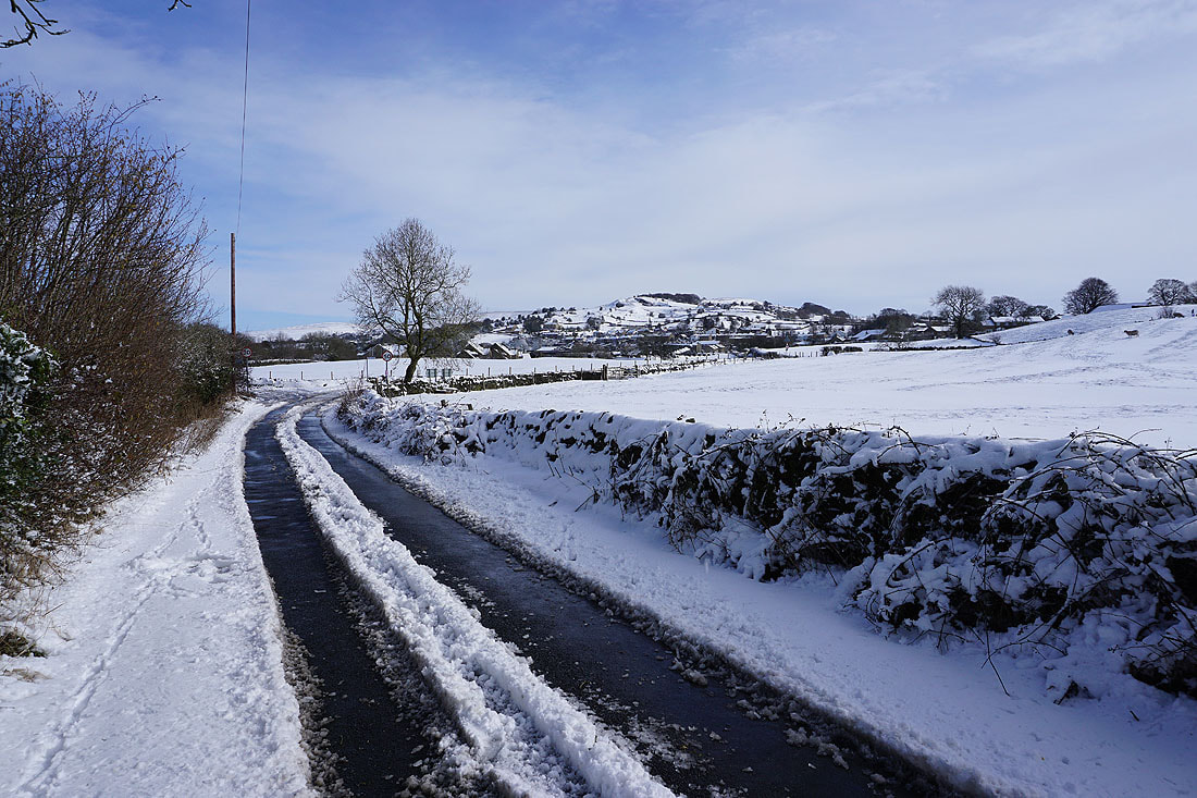
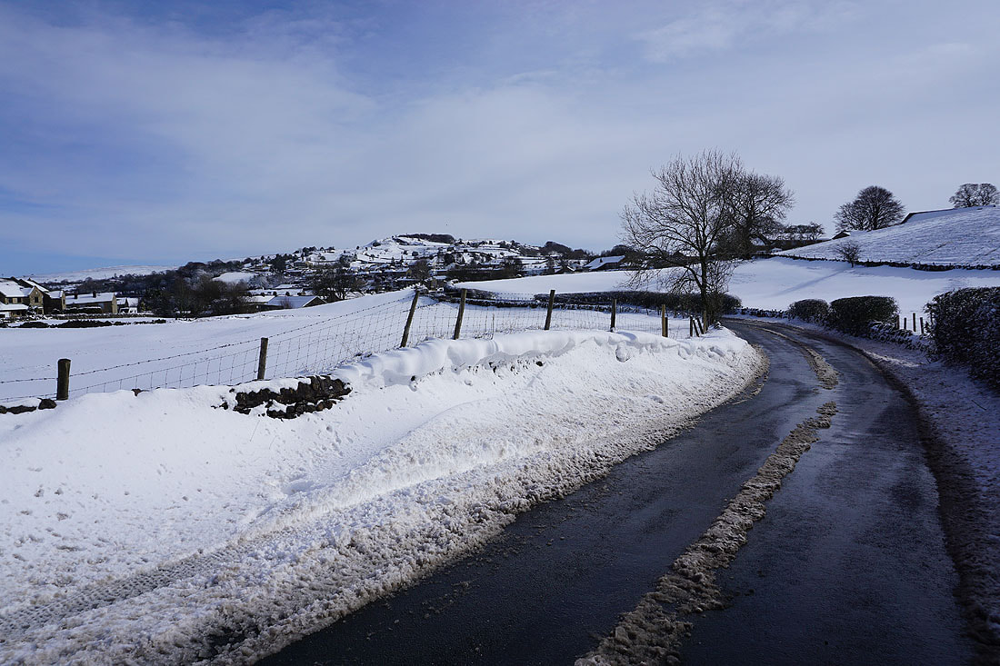
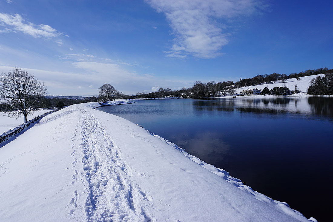
Looking back to Foulridge from Reedymoor Lane
Christmas card scenery as I walk south along Reedymoor Lane
Blacko Hill in the distance from Reedymoor Lane
Sand Hall
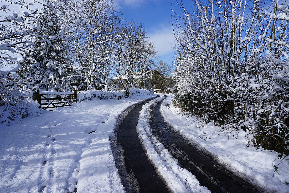
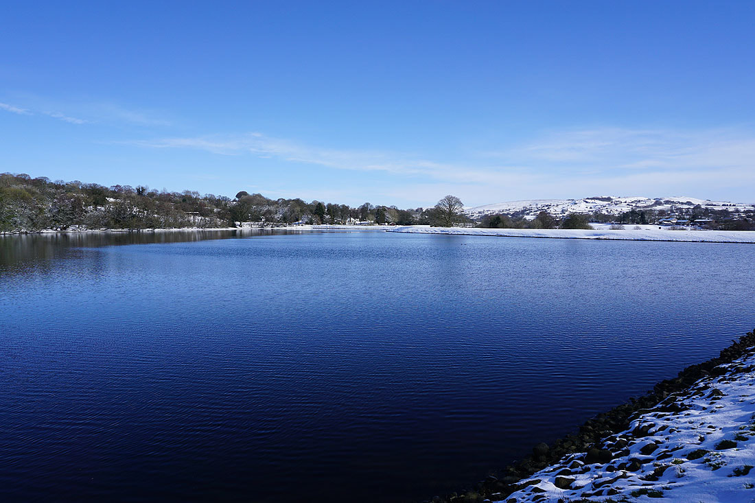
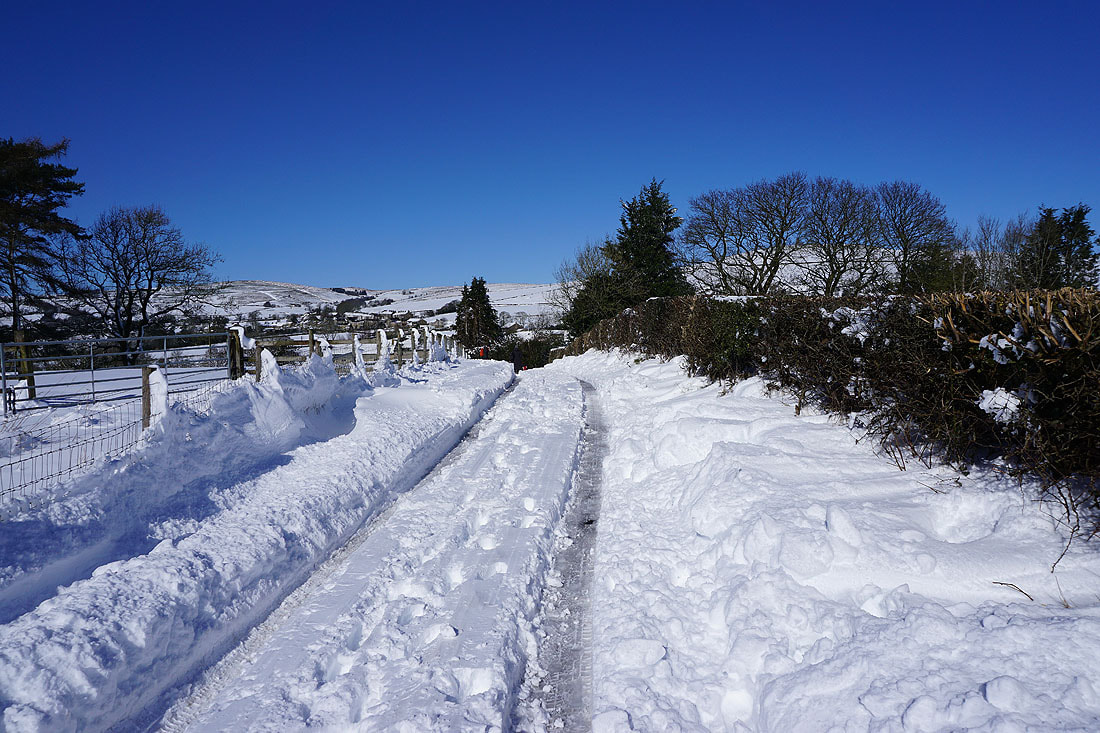
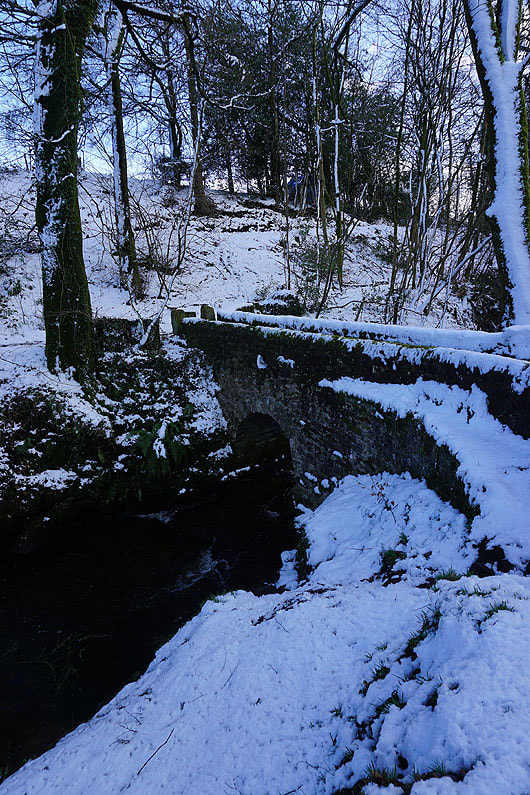
Making my way past Slipper Hill Reservoir..
|
|
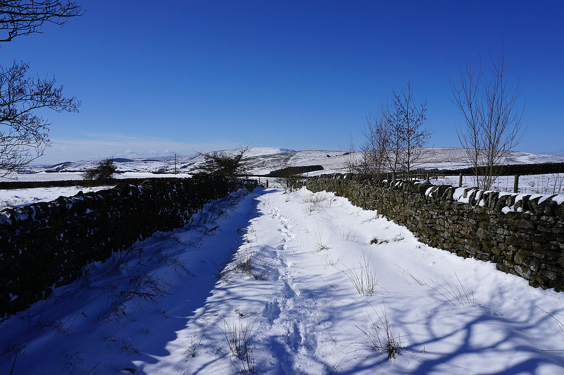
Deep snow in places as I head up Slipper Hill..
Boulsworth Hill in the distance from the footpath up to Barnoldswick Road
Crossing fields to The Cross Gaits Inn on Barnoldswick Road
Pendle Hill as I follow the footpath to Blacko from The Cross Gaits Inn
Blacko Hill to my right
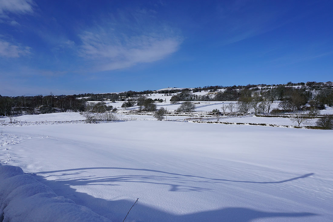
Looking back with Bleara Moor, Kelbrook Moor and Noyna Hill in the distance
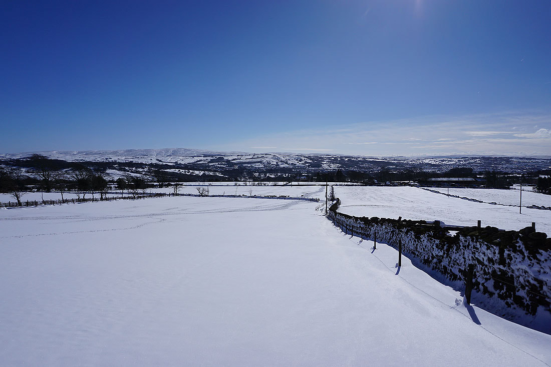
Deep drifts at Great Stonedge Farm in Blacko
Pendle Hill in the distance from Blacko
Blacko Hill from Burnt House Farm
and Boulsworth Hill in the distance beyond Colne
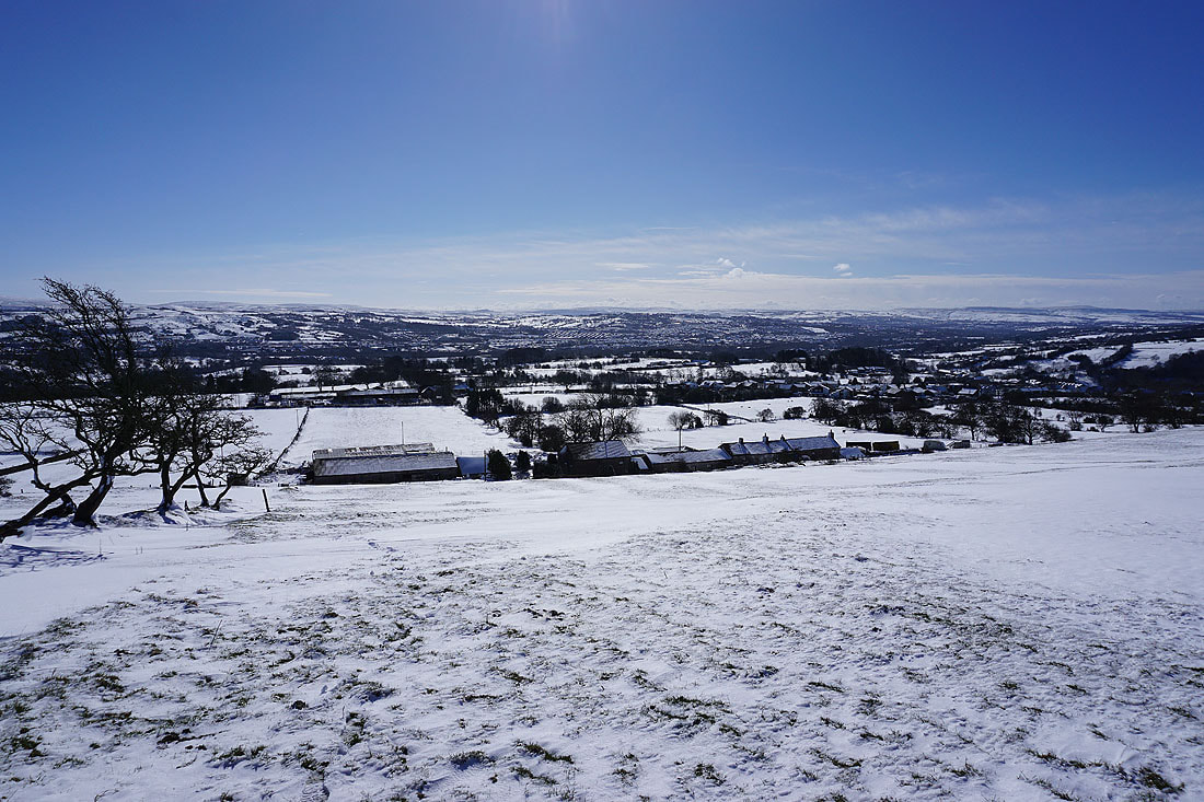
Looking down on Blacko Hill Side Farm and Blacko as I head up onto Blacko Hill
and across to Foulridge Lower Reservoir, Ickornshaw Moor, and Boulsworth Hill
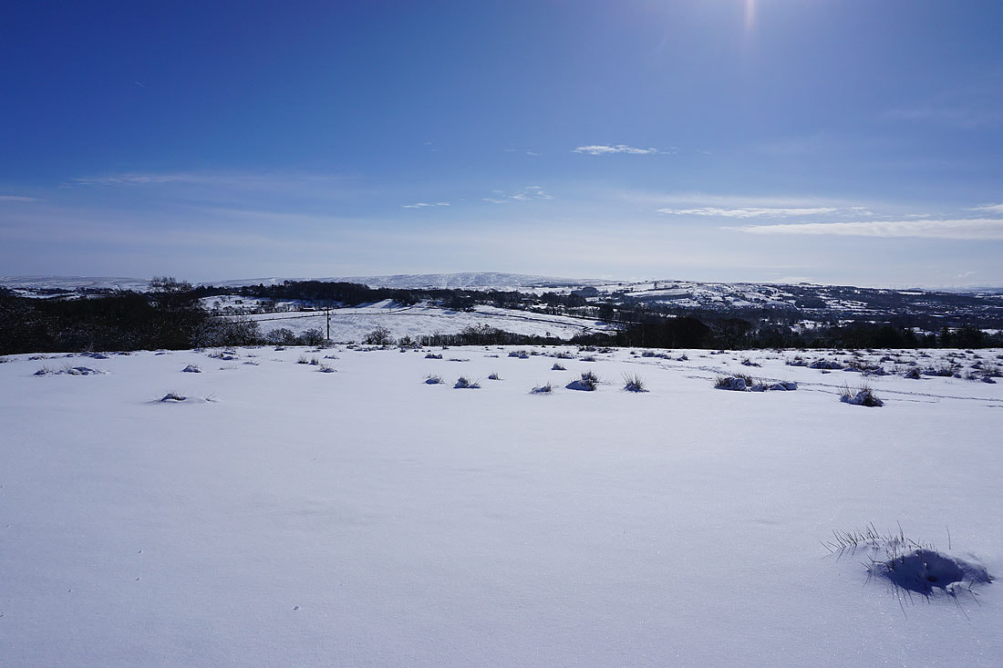
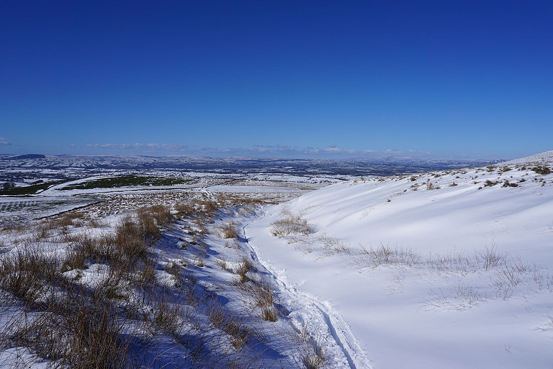
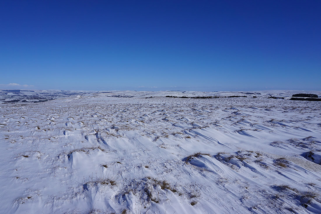
With some height gained the effect that the strong easterly wind had on the powdery snow becomes pretty obvious

On Blacko Hill
Pendle Hill in the distance from the bridleway at Peel's House Farm
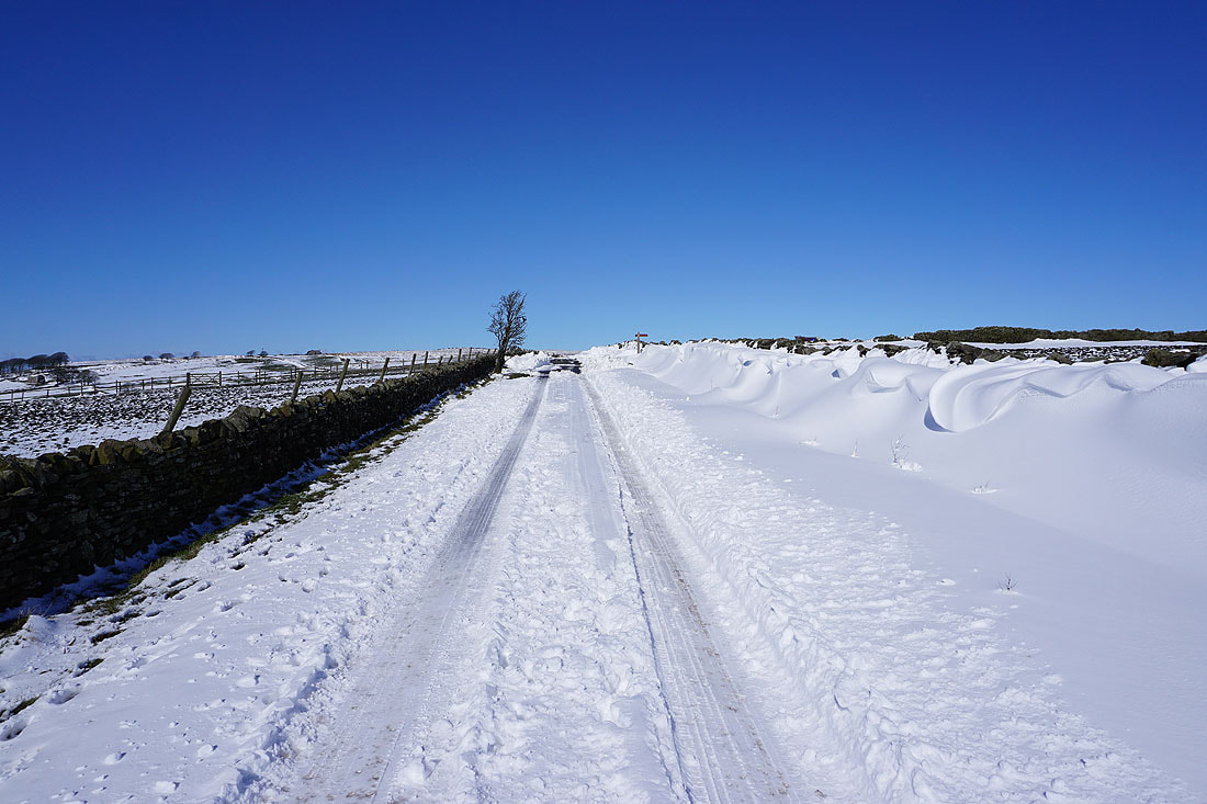
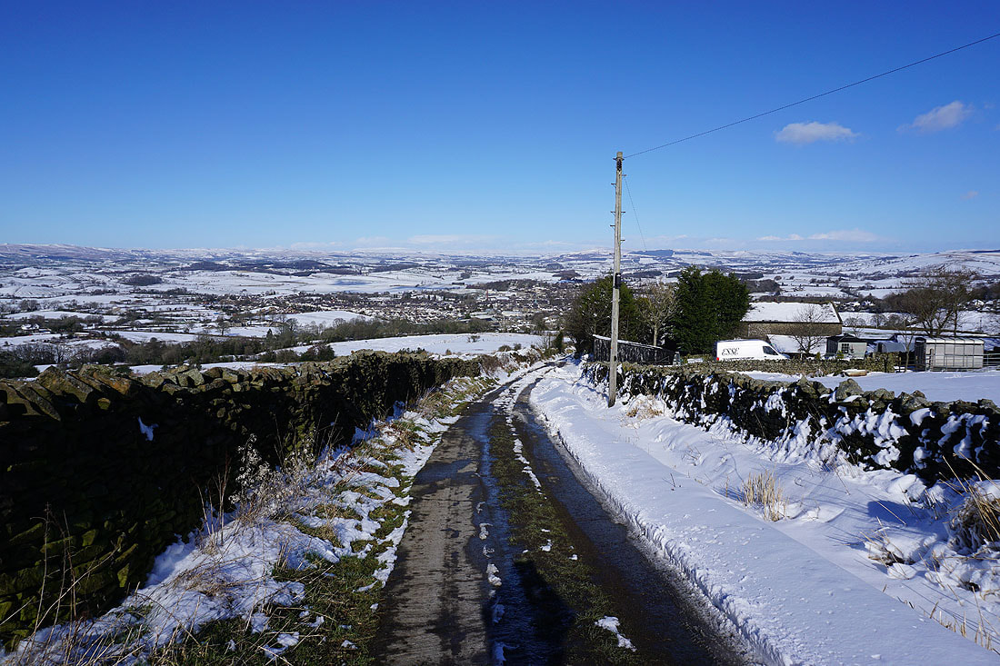
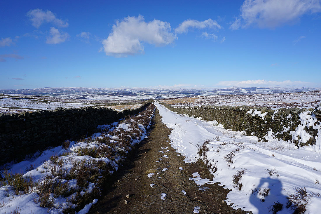
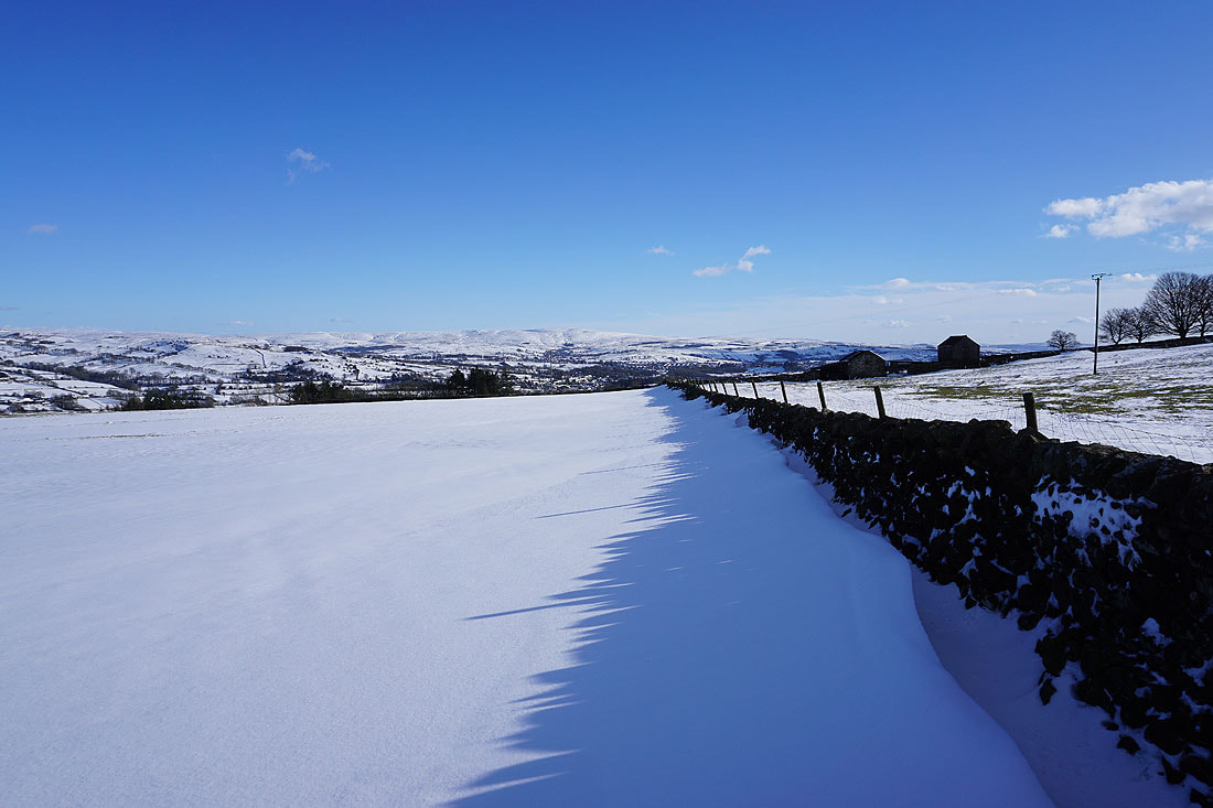
Heading up Gisburn Old Road
Pendle Hill and Burn Moor to my left
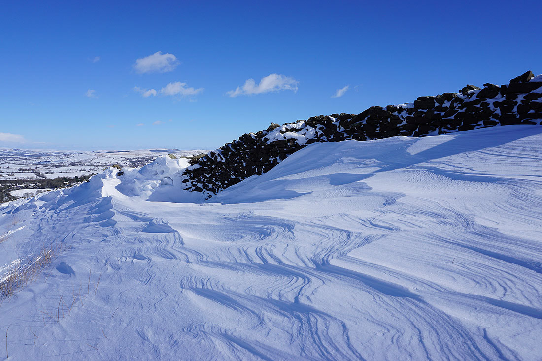
There's a big contrast between the deep drifts and where the strength of the wind has blown the snow away to leave grass showing
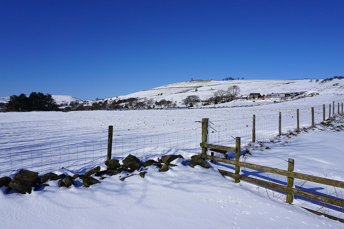
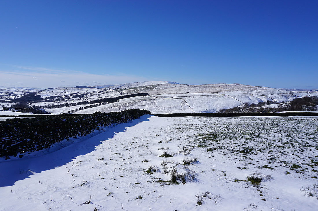
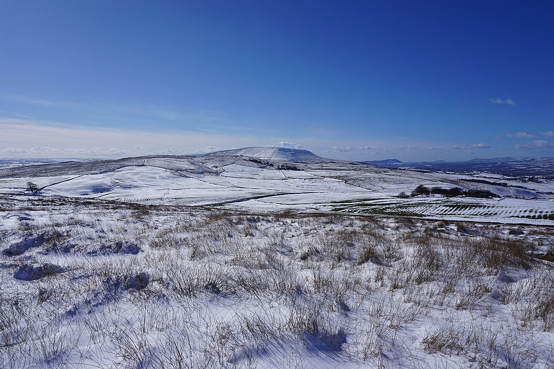
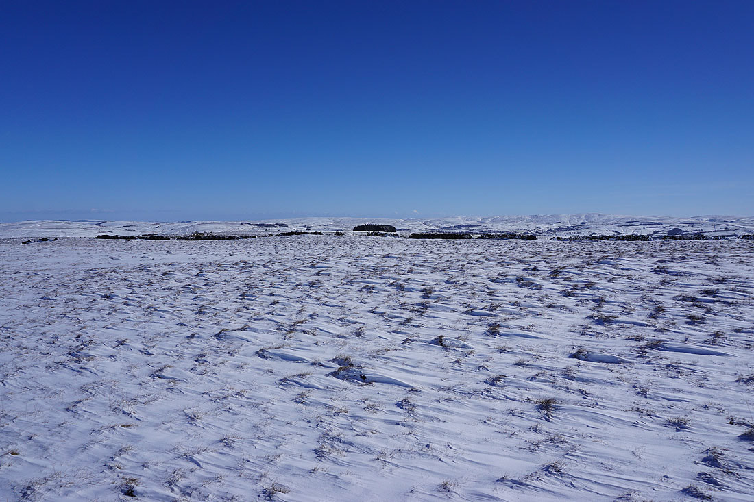
Blacko Hill, the Forest of Pendle and Pendle Hill
Looking back down Gisburn Old Road with Boulsworth Hill in the distance
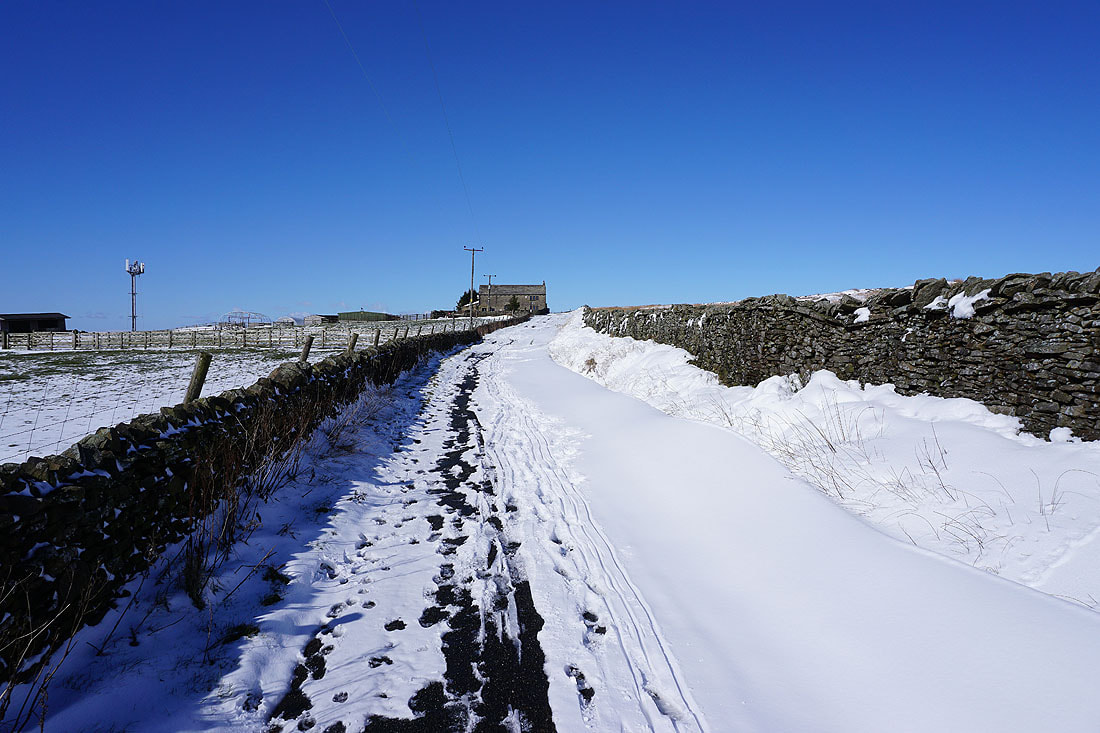
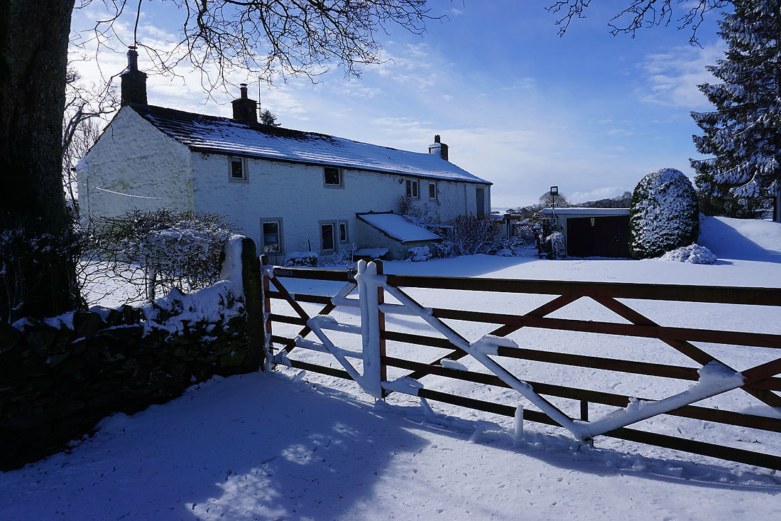
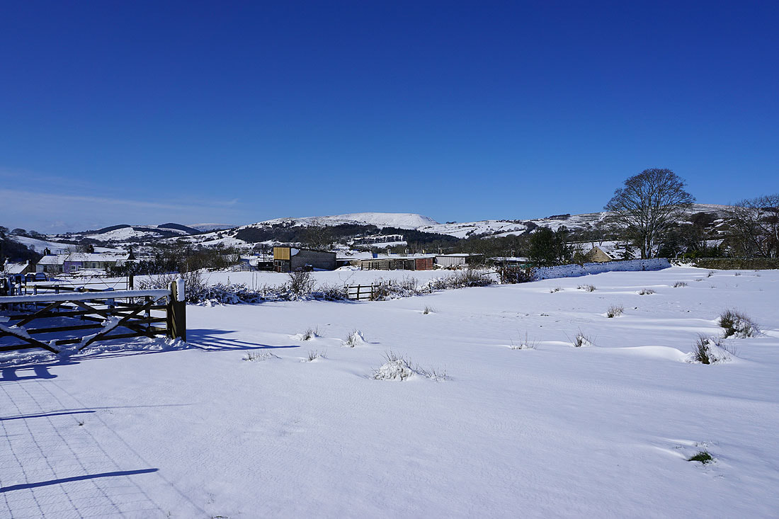
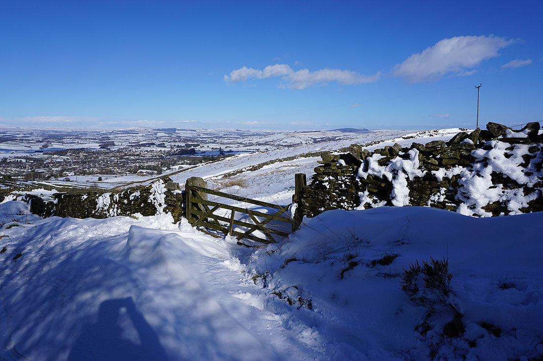
Approaching Weets House Farm at the top of Gisburn Old Road
At the top of the Pennine Bridleway beside Weets House Farm
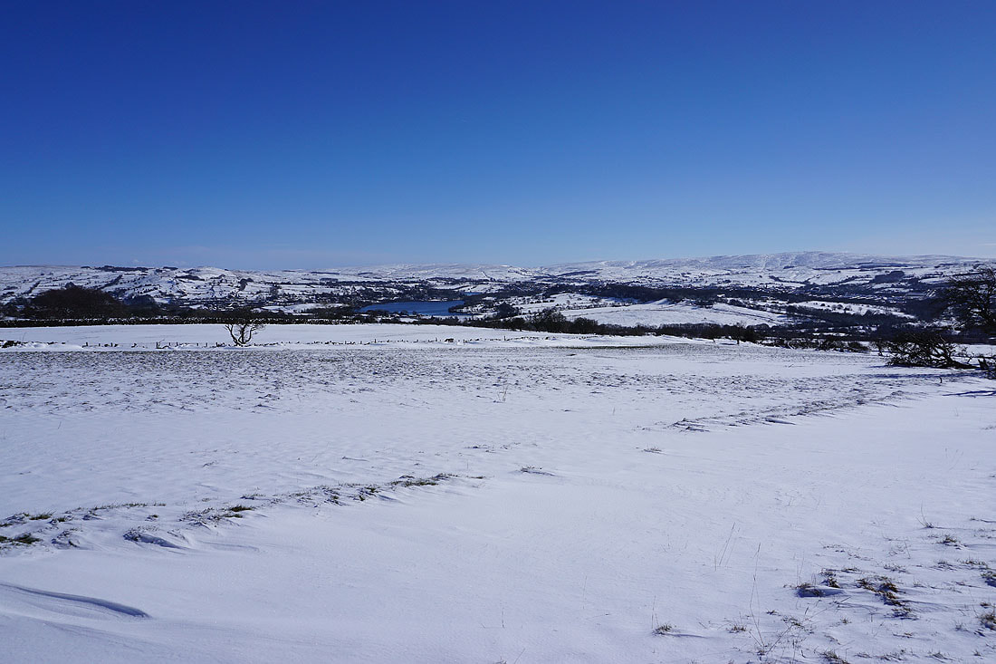
The Pennine Bridleway heads north towards the Ribble Valley
Pendle Hill beyond Rimington Moor
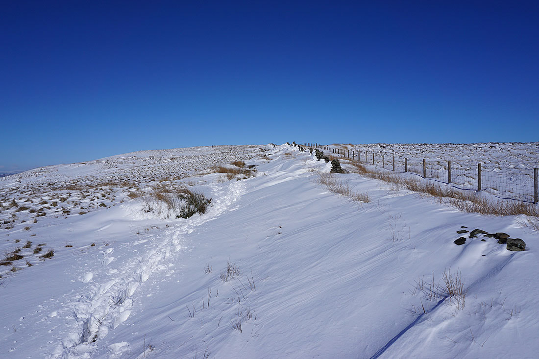
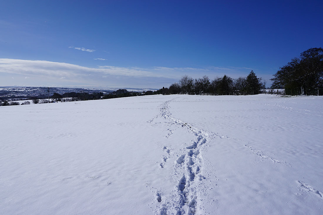
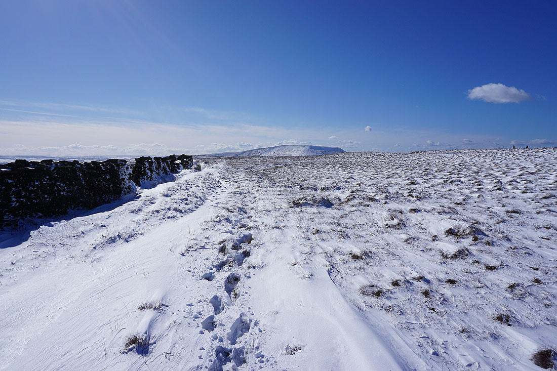
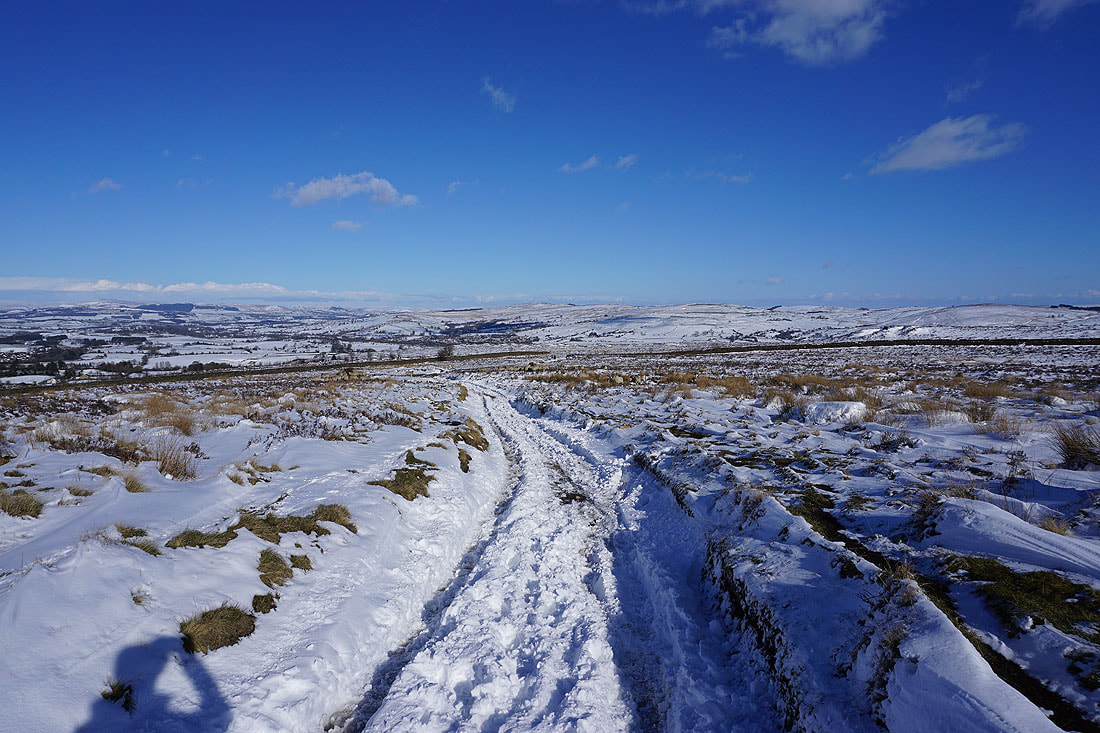
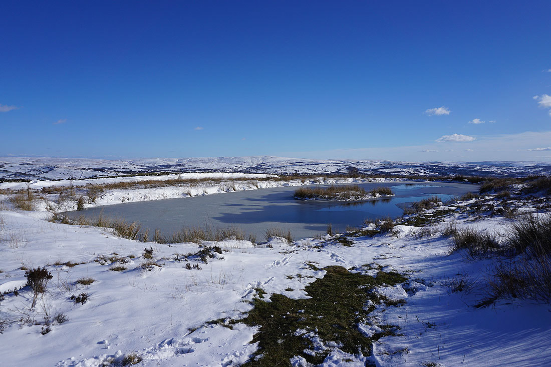
Heading for the top of Weets Hill. The snow is soft, and deep in places. I'll have to watch my step.
Crossing the top of Weets Hill..
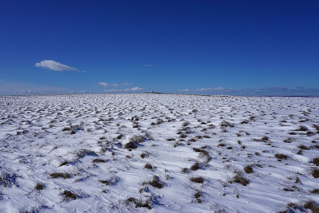
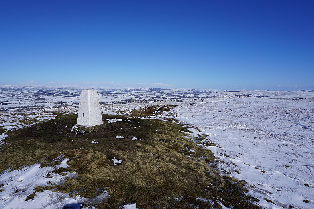
The trig point above me to my left
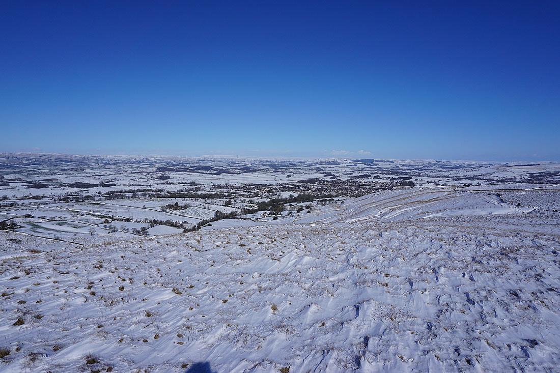
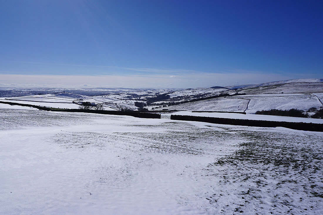
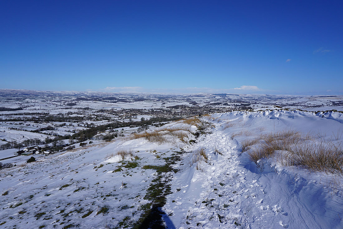
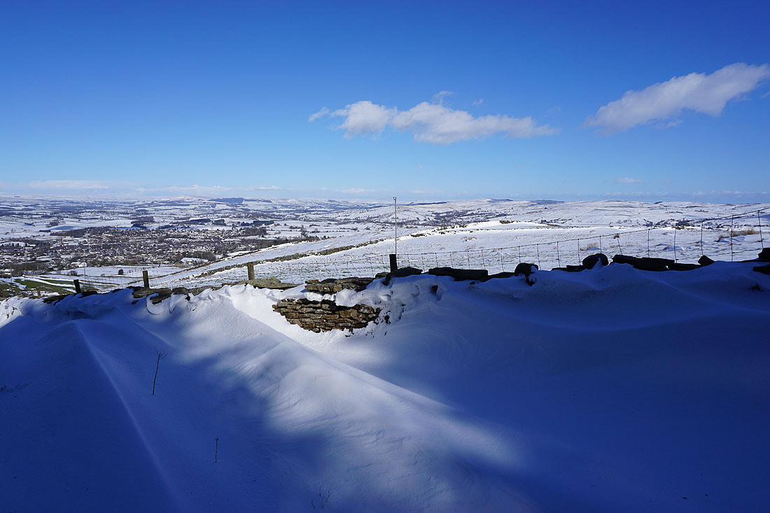
At the eastern end of the summit. A snow covered scene as I look northeast across Barnoldswick to Great Whernside and Barden Moor in the distance.
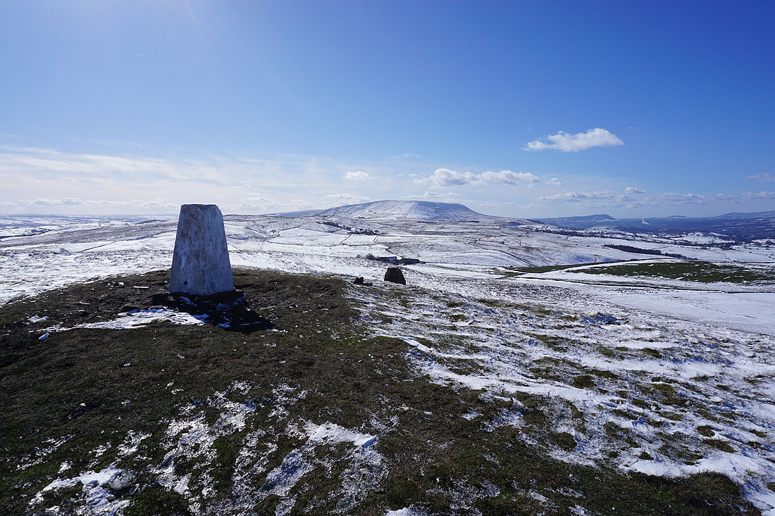
Pendle Hill from the trig point on Weets Hill
Wind scoured snow on Weets Hill, with Skipton Moor, Pinhaw Beacon and Bleara Moor to the east, and Boulsworth Hill to the southeast..
Great Whernside and Barden Moor in the distance
Ingleborough, Penyghent, and the moors around Malhamdale to the north on the other side of the Ribble Valley. Looks like there's less snow over there.
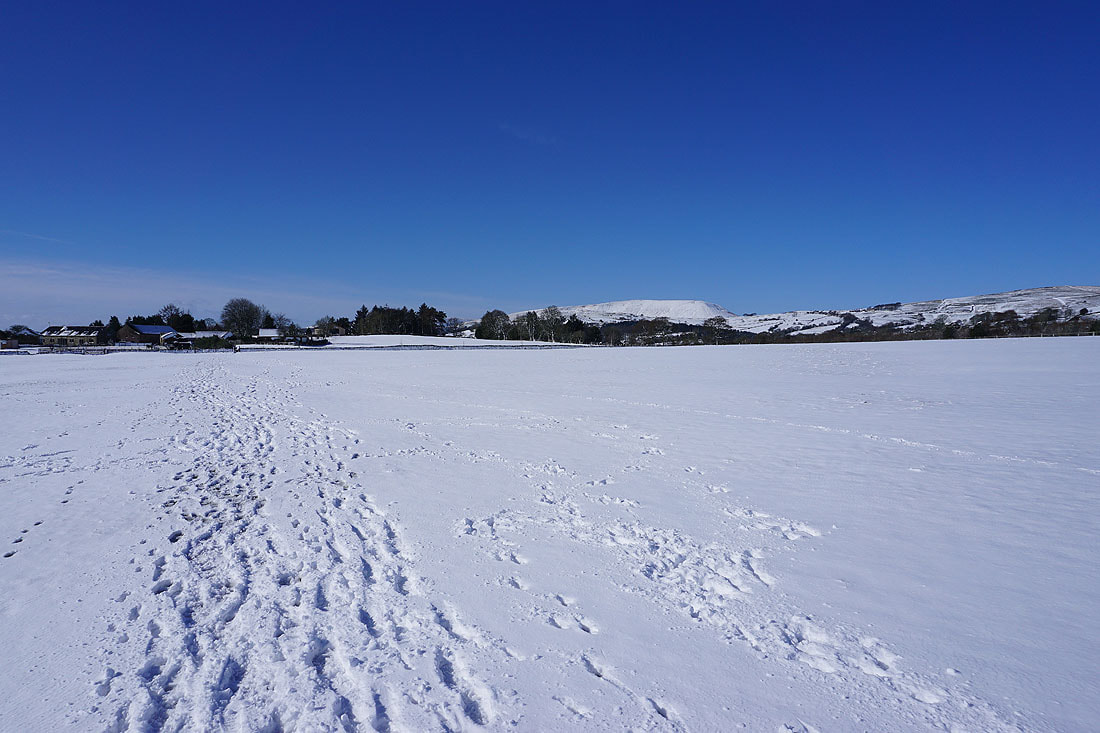
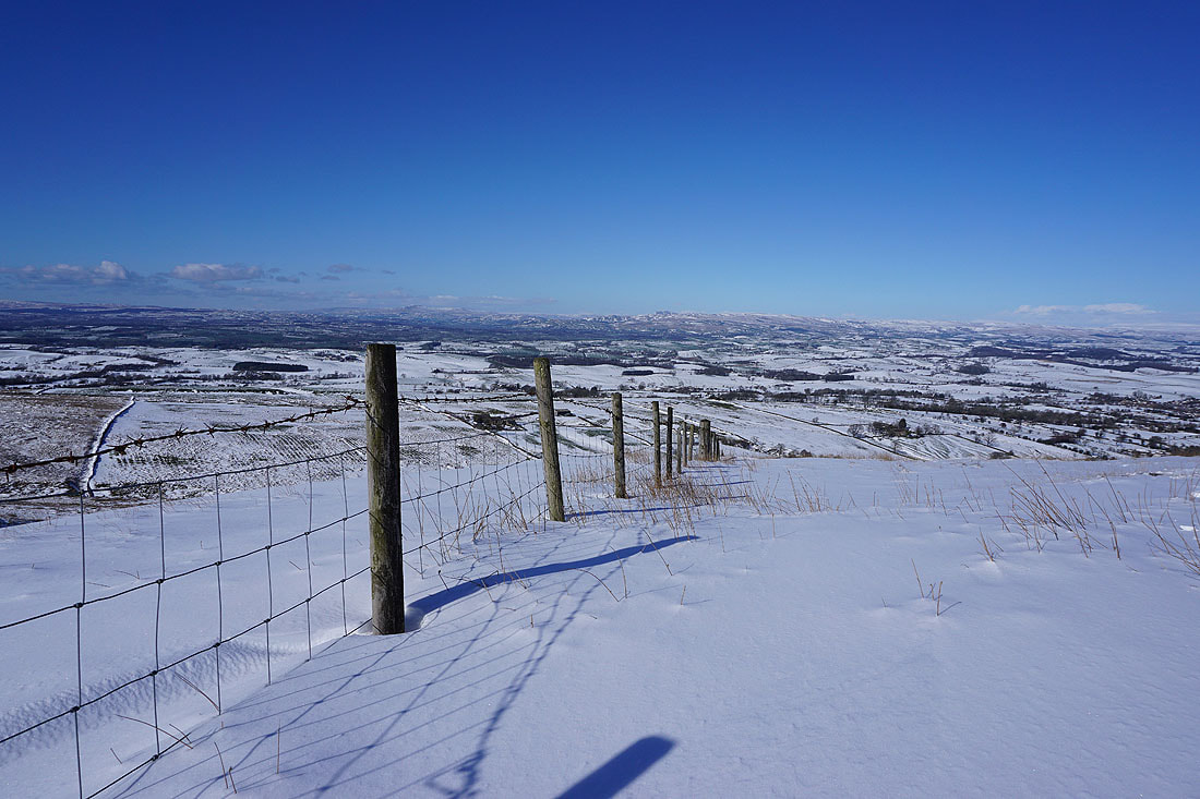
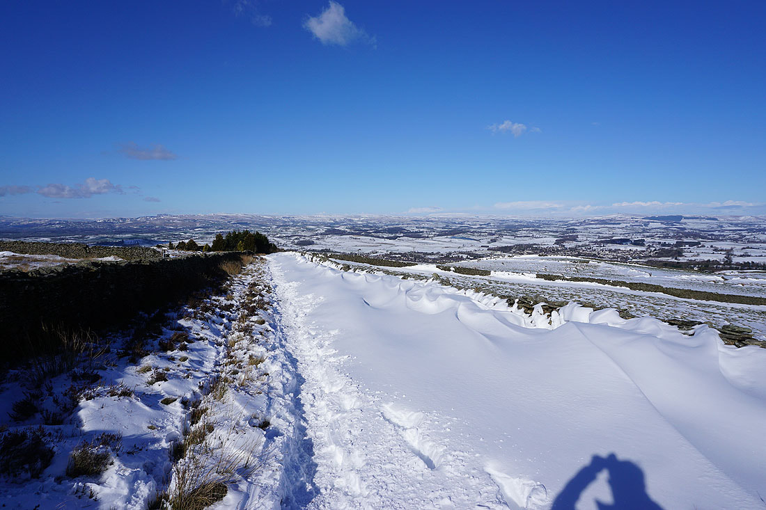
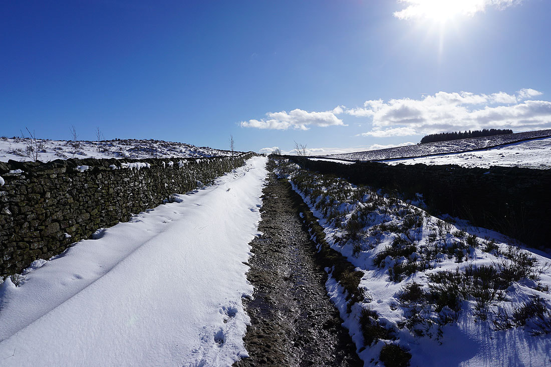
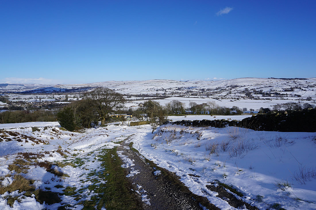
Following the Pendle Way down towards Barnoldswick
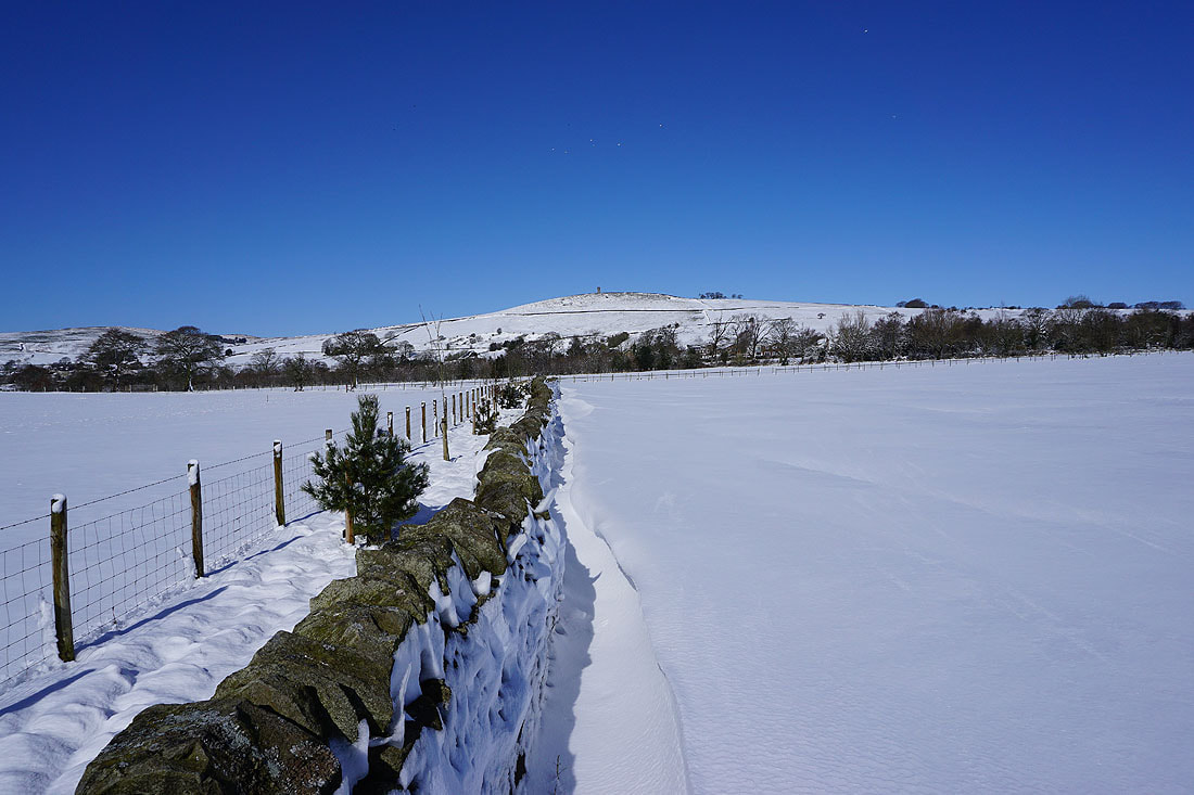
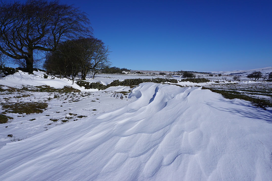
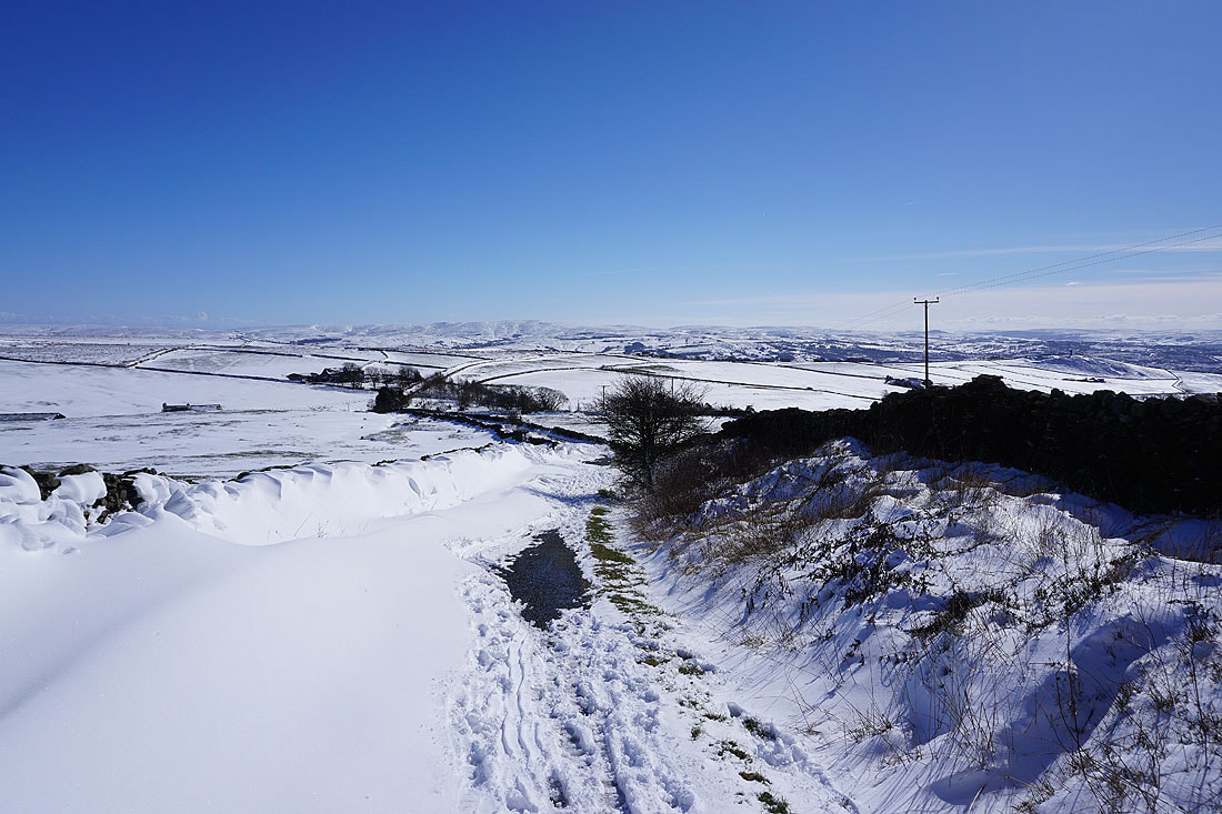
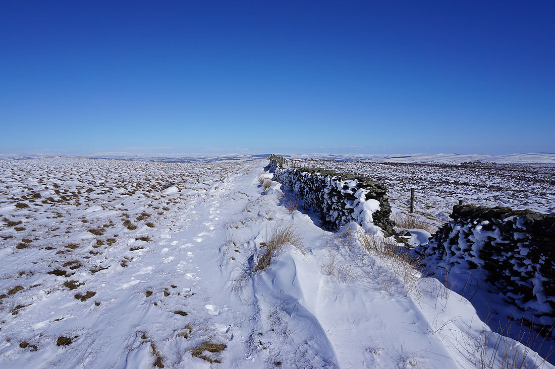
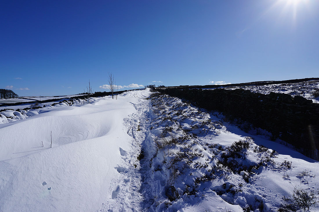
Deep drifts of wind sculpted snow against the wall by the path
On Folly Lane up to Higher View Farm. Looking back down to Barnoldswick.
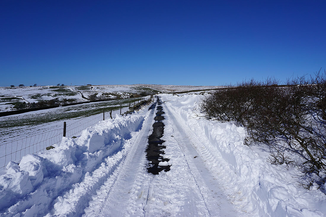
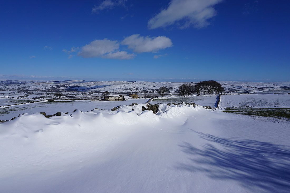
Deep drifts on the bridleway above Higher View Farm..
Following the bridleway from Higher View Farm up to Duck Pond Farm
Looking back to Penyghent, the moors above Malhamdale, and Great Whernside in the distance
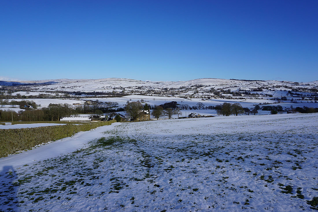
Bleara Moor and Kelbrook Moor to the east behind Prospect House Farm
From Duck Pond Farm I take the footpath down the track past Prospect House Farm to Lister Well Road
Heading up the bridleway of Lister Well Road
Looking back to Penyghent, the moors above Malhamdale, and Great Whernside in the distance
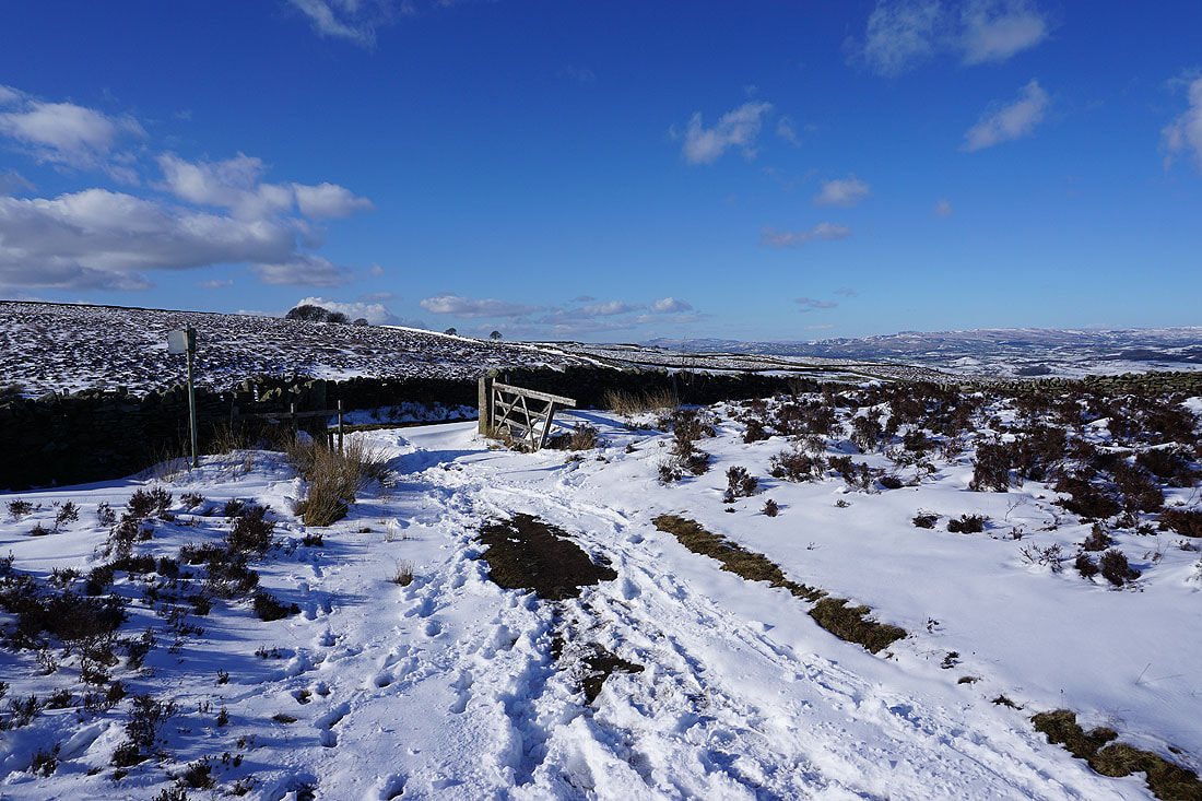
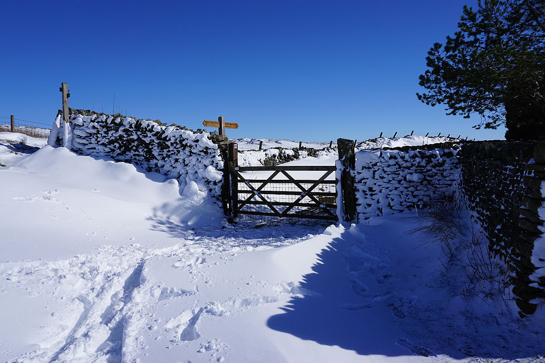
Lister Well Road is left through the gate for the footpath down the track past Copy Nook to High Lane
Boulsworth Hill from the pool on Lad Lowe Hill
and again from the track past Copy Nook down to High Lane
Approaching High Lane with Thornton Moor, Bleara Moor, and Kelbrook Moor ahead of me
Bleara Moor and Kelbrook Moor as I head down to Booth House Farm
Across the footbridge over County Brook
Looking back to the moors above Malham and Great Whernside in the distance from the footpath to Hey
Making my way through the hillside hamlet of Hey

Boulsworth Hill in the distance as I head back down to Foulridge..