10th November 2013 - Loughrigg Fell
Walk Details
Distance walked: 7.0 miles
Total ascent: 1723 ft
OS map used: OL7 - The English Lakes, South-eastern area
Time taken: 6 hrs
Route description: Elterwater-Skelwith Bridge-Loughrigg Tarn-Todd Crag-Lily Tarn-Ivy Crag-Loughrigg Fell-Loughrigg Terrace-Elterwater
Loughrigg Fell is one of those lesser Lakeland heights that punches far above its stature in terms of its scenic qualities. My only previous visit was three years ago on a grey day that included bagging Holme Fell and Black Crag, so it was a fleeting visit under far from ideal weather.
Today it was as good as it gets and I'm glad I resisted the temptation to climb a higher fell. There were fantastic views all round and great conditions for photography.
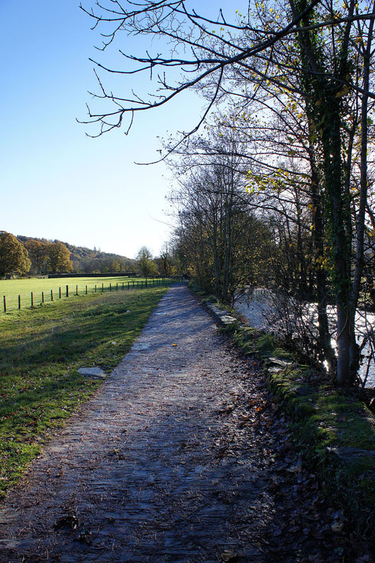
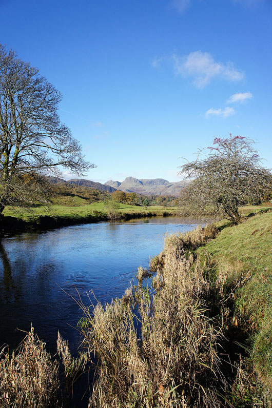
From the NT car park in Elterwater I followed the Cumbria Way by Elter Water and the River Brathay to Skelwith Bridge. There I crossed the A593 to take the minor road uphill past Little Loughrigg to Loughrigg Tarn. I then made my way along the lower slopes of Loughrigg Fell to Todd Crag above Clappersgate. The next stretch was the best as I visited Lily Tarn and Ivy Crag on the way to the summit of Loughrigg Fell. To get back to Elterwater I descended to the Loughrigg Terrace path to pick up the road from Grasmere over to Elterwater.
Total ascent: 1723 ft
OS map used: OL7 - The English Lakes, South-eastern area
Time taken: 6 hrs
Route description: Elterwater-Skelwith Bridge-Loughrigg Tarn-Todd Crag-Lily Tarn-Ivy Crag-Loughrigg Fell-Loughrigg Terrace-Elterwater
Loughrigg Fell is one of those lesser Lakeland heights that punches far above its stature in terms of its scenic qualities. My only previous visit was three years ago on a grey day that included bagging Holme Fell and Black Crag, so it was a fleeting visit under far from ideal weather.
Today it was as good as it gets and I'm glad I resisted the temptation to climb a higher fell. There were fantastic views all round and great conditions for photography.
From the NT car park in Elterwater I followed the Cumbria Way by Elter Water and the River Brathay to Skelwith Bridge. There I crossed the A593 to take the minor road uphill past Little Loughrigg to Loughrigg Tarn. I then made my way along the lower slopes of Loughrigg Fell to Todd Crag above Clappersgate. The next stretch was the best as I visited Lily Tarn and Ivy Crag on the way to the summit of Loughrigg Fell. To get back to Elterwater I descended to the Loughrigg Terrace path to pick up the road from Grasmere over to Elterwater.
Route map
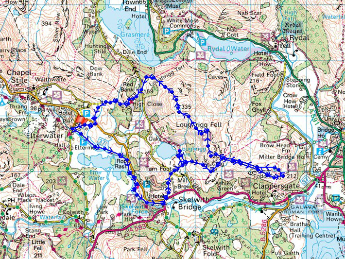
© Crown copyright. All rights reserved. License number PU 100034184.
Leaving Elterwater on the Cumbria Way
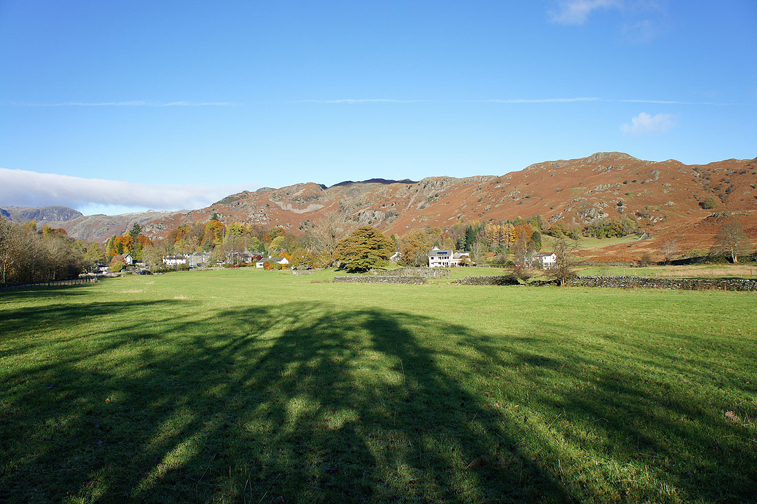
Looking back to Elterwater with Dow Bank behind
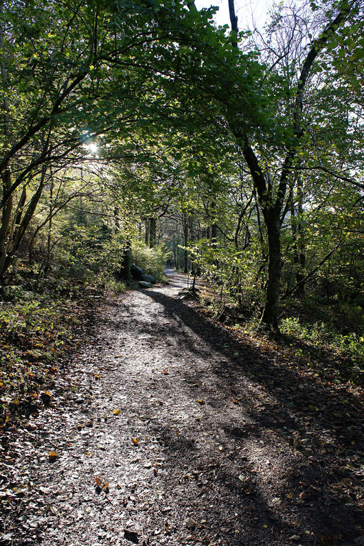
On the path to Elter Water
The Langdale Pikes from the shores of Elter Water. That's Lingmoor Fell on the left.
Fantastic scenery from the path by the River Brathay
Wetherlam and Great Carrs are the fells in the distance
The Langdale Pikes..
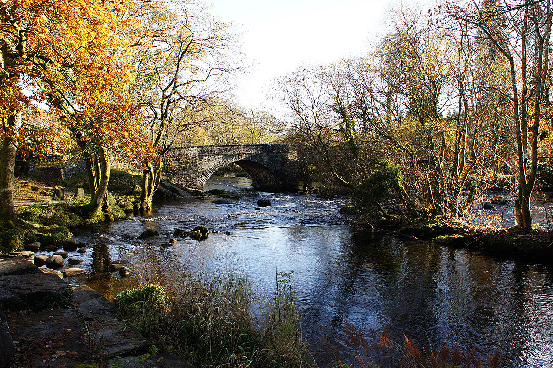
Skelwith Bridge and this is where I'll leave the Cumbria Way to head for Loughrigg Tarn
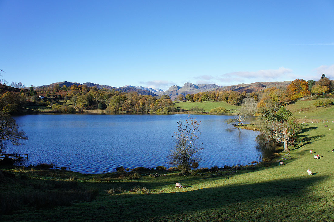
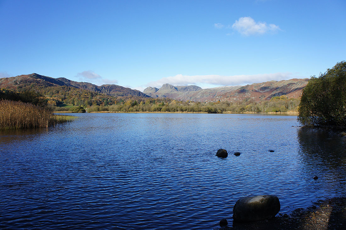
Loughrigg Tarn suddenly appears as the path rounds a corner
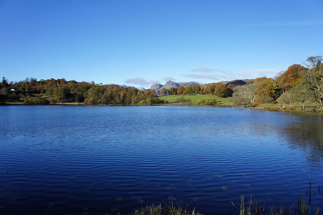
The Langdale Pikes in the distance from the shores of Loughrigg Tarn
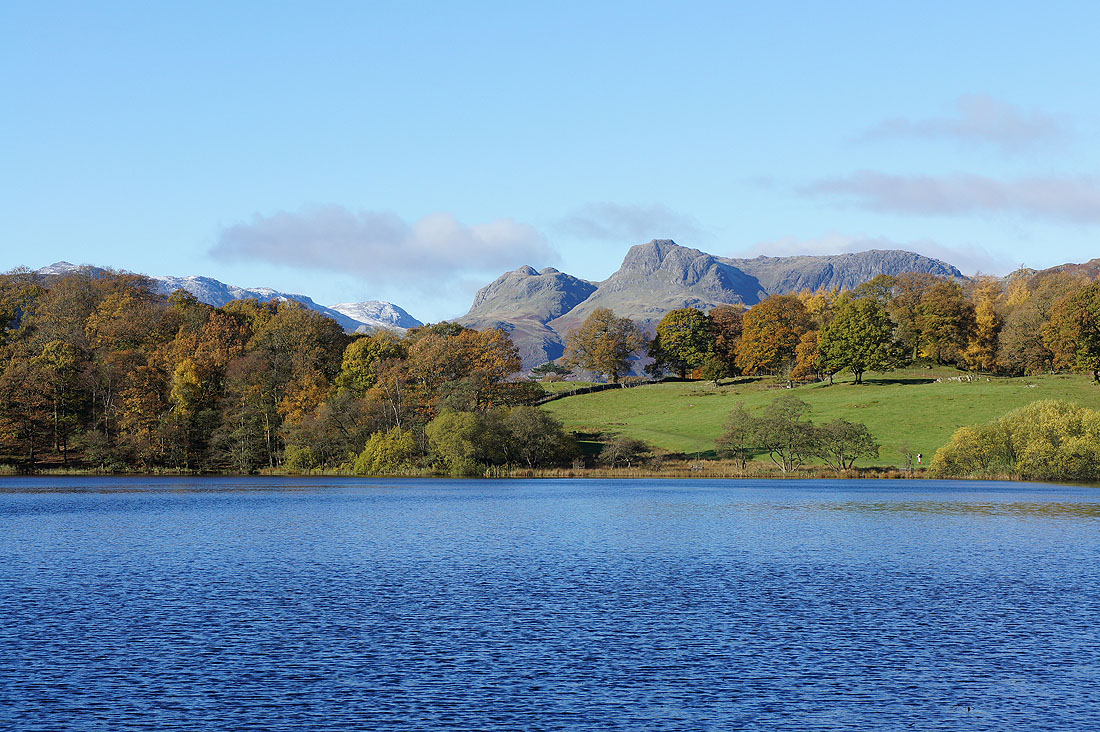
Zooming in to show the tops of Loft Crag, Pike o'Stickle, Harrison Stickle and Pavey Ark. The snow dusted fell to the left of the Langdale Pikes is Great End.
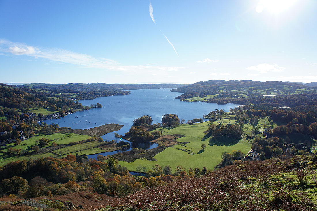
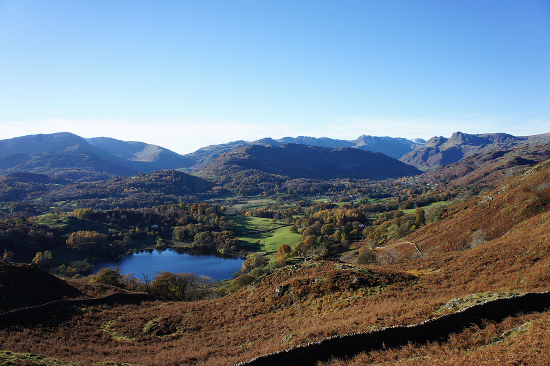
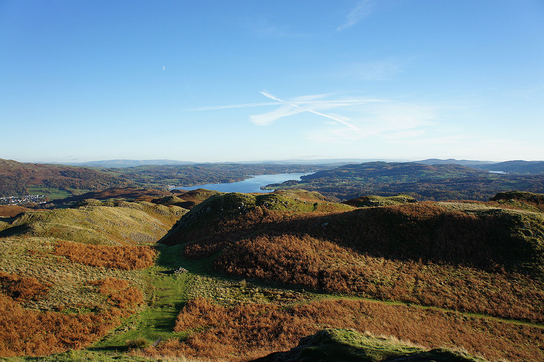
On the far point of the walk, Todd Crag. Well, the Todd Crag that's in AW's chapter on Loughrigg Fell. On the OS map Todd Crag is to the west of Lily Tarn. Anyway, there's a fantastic view of Windermere.
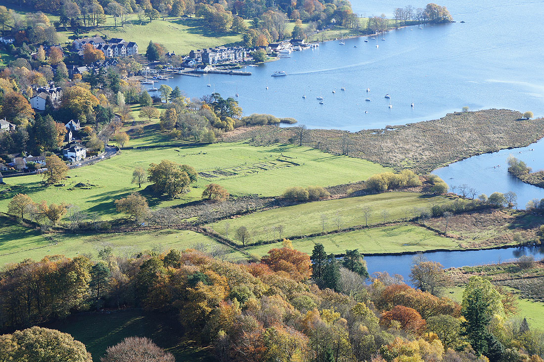
The ruins of the Roman Fort of Galava
The Fairfield Horseshoe and Red Screes
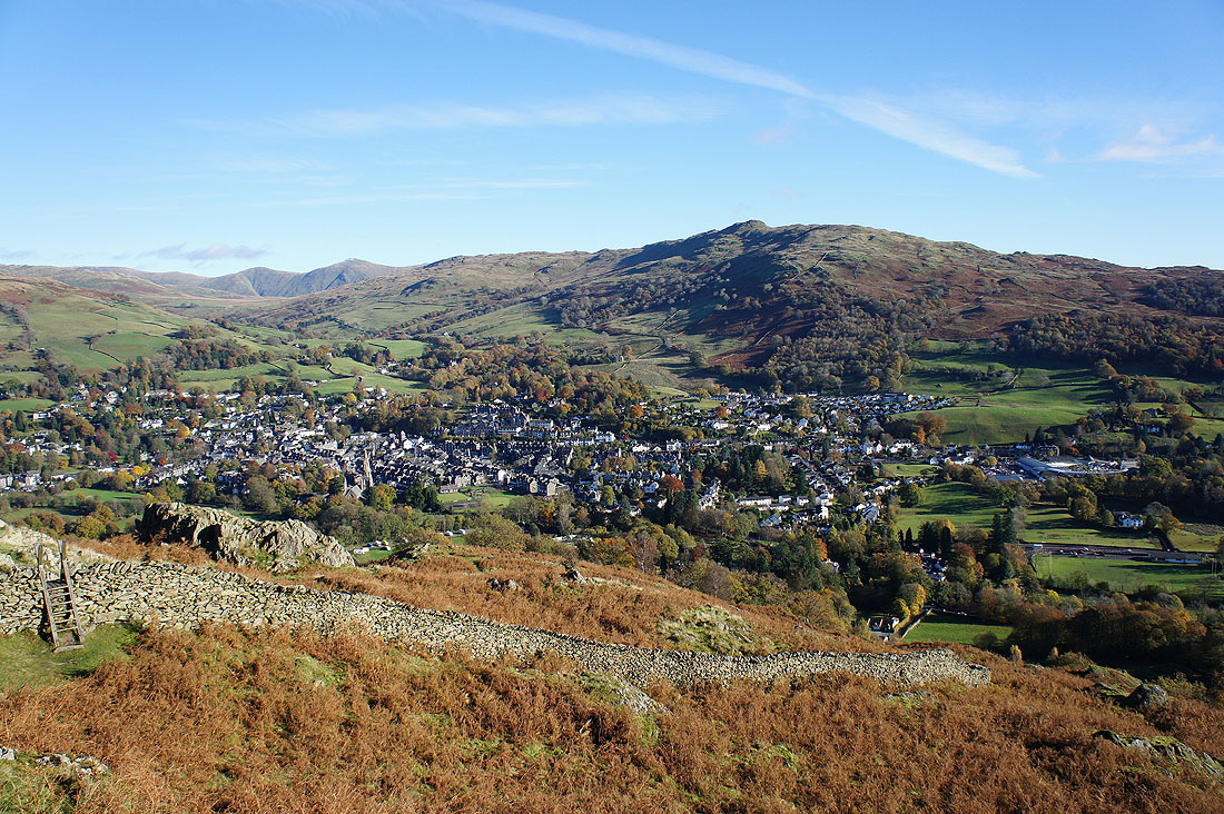
The town of Ambleside below Wansfell Pike
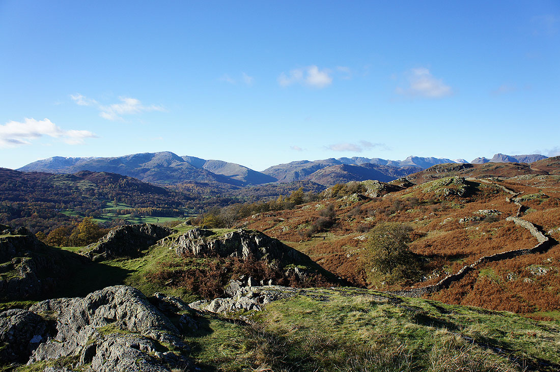
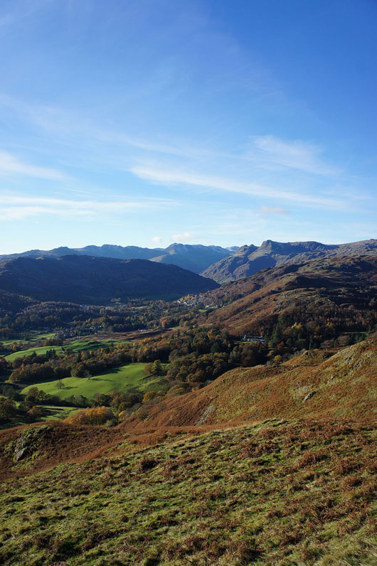
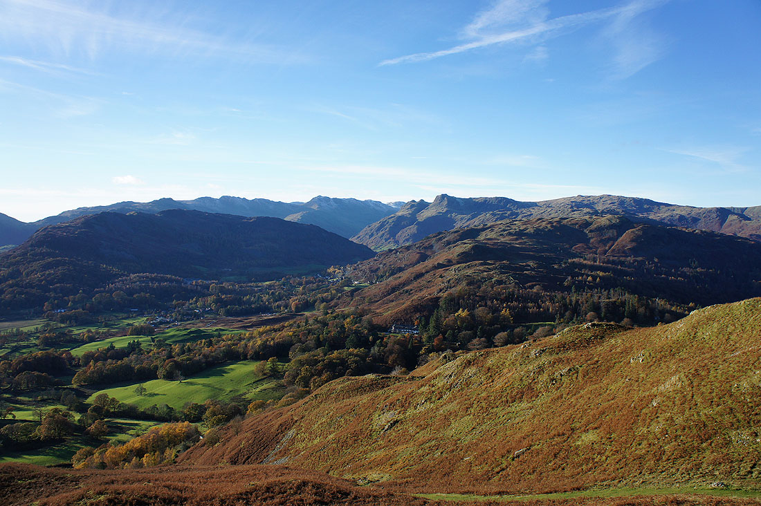
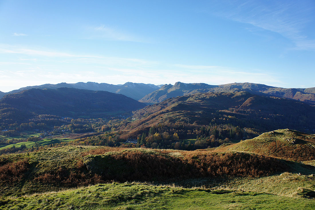
So much to see and the best is yet to come. The Coniston fells are on the left and to the right is Pike o'Blisco, the Crinkle Crags, Lingmoor Fell and Bowfell. The tops of the Langdale Pikes can also be made out.
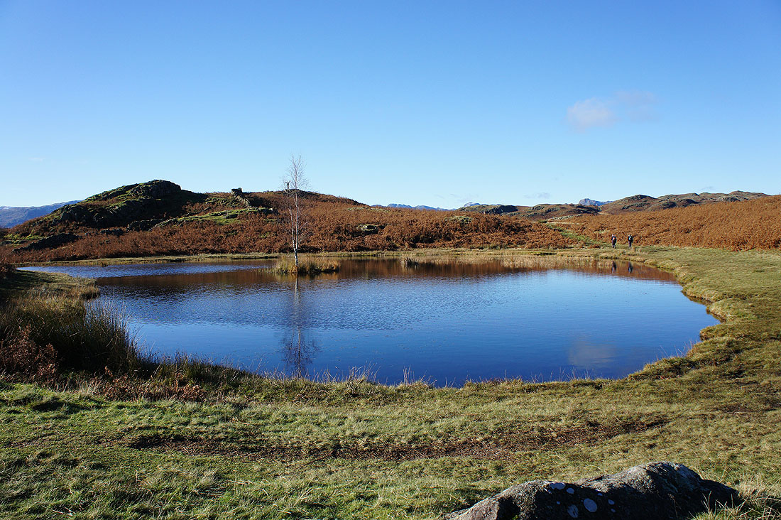
Passing Lily Tarn
Lily Tarn from the rocky outcrop behind the tarn in the previous picture
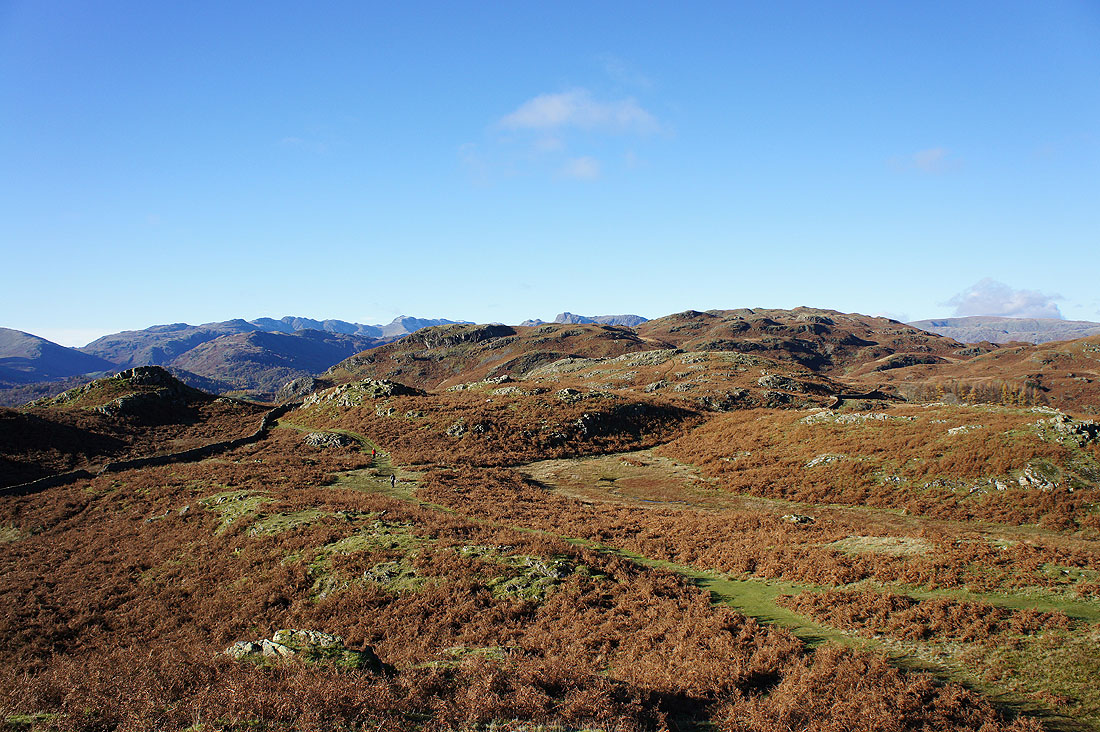
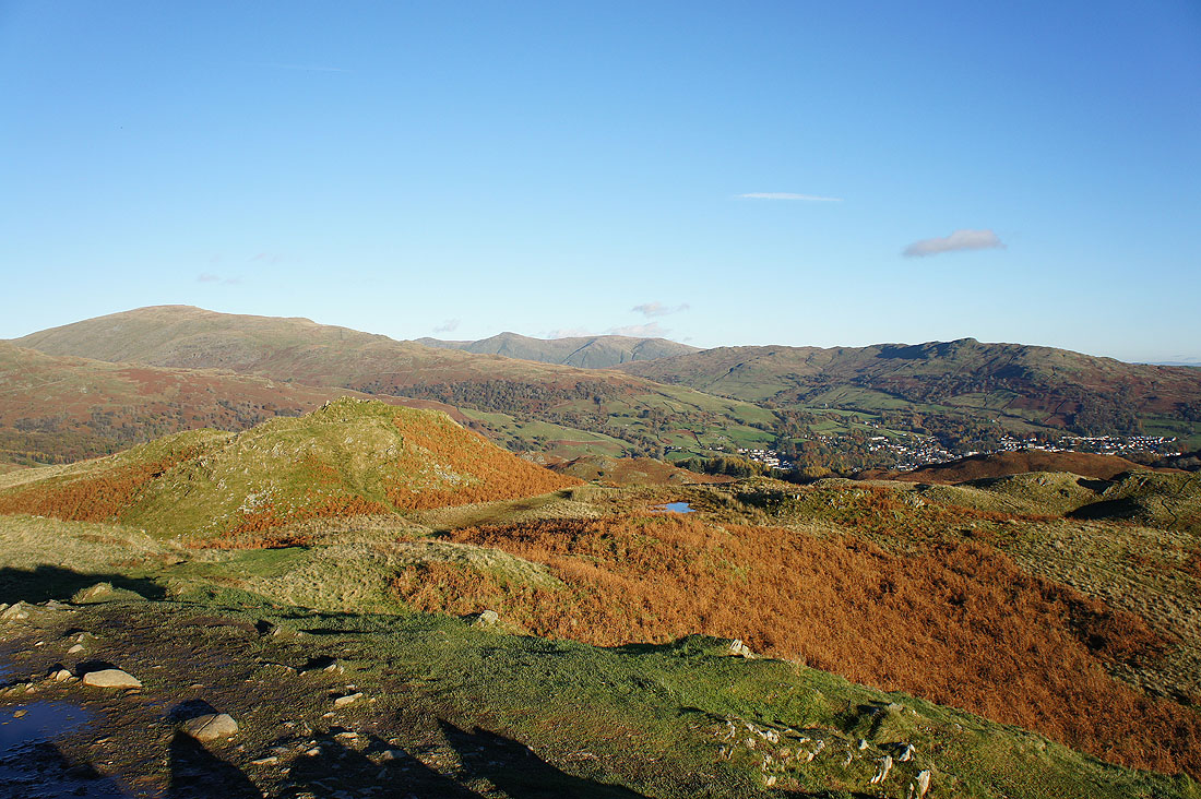
and from the same spot the undulating terrain of Loughrigg Fell that I'll walk through to reach the summit
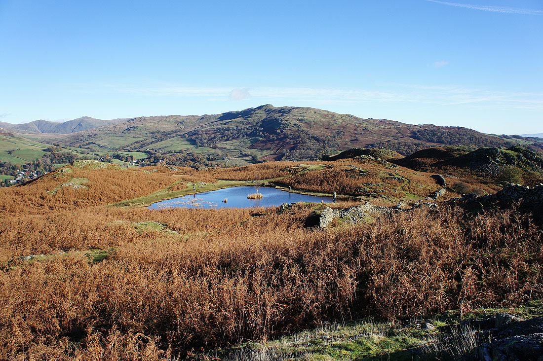
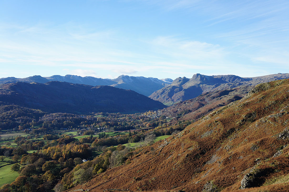
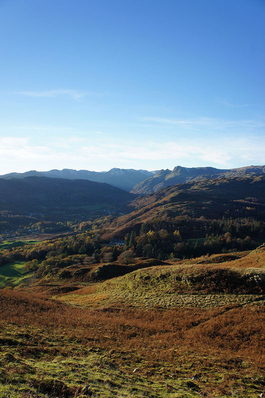
Near Ivy Crag and what a glorious scene across Great Langdale. Loughrigg Tarn is below, while the fells in view are Wetherlam, Great Carrs, Pike o'Blisco, the Crinkle Crags, Lingmoor Fell, Bowfell and the Langdale Pikes.
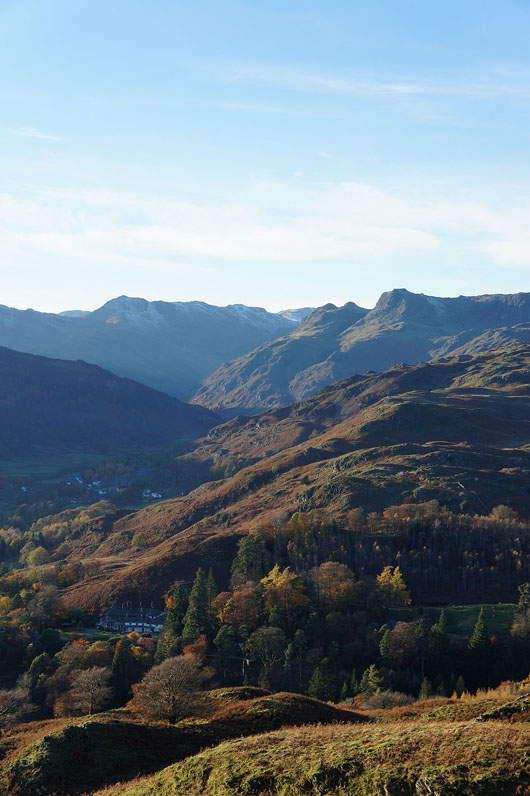
Zooming in on Pike o'Blisco, the Crinkle Crags, Lingmoor Fell, Bowfell and the Langdale Pikes
I'm finally near the trig point but it's busy so I'll wait a while and take in the scenery to the south of the summit above Lad Crag. Behind Elter Water are Wetherlam, Swirl How and Great Carrs. To the right is the cresent shaped Lingmoor Fell with Pike o'Blisco, Crinkle Crags and Bowfell behind it.
I couldn't resist taking a couple more shots of the head of Great Langdale. As the sun gets lower in the sky the colours and shadows change.
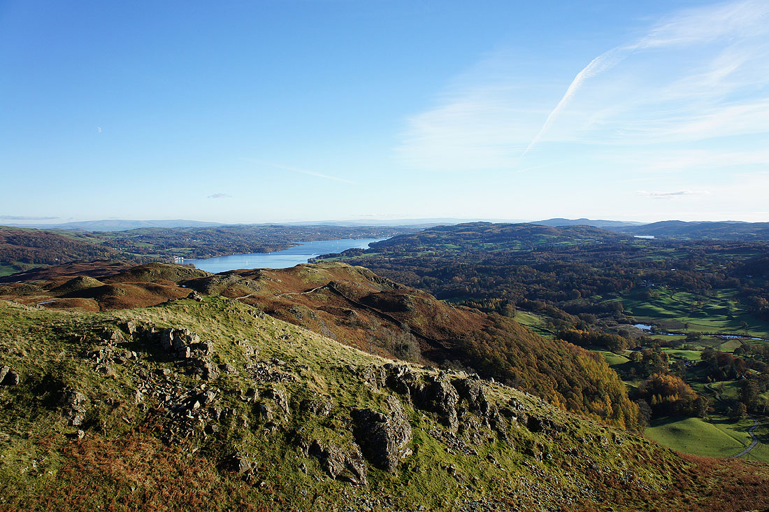
Windermere past Ivy Crag
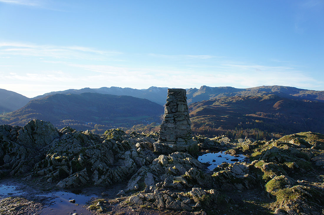
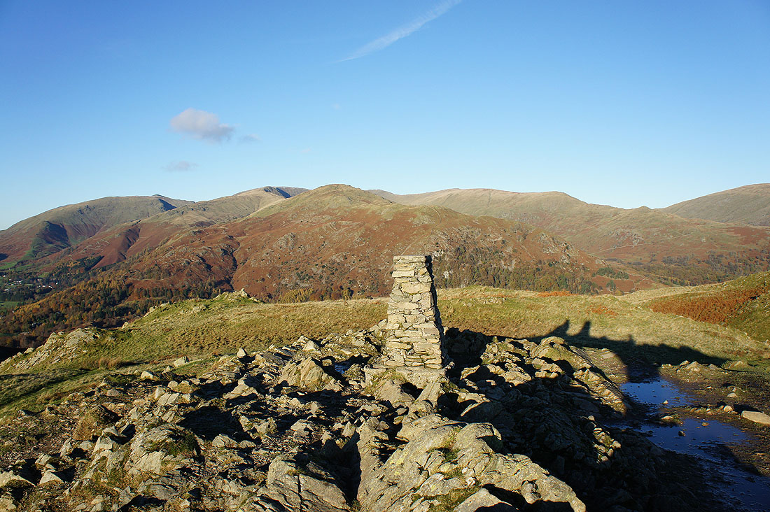
The trig point that marks the top of Loughrigg Fell and I almost have the place to myself
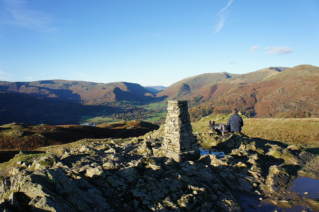
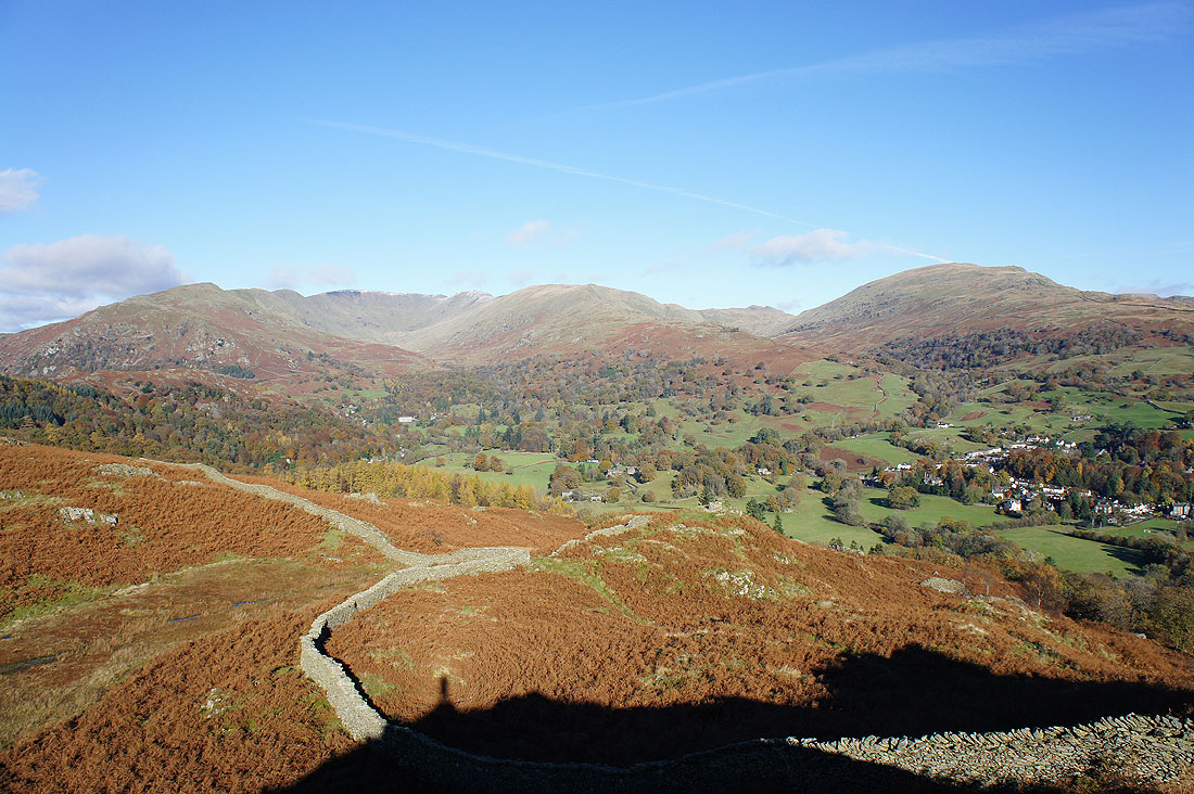
Looking north to the pass of Dunmail Raise
To its left are Helm Crag and Steel Fell and to the right is Seat Sandal
Seat Sandal and the fells that make up the Fairfield Horseshoe. If you follow it round in a clockwise direction that's Nab Scar, Heron Pike, Great Rigg, Fairfield, Hart Crag, Dove Crag, High Pike and Low Pike.
Red Screes and Wansfell Pike with the Ill Bell ridge in the gap between them
Windermere and beyond
Apologies, these are the last photos of Great Langdale. I promise.
|
|
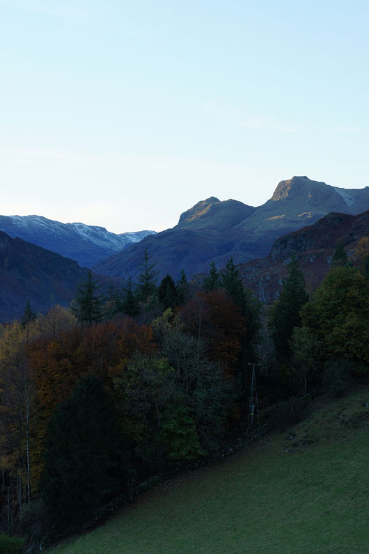
Bowfell, Loft Crag, Pike o'Stickle and Harrison Stickle
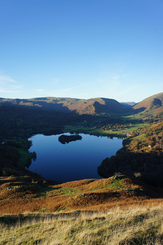
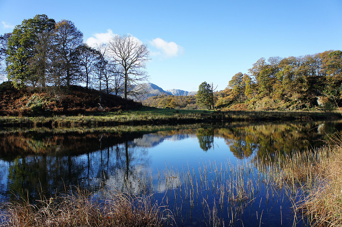
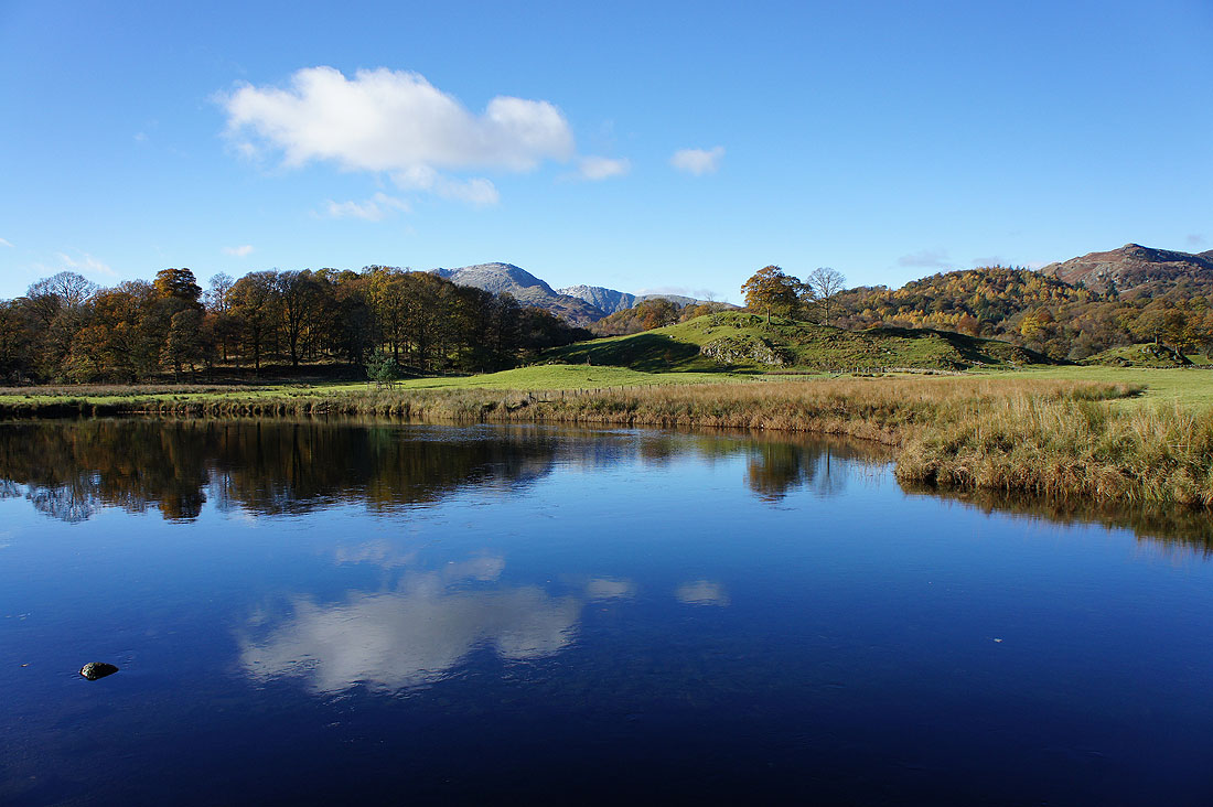
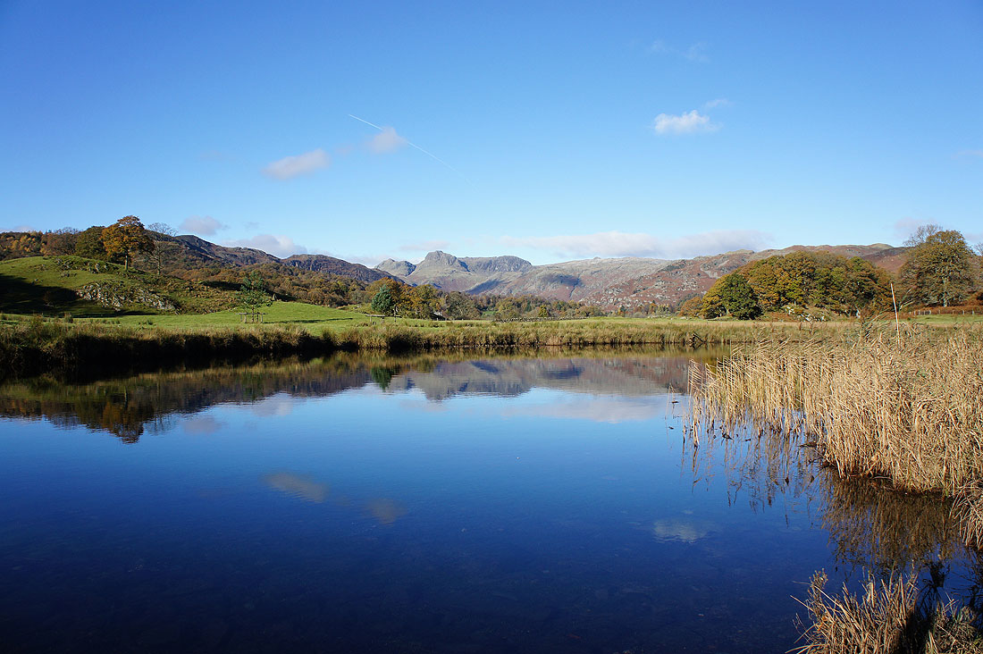
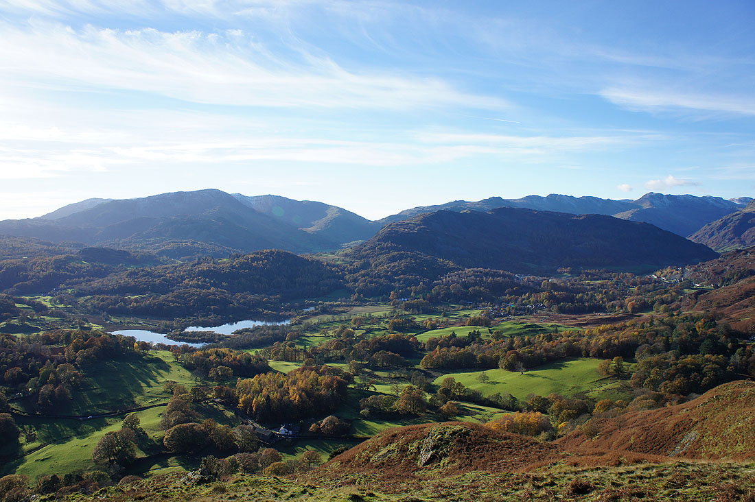
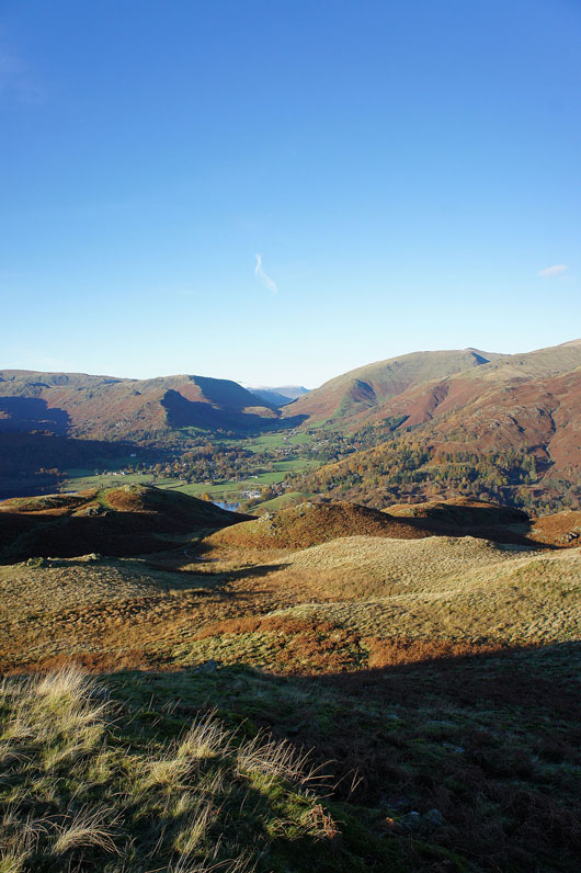
A fantastic view of Grasmere as I head down to the Loughrigg Terrace path
The last of the light catches the tops of Loft Crag and Harrison Stickle..
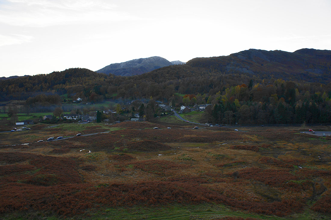
..with Elterwater in sight below