11th January 2014 - Place Fell
Walk Details
Distance walked: 8.0 miles
Total ascent: 2426 ft
OS map used: OL5 - The English Lakes, North-eastern area
Time taken: 5.5 hrs
Route description: Patterdale-Side Farm-Rooking-Boredale Hause-Place Fell-High Dodd-Sleet Fell-Sandwick-Side Farm-Patterdale
My first walk of 2014 and I fancied a walk in the Lakes to kick things off. My last visit to Place Fell was four years ago, a scary thought as it feels like it was just yesterday. Fresh snowfall higher up meant that some of the paths were quite slippery in places so I ended up sticking to the grass by their sides a lot of the time to avoid coming a cropper.
From the car park in Patterdale a brief walk down the road brought me to the village school and the track to Side Farm. Once through the farmyard I then followed the bridleway to Boredale Hause to commence the ascent of Place Fell. After taking in the views from the summit I made my way down to Sandwick via High Dodd and Sleet Fell. My route back was by the bridleway from Sandwick to Patterdale by the shores of Ullswater.
Route map
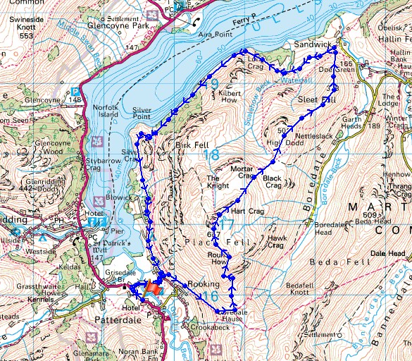
© Crown copyright. All rights reserved. License number PU 100034184.
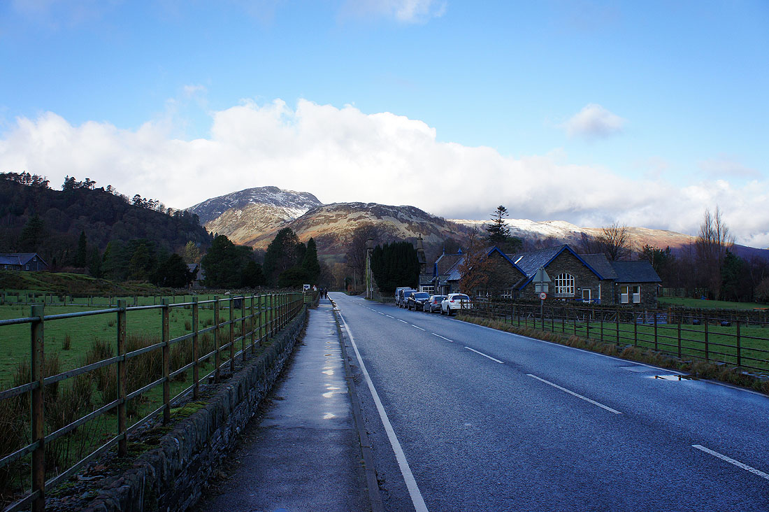
After parking in the car park opposite the Patterdale Hotel there's a brief walk by the road to the buildings ahead for the track to Side Farm
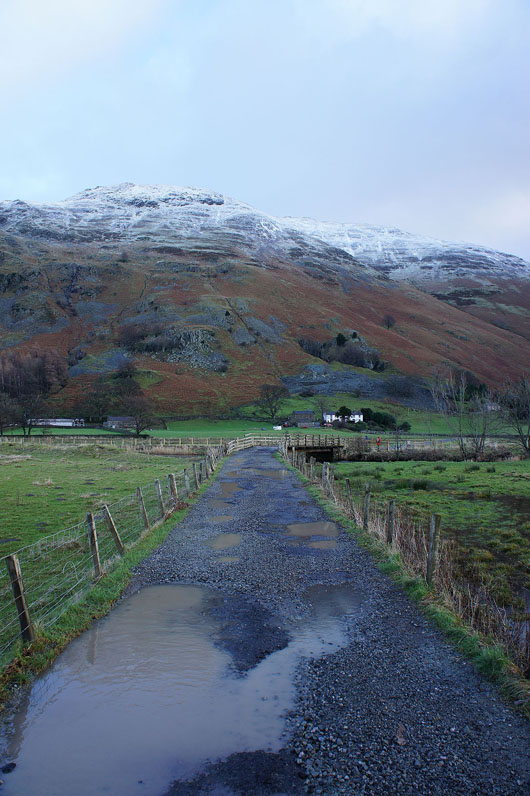
On the track to Side Farm with Place Fell behind
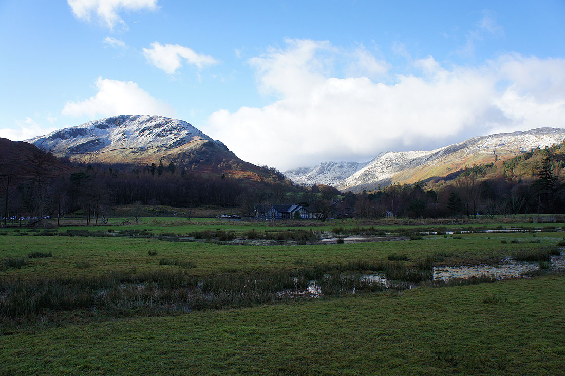
Birks on the left with Nethermost Pike and Birkhouse Moor to the right on the other side of Grisedale
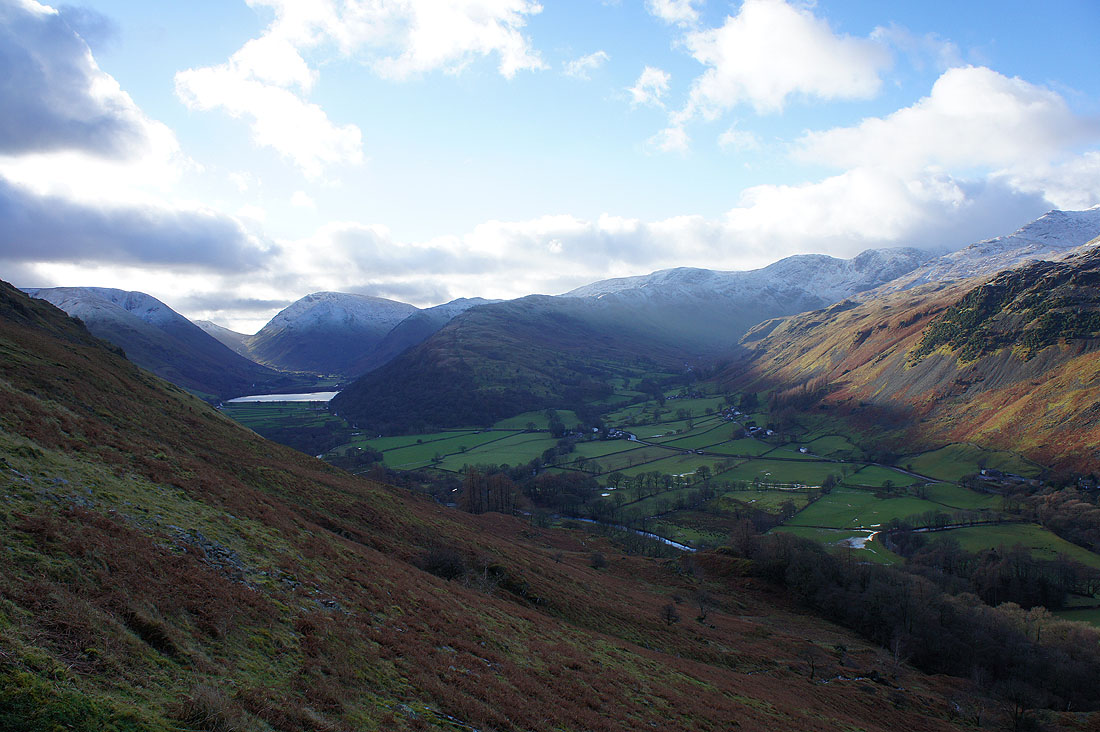
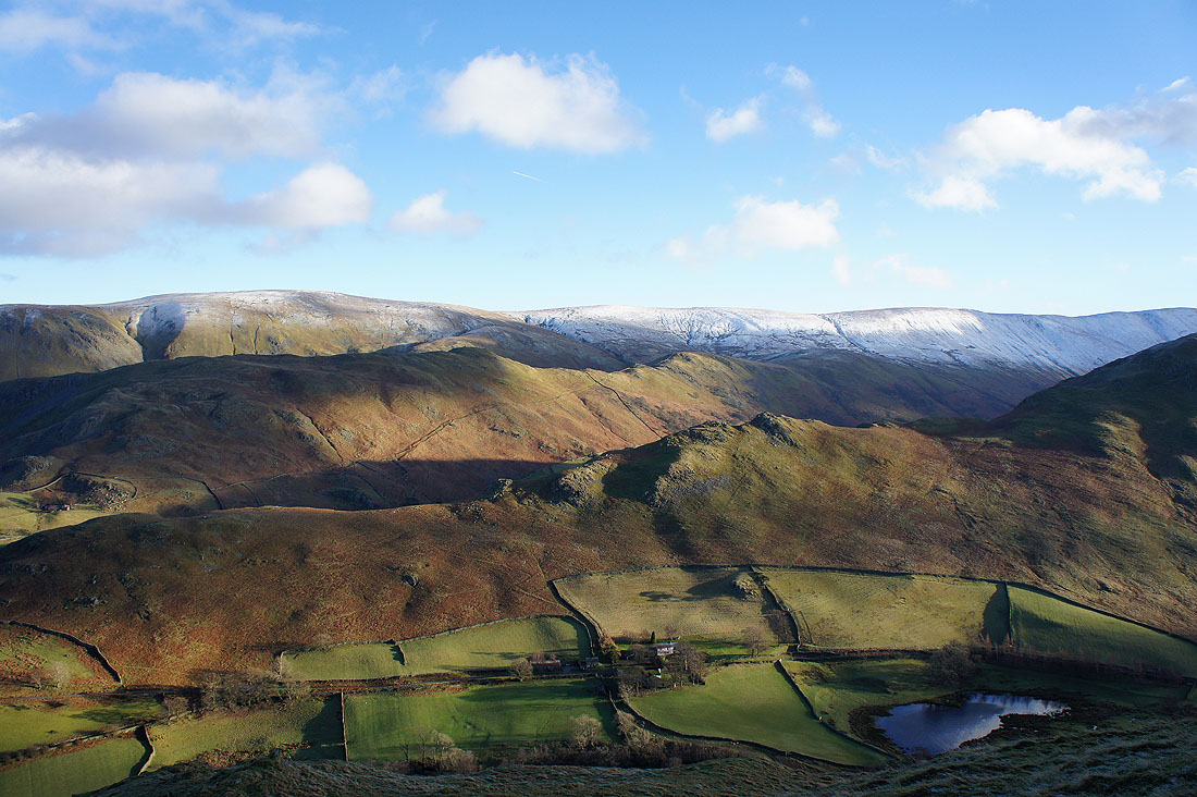
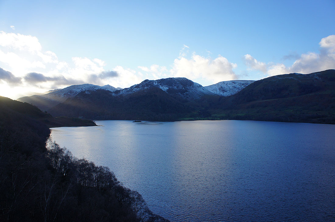
Great views from the path to Boredale Hause. Red Screes behind Brothers Water and the ridge of Hartsop above How heading up to Hart Crag.
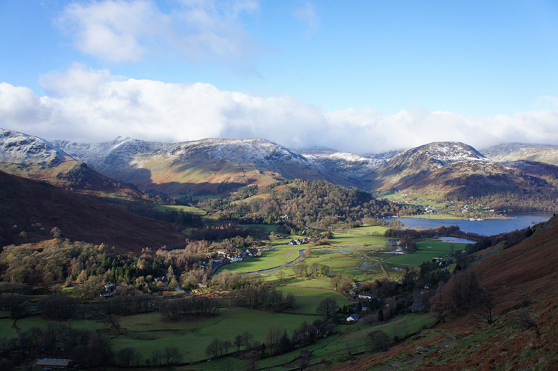
Patterdale, Birkhouse Moor and Keldas, Glenridding and Sheffield Pike
Arnison Crag, Birks and St Sunday Crag
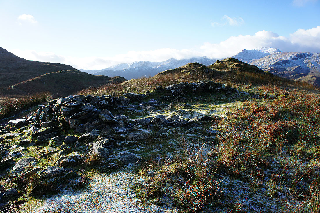
At Chapel in the Hause
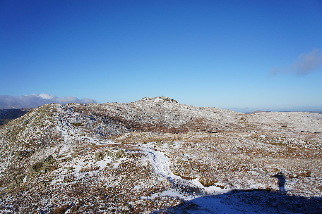
At Round How. The summit just ahead.
A few more shots from Round How. The fells around the Kirkstone Pass; Caudale Moor, Brothers Water, Red Screes, Little Hart Crag, Dove Crag, Hartsop above How and Hart Crag.
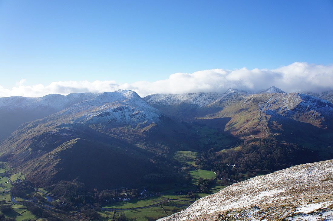
Arnison Crag, Birks, St Sunday Crag, Hart Crag and Fairfield to the left of Grisedale. To its right; Dollywagon Pike, Nethermost Pike and Helvellyn under cloud and Catstye Cam and Birkhouse Moor.
Couldn't resist another shot looking towards the Kirkstone Pass
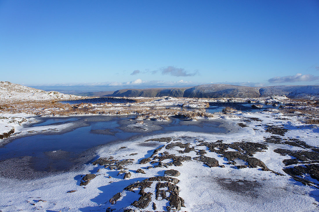
Cold and windy! These pools of water are freezing over.
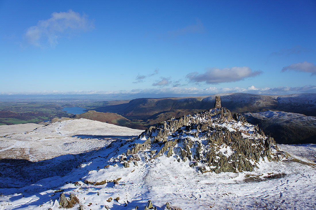
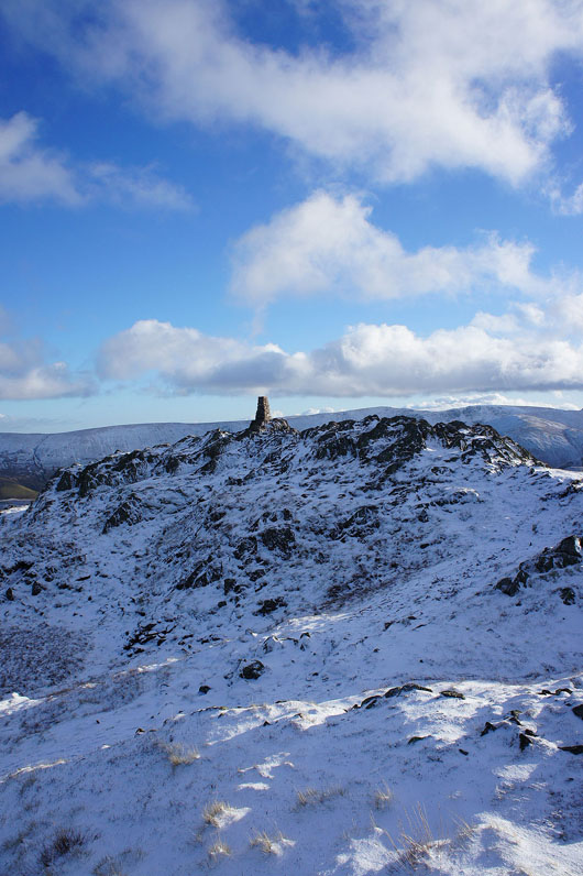
The rocky tor and trig point that marks the summit of Place Fell
High Raise, Rampsgill Head and High Street to the southeast
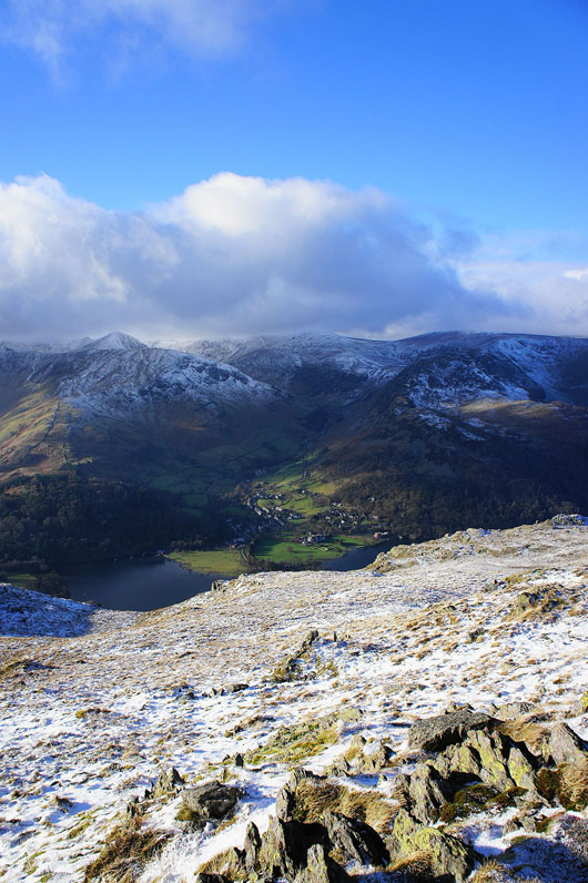
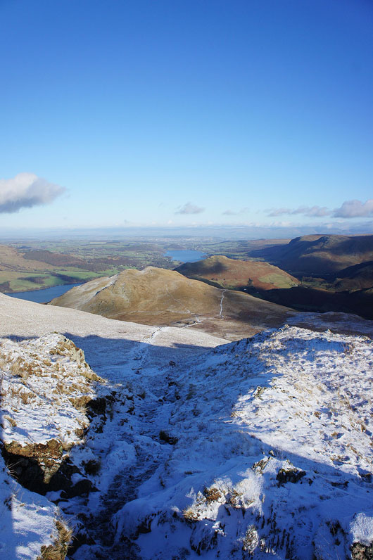
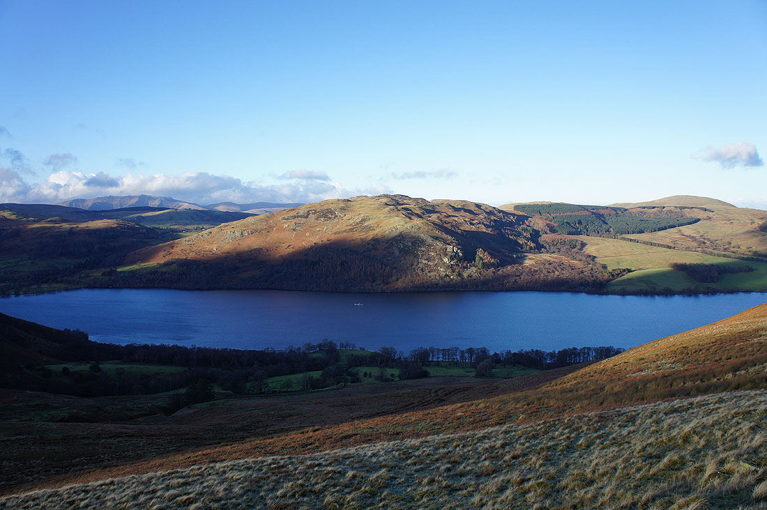
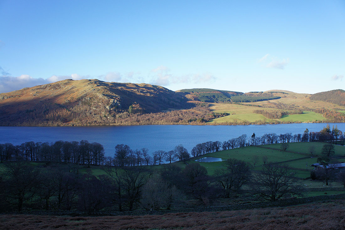
Looking northeast to the foot of Ullswater and Hallin Fell
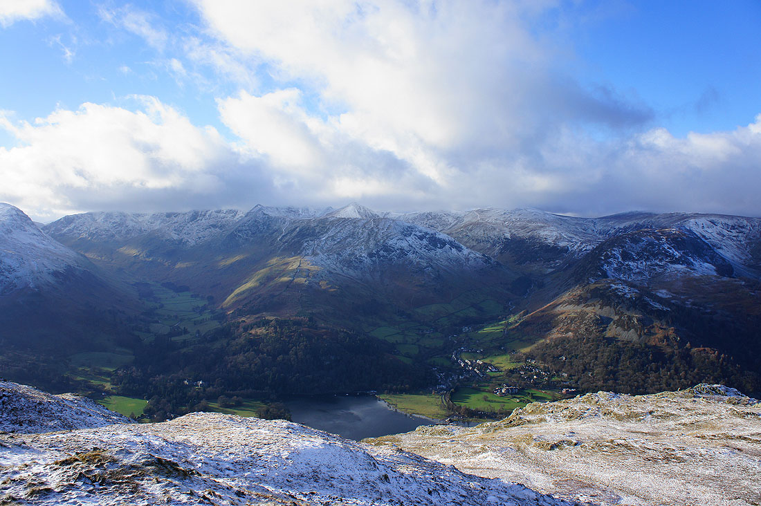
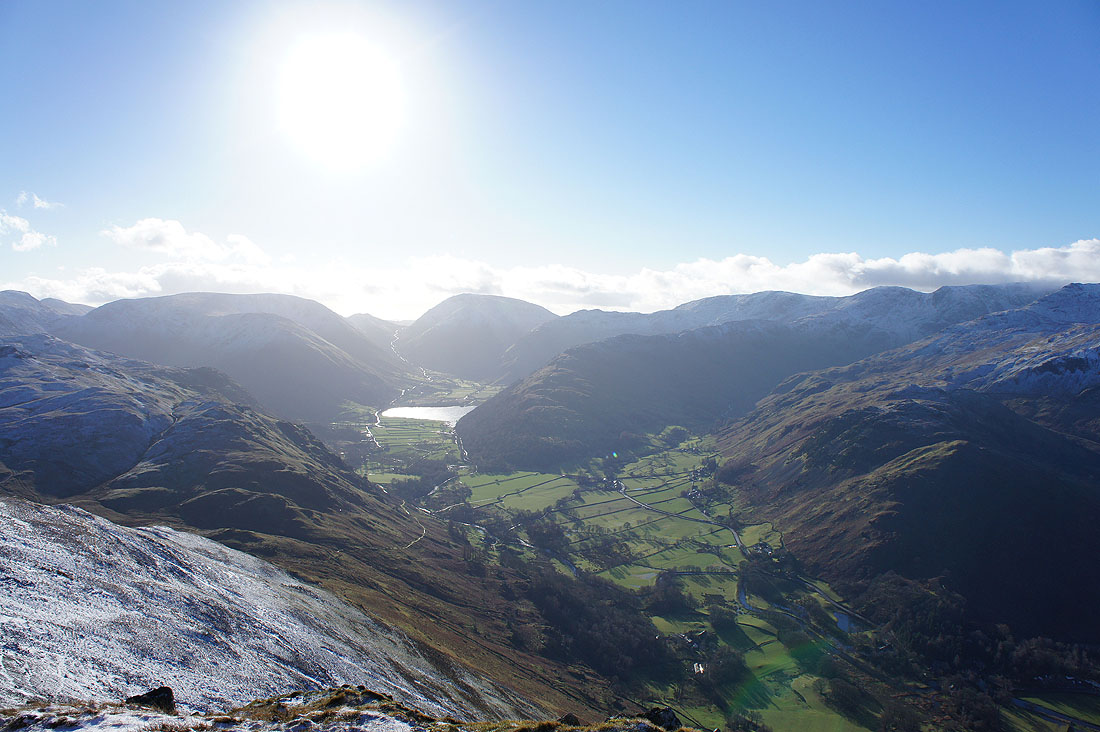
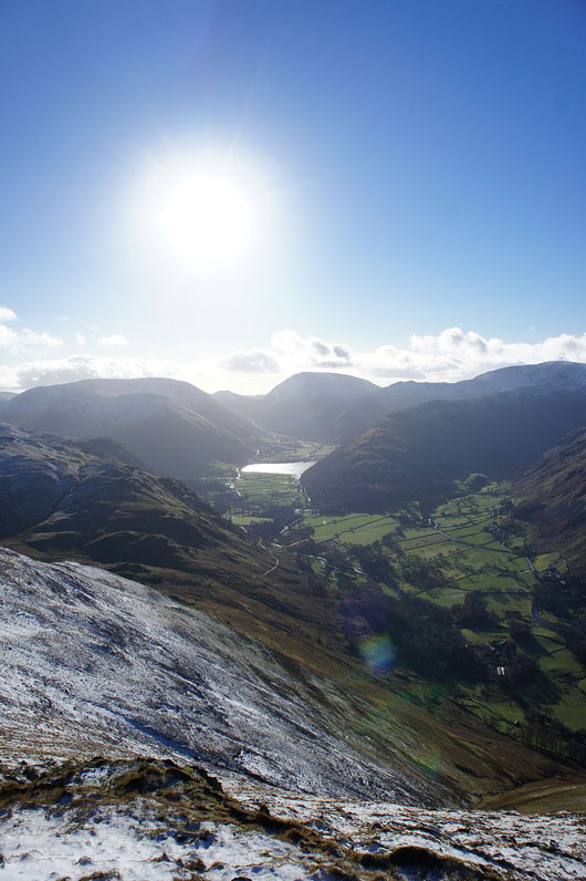
The two valleys of Grisedale and Glenridding with Birkhouse Moor inbetween leading up to Helvellyn
Sunshine on Glenridding
Hart Side, Glencoyne and Watermillock Common
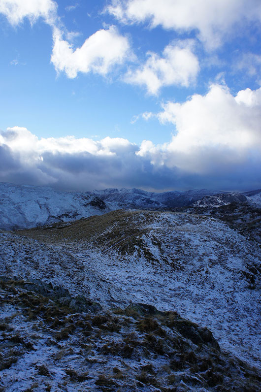
One last look back at the summit
Heading for High Dodd
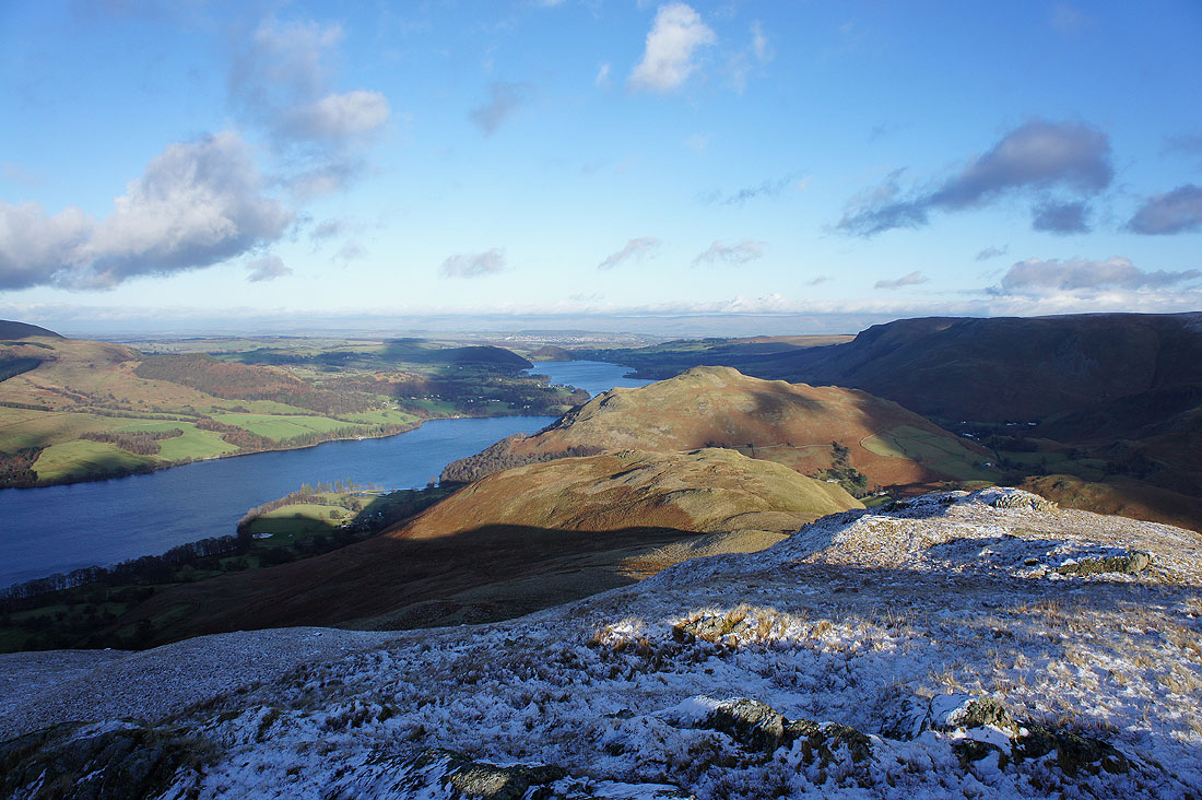
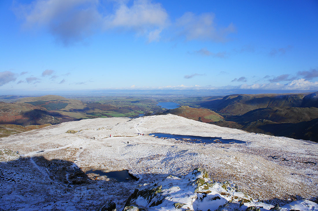
On the summit of High Dodd. A good bit of Ullswater in view along with Hallin Fell.
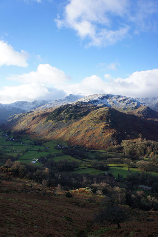
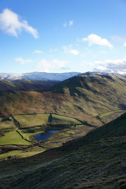
Beda Fell on the other side of a hidden Boredale with the High Street range in the distance
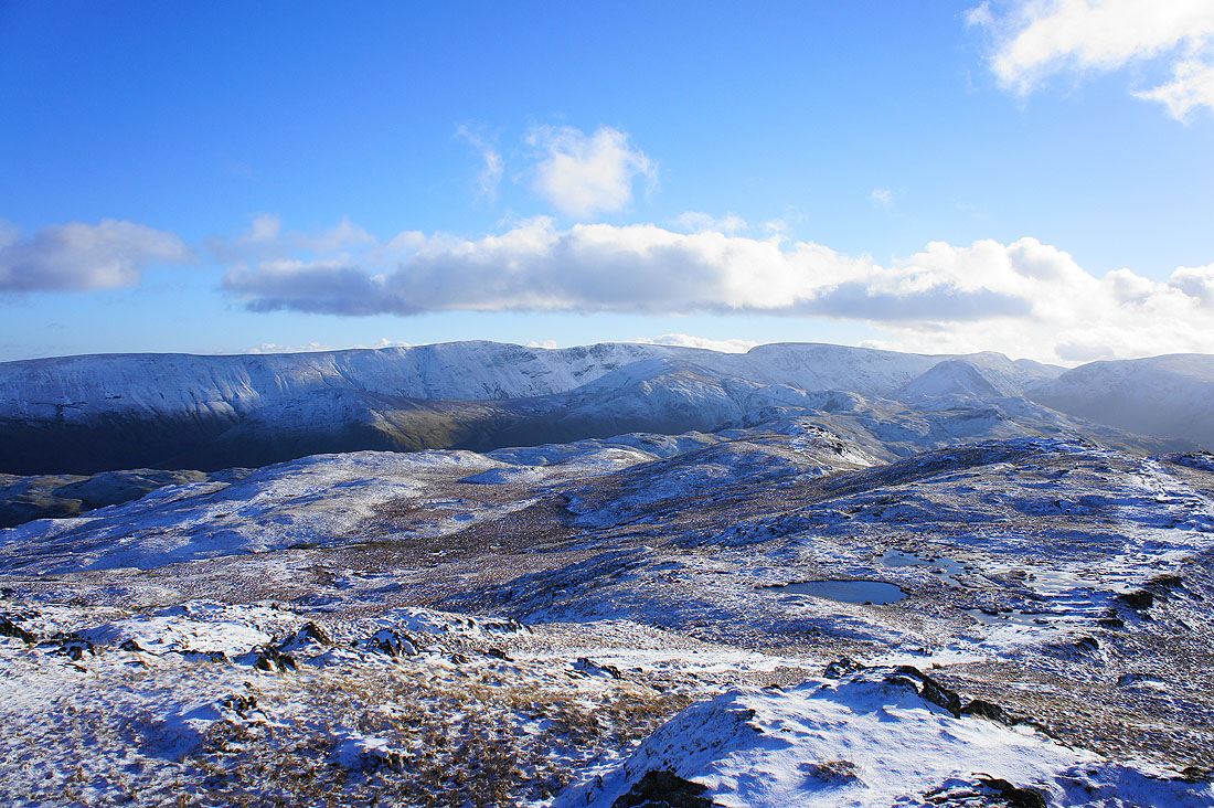
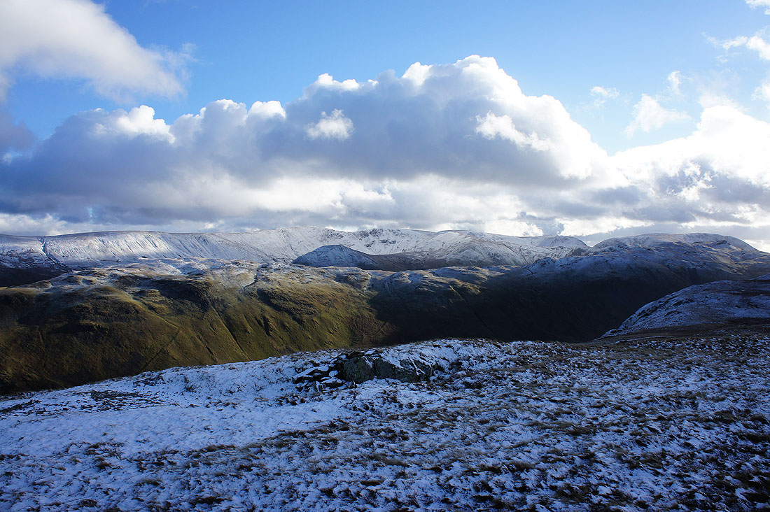
Wintery skies over Helvellyn
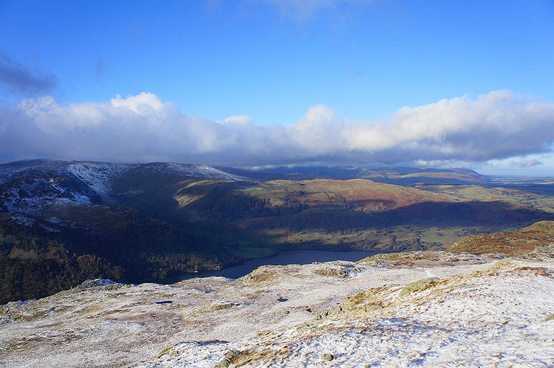
Making my way across Sleet Fell. Gowbarrow Fell on the other side of Ullswater.
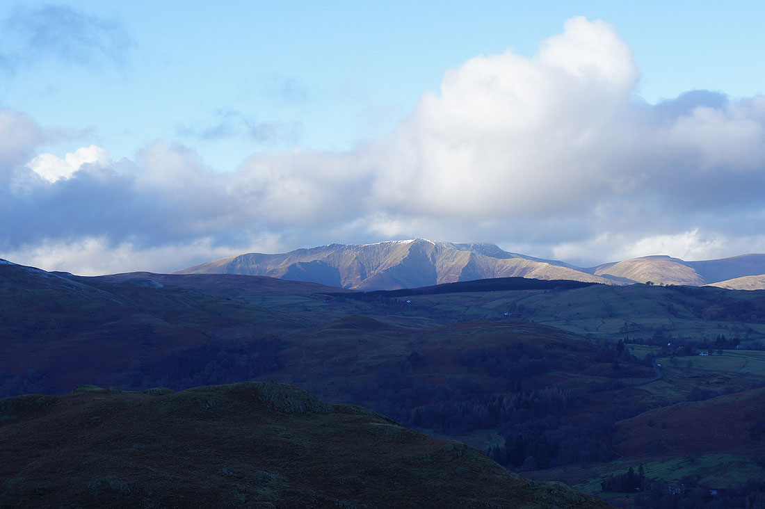
Zooming in to its left to see the many ridges of Blencathra
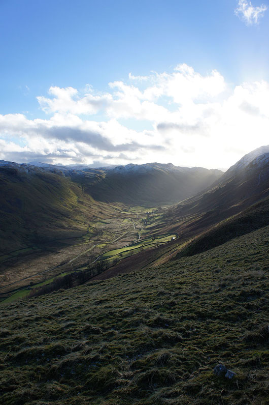
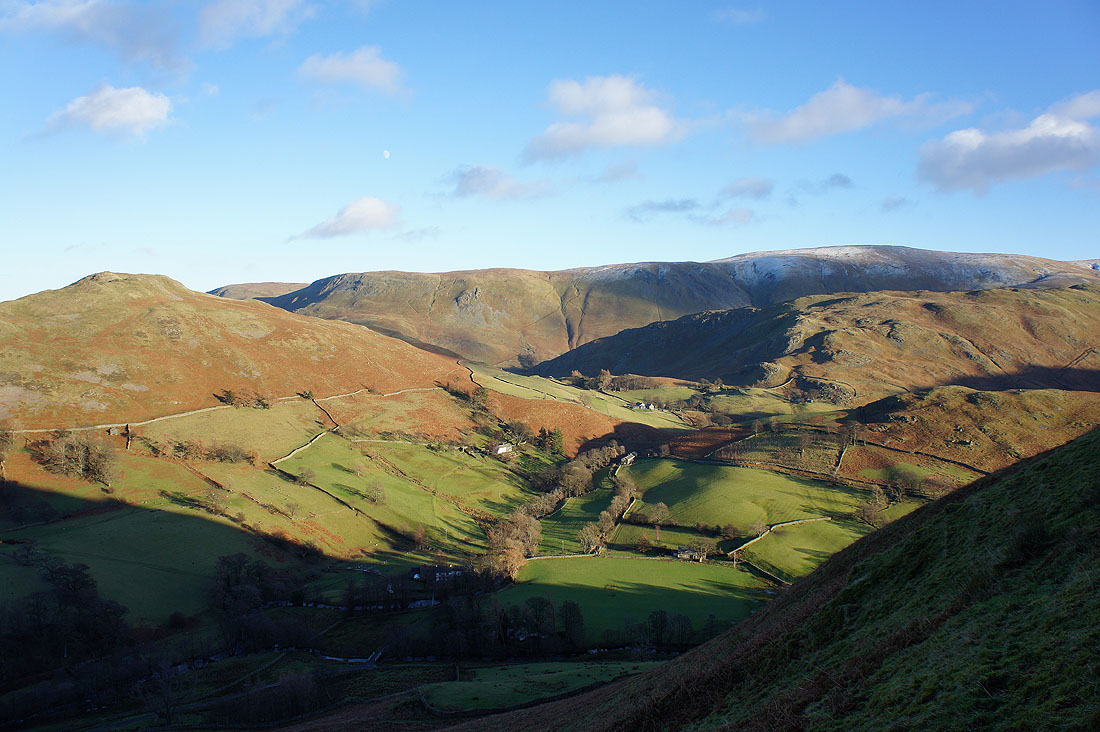
The valley of Boredale below
and Beda Head on the other side of the valley
The tangle of fells around Martindale. Howstead Brow is on the other side of Boredale, then Steel Knotts with Loadpot Hill and Wether Hill in the distance.
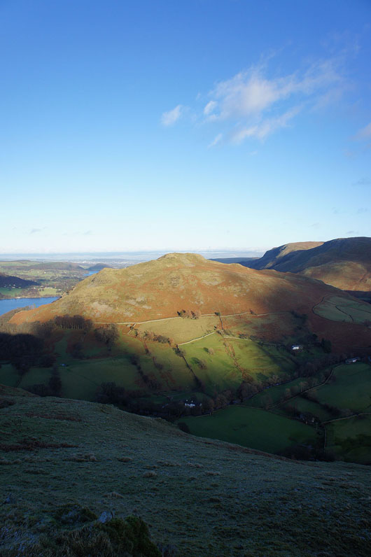
Hallin Fell
I've finally reached the end of Sleet Fell. One last shot across Martindale. Hallin Fell and Steel End, Bonscale Pike and Loadpot Hill in the background. A short, steep descent now to pick up the bridleway to Patterdale.
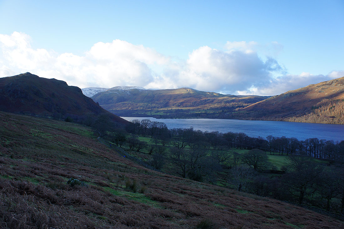
Watermillock Common on the other side of Ullswater
and Gowbarrow Fell and Swinburn's Park
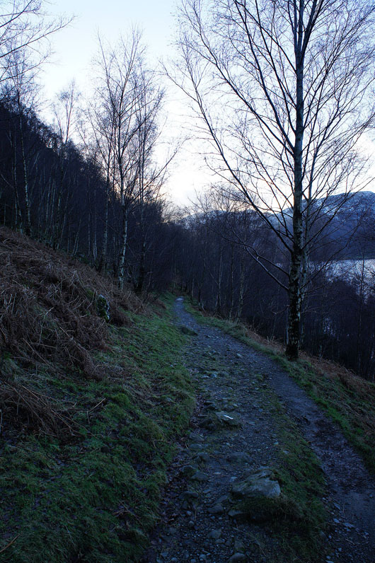
On the bridleway back to Patterdale
Around a corner and I suddenly have a view ahead to Silver Point and some of the fells around the head of Ullswater. There's Birkhouse Moor, the pointed top of Catstye Cam and Sheffield Pike.
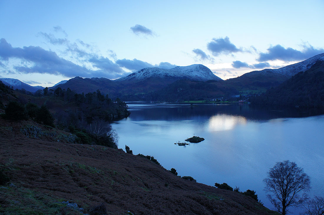
At Silver Point. Arnison Crag, Birks, St Sunday Crag and the head of Ullswater. That little island just below is Lingy Holm.
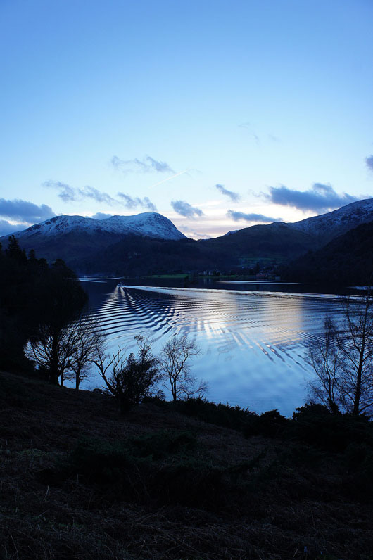
An Ullswater steamer breaks the calm
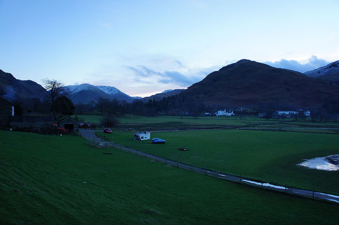
Side Farm and I'm almost back in Patterdale (note the caravan on its roof)