17th September 2017 - Cautley Spout and The Calf
Walk Details
Distance walked: 11.3 miles
Total ascent: 2824 ft
OS map used: OL19 - Howgill Fells & Upper Eden Valley
Time taken: 7 hrs
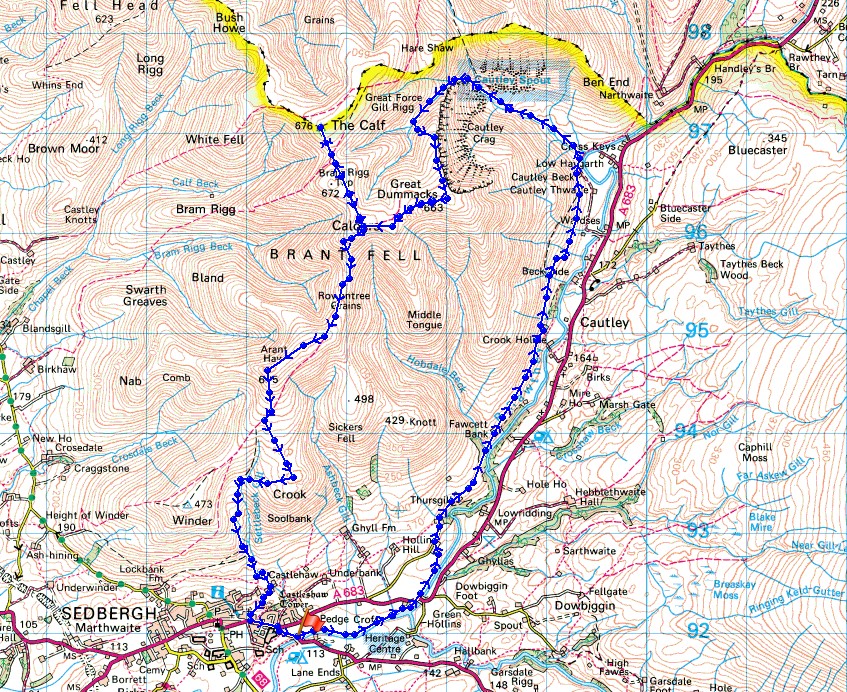
Route description: New Bridge, Sedbergh-Straight Bridge-Buckbank-Ellerthwaite-Thursgill-Fawcett Bank-Cautley Beck-Cautley Spout-Cautley Crag-Great Dummacks-Calders-The Calf-Calders-Arant Haw-Crook-Settlebeck Gill-Sedbergh-New Bridge, Sedbergh
I fancied a walk in the Howgills this weekend and with it being February 2011 since I'd last paid a visit to the waterfall of Cautley Spout, that had to be included today. In the end I came up with a route that started from New Bridge on the A684 just outside Sedbergh. This gave me the opportunity to follow a footpath that runs alongside the River Rawthey before joining the bridleway to Cautley and Cautley Spout, as well as visiting the tops of The Calf, Calders and Arant Haw that give such great views. Despite it being the middle of September autumn is starting to show its hand, with a noticeable change in the colours of the landscape and for an hour or two the weather made it feel like autumn as well. It started out sunny as I left Sedbergh but after I'd climbed to the top of Cautley Spout it clouded over for an hour or so as a shower passed through. It felt quite chilly in the northerly breeze.
From where I parked in the layby at New Bridge on the A684 I followed the footpath by the north bank of the Rawthey to Straight Bridge and then on and up to the minor road at Buckbank. I then walked east along the road past Ellerthwaite to its end at Thursgill Farm and onto the byway then bridleway past Fawcett Bank that heads north above the River Rawthey to Cautley. I left the bridleway after crossing the footbridge over Cautley Holme Beck to take the footpath to Cautley Spout. After the steep climb up by Cautley Spout I followed Red Gill Beck to the sheepfold that's on the map where I had my lunch. Lunch had, I made my way to the top of Cautley Crag. I followed the top of the crag to its southern end and onto the summit of Great Dummacks, from where I then made my way west to pick up the fence at the Top of Middle Tongue which brought me to the summit of Calders. I then followed the bridleway from Calders to the summit of The Calf before returning by the same route and continuing south down Rowantree Grains. The bridleway was left behind to reach the top of Arant Haw. That summit visited I made my descent south back to and across the bridleway to the top of Crook. After a final stop of the day I made my way down to and across Settlebeck Gill to a track on its other side which brought me to the edge of access land. I went through a gate to continue down the track and onto a footpath down to and across Settlebeck Gill to Castlehaw. I was then left with a walk down a road into Sedbergh and by the main road to New Bridge.
Total ascent: 2824 ft
OS map used: OL19 - Howgill Fells & Upper Eden Valley
Time taken: 7 hrs
Route description: New Bridge, Sedbergh-Straight Bridge-Buckbank-Ellerthwaite-Thursgill-Fawcett Bank-Cautley Beck-Cautley Spout-Cautley Crag-Great Dummacks-Calders-The Calf-Calders-Arant Haw-Crook-Settlebeck Gill-Sedbergh-New Bridge, Sedbergh
I fancied a walk in the Howgills this weekend and with it being February 2011 since I'd last paid a visit to the waterfall of Cautley Spout, that had to be included today. In the end I came up with a route that started from New Bridge on the A684 just outside Sedbergh. This gave me the opportunity to follow a footpath that runs alongside the River Rawthey before joining the bridleway to Cautley and Cautley Spout, as well as visiting the tops of The Calf, Calders and Arant Haw that give such great views. Despite it being the middle of September autumn is starting to show its hand, with a noticeable change in the colours of the landscape and for an hour or two the weather made it feel like autumn as well. It started out sunny as I left Sedbergh but after I'd climbed to the top of Cautley Spout it clouded over for an hour or so as a shower passed through. It felt quite chilly in the northerly breeze.
From where I parked in the layby at New Bridge on the A684 I followed the footpath by the north bank of the Rawthey to Straight Bridge and then on and up to the minor road at Buckbank. I then walked east along the road past Ellerthwaite to its end at Thursgill Farm and onto the byway then bridleway past Fawcett Bank that heads north above the River Rawthey to Cautley. I left the bridleway after crossing the footbridge over Cautley Holme Beck to take the footpath to Cautley Spout. After the steep climb up by Cautley Spout I followed Red Gill Beck to the sheepfold that's on the map where I had my lunch. Lunch had, I made my way to the top of Cautley Crag. I followed the top of the crag to its southern end and onto the summit of Great Dummacks, from where I then made my way west to pick up the fence at the Top of Middle Tongue which brought me to the summit of Calders. I then followed the bridleway from Calders to the summit of The Calf before returning by the same route and continuing south down Rowantree Grains. The bridleway was left behind to reach the top of Arant Haw. That summit visited I made my descent south back to and across the bridleway to the top of Crook. After a final stop of the day I made my way down to and across Settlebeck Gill to a track on its other side which brought me to the edge of access land. I went through a gate to continue down the track and onto a footpath down to and across Settlebeck Gill to Castlehaw. I was then left with a walk down a road into Sedbergh and by the main road to New Bridge.
Route map
© Crown copyright. All rights reserved. License number PU 100034184.
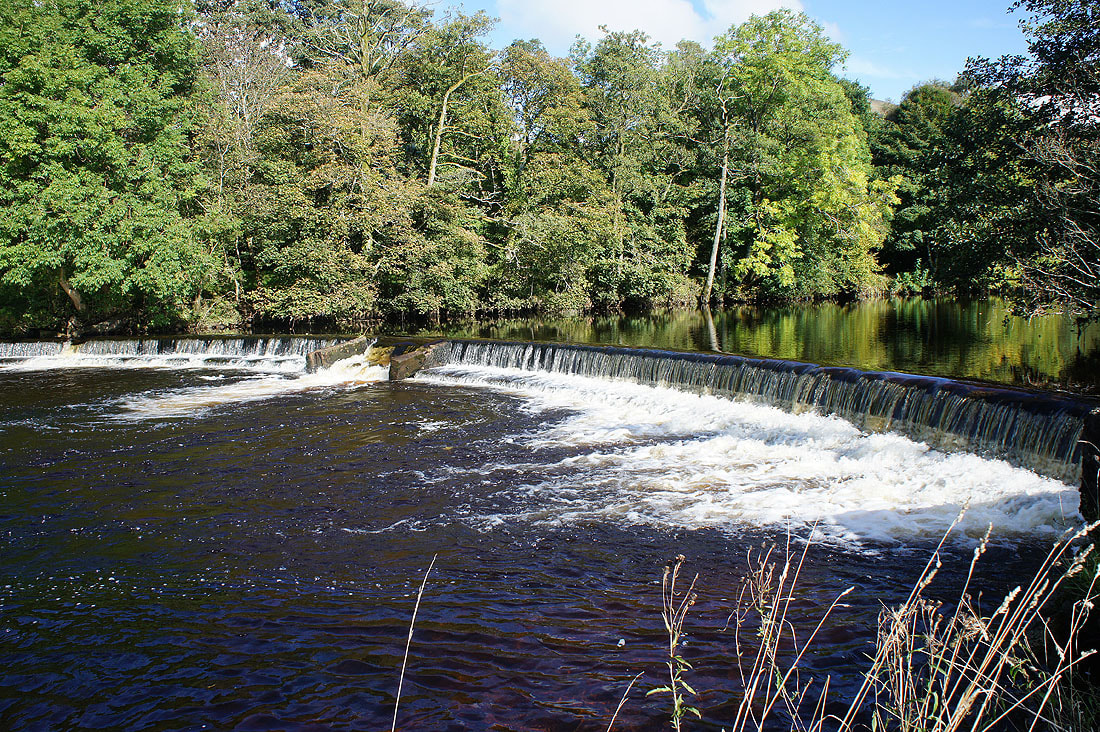
Before I follow the River Rawthey north, a quick walk south along its east bank to the weir a short distance from New Bridge
|
|
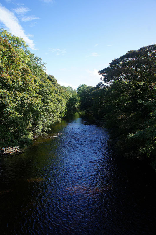
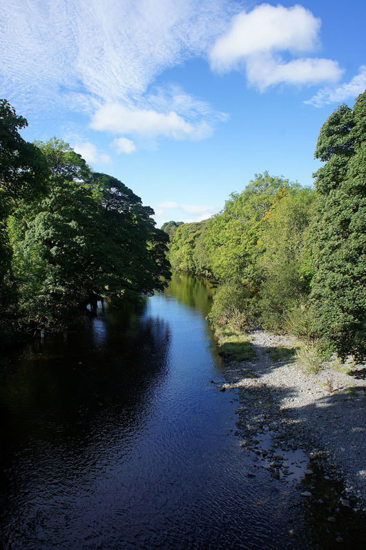
Back at New Bridge. The River Rawthey, looking upstream and downstream.
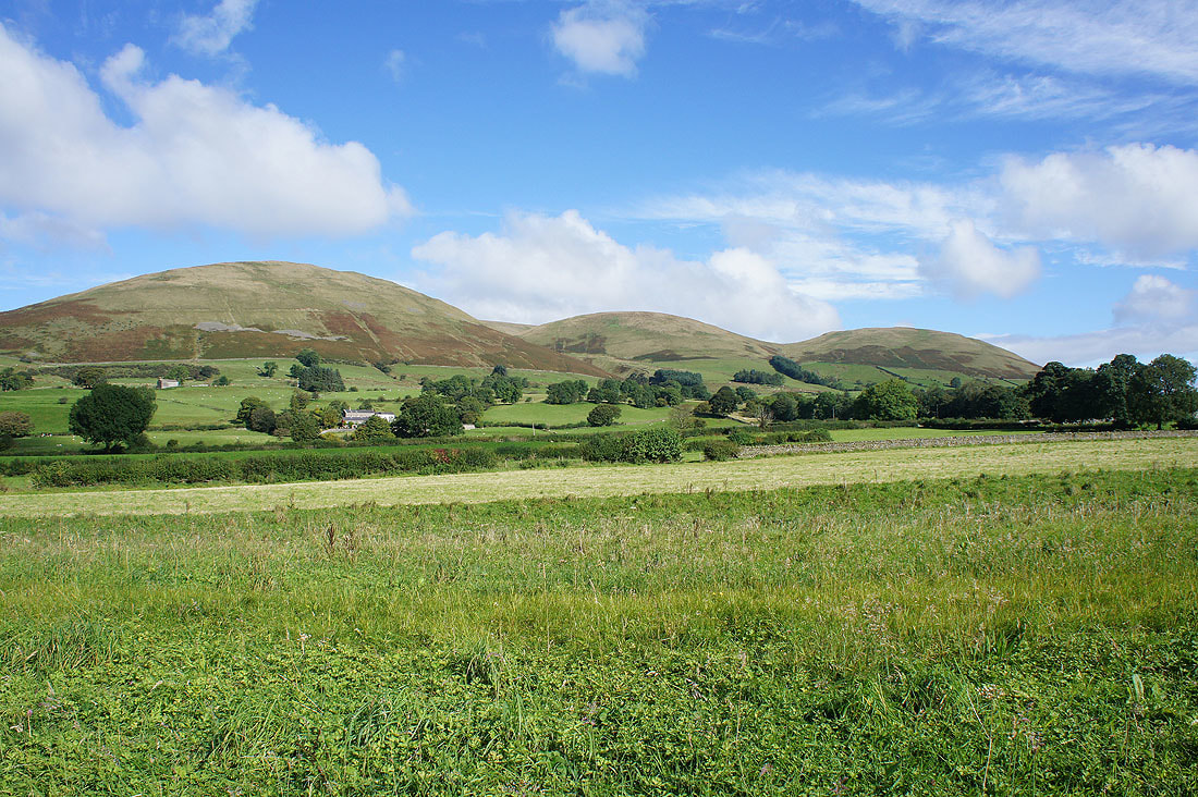
Following the footpath east by the River Rawthey beneath the foothills of the Howgills. Crook, Sickers Fell and Knott.
Winder and Crook. I'll visit Crook on the way back.
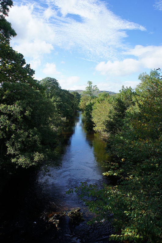
Looking down the River Rawthey from Straight Bridge
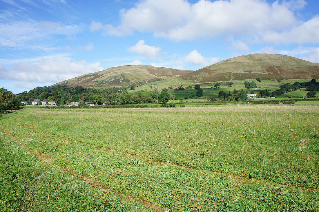
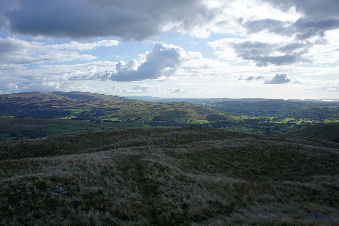
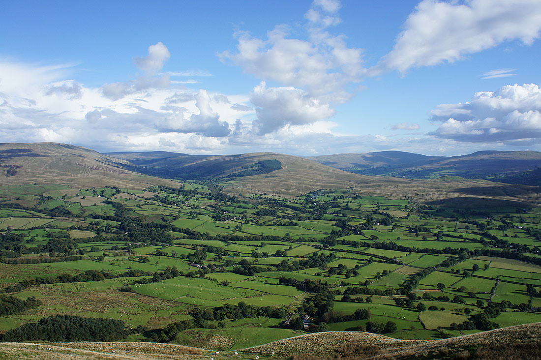
Looking back from the bridleway to Cautley to Great Coum and Middleton Fell
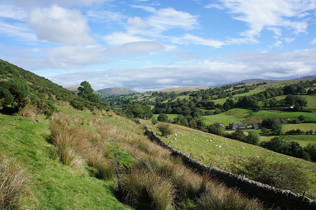
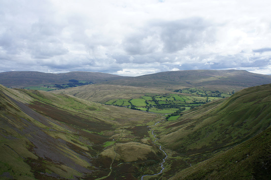
The view ahead of the Rawthey valley
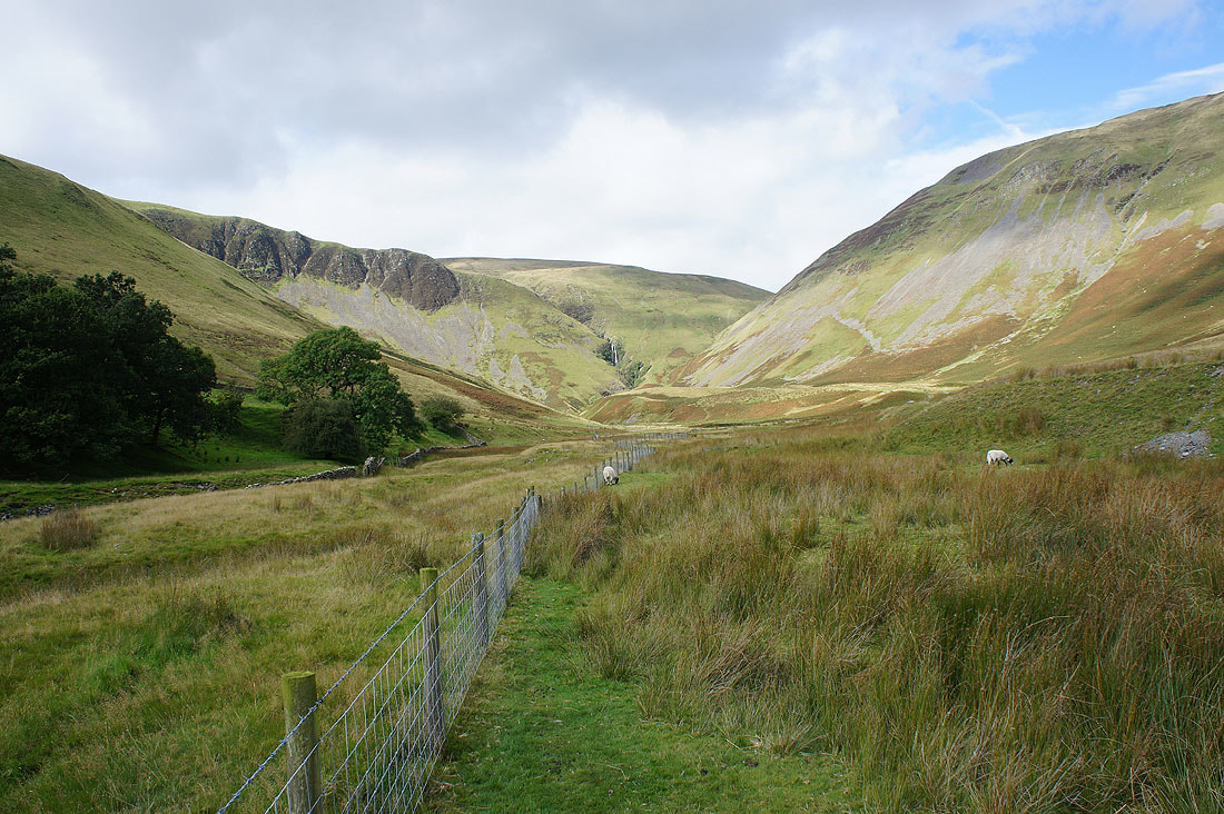
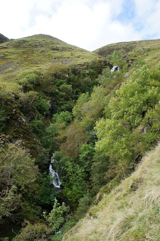
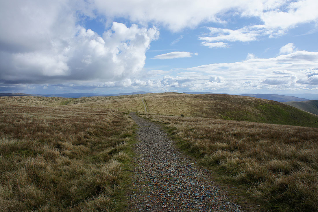
The bridleway is left behind to approach Cautley Spout
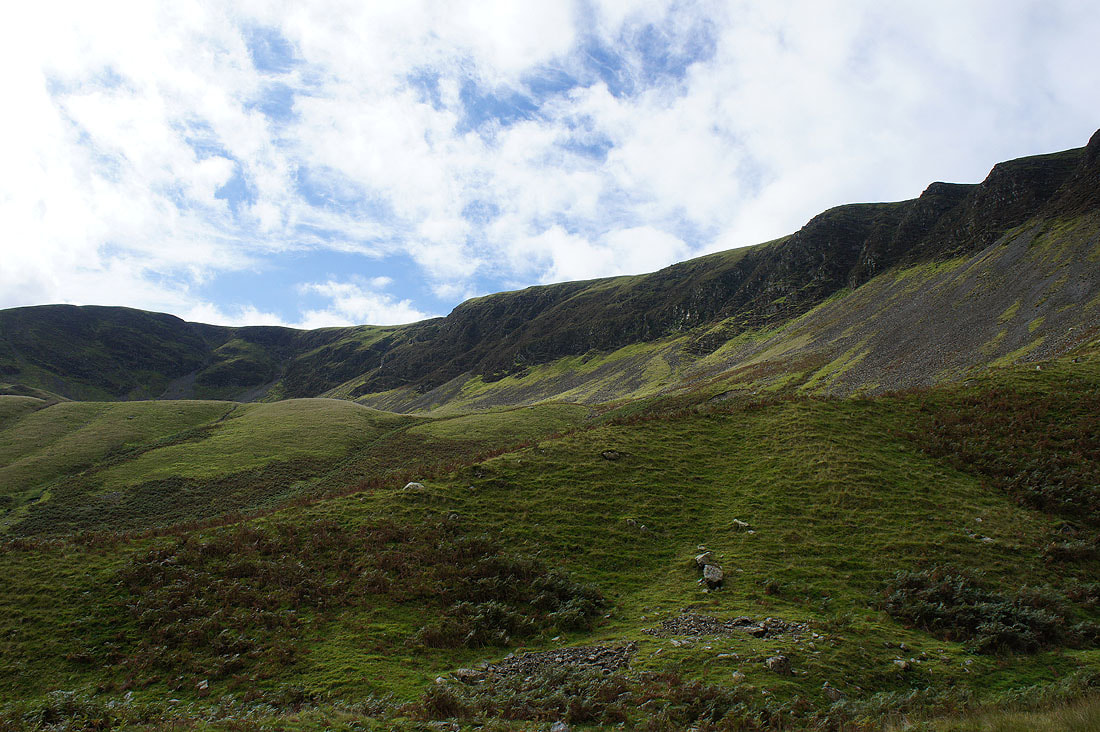
Cautley Crag above
|
|
|
|
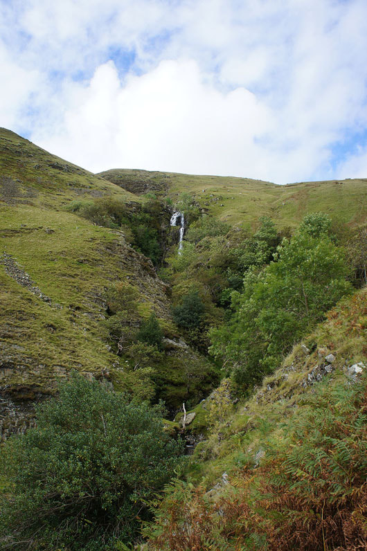
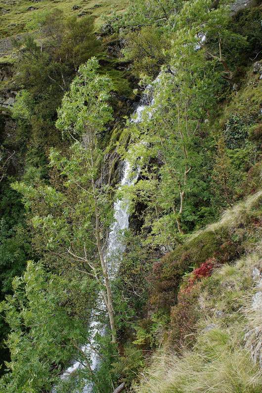
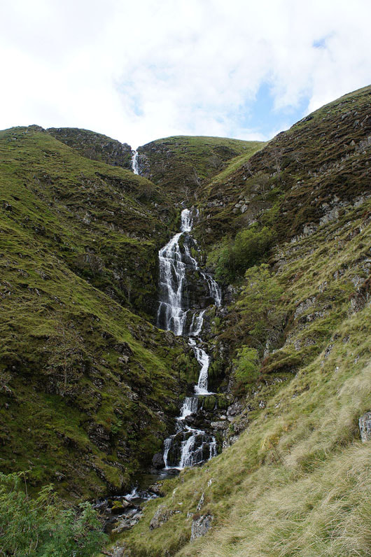
Some photos of Cautley Spout from the path that climbs steeply beside it....
Wild Boar Fell, Swarth Fell and Baugh Fell from the top of Cautley Spout
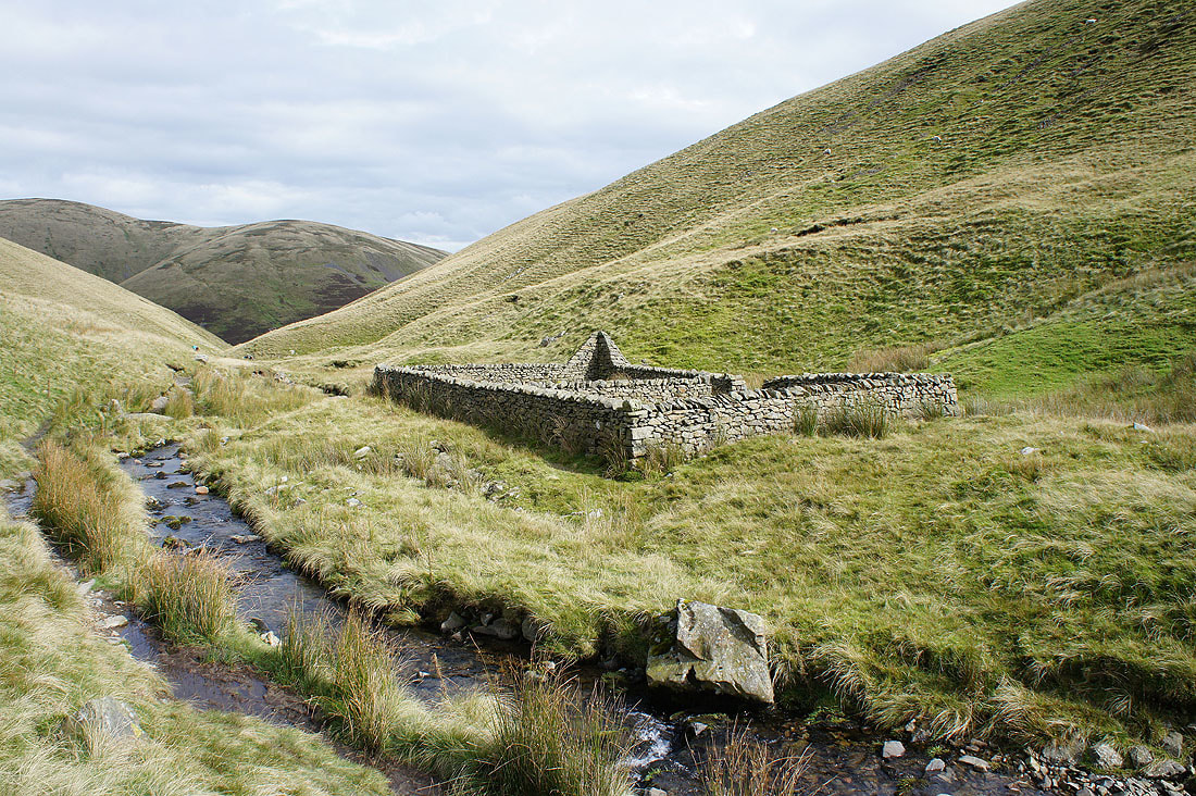
The Andy Goldsworthy sheepfold beside Red Beck. A lovely spot to stop and have my lunch. Just the sound of the beck and the wind moving through the grass.
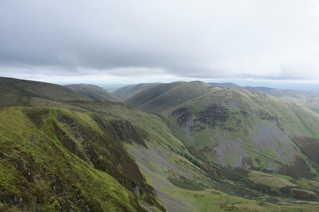
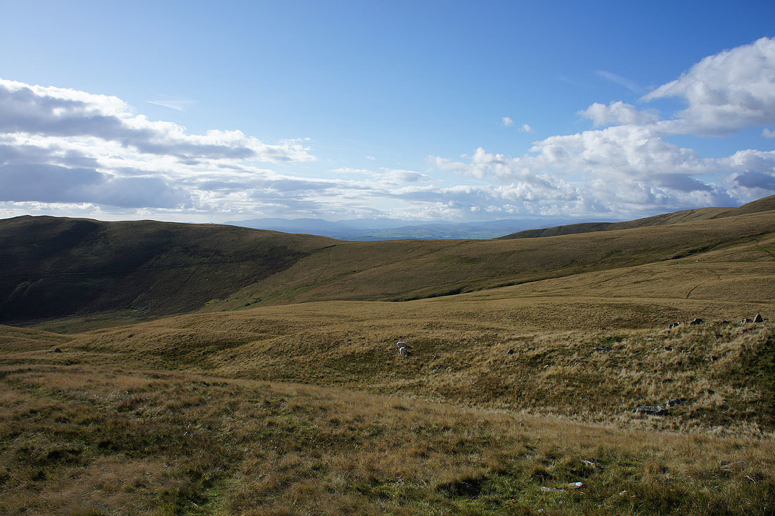
After lunch and I've made my way to the top of Cautley Crag. The weather has changed. It's clouded over, there's a cool breeze and a shower is about to pass through. I'm looking north to Bowderdale and the fell of Yarlside.
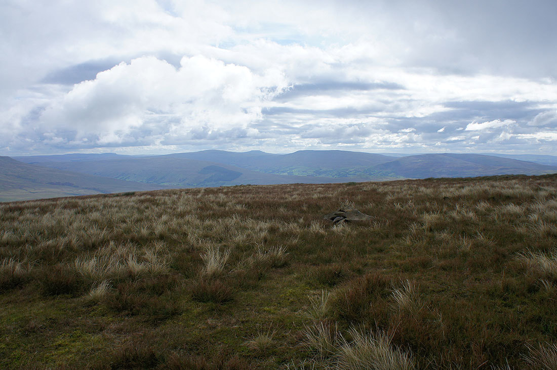
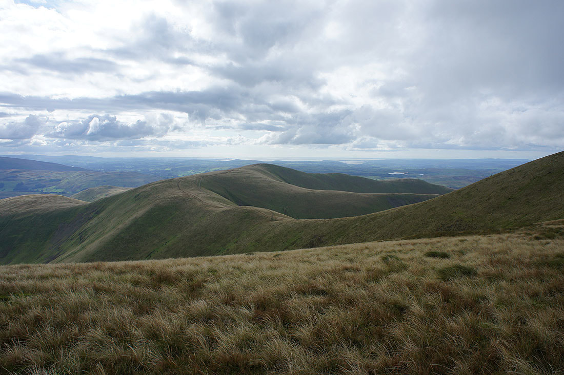
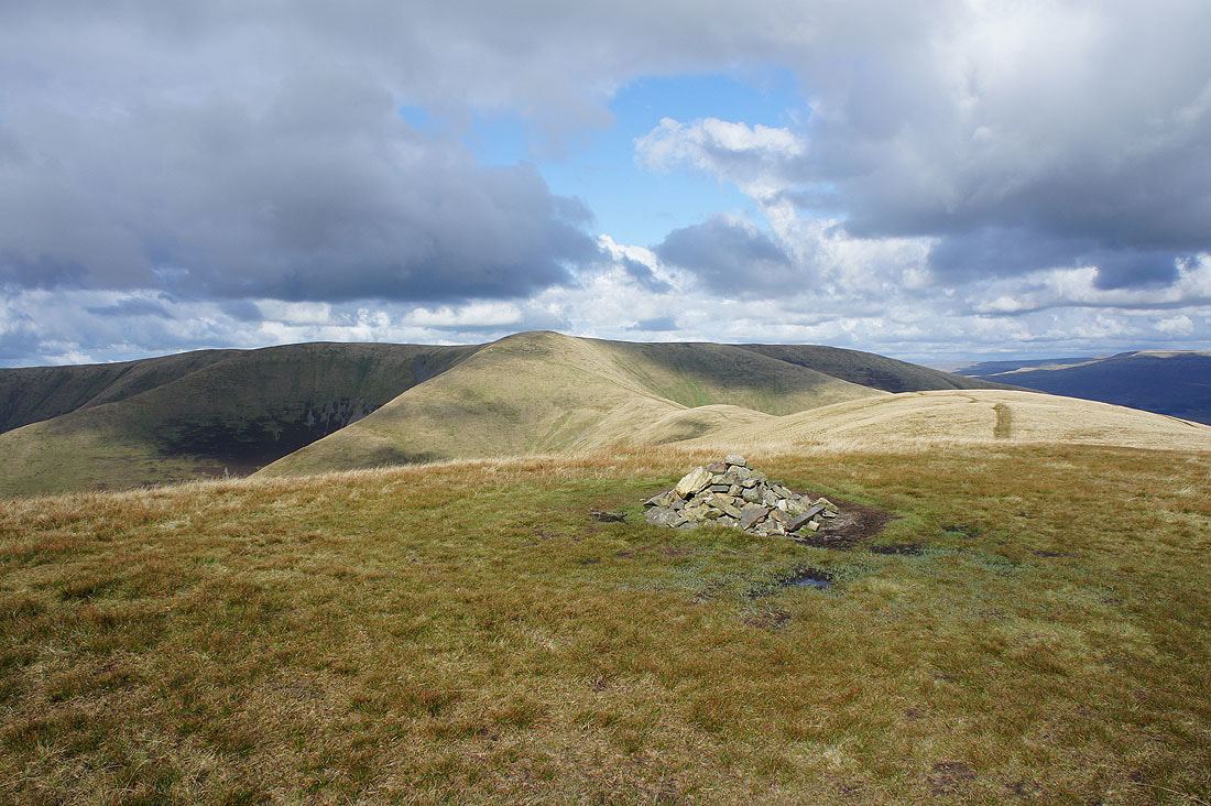
A short walk from Cautley Crag has brought me to the little cairn that marks the top of Great Dummacks. Looking south to Penyghent, Whernside, Ingleborough, Great Coum and Middleton Fell.
The same view is better from the Top of Middle Tongue as I head for Calders
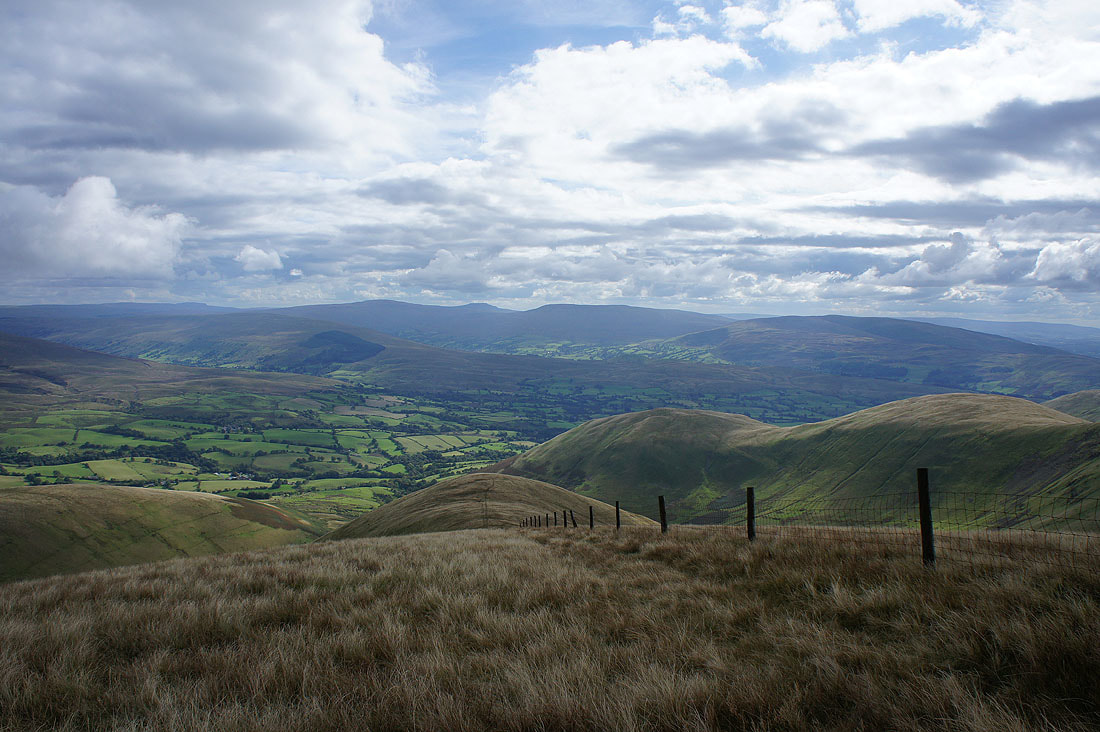
Arant Haw with Morecambe Bay behind
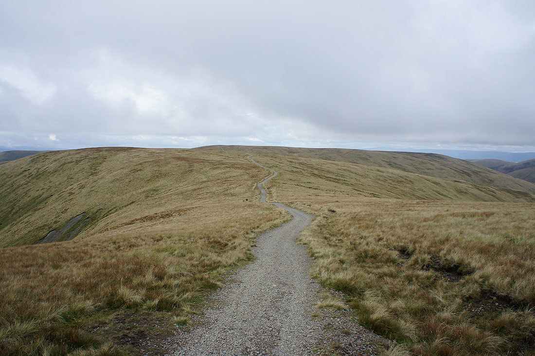
On the bridleway from Calders to The Calf
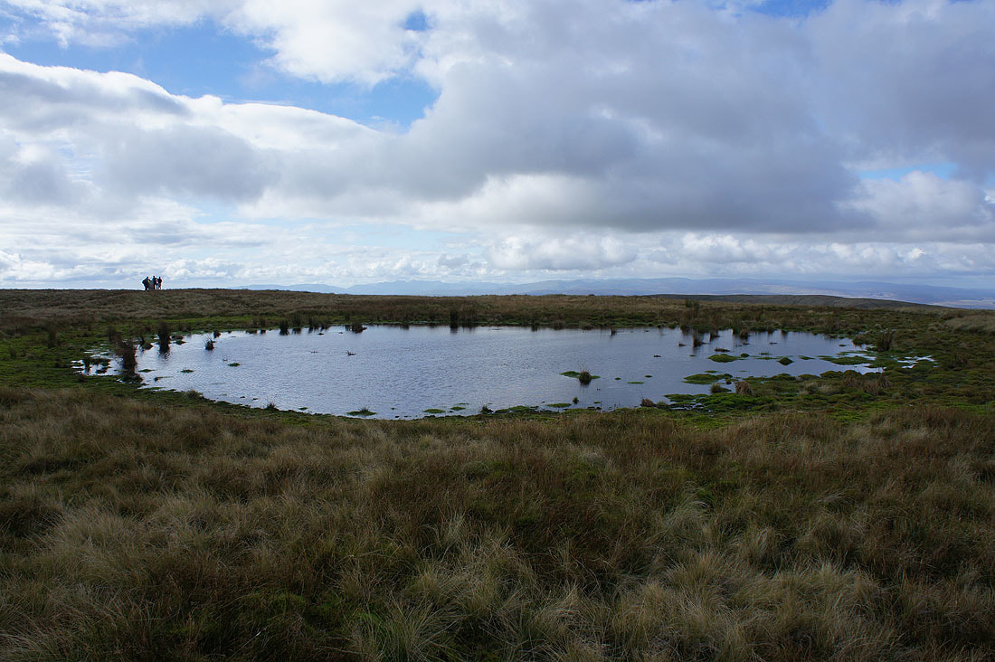
On the top of the Howgills at the summit of The Calf. The trig point is to the left behind the summit pool with the Lake District fells in the distance.
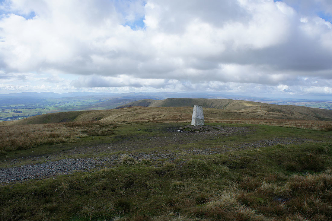
Back at the trig point with White Fell and Fell Head behind
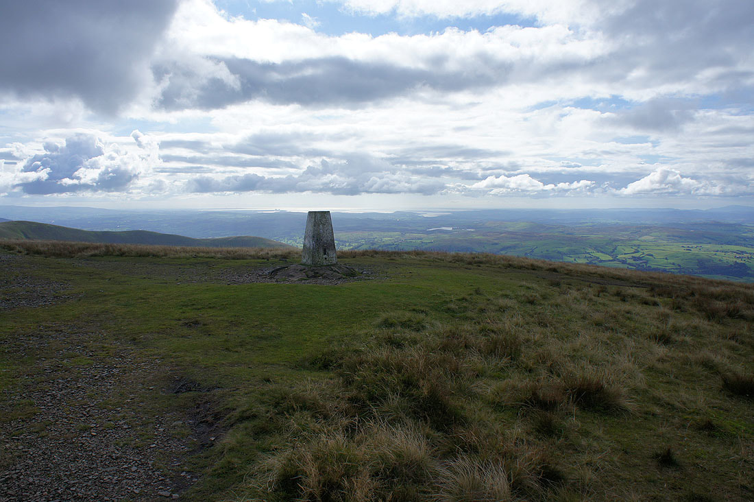
Looking towards Morecambe Bay
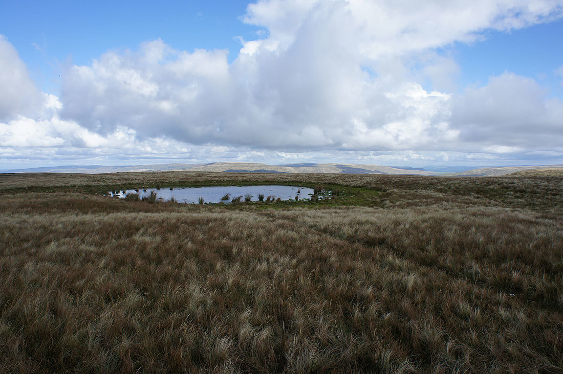
Wild Boar Fell behind the summit pool
The sun makes a welcome return as I look towards the distant line of the North Pennines on the other side of the Eden valley
A last shot from The Calf looking towards the Lake District fells
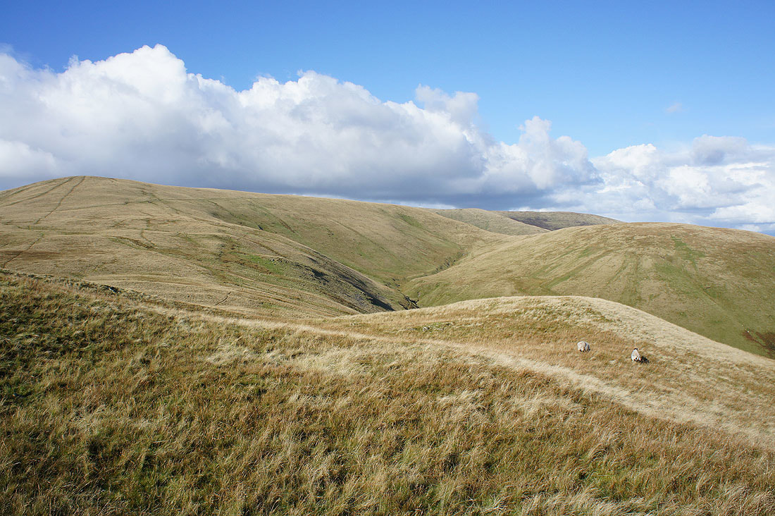
Time to head back to Sedbergh by the bridleway to Calders
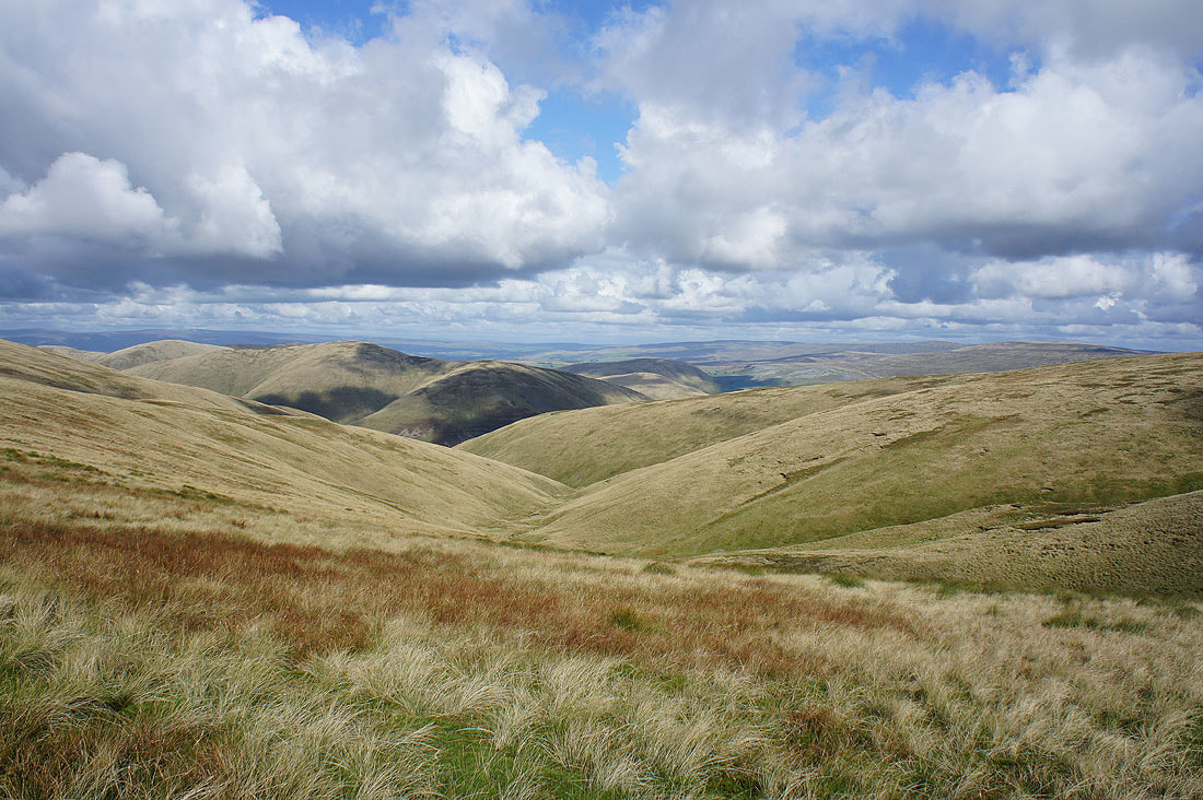
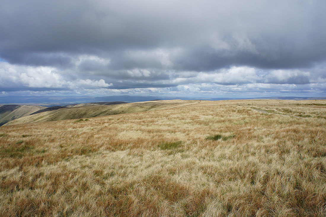
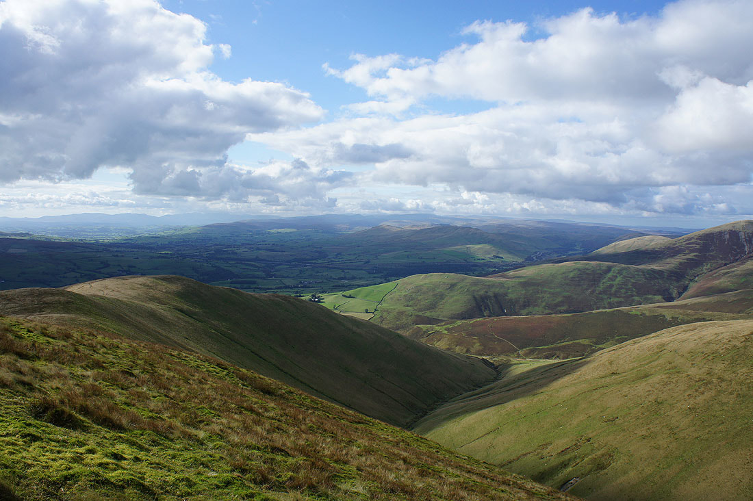
Autumn colours starting to show themselves as I look down Force Gill Beck to Yarlside
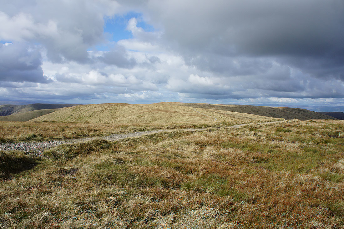
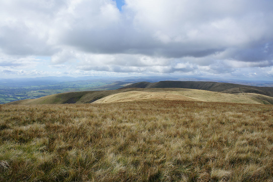
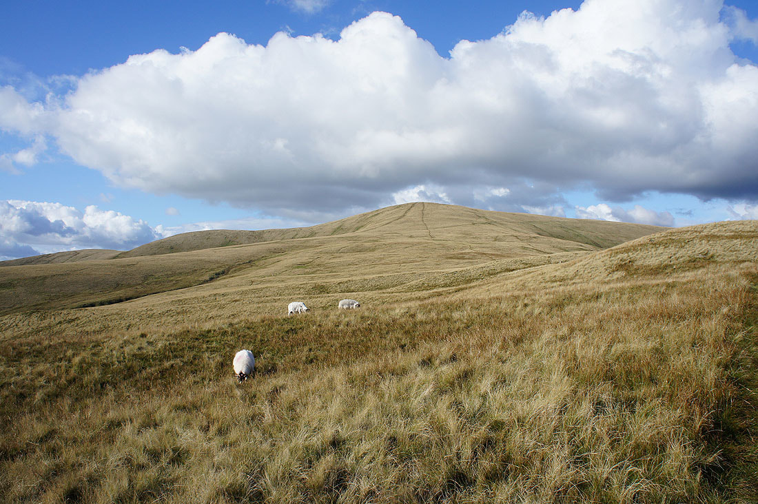
On Calders and looking north to Bram Rigg Top and The Calf
Great Dummacks with Wild Boar Fell behind
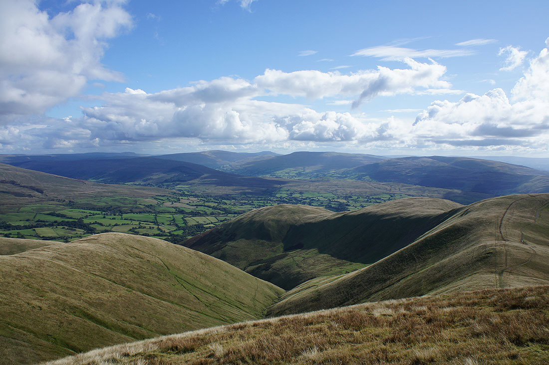
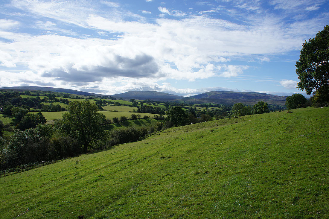
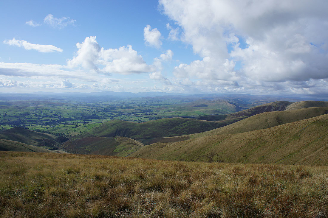
Looking south across the Rawthey valley to Penyghent, Whernside, Ingleborough, Great Coum and Middleton Fell
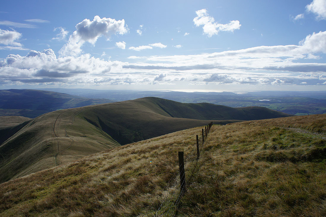
Morecambe Bay behind Arant Haw
The fantastic view west to the Lake District fells is my final shot from Calders
Calders from Arant Haw
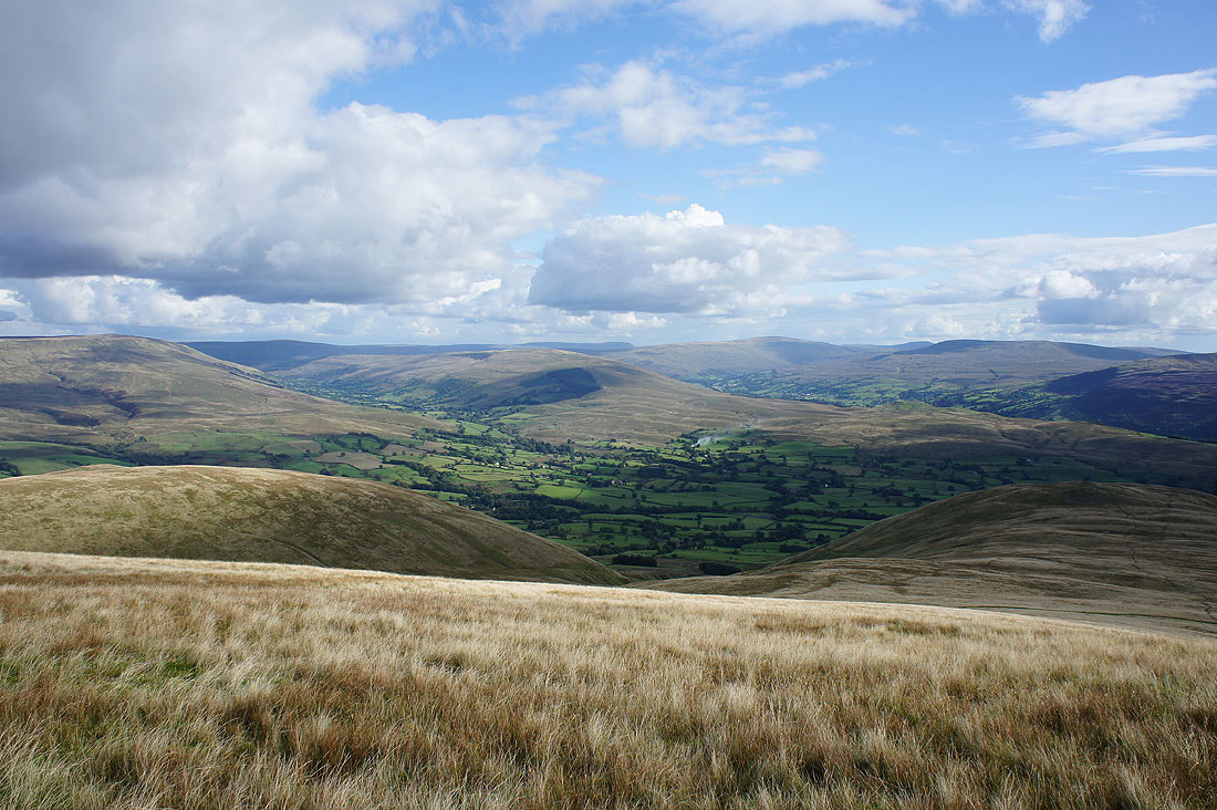
Baugh Fell, Garsdale, Aye Gill Pike, Penyghent, Dentdale, Whernside, Ingleborough and Great Coum
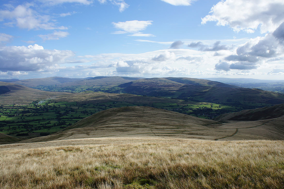
Dentdale, Whernside, Ingleborough, Great Coum and Middleton Fell. The hill just below is Crook, which I'll be visiting on the way down.
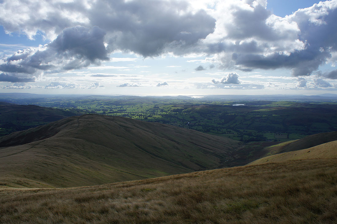
Winder and Lunesdale with Morecambe Bay in the distance
Finally, the view west to the Lake District
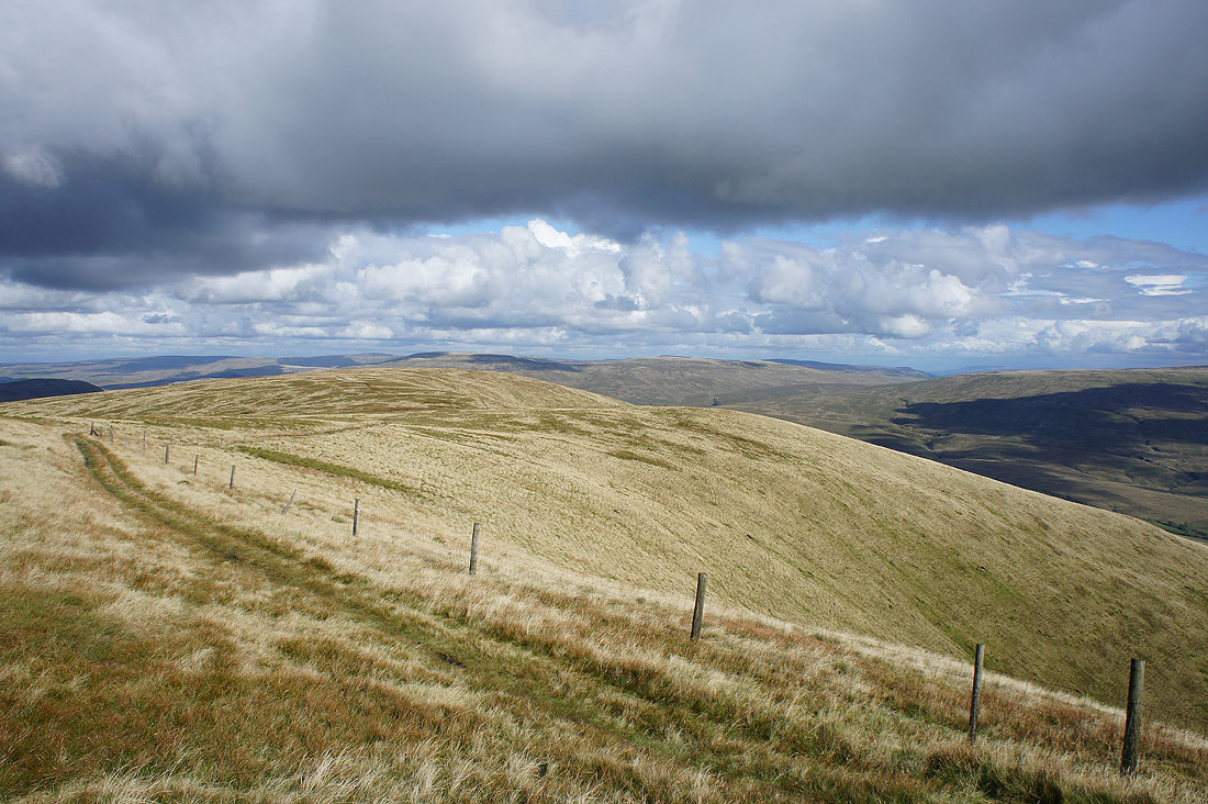
On the final top of Crook. Sunshine on Middleton Fell just to the south.
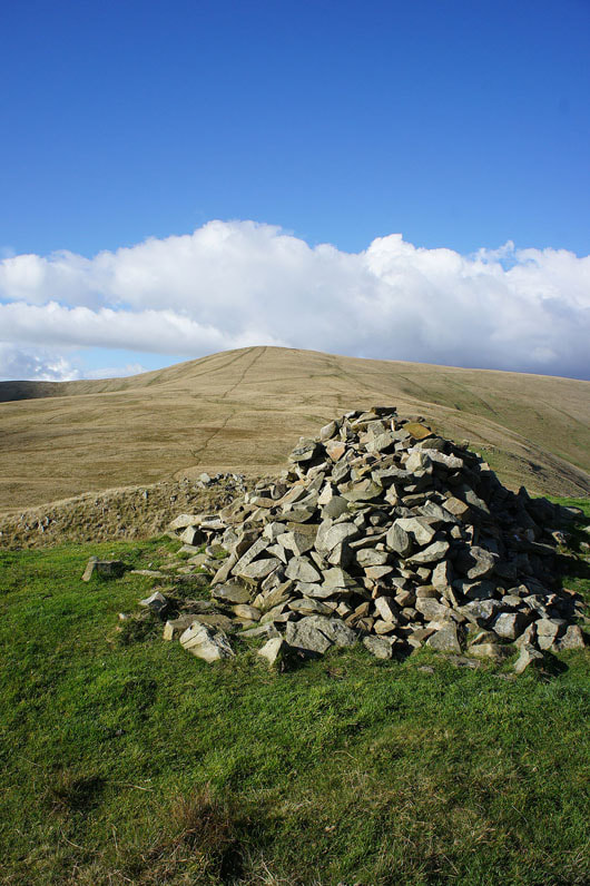
A substantial cairn for a rather insignificant top
I couldn't help taking photos of the hillsides rising behind the cairn. The colours look great as the sun gets lower in the sky.
A small cairn a short distance away marks a viewpoint where the hillside drops away to give a great view across the Rawthey valley to Baugh Fell, Garsdale, Great Knoutberry Hill, Aye Gill Pike, Dentdale, Whernside and Great Coum.
Distant Lake District fells through the gap to the right of Winder
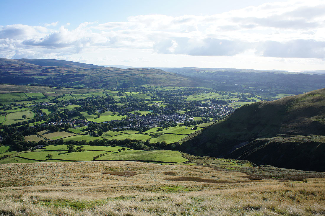
Sedbergh below as I make my final descent by Settlebeck Gill