18th April 2015 - The Peaks of the Peak
Walk Details
Distance walked: 9.9 miles
Total ascent: 2464 ft
OS map used: OL24 - The Peak District, White Peak area
Time taken: 7 hrs
Route description: Earl Sterndale-High Wheeldon-Green Lane-Underhill-Hitter Hill-Earl Sterndale-Glutton Dale-Glutton Grange-Parkhouse Hill-Chrome Hill-Stoop Farm-Booth Farm-Hollins Hill-Hollinsclough-Dowall Hall-Dowel Dale-Glutton Grange-Earl Sterndale
A fantastic day for this walk in the White Peak area of the Peak District. Blue skies, sunshine and great visibility for enjoying the superb scenery around the upper part of the Dove valley. I have done a walk around here before, back in November 2013. Then, I started from Longnor. This route I worked out from Earl Sterndale was much better. It was a little convoluted but I was able to fit more into the day. The recent dry weather certainly helped with getting up and down Parkhouse Hill and Chrome Hill. Having firm ground underfoot made the steepness easier to deal with.
I left Earl Sterndale by taking the high road east out of the village to below High Wheeldon. I then took the path onto access land, after a steep climb I arrived on the summit of High Wheeldon. After making my way back down I followed the footpath out to the road below Aldery Cliff. A brief walk down the road and I took the bridleway of Green Lane before turning right onto the bridleway past Underhill towards Glutton Grange. I then made my way up the path across Hitter Hill and back to Earl Sterndale (with a small detour onto access land). This time I went west to Glutton Dale and down to Glutton Grange. Parkhouse Hill and Chrome Hill were then tackled, concessionary paths let you get onto the access land they're on. The path down from Chrome Hill took me to the drive for Stoops Farm and onto the footpath to Booth Farm. Another steep climb and I was on the final summit of the day, Hollins Hill. Its south ridge is access land, once down a concessionary path brought me to a bridge over the River Dove and a footpath to the road to Hollinsclough. I turned left at the junction in the village and followed the road, then a footpath across the fields to the road below Parkhouse Hill. I then made my way up the road past Dowall Hall to Dowel Dale, a footpath on the right took me uphill, across fields and then down a valley to Glutton Grange. After a final climb over the side of Hitter Hill I was back in Earl Sterndale.
Route map
© Crown copyright. All rights reserved. License number PU 100034184.
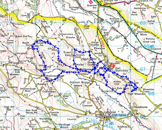
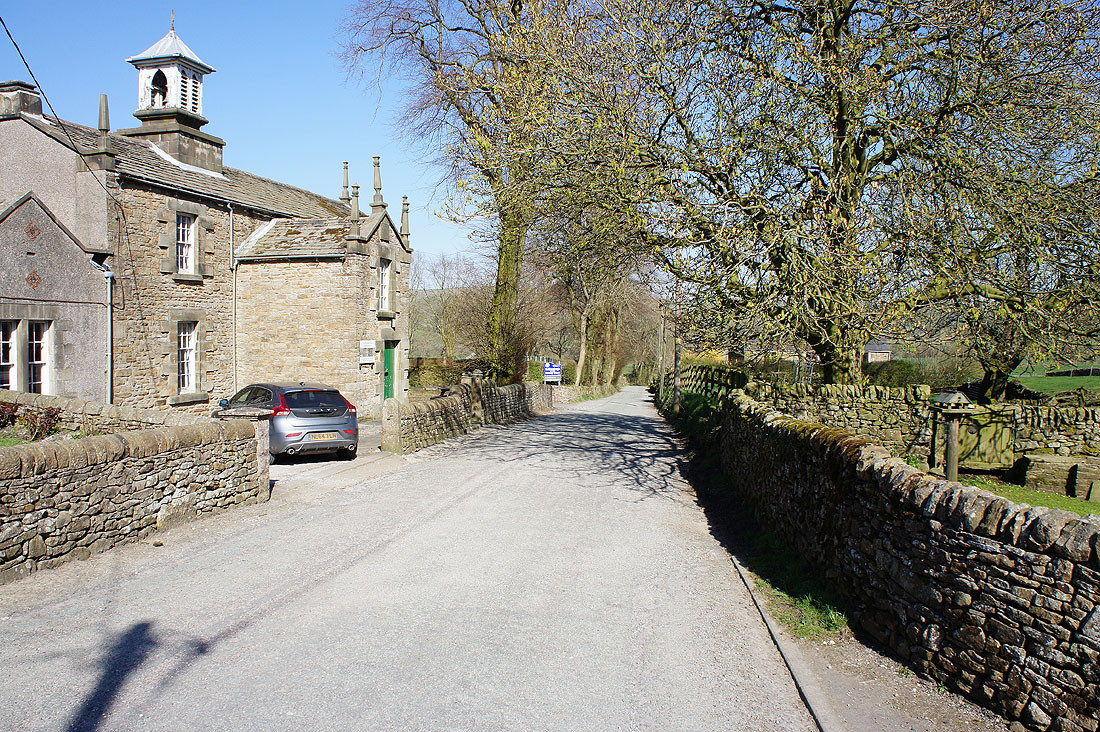
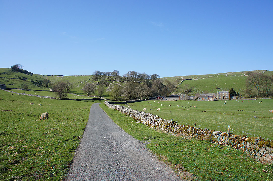
It's a beautiful morning in Earl Sterndale
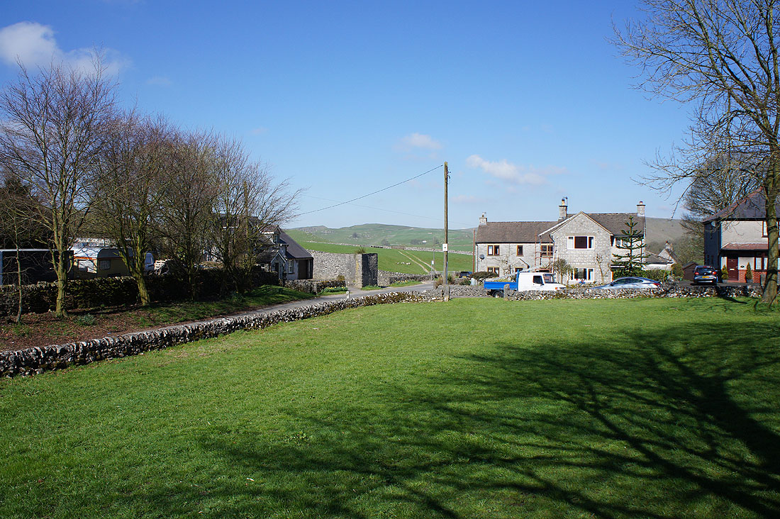
High Wheeldon, my first target for today
As I make my way up its side I get a great view back to Earl Sterndale
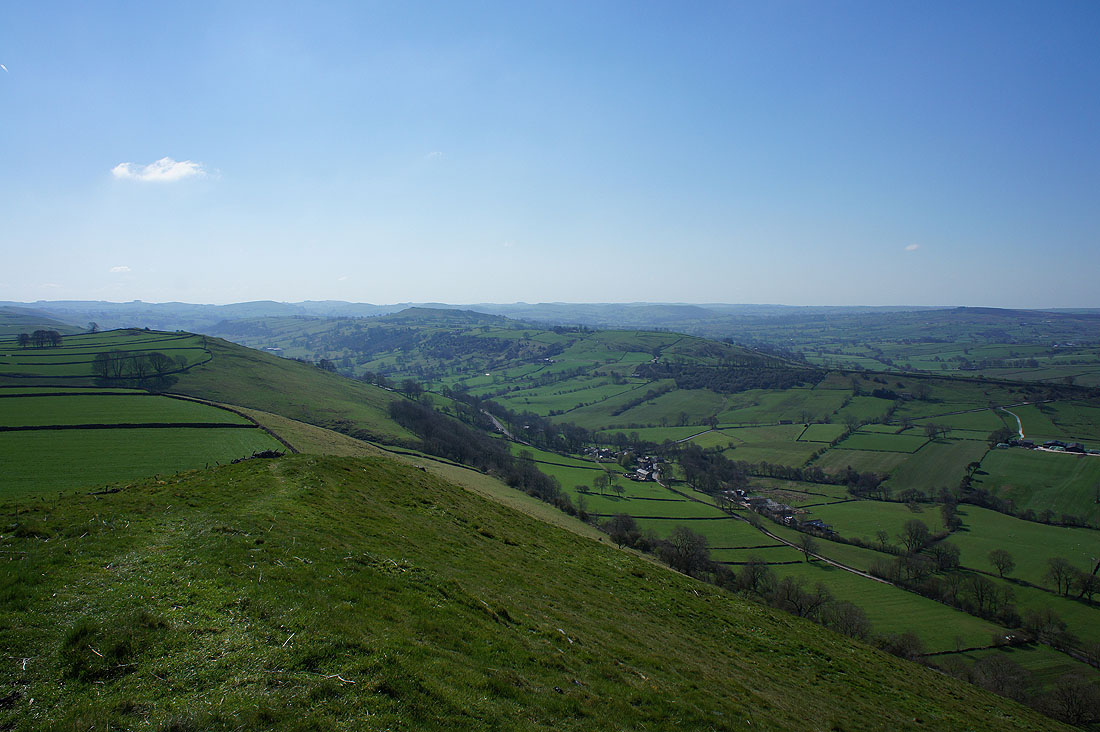
There's a fantastic view from the summit of High Wheeldon. All the way past the hills around the infant River Dove, which I'll be visiting later, to Axe Edge Moor.
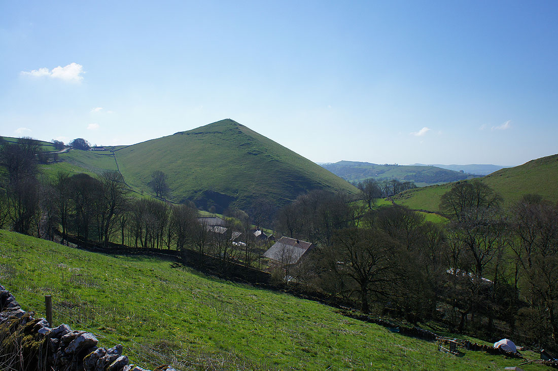
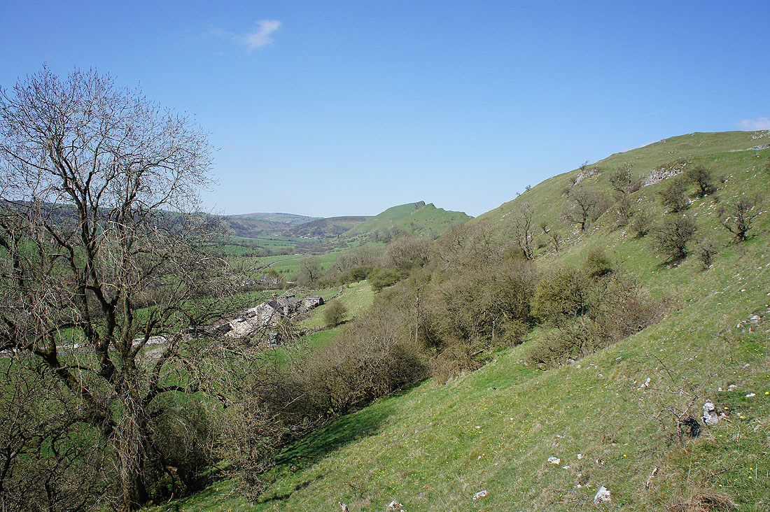
Looking south towards Sheen Hill with the hamlet of Crowdicote in the valley below
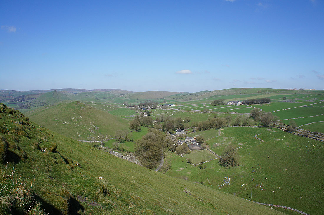
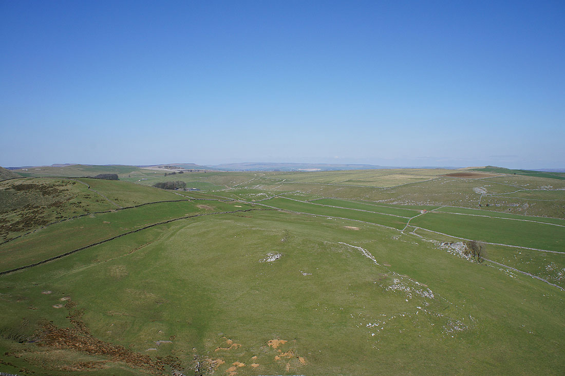
Revidge, Merryton Low and the Staffordshire moors in the distance to the southwest. On the other side of the Dove valley is Top o' th' Edge, with the village of Longnor on its other side.
I got a better view towards Earl Sterndale by making my way past the trig point to where the ground starts to steepen
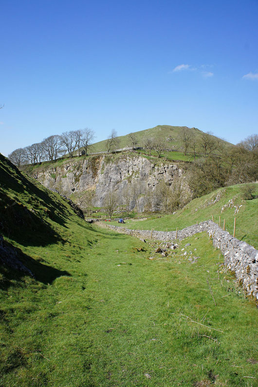
Heading down to the road below Aldery Cliff
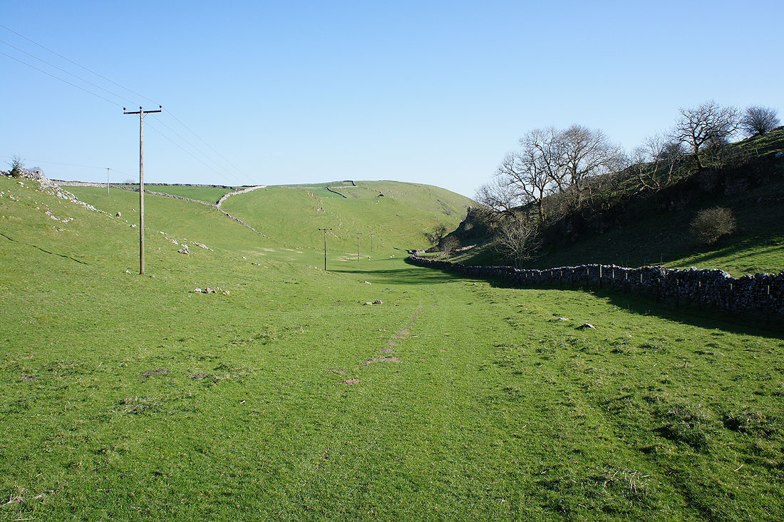
Making my way up the side of Hitter Hill
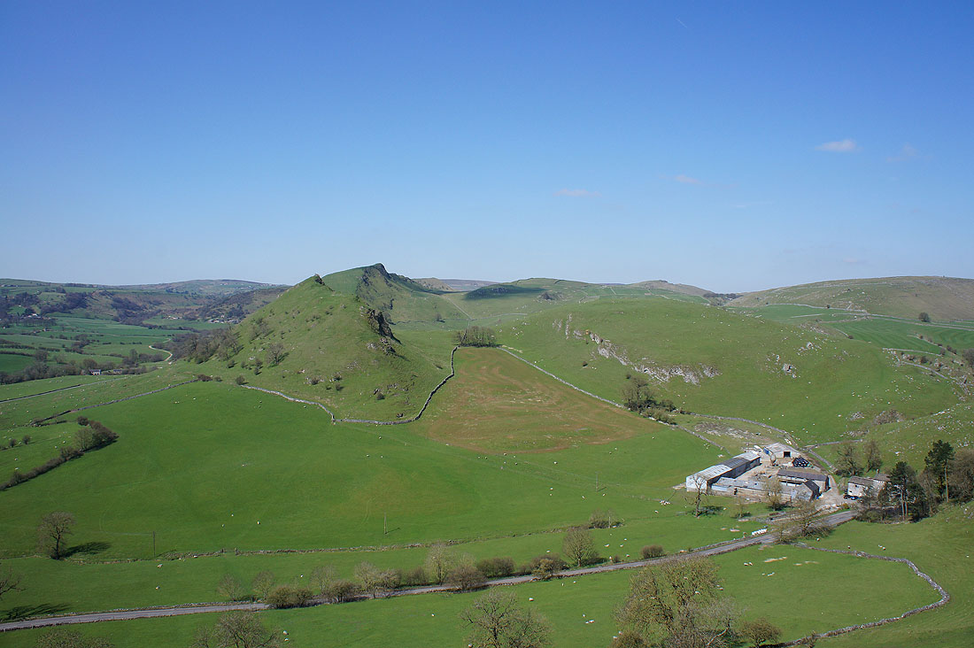
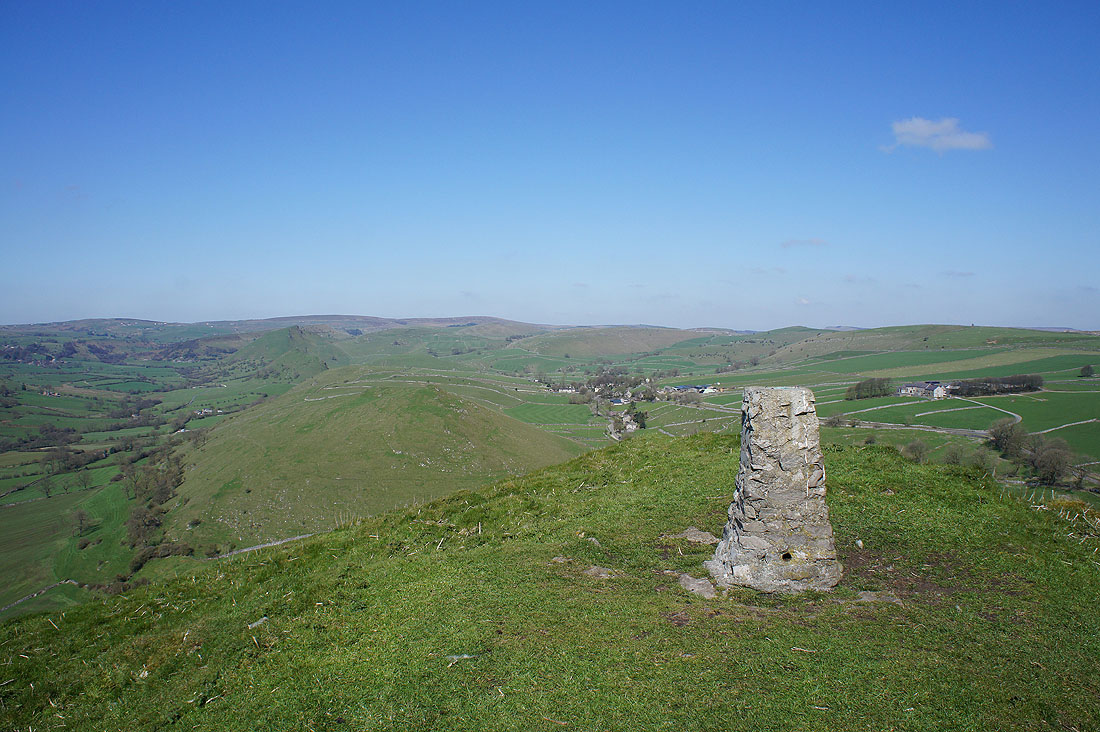
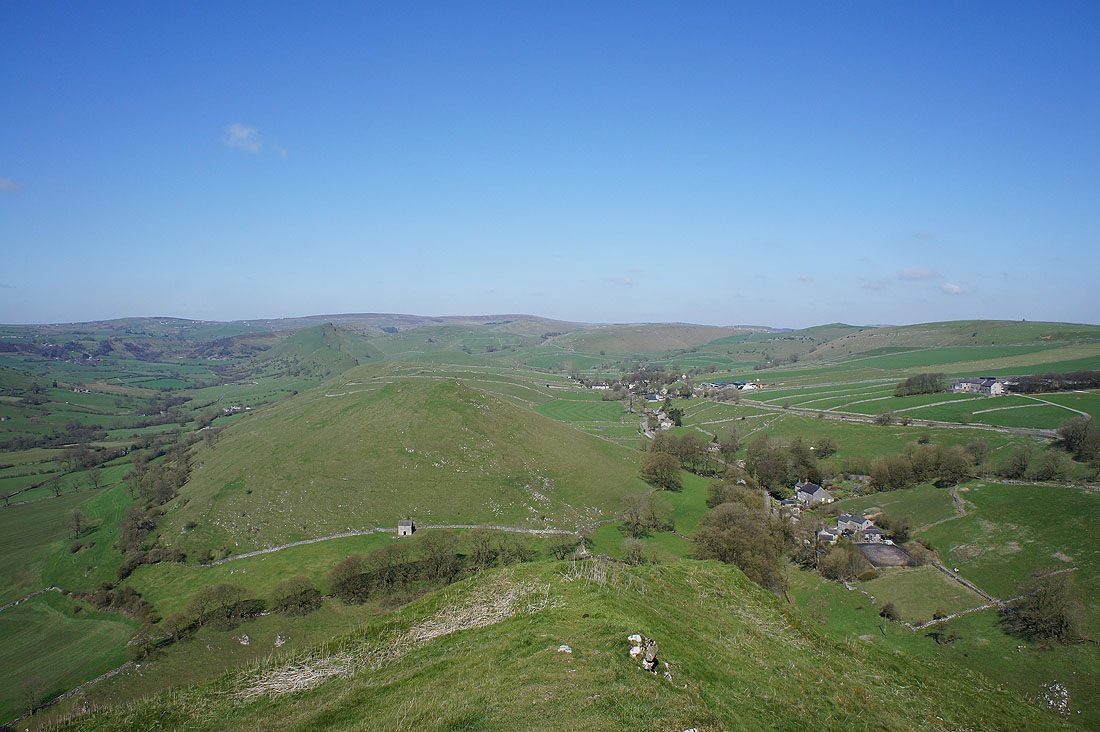
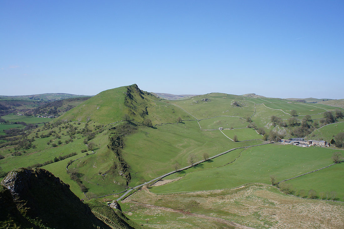
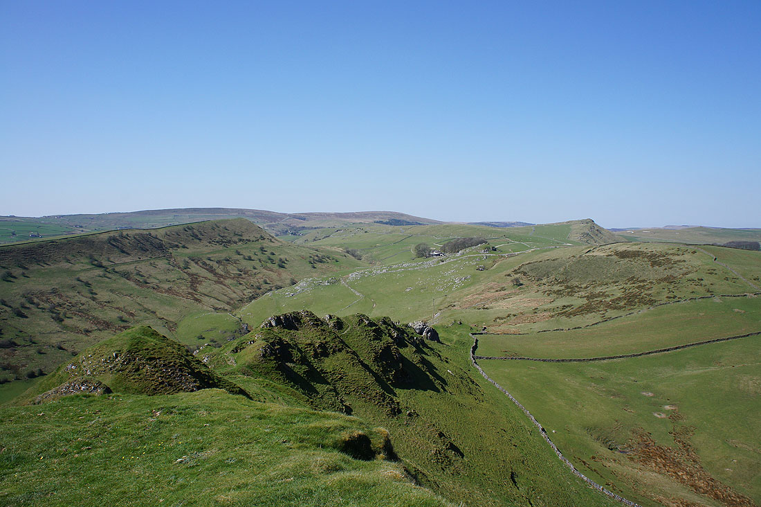
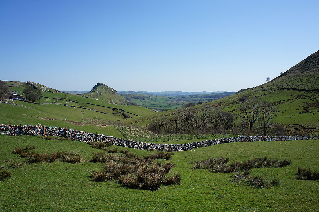
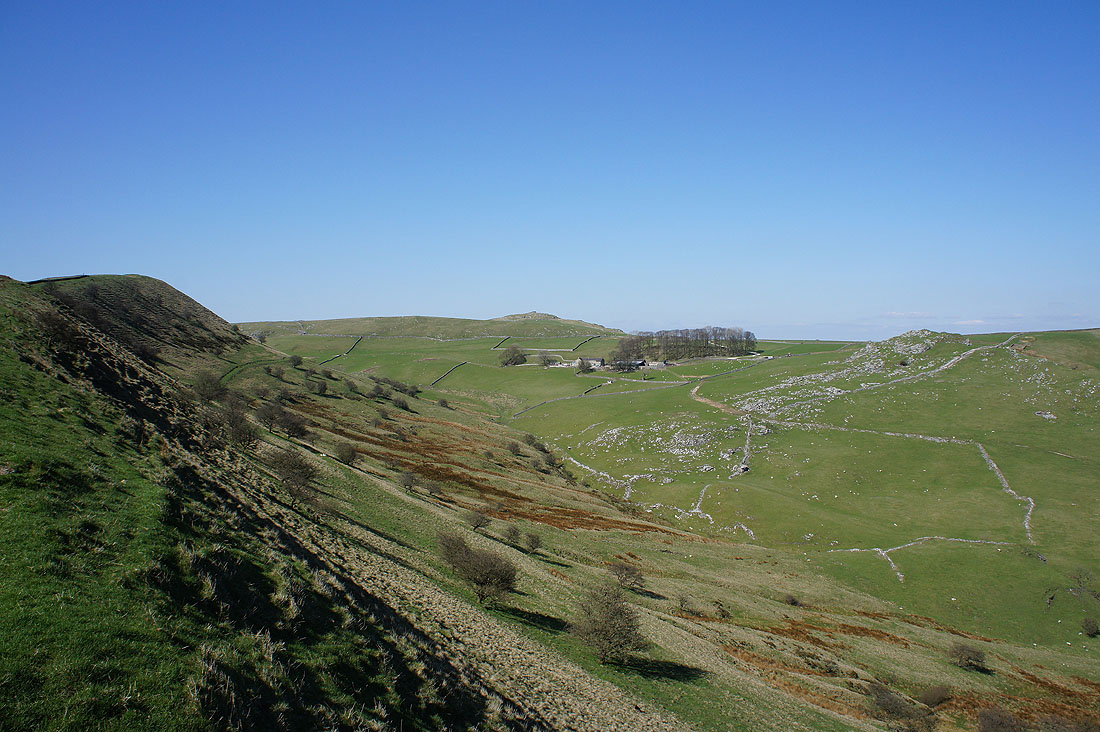
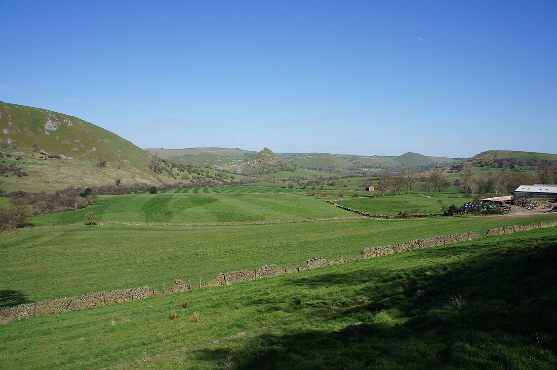
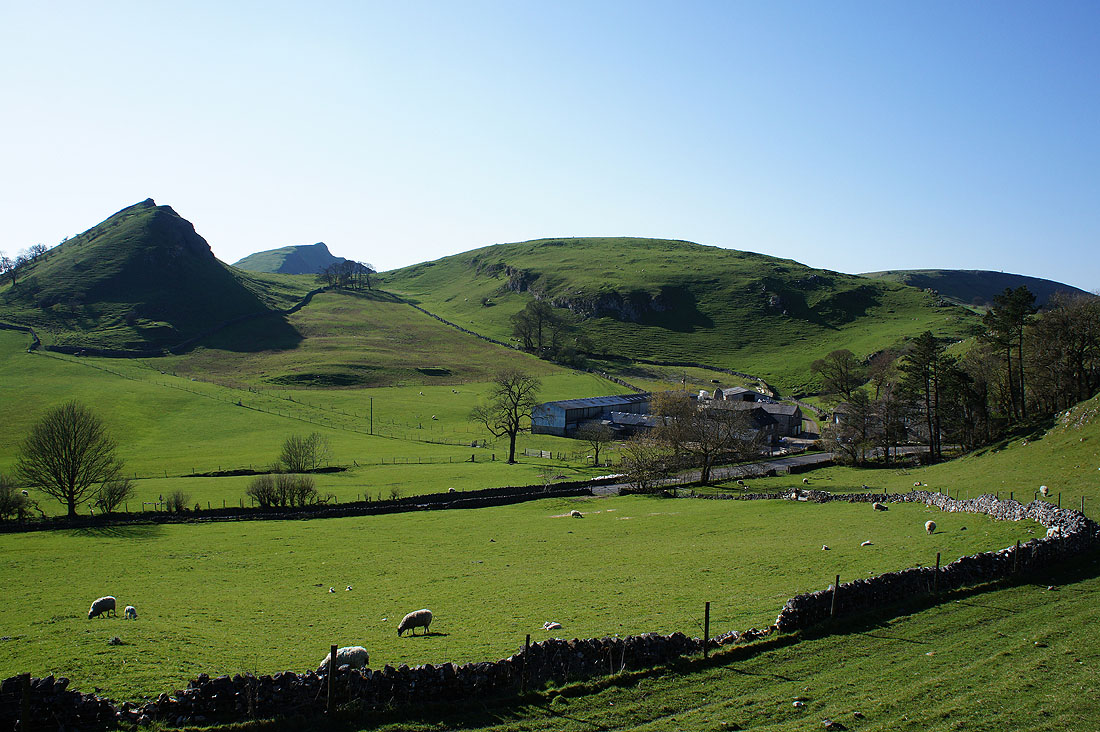
I take advantage of a pocket of access land to get this photo of Parkhouse Hill, Chrome Hill and Glutton Grange
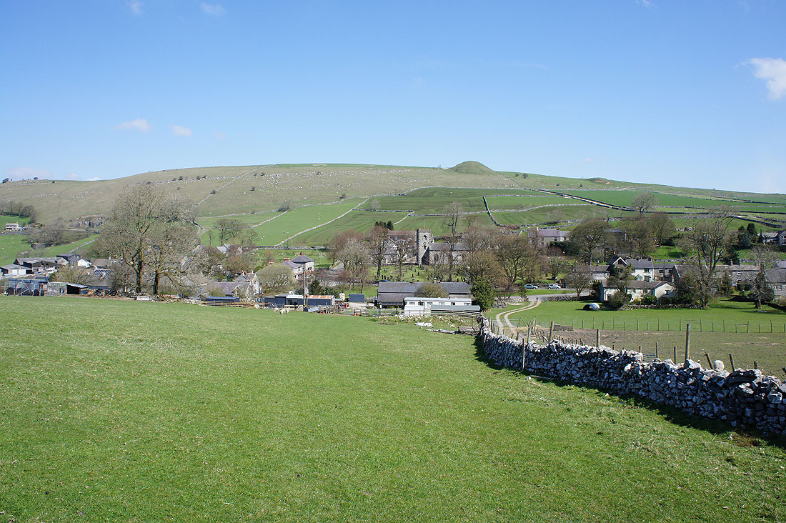
Earl Sterndale. Back so soon? My route required it, though I didn't actually cross paths with earlier in the day.
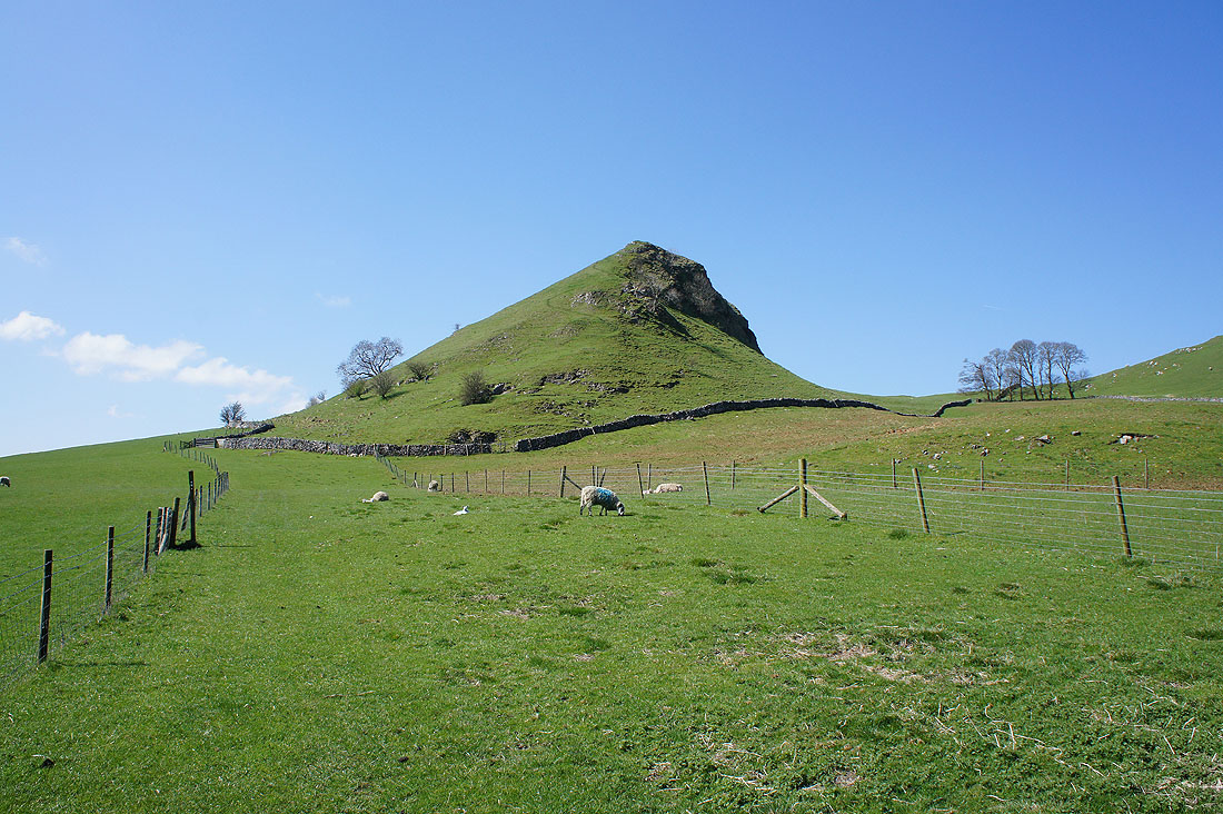
Time to tackle Parkhouse Hill. It was as steep as it looks.
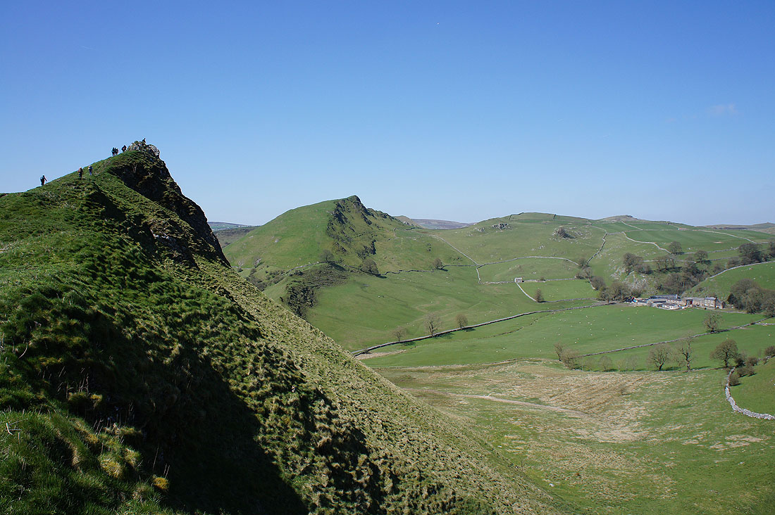
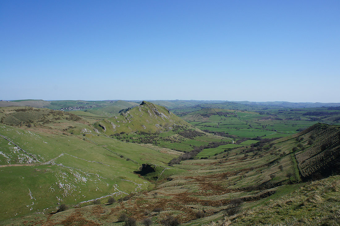
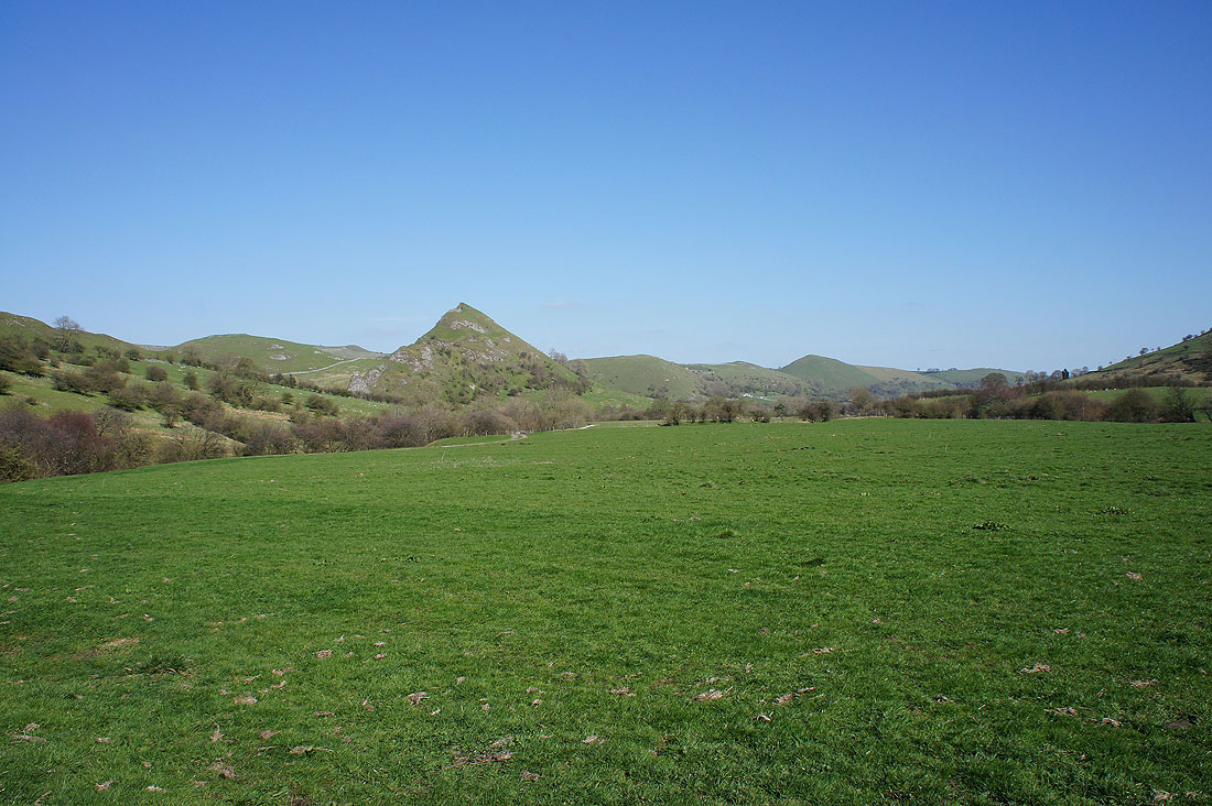
As I near its top Chrome Hill comes into view
After having my lunch it's time to take a look around. Looking across to Earl Sterndale.
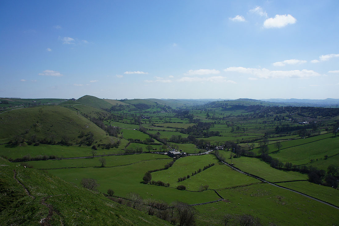
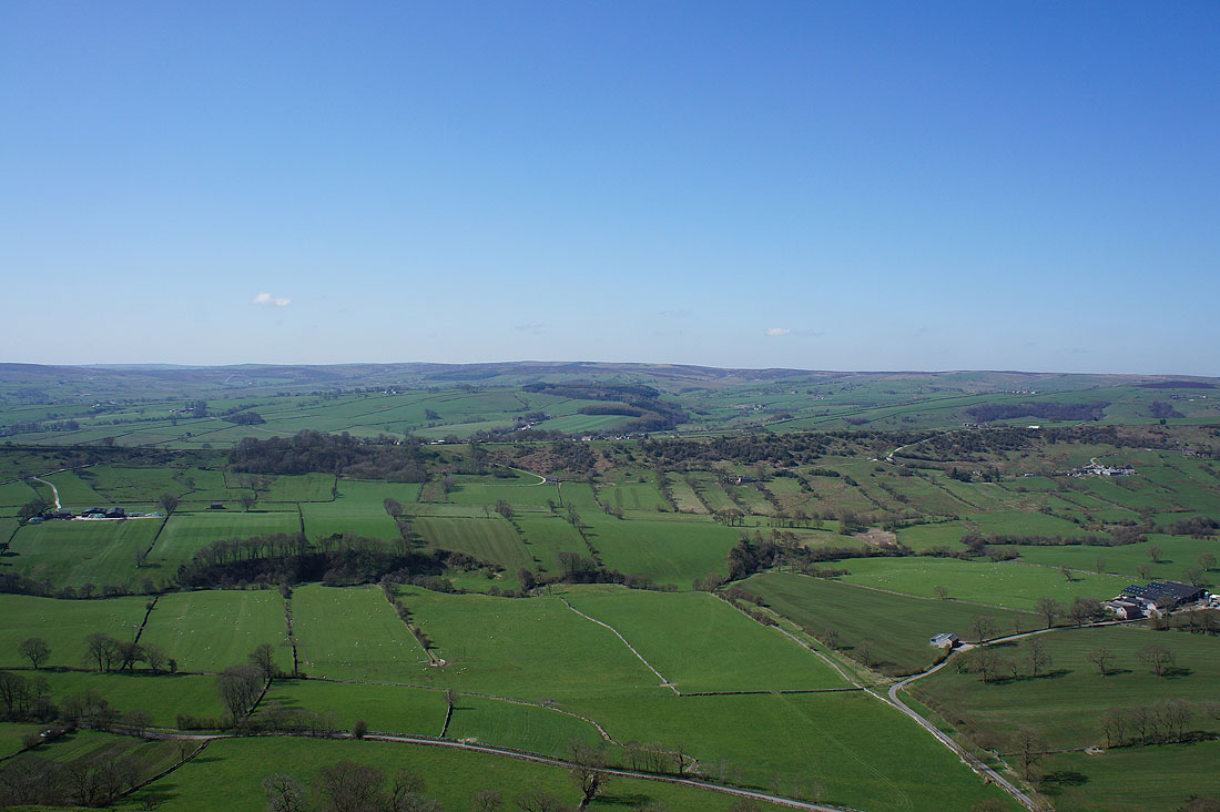
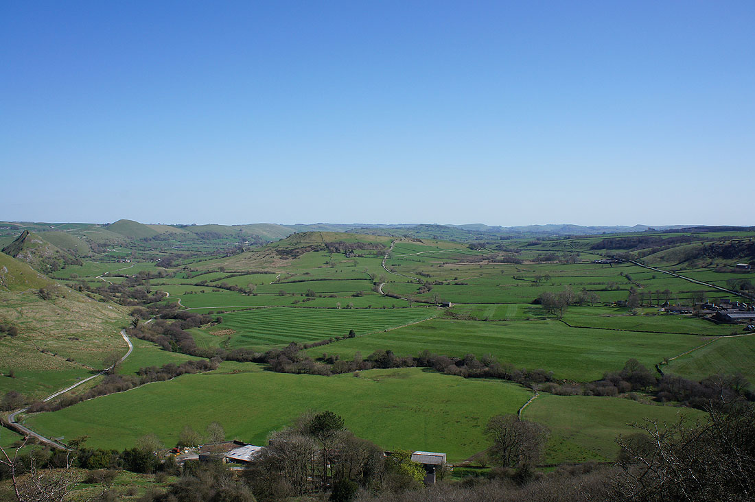
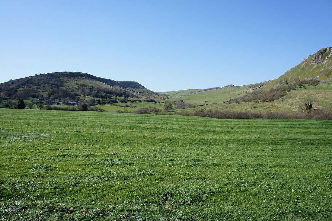
The Dove valley with Hitter Hill and High Wheeldon on the left
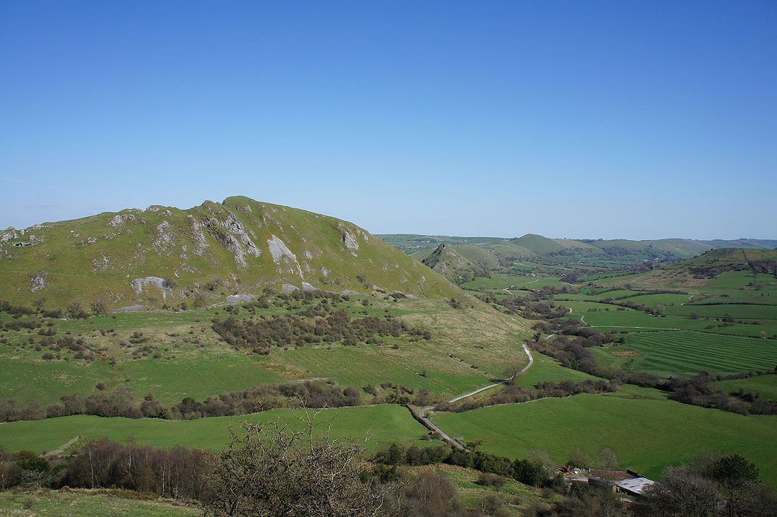
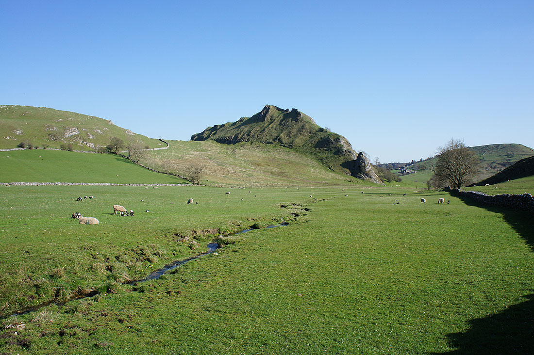
Chrome Hill. I've got a steep down and up to get there.
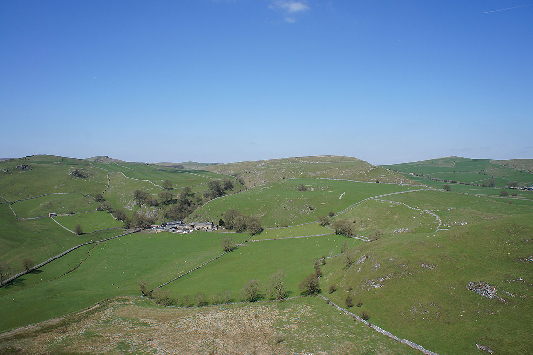
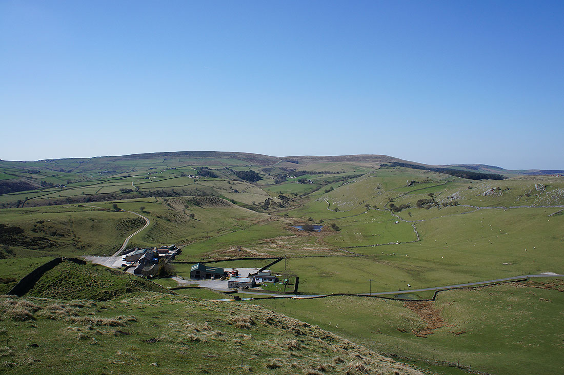
Dowall Hall and Upper Edge
Sugarloaf at the western end of Parkhouse Hill. The final descent was on its other side.
Parkhouse Hill as I climb Chrome Hill
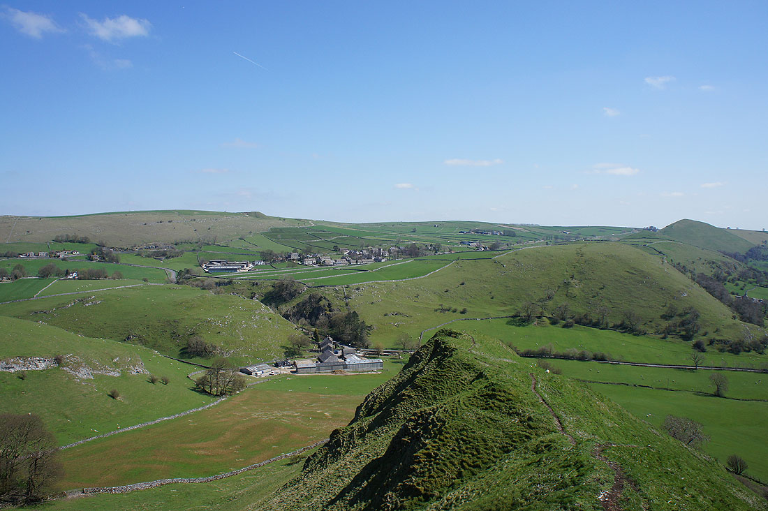
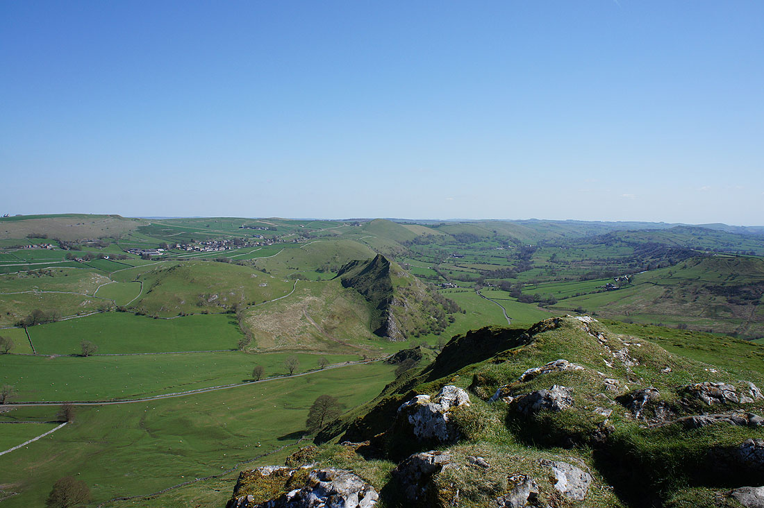
On the summit of Chrome Hill. As well as the blue skies and sunshine there's great visibility today, it makes for fantastic views. Hollins Hill and High Edge nearby with Axe Edge and Axe Edge Moor in the distance.
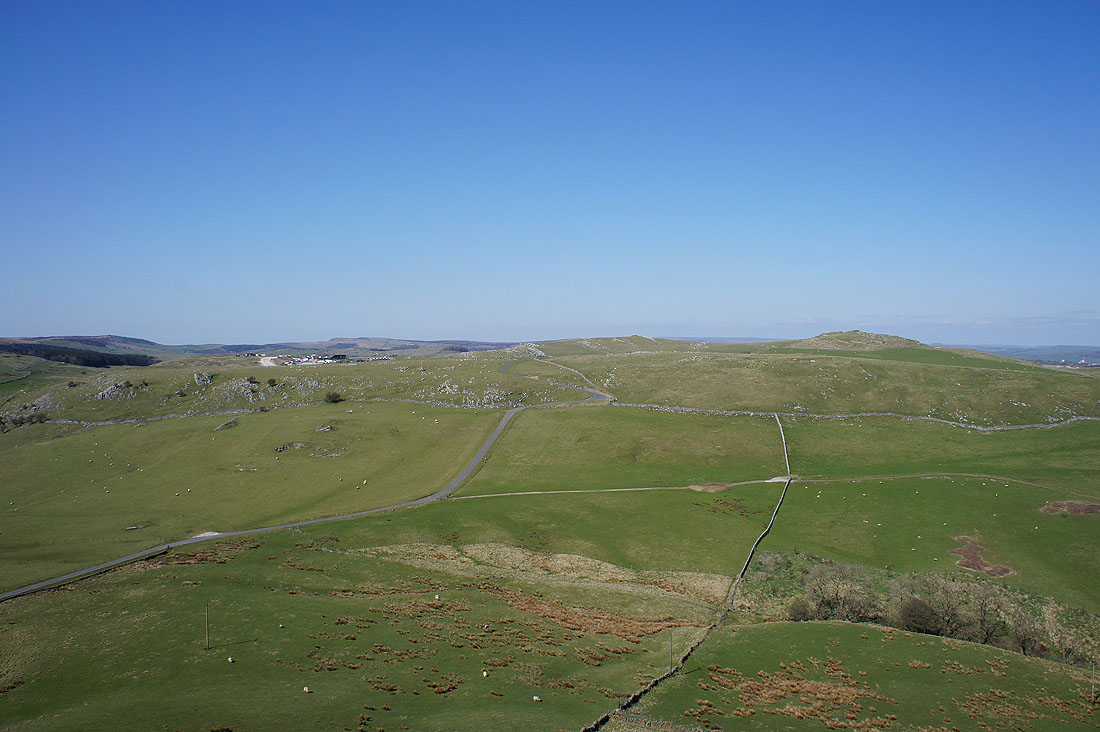
Kinder Scout way to the north
This might be my favourite shot of the day. Earl Sterndale, Parkhouse Hill and the Dove valley.
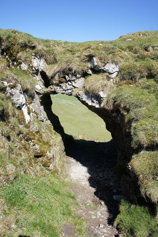
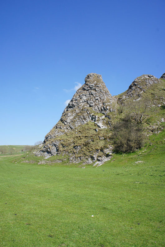
I passed this natural archway as I make my way down
On the path to Booth Farm and bound for Hollins Hill. A different angle to see Chrome Hill and the Dove valley from.
After another steep climb I'm on the summit of Hollins Hill, the final top of the day. That's Booth Farm below with Axe Edge and Axe Edge Moor in the distance. The River Dove has its source on the slopes of Axe Edge.
High Edge
Chrome Hill with the valley of Swallow Brook below
High Edge and Stoop Farm as I make my way down Hollins Hill's south ridge
A beautiful scene. Springtime in the Dove valley.
As I reach the bottom of the ridge I can see round Chrome Hill to Parkhouse Hill
Across the infant River Dove
Looking across to Parkhouse Hill as I head to Hollinsclough
Making my way through Hollinsclough
Hollins Hill and the western slope of Chrome Hill as I leave the road and follow a path across to the road beneath Parkhouse Hill
There's Parkhouse Hill just ahead, as well as Hitter Hill and High Wheeldon
Heading for Dowall Hall
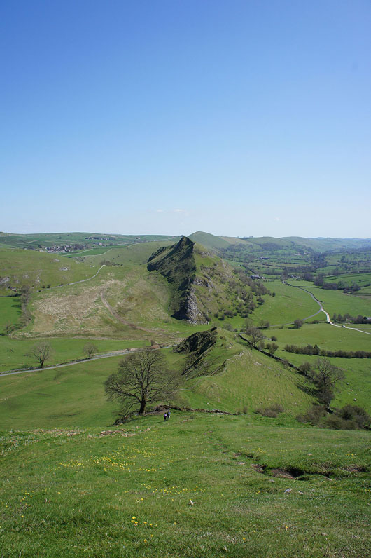
A real "Dragon's Back" view of Parkhouse Hill
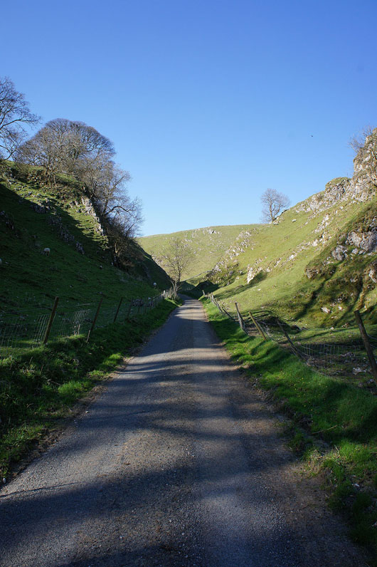
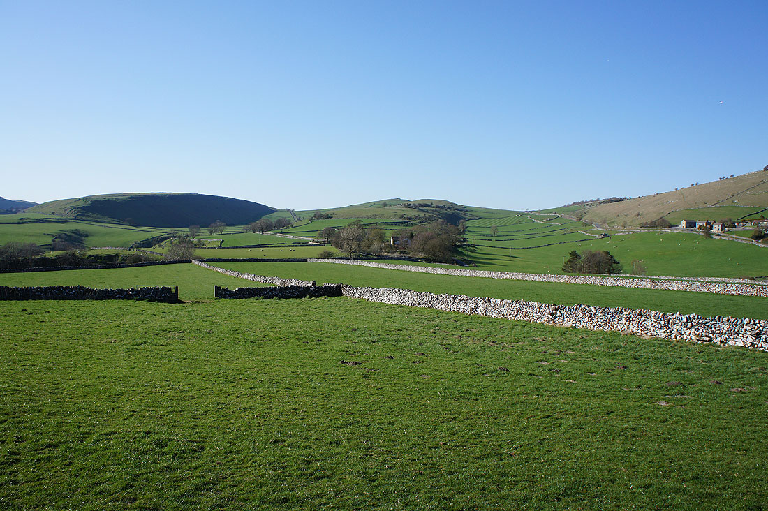
On the road into Dowel Dale
On the finishing straight at last. That's Earl Sterndale in the distance.
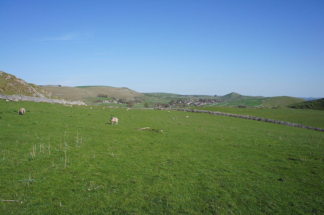
The path through this nameless valley will take to Glutton Grange
Then from Glutton Grange the final uphill bit of the day, across the side of Hitter Hill. A lovely view of Parkhouse Hill and the hill above Glutton Grange.
It's a beautiful end to the afternoon as..
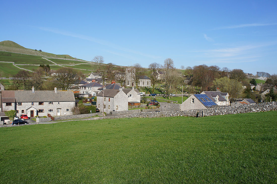
..I make it back to Earl Sterndale