18th November 2019 - Rossett Pike, Esk Pike and Bowfell
Walk Details
Distance walked: 9.9 miles
Total ascent: 3496 ft
OS map used: OL6 - The English Lakes, Southwestern area
Time taken: 6.5 hrs
Route description: NT car park, Old Dungeon Ghyll hotel-Mickleden-Langdale Combe-Stake Pass-Rossett Pike-Angle Tarn-Esk Hause-Esk Pike-Ore Gap-Bowfell-Three Tarns-The Band-Stool End Farm-NT car park, Old Dungeon Ghyll hotel
I happened to have booked today off work, which was good thing considering how poor the weather was over the weekend. The perfect autumn day is forecast for today though; lots of sunshine, clear air with excellent visibility, and light winds even high up. So, although it's cold and frosty it won't feel too bad with only a little wind chill. With such a good day on offer I decided to treat myself and head up to the Lakes for a walk. I fancied taking in the summit of Bowfell from Langdale, which would give me some fantastic views, but I needed to try and work out a route that would take in Wainwrights for my second round. I knew that Rossett Pike would but Esk Pike was a surprise. I hadn't realised my last visit to it was so long ago. The route I went for took me along Mickleden and up to the Stake Pass, then to Rossett Pike and past Angle Tarn to Esk Hause, across the fells of Esk Pike and Bowfell, then down The Band to Stool End Farm and back to Langdale. Old snow on the highest slopes of Esk Pike and Bowfell was a bit tricky to negotiate in places, having my microspikes would have made life a little easier.
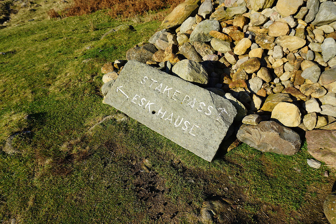
From the NT car park next to the Old Dungeon Ghyll Hotel I took the bridleway west up Mickleden (part of Cumbria Way), then up by Stake Gill into Langdale Combe and to the top of the Stake Pass. I left the bridleway at the top of the pass and followed a path southwest along the ridgeline over the top of Black Crags to the summit of Rossett Pike, where I stopped for lunch. After lunch I made my way down from Rossett Pike and picked up the bridleway west past Angle Tarn and up to the cross shelter at the lower Esk Hause. I turned left here, went up to the true Esk Hause, then left again, and made my way up to the summit of Esk Pike. The ridge line was then followed southeast across Ore Gap and up to the summit of Bowfell. From Bowfell I descended to Three Tarns, then made my way down The Band to Stool End Farm for a walk along the access road back to the car park next to the Old Dungeon Ghyll Hotel.
Total ascent: 3496 ft
OS map used: OL6 - The English Lakes, Southwestern area
Time taken: 6.5 hrs
Route description: NT car park, Old Dungeon Ghyll hotel-Mickleden-Langdale Combe-Stake Pass-Rossett Pike-Angle Tarn-Esk Hause-Esk Pike-Ore Gap-Bowfell-Three Tarns-The Band-Stool End Farm-NT car park, Old Dungeon Ghyll hotel
I happened to have booked today off work, which was good thing considering how poor the weather was over the weekend. The perfect autumn day is forecast for today though; lots of sunshine, clear air with excellent visibility, and light winds even high up. So, although it's cold and frosty it won't feel too bad with only a little wind chill. With such a good day on offer I decided to treat myself and head up to the Lakes for a walk. I fancied taking in the summit of Bowfell from Langdale, which would give me some fantastic views, but I needed to try and work out a route that would take in Wainwrights for my second round. I knew that Rossett Pike would but Esk Pike was a surprise. I hadn't realised my last visit to it was so long ago. The route I went for took me along Mickleden and up to the Stake Pass, then to Rossett Pike and past Angle Tarn to Esk Hause, across the fells of Esk Pike and Bowfell, then down The Band to Stool End Farm and back to Langdale. Old snow on the highest slopes of Esk Pike and Bowfell was a bit tricky to negotiate in places, having my microspikes would have made life a little easier.
From the NT car park next to the Old Dungeon Ghyll Hotel I took the bridleway west up Mickleden (part of Cumbria Way), then up by Stake Gill into Langdale Combe and to the top of the Stake Pass. I left the bridleway at the top of the pass and followed a path southwest along the ridgeline over the top of Black Crags to the summit of Rossett Pike, where I stopped for lunch. After lunch I made my way down from Rossett Pike and picked up the bridleway west past Angle Tarn and up to the cross shelter at the lower Esk Hause. I turned left here, went up to the true Esk Hause, then left again, and made my way up to the summit of Esk Pike. The ridge line was then followed southeast across Ore Gap and up to the summit of Bowfell. From Bowfell I descended to Three Tarns, then made my way down The Band to Stool End Farm for a walk along the access road back to the car park next to the Old Dungeon Ghyll Hotel.
Route map
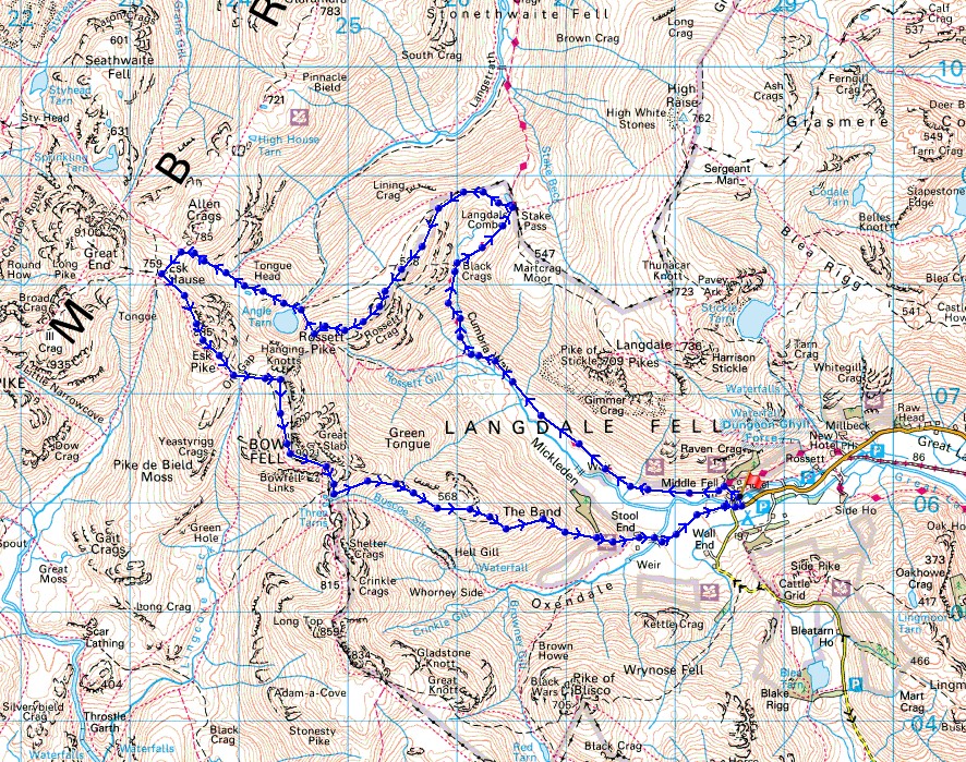
© Crown copyright. All rights reserved. License number PU 100034184.
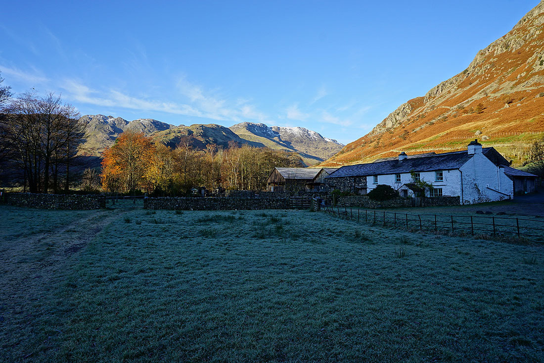
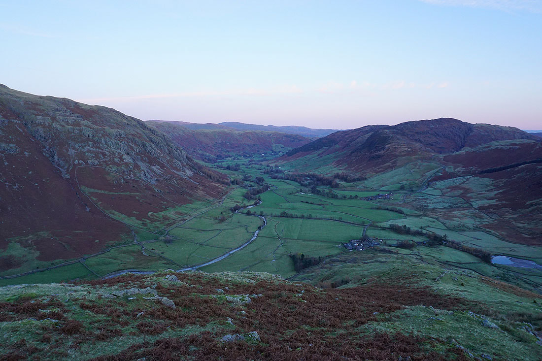
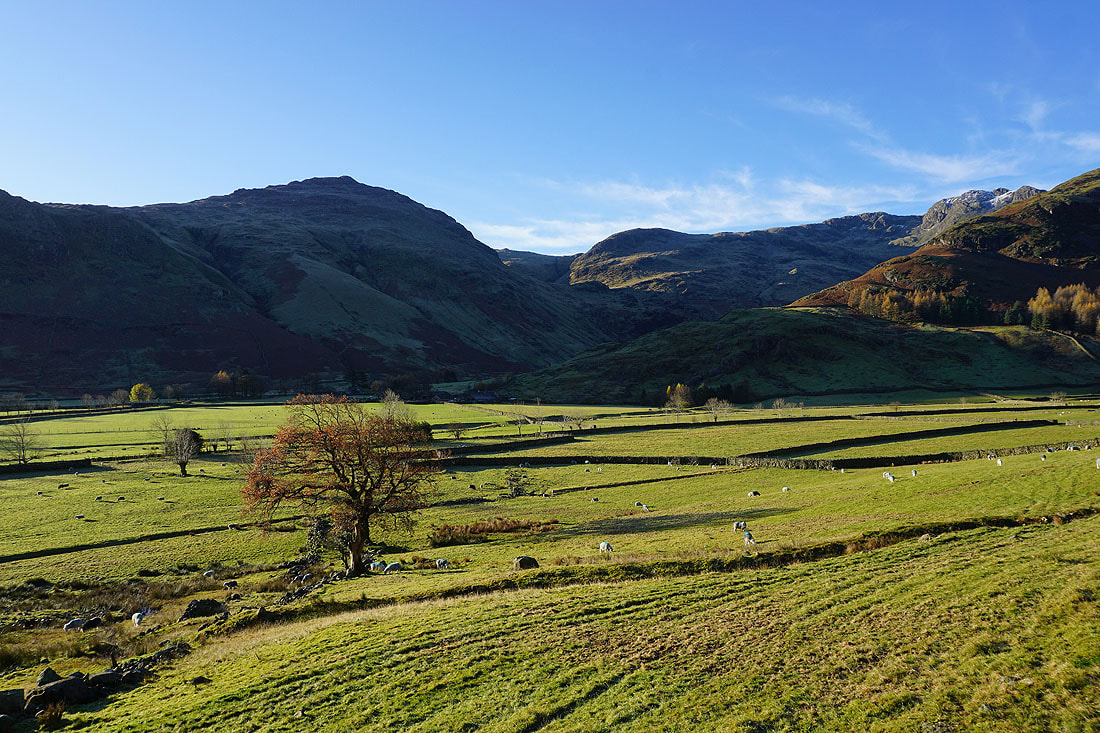
A fantastic view to start my walk with. Crinkle Crags, Bowfell and Middle Fell Farm.
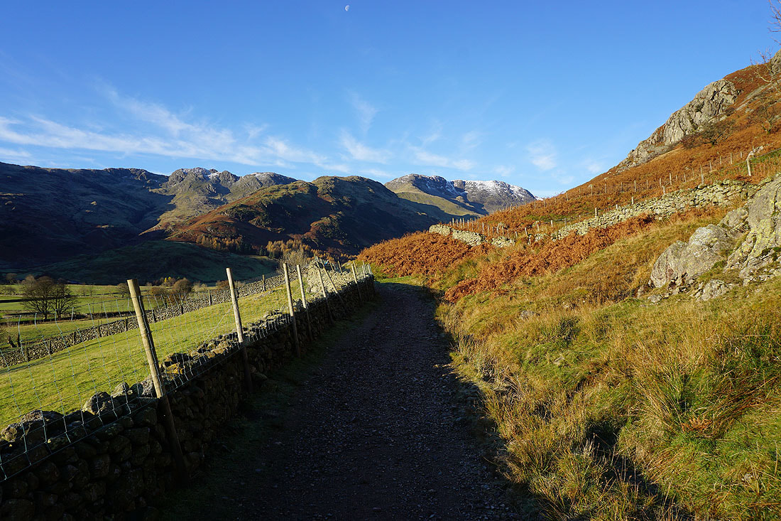
Crinkle Crags and Bowfell as I follow the bridleway to Mickleden
Pike of Blisco and Great Knott on the other side of the head of Langdale
Pike of Stickle and Loft Crag
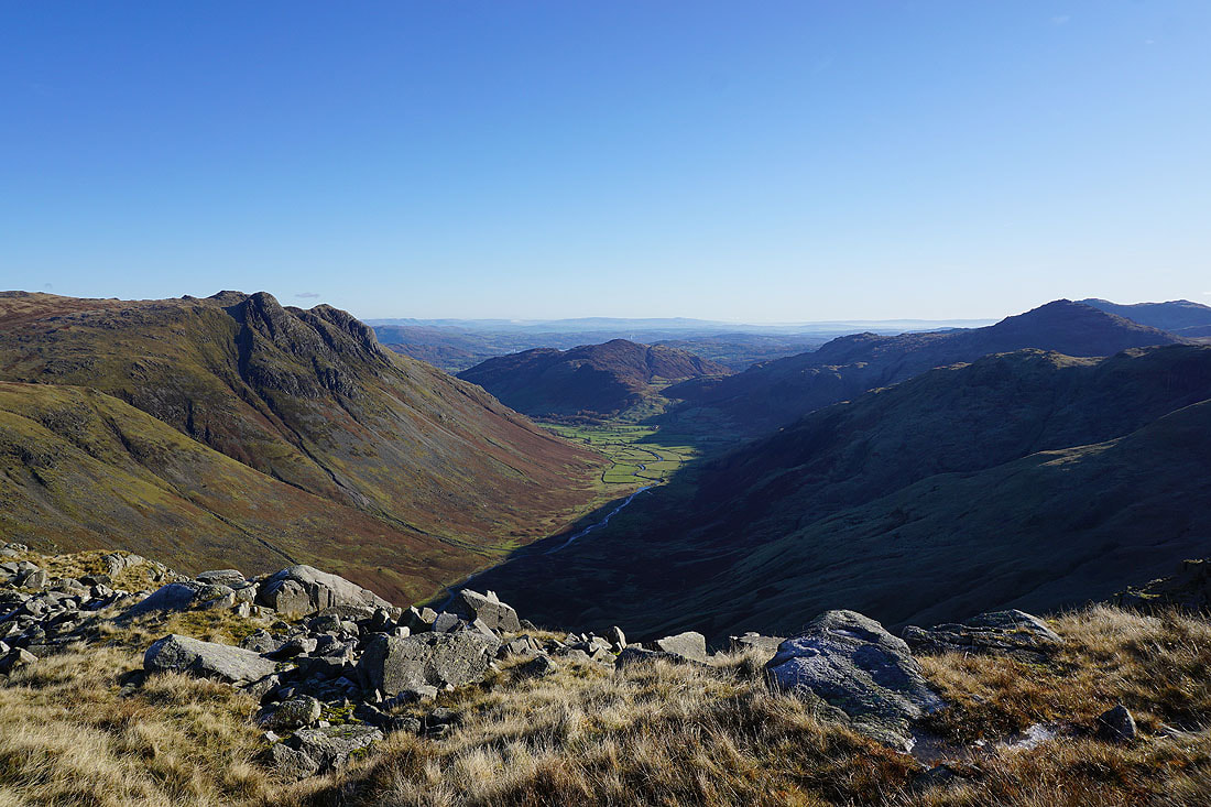
Heading into Mickleden. Rossett Pike is on the left, but instead of taking the more direct route up Rossett Gill, which is to the left of Rossett Pike, I'm going to exit Mickleden via the bridleway up to the Stake Pass.
Bowfell, Hanging Knotts and Rossett Pike above Mickleden Beck..
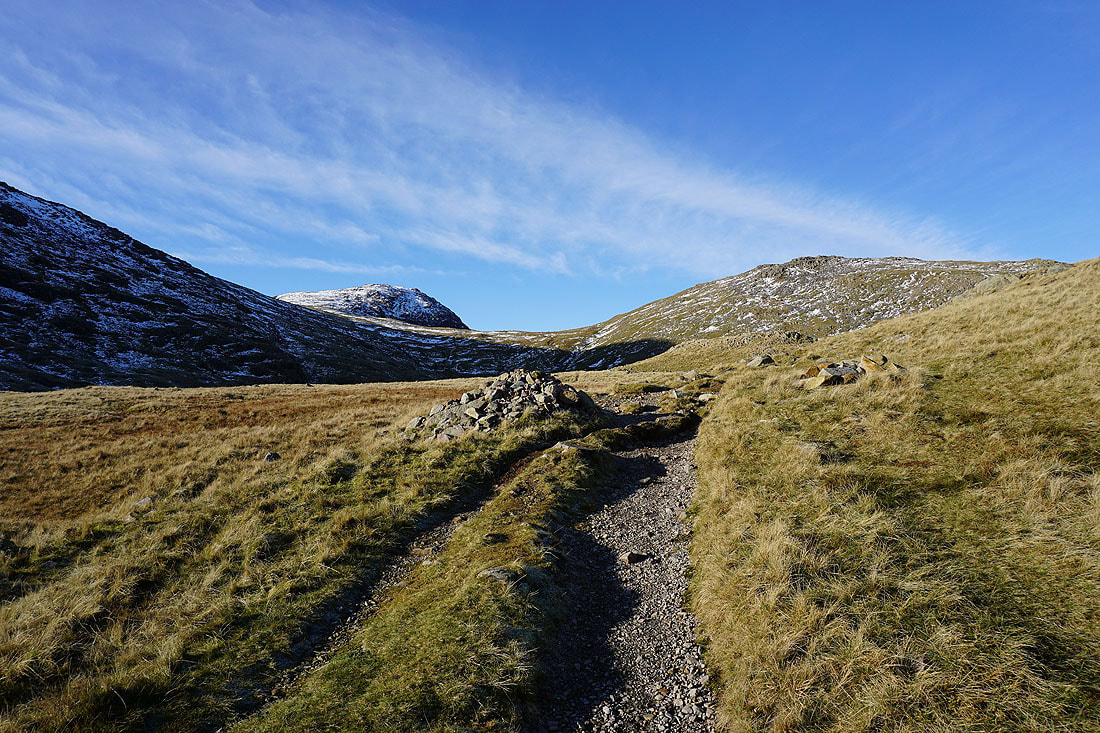
The way ahead divides. The bridleway to Esk Hause goes up by Rossett Gill, but it's the Stake Pass for me.
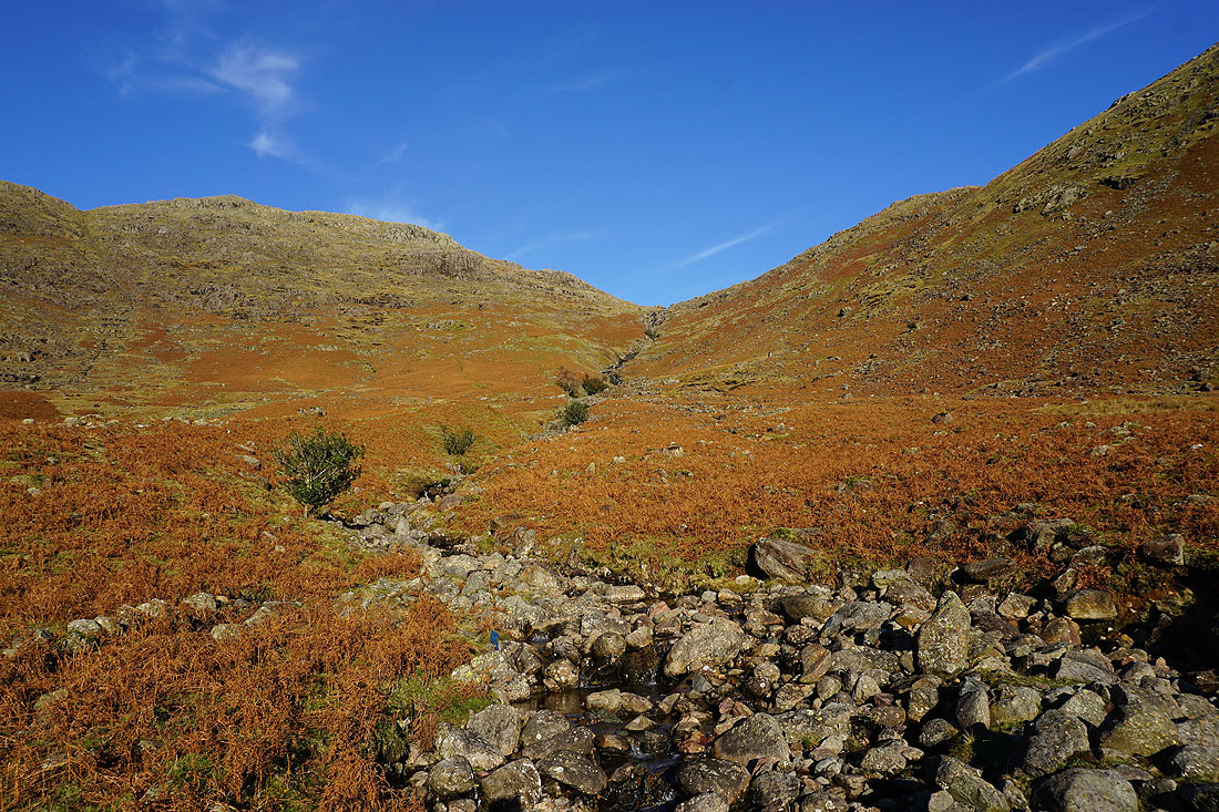
Stake Gill
Pike of Stickle on the left, Lingmoor Fell, Langdale, Pike of Blisco and Mickleden, as I look back on the bridleway up to the Stake Pass
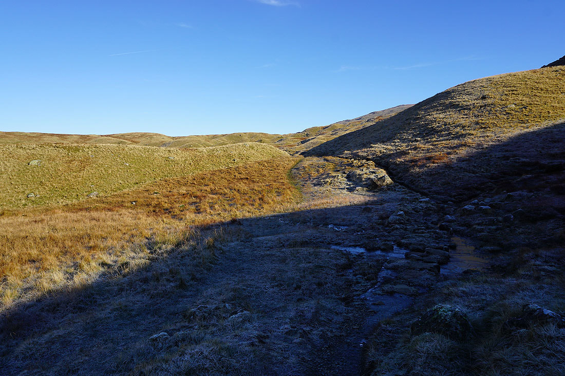
Higher up, and there's frost and ice in the shadows
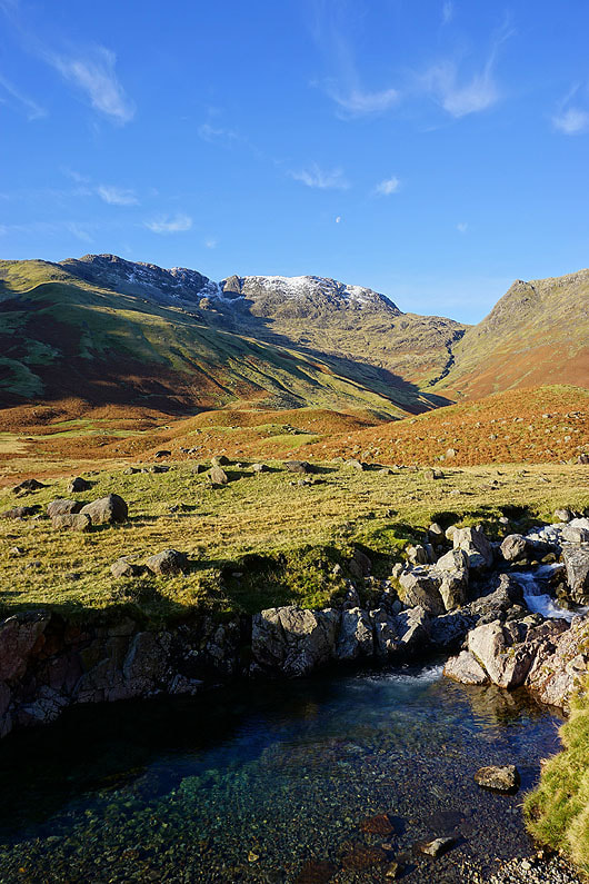
At the cairn at the top of the Stake Pass. Allen Crags (with a bit of snow) and Glaramara on the other side of a hidden Langstrath.
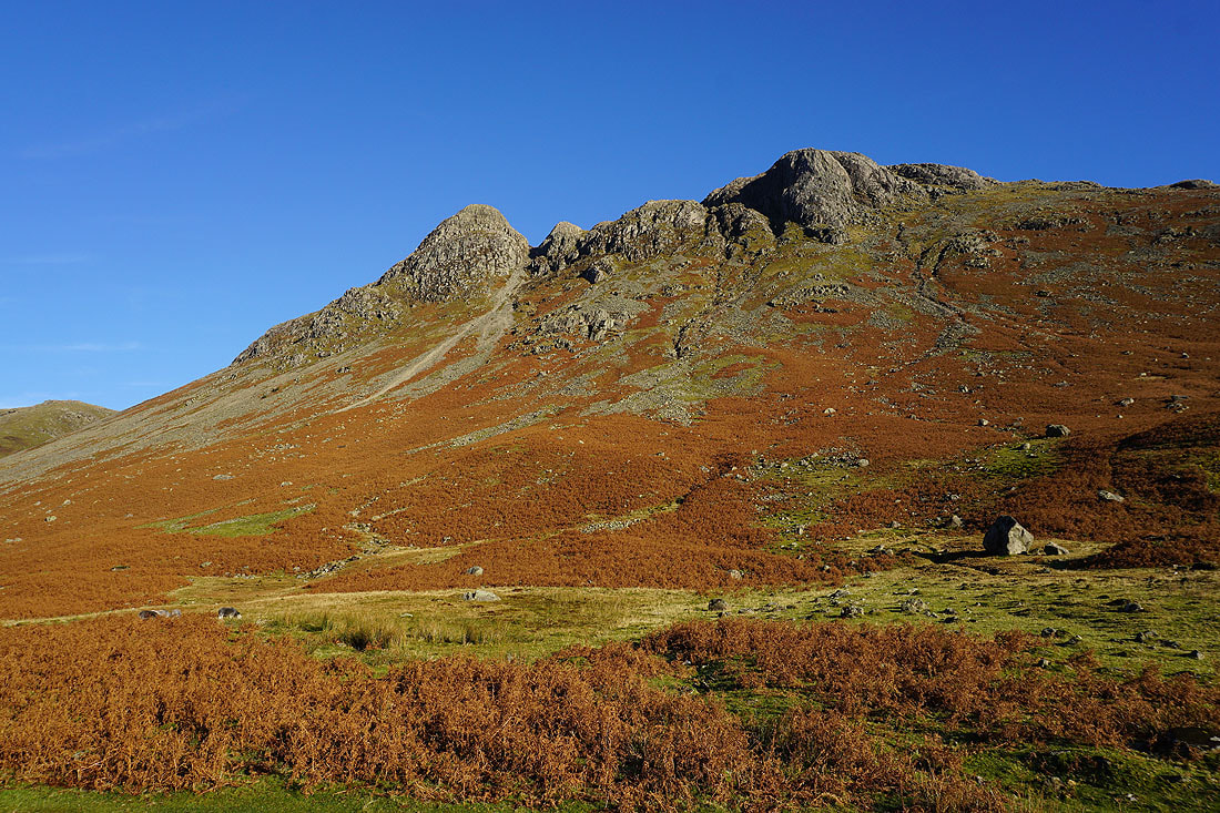
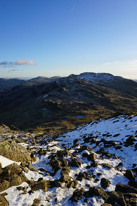
Crinkle Crags, Bowfell and Esk Pike
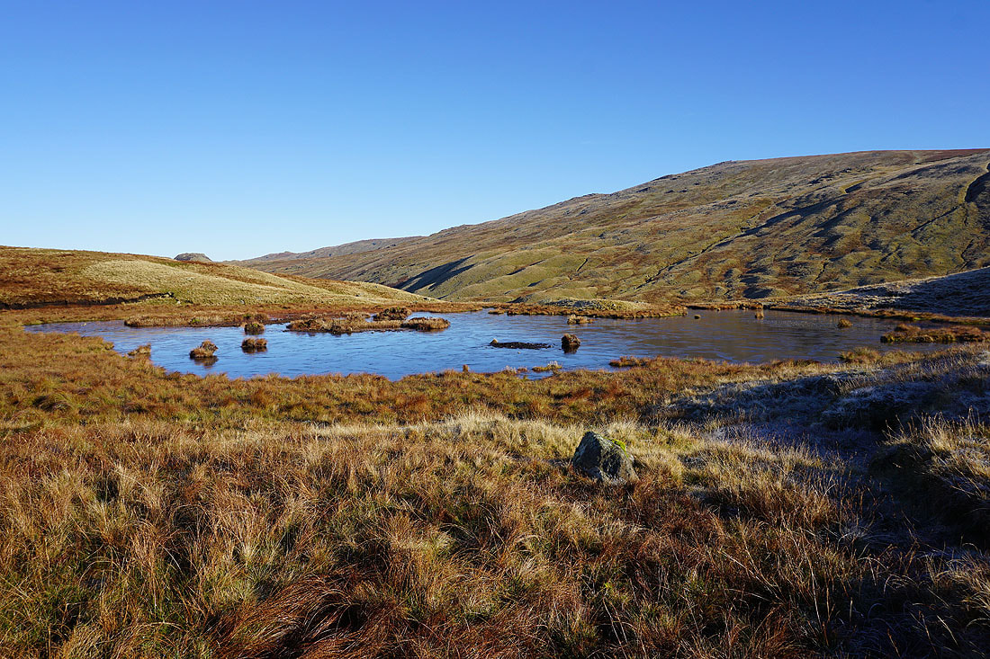
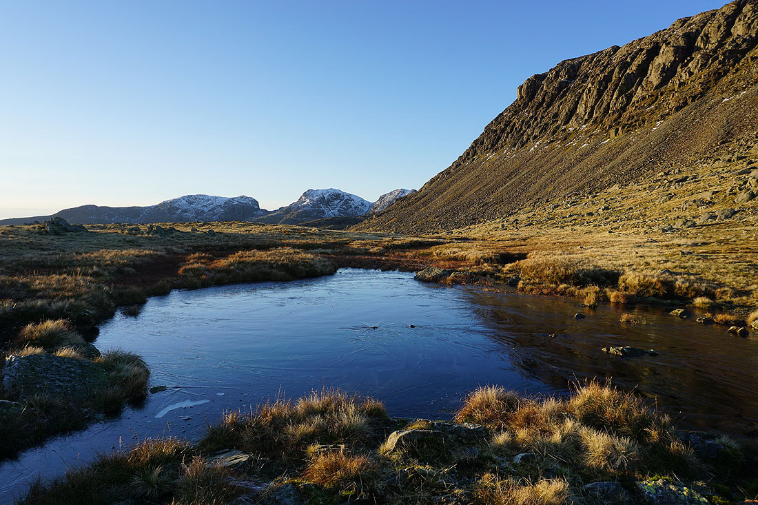
A frozen tarn
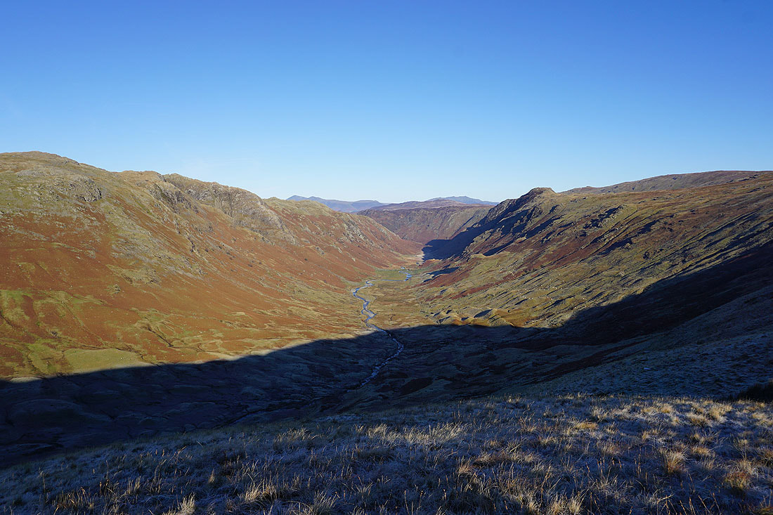
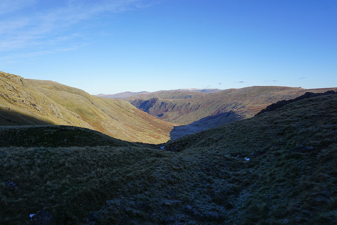
Walking a bit further north from the top of the pass has given me a view down Langstrath
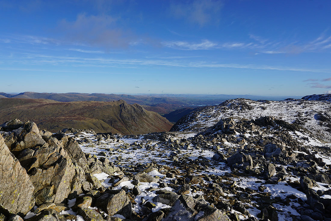
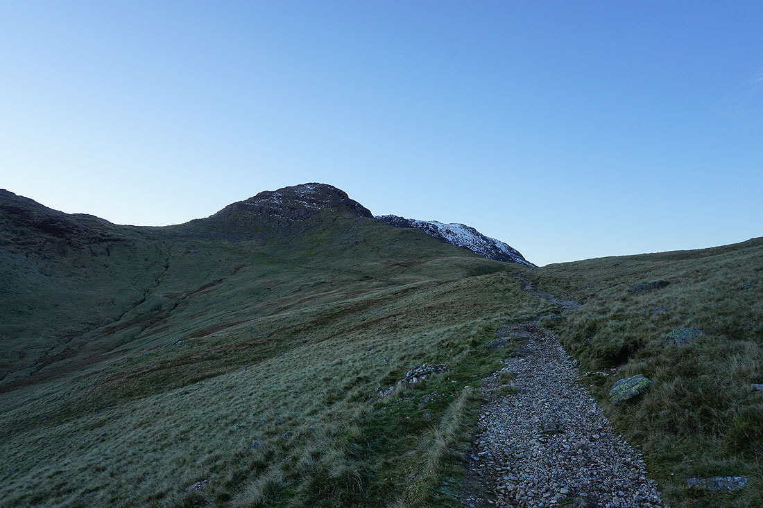
Bowfell and Esk Pike as I head south along the ridge to Rossett Pike
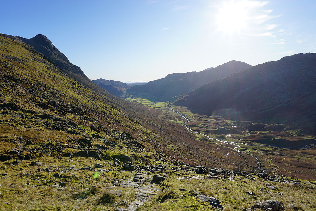
There's a great view to my left down Mickleden to Langdale, and beyond..
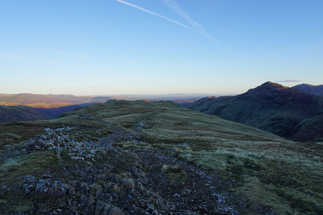
and it's at its best from Rossett Pike. The Langdale Pikes are on the left, Mickleden and Lingmoor Fell, and the northern slopes of The Band on the right. I can easily make out Ingleborough in the distance just to the right of Lingmoor Fell.
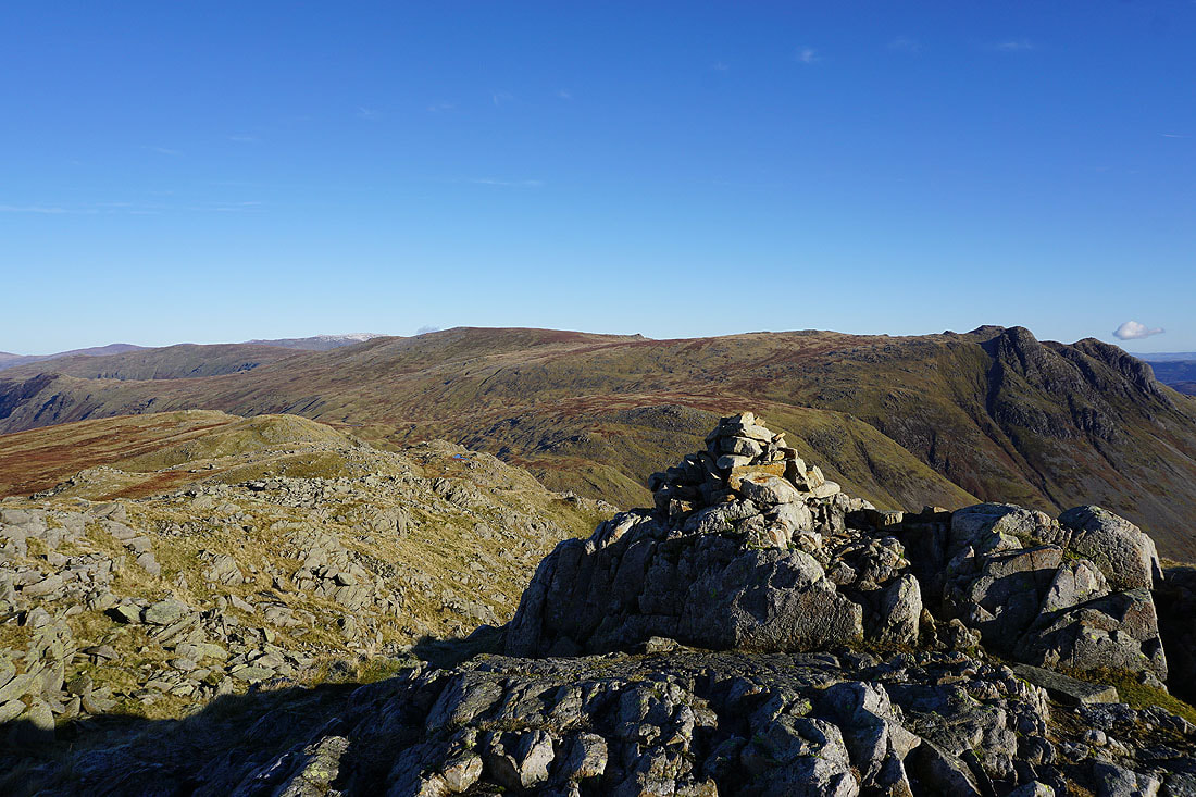
High Raise and the Langdale Pikes from the summit cairn on Rossett Pike
Looking north down Langstrath with Glaramara on the left
and Eagle Crag, Sergeant's Crag and High Raise on the right
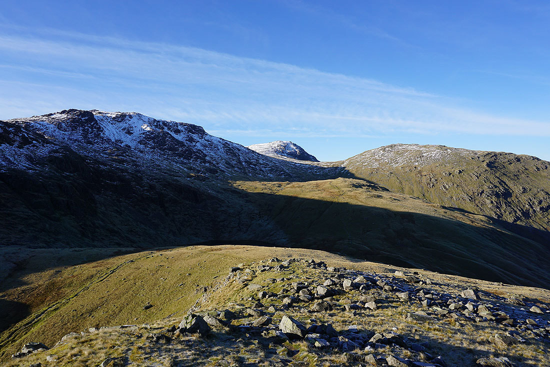
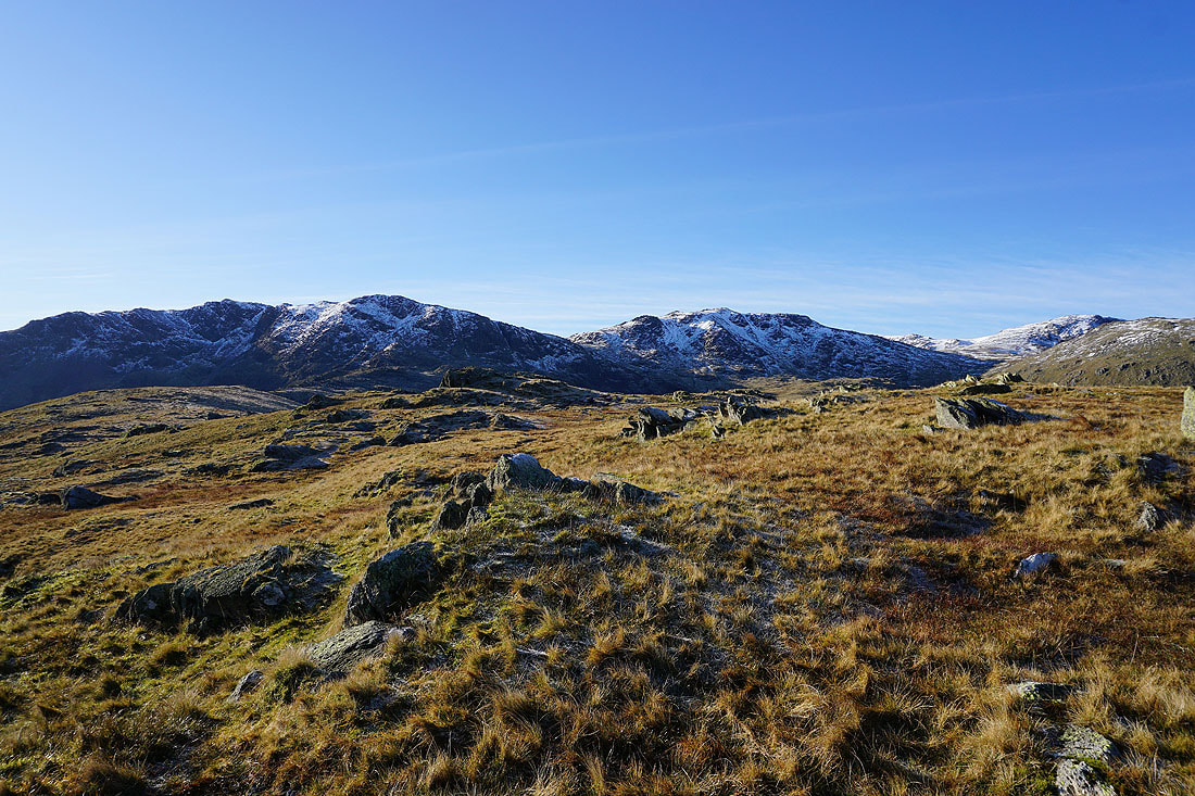
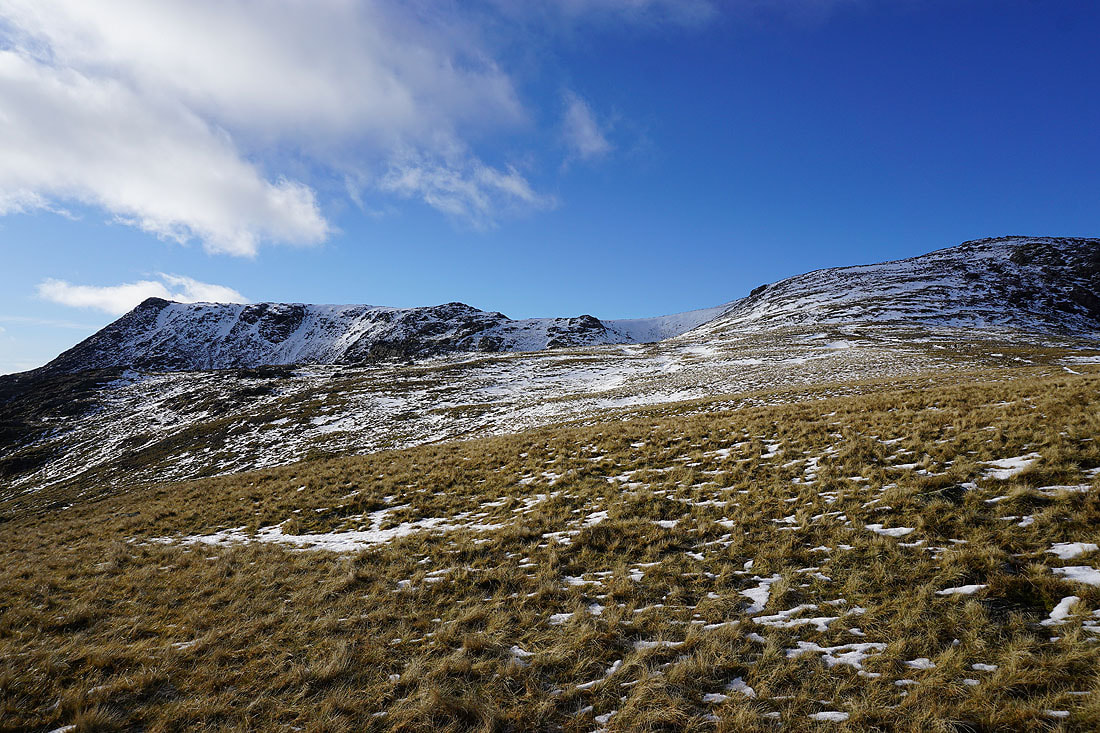
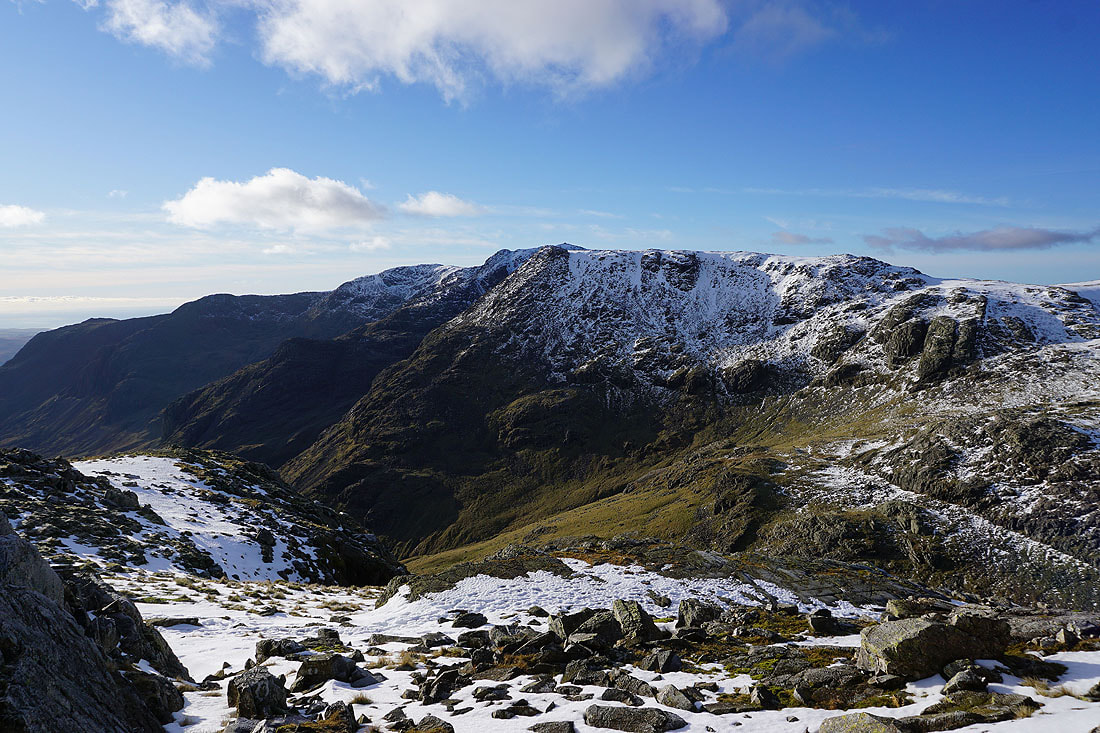
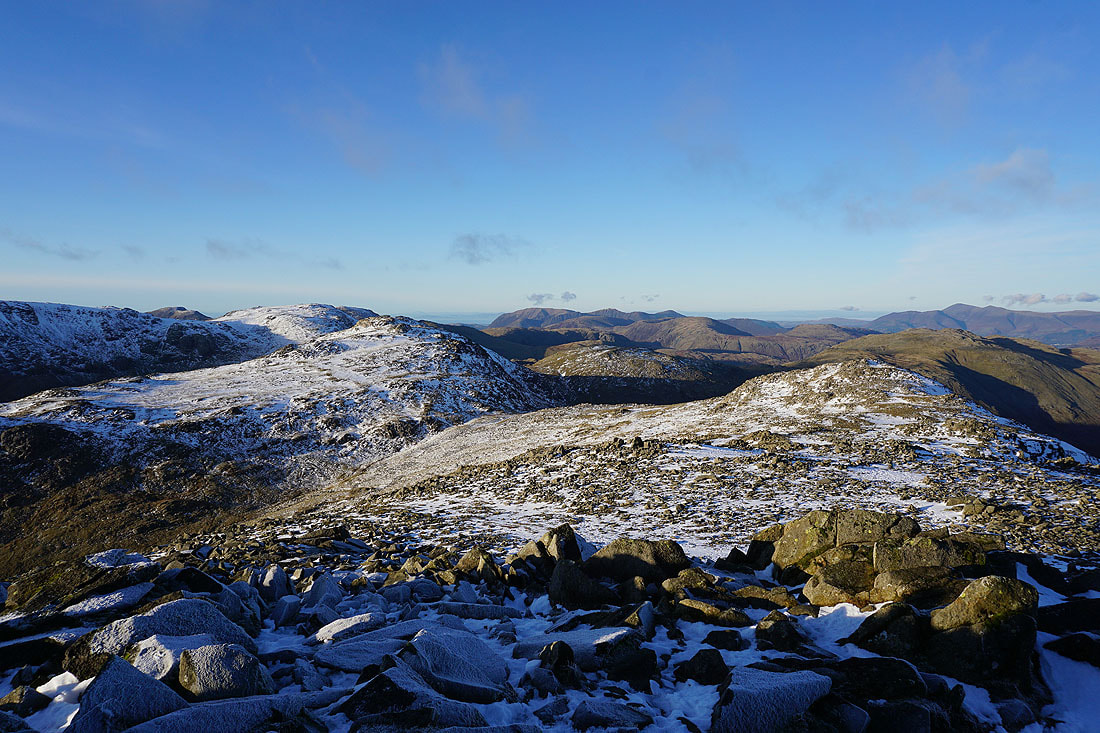
Esk Pike, Great End and Allen Crags
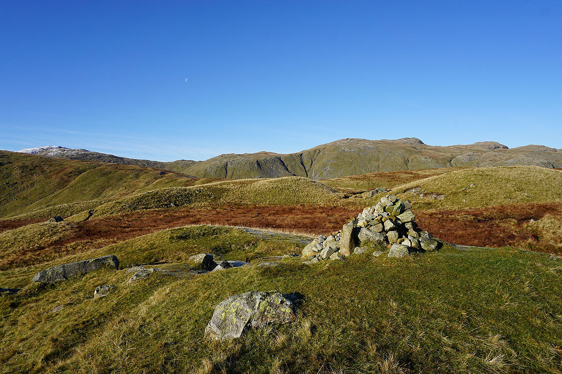
Rossett Pike on the left as I head for the bridleway to Esk Hause
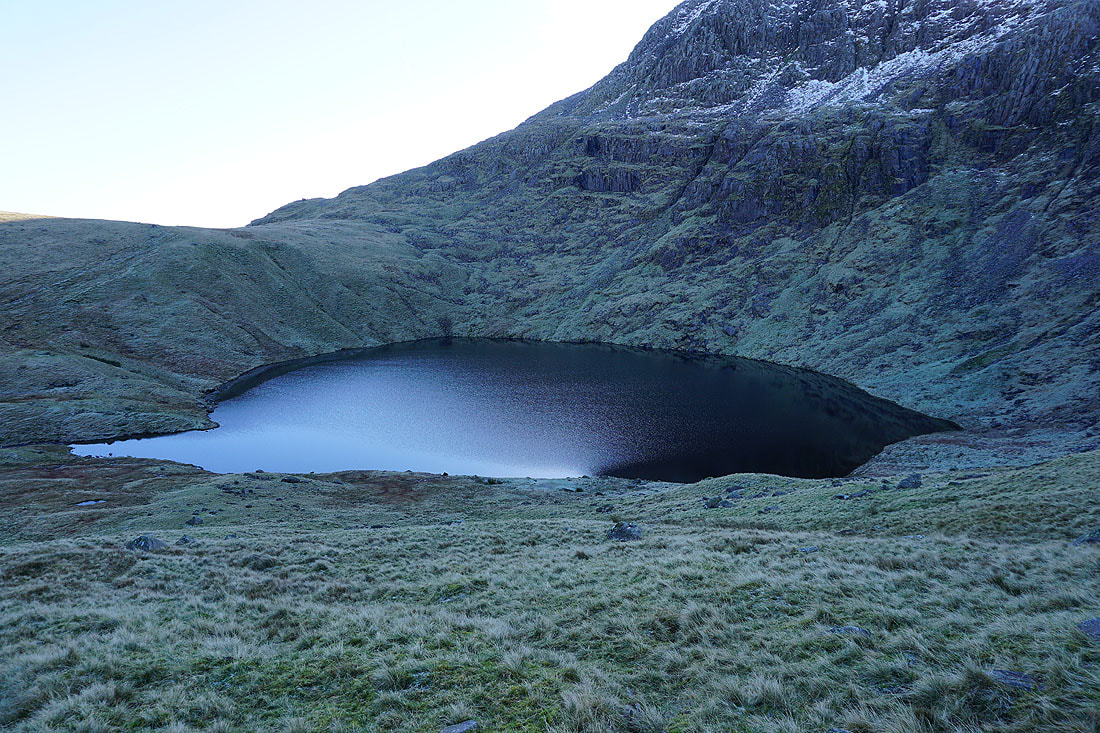
A dark and cold Angle Tarn. It's permanently in shadow at this time of year.
Looking back to the Langdale Pikes and Rossett Pike
On the bridleway to Esk Hause with Great End and Allen Crags ahead
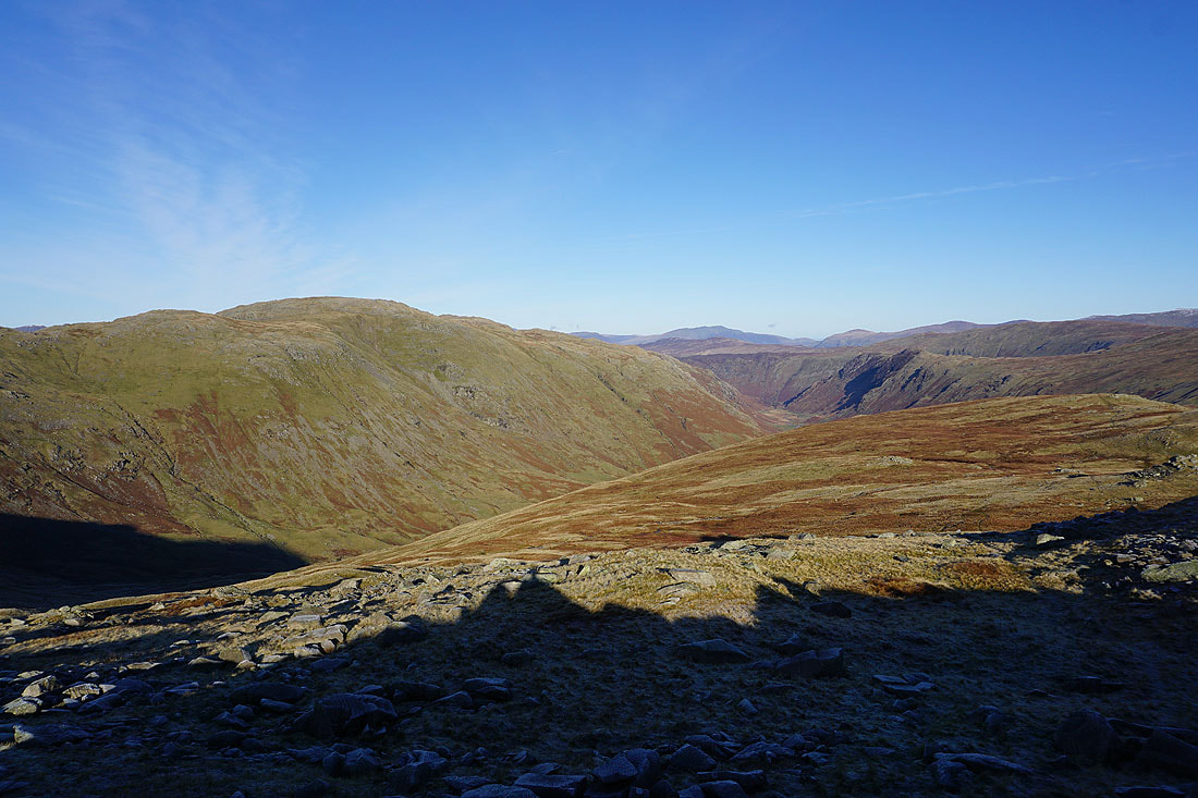
Looking down Allencrags Gill into Langstrath
The Langdale Pikes, Rossett Pike, Lingmoor Fell and beyond as I reach the lower Esk Hause
Great Gable, Green Gable, Grasmoor, Dale Head, High Spy and Skiddaw
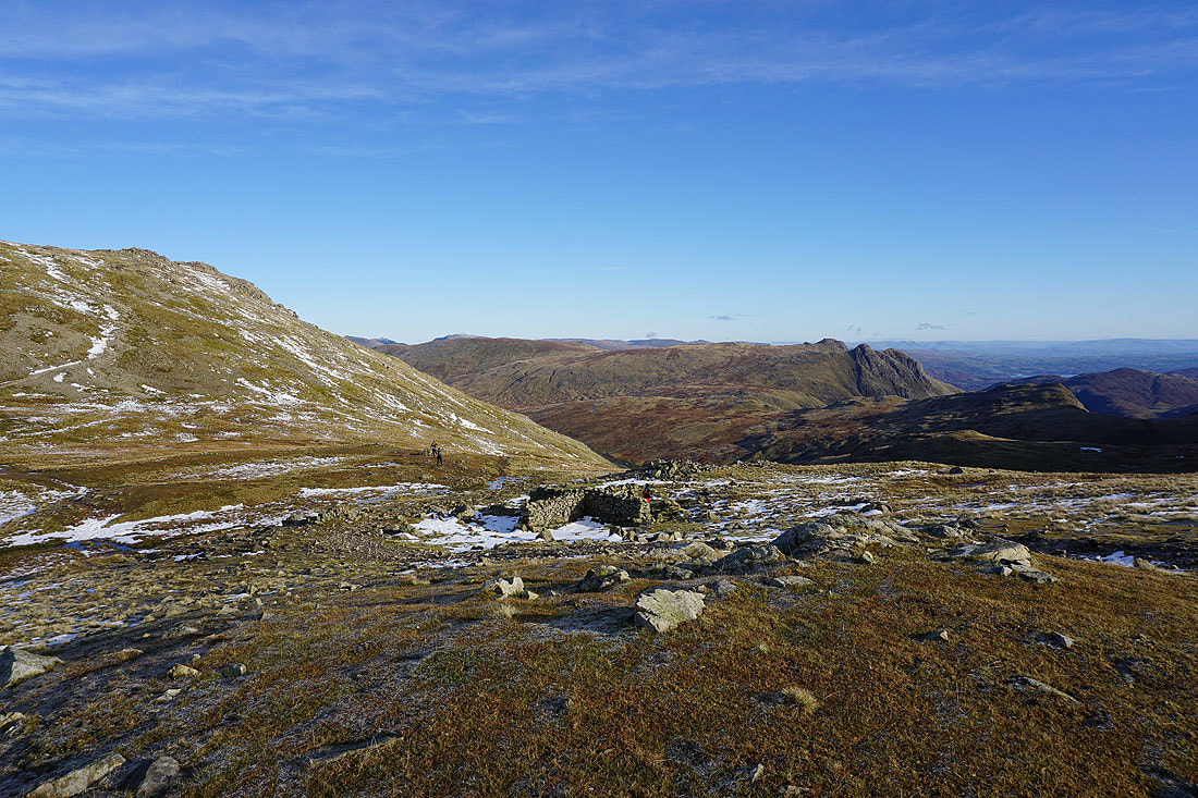
The cross shelter at the lower Esk Hause
Up at the true Esk Hause and I can see Harter Fell and Eskdale to the south
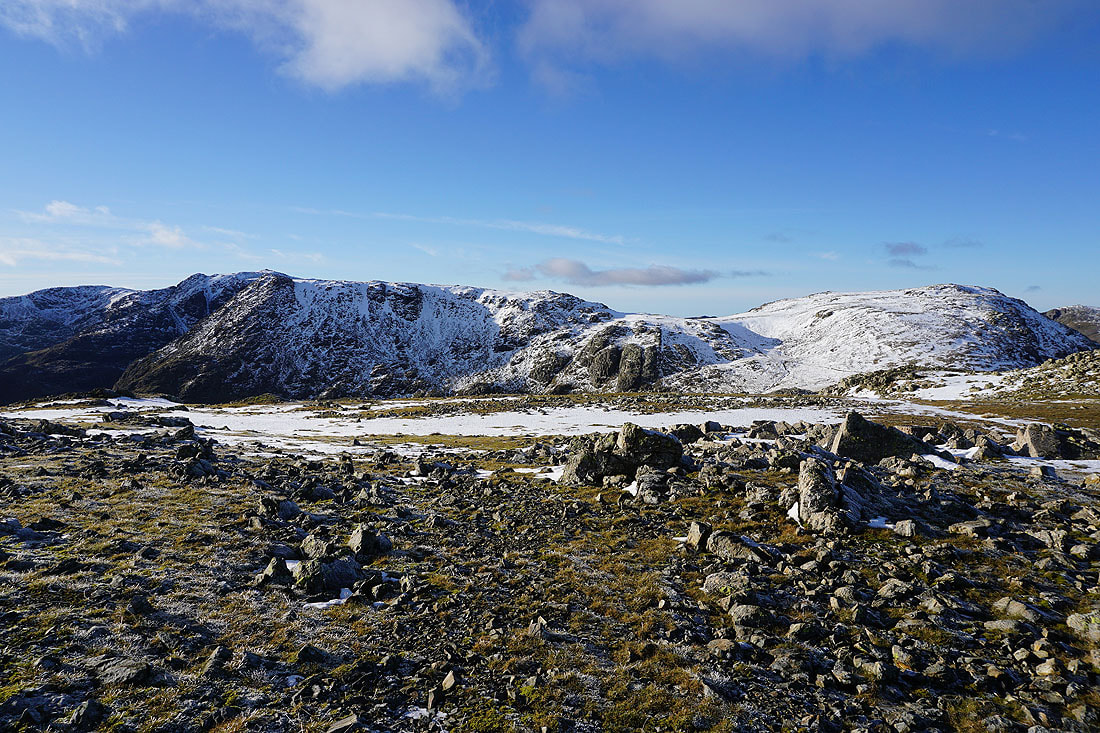
Ill Crag, Calf Cove and Great End
Great End, Esk Hause, Great Gable, Green Gable and the northwestern fells as I head up onto Esk Pike
Looking across the head of Eskdale to Ill Crag. I can see the top of Scafell Pike above its summit.
Scafell Pike, Ill Crag and Great End
On the summit of Esk Pike. Time for a break, though not for too long, with the days as short as they are now and Bowfell still to come.
Great End, Great Gable, Green Gable, Grasmoor, Grisedale Pike, Dale Head, High Spy and Skiddaw, to name but a few
Fairfield, High Street and the Langdale Pikes, a bit of Windermere, and I can easily make out the Howgills and Ingleborough in the distance
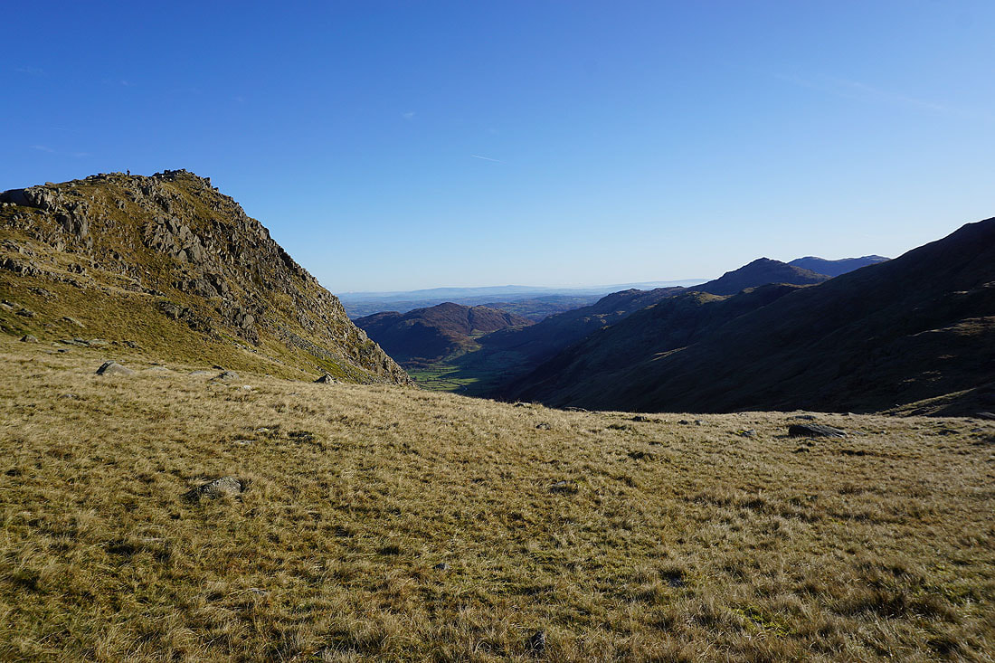
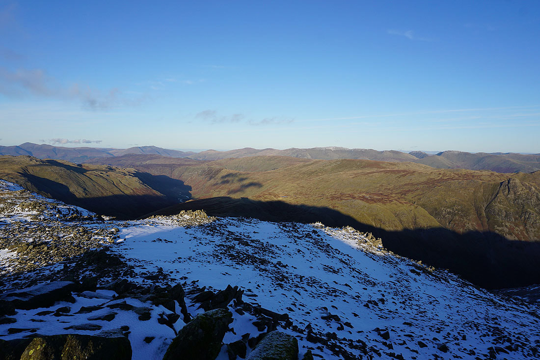
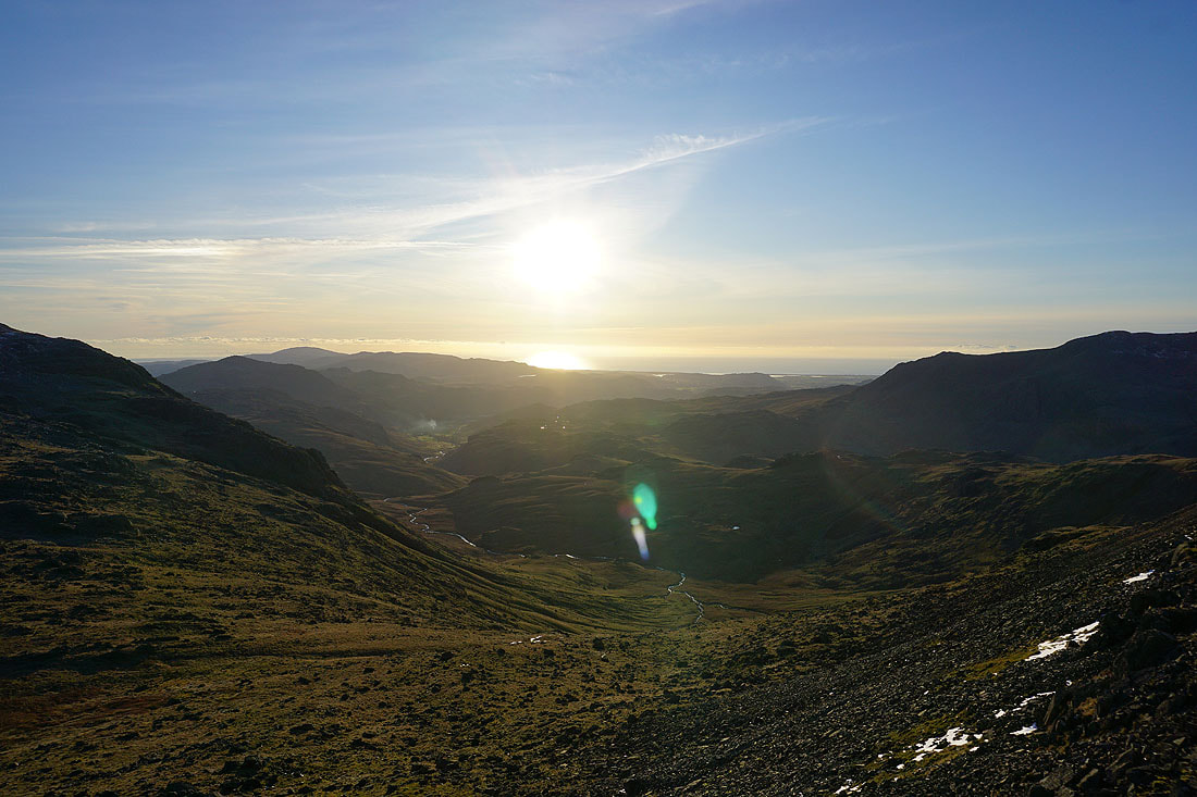
Looking down Eskdale to Harter Fell with Black Combe and the Irish Sea in the distance
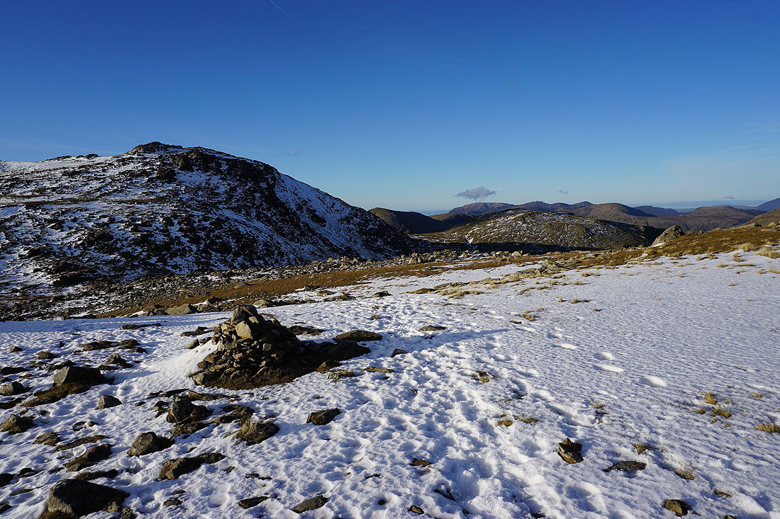
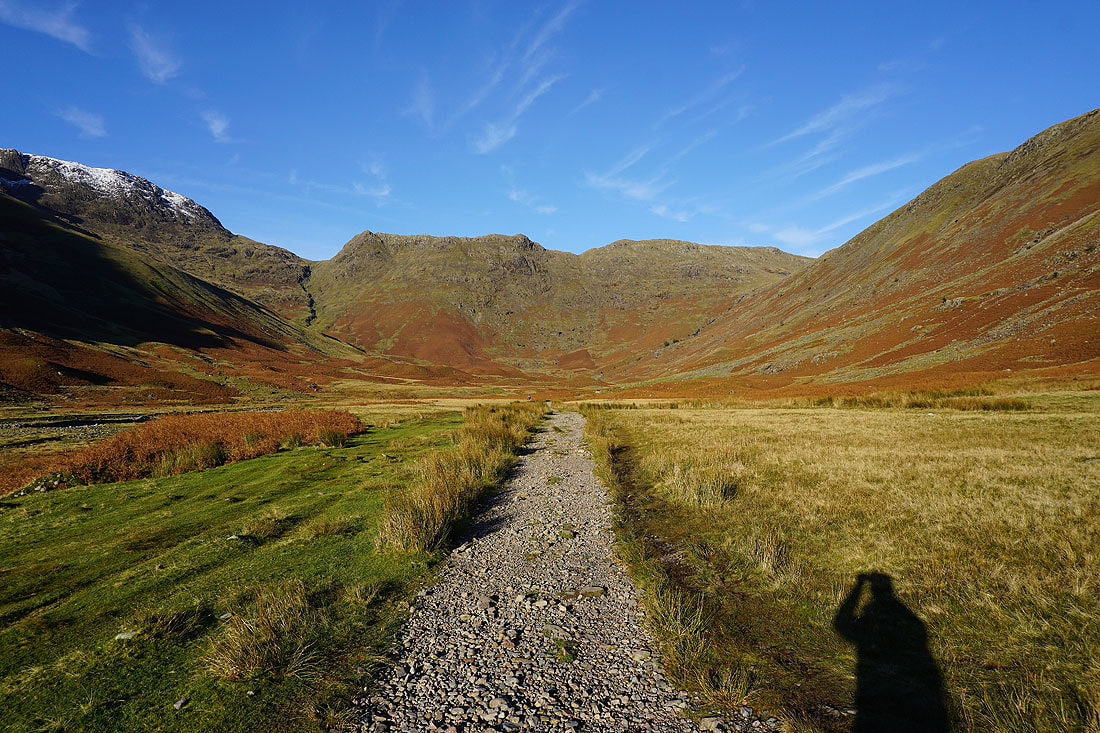
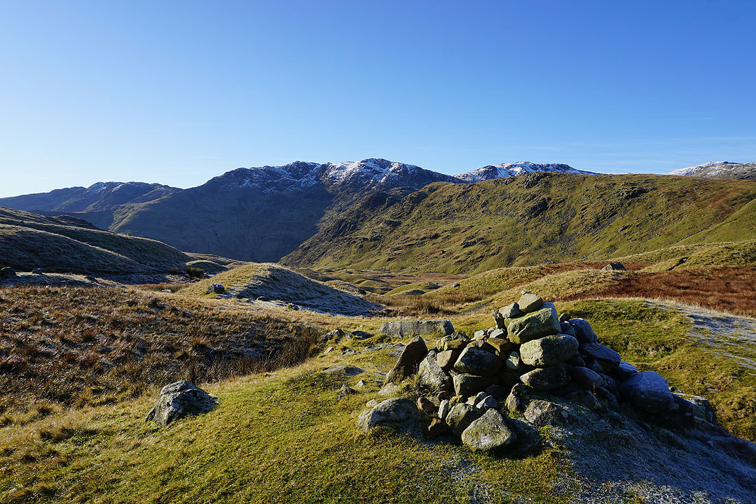
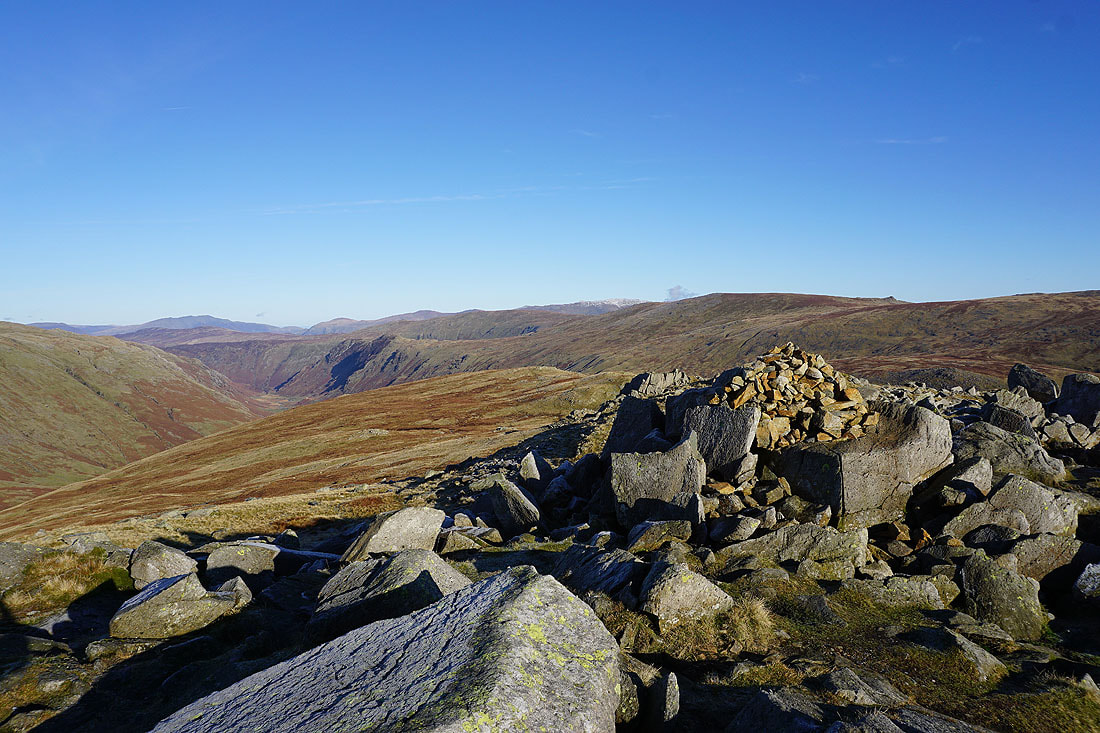
At Ore Gap between Esk Pike and Bowfell
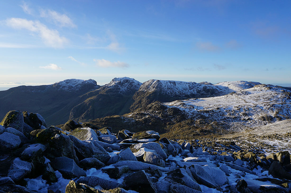
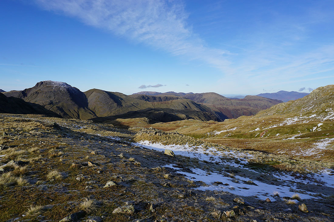
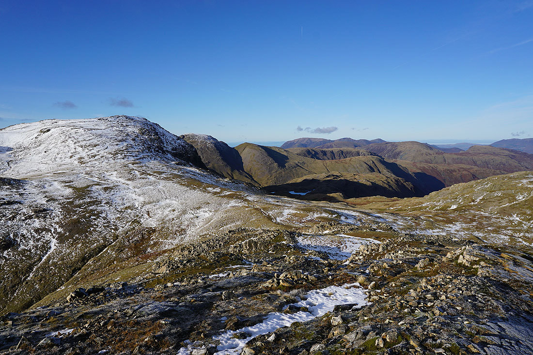
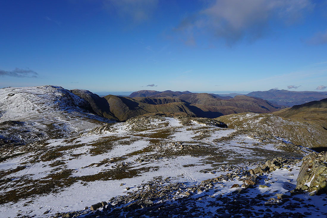
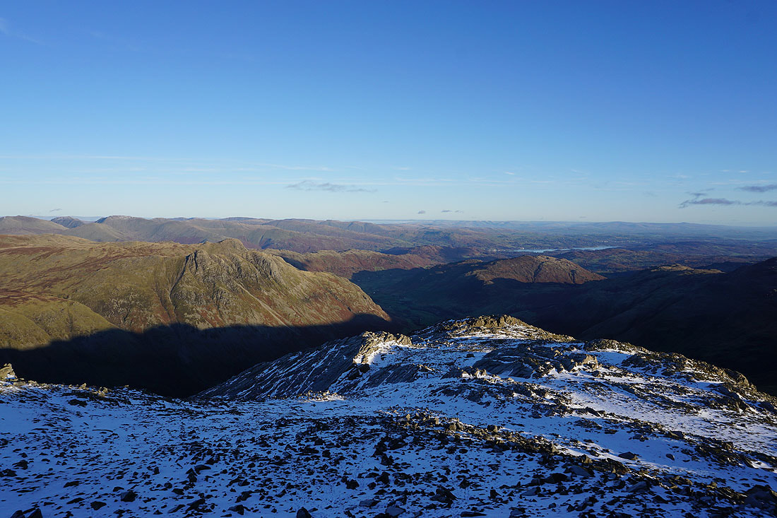
On the summit of Bowfell and there's a fantastic all-round view to take in today with the clear air and excellent visibility. To the west are Scafell, Scafell Pike, Ill Crag and Great End.
Great End, Esk Pike, Grasmoor, Grisedale Pike, Dale Head, High Spy, Glaramara and Skiddaw to the northwest
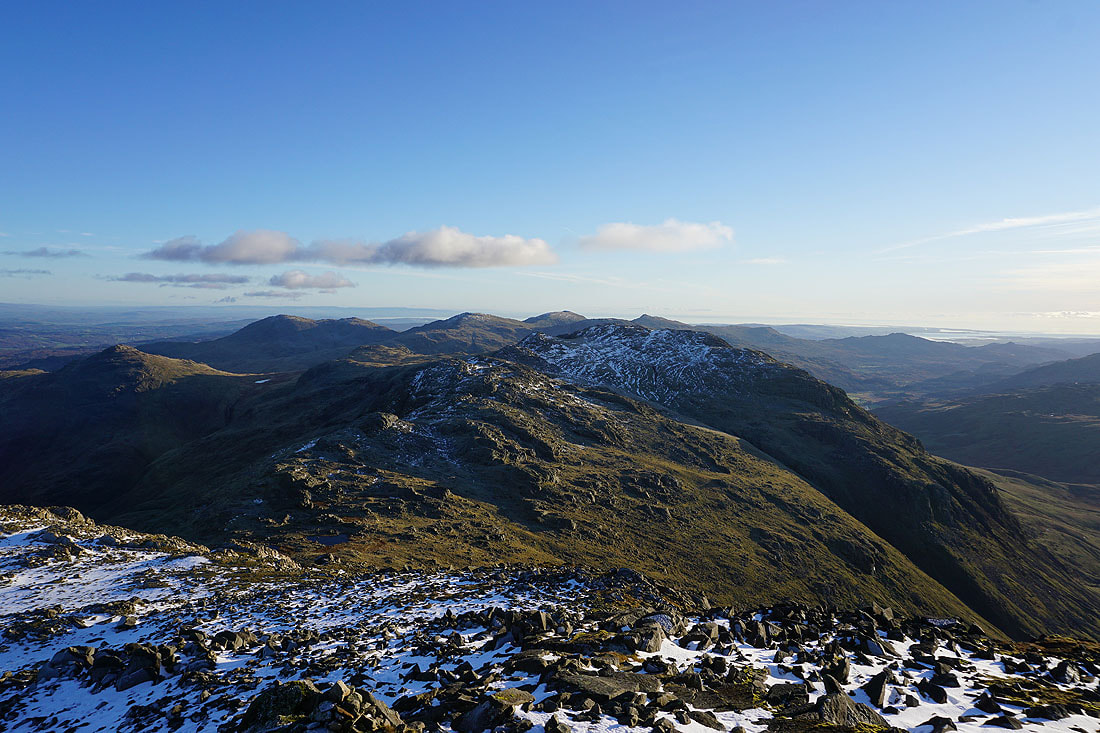
Looking northeast to High Seat, Langstrath, Ullscarf and High Raise, with Skiddaw, Blencathra, the Helvellyn range and Fairfield in the distance
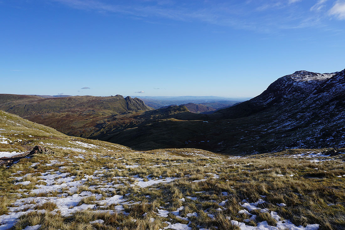
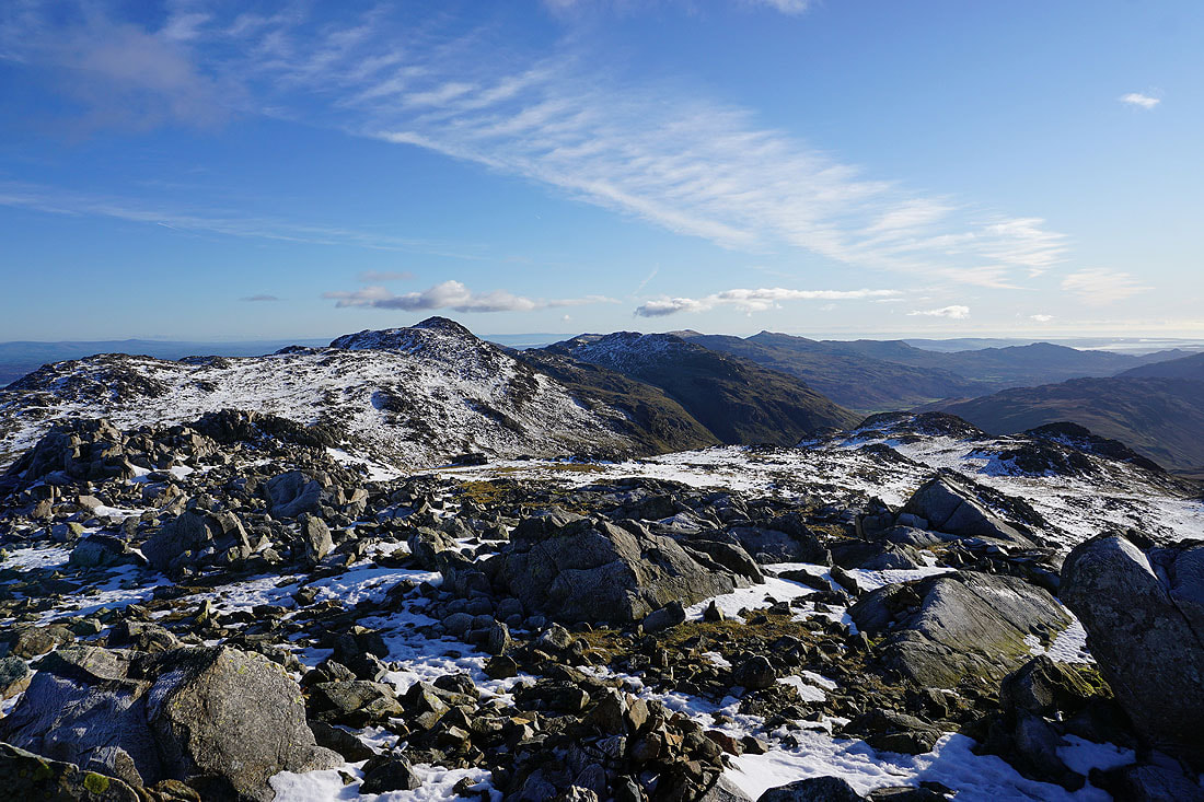
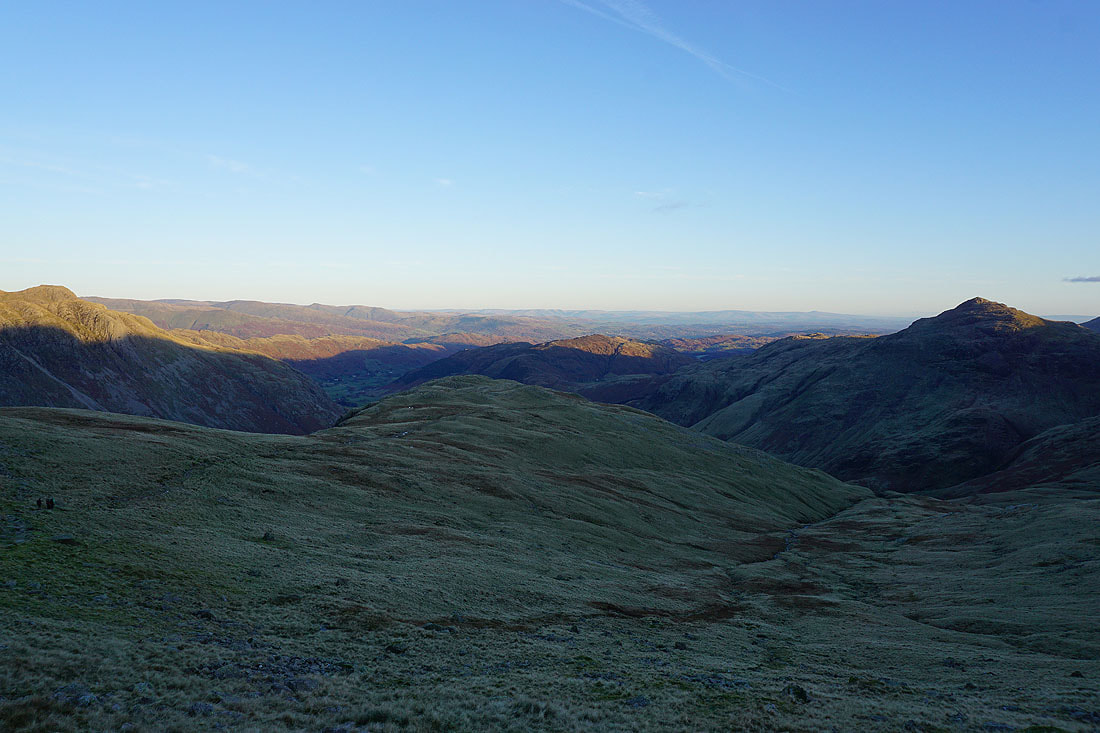
Fairfield, High Street, the Langdale Pikes, Langdale, Lingmoor Fell and Windermere to the east
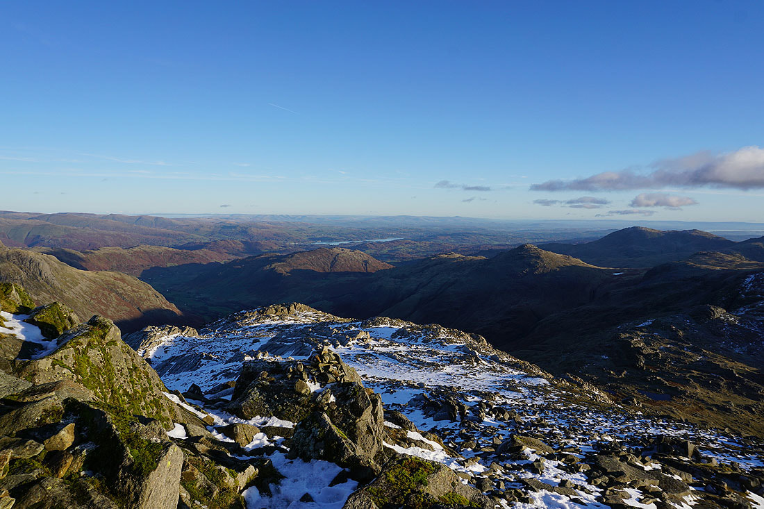
Way in the distance beyond Windermere are the fells of the Yorkshire Dales, with the Howgills and Ingleborough standing out
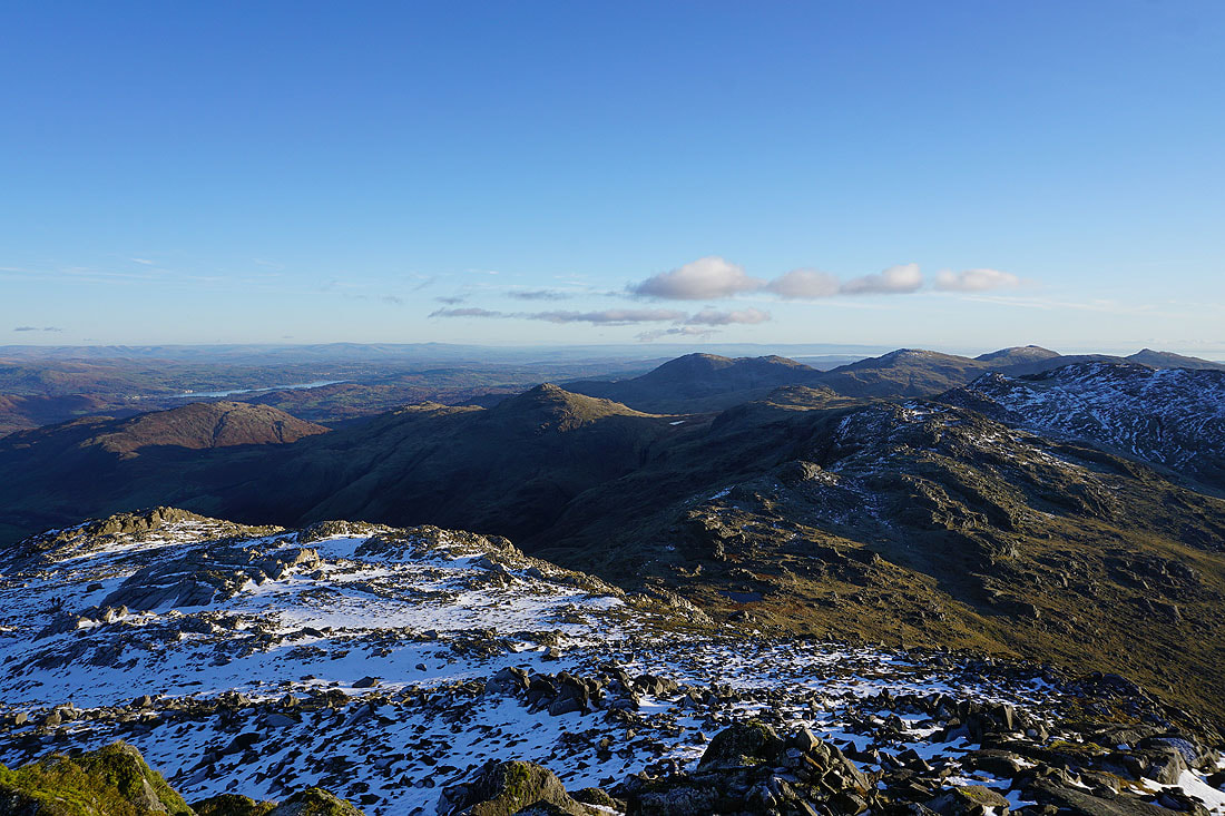
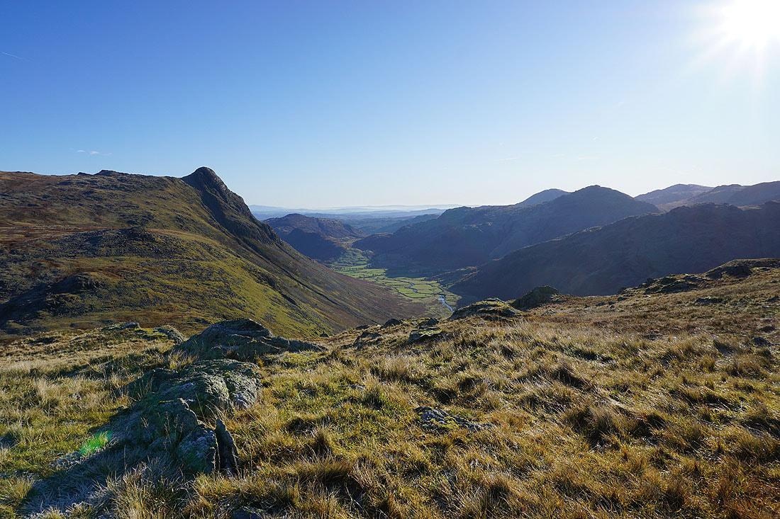
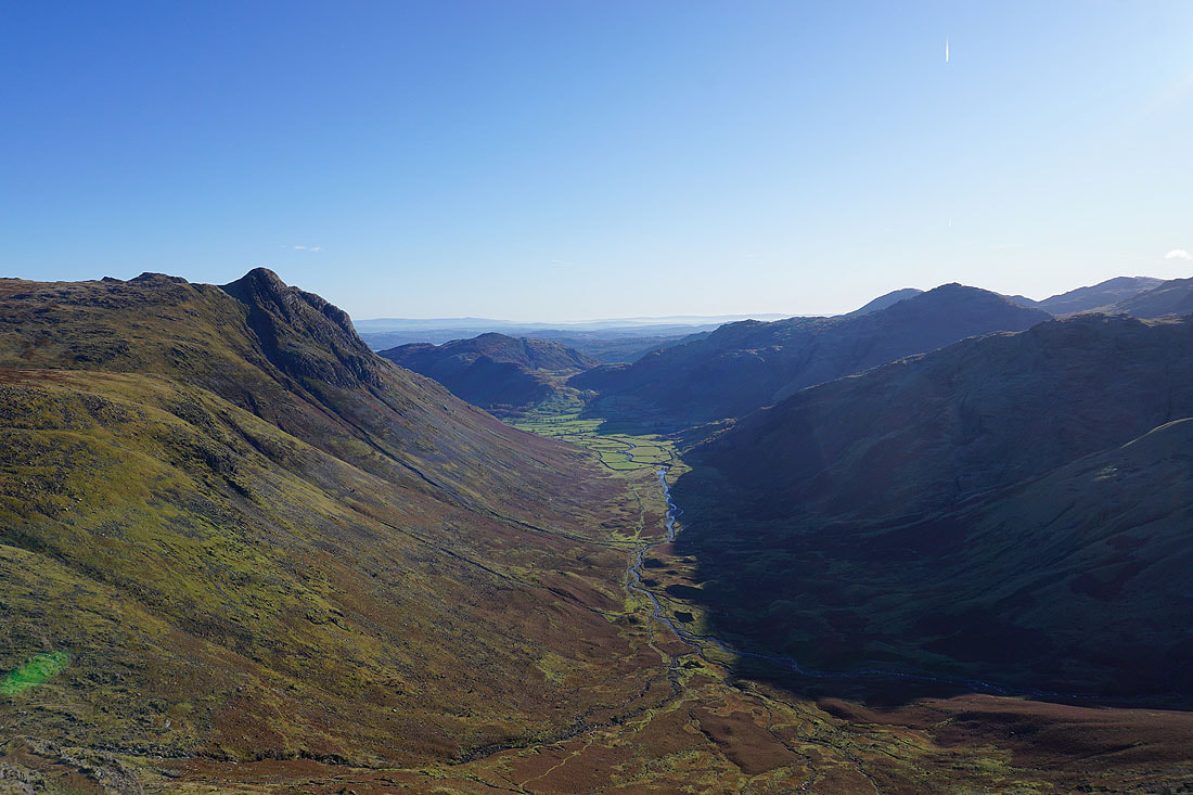
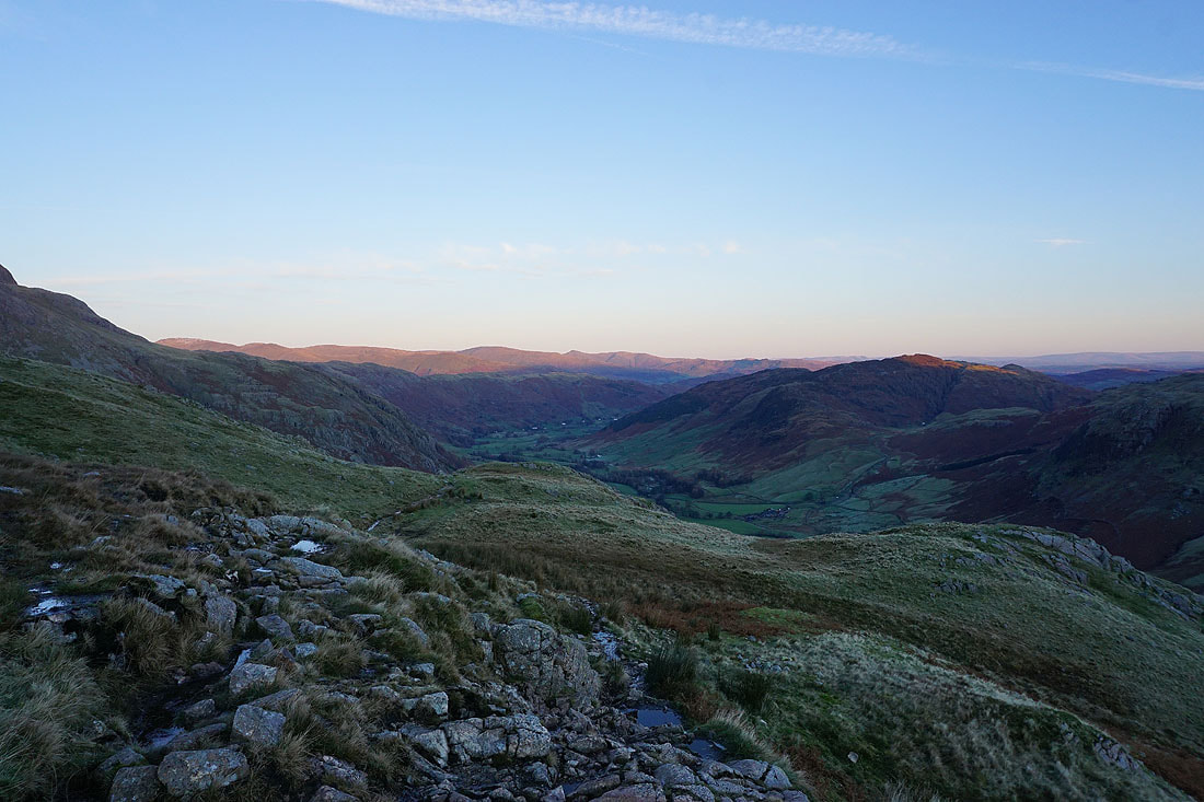
Lingmoor Fell and Windermere, Pike of Blisco, the Crinkle Crags and the Coniston fells to the southeast..
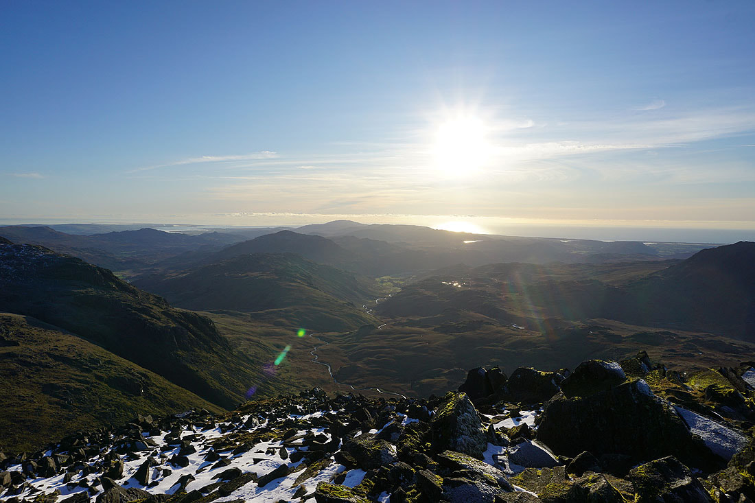
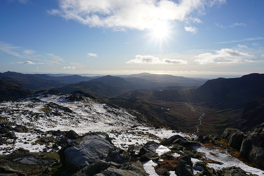
Finally, looking south to the Duddon Valley, Eskdale, Harter Fell, Black Combe and the Irish Sea
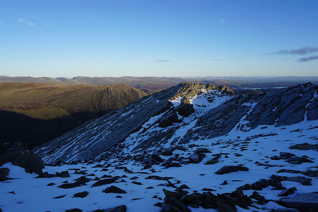
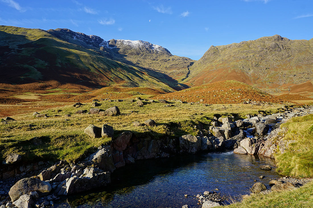
On my way down from Bowfell and I pass the Great Slab
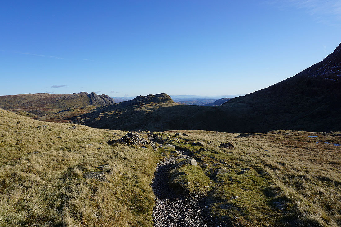
The descent to Three Tarns
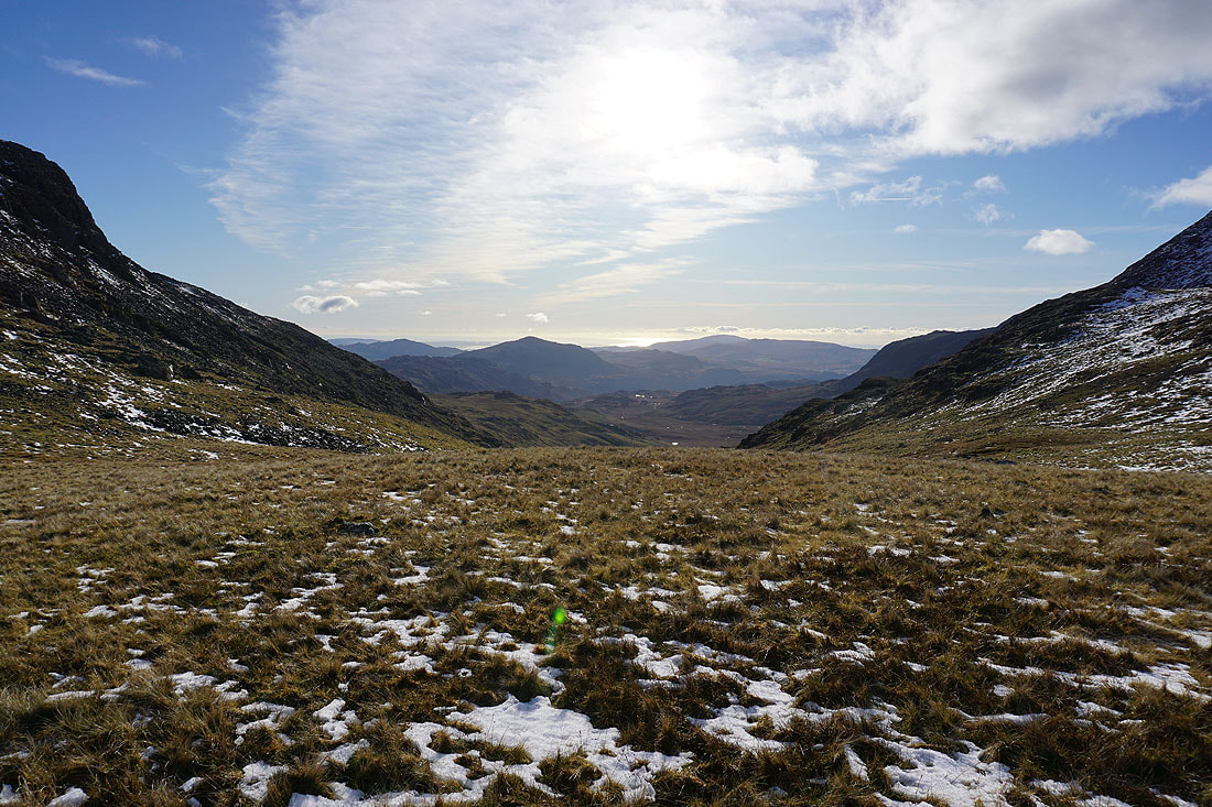
Looking down the valley of Lingcove Beck and into Eskdale
Scafell, Scafell Pike and the gullies of Bowfell Links from one of the Three Tarns
Lengthening shadows as I make my way down The Band..
Looking back to Bowfell
Down The Band to Stool End Farm and Langdale..