20th January 2023 - A Fairfield Horseshoe
Walk Details
Distance walked: 10.4 miles
Total ascent: 3493 ft
OS map used: OL5 - The English Lakes, Northeastern area & OL7 - The English Lakes, Southeastern area
Time taken: 7 hrs
Route description: Ambleside-Rydal Park-Rydal-Nab Scar-Heron Pike-Erne Crag-Great Rigg-Fairfield-Hart Crag-Dove Crag-High Pike-Low Pike-Low Sweden Bridge-Nook Lane-Ambleside
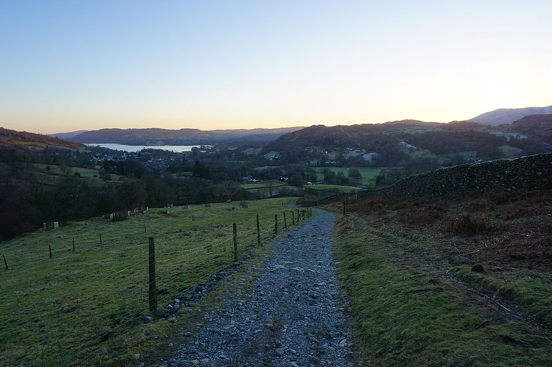
It isn't often that I have a day trip up to the Lake District, but since this is my Friday off work and there's a day of fantastic winter weather forecast I thought, why not? It being a weekday it should be much quieter than at the weekend, not just on the fells but on the road through Ambleside and Windermere. A bit of snow had fallen at home during the past couple of days, which I plan on having a walk in tomorrow, fingers crossed, but the Lake District missed out on it. There was some snow on the high fells from previous falls though, so I decided to do the Fairfield Horseshoe from Ambleside. It's a route that I've done many times and in conditions very similar to those that I experienced today, so I knew what I was letting myself in for. I went round clockwise to get the steepest climb up Nab Scar out of the way at the beginning and to leave myself with a gentle descent from Dove Crag. I brought my spikes with me but in the end I hardly wore them, the snow cover just wasn't deep enough. The forecast proved to be accurate, and I enjoyed a great day on the fells with more or less wall-to-wall blue skies and sunshine, excellent visibility, and a gentle northerly breeze, so it didn't feel that cold.
Starting from the main car park in Ambleside I walked west by the main road to Grasmere until I reached the footpath through Rydal Park to Rydal Hall. Once through the grounds of Rydal Hall I walked to the top of the lane and up the footpath to the top of Nab Scar. I then made my way up the western arm of the horseshoe, taking in Heron Pike, Erne Crag and Great Rigg to reach the summit of Fairfield. After taking a break for lunch here it was time to head down the eastern arm of the horseshoe, via Hart Crag, Dove Crag, High Pike and Low Pike to Low Sweden Bridge. I then walked down Nook Lane and back into Ambleside.
Total ascent: 3493 ft
OS map used: OL5 - The English Lakes, Northeastern area & OL7 - The English Lakes, Southeastern area
Time taken: 7 hrs
Route description: Ambleside-Rydal Park-Rydal-Nab Scar-Heron Pike-Erne Crag-Great Rigg-Fairfield-Hart Crag-Dove Crag-High Pike-Low Pike-Low Sweden Bridge-Nook Lane-Ambleside
It isn't often that I have a day trip up to the Lake District, but since this is my Friday off work and there's a day of fantastic winter weather forecast I thought, why not? It being a weekday it should be much quieter than at the weekend, not just on the fells but on the road through Ambleside and Windermere. A bit of snow had fallen at home during the past couple of days, which I plan on having a walk in tomorrow, fingers crossed, but the Lake District missed out on it. There was some snow on the high fells from previous falls though, so I decided to do the Fairfield Horseshoe from Ambleside. It's a route that I've done many times and in conditions very similar to those that I experienced today, so I knew what I was letting myself in for. I went round clockwise to get the steepest climb up Nab Scar out of the way at the beginning and to leave myself with a gentle descent from Dove Crag. I brought my spikes with me but in the end I hardly wore them, the snow cover just wasn't deep enough. The forecast proved to be accurate, and I enjoyed a great day on the fells with more or less wall-to-wall blue skies and sunshine, excellent visibility, and a gentle northerly breeze, so it didn't feel that cold.
Starting from the main car park in Ambleside I walked west by the main road to Grasmere until I reached the footpath through Rydal Park to Rydal Hall. Once through the grounds of Rydal Hall I walked to the top of the lane and up the footpath to the top of Nab Scar. I then made my way up the western arm of the horseshoe, taking in Heron Pike, Erne Crag and Great Rigg to reach the summit of Fairfield. After taking a break for lunch here it was time to head down the eastern arm of the horseshoe, via Hart Crag, Dove Crag, High Pike and Low Pike to Low Sweden Bridge. I then walked down Nook Lane and back into Ambleside.
Route map
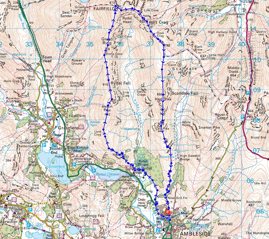
© Crown copyright. All rights reserved. License number PU 100034184.
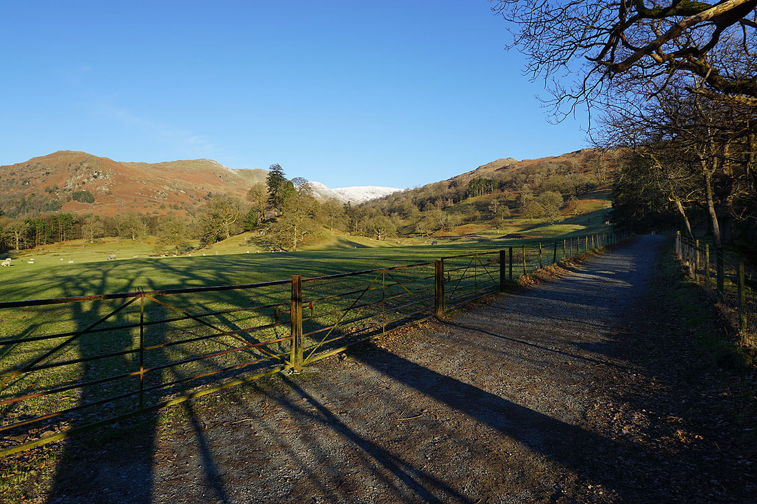
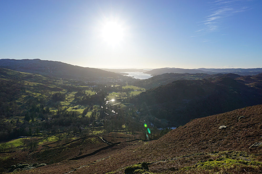
On my way through Rydal Park. The first half of my walk is in front of me. Nab Scar, Heron Pike, Erne Crag, Great Rigg and Fairfield.
Bright blue skies and sunshine as I head for Nab Scar
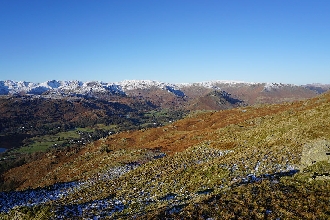
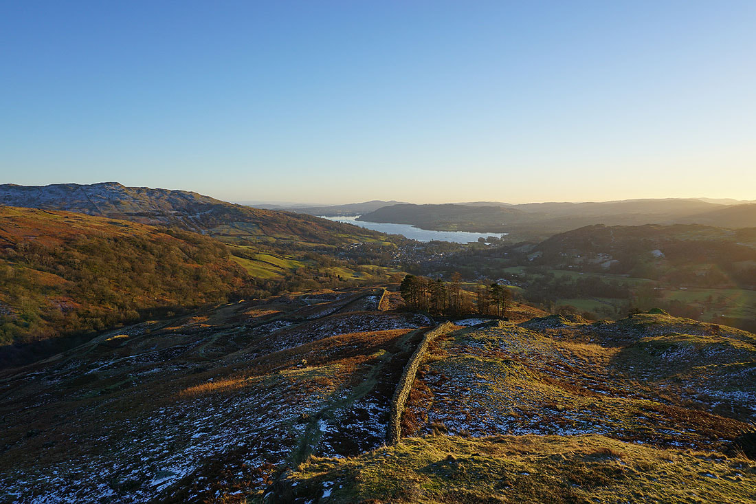
Looking back down to Ambleside and Windermere
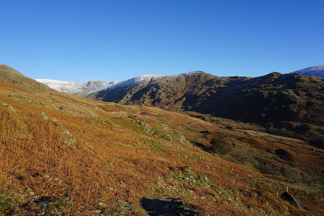
and across Rydal to Hart Crag, High Pike, and Low Pike
My arrival on the top of Nab Scar is greeted by a great view of the Coniston fells, Crinkle Crags and Bowfell, with Grasmere below
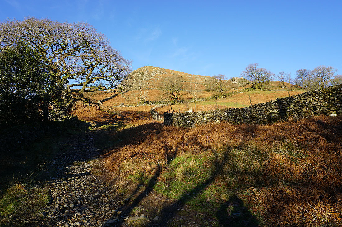
The hillside ahead rises towards Heron Pike
Bowfell, High Raise, the Vale of Grasmere, Helm Crag, Ullscarf, and Steel Fell
The Coniston fells from the large cairn on Nab Scar
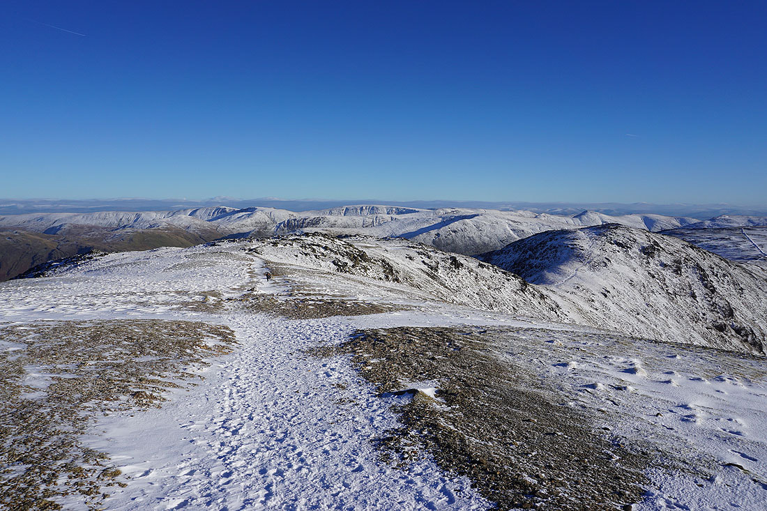
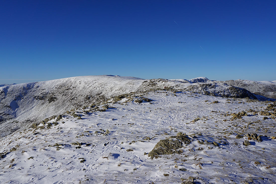
From Nab Scar I've made my way north to Heron Pike. Great Rigg, Fairfield, Hart Crag, and Dove Crag at the head of the horseshoe are now in sight..
Looking across Rydal to Dove Crag and High Pike, with Red Screes in the background on the right
and south to Ambleside and Windermere
On the next top of Erne Crag, with Great Rigg, Fairfield and Hart Crag at the head of Rydal
The Coniston fells, Crinkle Crags, Bowfell, Scafell Pike, Great End, and High Raise to the west
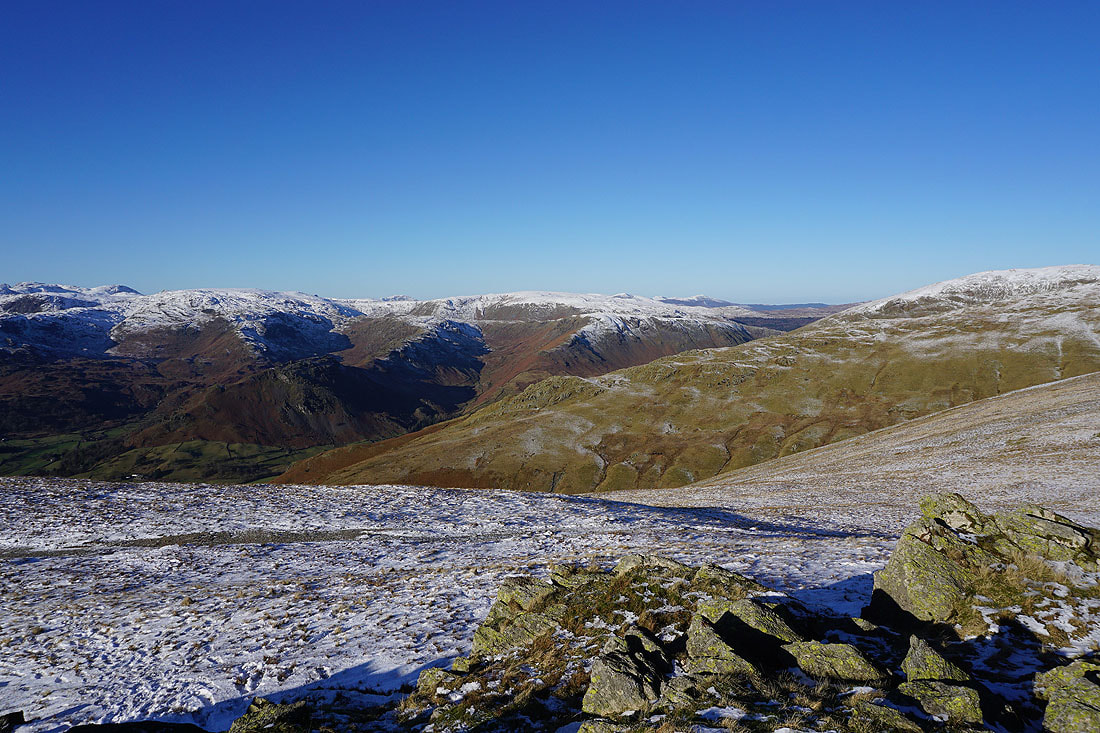
and High Raise, Ullscarf, and Steel Fell to the northwest beyond Stone Arthur on the ridge up to Great Rigg
Looking back to Ambleside, Windermere, and Heron Pike

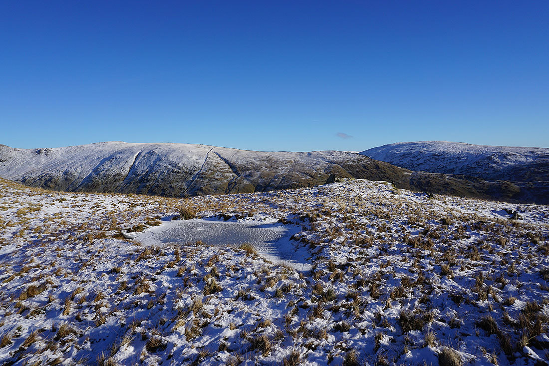
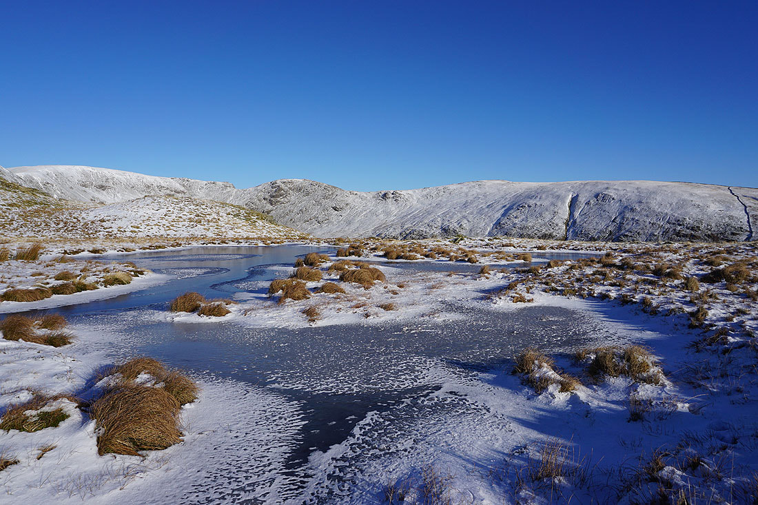
On my way to Great Rigg, and the surrounding snow covered grass and ice covered pools provides a foreground for the neighbouring fells..
Heading for Great Rigg
Looking back along the ridge to Erne Crag and Heron Pike as I reach the point where the path up from Stone Arthur meets mine
The Vale of Grasmere and Helm Crag below with the Coniston fells, Crinkle Crags, Bowfell and Scafell Pike in the distance
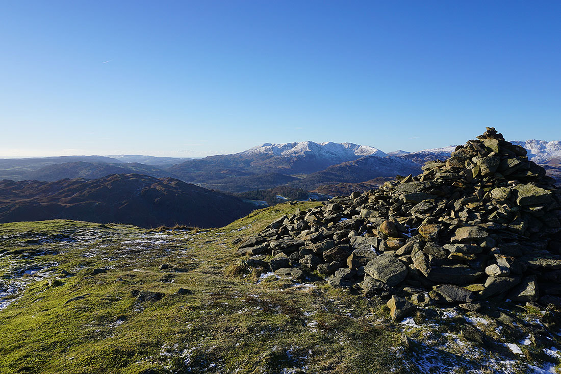
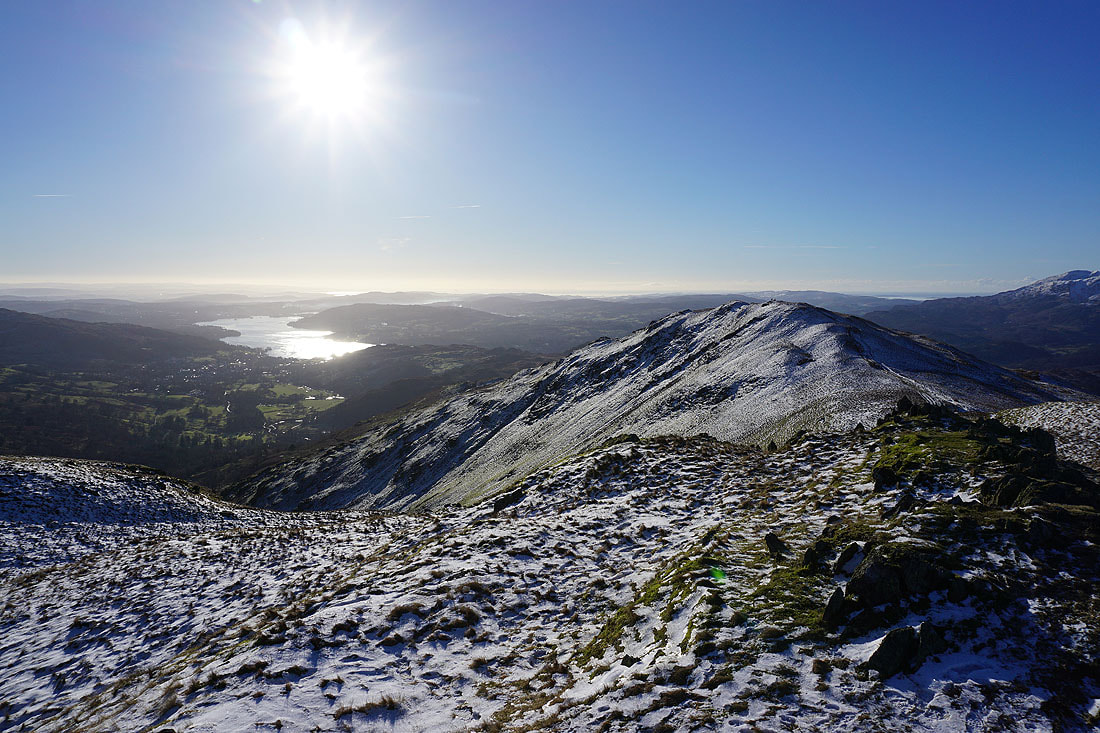
On Great Rigg. Looking south to Ambleside, Windermere and Coniston Water.
The Consiton fells, Crinkle Crags, Bowfell, Scafell Pike, Great End, High Raise, Great Gable and Pillar to the west
and Pillar, High Stile, Ullscarf, Crag Hill, Grisedale Pike, and Seat Sandal to the northwest
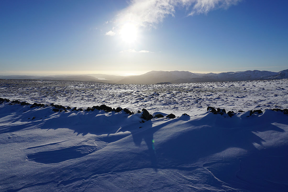
Wind scoured snow on Great Rigg
Heading for Fairfield
To my left, Seat Sandal and Grisedale Hause
Looking down Rydal to Windermere with Great Rigg on the right
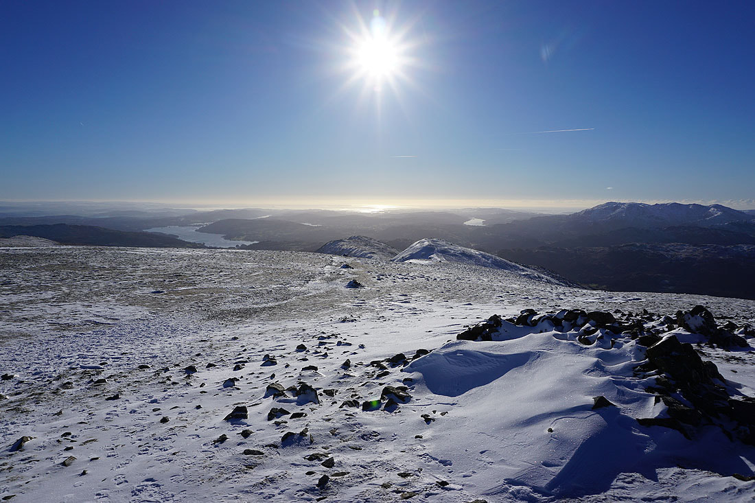
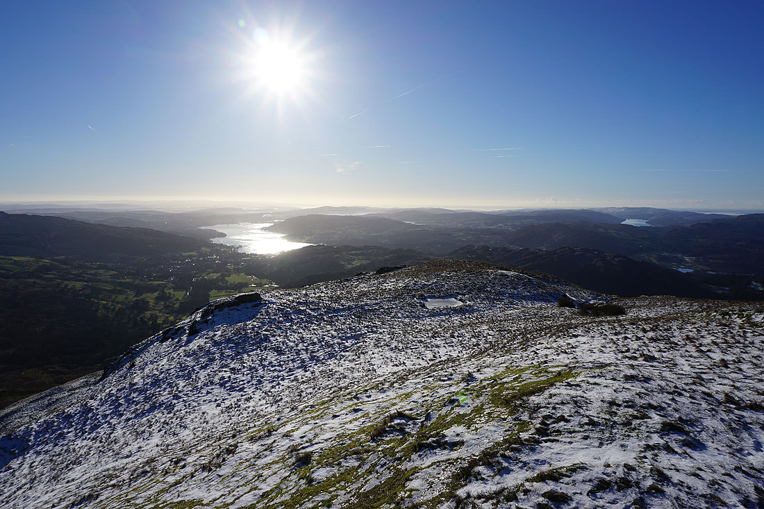
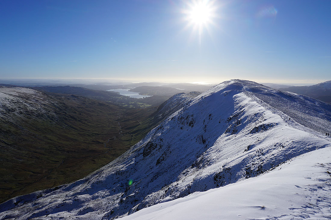
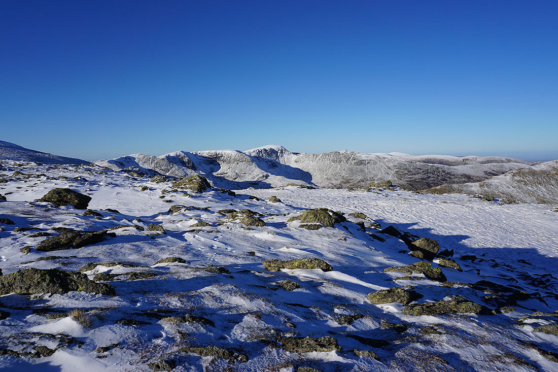
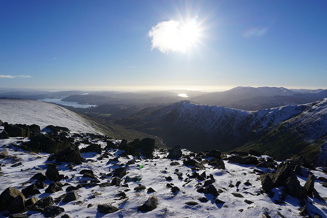
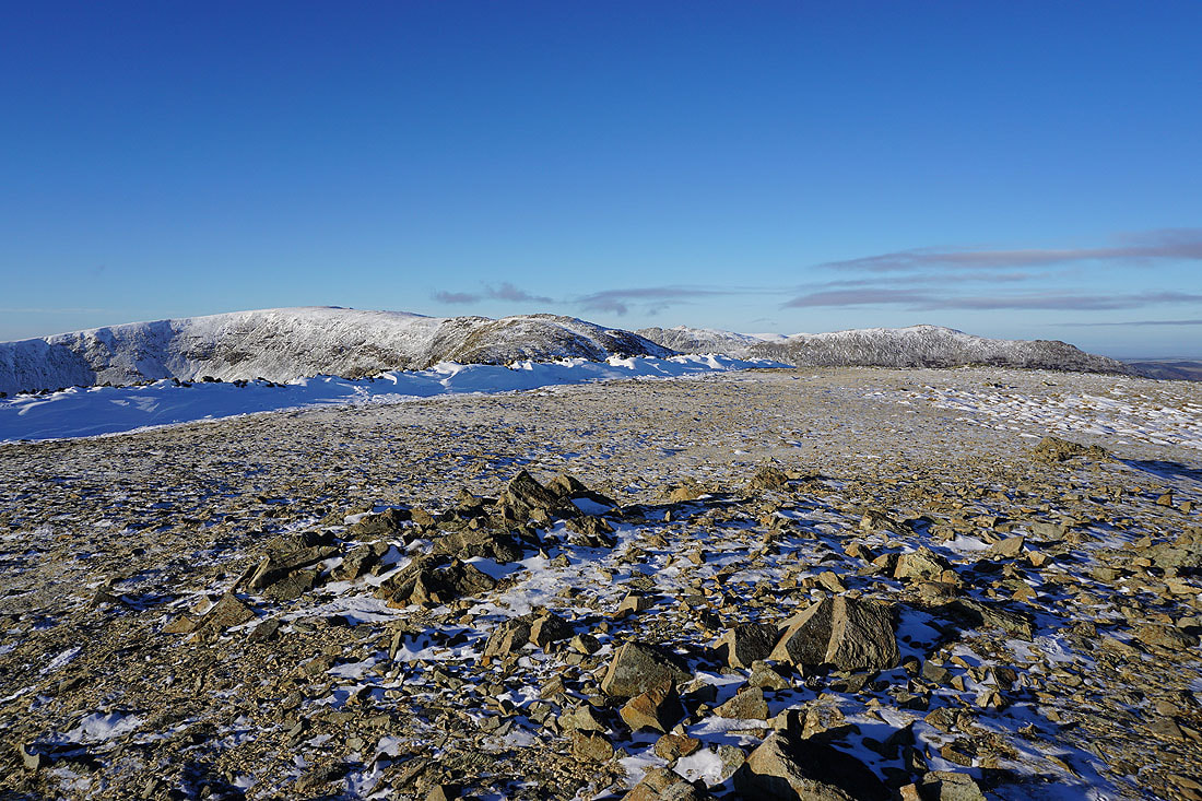
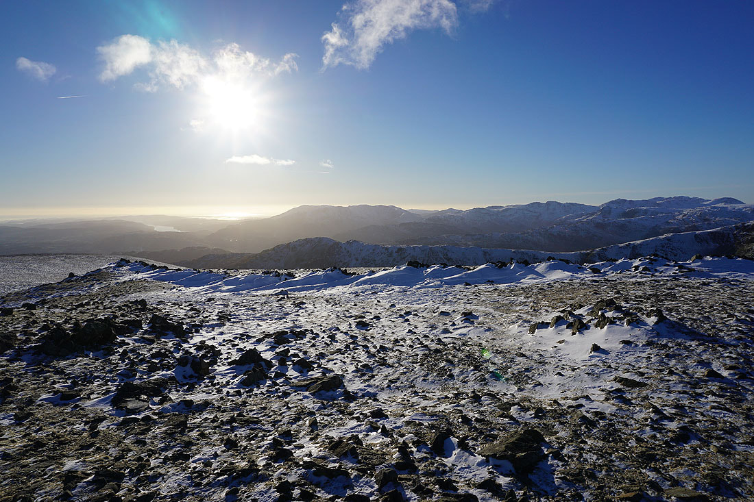
Excellent visibility means a fantastic long distance view south to Windermere, Coniston Water and the Irish Sea as I reach the summit plateau of Fairfield
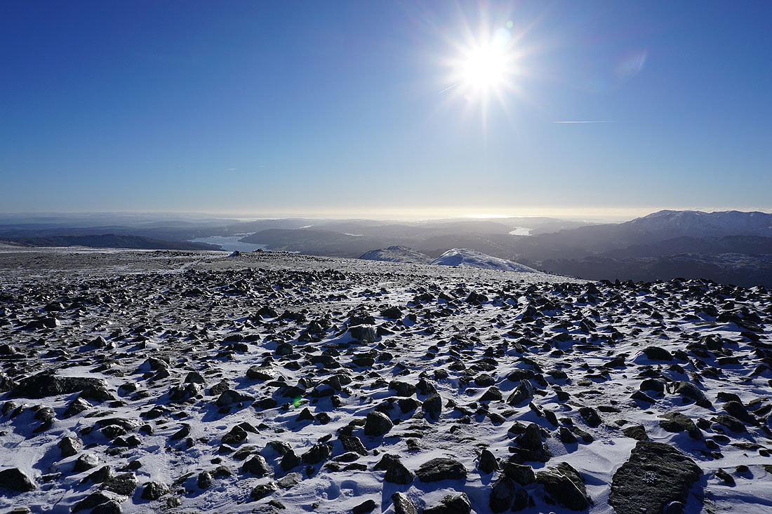
Lunch had in one of the summit shelters, it's time to walk round the plateau and take in the view. A stony foreground for looking south to Windermere and Coniston Water.
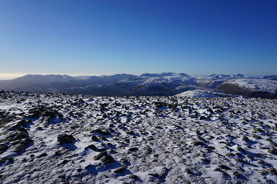
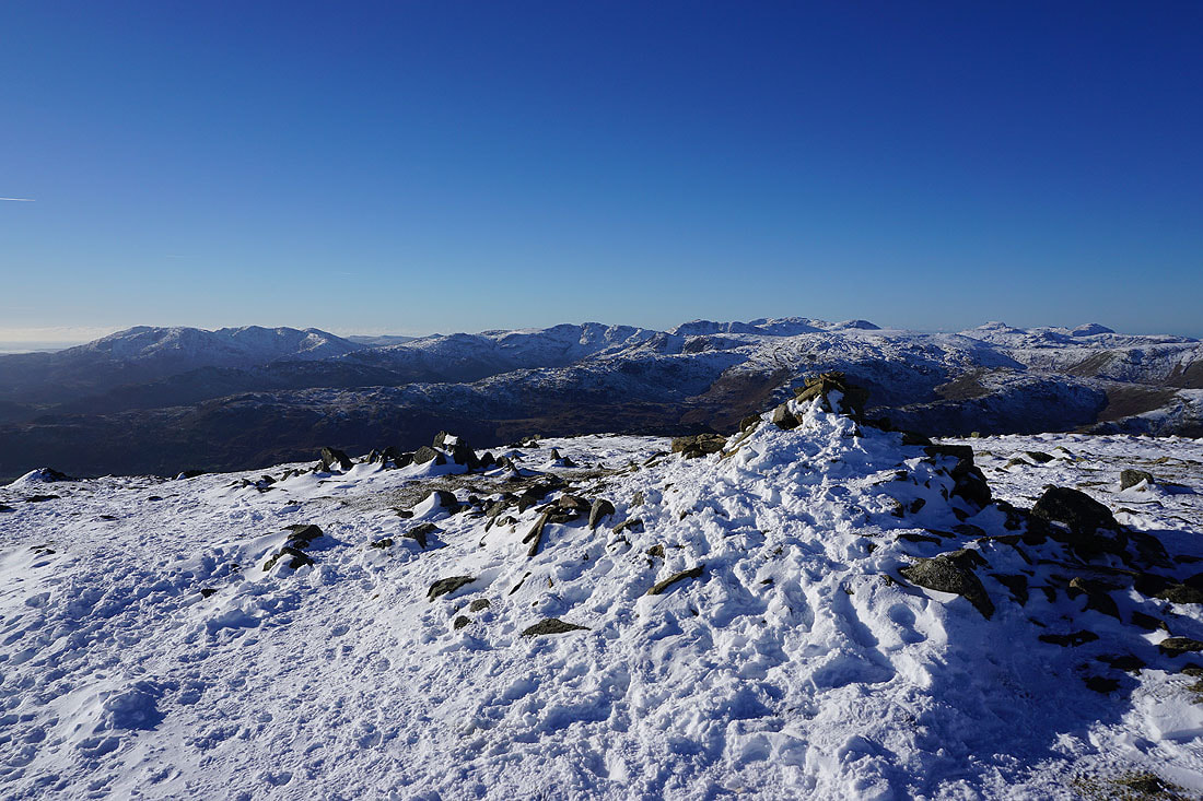
The Coniston fells, Crinkle Crags, Bowfell, Scafell Pike, Great End, and Great Gable to the southwest and west
and Scafell Pike, Great End, Great Gable, Pillar, Ullscarf, High Stile, Dale Head, Hindscarth, Crag Hill, and Grisedale Pike to the west and northwest
Dollywagon Pike, Nethermost Pike and Helvellyn on the other side of Grisedale
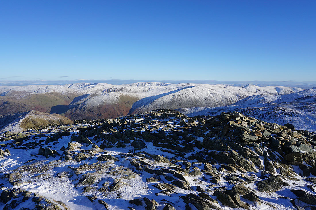
Cofa Pike and St. Sunday Crag
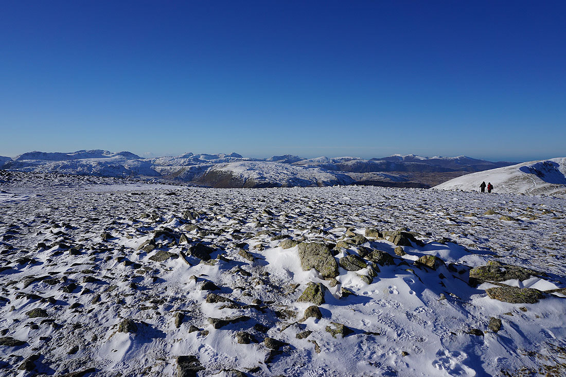
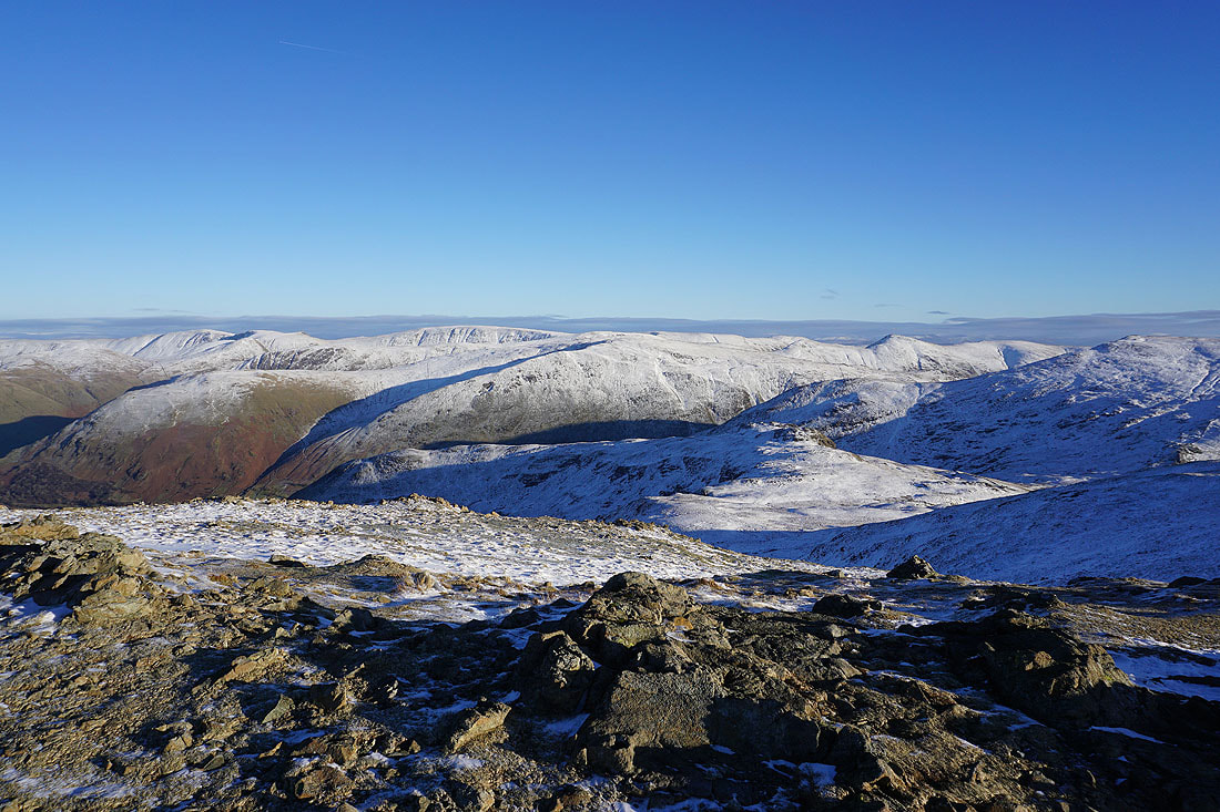
Looking across the icy crags of Greenhow End to High Street and the far eastern fells
It's time I was making tracks to the next summit of Hart Crag
On the way there and I thought this shot showing the coves of Nethermost Pike and Helvellyn was worth taking..
..as was this, looking down Rydal to Windermere, Coniston Water, and my route of ascent of Heron Pike to Great Rigg
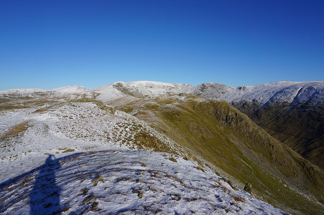
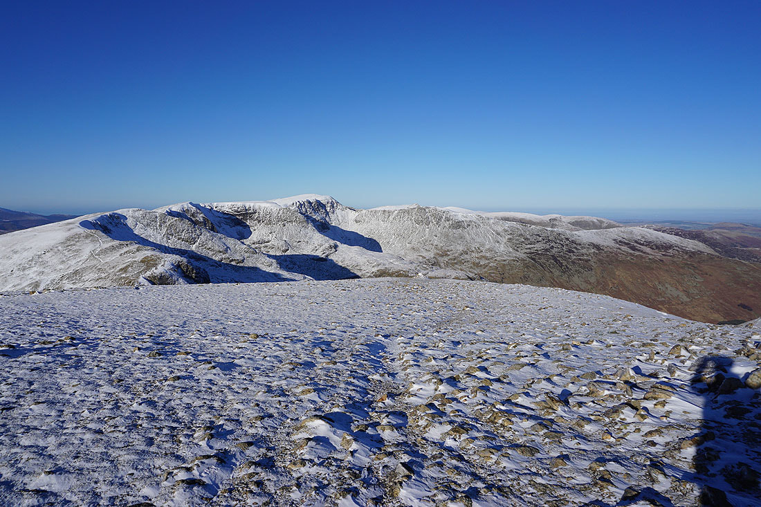
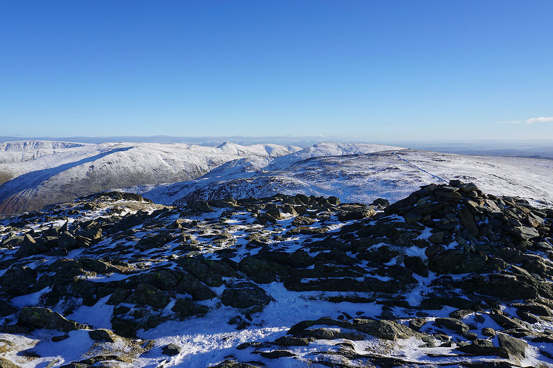
On the summit of Hart Crag. Helvellyn behind Scrubby Crag on the left, and St. Sunday Crag on the right.
Looking back to Fairfield
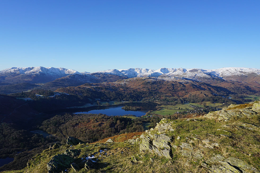
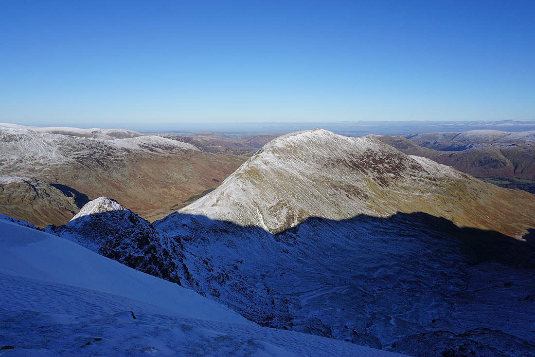
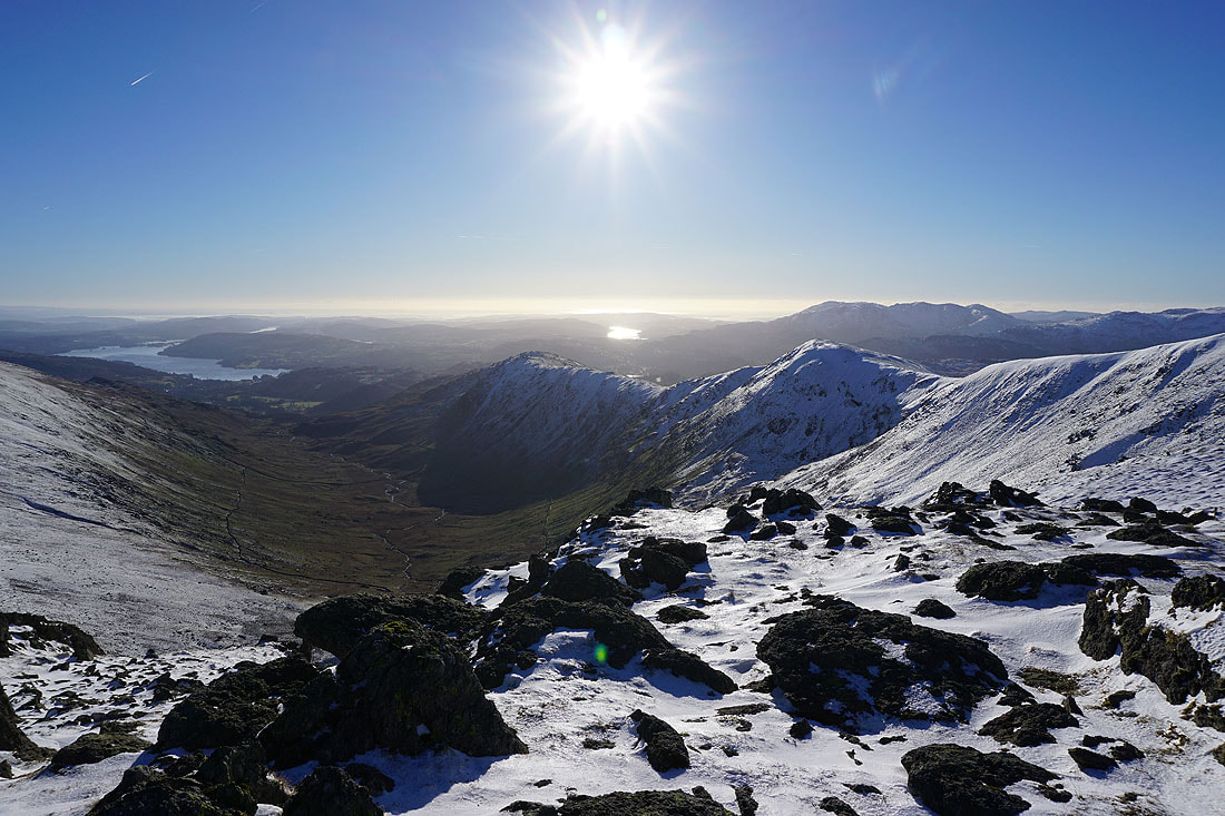
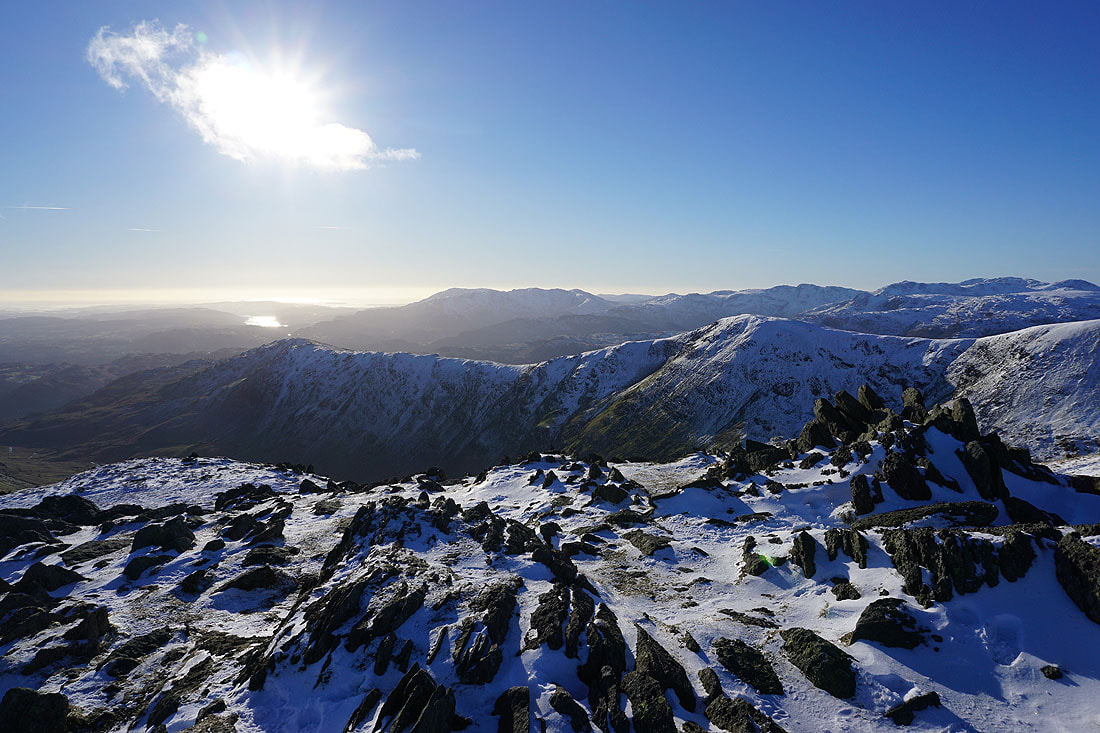
Maybe my favourite photos of the day. Looking down Rydal to Windermere, and across the western arm of the horseshoe to a multitude of fells..
The ridge of Hartsop above How heads down into Patterdale. Place Fell, Angletarn Pikes and Brock Crags with the Loadpot Hill to High Raise ridge in the distance.
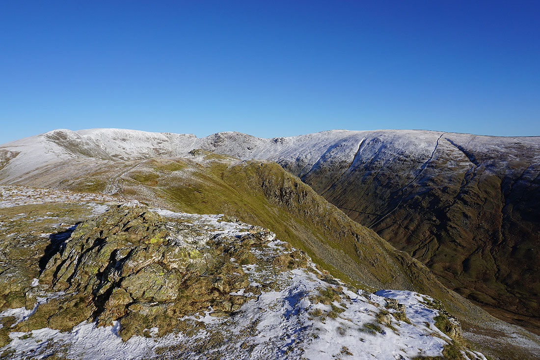
High Raise, Rampsgill Head, High Street, Thornthwaite Crag, Caudale Moor and Ill Bell
High Street, Thornthwaite Crag, Caudale Moor, Ill Bell, Red Screes, and Dove Crag
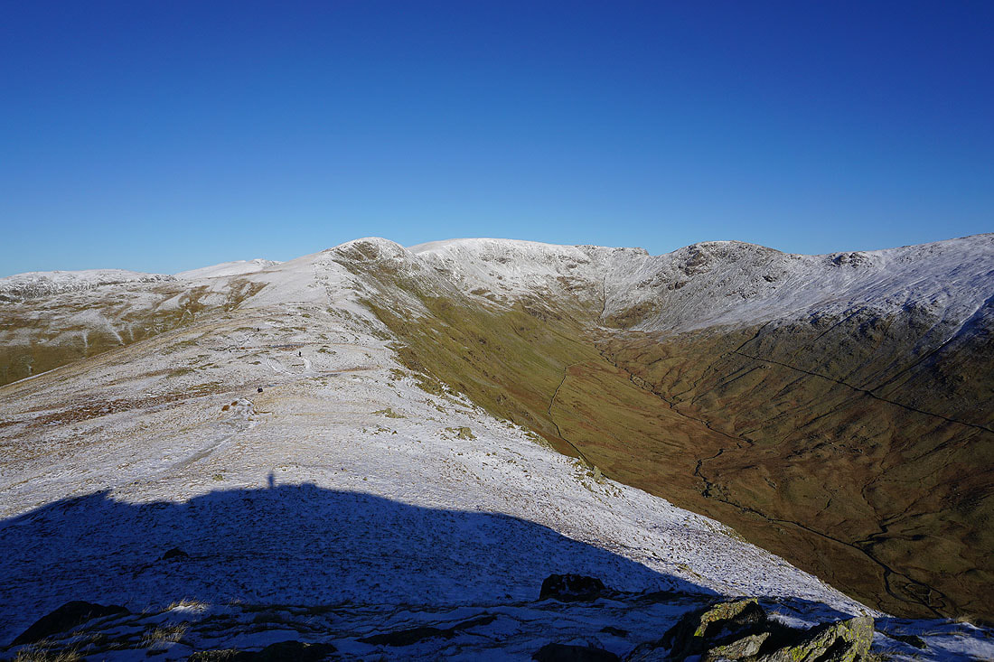
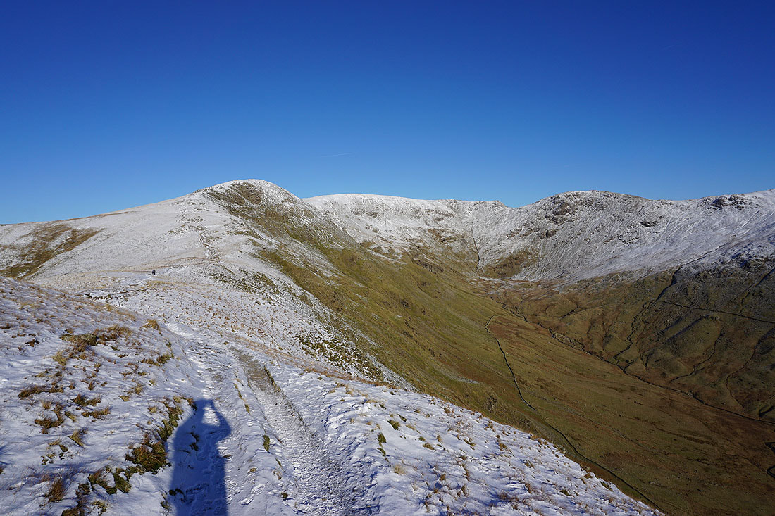
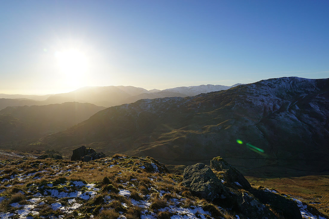
Heading for Dove Crag
Looking back to Fairfield and Hart Crag
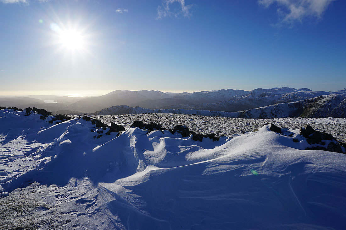
Deep snowdrifts against the wall that will accompany my route back to Ambleside
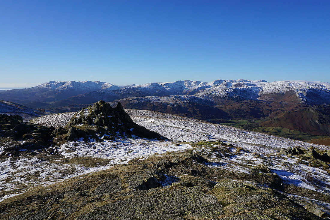
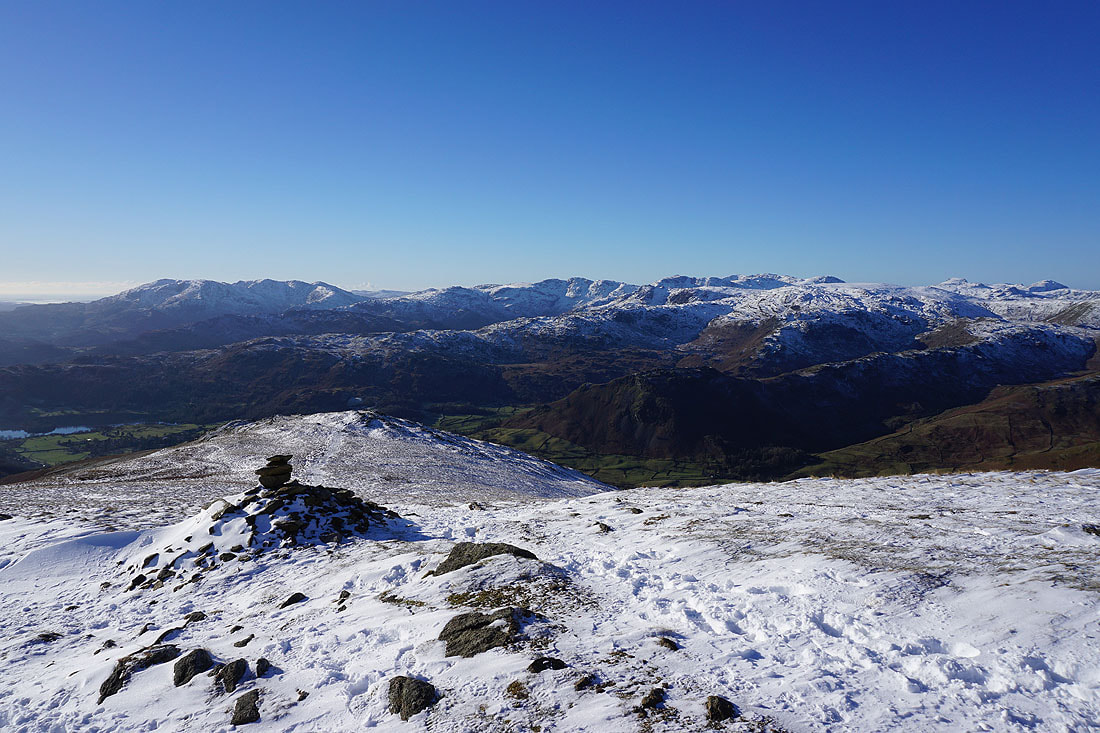
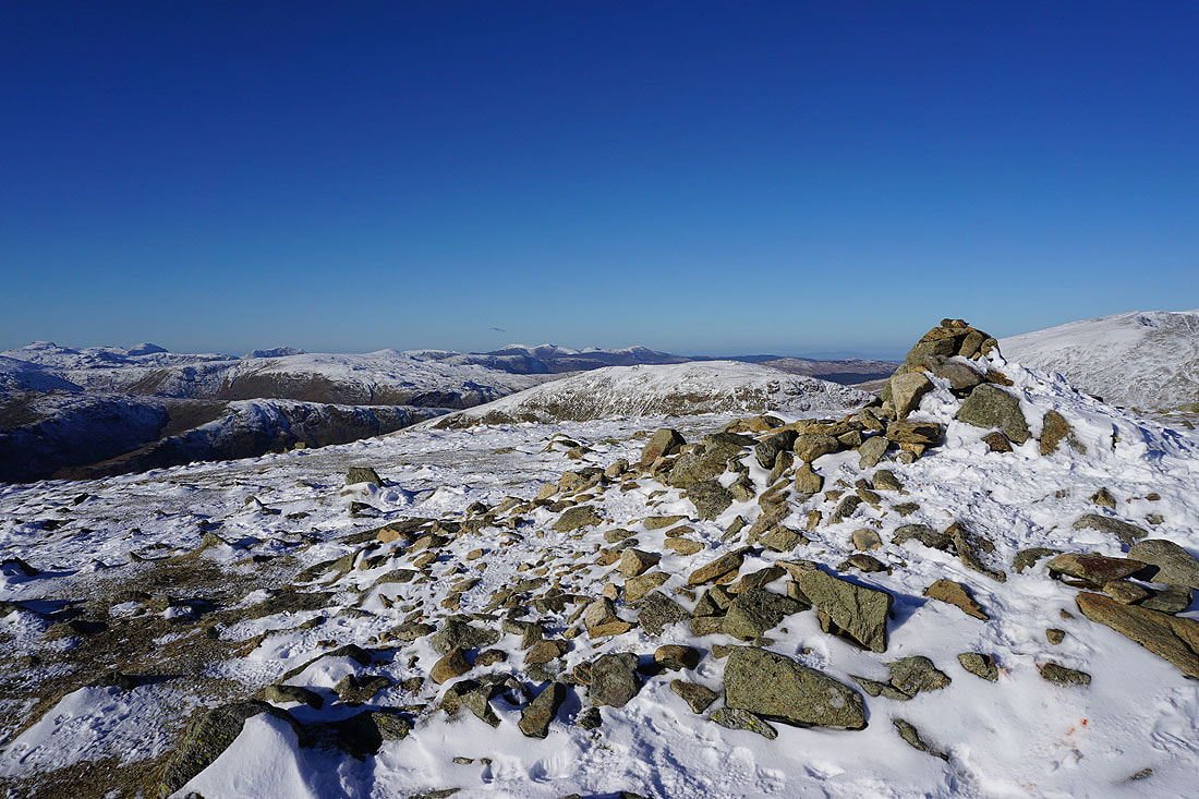
On the summit of Dove Crag
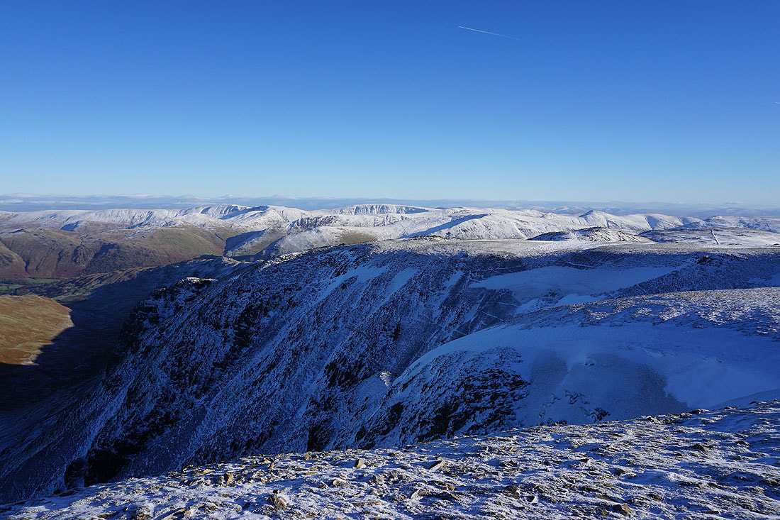
Looking east to High Raise, High Street, Caudale Moor, and Ill Bell
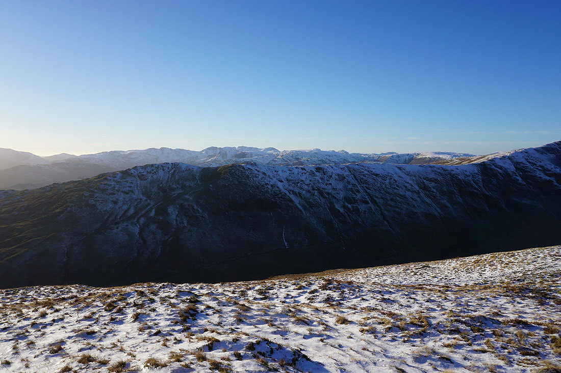
and back to Fairfield and Hart Crag on the left with St Sunday Crag on the right
Coniston Water, the Coniston fells, Crinkle Crags, and Bowfell in the distance beyond the western arm of the horseshoe
Wind sculpted drifts of snow against the wall
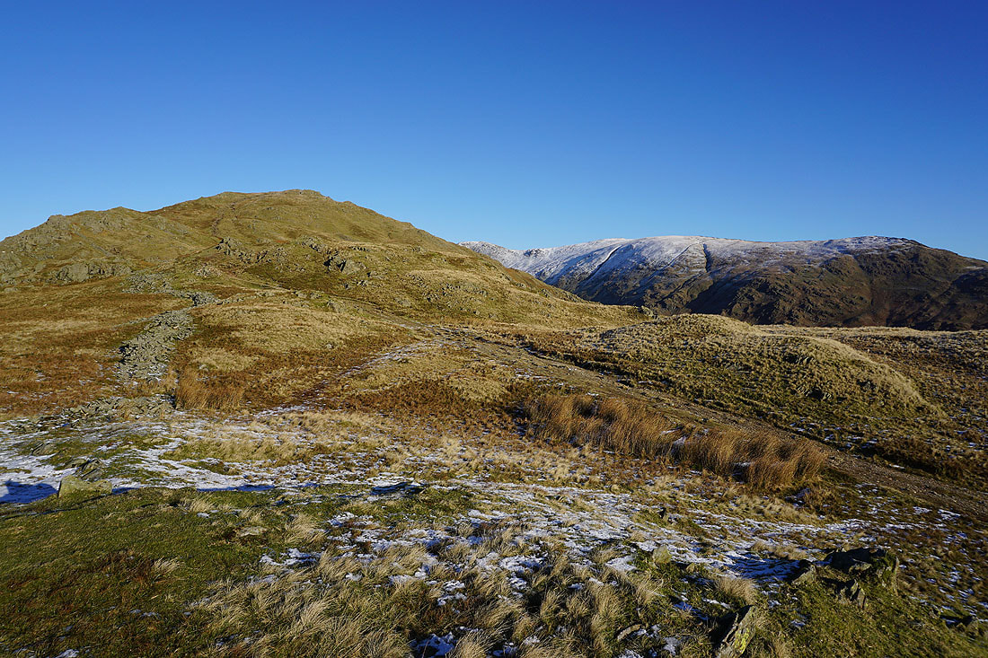
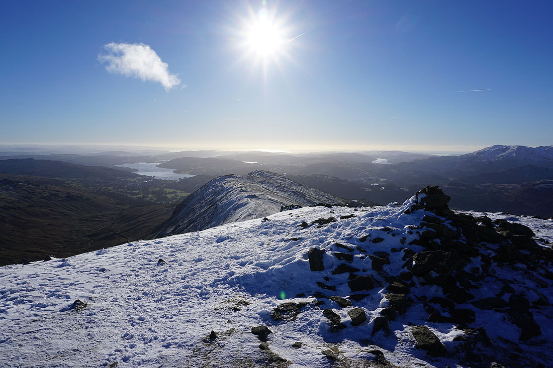
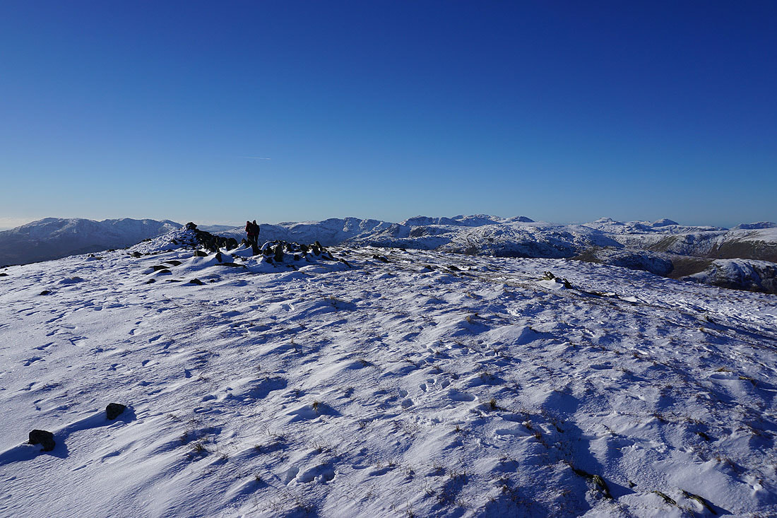
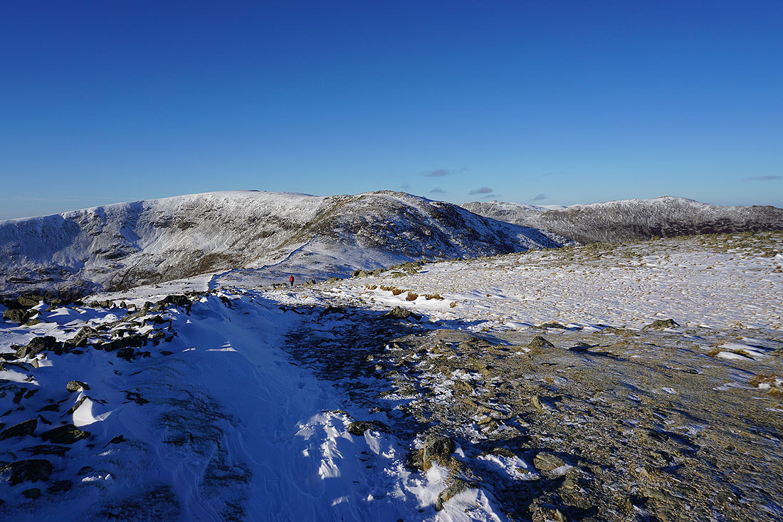
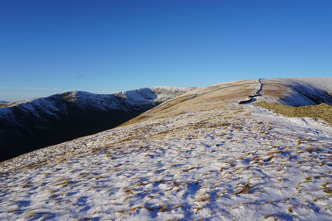
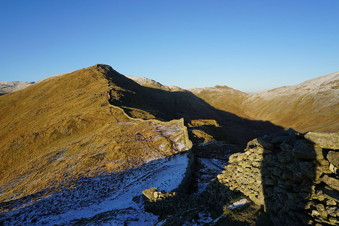
High Pike ahead
Looking back to Dove Crag
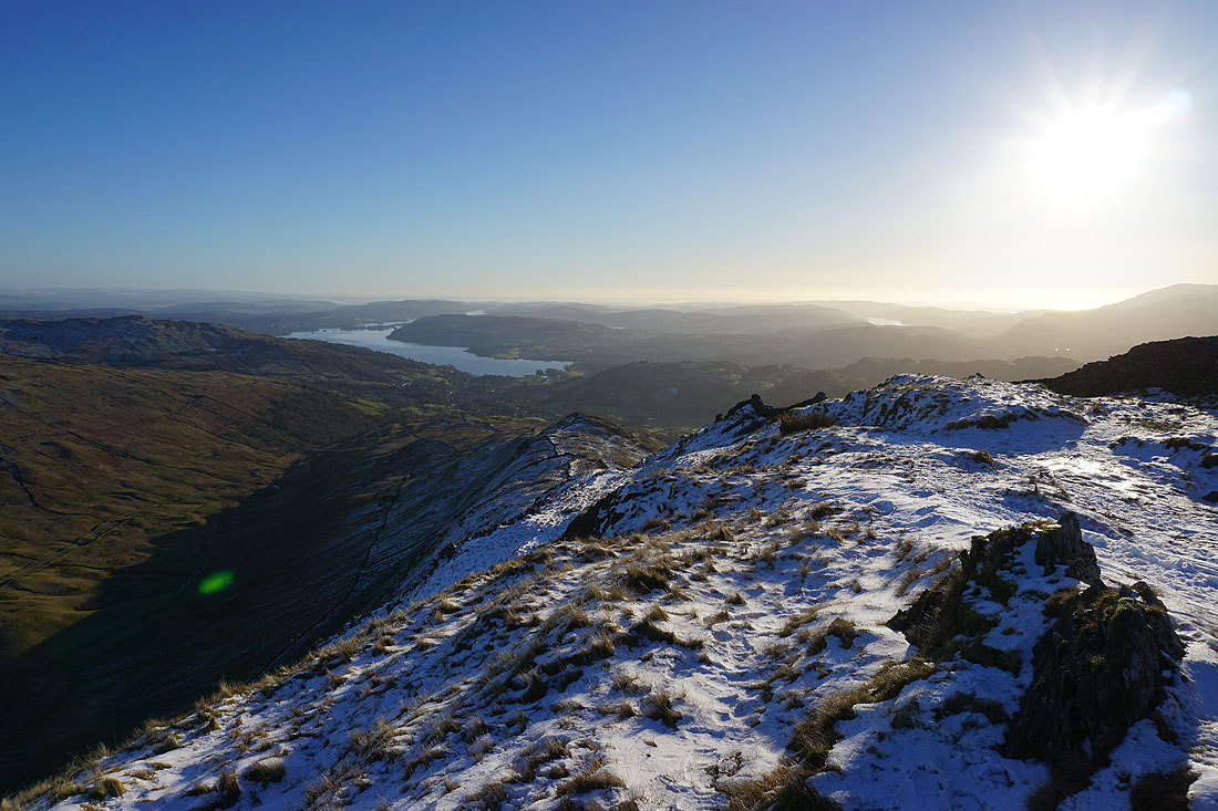
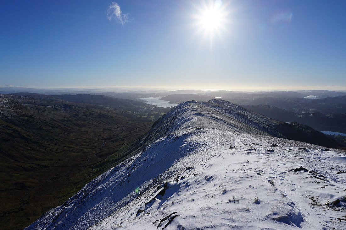
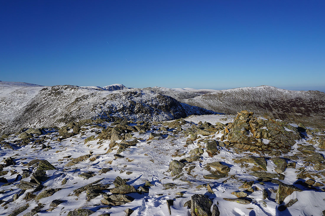
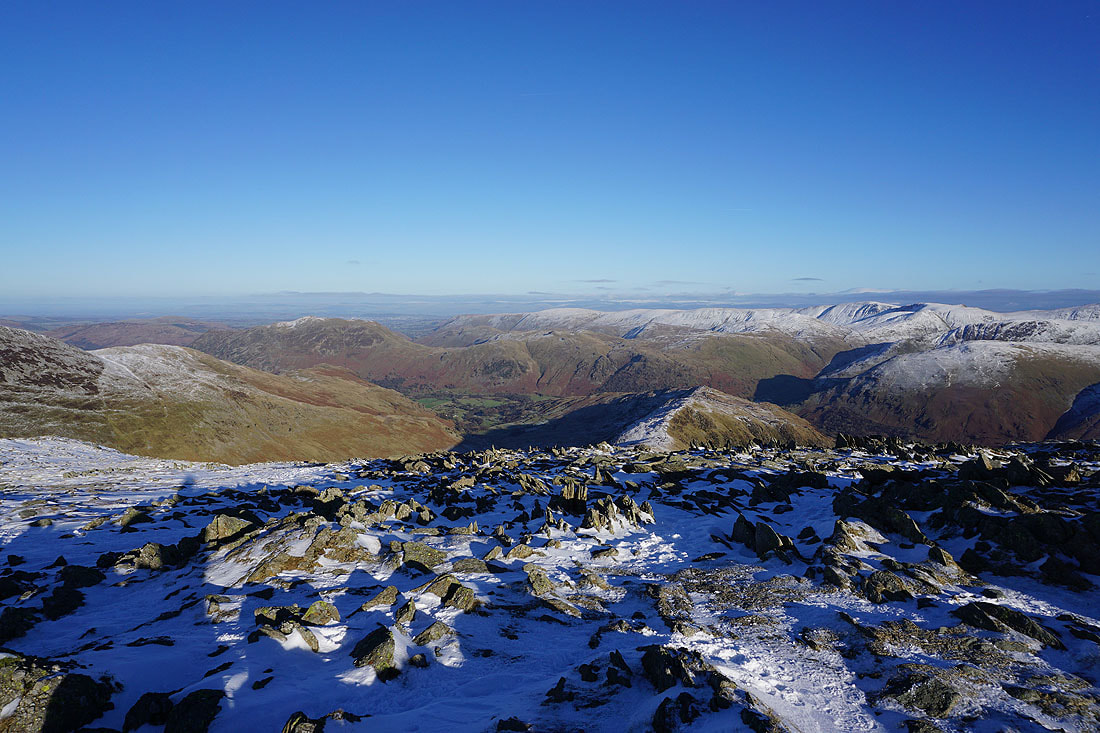
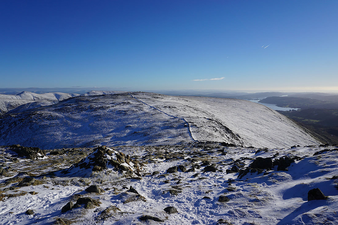
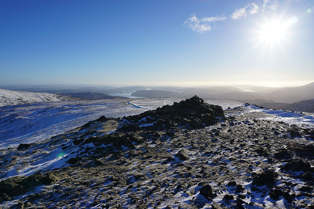
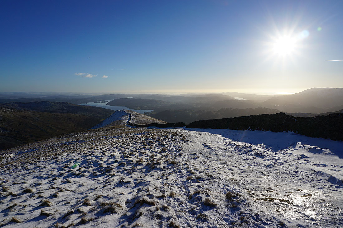
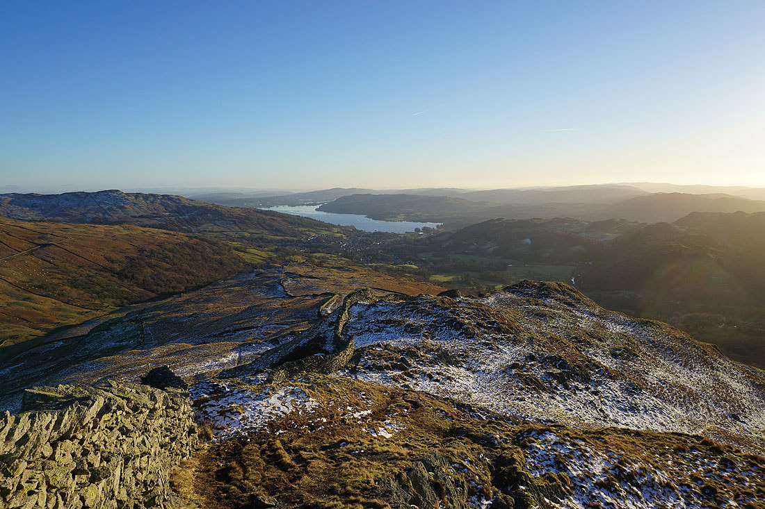
On High Pike. Ambleside and Windermere with the ridge down to Low Pike to come.
Heron Pike, Erne Crag and the ridge up to Great Rigg on the other side of Rydal
Great Rigg, Fairfield and the ridge back up to Dove Crag
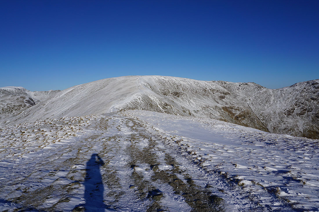
Making my descent to Low Pike
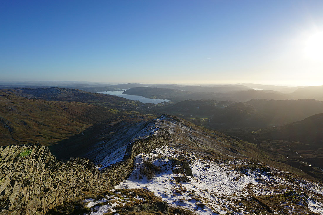
Ambleside and Windermere from Low Pike
Looking across Rydal to Nab Scar as the sun starts to set behind the Coniston fells
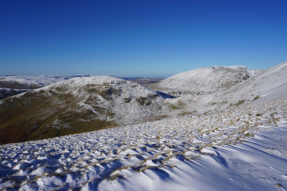
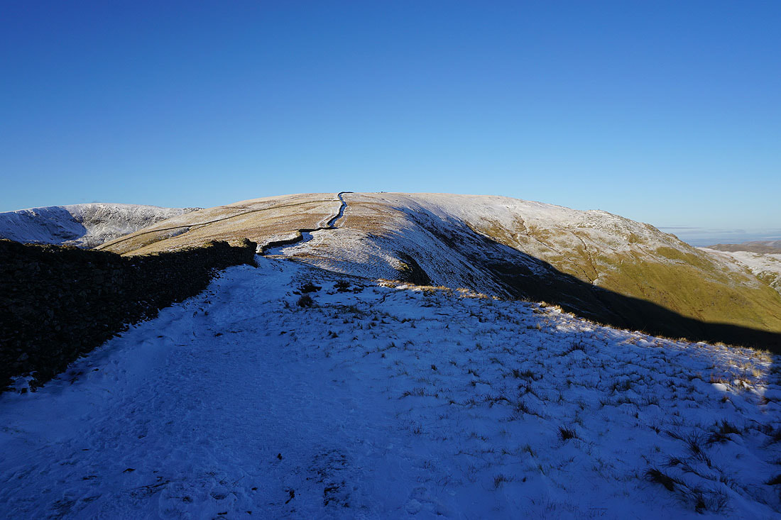
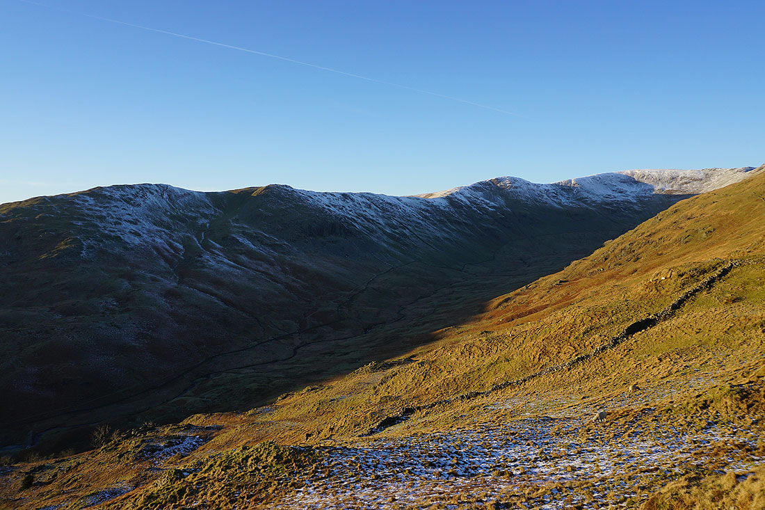
The ridge back up to High Pike, Little Hart Crag and Scandale
Heron Pike, Erne Crag, Great Rigg and Rydal from Low Pike
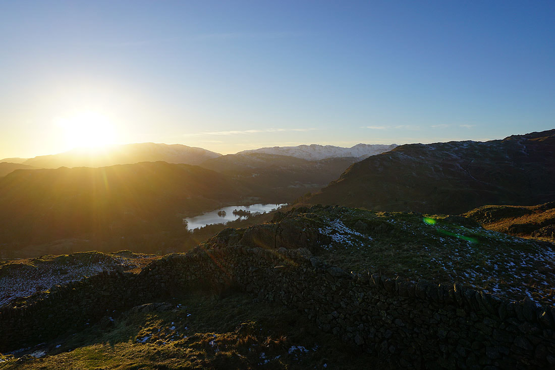
Loughrigg Fell, Rydal Water and Nab Scar
The final descent from Low Pike back to Ambleside to finish..