20th March 2016 - Whernside
Walk Details
Distance walked: 13.3 miles
Total ascent: 1847 ft
OS map used: OL2 - Yorkshire Dales, Southern & Western areas
Time taken: 7 hrs
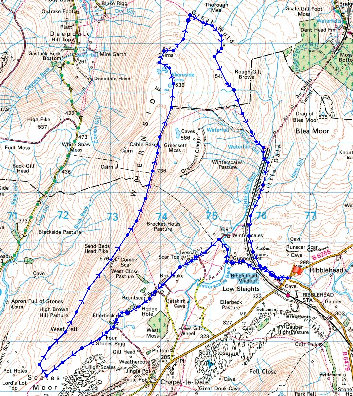
Route description: Ribblehead-Gunnerfleet Farm-Ivescar-Bruntscar-Ellerbeck-Blake Bank-Scales Moor-West Fell-Combe Scar-Whernside-Whernside Tarns-Dales High Way-Ribblehead
After having a walk up Ingleborough a couple of weeks ago I fancied paying another of the Yorkshire three peaks a visit this weekend. Today it was Whernside's turn to feel my boots upon it. The route I decided on was pretty long with an ascent up Whernside's southwest ridge but what I had to include on my walk were Whernside Tarns. I've missed out on seeing them on all my previous visits. They're definitely worth a look if the weather is OK. The highlight of the day however was the view I had from the cairns that sit on the edge of the moorland to the north. I might have set off from Ribblehead under sunny skies but it didn't stay that way. Cloud built up into the afternoon, so that by the time I reached the summit of Whernside there wasn't much blue sky, it had become quite hazy and there was a cold breeze.
From the laybys at Ribblehead I set off by taking the track to and under the viaduct to reach Gunnerfleet Farm. Here I turned right onto the byway to Winterscales and when that came to an end I turned left onto the bridleway to Scar End. I followed this southwest past Ivescar, Broadrake, Bruntscar and Ellerbeck to reach the moorland of Blake Bank and Scales Moor. It was at this point that I decided to find a convenient place to get onto Whernside's southwest ridge. Once on it there was a long, gradual ascent up West Fell and Combe Scar (a convenient place to have lunch was found here) to finally arrive on the summit of Whernside. After taking in the view I continued by taking the main path back to Ribblehead as it heads north but just before it turns to the right and goes downhill I crossed a stile to gain access to the moorland where Whernside Tarns are situated. A fairly clear path heads north towards them and the cairns beyond. I then had to head north again to the right of the easternmost of a set of enclosures to the find the trail of the Dales High Way. I followed this east then south, down Little Dale, and all the way to Bleamoor Sidings before leaving it for the path back to Ribblehead.
Total ascent: 1847 ft
OS map used: OL2 - Yorkshire Dales, Southern & Western areas
Time taken: 7 hrs
Route description: Ribblehead-Gunnerfleet Farm-Ivescar-Bruntscar-Ellerbeck-Blake Bank-Scales Moor-West Fell-Combe Scar-Whernside-Whernside Tarns-Dales High Way-Ribblehead
After having a walk up Ingleborough a couple of weeks ago I fancied paying another of the Yorkshire three peaks a visit this weekend. Today it was Whernside's turn to feel my boots upon it. The route I decided on was pretty long with an ascent up Whernside's southwest ridge but what I had to include on my walk were Whernside Tarns. I've missed out on seeing them on all my previous visits. They're definitely worth a look if the weather is OK. The highlight of the day however was the view I had from the cairns that sit on the edge of the moorland to the north. I might have set off from Ribblehead under sunny skies but it didn't stay that way. Cloud built up into the afternoon, so that by the time I reached the summit of Whernside there wasn't much blue sky, it had become quite hazy and there was a cold breeze.
From the laybys at Ribblehead I set off by taking the track to and under the viaduct to reach Gunnerfleet Farm. Here I turned right onto the byway to Winterscales and when that came to an end I turned left onto the bridleway to Scar End. I followed this southwest past Ivescar, Broadrake, Bruntscar and Ellerbeck to reach the moorland of Blake Bank and Scales Moor. It was at this point that I decided to find a convenient place to get onto Whernside's southwest ridge. Once on it there was a long, gradual ascent up West Fell and Combe Scar (a convenient place to have lunch was found here) to finally arrive on the summit of Whernside. After taking in the view I continued by taking the main path back to Ribblehead as it heads north but just before it turns to the right and goes downhill I crossed a stile to gain access to the moorland where Whernside Tarns are situated. A fairly clear path heads north towards them and the cairns beyond. I then had to head north again to the right of the easternmost of a set of enclosures to the find the trail of the Dales High Way. I followed this east then south, down Little Dale, and all the way to Bleamoor Sidings before leaving it for the path back to Ribblehead.
Route map
© Crown copyright. All rights reserved. License number PU 100034184.
It's a lovely morning as I arrive at Ribblehead
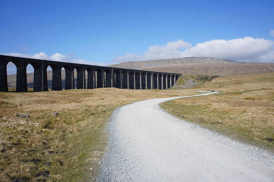
Setting off and I'm going to head underneath the arches
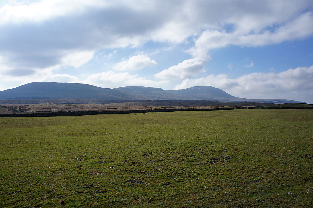
Park Fell, Simon Fell and Ingleborough
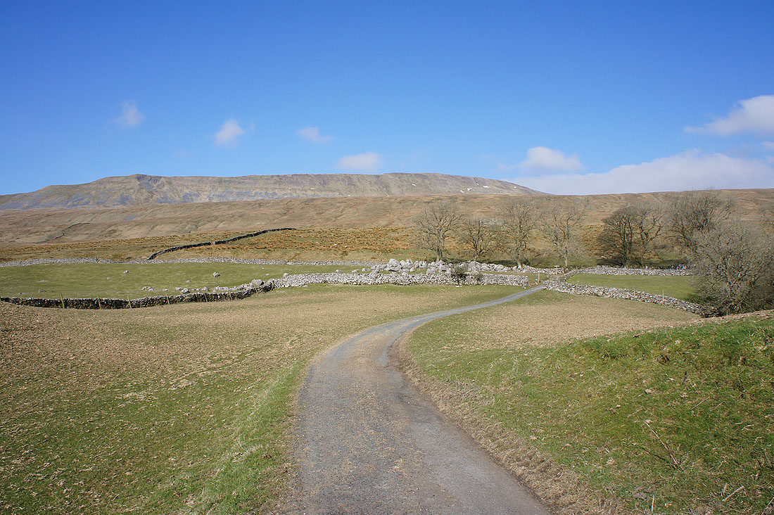
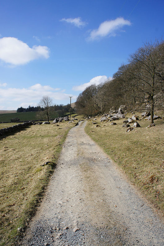
Whernside looms large as I follow the byway from Gunnerfleet Farm to Winterscales to pick up the bridleway to Scar End
Ivescar ahead
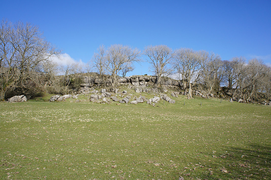
Past Ivescar the bridleway runs beneath a low limestone scar topped with trees, appropriately called The Scar
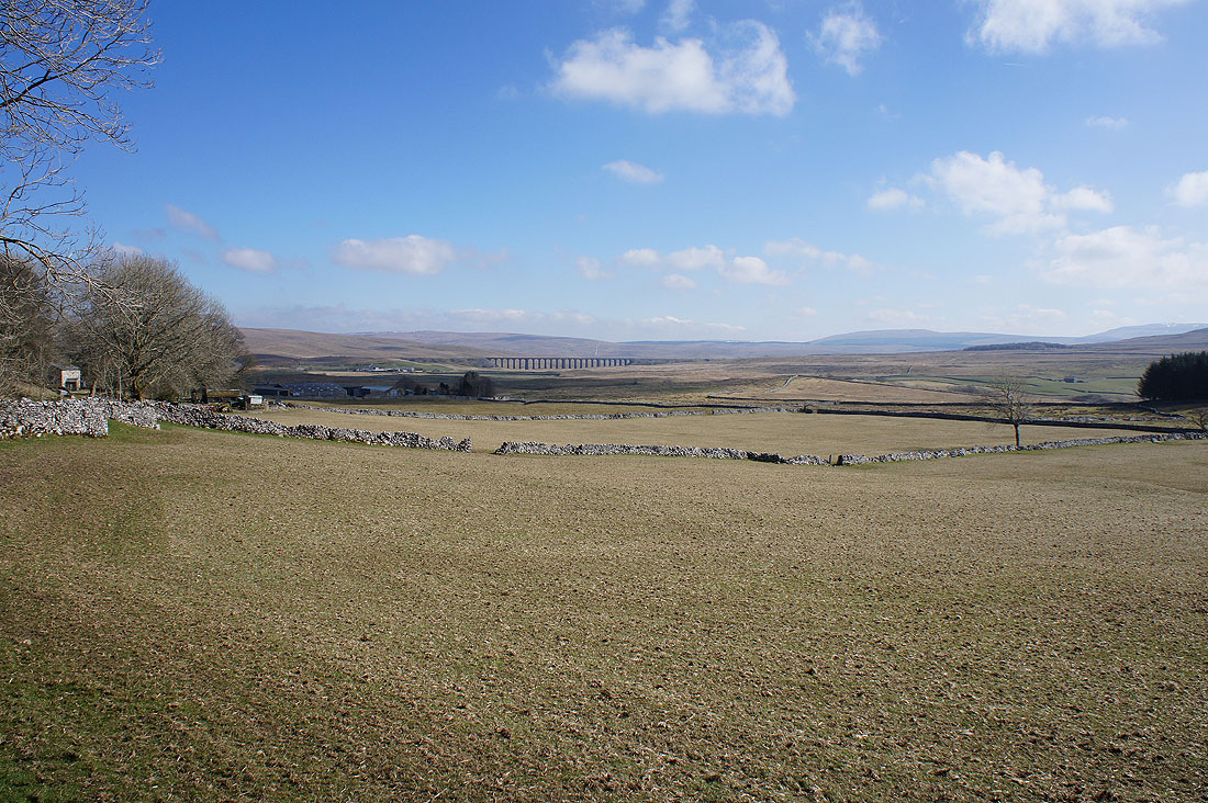
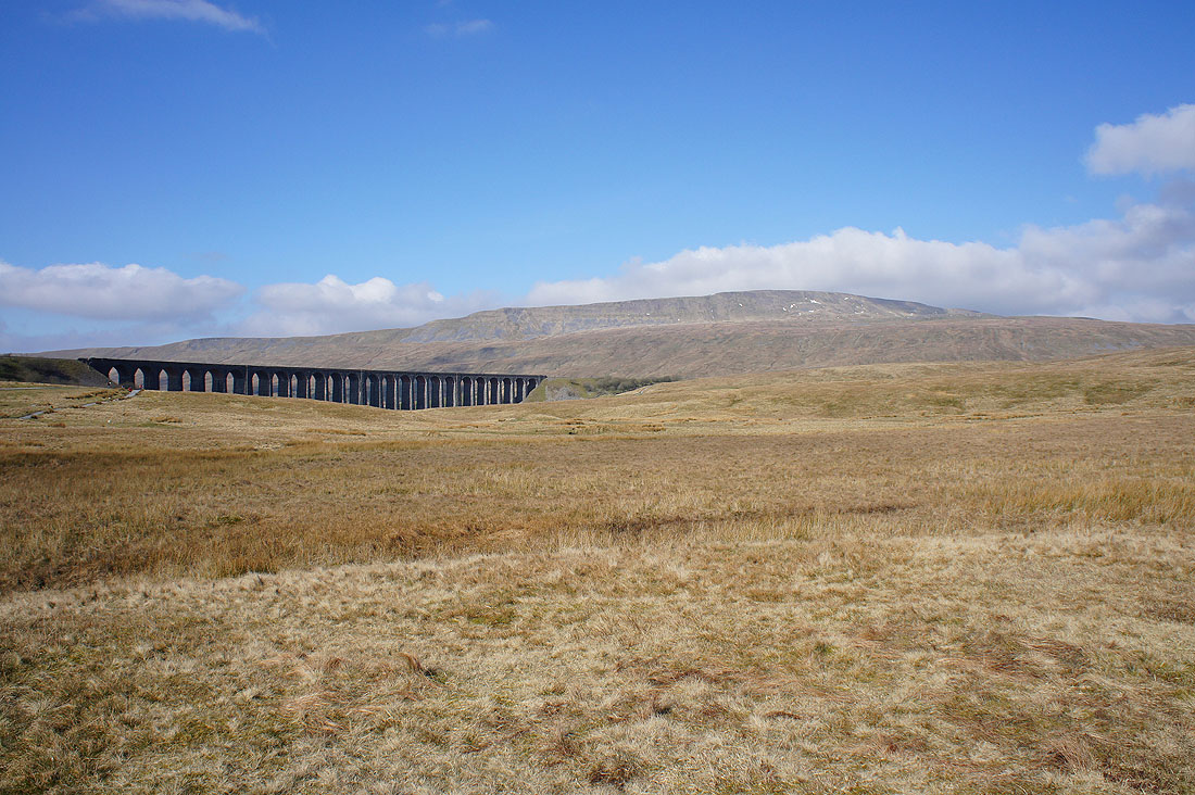
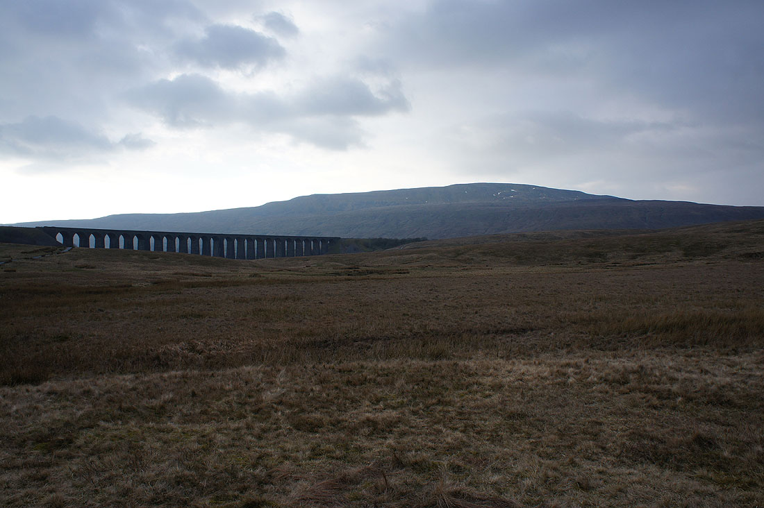
Looking back to the Ribblehead Viaduct
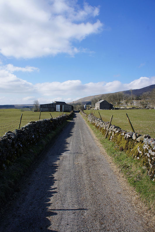
Onwards to Ellerbeck
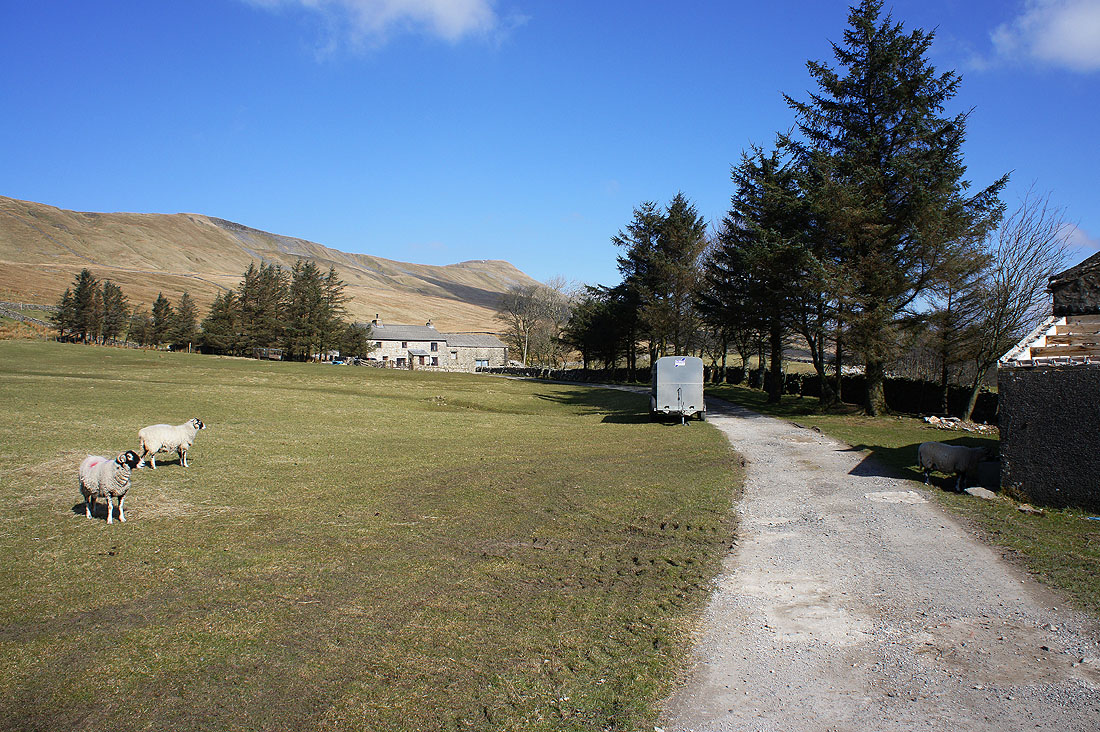
Ellerbeck with Whernside above
Onto the moorland of Blake Bank and I'm now a long way from Ribblehead
Ingleborough across the limestone pavement of Twisleton
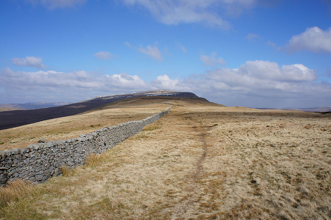
Finally on the southwest ridge of Whernside and there's a long gradual ascent to come
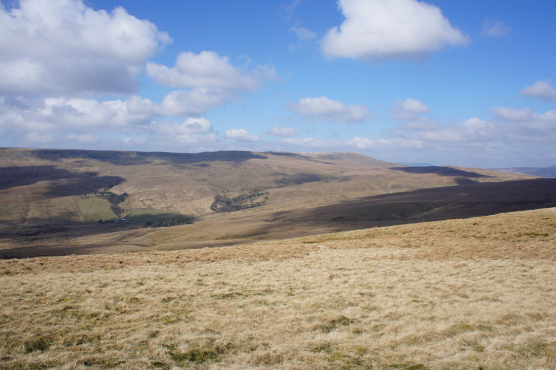
Looking across Kingsdale to Green Hill and Great Coum
Higher up and the Howgills appear through the gap in the hills taken by the Kingsdale to Deepdale road
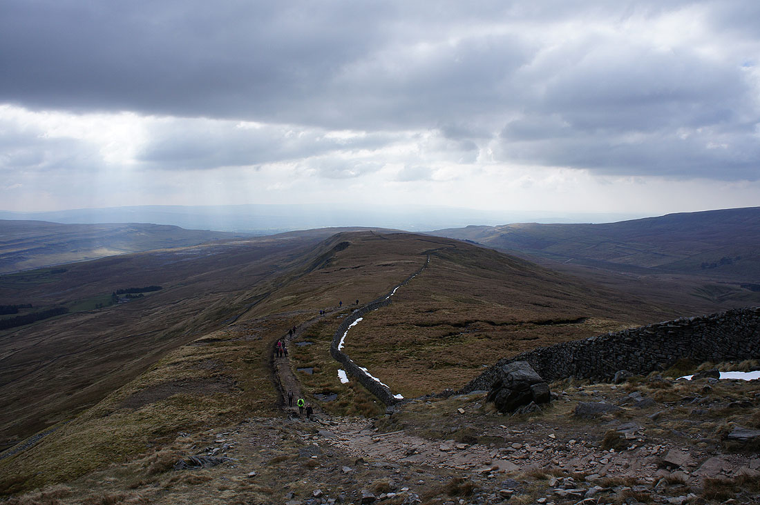
Looking back down the southwest ridge as I reach the final climb to the summit. It's become much busier now as I join the popular route up from Ribblehead.
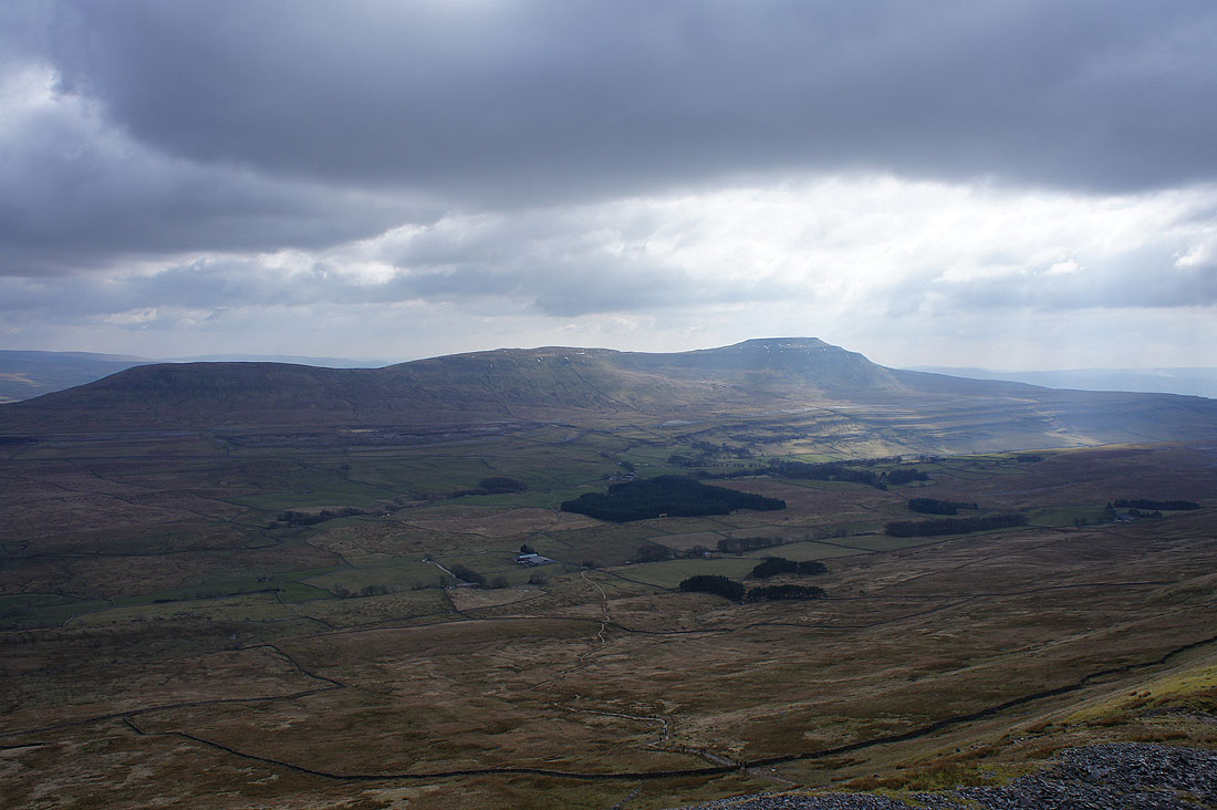
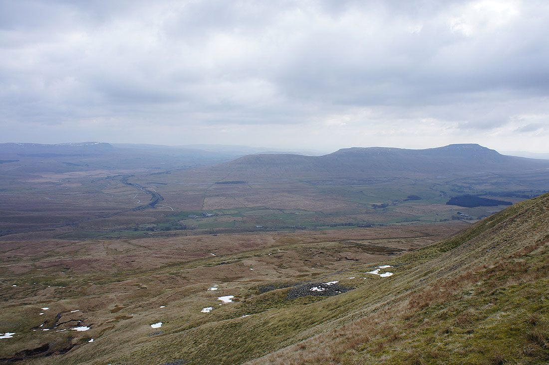
Ingleborough across Chapel-le-Dale
Ribblehead unfortunately now under predominantly cloudy skies
On the summit of Whernside with Ingleborough in the background
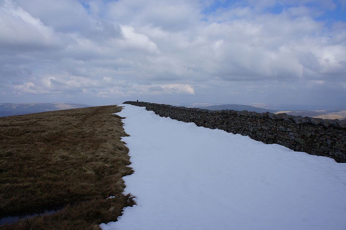
There's one heck of a drift hanging on in the lee of the western side of the summit wall
It's so hazy now that I can barely make out the fells of the Forest of Bowland to the south
Gragareth and Great Coum
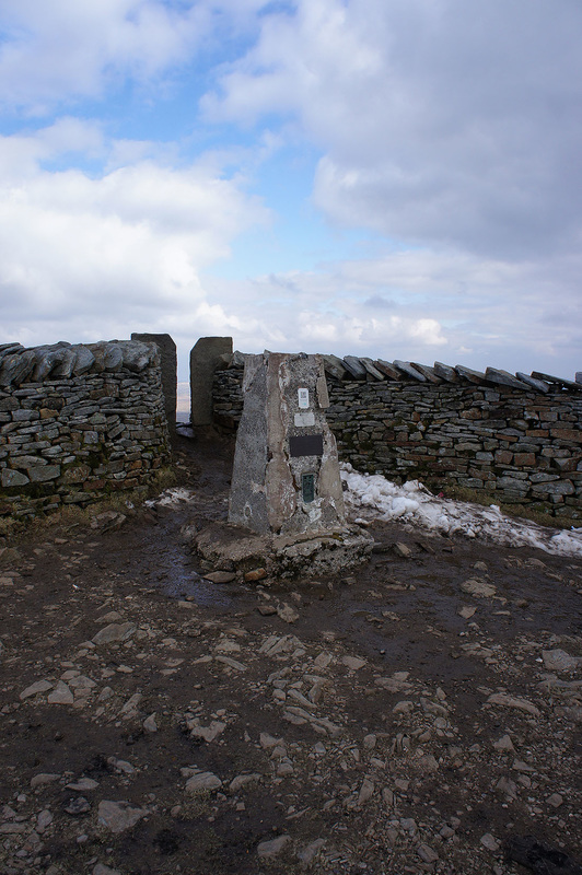
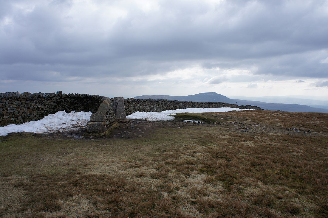
The trig point and squeeze stile through to the other side of the wall, which is where I'm going to now
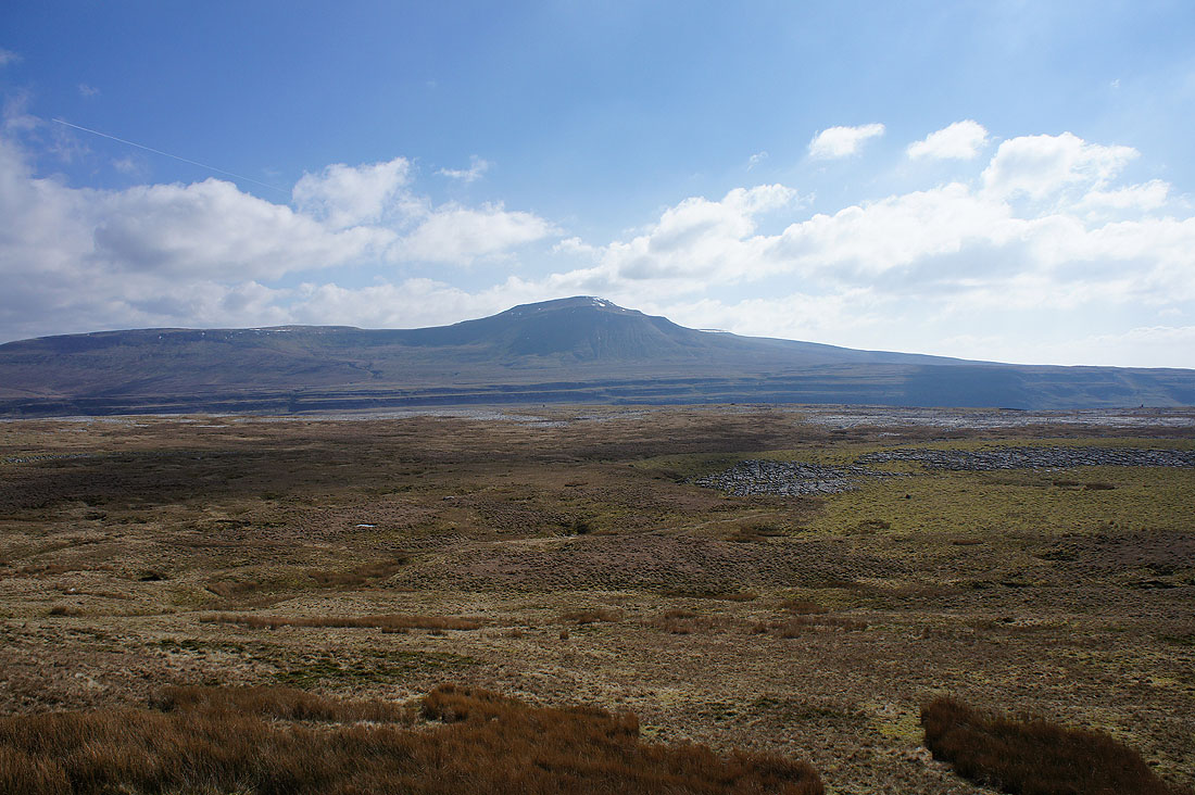
Penyghent, Ribblehead, Park Fell, Simon Fell and Ingleborough
Greensett Tarn, Great Knoutberry Hill and Wold Fell
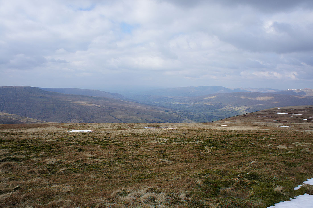
Looking over the wall to see Great Coum and Middleton Fell on the left then Dentdale, the Howgills and Aye Gill Pike on the right
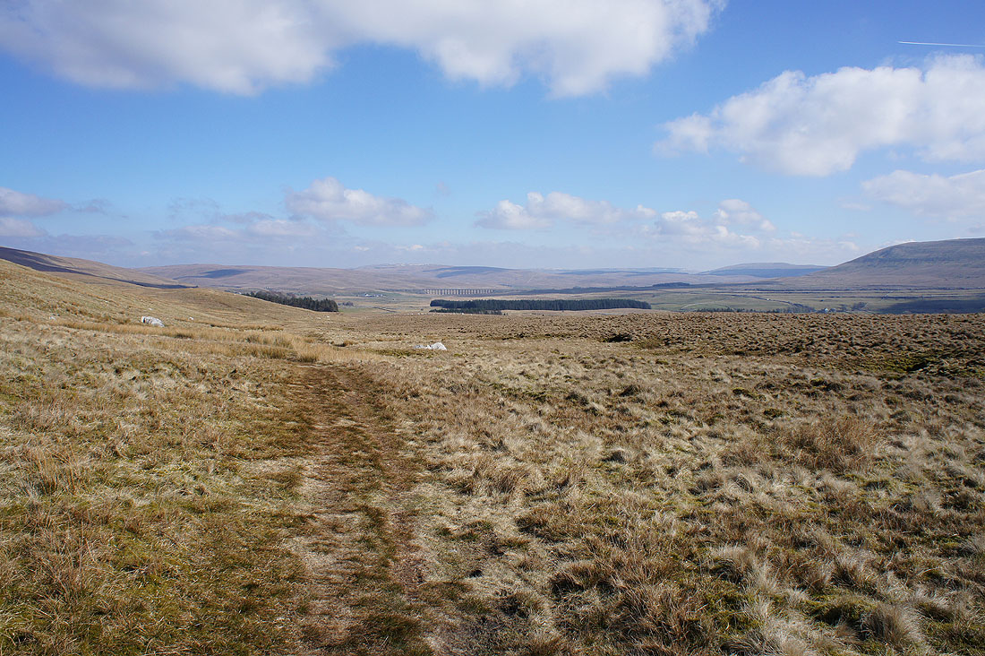
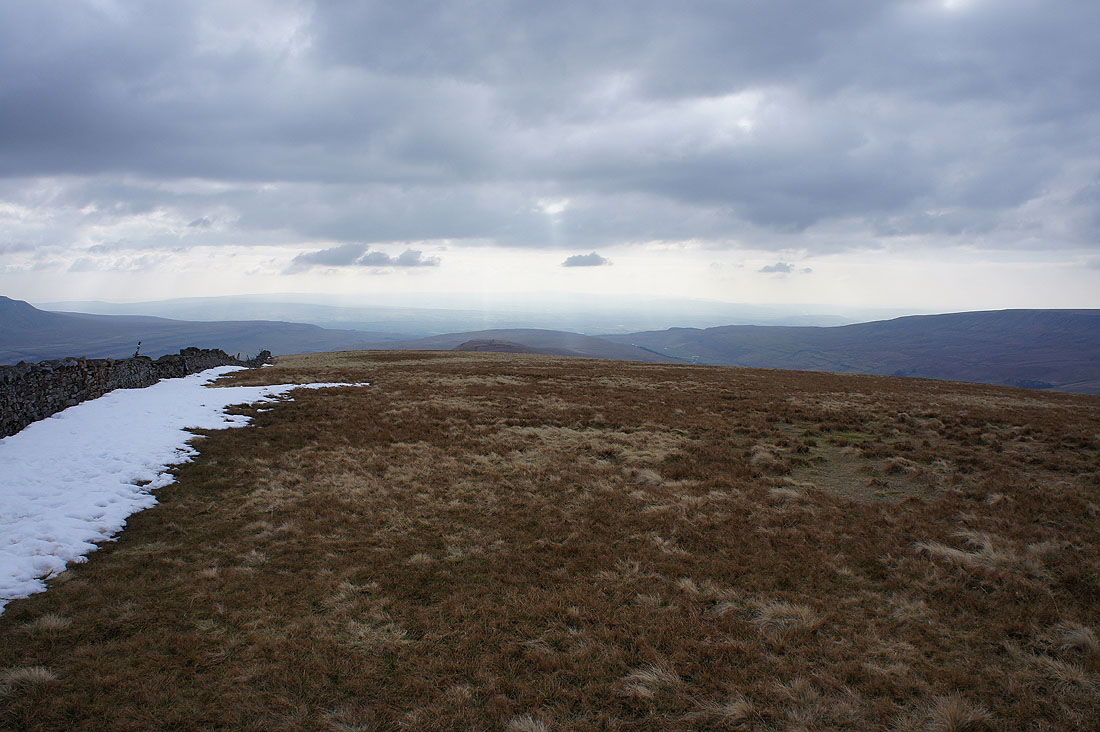
Heading north from the summit and I'll soon leave the main path up from Ribblehead and make my way to Whernside Tarns
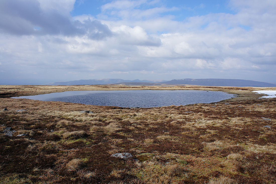
By the southernmost of the Whernside Tarns with the Howgills and Baugh Fell in the background. I'm glad that I've taken the trouble to visit them. They have a wild and remote feeling with their moorland setting.
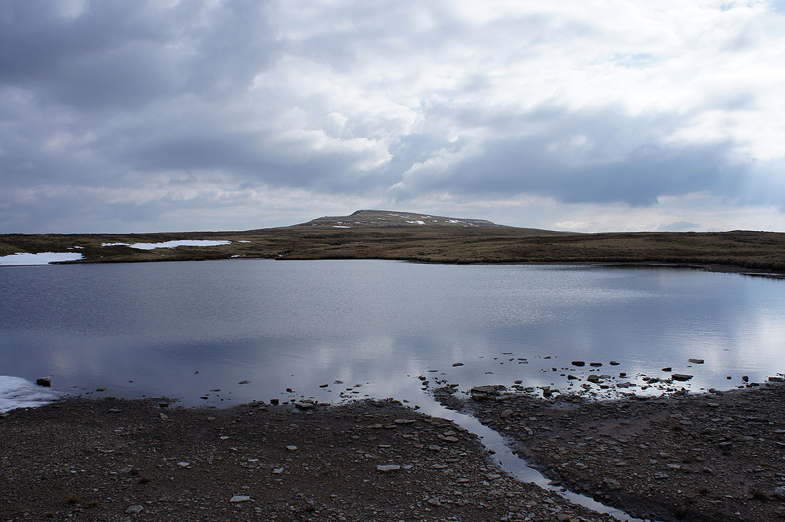
By another of the tarns with the summit of Whernside above
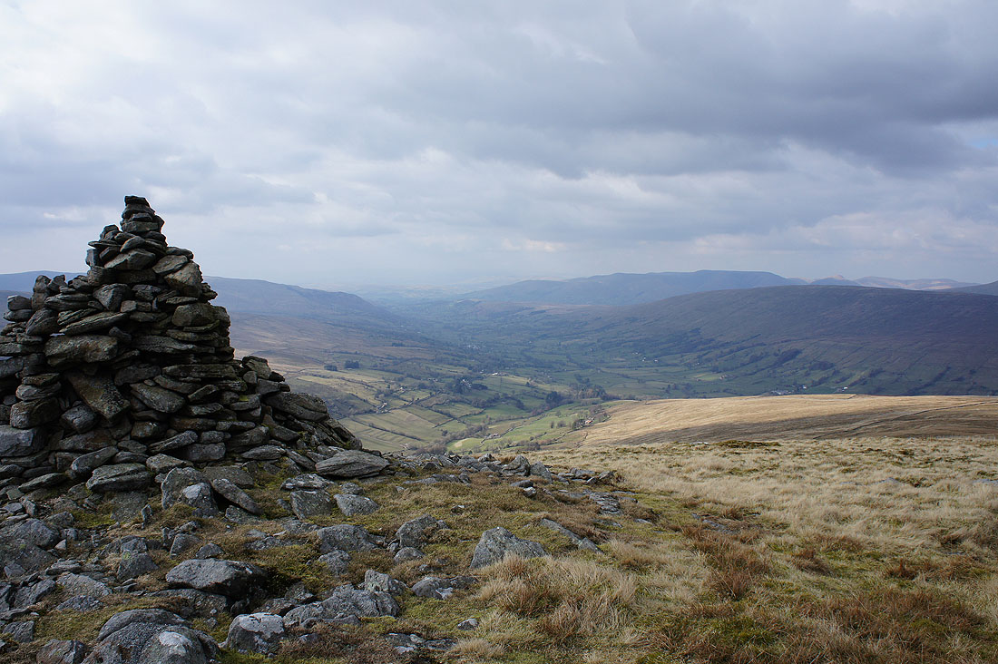
I could see this cairn from where I was stood by the tarn in that last photo, so I thought it might be worth wandering over and seeing the view from it. Definitely worth it.
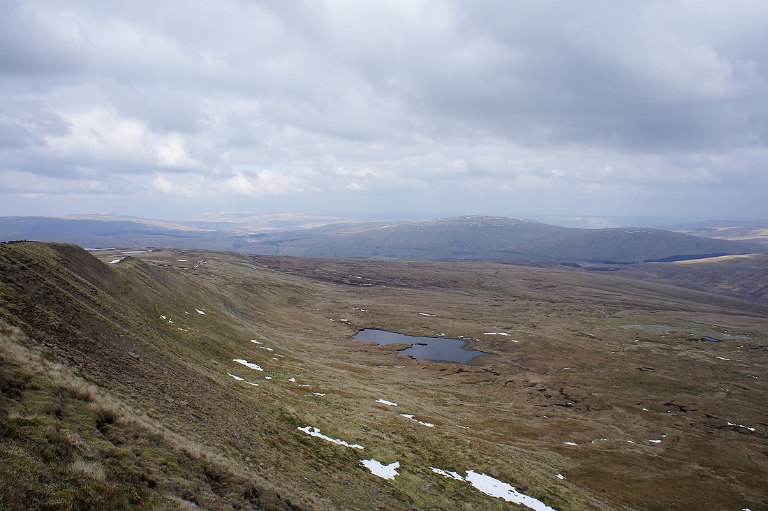
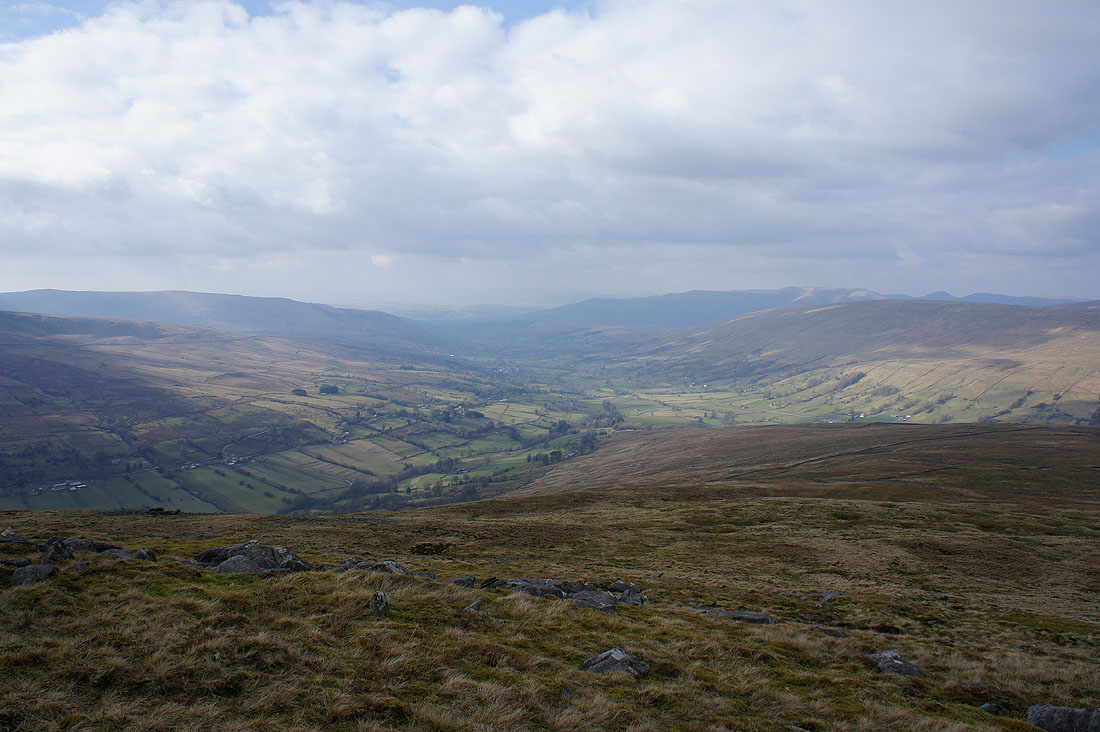
If I step in front of it you can see more. The slopes of Great Coum fall into Deepdale on the left, which runs down into Dentdale, with the Howgills and Aye Gill Pike on the right.
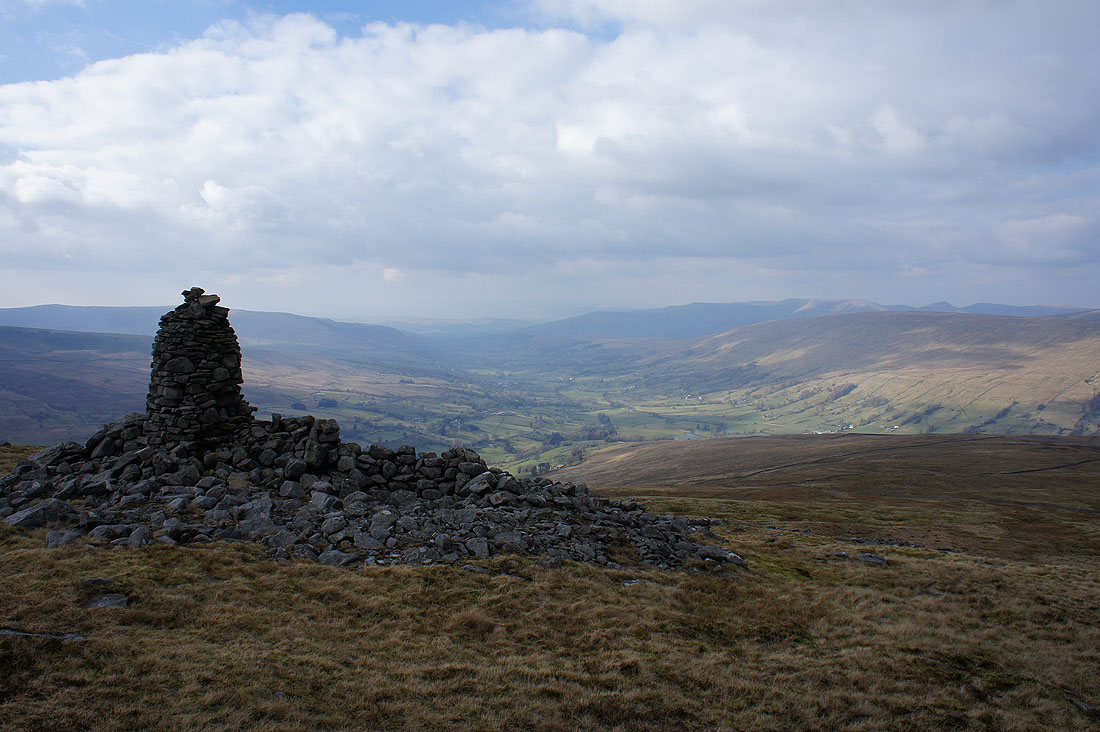
There was another more handsomely built cairn a few hundred yards away to the north with a view that was equally as good. This is a place that I'll definitely return to but when it isn't so hazy.
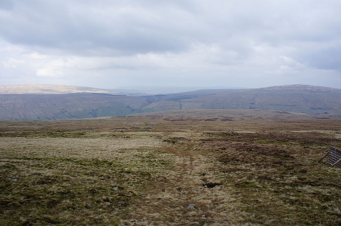
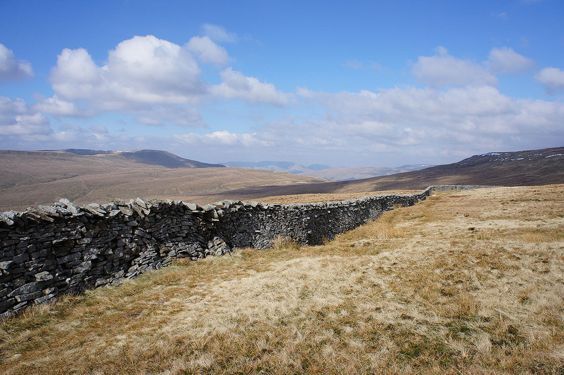
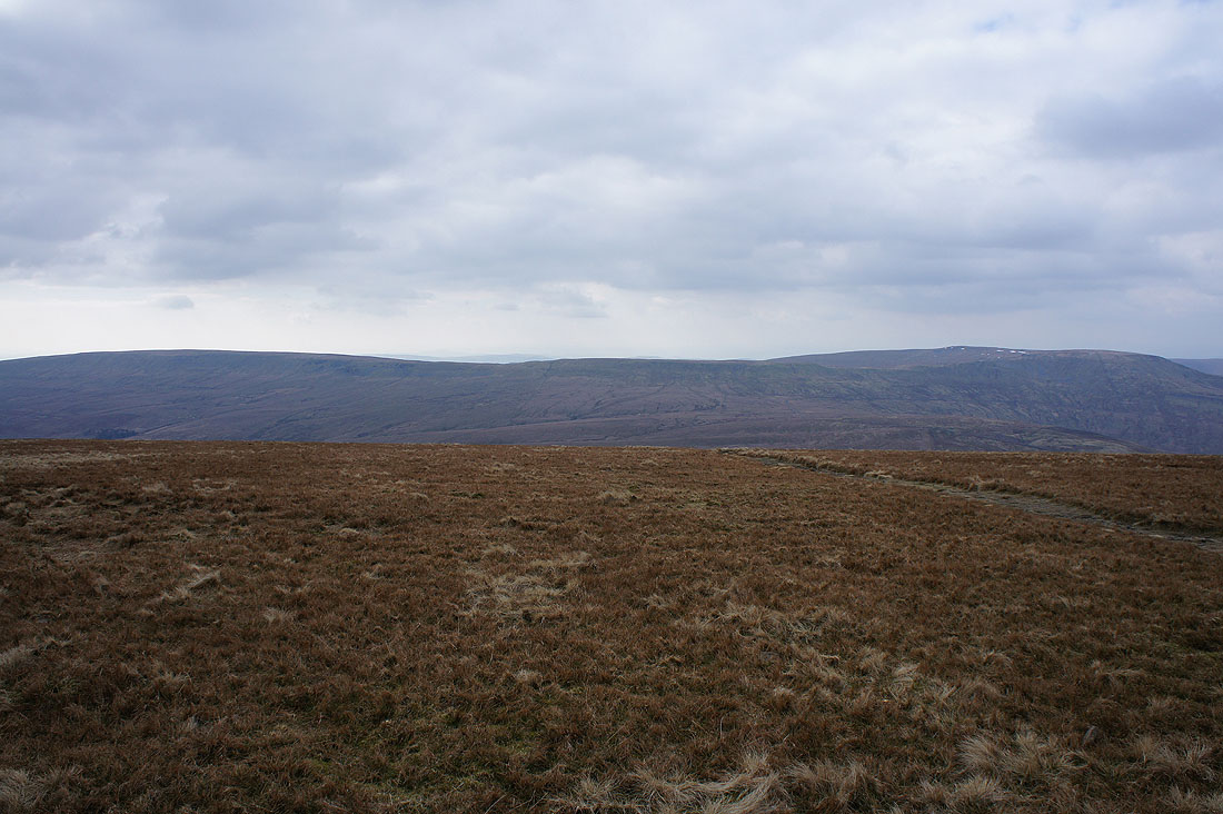
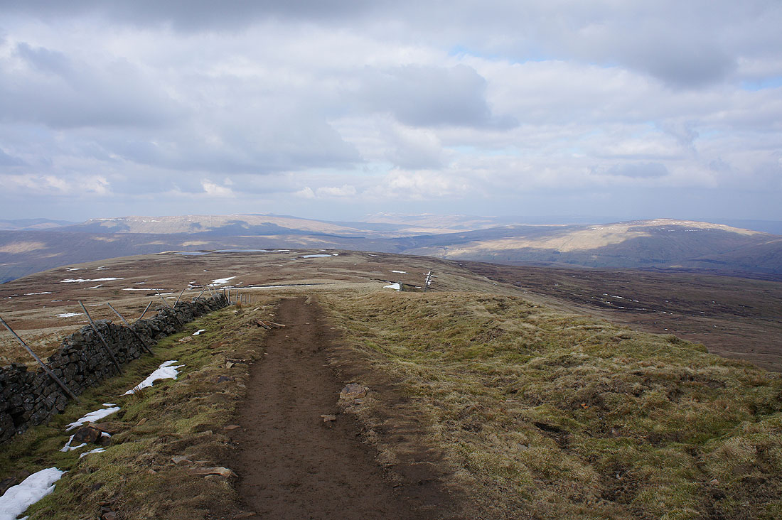
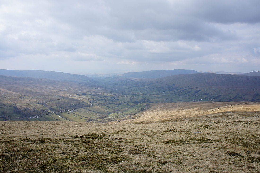
From that second cairn I made my way east past a shelter and now I need to head north and pick up the Dales High Way trail that runs across the fellside below. A path follows a line of grouse butts down to the eastern most wall of a series of enclosures.
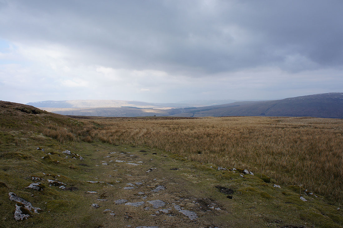
A last look back to the north and Baugh Fell from the Dales High Way
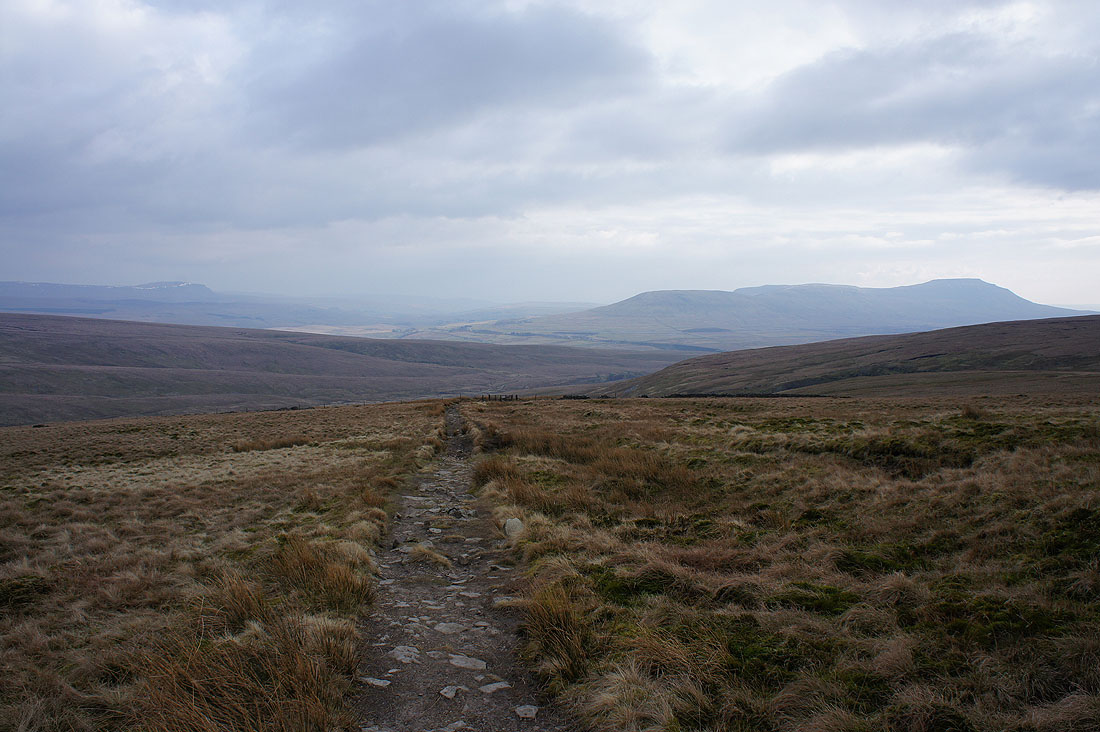
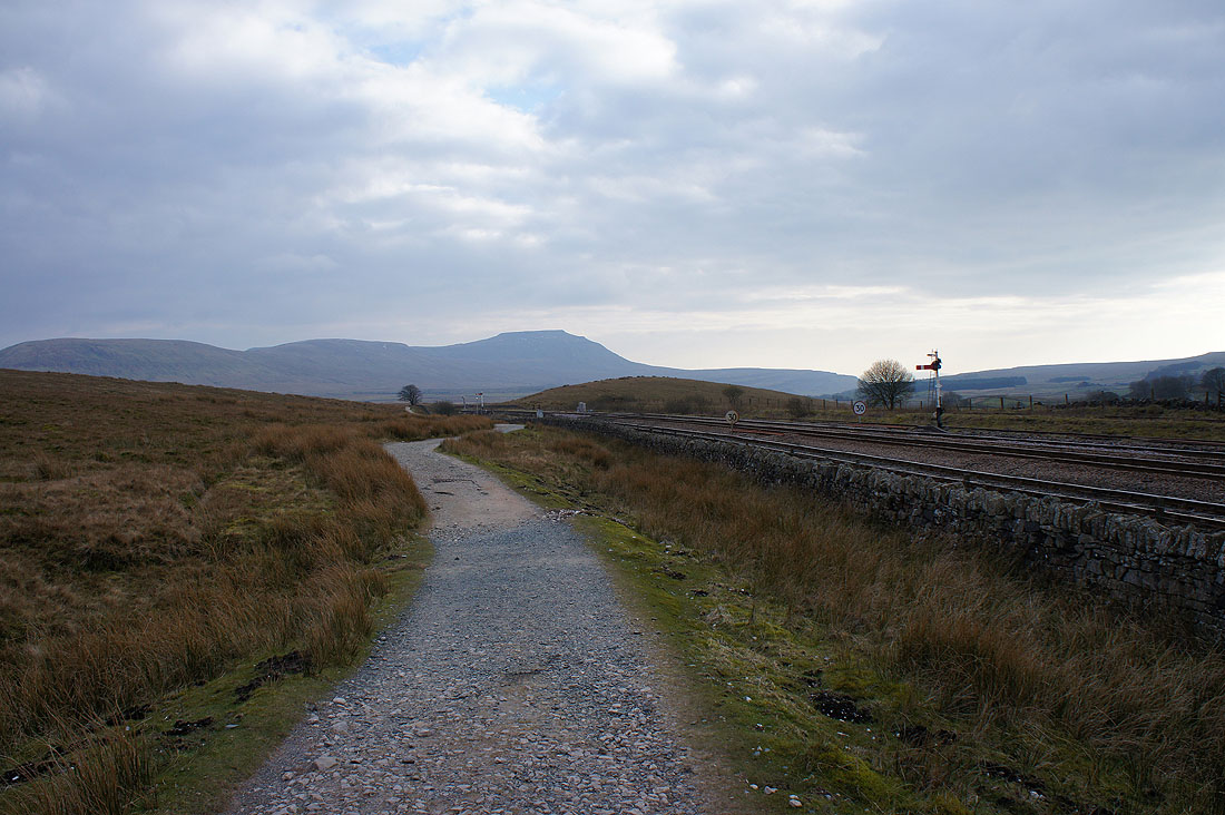
Penyghent and Ingleborough as I start the long downhill walk to Ribblehead
|
|
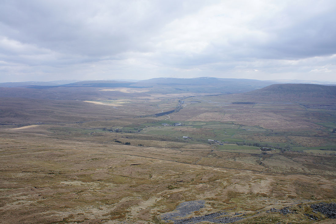
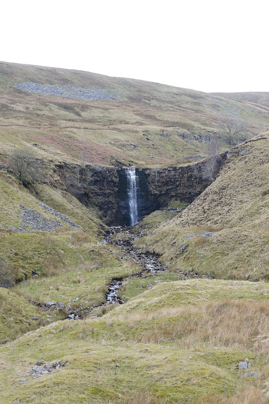
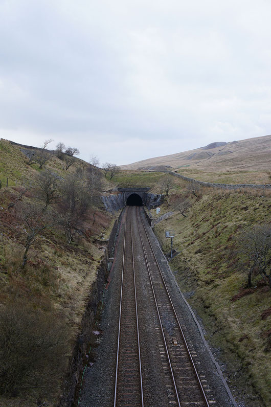
Zooming in on the waterfall on Force Gill and crossing the Settle to Carlisle line just before it enters the Bleamoor Tunnel
Past Bleamoor Sidings
Back at Ribblehead and it's quite different to how it was this morning