21st February 2015 - Blea Rigg & Silver How
Walk Details
Distance walked: 7.3 miles
Total ascent: 1988 ft
OS map used: OL7 - The English Lakes, Southeastern area
Time taken: 6 hrs
Route description: Layby on A591-Grasmere-Easedale Road-Easedale-Easedale Tarn-Blea Rigg-Little Castle How-Swinescar Hause-Silver How-Wray Gill-Allan Bank-Grasmere-Layby on A591
I fancied doing a walk in the Lakes today and in keeping with my ambition of completing a second round of Wainwrights I went somewhere that I haven't been to in years. Looking back, the last time I did a walk from Grasmere was 2009 and the last and only time I visited the Wainwrights of Blea Rigg and Silver How was 2006 when I walked back to Grasmere along the ridge after doing the Langdale Pikes. How time flies. It was quite a nice day weather wise with some good sunny spells though there was a cold wind and the odd brief wintry shower passed through.
After parking in the layby on the A591 outside Grasmere I crossed the road and took the footpath into the village. I decided to visit Sarah Nelson's to buy some gingerbread (a bit of a treat and who knows when I'll next have the opportunity). I then left the village by walking up Easedale Road then onto the bridleway to Easedale Tarn. When I reached Easedale Tarn I took the path that heads uphill to the left of Blea Crag to reach the summit of Blea Rigg. Lunch was had in the shelter of a crag, after which it was time to walk the ridge to Silver How. Several of the many lumps and bumps were scaled along the way. My route of descent from Silver How was the path across Wray Gill and then down to the Allan Bank estate. I then had a walk through Grasmere to where I was parked.
Route map
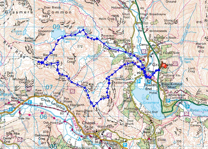
© Crown copyright. All rights reserved. License number PU 100034184.
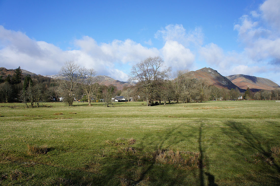
Heading for Grasmere from the layby on the A591
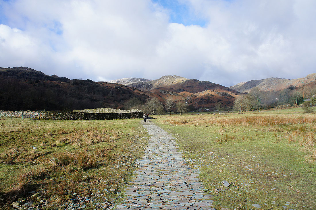
After buying some gingerbread from Sarah Nelson's I left Grasmere by the Easedale Road and onto the bridleway to Easedale Tarn
|
|
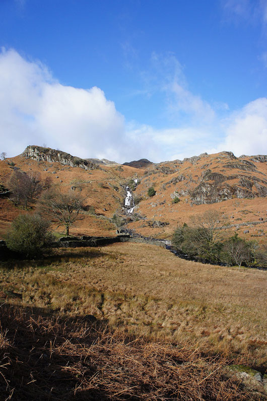
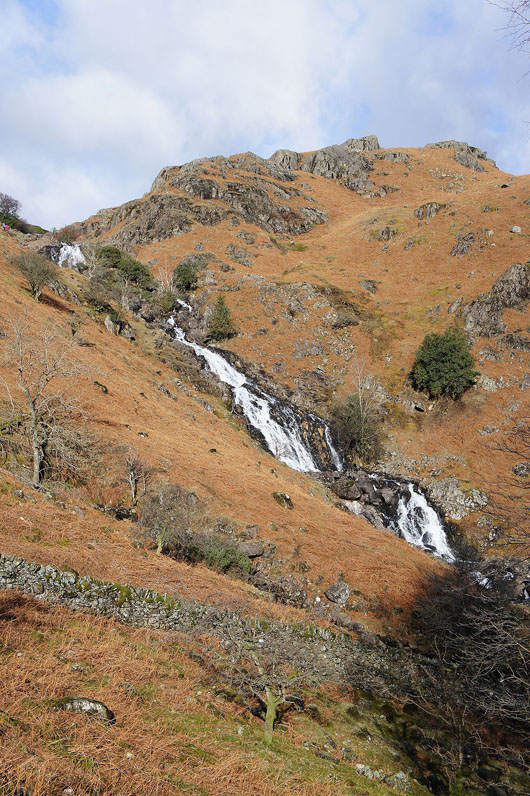
The waterfalls of Sourmilk Gill get closer and closer
Looking back across Easedale to Helm Crag with a snow covered Fairfield beyond
Blea Crag ahead. My route will take me up a path across the hillside to its left.
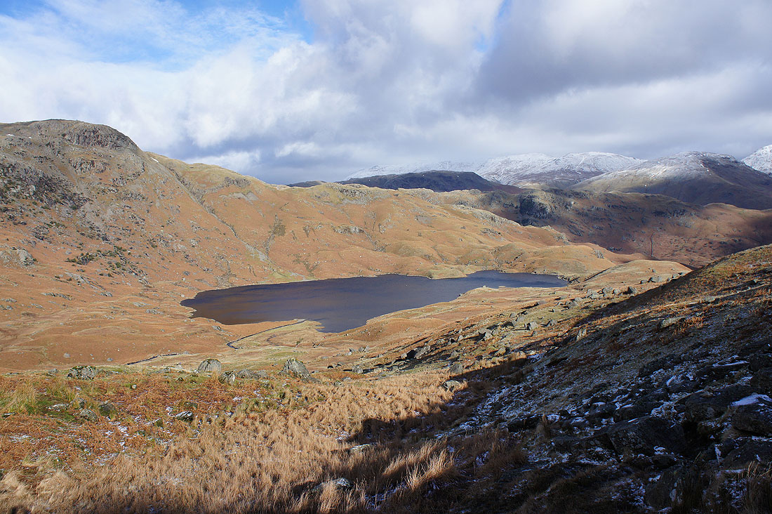
Looking back down on Easedale Tarn
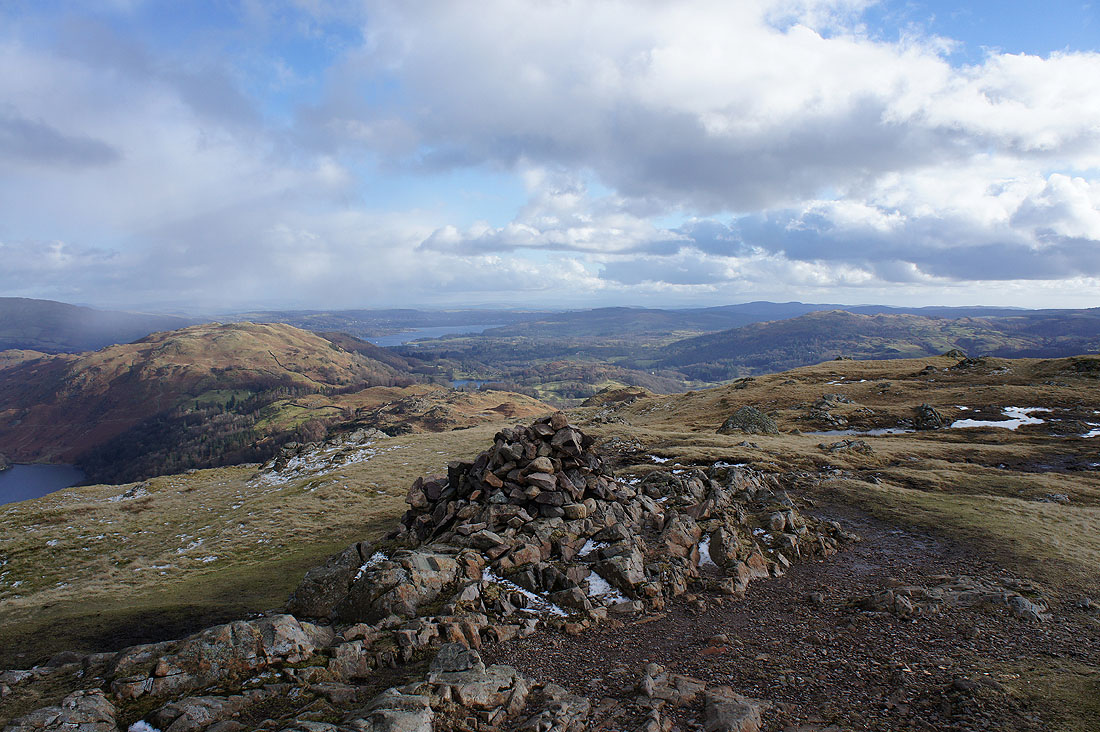
On the "summit" of Blea Rigg. Though it could be that rocky top with the cairn over there, so I paid that a visit too.
Snow covered Helvellyn and Fairfield from the top with the cairn
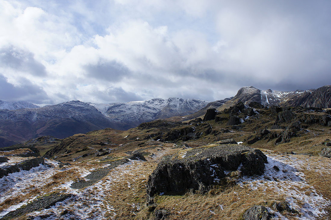
Pike o'Blisco, Crinkle Crags and Harrison Stickle
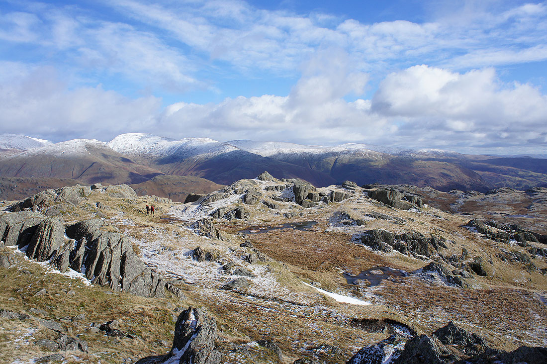
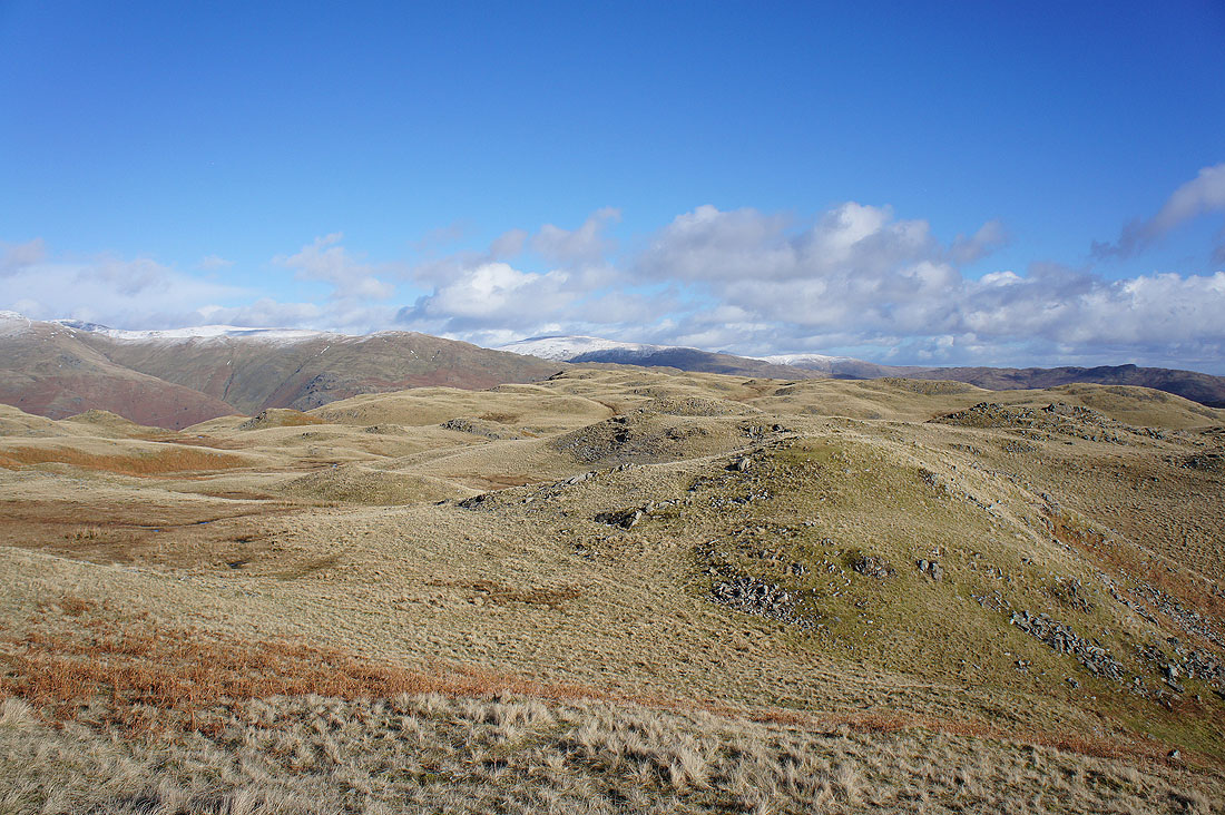
The ridge stretches out to the east with lots of lumps and bumps to visit
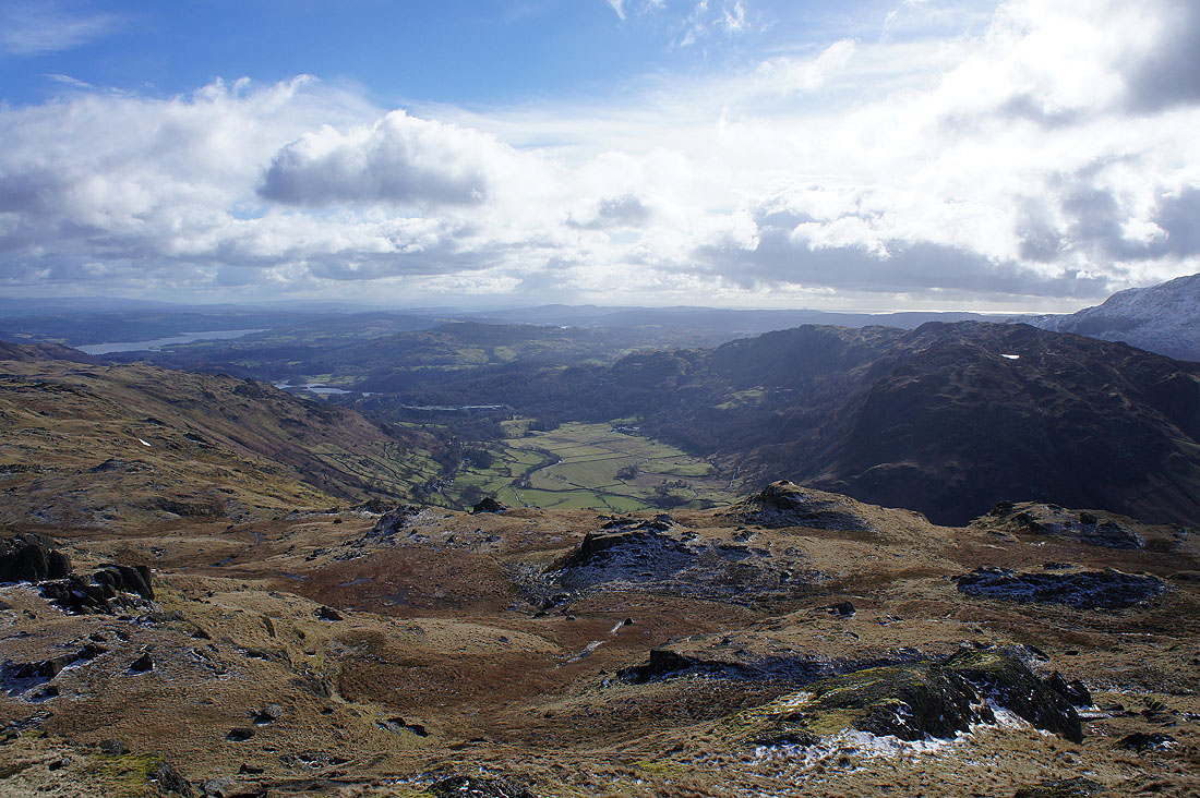
Great Langdale below with Lingmoor Fell on the right
A wintry shower moves away as I reach Little Castle How. Fortunately I was only caught by its edge and it didn't last long.
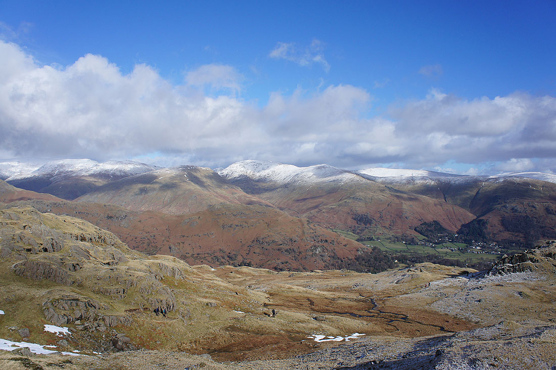
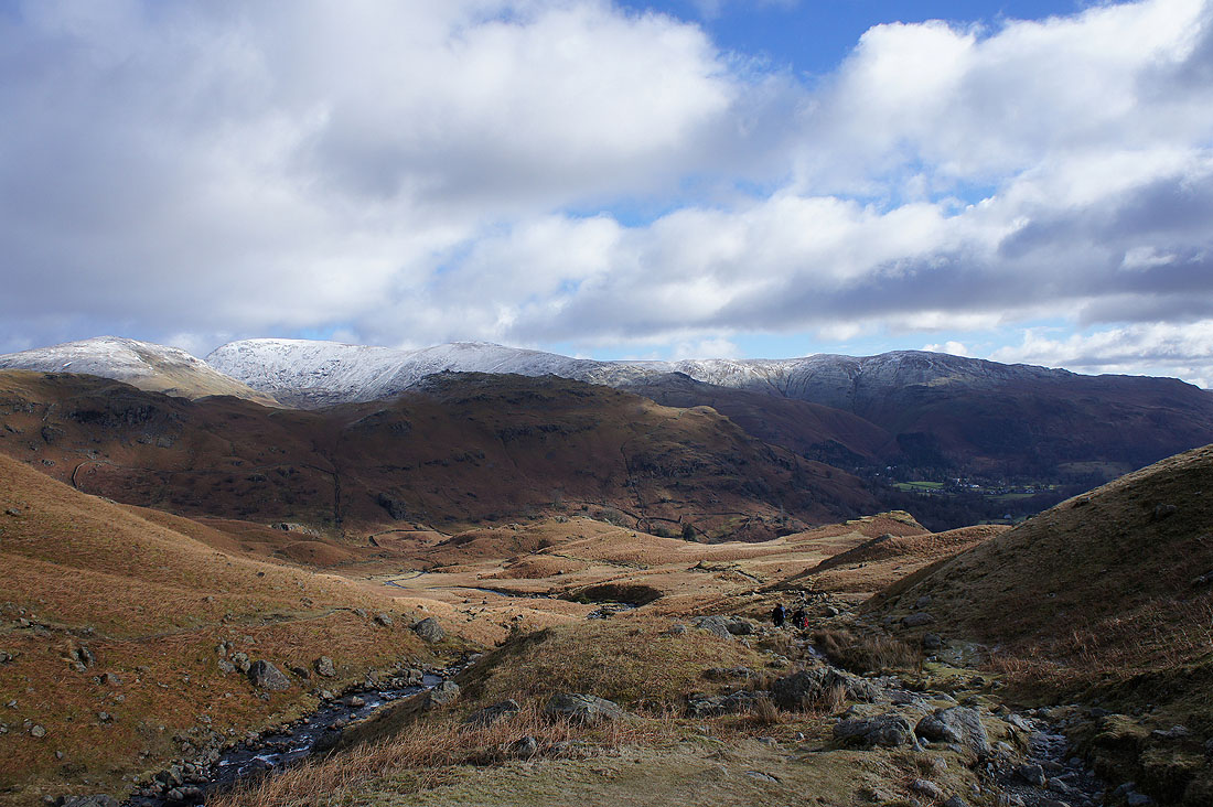
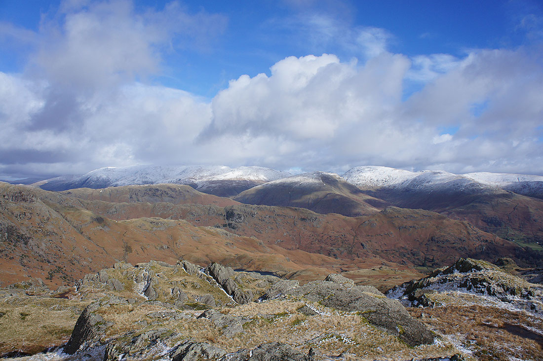
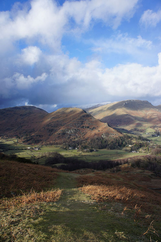
Helvellyn, Seat Sandal, Fairfield, Helm Crag and Grasmere with the boggy depression of Blindtarn Moss below
I can see Rydal Water and Wansfell Pike in the distance across the northern slopes of the ridge
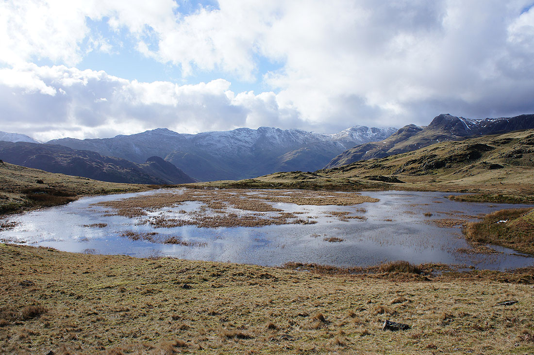
Past Swinescar Hause and I thought this unnamed tarn made a nice foreground for Pike o'Blisco, Crinkle Crags, Bowfell and the Langdale Pikes
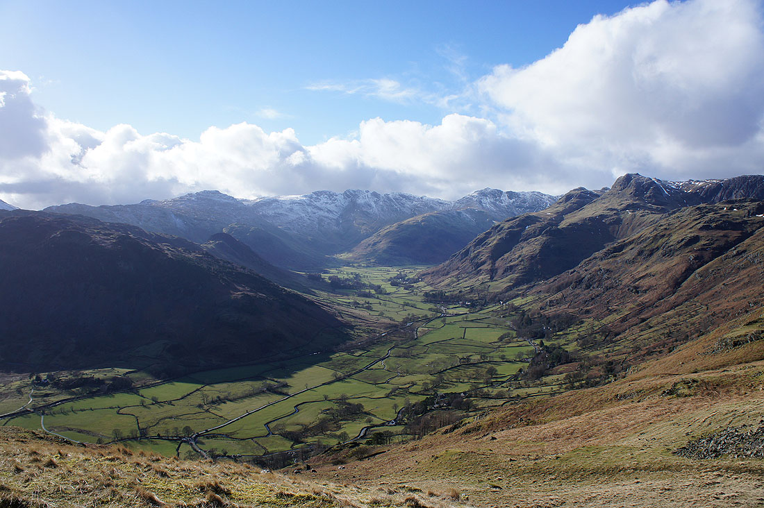
I paid the south side of the ridge a numbers of visits to take photos of the view up Great Langdale and this was my favourite. From what I can see in the valley below I think I'm at the top of the slope to the east of Robin Gill.
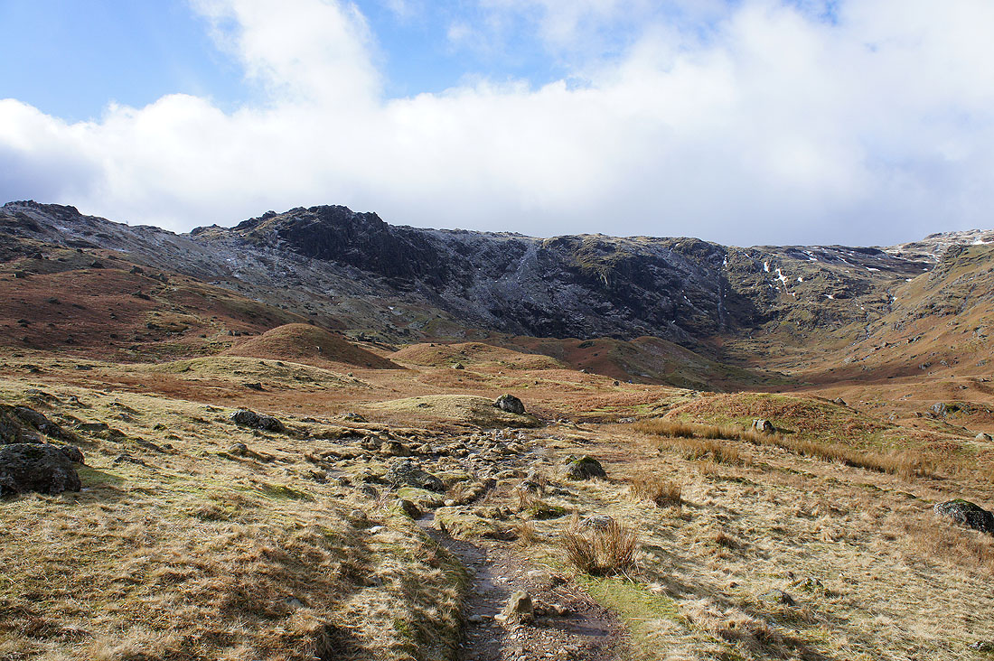
You can't really make it out but the top of Silver How is just over there
One last detour before I reach it. Loughrigg Fell, Spedding Crag, the ravine of Megs Gill, Windermere and Elter Water.
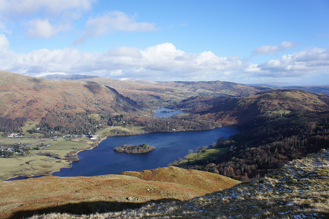
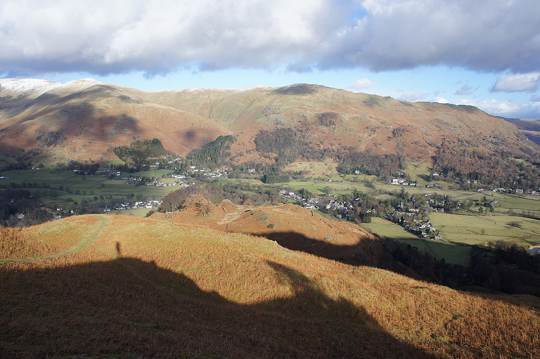
My arrival on Silver How is rewarded with a great view of Grasmere and Rydal Water
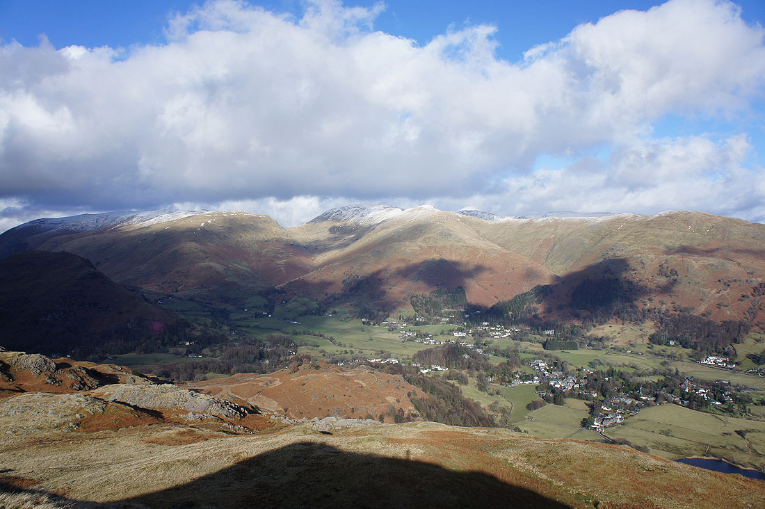
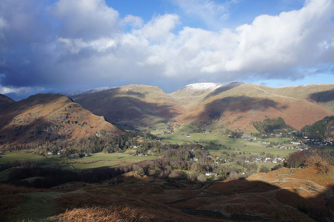
Helvellyn, Seat Sandal, Fairfield and the Vale of Grasmere
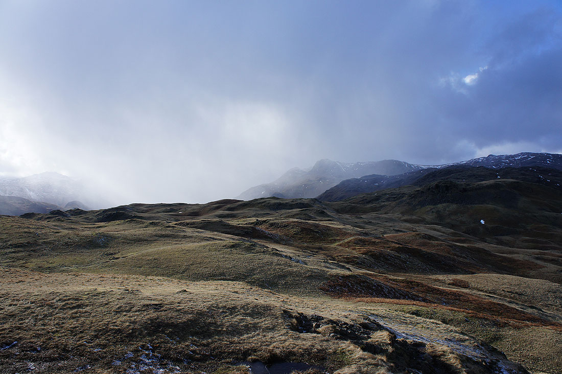
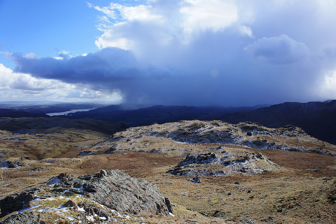
A shower approaches from the Langdale Pikes
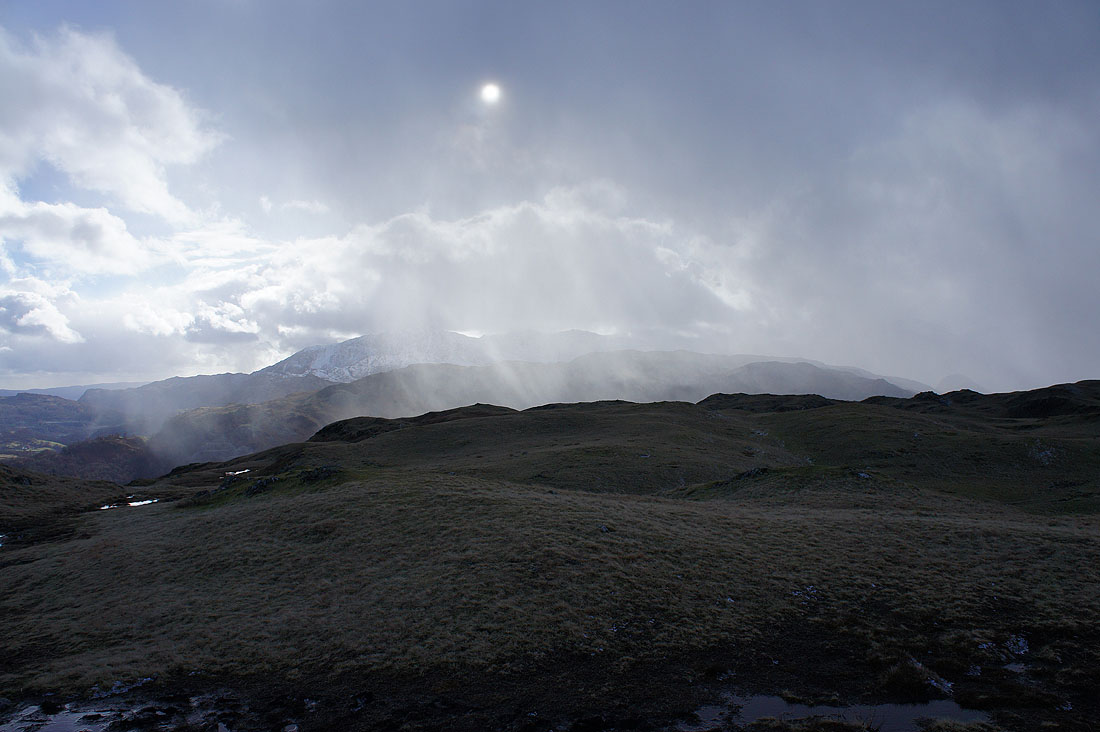
and sweeps by to the south..
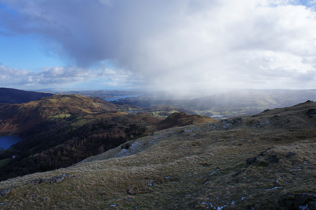
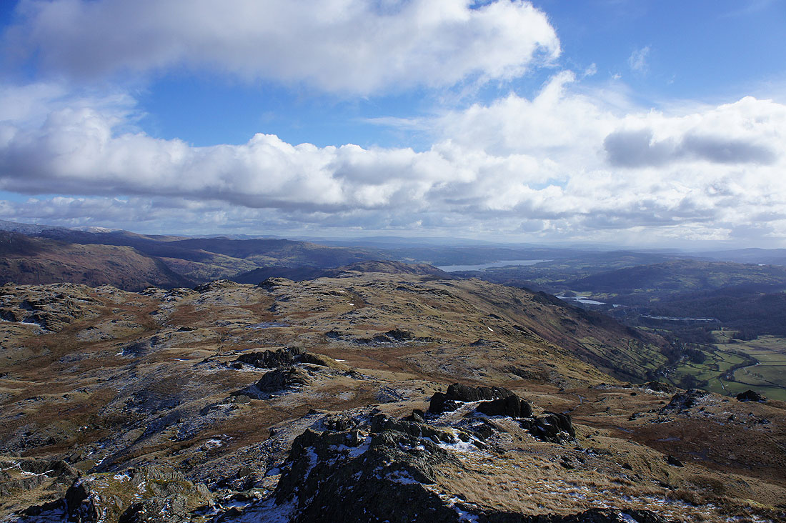
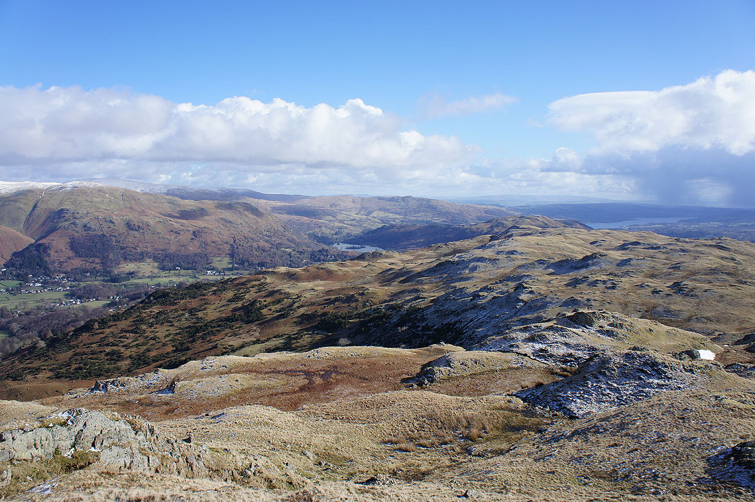
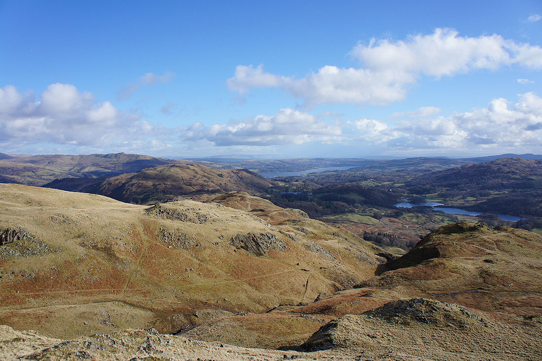
Once it's gone there's a clear view from the summit to Loughrigg Fell, Windermere and Black Fell
Grasmere the village and..
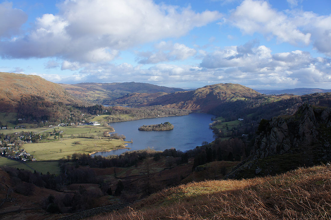
..Grasmere the lake as I follow the path across Wray Gill and down to Allan Bank
Helm Crag stands proud on the other side of Easedale
A sunlit Vale of Grasmere
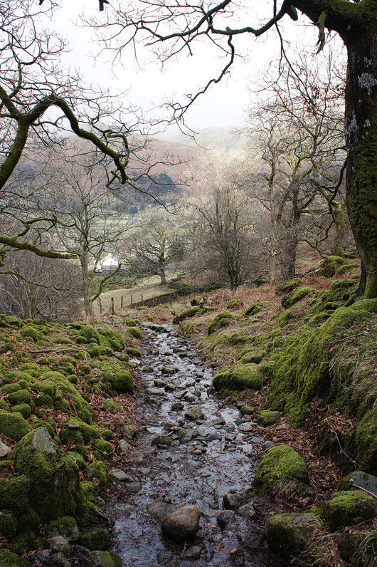
The path down is rough and stony in places
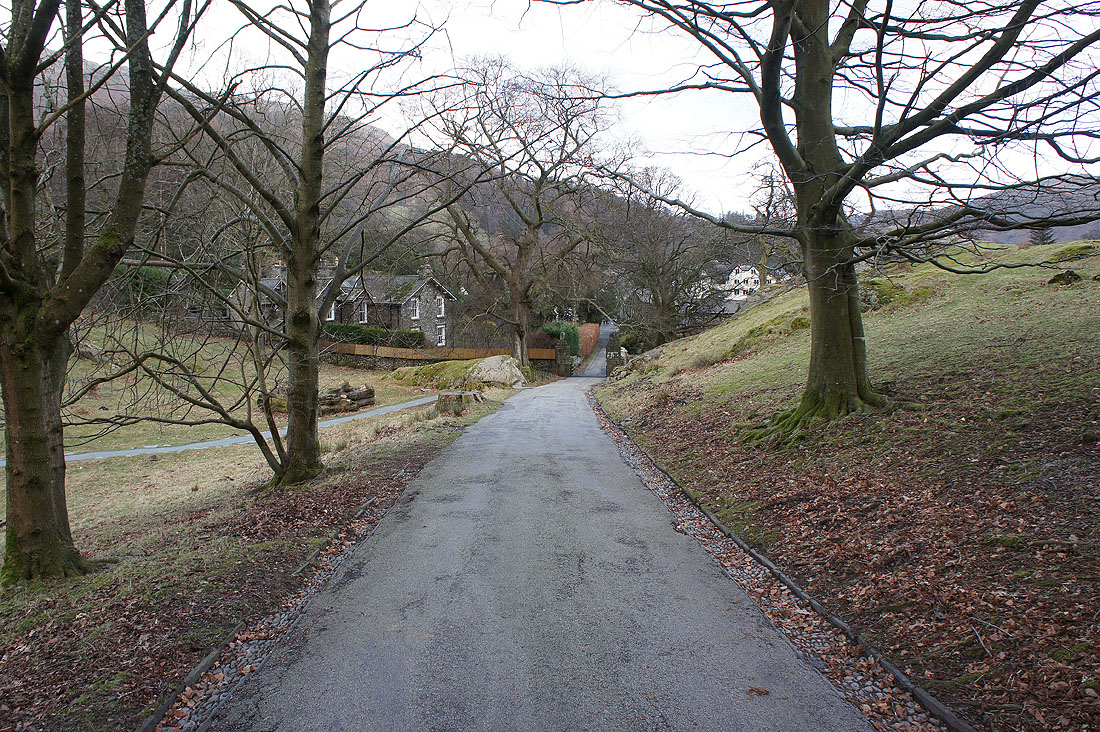
Grasmere ahead as I approach the exit of the Allan Bank estate