21st September 2023 - The Fairy Pools
Walk Details
Distance walked: 4.4 miles
Total ascent: 1091 ft
OS map used: 411 - Skye, Cuillin Hills
Time taken: 2 hrs
Route description: Glenbrittle Forest car park-Glen Brittle road-Fairy Pools-Glen Brittle road-Glenbrittle Forest car park
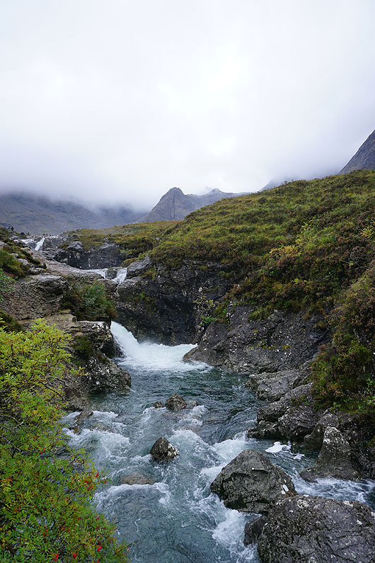
My final day on the Isle of Skye, as I make the long drive back south tomorrow. There's another day of changeable weather forecast, with hopefully a slow improvement from the west, although any sunshine will be limited, there'll be drizzly showers, and the cloud will cover the tops of the hills. It was a bit of struggle trying to decide where to go. In the end I went to Glen Brittle in Minginish with two routes in mind, the first being a tour of Glen Brittle Forest, and the second being a visit to the Fairy Pools. With no real sign of the weather getting any better when I arrived there I went for the latter. It was an enjoyable walk with lots waterfalls and pools by the path as it makes it way up towards the corries below The Cuillin.
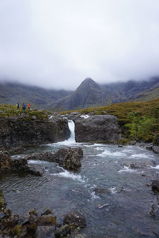
From the Glenbrittle Forest car park I walked down the Glen Brittle road, then took the path down into Coire na Creiche, and up along Allt Coir' a' Mhadaidh to visit the Fairy Pools. When I reached the cairn at the top of the path below the entrance to Coir' a' Tairneilar I turned around and retraced my steps back to the car park.
Total ascent: 1091 ft
OS map used: 411 - Skye, Cuillin Hills
Time taken: 2 hrs
Route description: Glenbrittle Forest car park-Glen Brittle road-Fairy Pools-Glen Brittle road-Glenbrittle Forest car park
My final day on the Isle of Skye, as I make the long drive back south tomorrow. There's another day of changeable weather forecast, with hopefully a slow improvement from the west, although any sunshine will be limited, there'll be drizzly showers, and the cloud will cover the tops of the hills. It was a bit of struggle trying to decide where to go. In the end I went to Glen Brittle in Minginish with two routes in mind, the first being a tour of Glen Brittle Forest, and the second being a visit to the Fairy Pools. With no real sign of the weather getting any better when I arrived there I went for the latter. It was an enjoyable walk with lots waterfalls and pools by the path as it makes it way up towards the corries below The Cuillin.
From the Glenbrittle Forest car park I walked down the Glen Brittle road, then took the path down into Coire na Creiche, and up along Allt Coir' a' Mhadaidh to visit the Fairy Pools. When I reached the cairn at the top of the path below the entrance to Coir' a' Tairneilar I turned around and retraced my steps back to the car park.
Route map
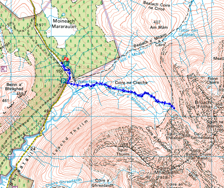
© Crown copyright. All rights reserved. License number PU 100034184.
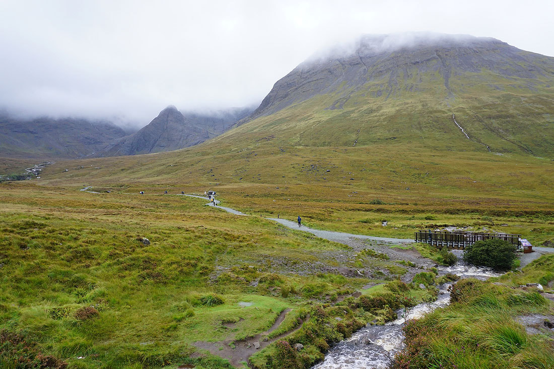
Heading down to the path into Coire na Creiche. The mountain on the right which forms its southern wall is Sgurr Thuilm.

The hills on the other side of Glen Brittle as I reach Allt Coir' a' Mhadaidh

|
|
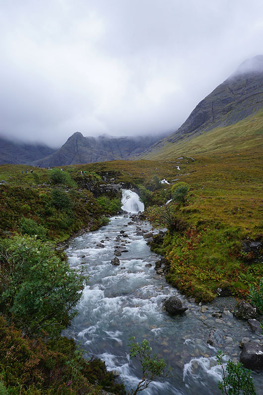
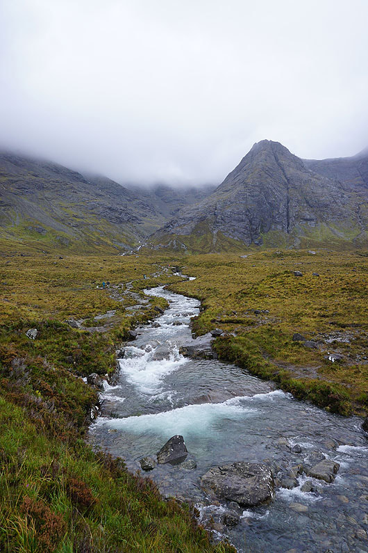
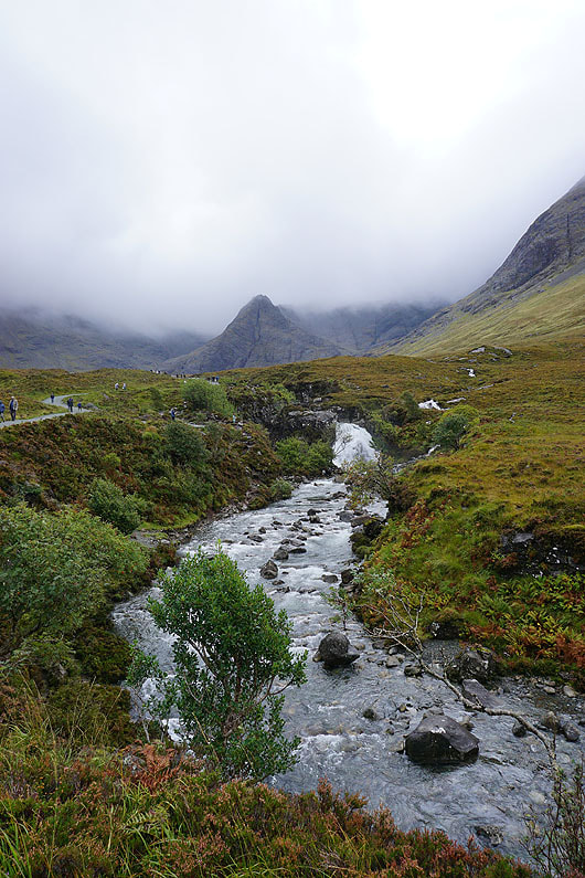
Following Allt Coir' a' Mhadaidh upstream and I reach the Fairy Pools....
|
|

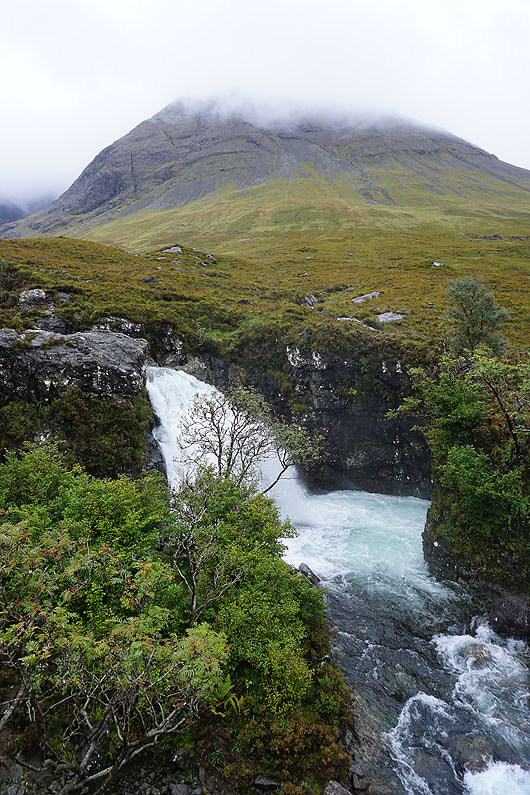
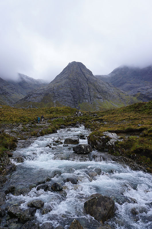
The peak in the middle of the photo is Sgurr an Fheadain..
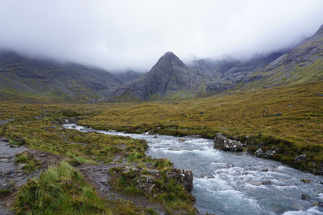
Making my way upstream. To the left of Sgurr an Fheadain is Coire na Creiche, and to its right is Coire a' Mhadaidh.
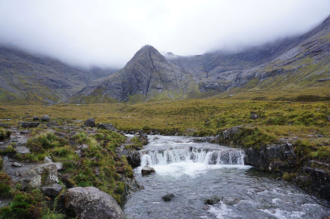
That vertical slash down Sgurr an Fheadain is called Waterpipe Gully
|
|
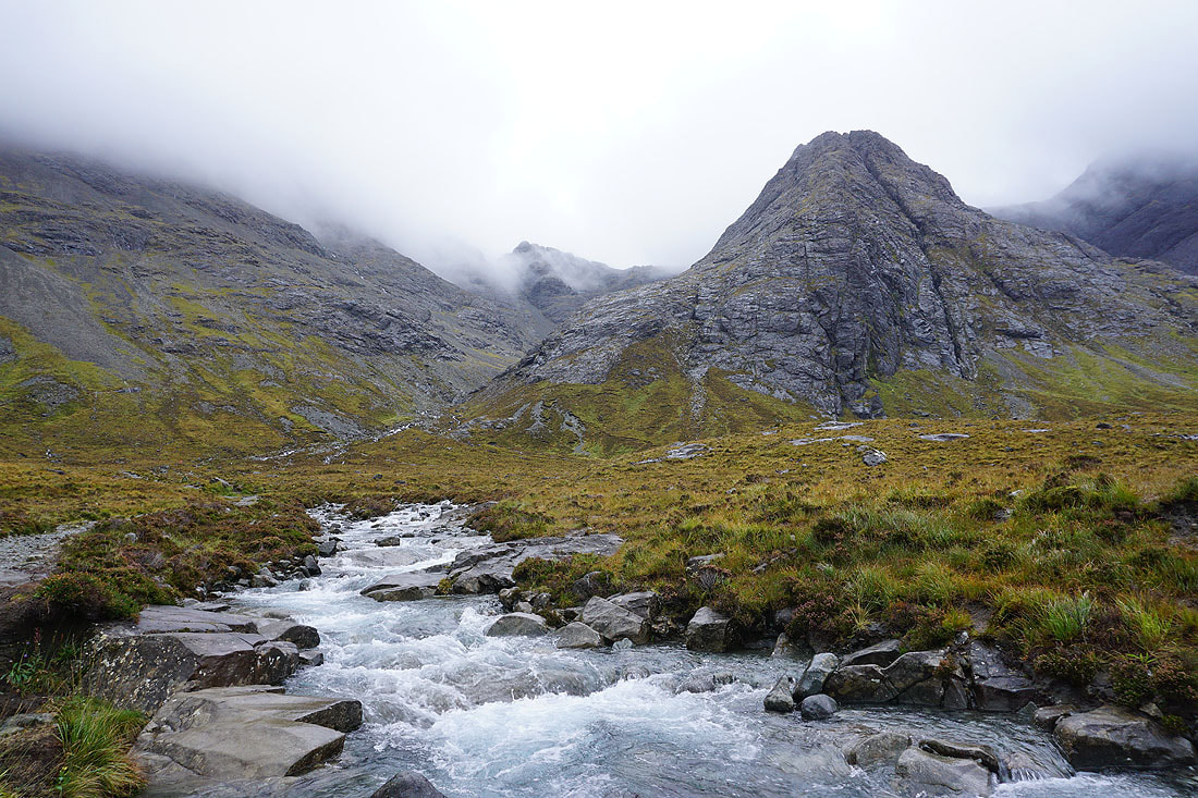
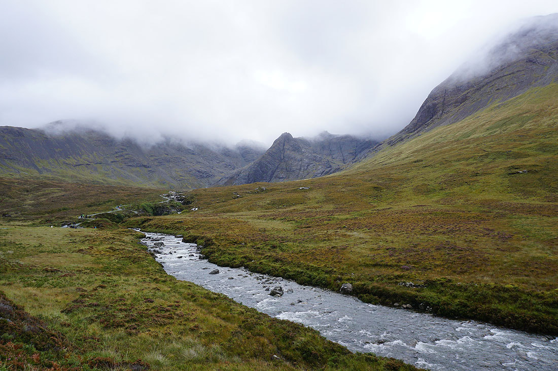
Further upstream and Allt Coir' a' Mhadaidh becomes Allt Coir' a' Tairneilar..

I think the peak with its top in cloud is Sgurr a' Mhadaidh
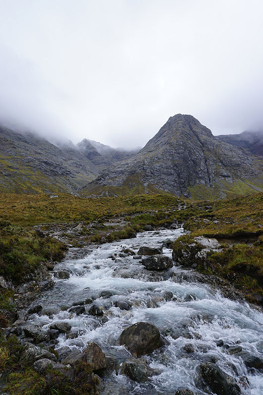
I've more or less reached the top of the path here, and round the side of Sgurr an Fheadain I get a glimpse into Coir' a' Tairneilar...

|
|

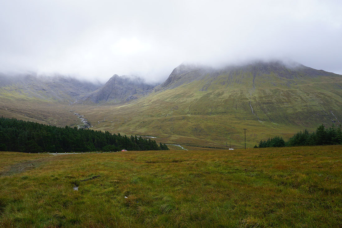
Making my way back down with Beinn a' Bhraghad on the other side of Glen Brittle

|
|
A few photos looking back as I make my way back down to the road...
Coire na Creiche, Sgurr an Fheadain, and Sgurr Thuilm as I walk up the road to the car park
21st September 2023 - Oronsay
Walk Details
Distance walked: 5.4 miles
Total ascent: 688 ft
OS map used: 410 - Skye, Portree & Bracadale
Time taken: 2 hrs
Route description: Layby on A863-Ullinish-Ullinish Point-Oronsay-Ullinish Point-Ullinish-Layby on A863
When I went to Glen Brittle earlier today I knew that if did the Fairy Pools walk I'd have the second half of the afternoon to do another short one. I picked out a visit to the tidal island of Oronsay, it being a short drive west along the A863 after returning to it from Glen Brittle. I'd already checked when low tide was going to be, 1630, so I knew that I'd be able to get onto Oronsay and that I wouldn't have a wasted trip. It was a great walk with wonderful views of the coast and islands of Loch Bracadale. I did try to park at the end of the road at Ullinish, but found that the few spaces there are to be already taken.
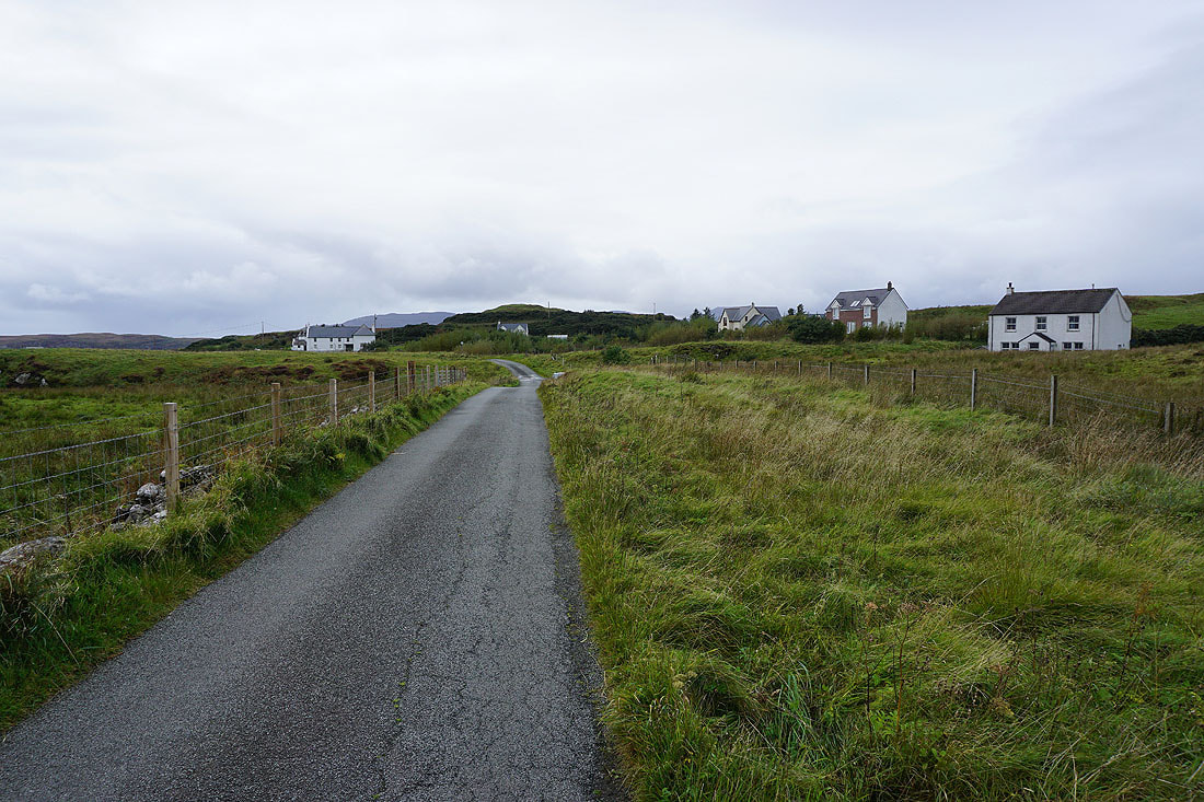
After parking my car in the car park by the A863 next to the turn off for the road to Ullinish, I walked down the road to Ullinish, then turned left and walked down the lane signposted "Oronsay Path". I followed this all the way down to its end, turning left at the last fork in the road, where there are a few parking spaces and the path to Oronsay leaves the track to a cottage. I then followed this path south to Ullinish Point, and crossed the tidal causeway onto Oronsay. After taking in the views from Oronsay I retraced my steps back to the car park by the A863.
Total ascent: 688 ft
OS map used: 410 - Skye, Portree & Bracadale
Time taken: 2 hrs
Route description: Layby on A863-Ullinish-Ullinish Point-Oronsay-Ullinish Point-Ullinish-Layby on A863
When I went to Glen Brittle earlier today I knew that if did the Fairy Pools walk I'd have the second half of the afternoon to do another short one. I picked out a visit to the tidal island of Oronsay, it being a short drive west along the A863 after returning to it from Glen Brittle. I'd already checked when low tide was going to be, 1630, so I knew that I'd be able to get onto Oronsay and that I wouldn't have a wasted trip. It was a great walk with wonderful views of the coast and islands of Loch Bracadale. I did try to park at the end of the road at Ullinish, but found that the few spaces there are to be already taken.
After parking my car in the car park by the A863 next to the turn off for the road to Ullinish, I walked down the road to Ullinish, then turned left and walked down the lane signposted "Oronsay Path". I followed this all the way down to its end, turning left at the last fork in the road, where there are a few parking spaces and the path to Oronsay leaves the track to a cottage. I then followed this path south to Ullinish Point, and crossed the tidal causeway onto Oronsay. After taking in the views from Oronsay I retraced my steps back to the car park by the A863.
Route map
© Crown copyright. All rights reserved. License number PU 100034184.

Walking down the road to Ullinish..
Looking across to Ardtreck Point and Portnalong at the entrance to Loch Harport
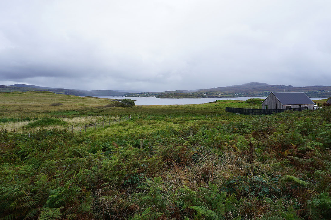
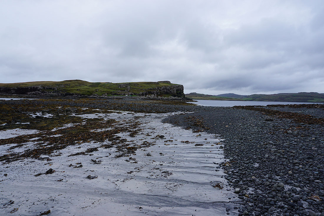
The path crosses wet ground to reach Ullinish Point
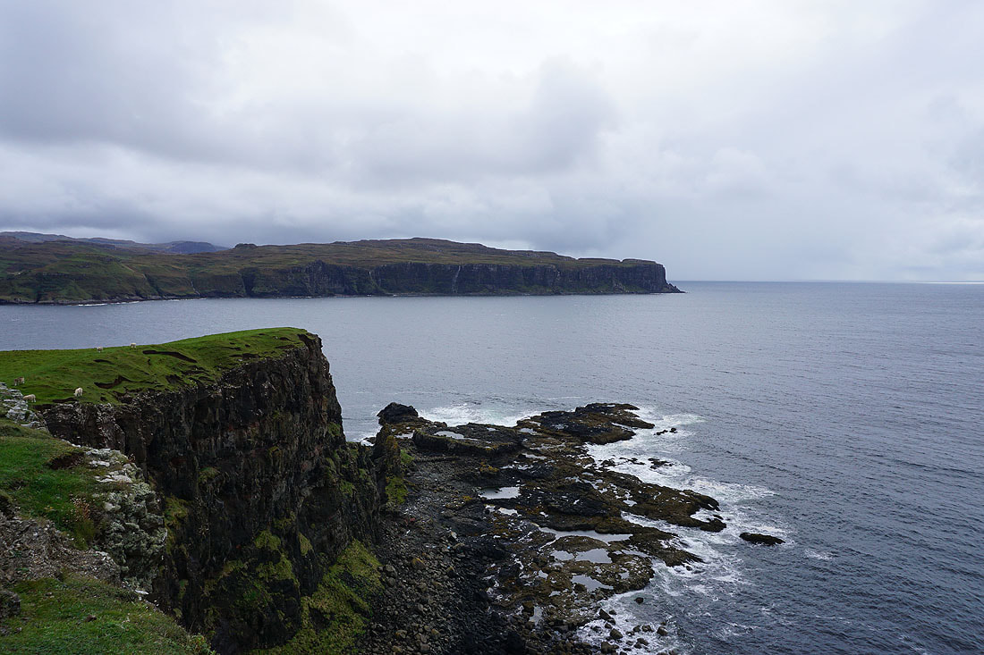
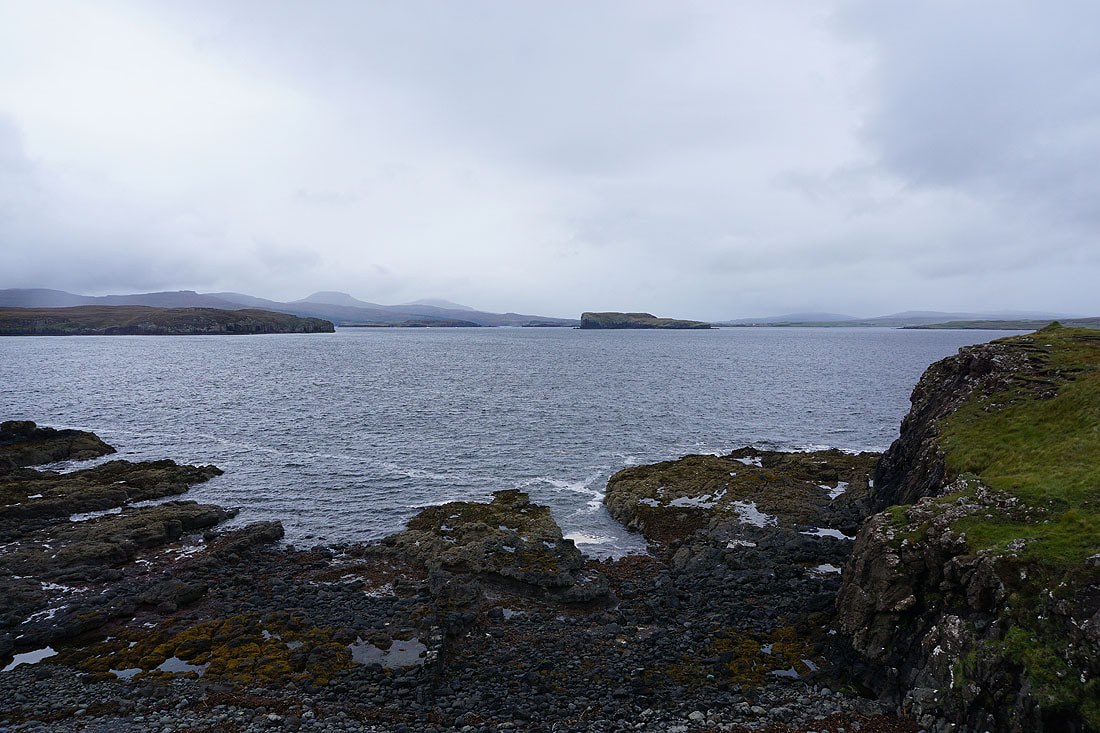
Looking across Loch Bracadale to Duirinish
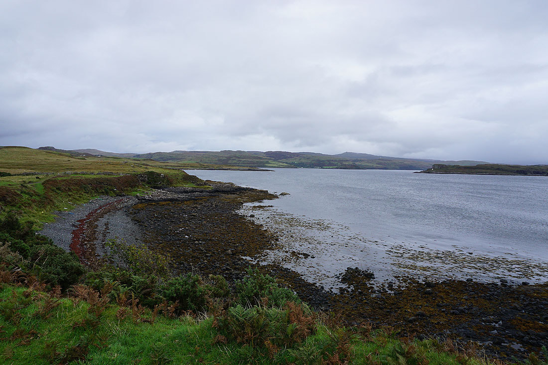
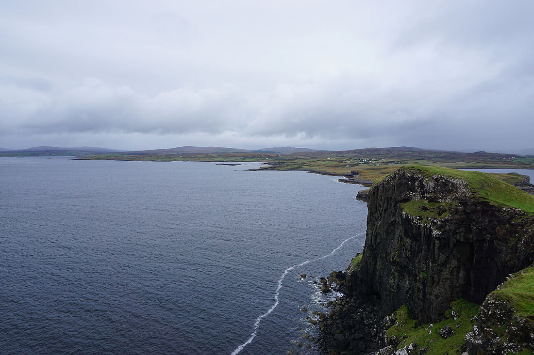
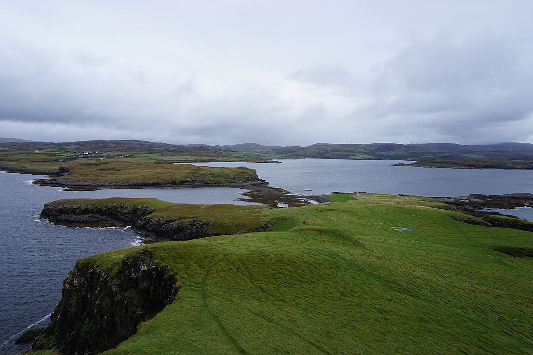
Above the eastern shore of Ullinish Point. Bracadale Point, Ardtreck Point, and Loch Harport to the east.

Looking back to Ullinish

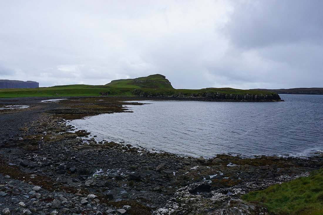
From Ullinish Point I make my way down to cross the causeway to Oronsay..
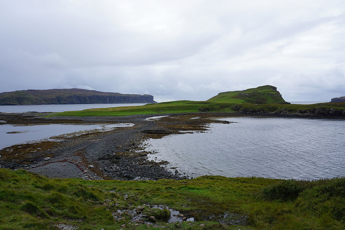
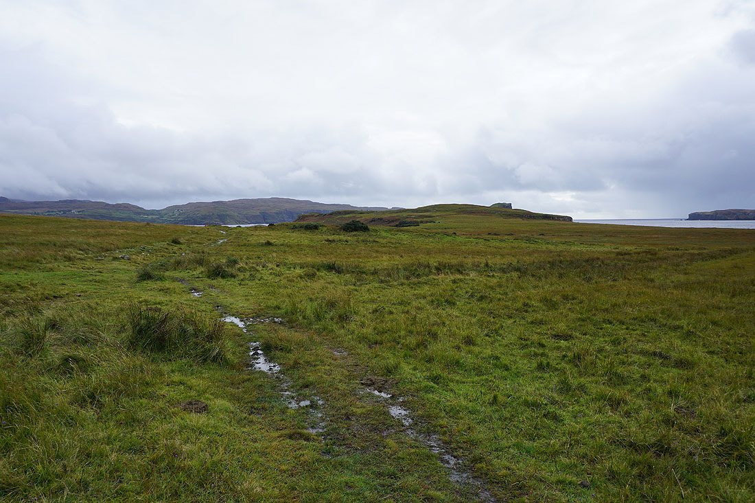
Crossing the causeway to Oronsay..

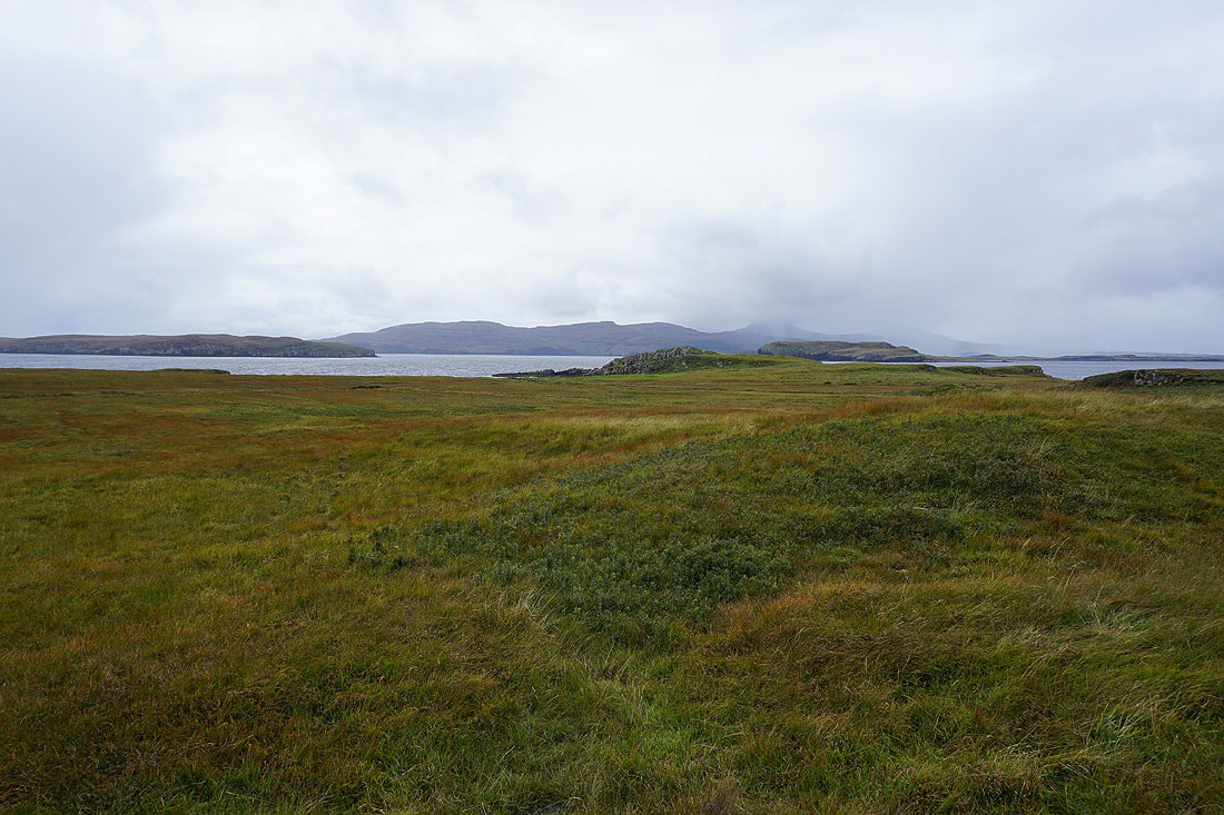
Looking back to Ullinish Point from Oronsay

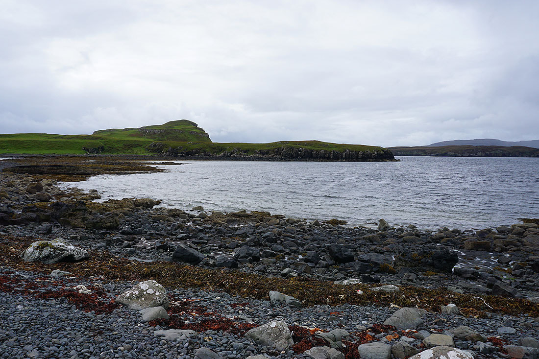
At the southern end of Oronsay. Looking west across Loch Bracadale and the southern half of the island of Wiay to Idrigill Point on Duirinish.
Beinn nan Dubh-lochan and the headland of Rubha nan Clach on Minginish to the south
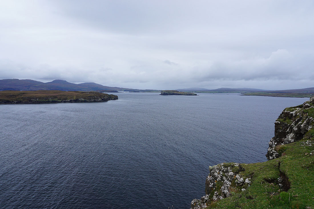
Loch Bracadale, Wiay, and Tarner Island
Looking east to Ardtreck Point and Fiskavaig
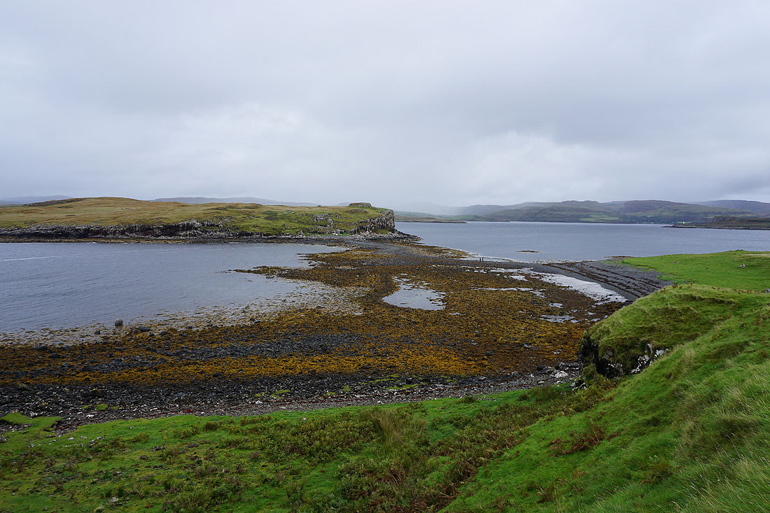
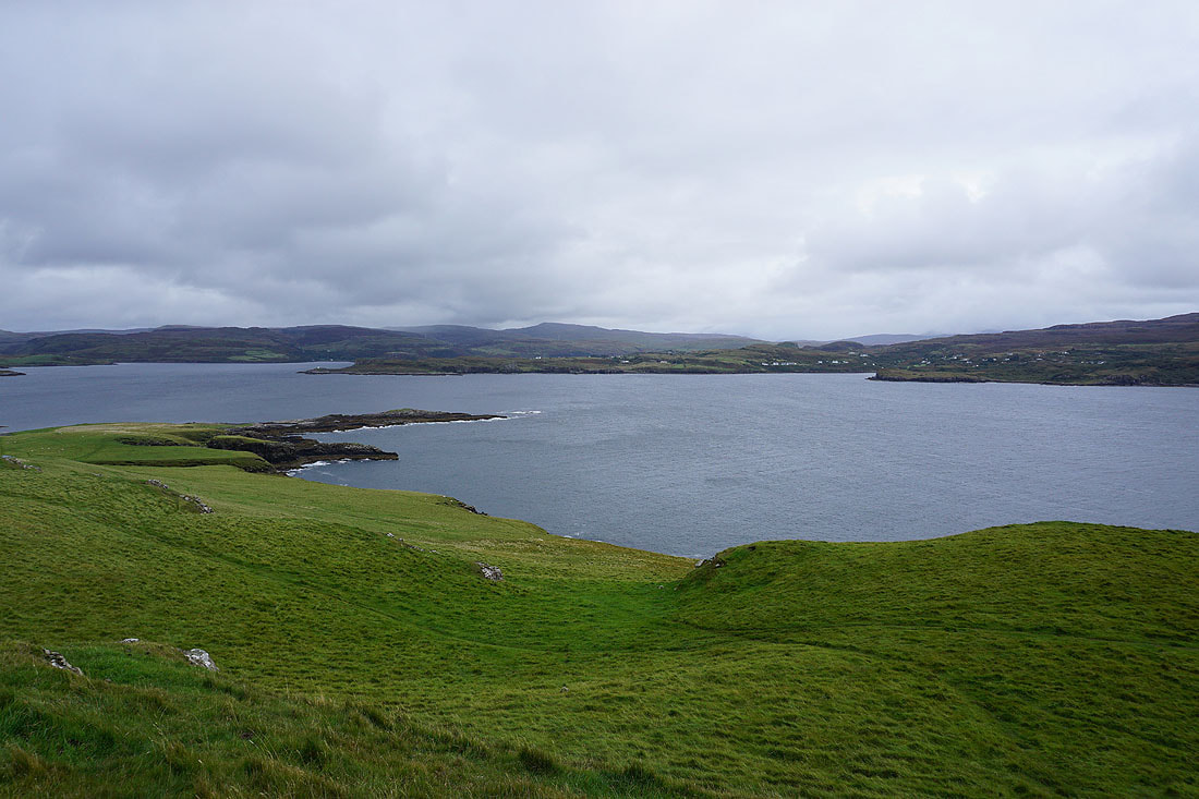
Eabost and Ullinish to the north
Along with Ullinish Point, Bracadale Point, the entrance to Loch Harport, and Ardtreck Point
Back to the northern end of Oronsay. Looking west across Loch Bracadale to the flat-topped hills of Macleod's Tables on Duirinish, Harlosh Island, and Tarner Island.
Crossing the causeway back to Ullinish Point
Looking back to Oronsay

Walking back up the road to the A863, and that's the end of my walking holiday on Skye.