25th June 2018 - Hard Knott
Walk Details
Distance walked: 6.1 miles
Total ascent: 1776 ft
OS map used: OL6 - The English Lakes, Southwestern area
Time taken: 4.5 hrs
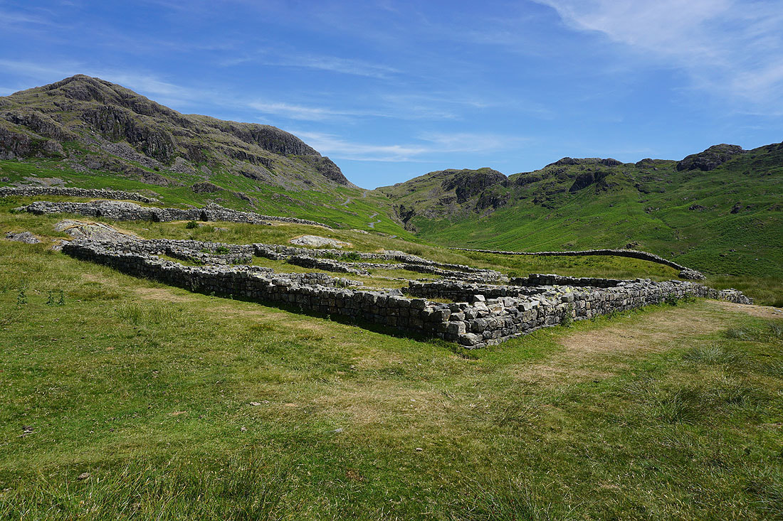
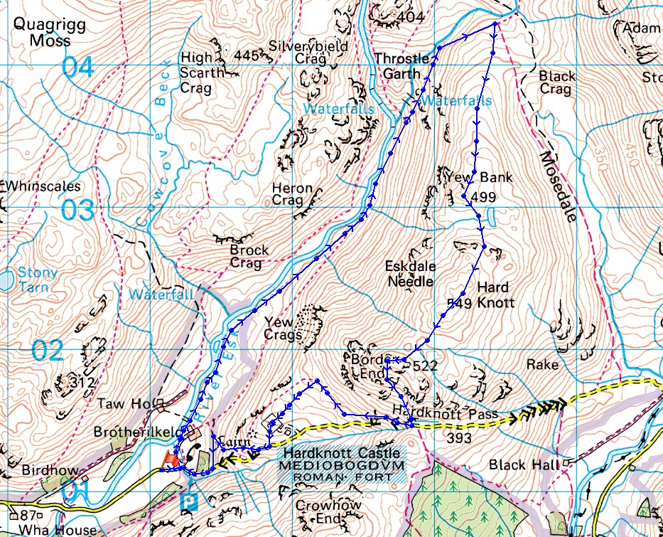
Route description: Roadside near Brotherilkeld Farm, Eskdale-Lingcove Bridge-Lingcove Beck-Hard Knott-Border End-Hardknott Pass-Mediobogdvm (Roman Fort)-Jubilee Bridge-Roadside near Brotherilkeld Farm, Eskdale
The final walk of my short break in the Lakes and also the shortest one. I planned to be heading back home by the middle of the afternoon so this route to the top of Hard Knott fit the bill. My only previous visit was in 2008, so this was another one ticked off for my second round of Wainwrights and it took the total to 127. Another hot and sunny day, the hottest so far, and I was glad that I hadn't gone for a longer or more strenuous route, I might well have ended up struggling with the heat. There was plenty of great scenery to enjoy with following the path by the River Esk to Lingcove Bridge and the views of the head of Eskdale from Hard Knott and Border End.
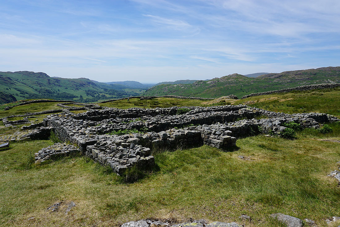
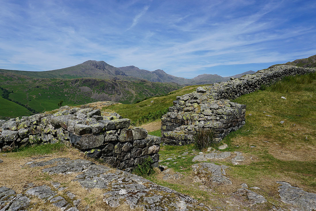
From where I parked on the grassy verge by the road near Brotherilkeld Farm I took the footpath towards Brotherilkeld Farm, round the farm and then up the valley by the River Esk to Lingcove Bridge. I didn't cross the bridge and carried on uphill on the path by Lingcove Beck to reach the grassy saddle at the northern end of Hard Knott. I then made my way south across Hard Knott to its summit cairn. After having lunch here I continued south to reach Border End. A pathless descent then took me down to the road at the Hardknott Pass. I had a brief walk west down the road until I reached the public footpath across the hillside to the Roman Fort. After exploring the fort I made my way out to the road, walked downhill a short distance and onto a public footpath towards Brotheilkeld Farm that took me down to the edge of access land by the road just uphill from Jubilee Bridge. A walk down the road took me back to where I was parked.
Total ascent: 1776 ft
OS map used: OL6 - The English Lakes, Southwestern area
Time taken: 4.5 hrs
Route description: Roadside near Brotherilkeld Farm, Eskdale-Lingcove Bridge-Lingcove Beck-Hard Knott-Border End-Hardknott Pass-Mediobogdvm (Roman Fort)-Jubilee Bridge-Roadside near Brotherilkeld Farm, Eskdale
The final walk of my short break in the Lakes and also the shortest one. I planned to be heading back home by the middle of the afternoon so this route to the top of Hard Knott fit the bill. My only previous visit was in 2008, so this was another one ticked off for my second round of Wainwrights and it took the total to 127. Another hot and sunny day, the hottest so far, and I was glad that I hadn't gone for a longer or more strenuous route, I might well have ended up struggling with the heat. There was plenty of great scenery to enjoy with following the path by the River Esk to Lingcove Bridge and the views of the head of Eskdale from Hard Knott and Border End.
From where I parked on the grassy verge by the road near Brotherilkeld Farm I took the footpath towards Brotherilkeld Farm, round the farm and then up the valley by the River Esk to Lingcove Bridge. I didn't cross the bridge and carried on uphill on the path by Lingcove Beck to reach the grassy saddle at the northern end of Hard Knott. I then made my way south across Hard Knott to its summit cairn. After having lunch here I continued south to reach Border End. A pathless descent then took me down to the road at the Hardknott Pass. I had a brief walk west down the road until I reached the public footpath across the hillside to the Roman Fort. After exploring the fort I made my way out to the road, walked downhill a short distance and onto a public footpath towards Brotheilkeld Farm that took me down to the edge of access land by the road just uphill from Jubilee Bridge. A walk down the road took me back to where I was parked.
Route map
© Crown copyright. All rights reserved. License number PU 100034184.
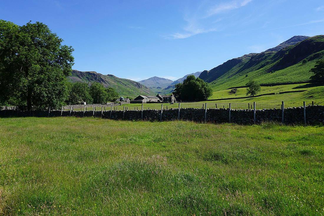
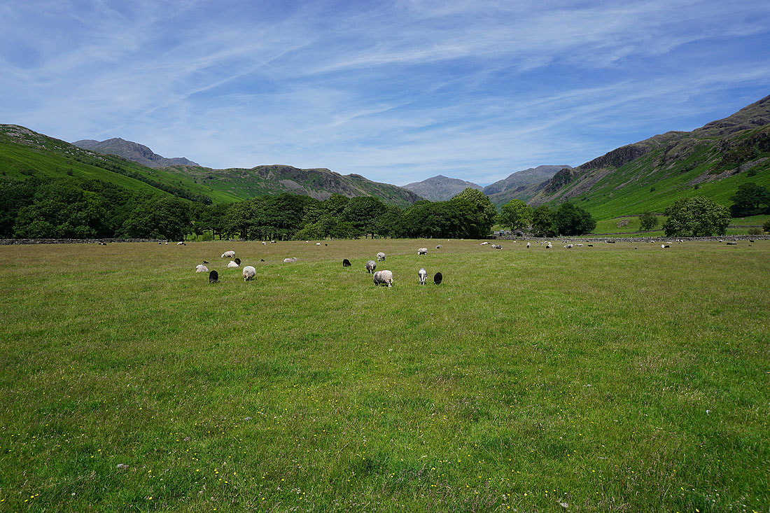
My last morning in the Lakes and I'm back where I started from on my first day, by the road at Brotherilkeld Farm looking up Eskdale to Bowfell
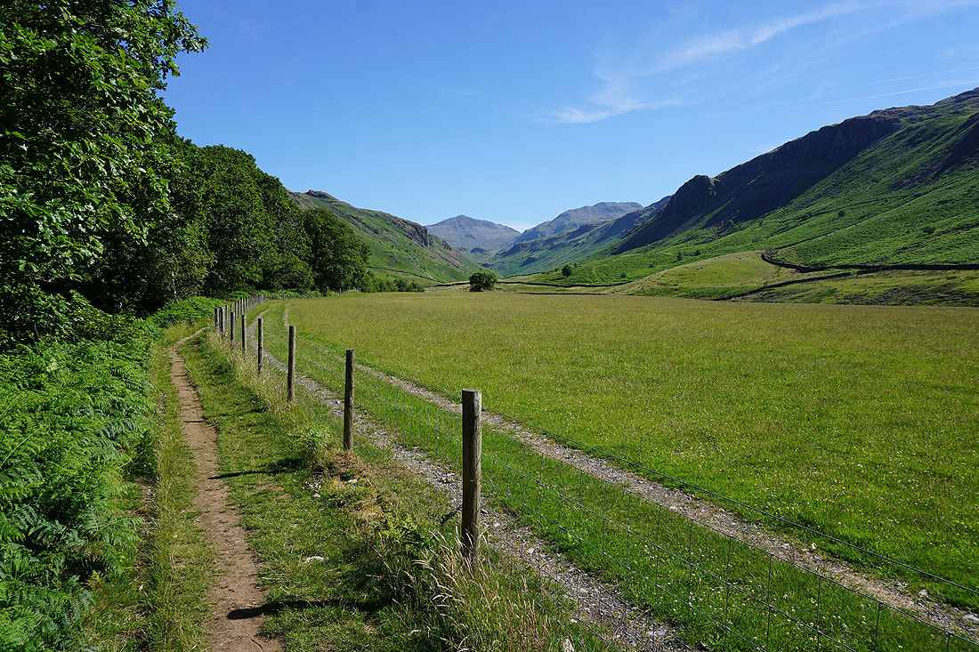
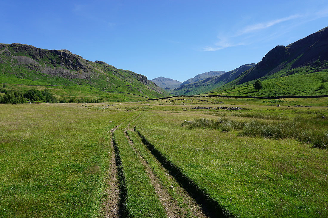
I've taken the path past Brotherilkeld Farm up Eskdale towards Lingcove Bridge..
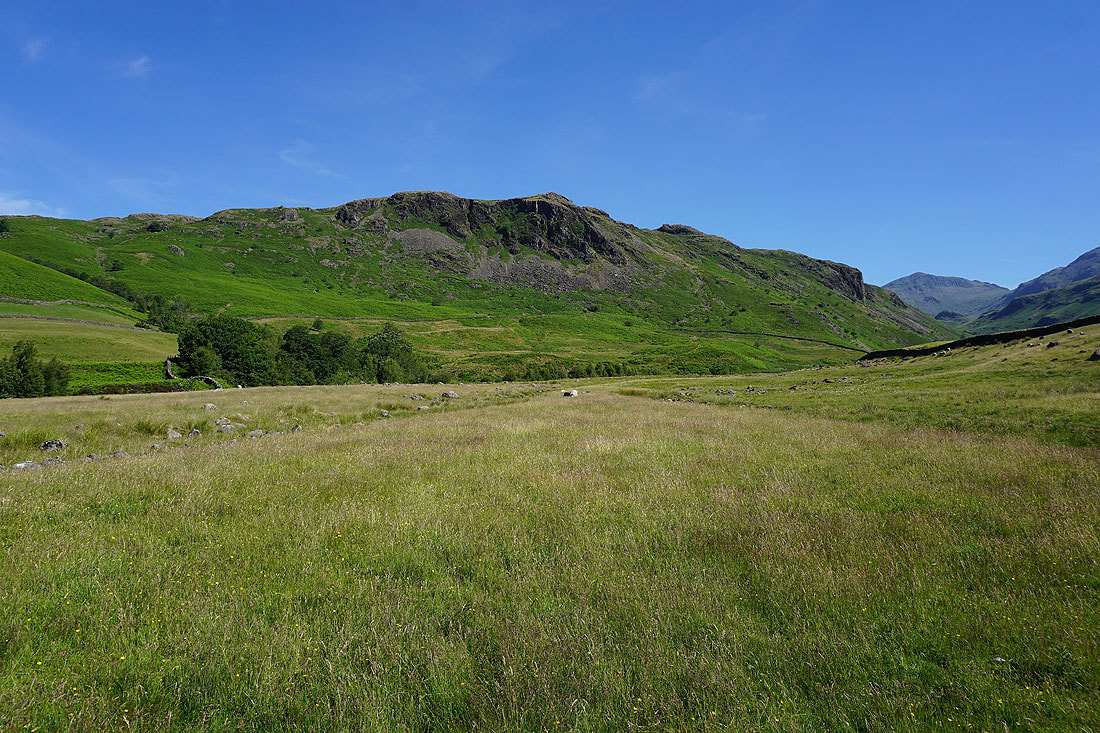
Brock Crag on the other side of the valley
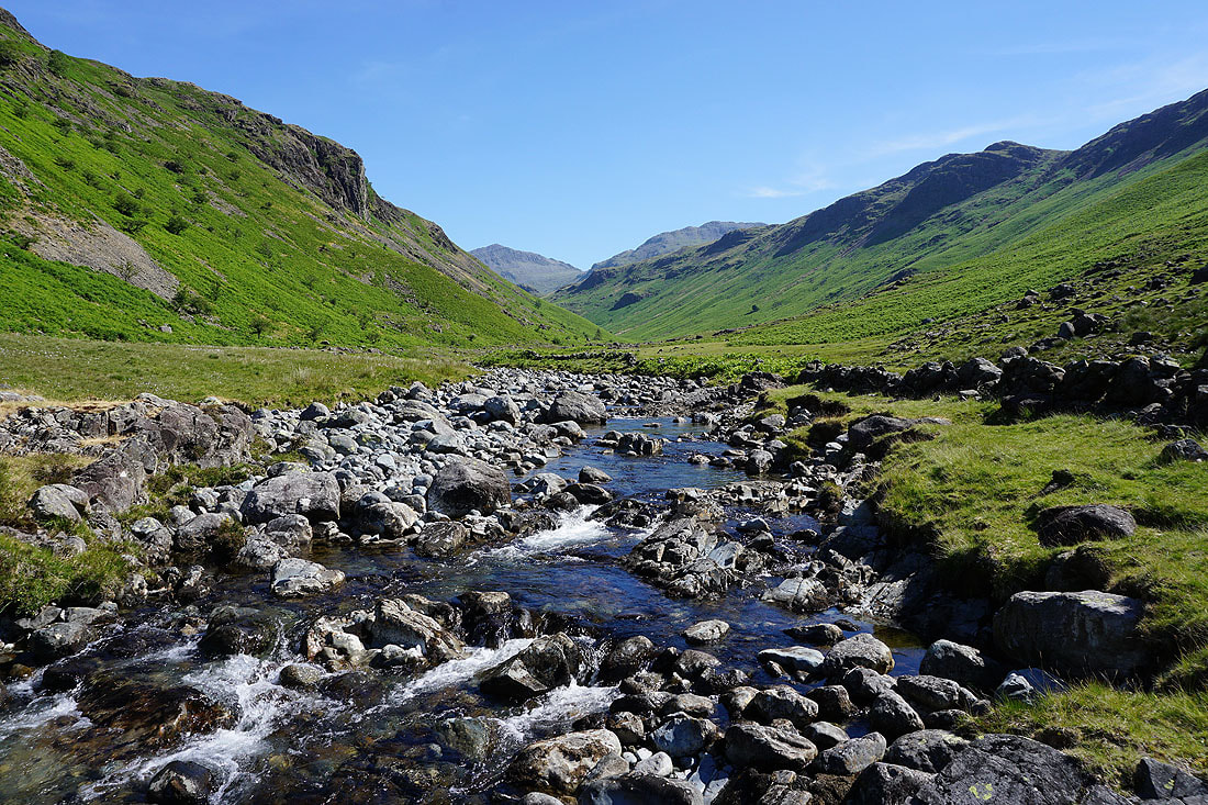
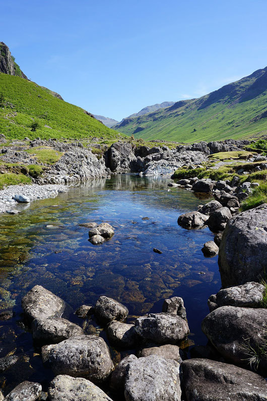
The path joins the River Esk and I'm treated to some great scenery with its crystal clear waters and waterfalls........
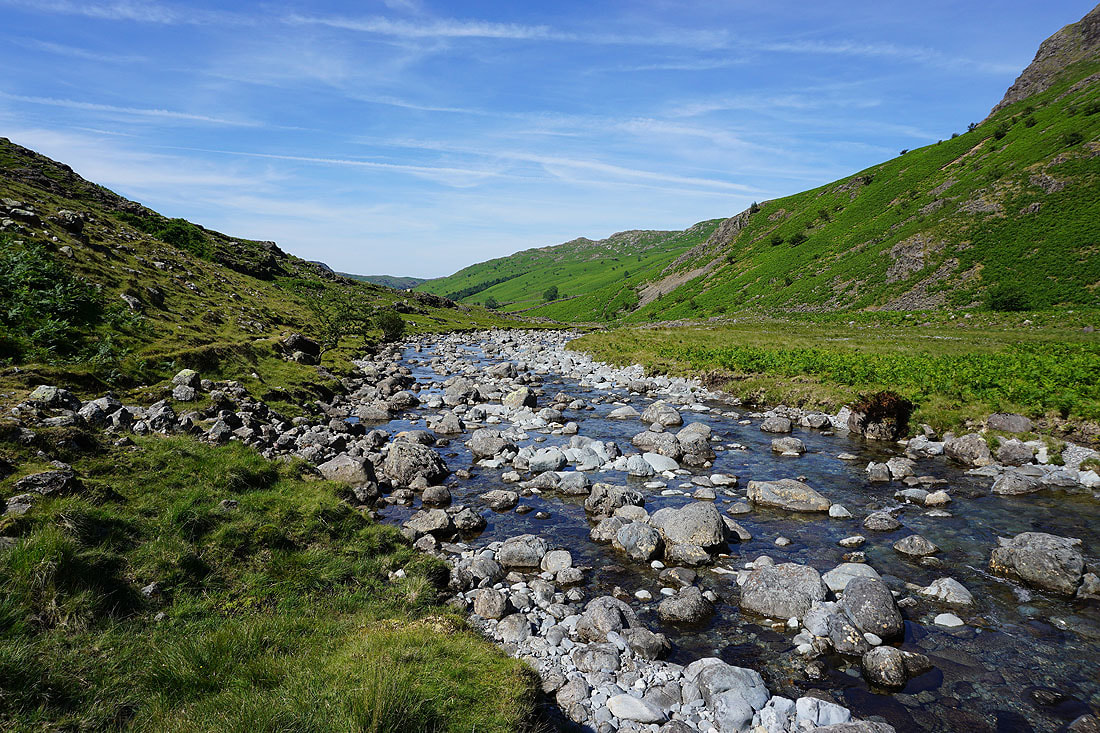
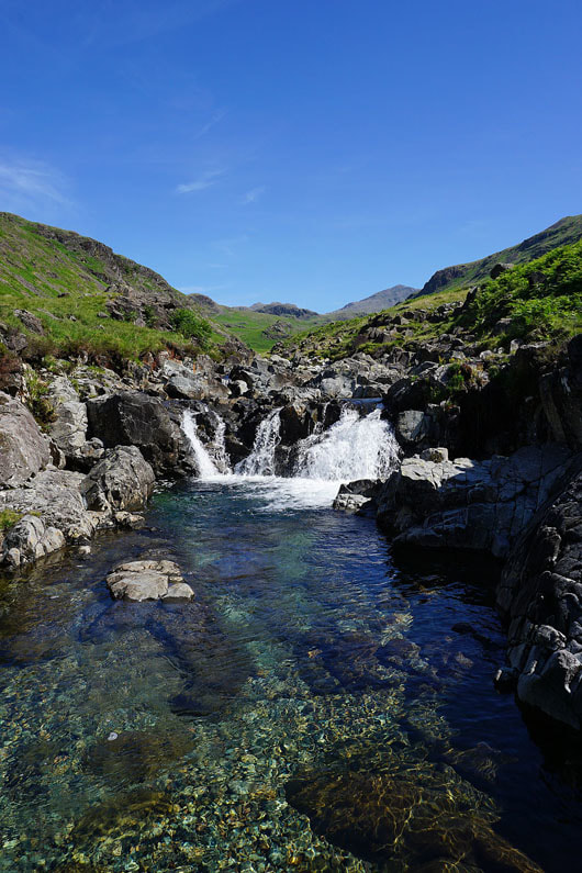
|
|
|
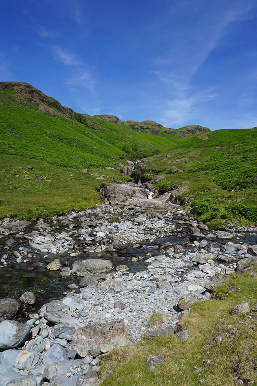
|
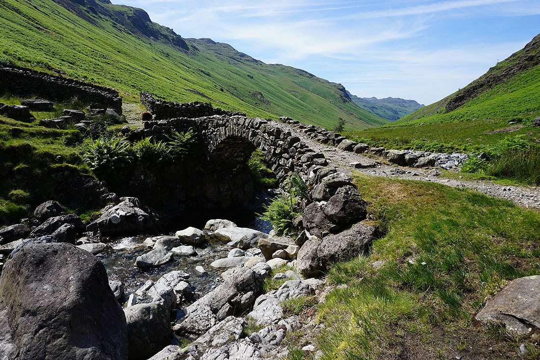
Lingcove Bridge. This is where I leave the River Esk behind.
|
|
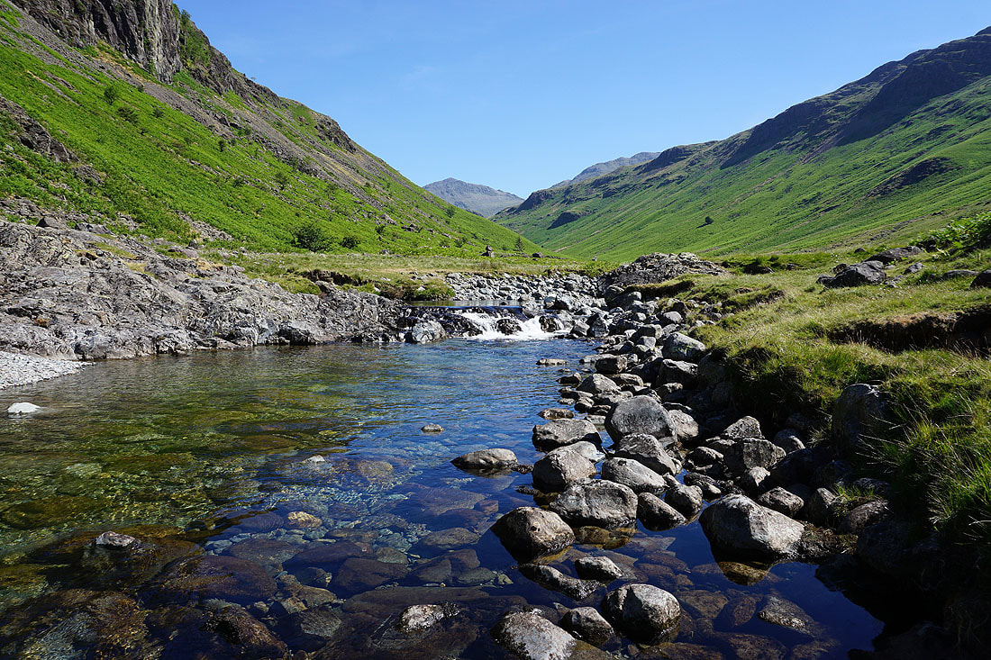
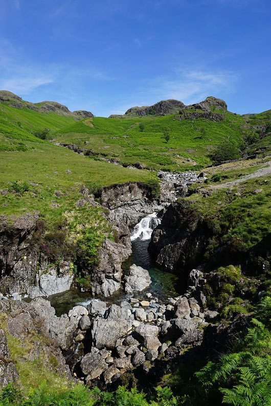
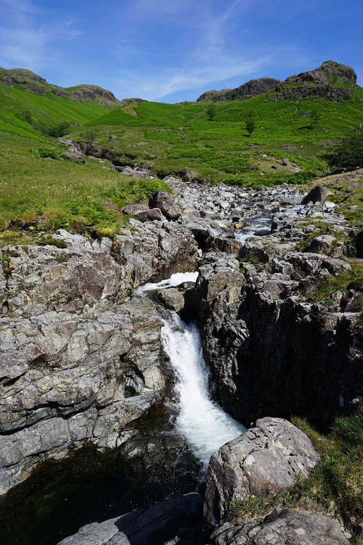
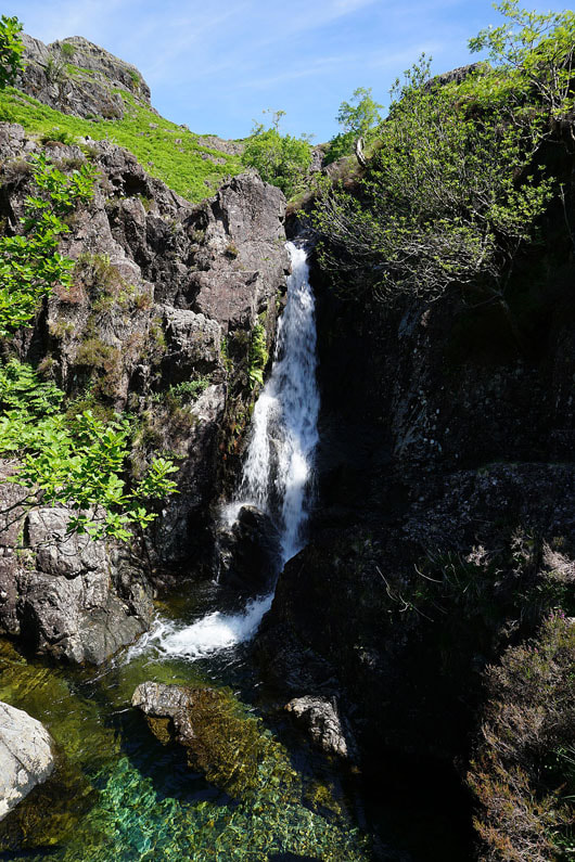
A waterfall on Lingcove Beck and Throstlehow Crag above the beck
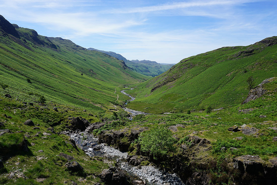
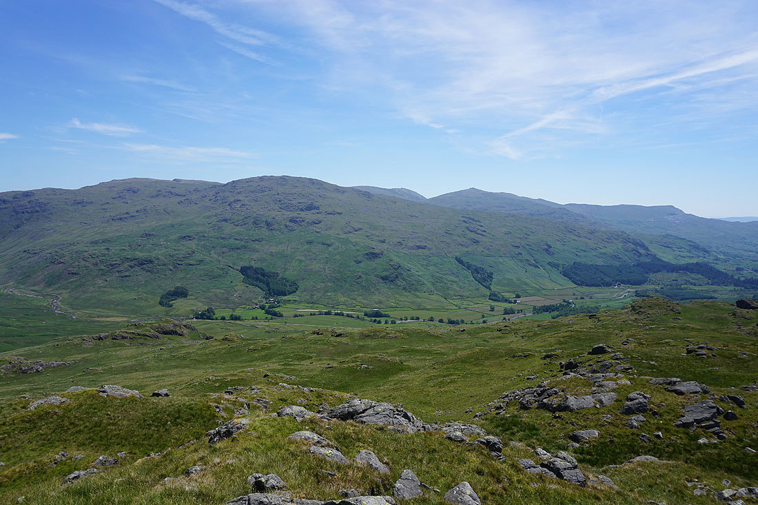
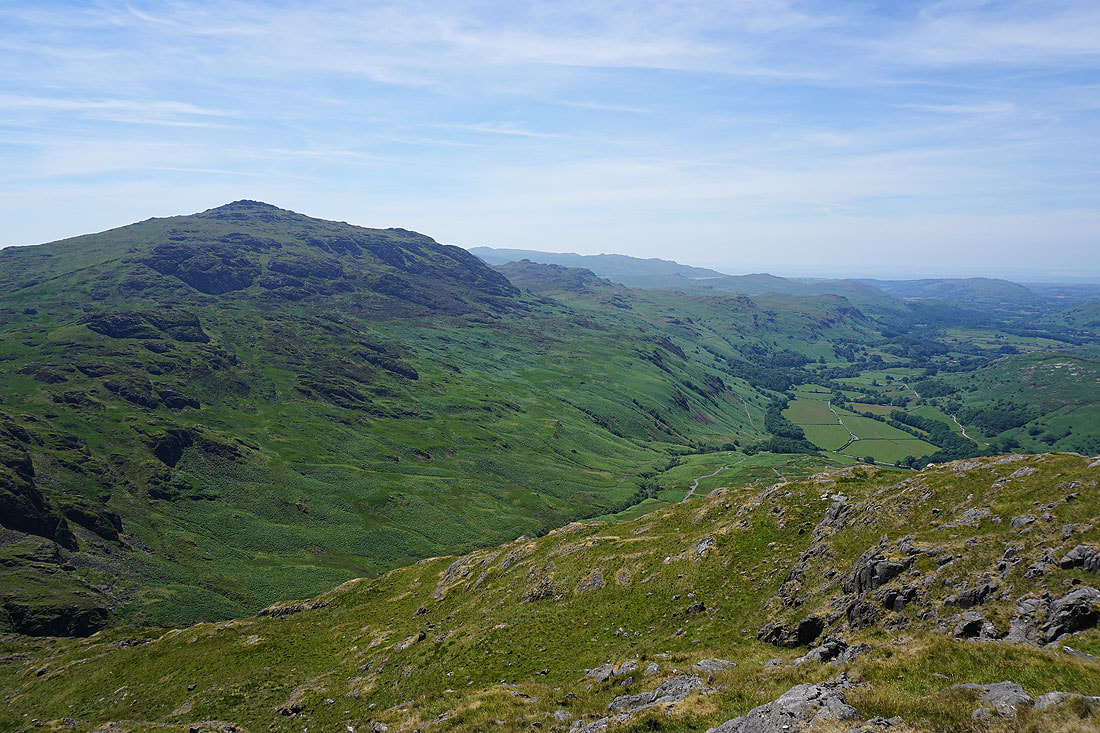
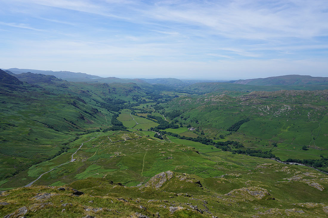
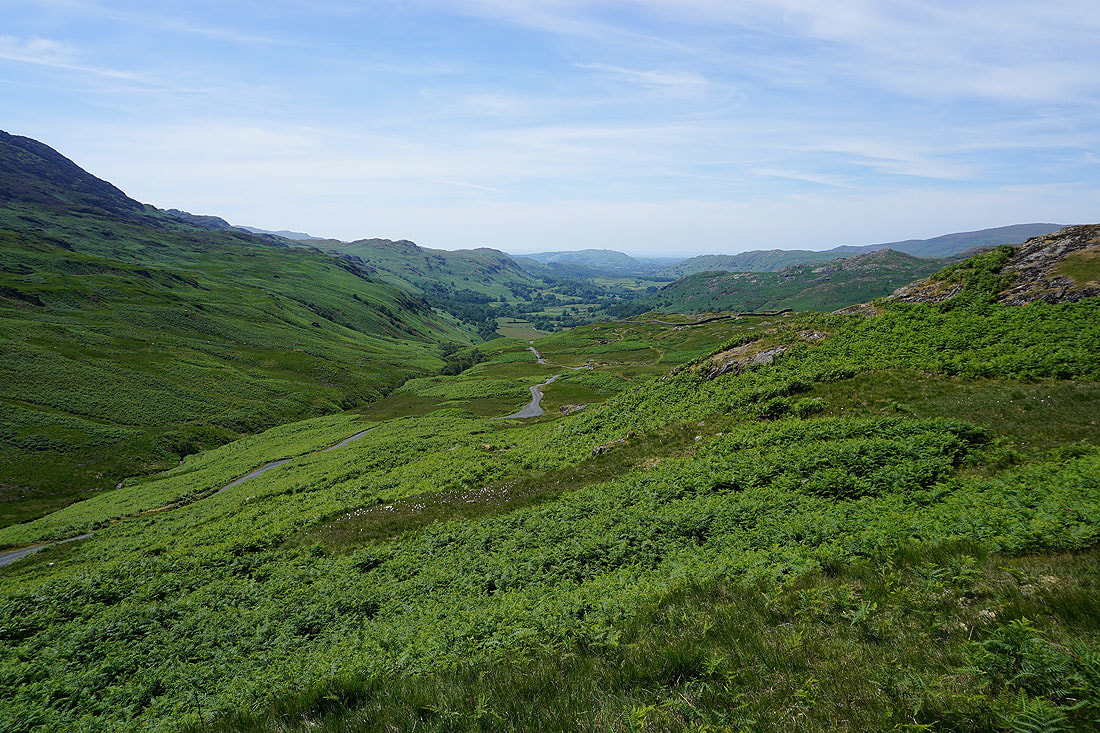
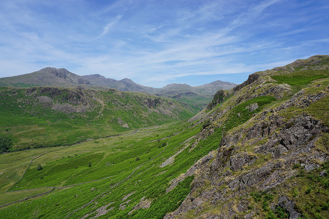
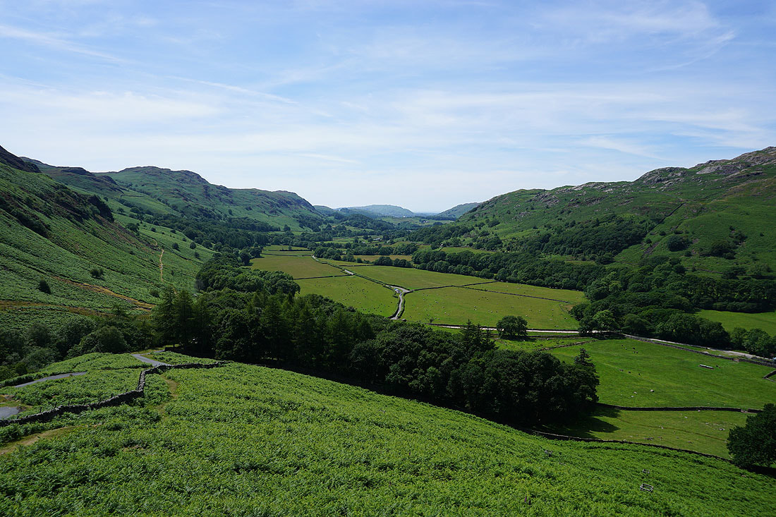
Looking back down Eskdale
Slight Side and Long Green appear to the left of Throstlehow Crag
and Bowfell appears above Pianet Knott
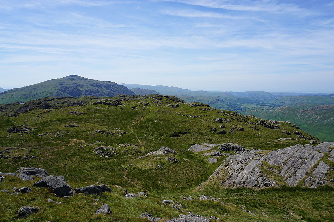
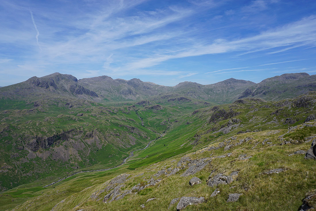
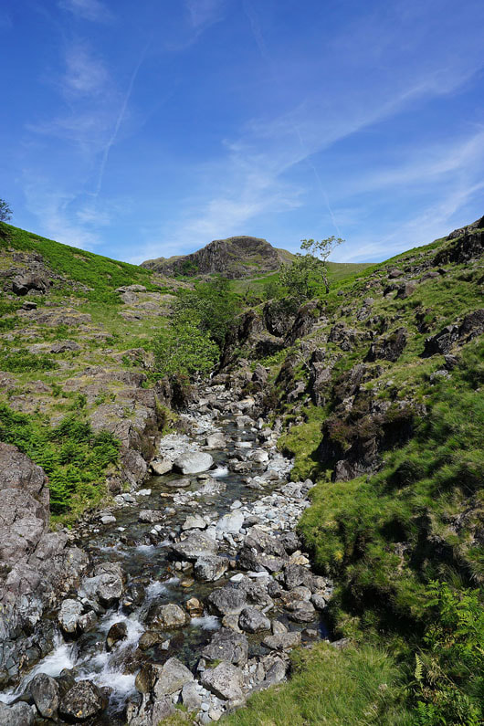
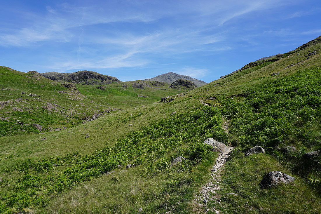
Esk Pike, Bowfell and Lingcove Beck. This was where I left the beck behind..
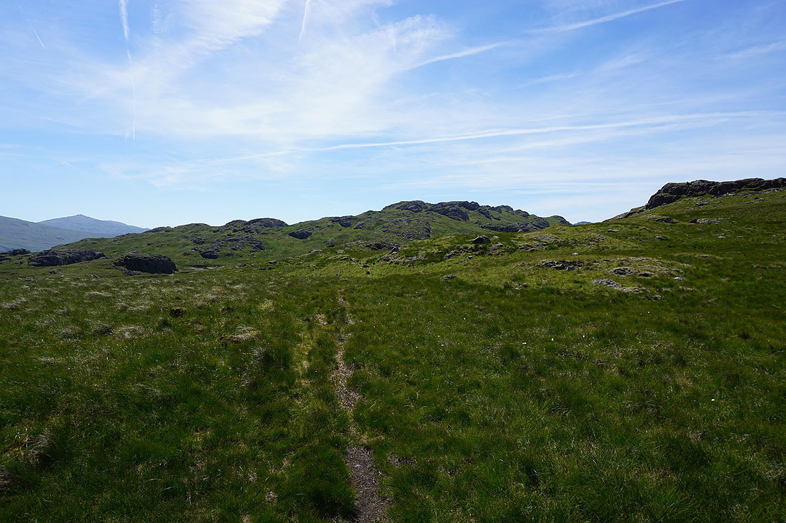
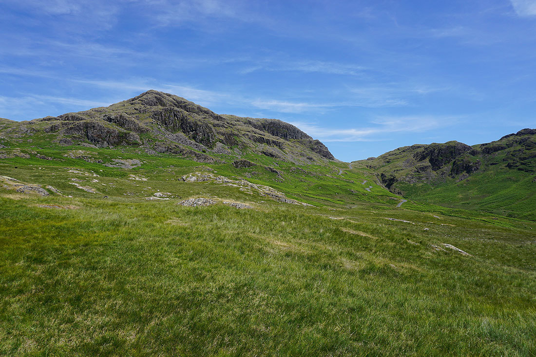
..to head south up onto Hard Knott
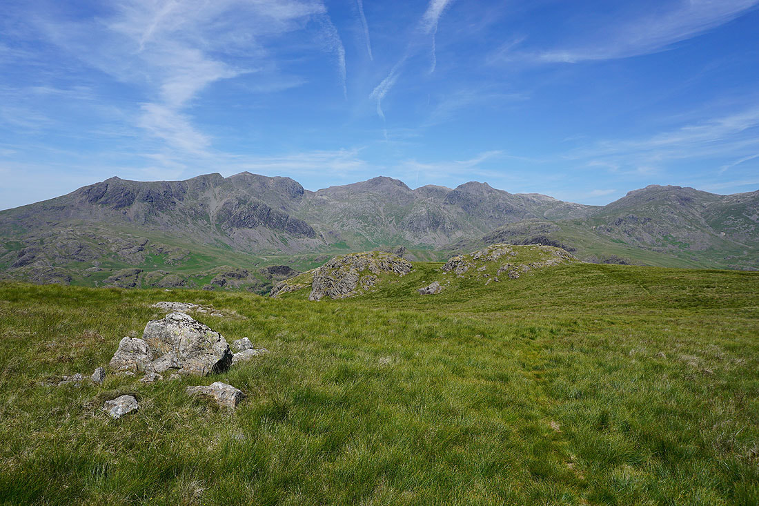
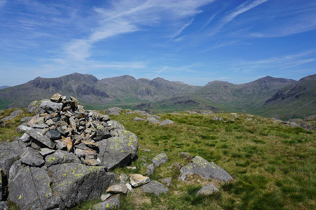
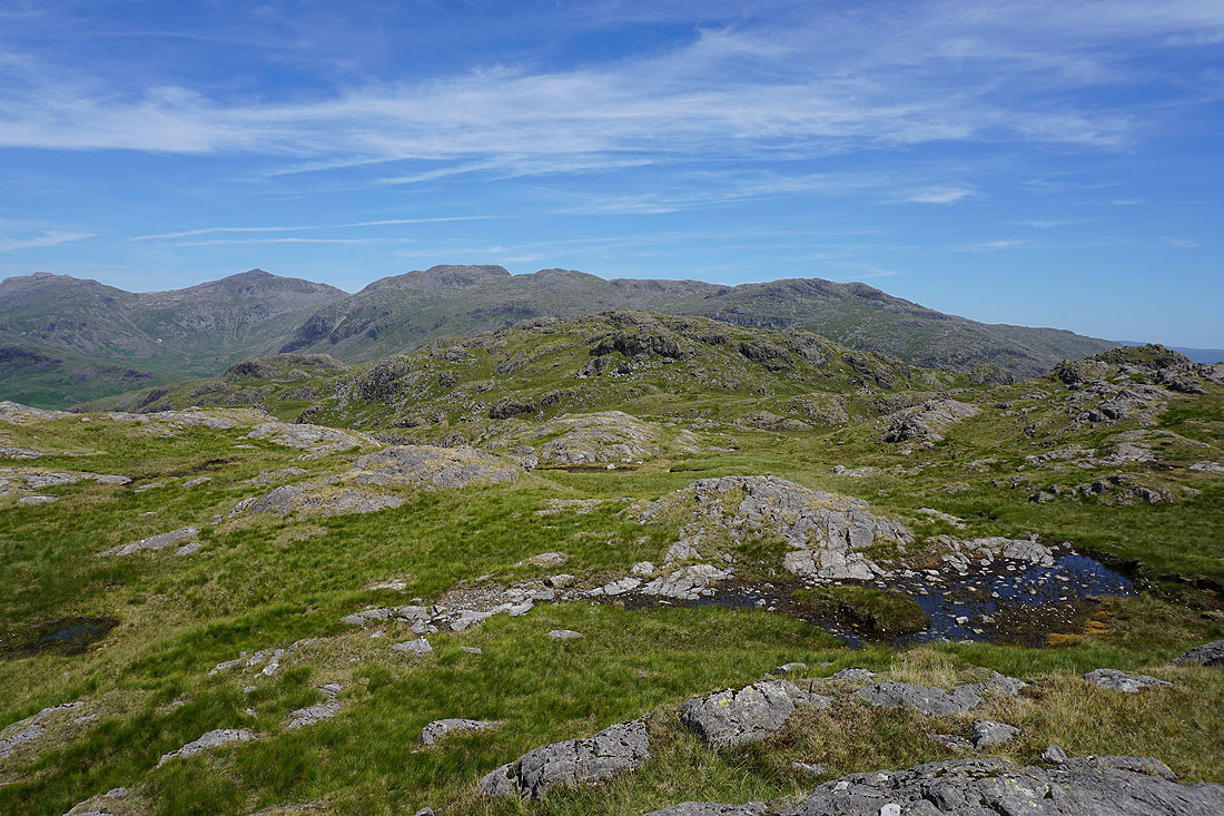
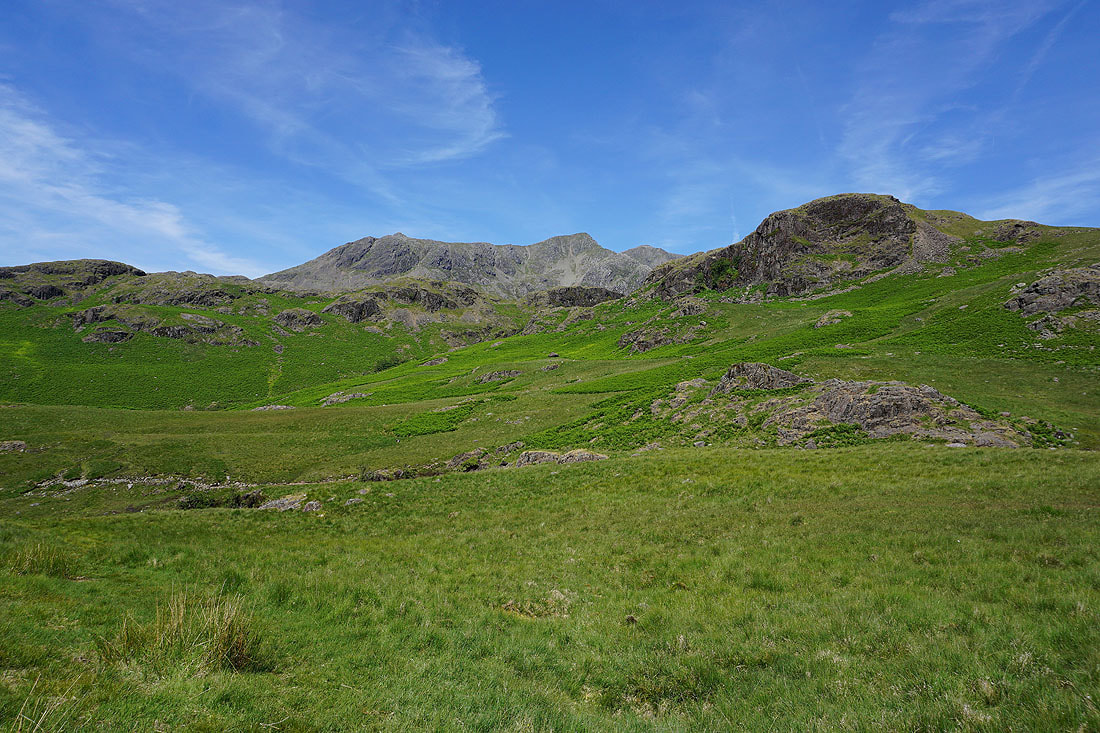
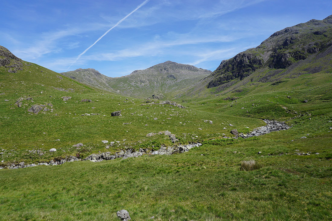
It doesn't take long for the fells around the head of Eskdale to come into view. Slight Side, Scafell, Scafell Pike, Broad Crag, Ill Crag and Esk Pike.
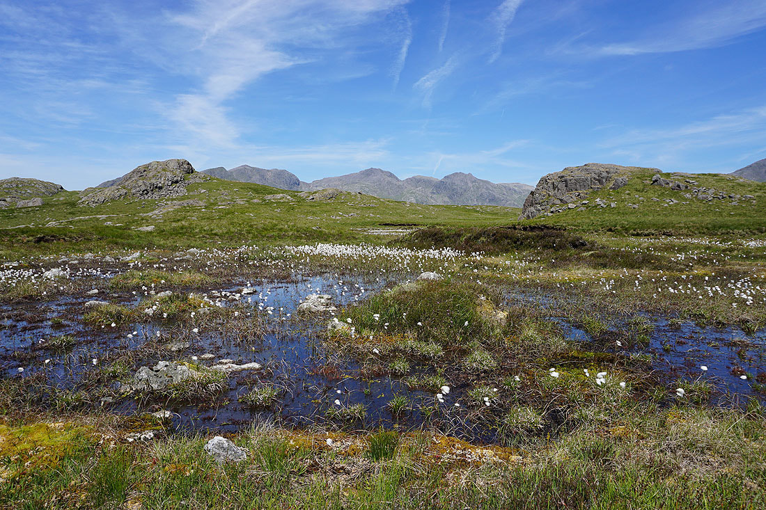
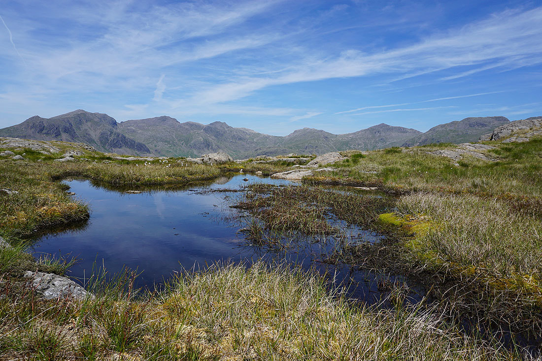
A cotton grass filled pool..
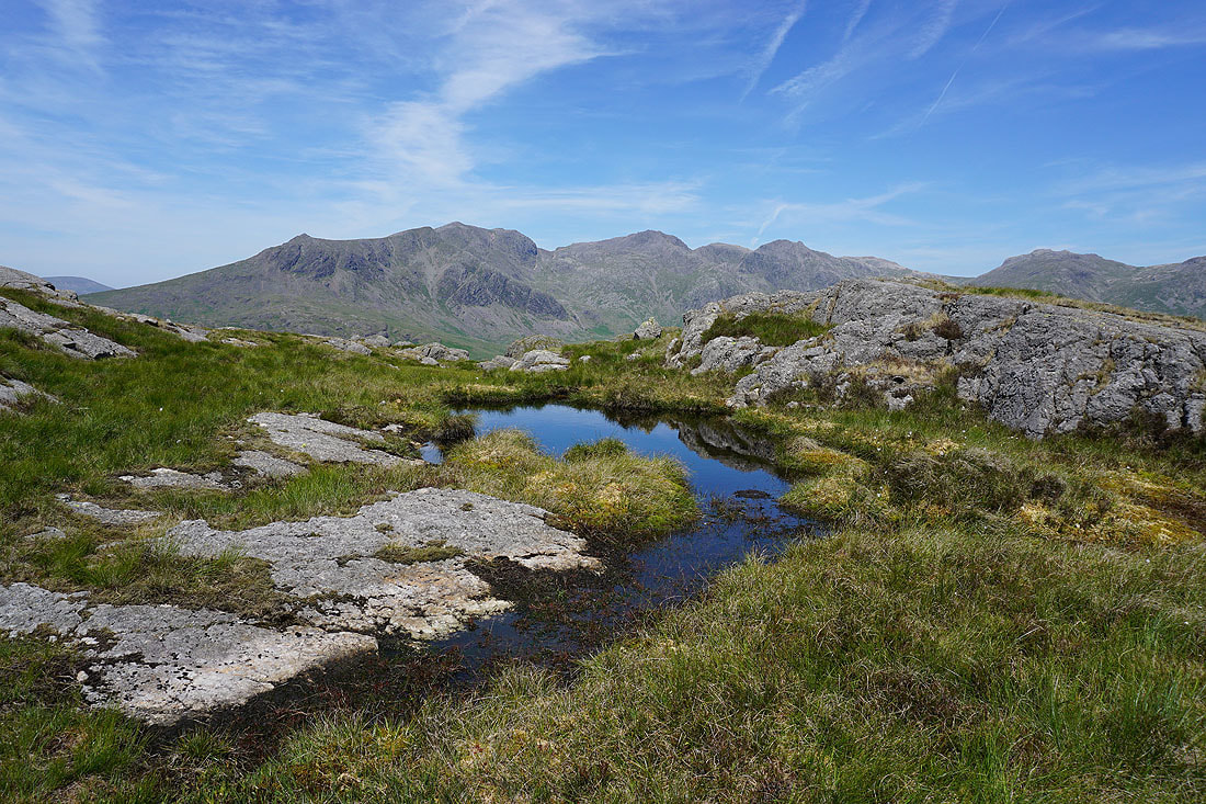
..and a blue pool provide a foreground