25th March 2015 - A Mardale Round
Walk Details
Distance walked: 7.9 miles
Total ascent: 2717 ft
OS map used: OL5 - The English Lakes, Northeastern area
Time taken: 6.5 hrs
Route description: Mardale Head-The Rigg-Rough Crag-High Street-Thornthwaite Crag-Mardale Ill Bell-Nan Bield Pass-Harter Fell-Gatescarth Pass-Mardale Head
There's a fine spring day forecast so I decided to head for the Lake District to do a walk from Mardale that would tick off a few more Wainwrights for my second round. What was surprising is that had been more than two years since I last walked in the area, back in November 2012, just three weeks before I completed my Wainwrights. The far eastern fells was one part of the Lakes that I used to visit quite often. The day started out quite sunny, unfortunately cloud built up around the middle of the day so I lost the sunshine for a couple of hours but it did melt away as the afternoon wore on.
Before I started the walk I stopped in the layby at the bottom of the Old Corpse Road. I decided that if the weather was looking good I'd take the trouble to head up to the first of the peat hut ruins to get a photo of one of the classic Lake District views. I wasn't disappointed. When I finally arrived at Mardale Head I set off by following the path round to The Rigg. I then made my way up the ridge of Rough Crag to the summit of High Street. Next stop was Thornthwaite Crag, then across to Mardale Ill Bell before heading down to the Nan Bield Pass and up to the top of Harter Fell. I then made my way down to the Gatescarth Pass for the final descent back to Mardale Head.
Route map
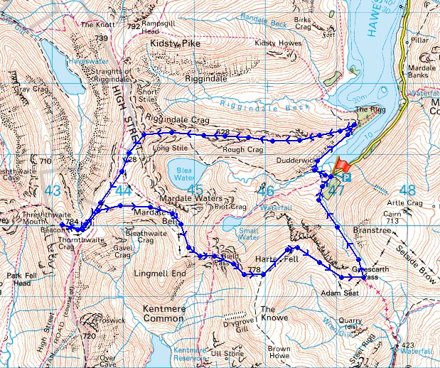
© Crown copyright. All rights reserved. License number PU 100034184.
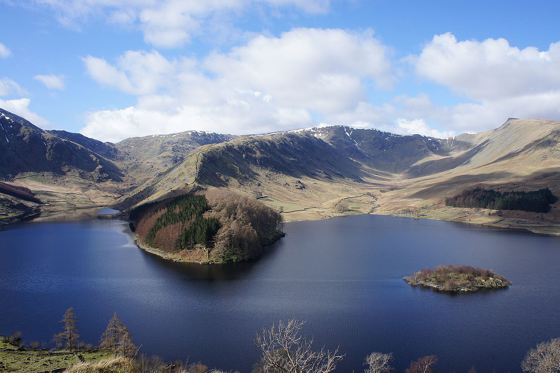
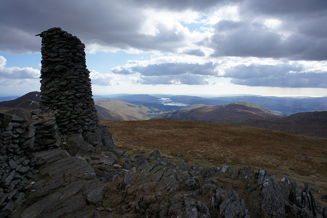
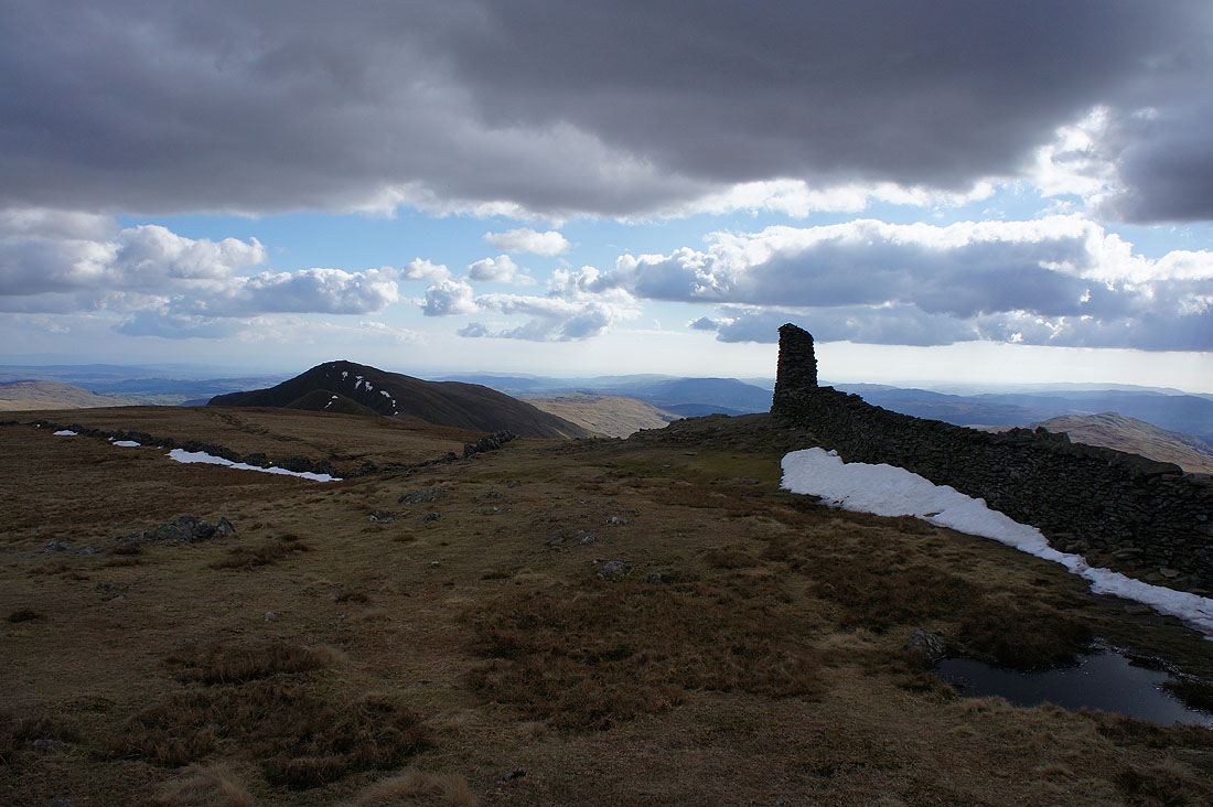
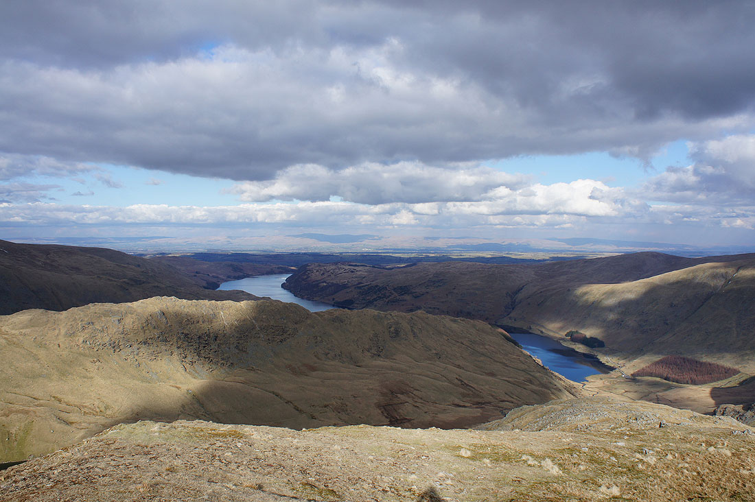
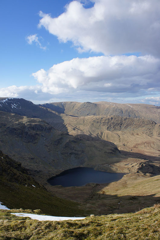
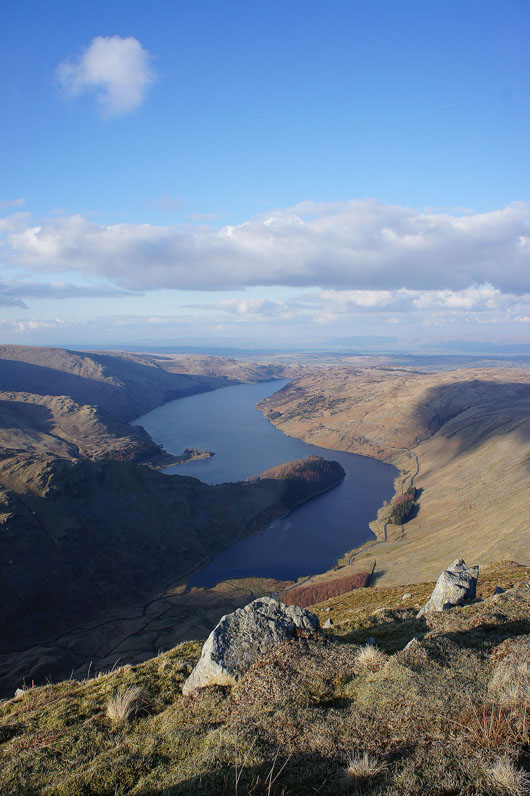
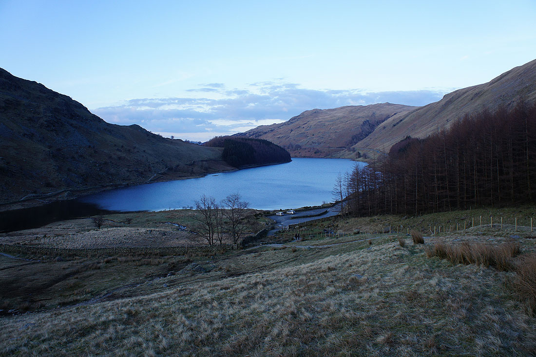
Certainly worth taking the trouble to do this
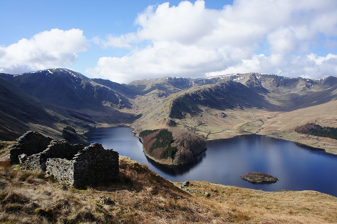
and this was the shot I was after. Taken from the first peat hut next to the Old Corpse Road.
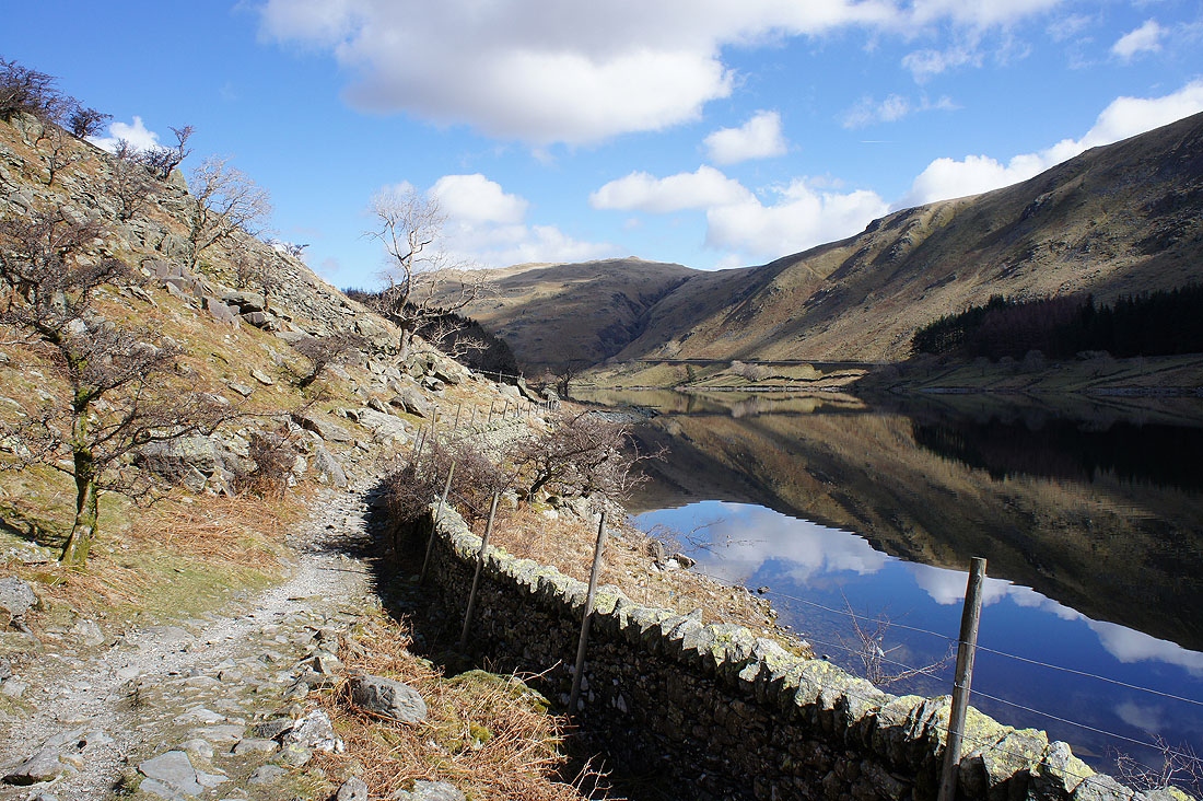
Time to get on with the walk. Haweswater is almost flat calm as I head for The Rigg.
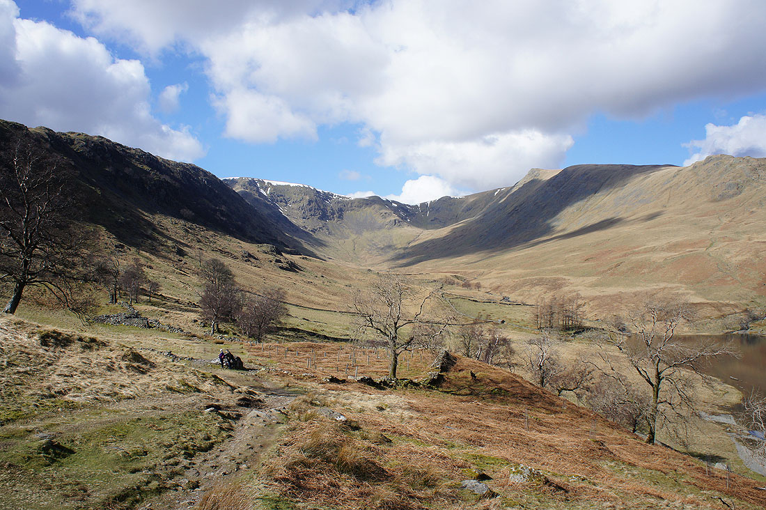
and as I round The Rigg, Riggindale comes into view
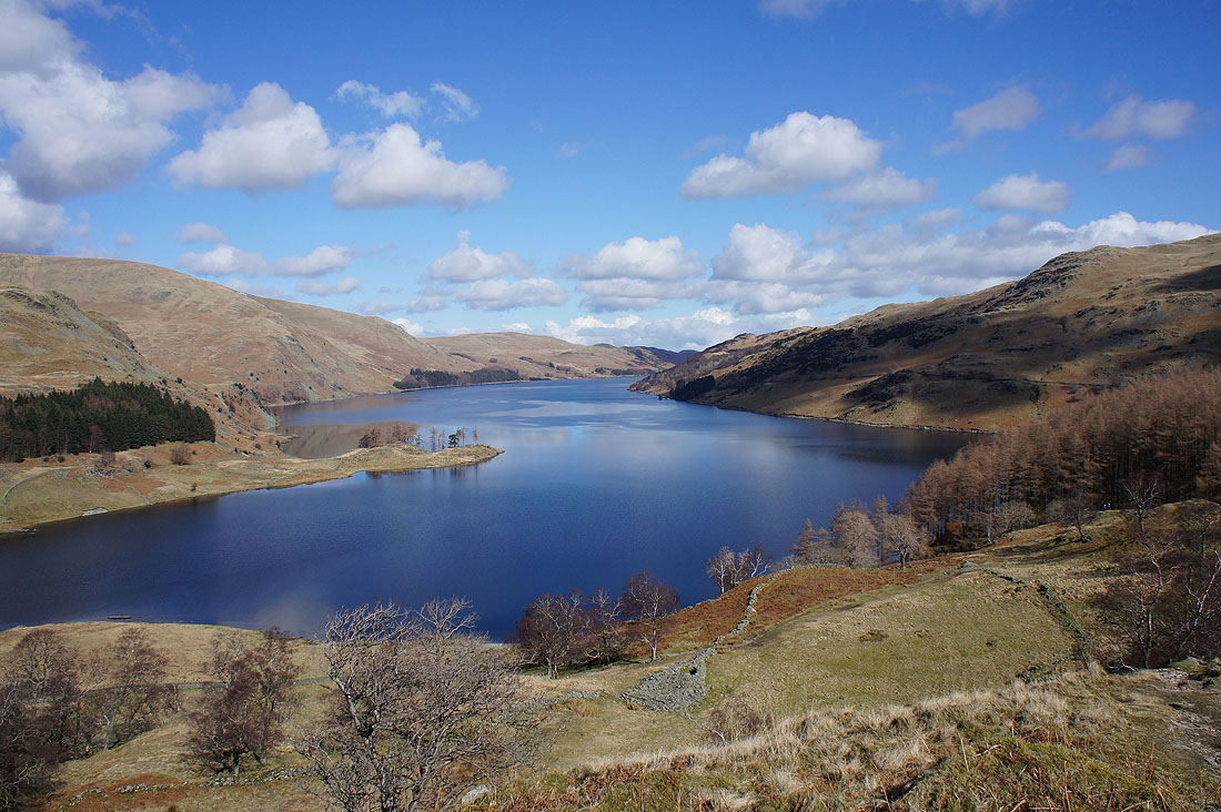
Changing aspects of Haweswater as I ascend the ridge to Rough Crag..
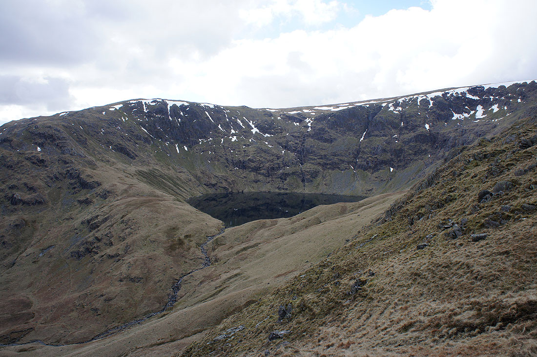
Blea Water
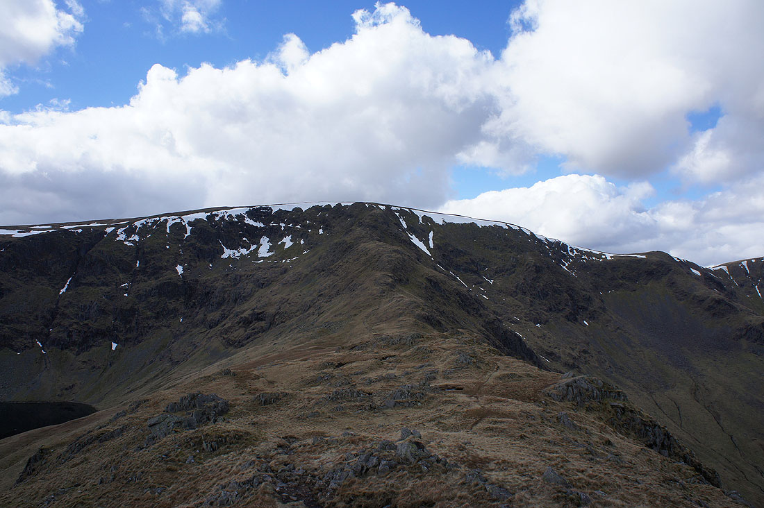
On the top of Rough Crag and the final climb up Long Stile to High Street awaits
Haweswater below
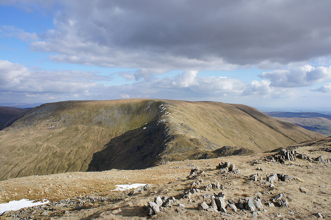
Rough Crag as I reach the top of Long Stile
and there's now a view across the Eden valley to the North Pennines
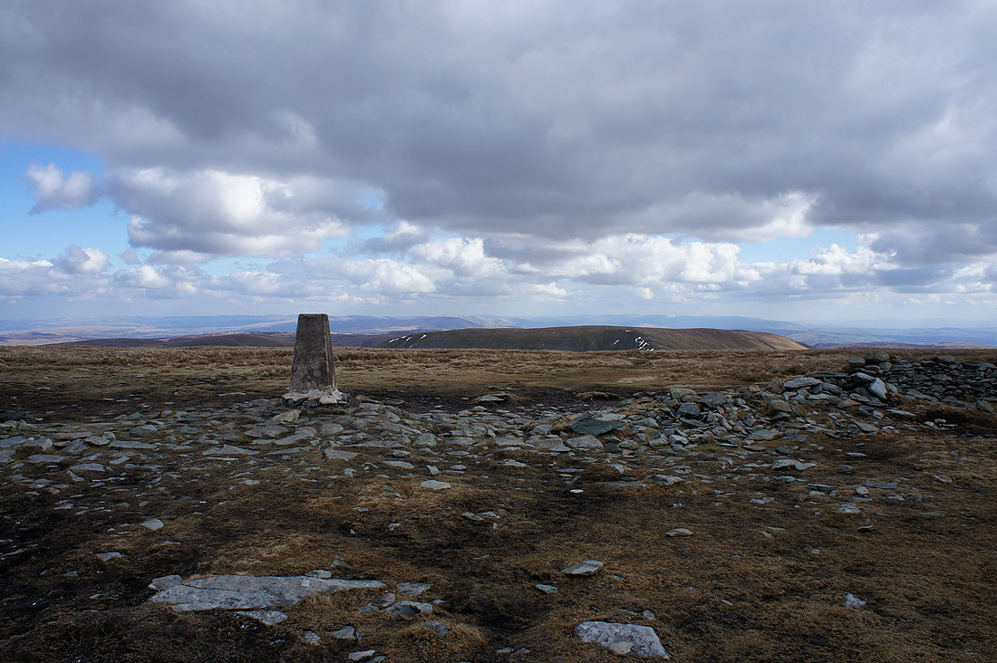
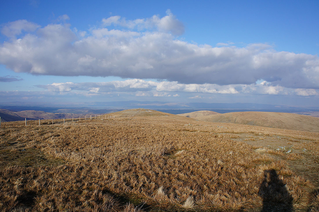
Big views from the summit of High Street. All the way to the Howgills and Ingleborough.
Closer at hand are Helvellyn, the Dodds and Blencathra
Next stop Thornthwaite Crag
Hayeswater is briefly visible on the way there
Thornthwaite Crag and its beacon is a great place to see Windermere from
The Coniston fells, Crinkle Crags and Scafells beyond the nearby Red Screes and Caudale Moor
Fairfield, Helvellyn and the Dodds
The whaleback of High Street
One last shot from Thornthwaite Crag looking south towards Morecambe Bay with the cone of Ill Bell on the left
A couple of photos as I head for Mardale Ill Bell. Sunshine on Kentmere and..
..Yoke, Ill Bell and Froswick
High Street from Mardale Ill Bell
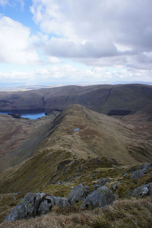
The Rough Crag ridge and Haweswater
Harter Fell, the last stop of the day
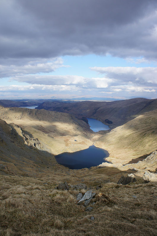
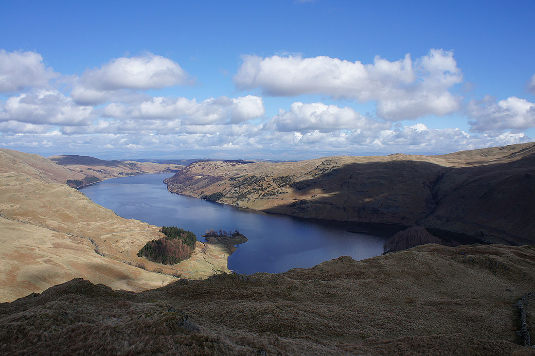
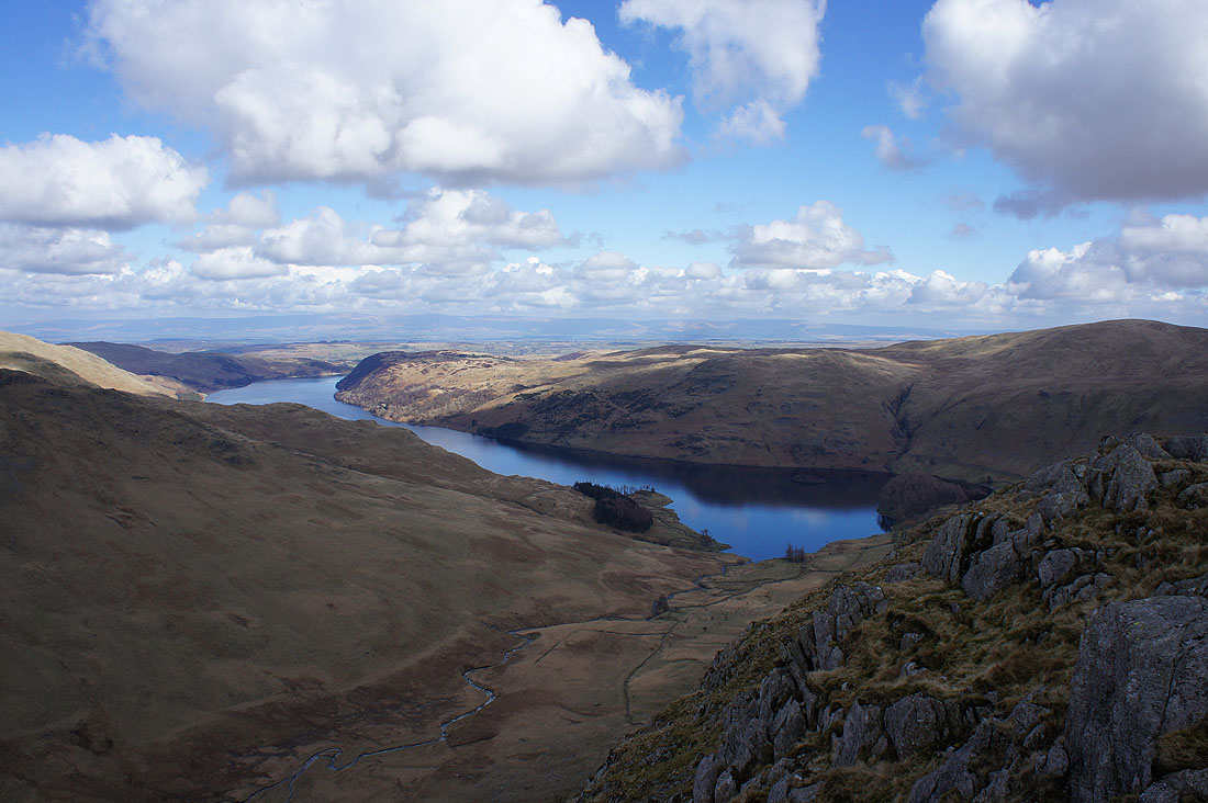
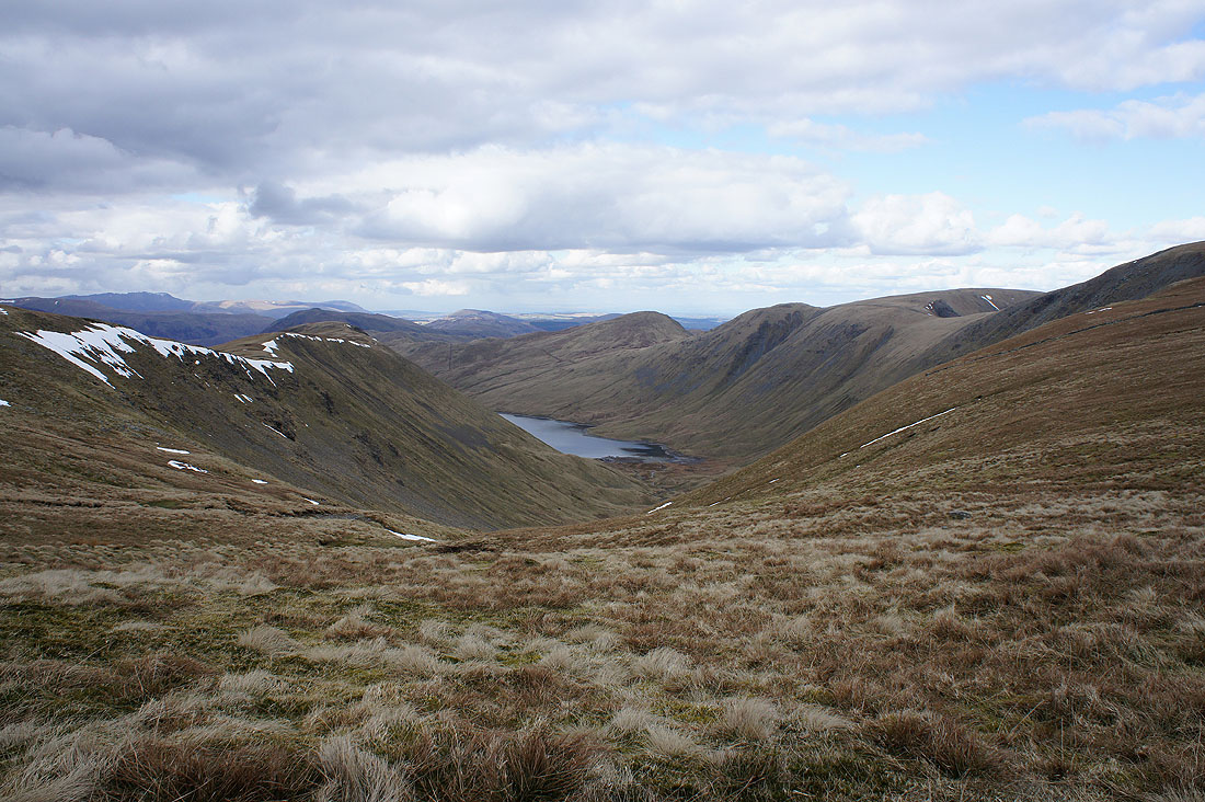
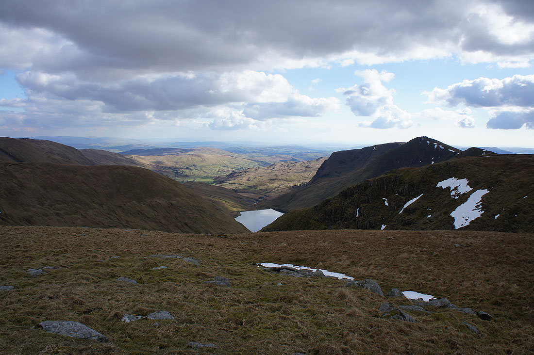
Small Water and Haweswater as I head down to the Nan Bield Pass
The Nan Bield Pass
Small Water as I head up Harter Fell
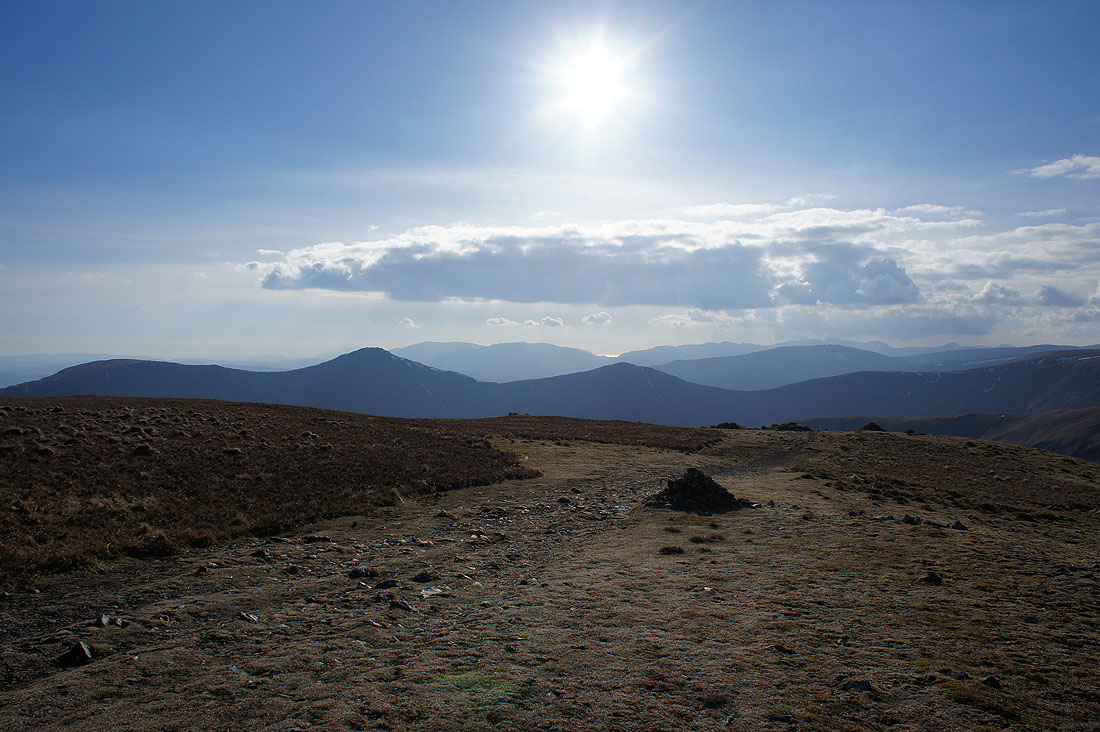
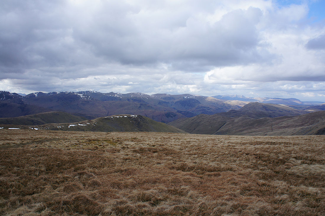
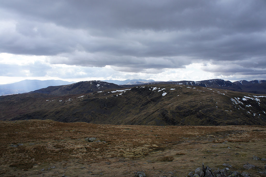
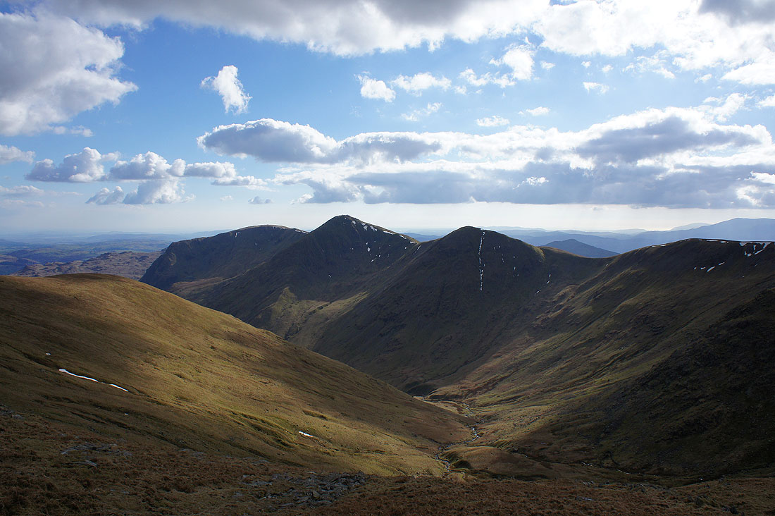
Great views as I reach the top of Harter Fell. The cloud has been melting away during the past hour as it has gotten later into the afternoon. Looking past the Ill Bell ridge to the Coniston fells.
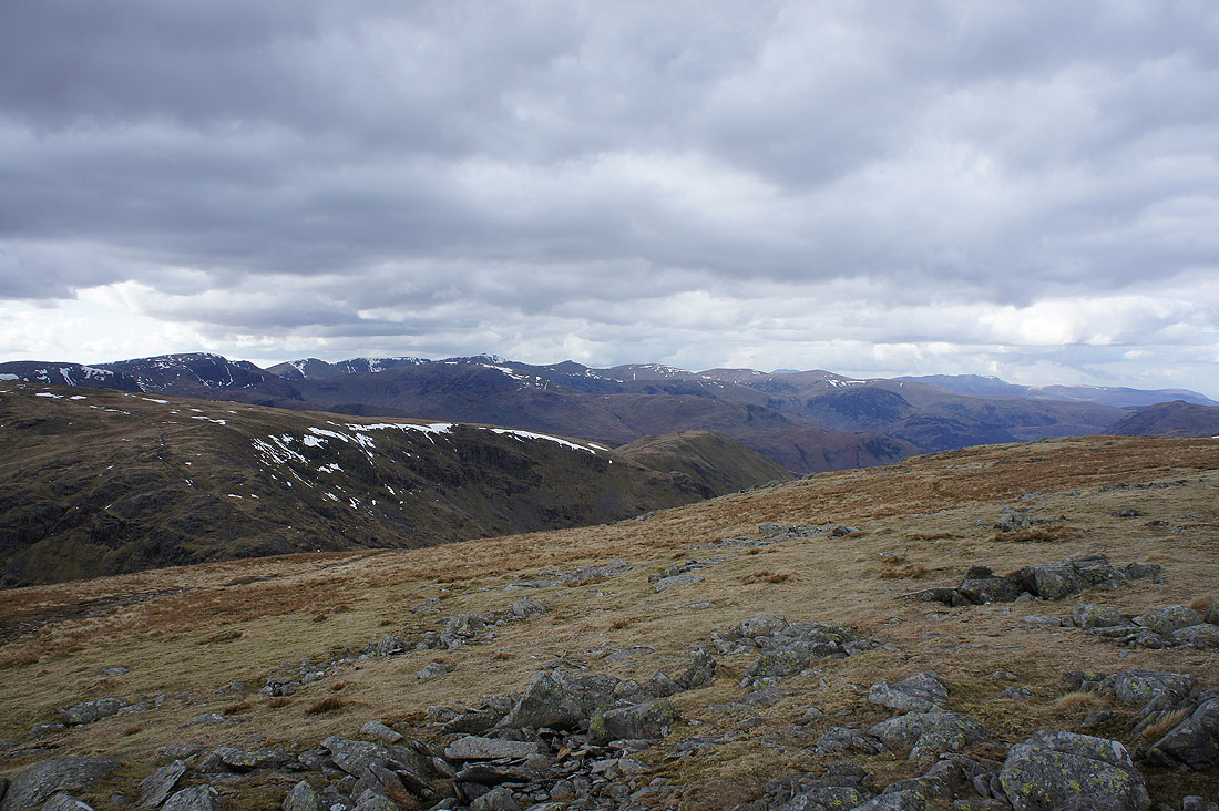
The Crinkle Crags, the Scafells and Great Gable in the far distance with Dove Crag, Fairfield and Helvellyn beyond the nearby ridge up to High Street
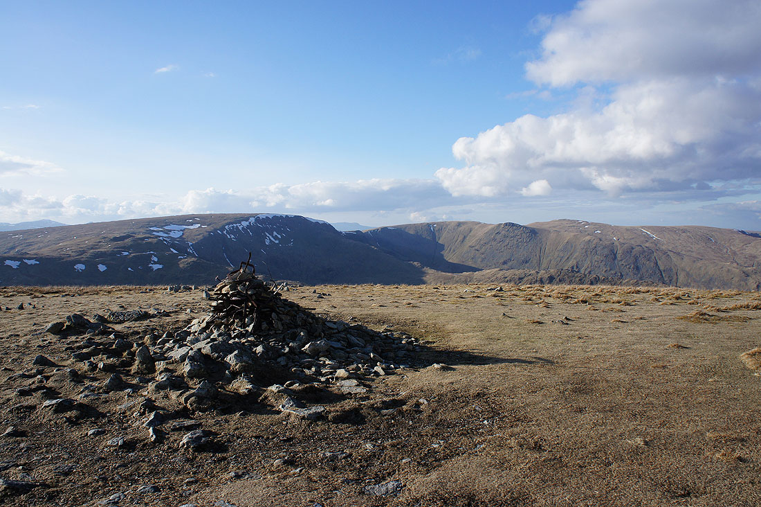
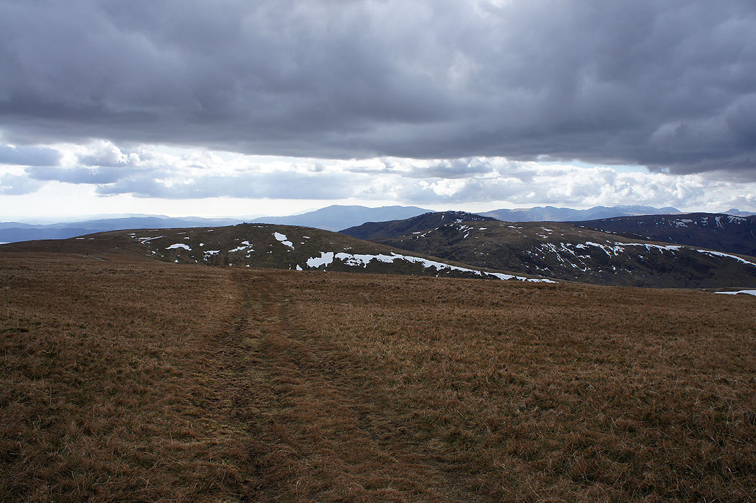
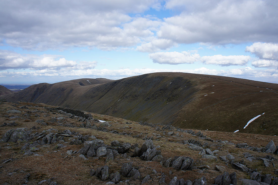
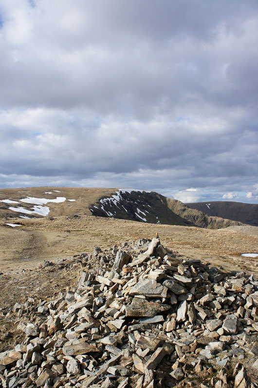
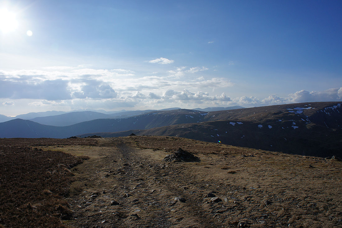
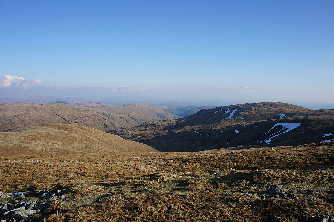
High Street, Rampsgill Head, Kidsty Pike and High Raise from the summit of Harter Fell
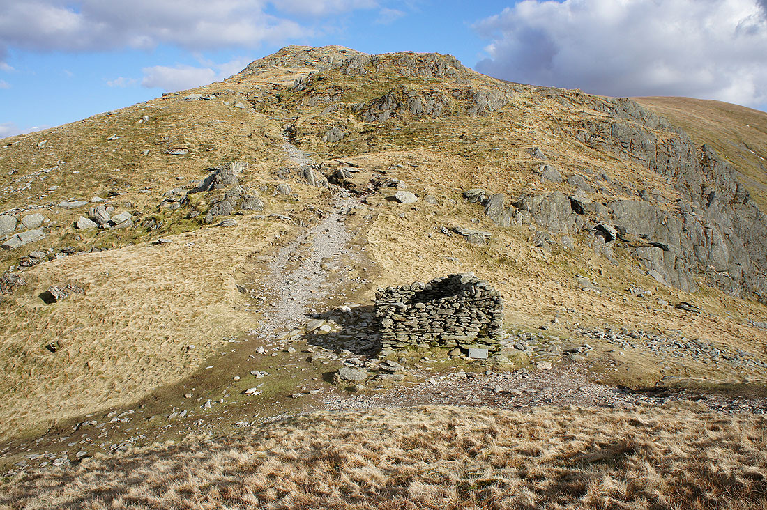
It's time I was getting a move on so I'll follow the fence to the corner and down to the Gatescarth Pass
On the way there I can see a bit of Longsleddale to the left of Kentmere Pike
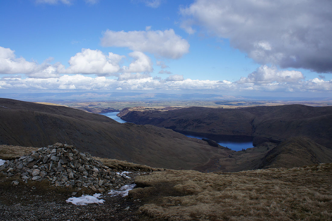
A great view of Haweswater from the corner
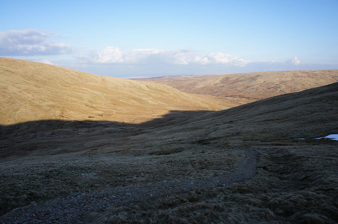
The Gatescarth Pass below
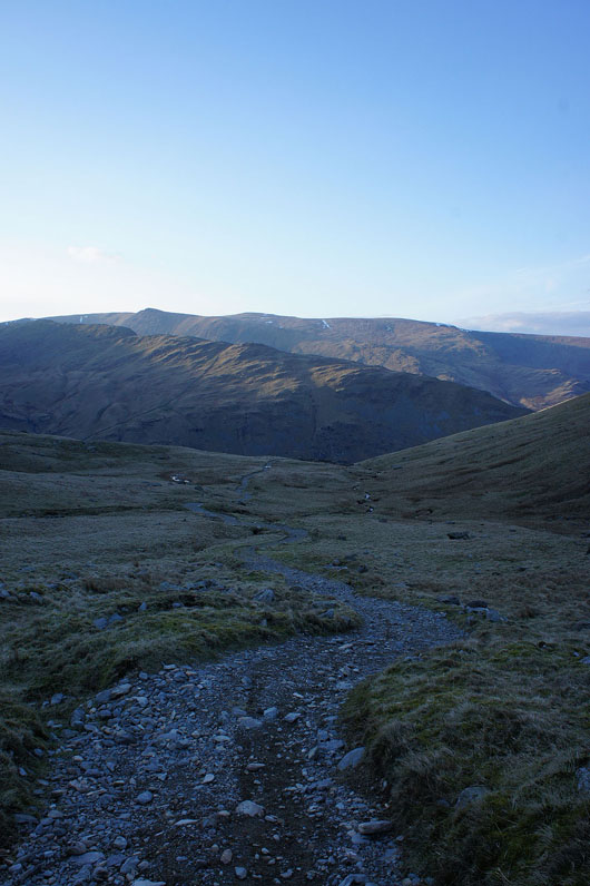
Heading down to Mardale Head
The car park is finally in sight