25th May 2017 - Great Gable
Walk Details
Distance walked: 5.4 miles
Total ascent: 2448 ft
OS map used: OL4 - The English Lakes, Northwestern area
Time taken: 6.5 hrs
Route description: Honister-Grey Knotts-Brandreth-Gillercomb Head-Green Gable-Windy Gap-Great Gable-Beck Head-Moses Trod-Honister
My walk today may have been short in terms of distance but it certainly didn't lack excitement. This route took me to the top of one of my favourite fells, Great Gable, and to some of the best views in the district. I managed to add another four Wainwrights to my second round total with Grey Knotts, Brandreth, Green Gable and Great Gable done. The latter two I last visited back in March 2012 but I've been to Grey Knotts and Brandreth just the once before in March 2007. So long ago. The weather was perfect for being on the high fells. It was forecast to be very warm down in the valleys but up here there was a breeze, which made it comfortable. Plenty of sunshine and good visibility for taking photos made it a great day.
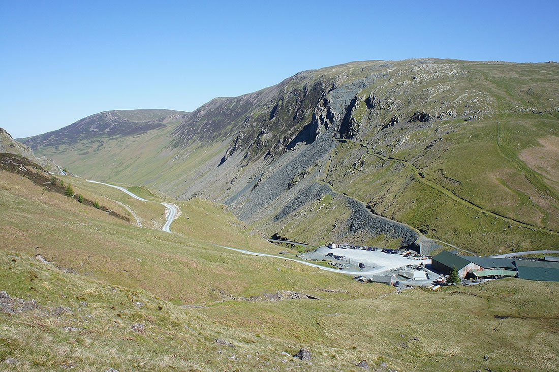
From the National Trust car park at Honister I started by taking the footpath signposted for Grey Knotts that makes it way through the grounds of the slate mine and up by the fence on the fellside opposite. After paying a visit to each of the tops of Grey Knotts I continued to follow the fence south to Brandreth before crossing Gillercomb Head to reach Green Gable. Lunch had, I made my way down to Windy Gap to do the steep and rocky climb to the summit of Great Gable. While up there I went to the top of Gable Crag and to the Westmorland Cairn. I then descended the path to Beck Head to pick up the Moses Trod path back to Honister.
Total ascent: 2448 ft
OS map used: OL4 - The English Lakes, Northwestern area
Time taken: 6.5 hrs
Route description: Honister-Grey Knotts-Brandreth-Gillercomb Head-Green Gable-Windy Gap-Great Gable-Beck Head-Moses Trod-Honister
My walk today may have been short in terms of distance but it certainly didn't lack excitement. This route took me to the top of one of my favourite fells, Great Gable, and to some of the best views in the district. I managed to add another four Wainwrights to my second round total with Grey Knotts, Brandreth, Green Gable and Great Gable done. The latter two I last visited back in March 2012 but I've been to Grey Knotts and Brandreth just the once before in March 2007. So long ago. The weather was perfect for being on the high fells. It was forecast to be very warm down in the valleys but up here there was a breeze, which made it comfortable. Plenty of sunshine and good visibility for taking photos made it a great day.
From the National Trust car park at Honister I started by taking the footpath signposted for Grey Knotts that makes it way through the grounds of the slate mine and up by the fence on the fellside opposite. After paying a visit to each of the tops of Grey Knotts I continued to follow the fence south to Brandreth before crossing Gillercomb Head to reach Green Gable. Lunch had, I made my way down to Windy Gap to do the steep and rocky climb to the summit of Great Gable. While up there I went to the top of Gable Crag and to the Westmorland Cairn. I then descended the path to Beck Head to pick up the Moses Trod path back to Honister.
Route map
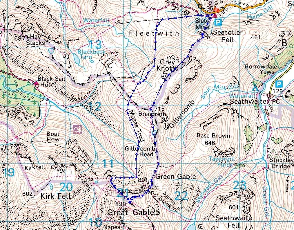
© Crown copyright. All rights reserved. License number PU 100034184.
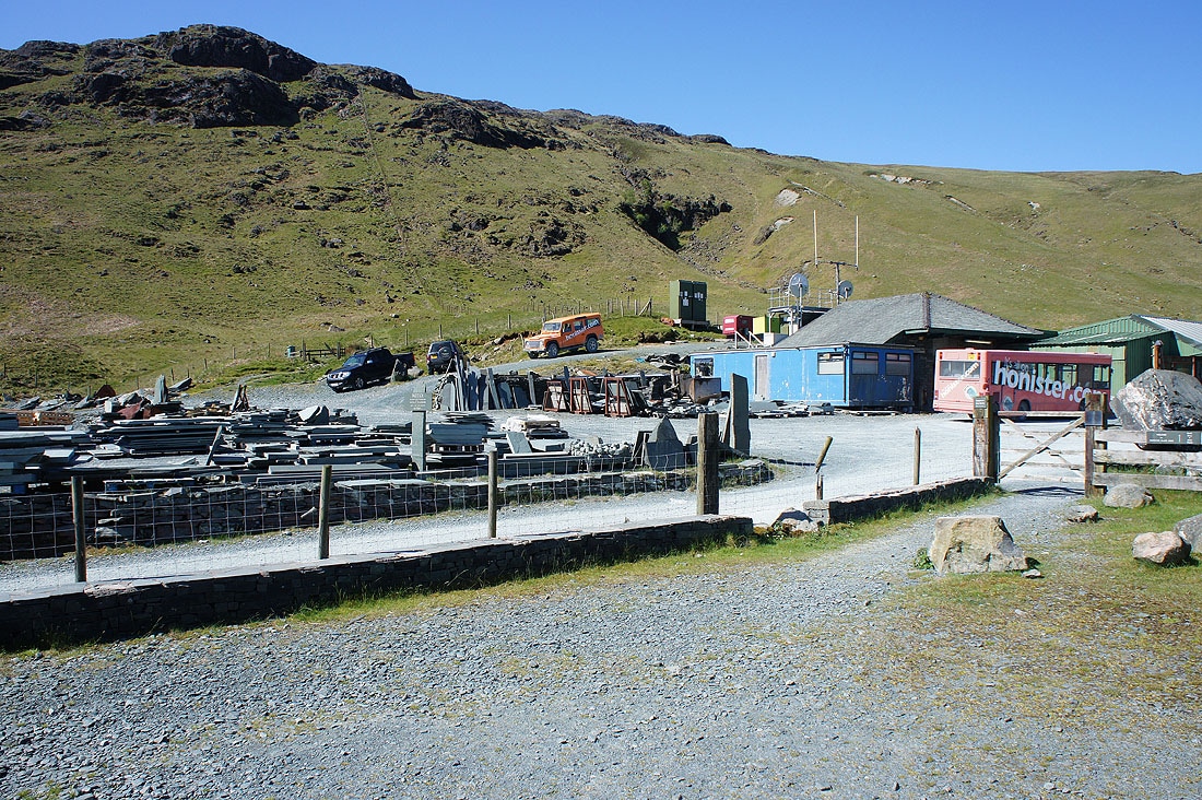
Setting out from the NT car park at Honister. I'll walk through the grounds of the slate mine and follow the fence up the hillside.
Looking across to Yew Crag on the side of Dale Head as I head uphill
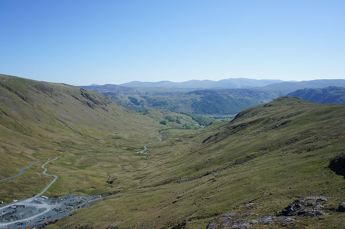
and down to Borrowdale
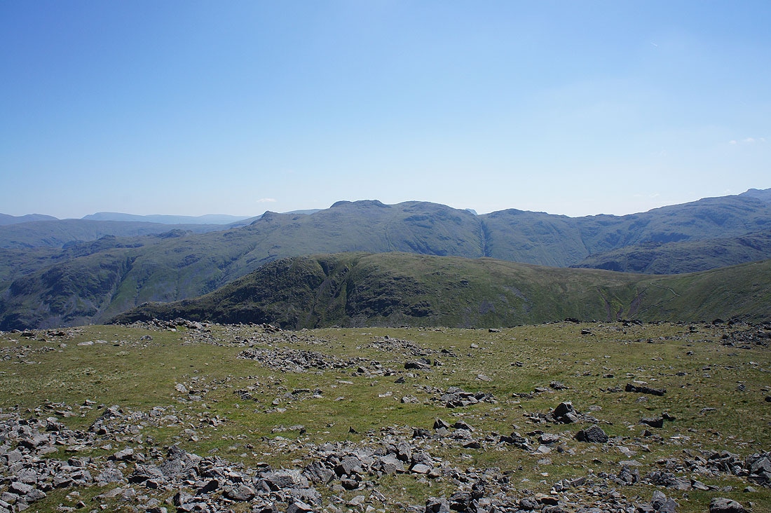
On one of the tops of Grey Knotts (not the highest one) looking south to Scafell Pike and Great Gable
Pillar round to High Stile. That other top just to the left will be visited in due course.
Grasmoor, Crag Hill, Grisedale Pike, Robinson, Hindscarth and Dale Head
On the highest top of Grey Knotts looking east to Helvellyn and Fairfield
Borrowdale below
The Glaramara to Allen Crags ridge, which I'll be on tomorrow
I'm on that other top now and this is why I wanted to visit it. A great view of the Buttermere valley.
Following the fence to Brandreth
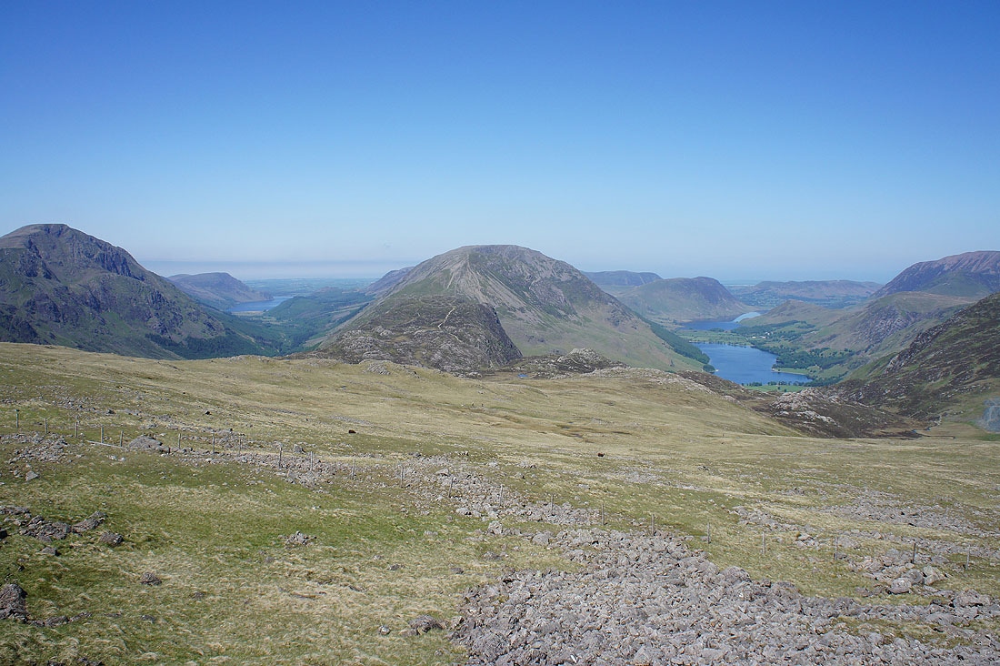
As I near the top Ennerdale and Buttermere can be seen at the same time. I'll get a better view from the Moses Trod path on the way back to Honister.
Raven Crag on the side of Grey Knotts and Borrowdale
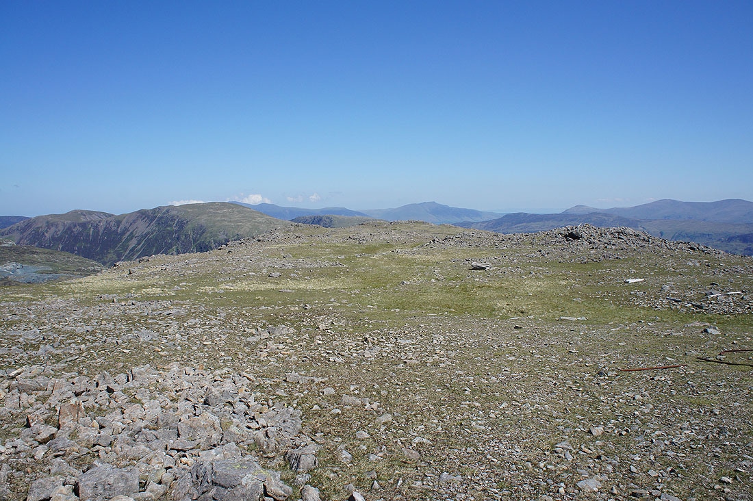
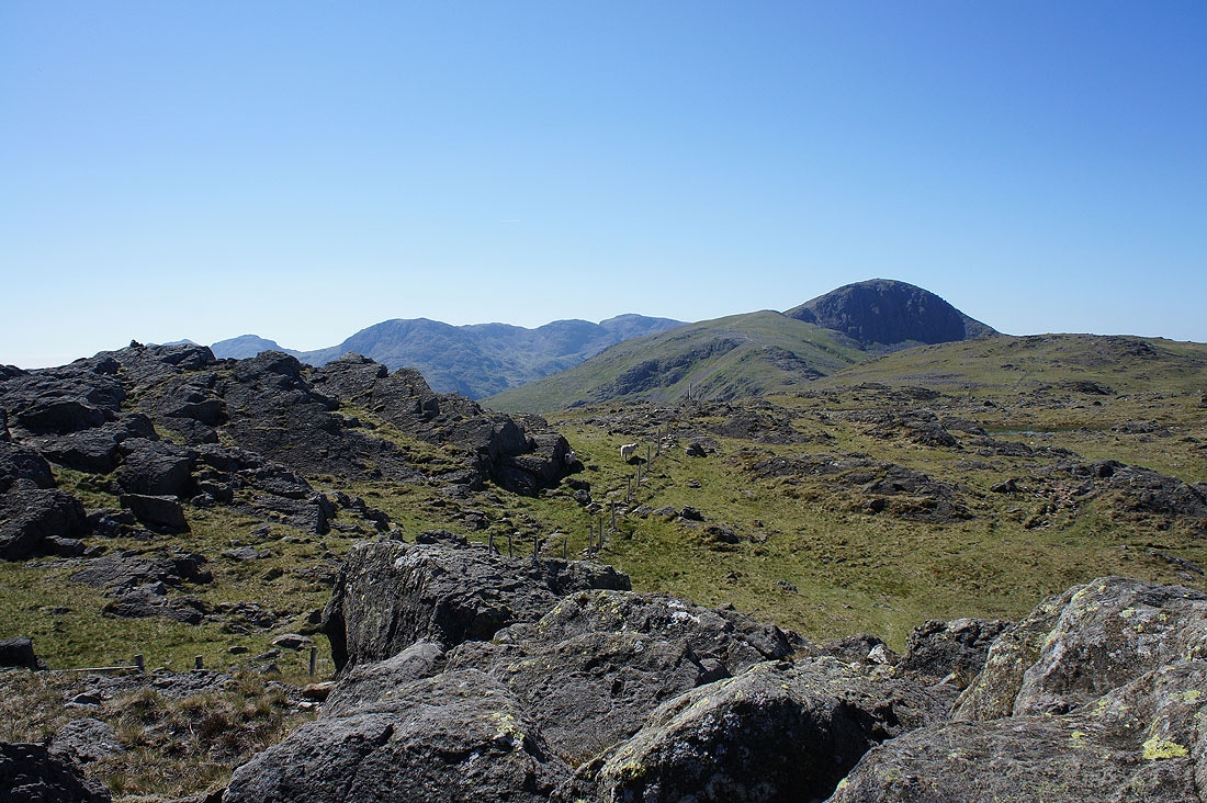
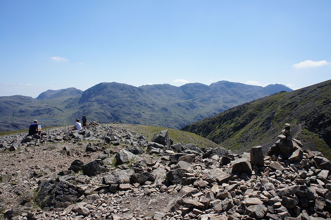
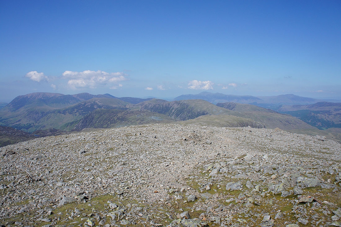
A broad and stony top looking north to Grey Knotts
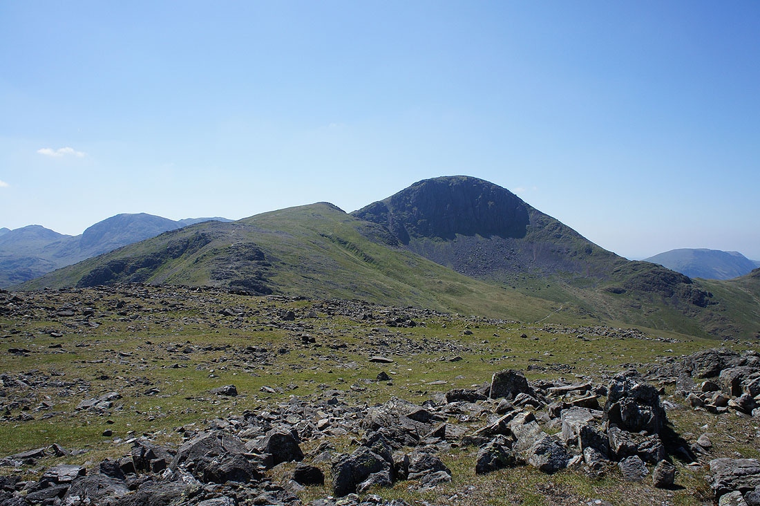
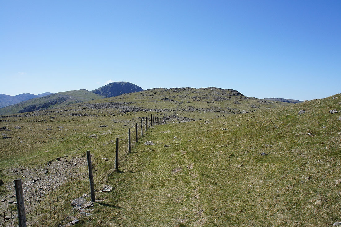
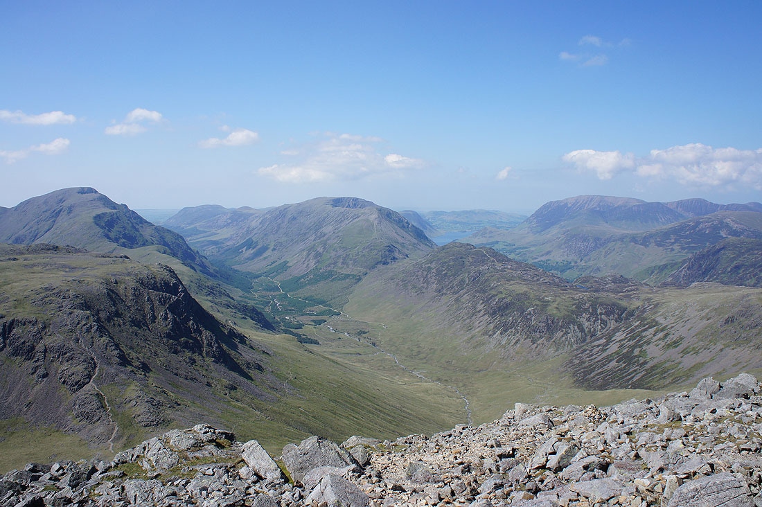
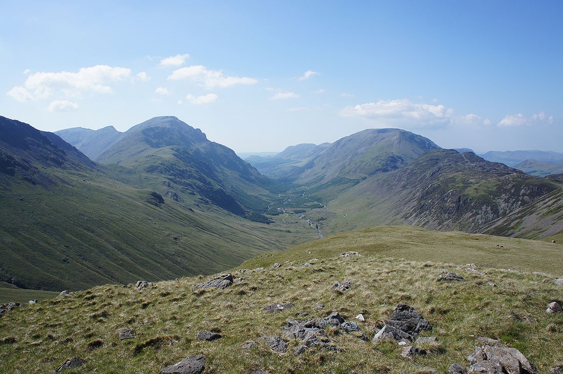
What's still to come. Green Gable and Great Gable.
Glaramara behind Base Brown
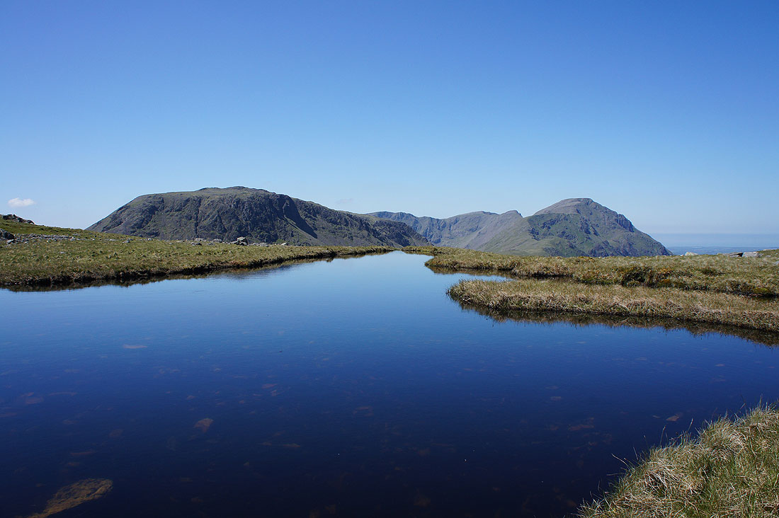
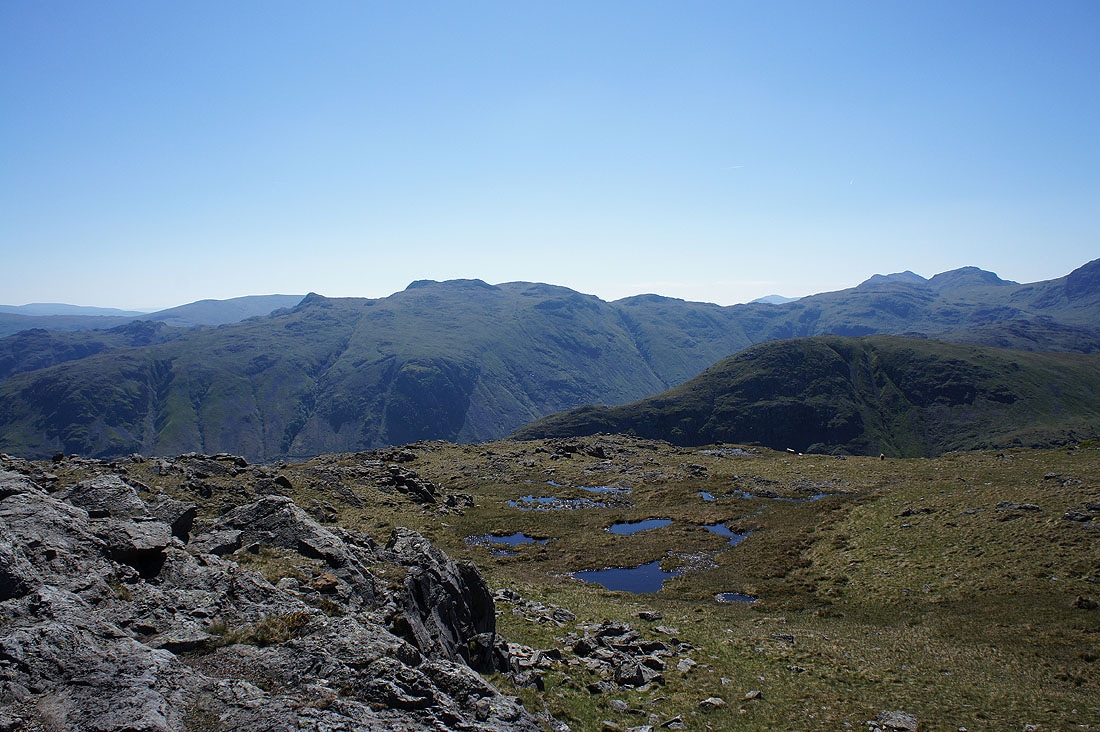
Kirk Fell and Pillar from a blue pool that I couldn't pass without taking a photo
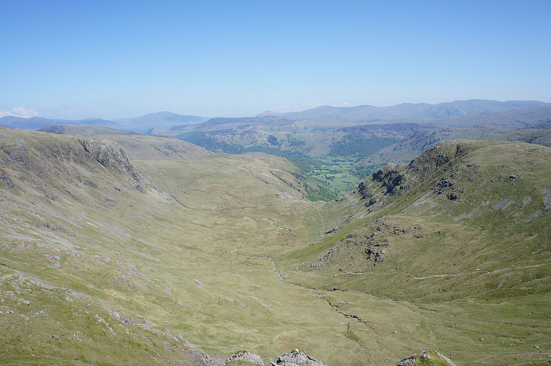
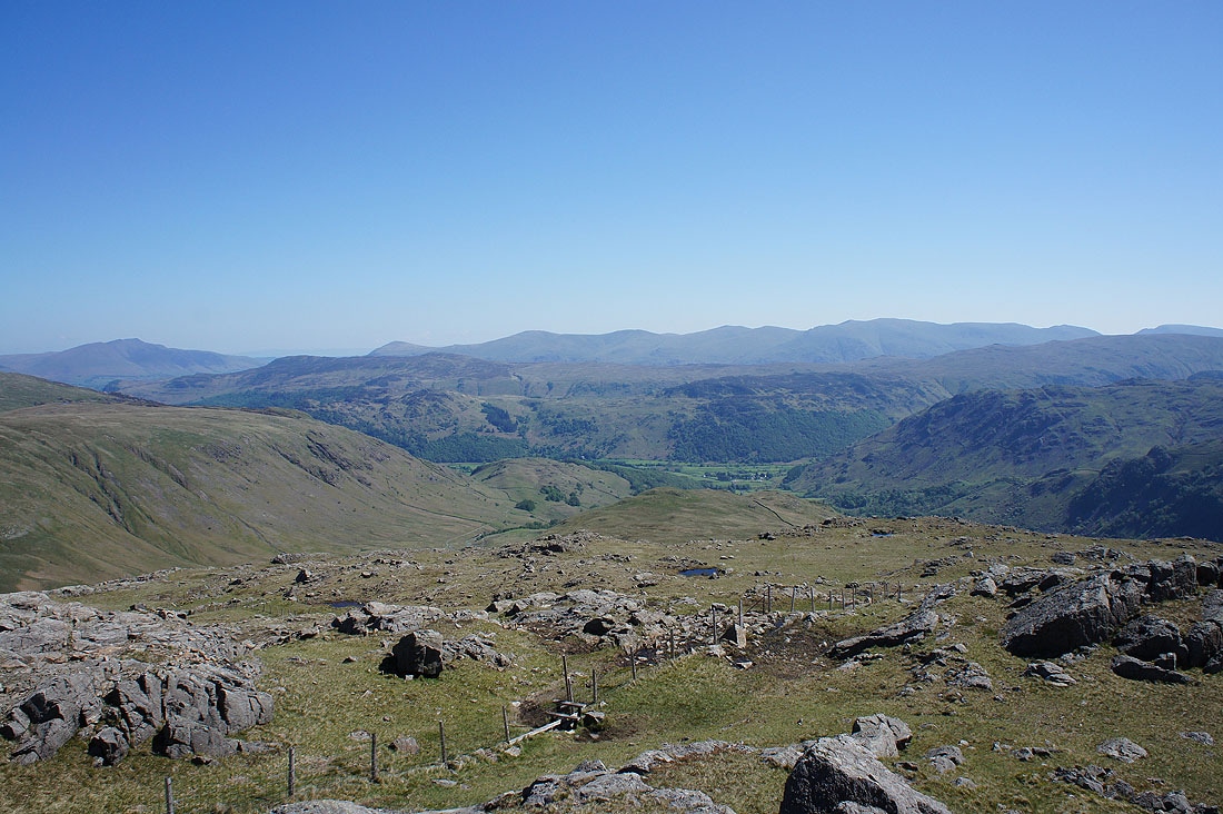
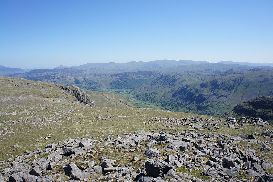
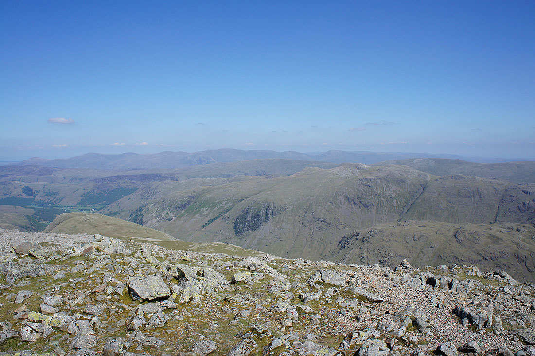
The hanging valley of Gillercomb and down to Borrowdale from Gillercomb Head
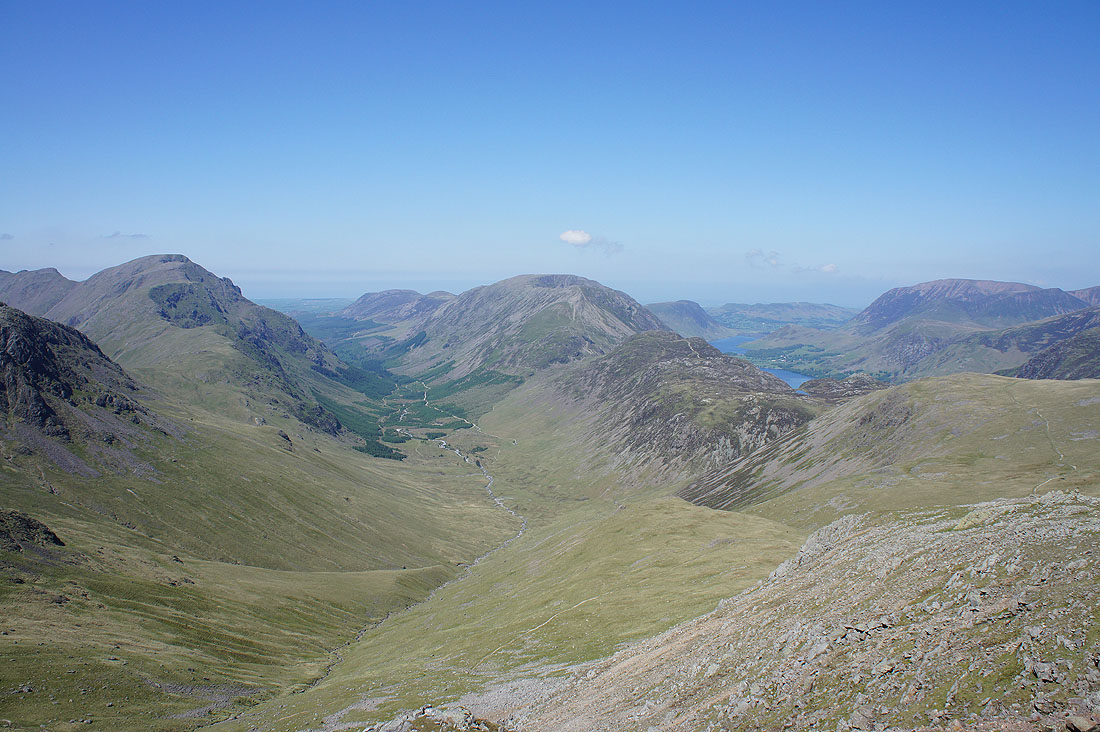
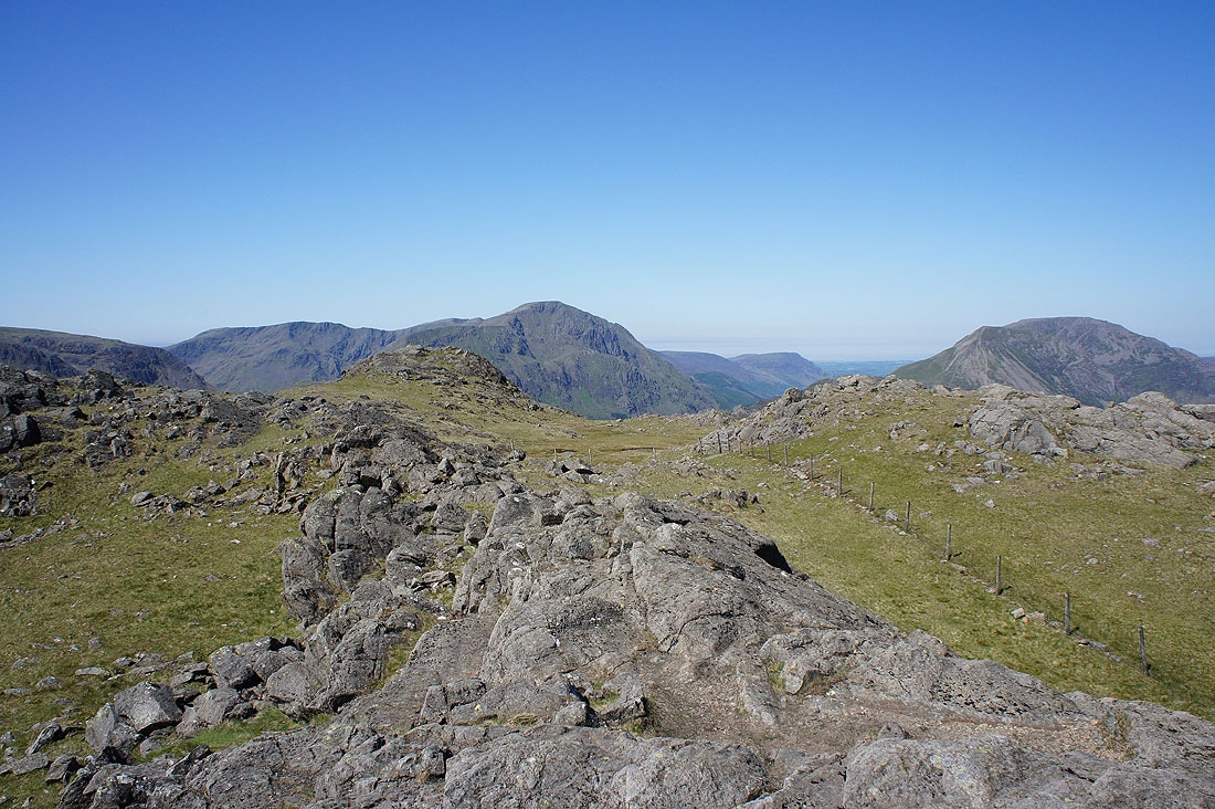
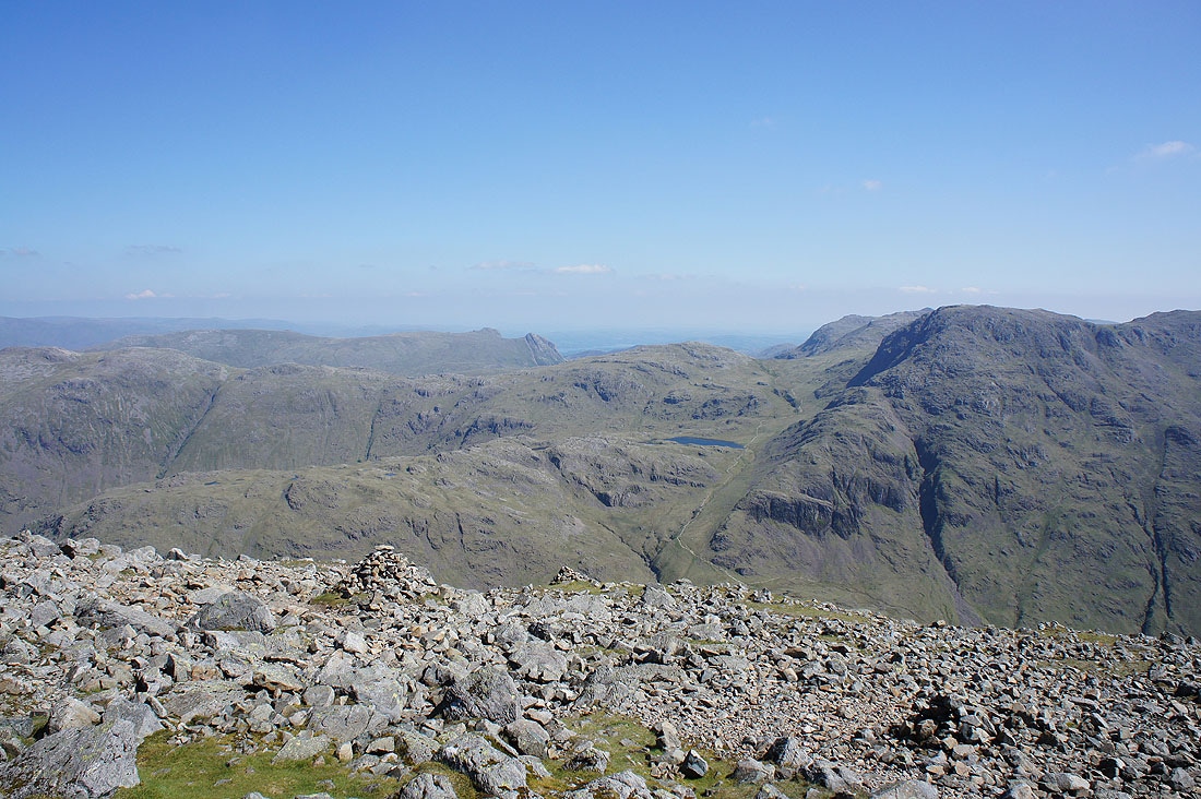
The view from my lunch stop on Green Gable. Pillar, Ennerdale, the High Stile range and Buttermere.
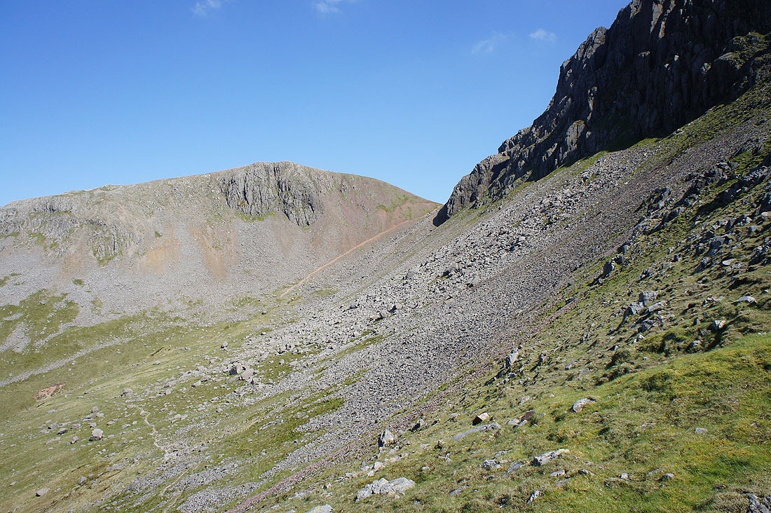
Gable Crag
Taking in the view from Green Gable. The northwestern fells and Skiddaw.
Skiddaw, Blencathra, Borrowdale and the northern end of the Helvellyn range
Helvellyn, Fairfield and Glaramara
Finally, the Scafell range. Great End, Ill Crag, Broad Crag, Scafell Pike and Scafell.
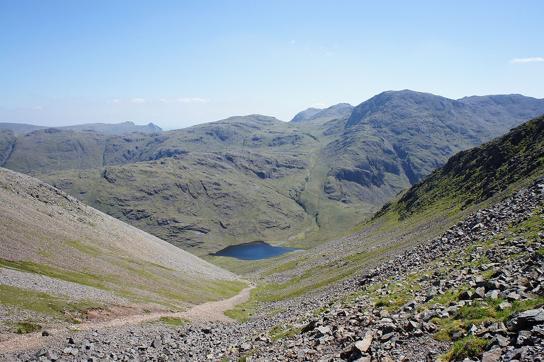
Styhead Tarn below as I cross Windy Gap
Before making the final climb to the summit of Great Gable I went to the top of Gable Crag to see what the view was like. I can see down the length of Ennerdale.
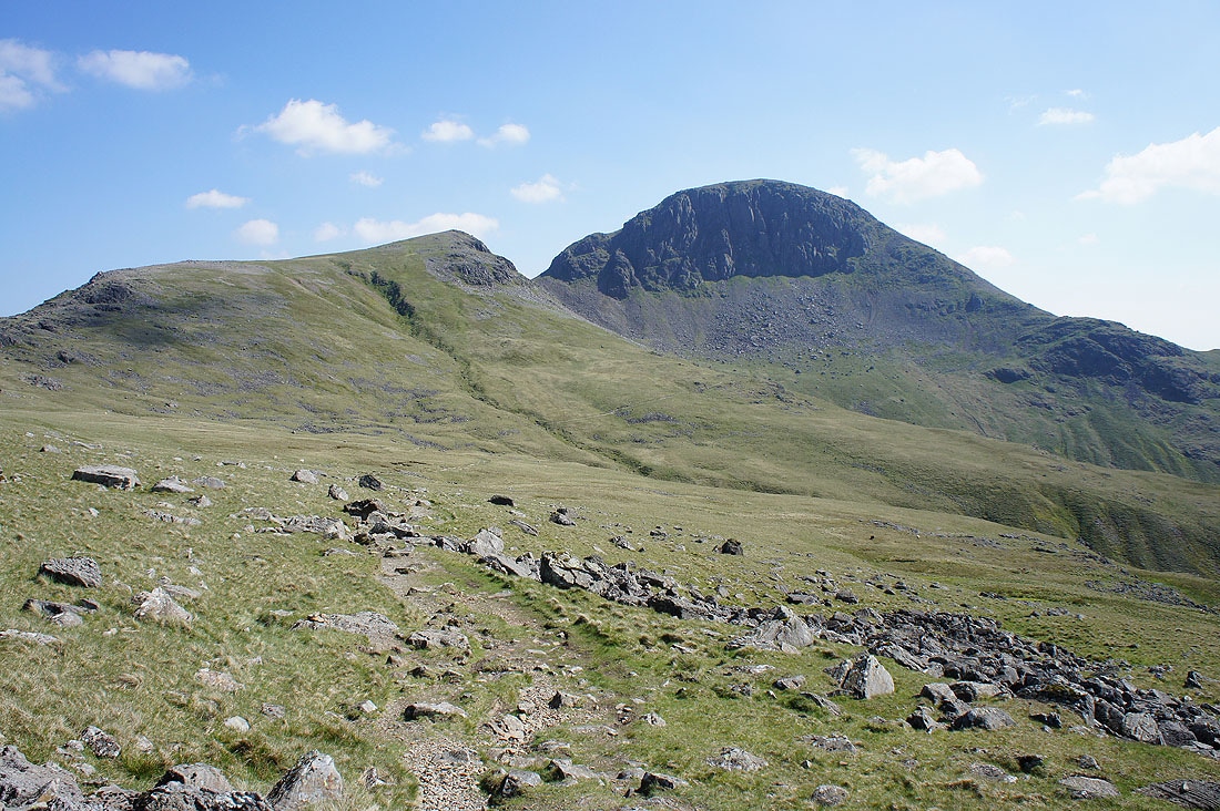
and Green Gable certainly looks inferior from this angle
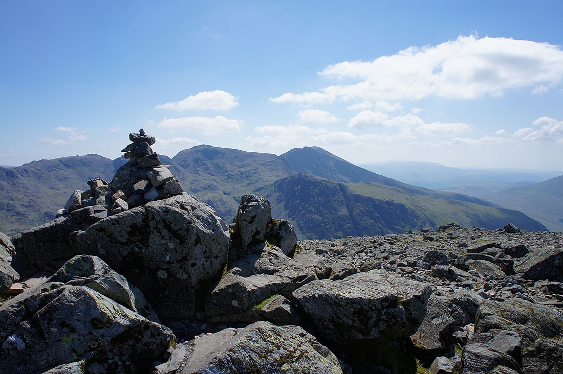
On the summit of Great Gable and it's not that busy. I went to the Westmorland Cairn straight away before coming back up here.
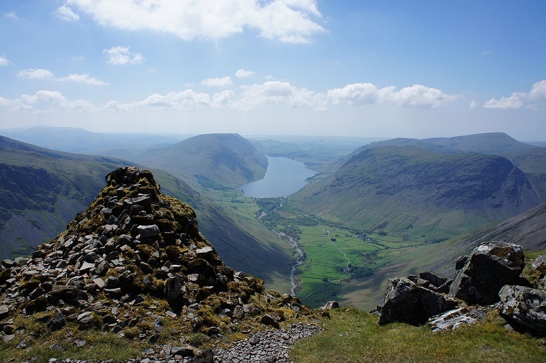
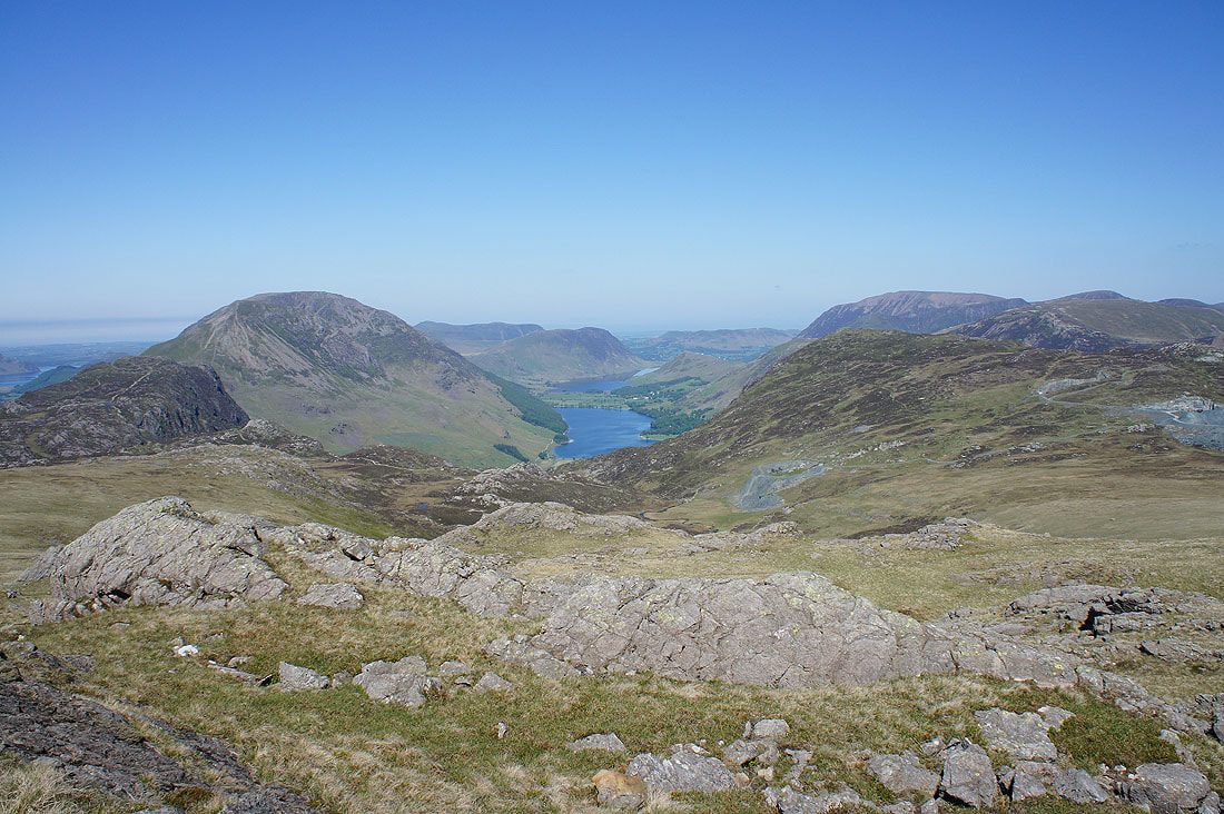
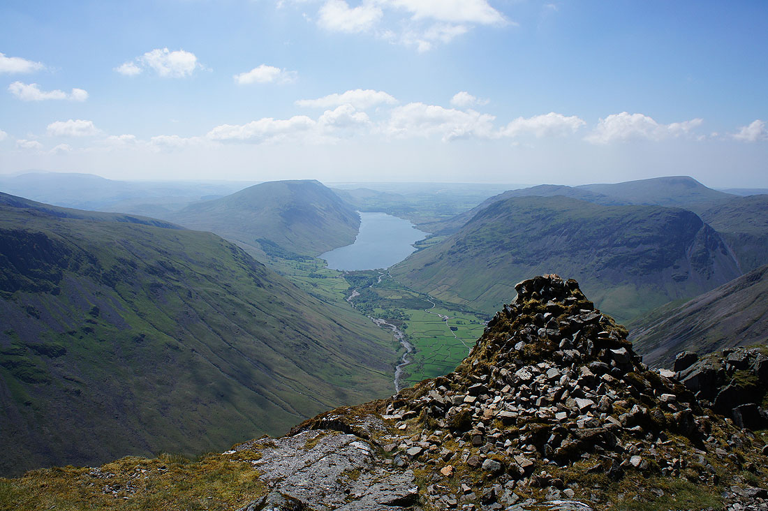
One of the classic Lake District views. Wast Water and Wasdale from the Westmorland Cairn.
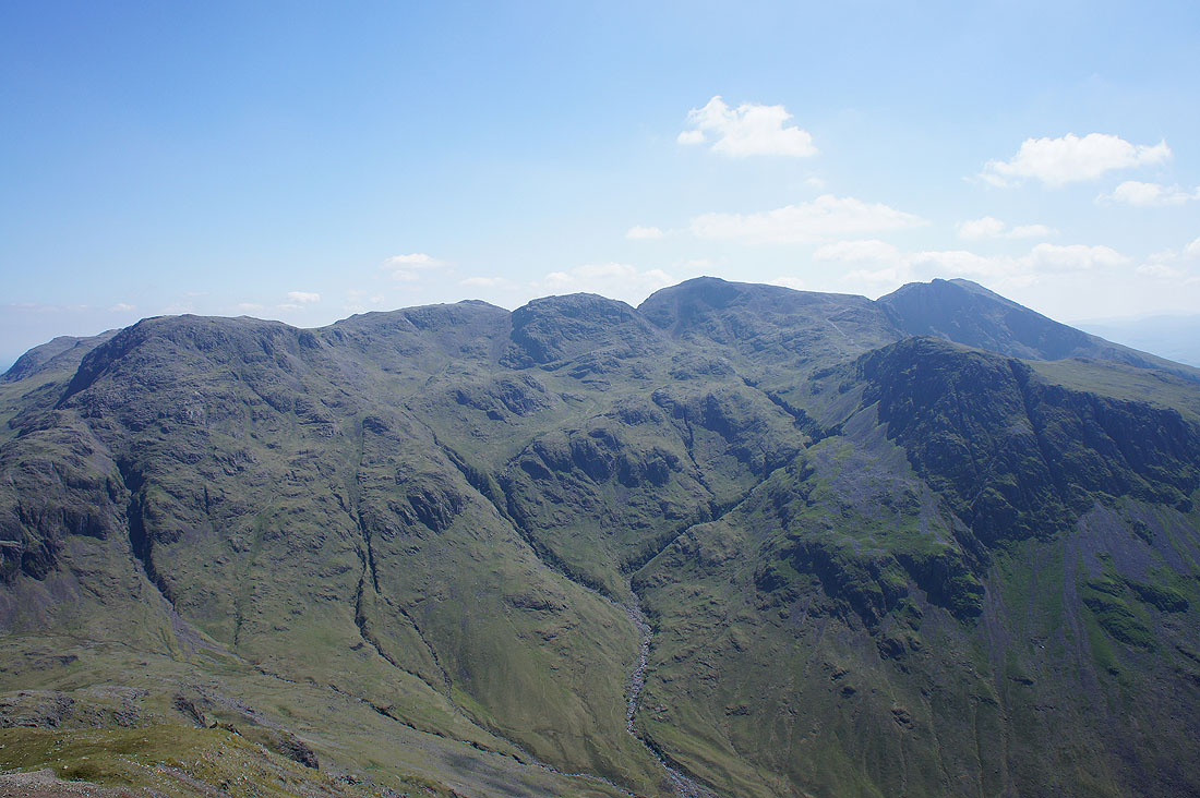
The whole of the Scafell range. Great End, Ill Crag, Broad Crag, Scafell Pike and Lingmell below Scafell.
Scafell Pike and Scafell across the gulf of Great Hell Gate and Lingmell Beck
I couldn't resist taking another shot
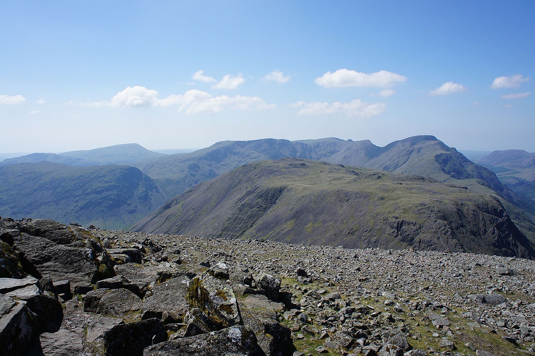
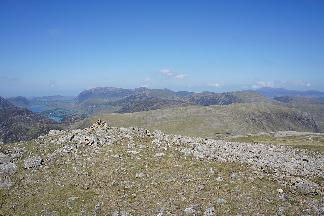
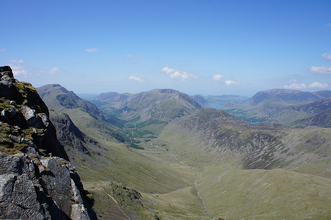
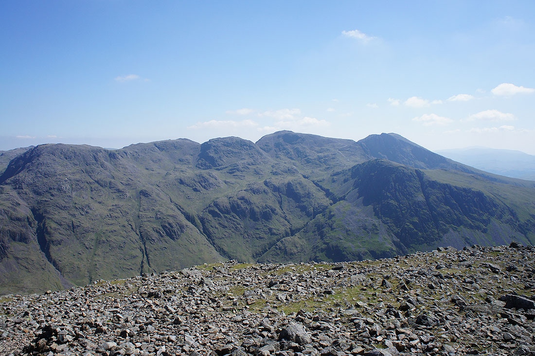
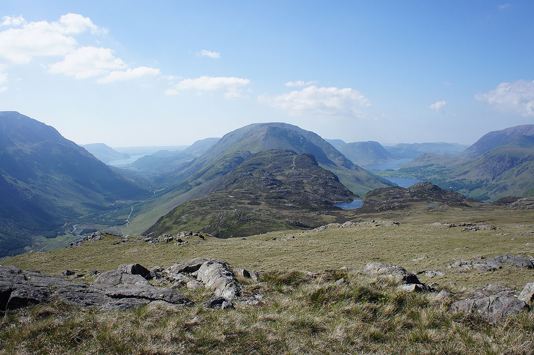
Back on the summit to take in the view. Seatallan, Red Pike, Scoat Fell, Pillar and Kirk Fell.
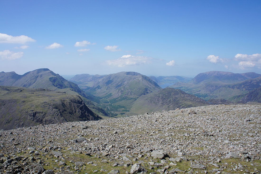
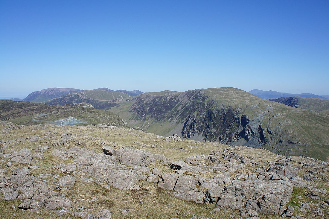
Pillar, Ennerdale, the High Stile range, Buttermere and Grasmoor
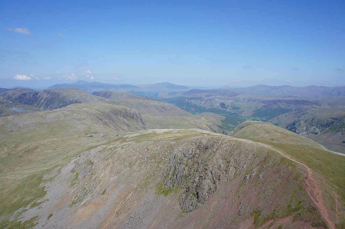
The northwestern fells, Skiddaw and Blencathra
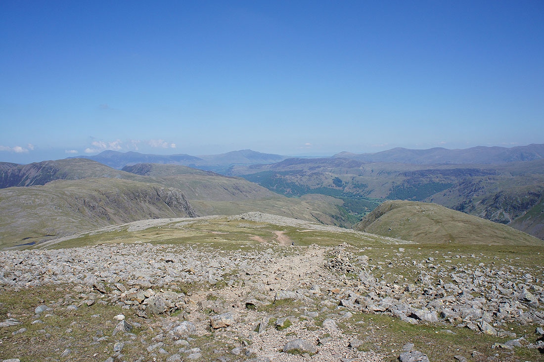
Glaramara with the Helvellyn range and Fairfield in the distance
Harrison Stickle, Pike o'Stickle, Allen Crags, Sprinkling Tarn and Great End
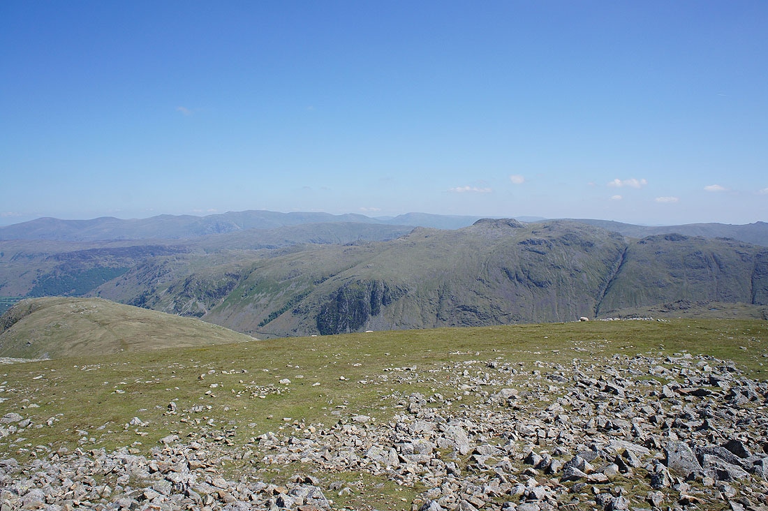
The Scafell range
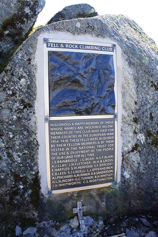
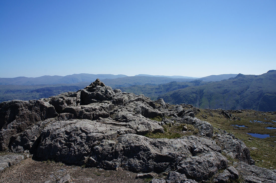
A last shot from summit of The Fell and Rock Climbing Club war memorial
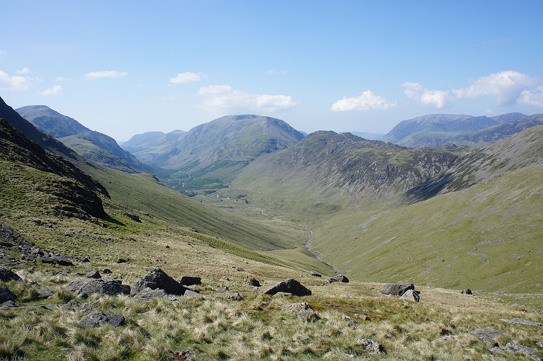
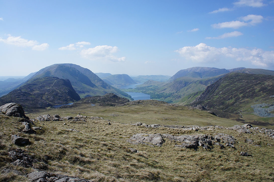
Pillar, Ennerdale and the High Stile range as I make my way down to Beck Head
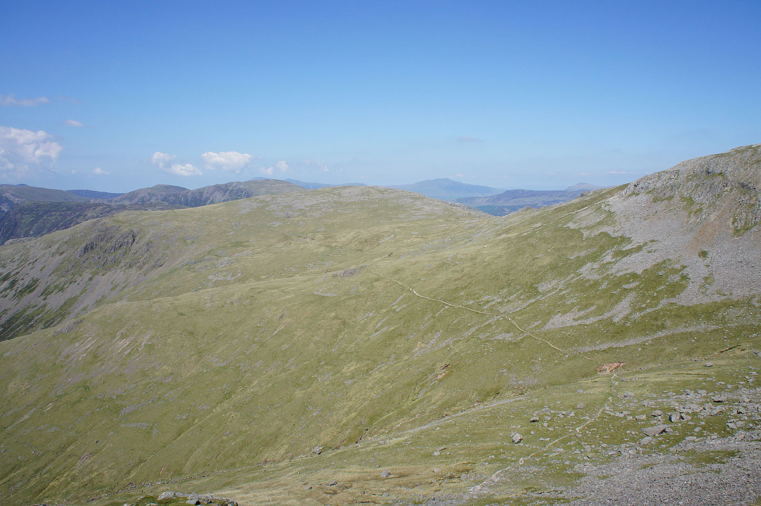
Joining the Moses Trod path which can be seen snaking north across the sides of Brandreth and Green Gable
Greengable Crag and a shadowed Gable Crag
A changing perspective of Ennerdale as I follow the path north..
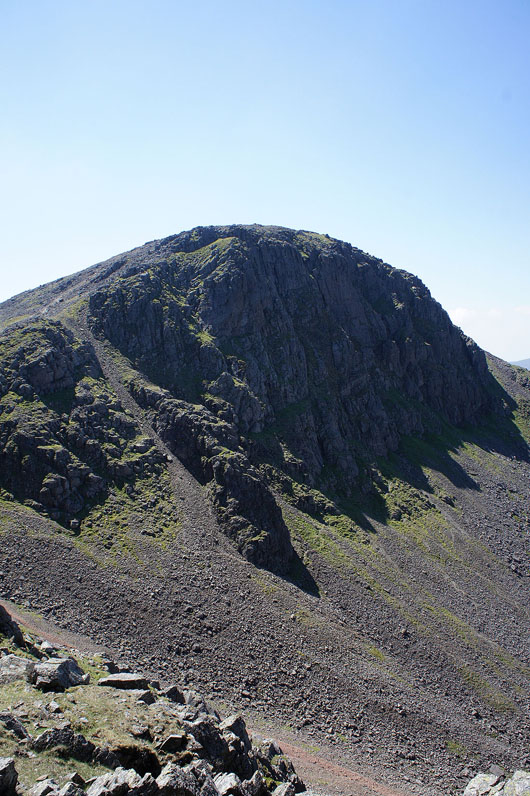
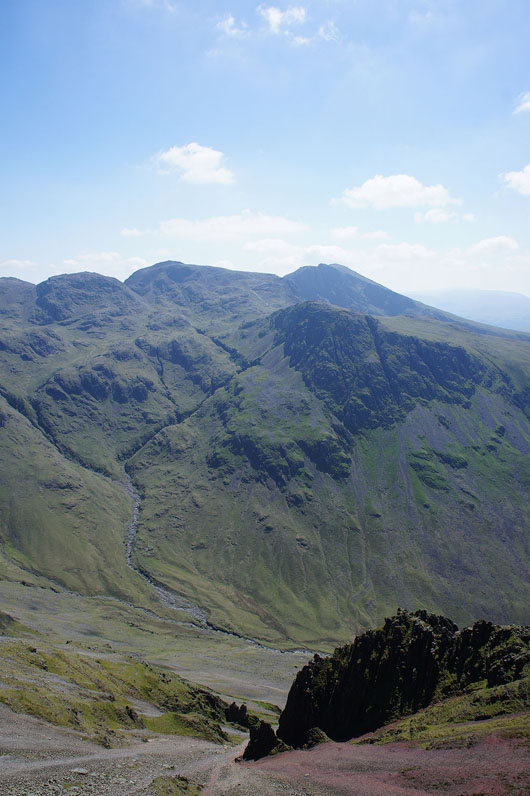
Looking back to Green Gable and an impressive looking Great Gable
Just to the left of the Moses Trod path there are some rocky outcrops that I purposely went to. This was why. Ennerdale and Buttermere in the one shot separated by the High Stile range.
From another rocky outcrop just a bit further on. Haystacks, High Stile, Buttermere and Grasmoor.
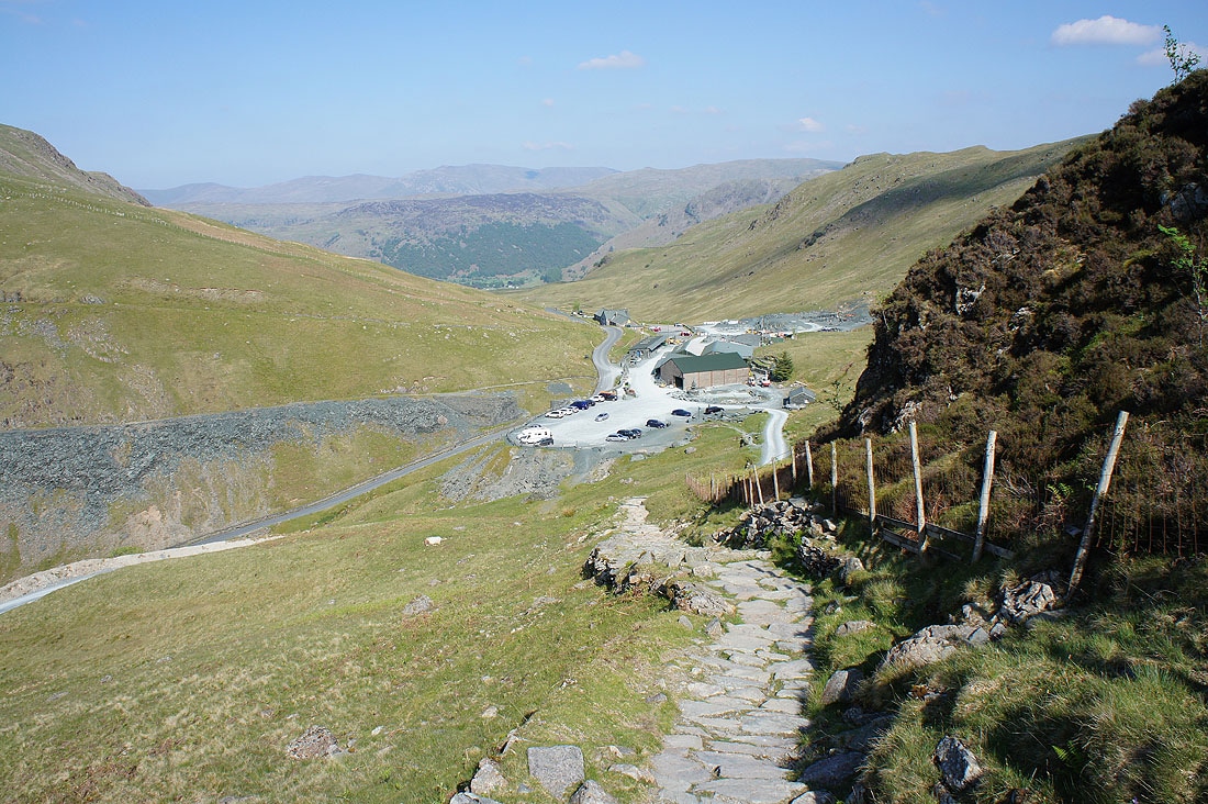
The final descent back to Honister. It's now a very warm afternoon and the ice-cream and can of pop from the cafe was much needed.