26th March 2012 - An Introduction to Ennerdale
Walk Details
Distance walked: 13.9 miles
Total ascent: 3695 ft
OS map used: OL4 - The English Lakes, North-western area
Time taken: 8.5 hrs
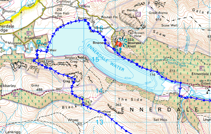
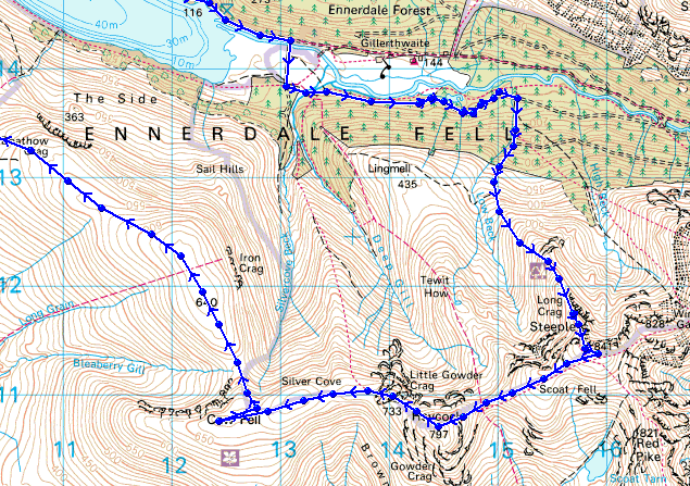
Route description: Bowness Point-Irish Bridge-Low Beck-Steeple-Scoat Fell-Haycock-Little Gowder Crag-Caw Fell-Iron Crag-Crag Fell-Crag Farm House-Bleach Green Cottages-Ennerdale Water-Bowness Point
A glorious day for my first visit to Ennerdale. The haze of yesterday has gone and the visibility is superb. Once I was on the tops the Isle of Man seemed close enough to touch and I'm sure that I could see the mountains of Snowdonia across the Irish Sea to the south. Looking in that direction, there's nothing else they could be. I measured the distance in my atlas and it's about 90 miles.
I started the walk from the car park at Bowness Point which is as far up Ennerdale as you can take a car. I then followed the track by the side of the lake to the Irish Bridge which I crossed to continue up the south side of the valley. Once I reached Low Beck I then took the path up through the forest to get on the ridge to the summit of Steeple. From Steeple I did the down and up to Scoat Fell and then it was a great high level walk across Haycock, Caw Fell and Iron Crag to the final summit of the day, Crag Fell. My route of descent was down a path across Ben Gill, through the woods below and then back by the shore of Ennerdale Water.
Total ascent: 3695 ft
OS map used: OL4 - The English Lakes, North-western area
Time taken: 8.5 hrs
Route description: Bowness Point-Irish Bridge-Low Beck-Steeple-Scoat Fell-Haycock-Little Gowder Crag-Caw Fell-Iron Crag-Crag Fell-Crag Farm House-Bleach Green Cottages-Ennerdale Water-Bowness Point
A glorious day for my first visit to Ennerdale. The haze of yesterday has gone and the visibility is superb. Once I was on the tops the Isle of Man seemed close enough to touch and I'm sure that I could see the mountains of Snowdonia across the Irish Sea to the south. Looking in that direction, there's nothing else they could be. I measured the distance in my atlas and it's about 90 miles.
I started the walk from the car park at Bowness Point which is as far up Ennerdale as you can take a car. I then followed the track by the side of the lake to the Irish Bridge which I crossed to continue up the south side of the valley. Once I reached Low Beck I then took the path up through the forest to get on the ridge to the summit of Steeple. From Steeple I did the down and up to Scoat Fell and then it was a great high level walk across Haycock, Caw Fell and Iron Crag to the final summit of the day, Crag Fell. My route of descent was down a path across Ben Gill, through the woods below and then back by the shore of Ennerdale Water.
Route map
© Crown copyright. All rights reserved. License number PU 100034184.
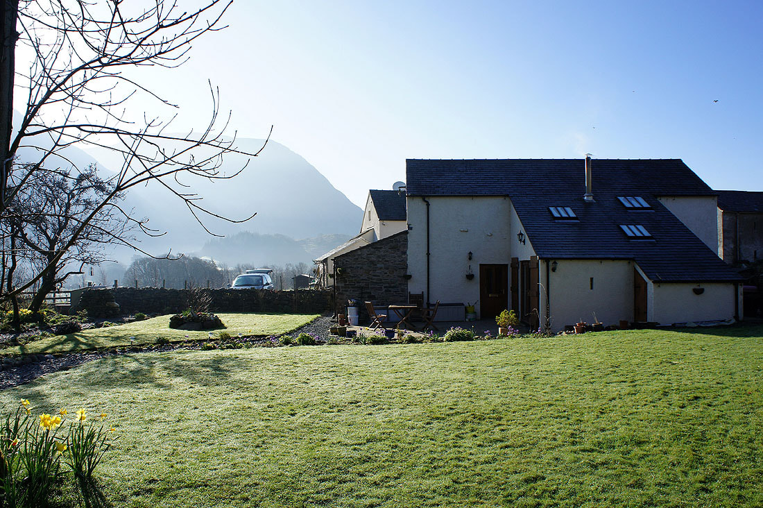
A glorious morning at my place of residence for the week, Damson Ghyll in Loweswater
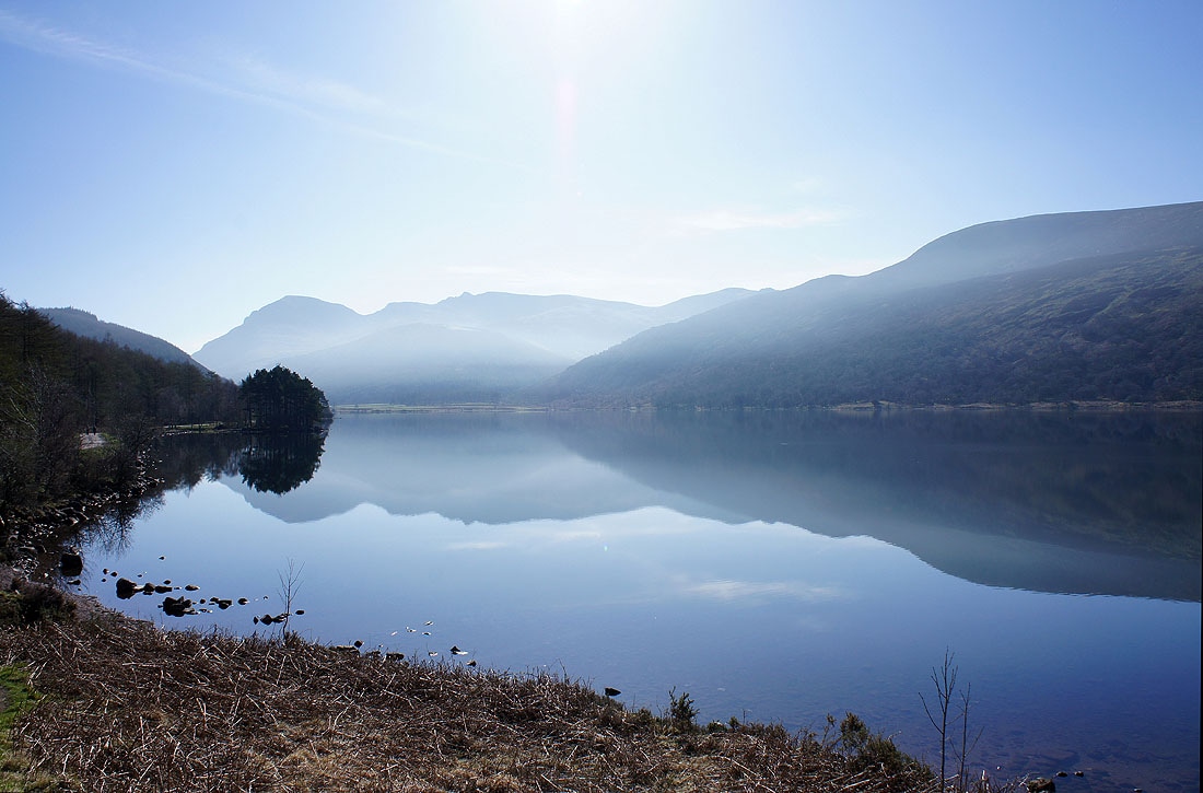
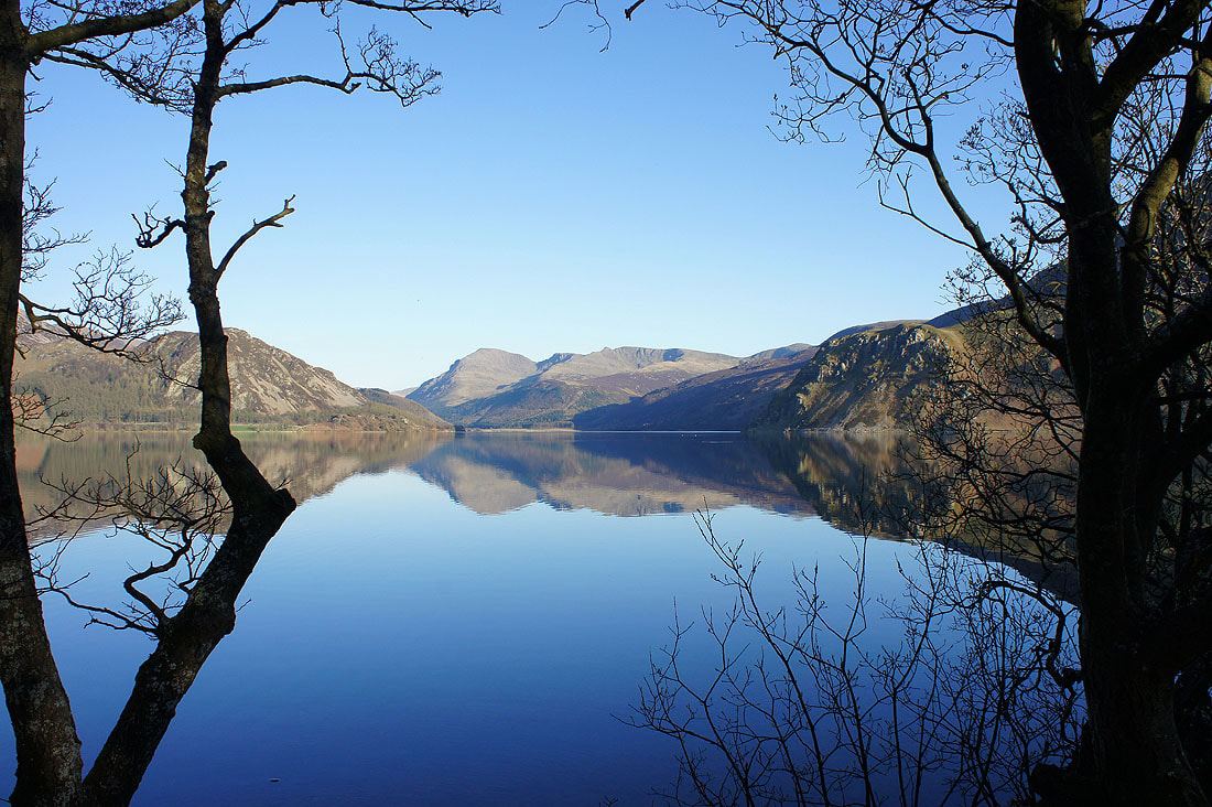
A beautiful start to the walk by Ennerdale Water
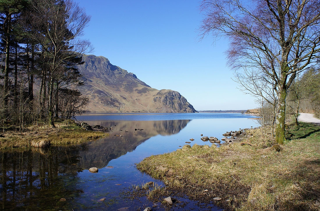
Reflected Crag Fell and Anglers Crag
Crossing the bridge over Woundell Beck. The slopes on the other side of the valley rise to the summit of Red Pike.
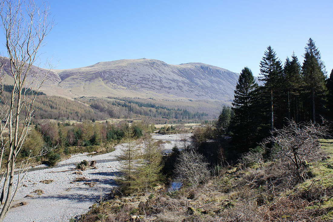
The view across the River Liza to Red Pike and High Stile
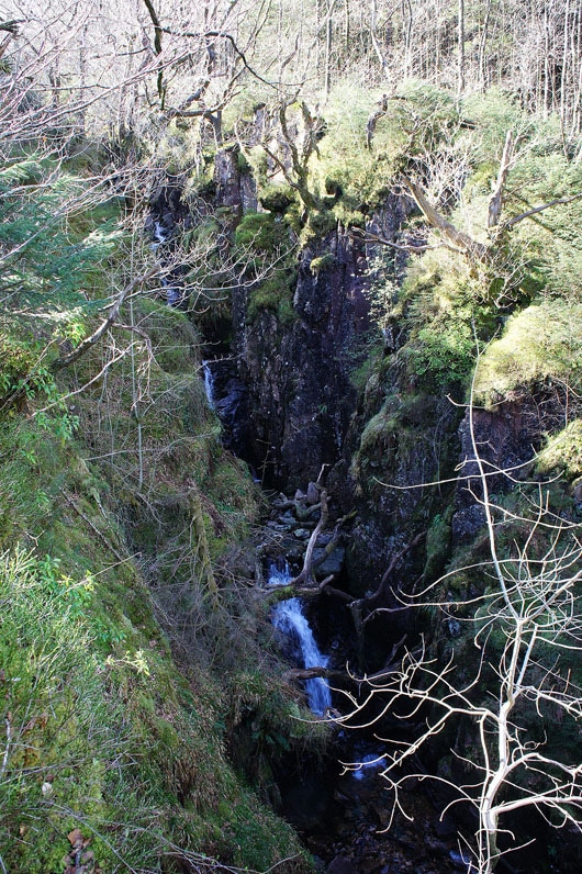
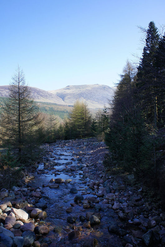
Waterfalls in the ravine of Low Beck
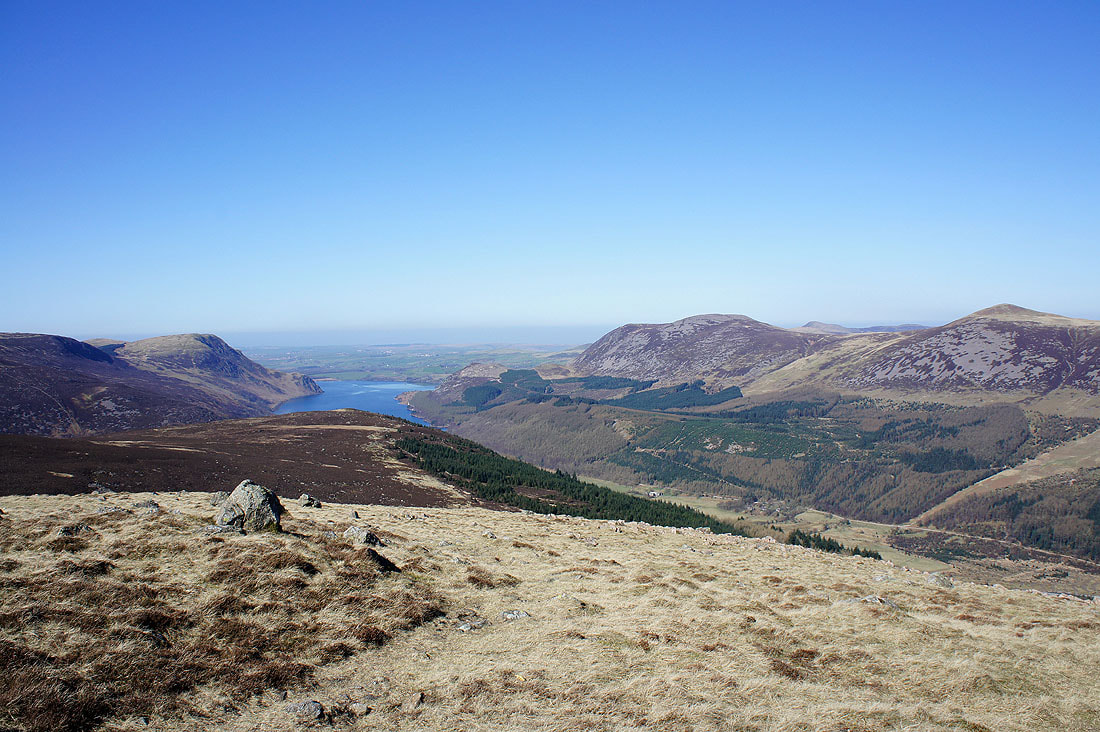
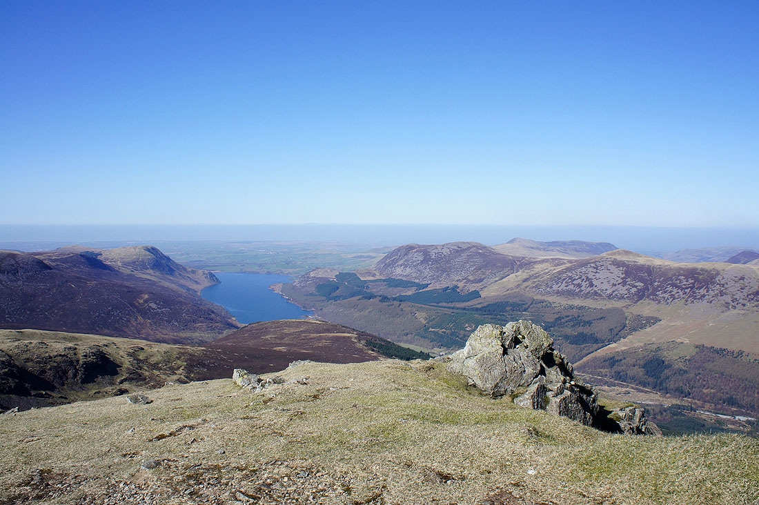
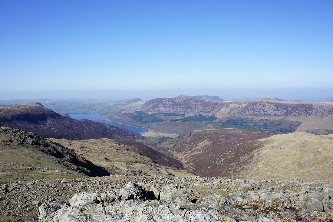
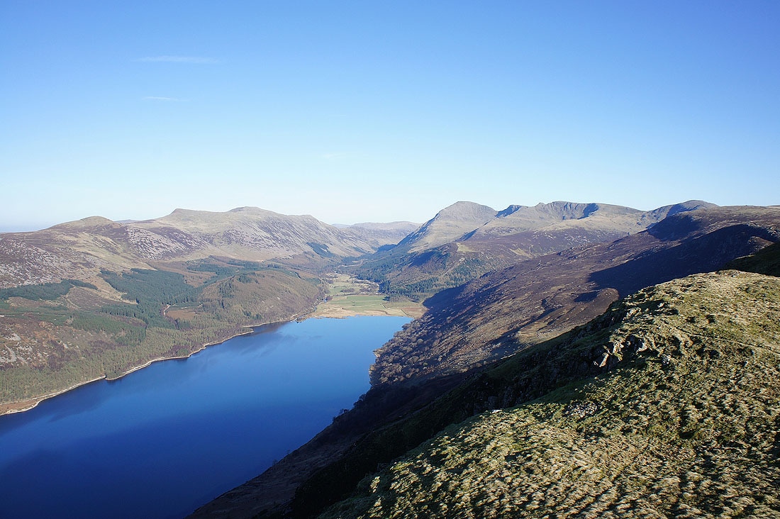
On the ridge to Steeple and the view has opened out. Ennerdale Water can be seen with the summits of Great Borne and Starling Dodd on the other side of the valley.
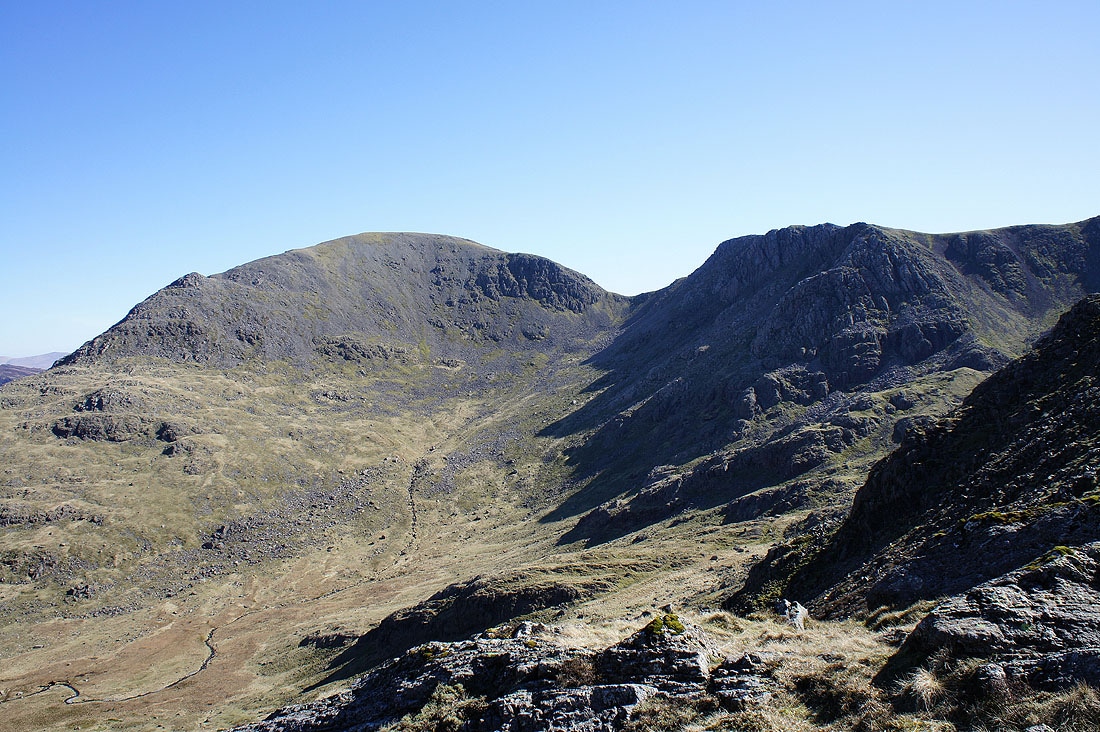
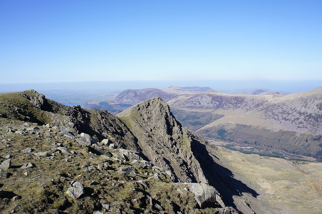
Pillar and Black Crag
The view down Ennerdale from the summit of Steeple
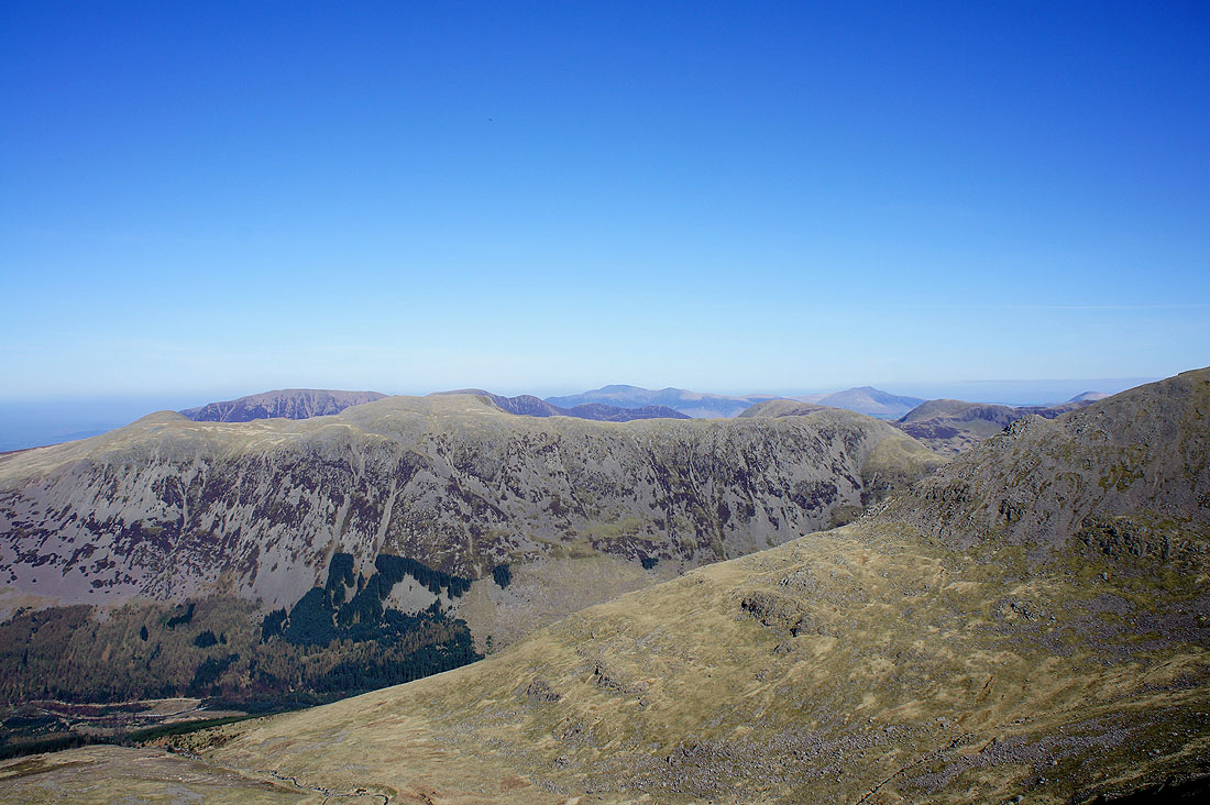
The High Stile ridge on the other side of Ennerdale with Skiddaw and Blencathra in the distance
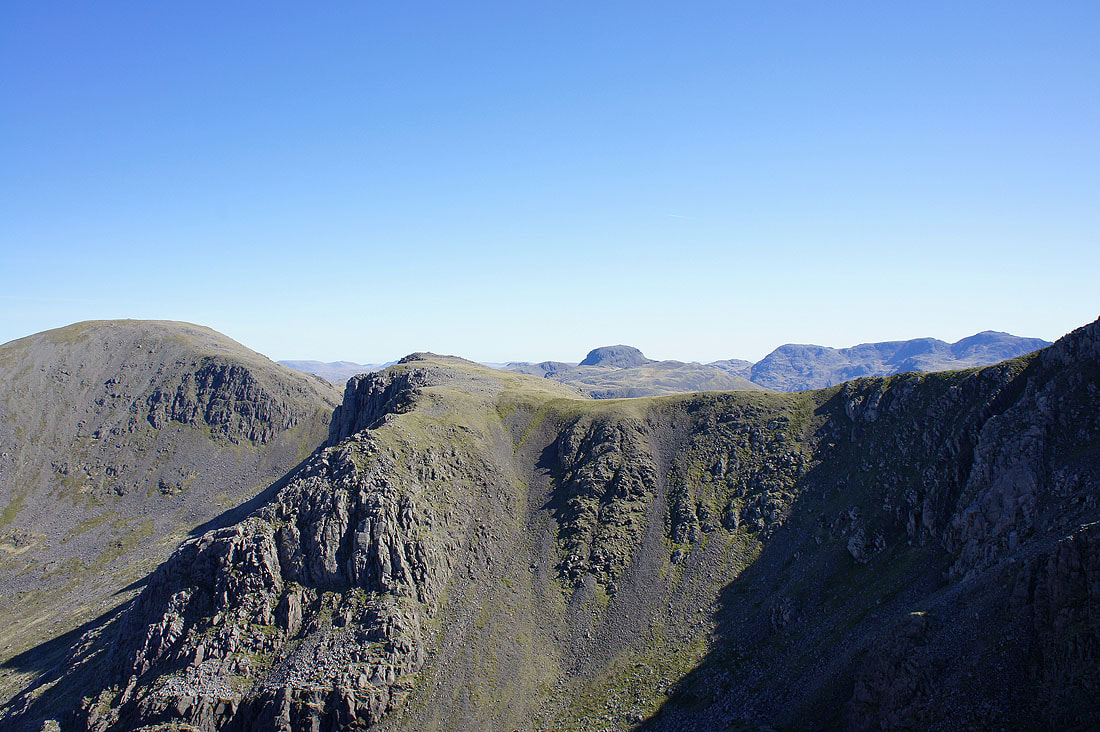
Pillar and Black Crag. The domed top of Great Gable and Great End to Scafell Pike is behind.
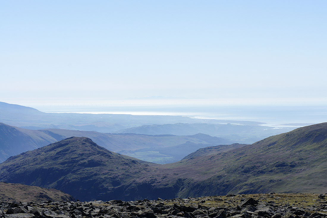
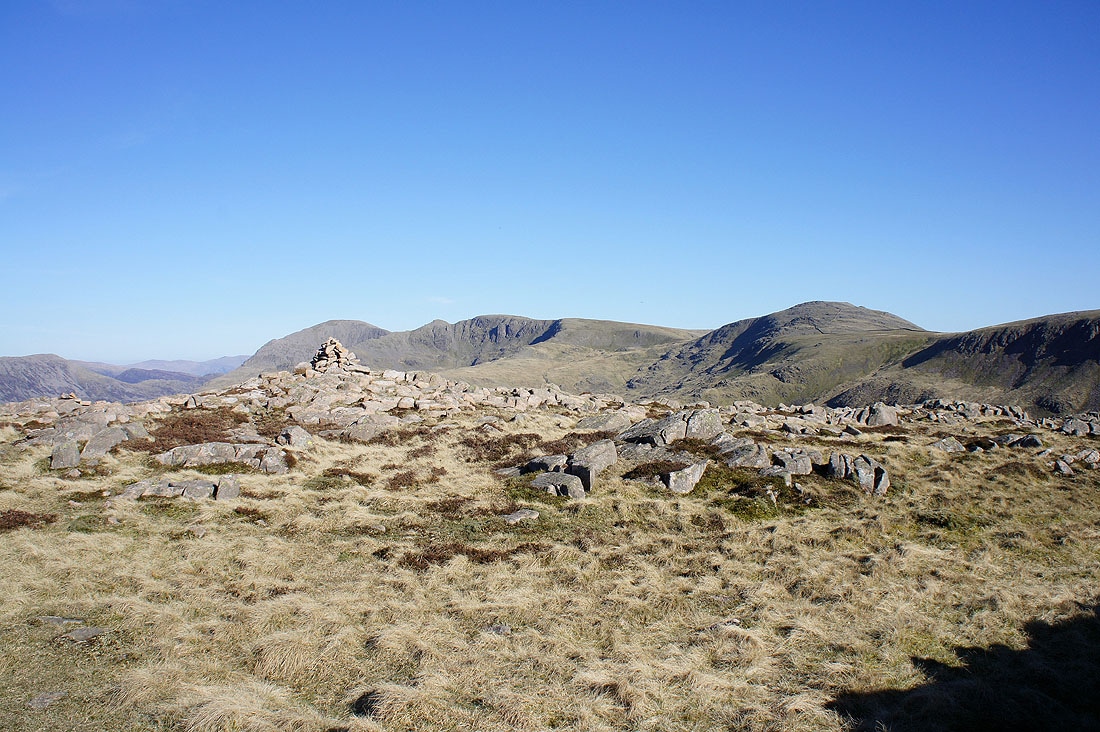
The ridge of Tewit How rising up to Scoat Fell is across Mirklin Cove with a good part of the rest of my walk heading into the distance across Haycock, Caw Fell and Iron Crag. The first appearance of the Isle of Man can be seen above Caw Fell.
On Scoat Fell looking back at Steeple
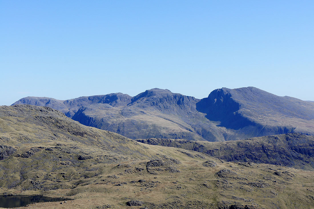
Great Gable and the Scafells. The fell on the right is the Wasdale Red Pike.
Pillar and Great Gable with Helvellyn and Fairfield in the distance between them
Black Combe far away to the south. The Wastwater Screes on the left and Middle Fell, Seatallan middle and right respectively.
I hope you can make out the faint outline of hills in the middle of the picture on the horizon. They're the mountains of Snowdonia. About 90 miles away as the crow flies. It was easier to make them out with the naked eye than for my camera to focus on them.
Skiddaw and Blencathra in the distance. The fell on the right is Pillar.
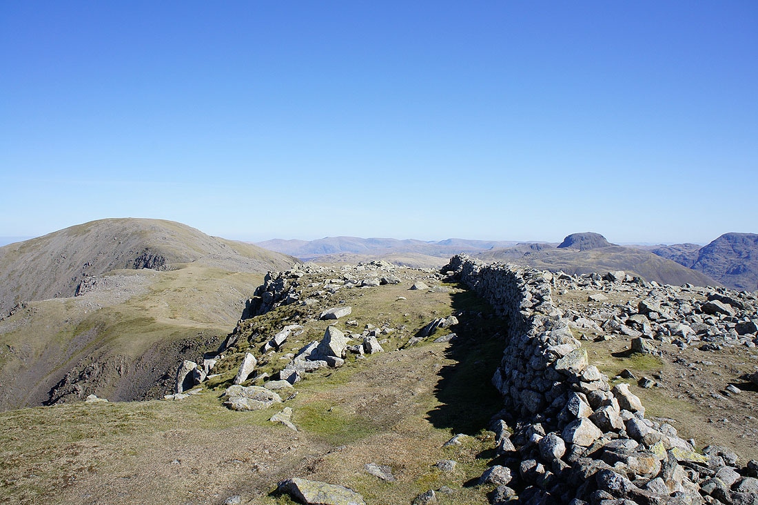
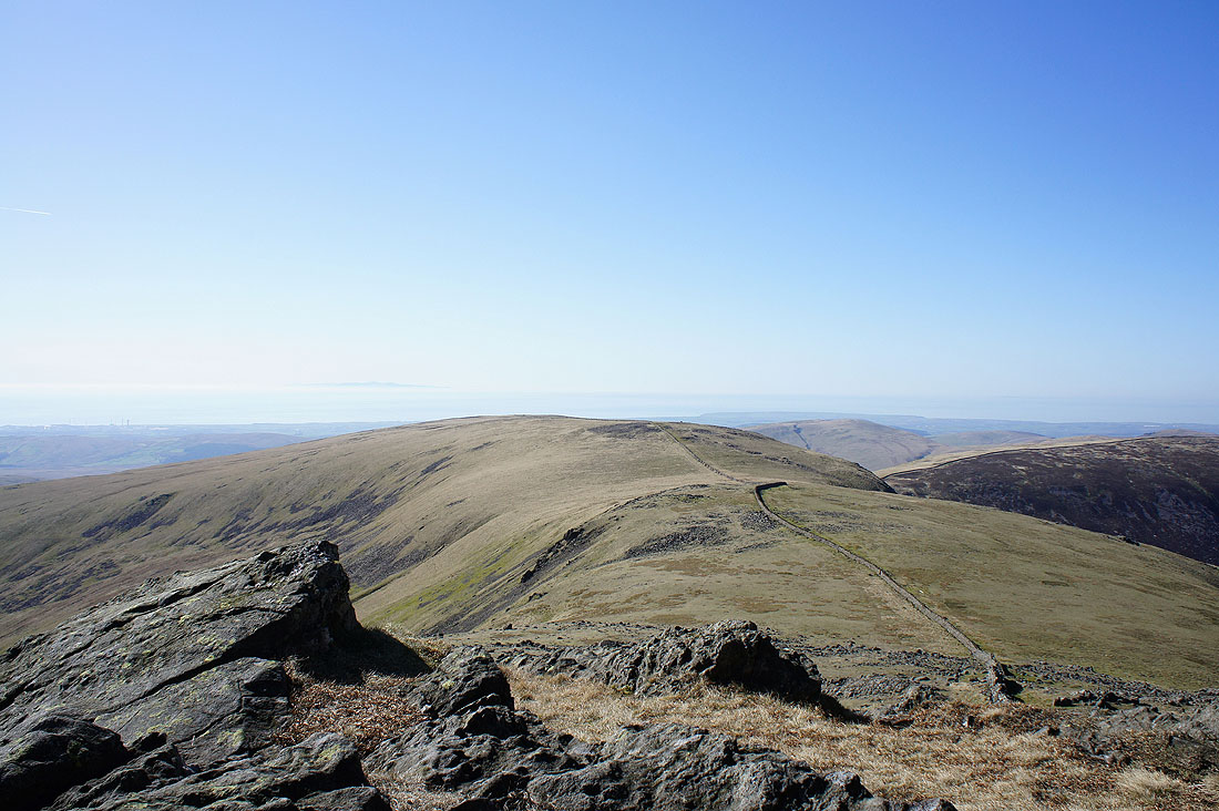
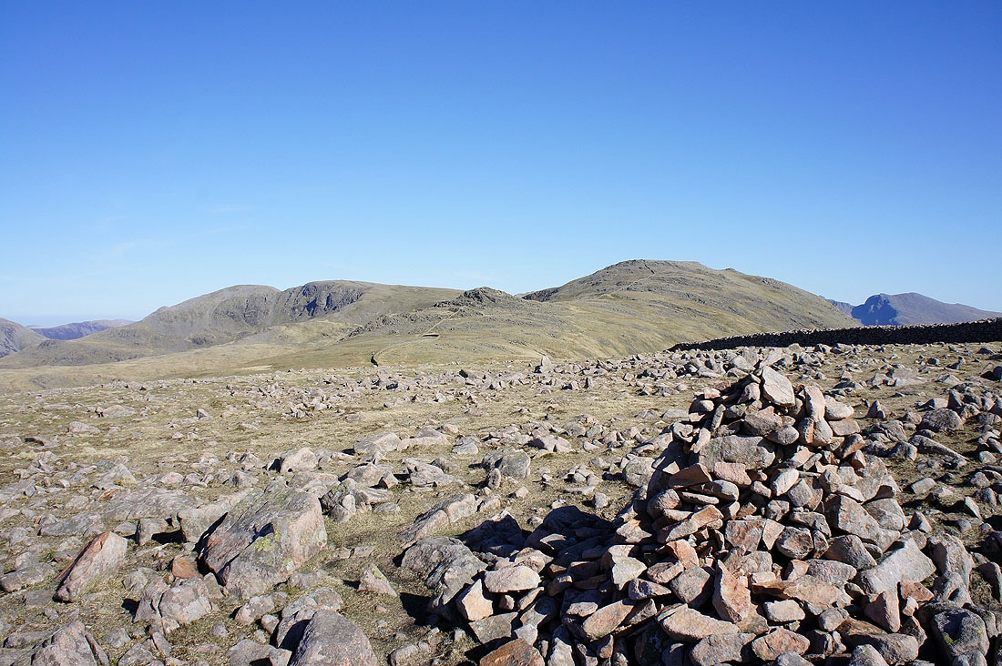
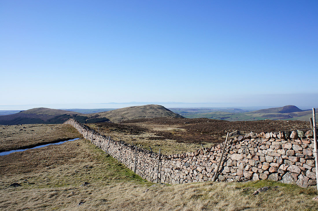
Follow the wall to my next summits of Haycock and Caw Fell
Looking down into Mirklin Cove and across to the ridge of Tewit How and Ennerdale Water
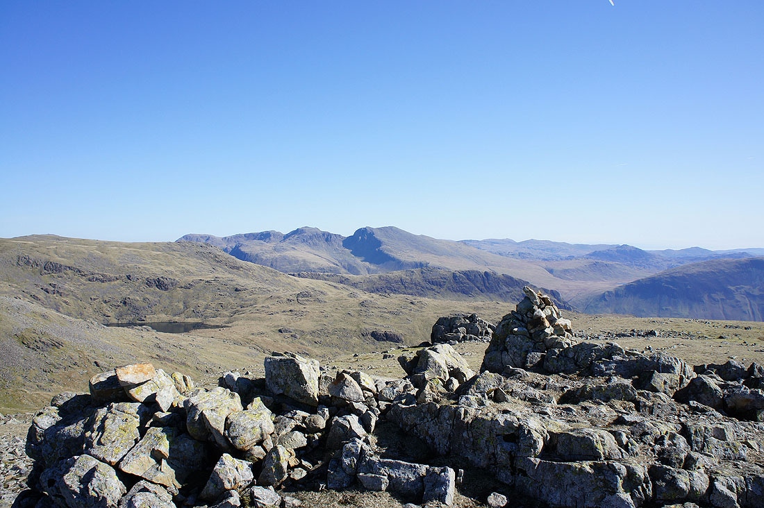
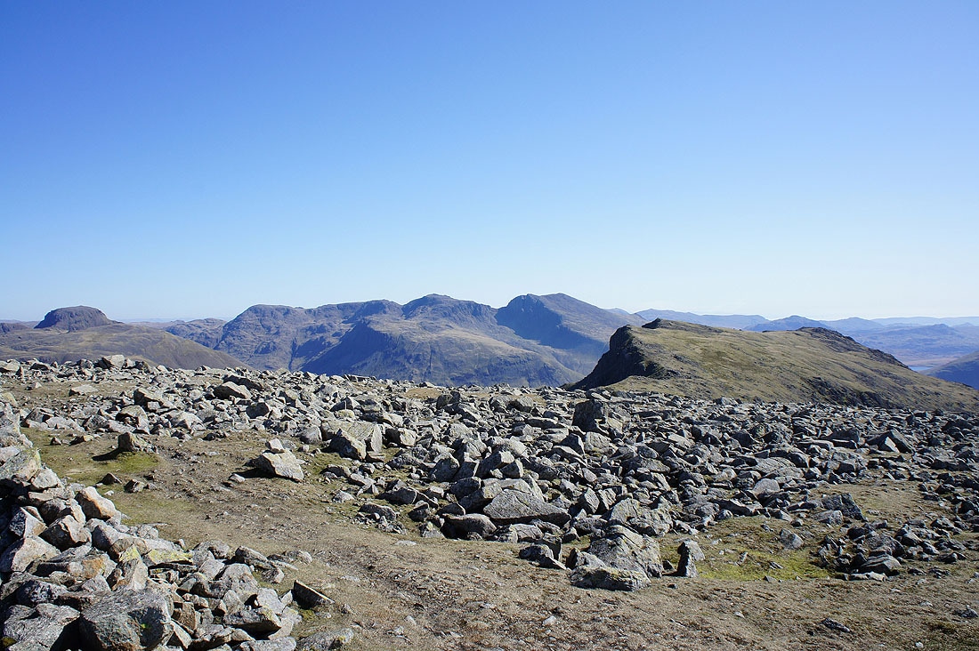
The Scafells from Haycock
Left to right. Great End, Broad Crag, Scafell Pike and Scafell.
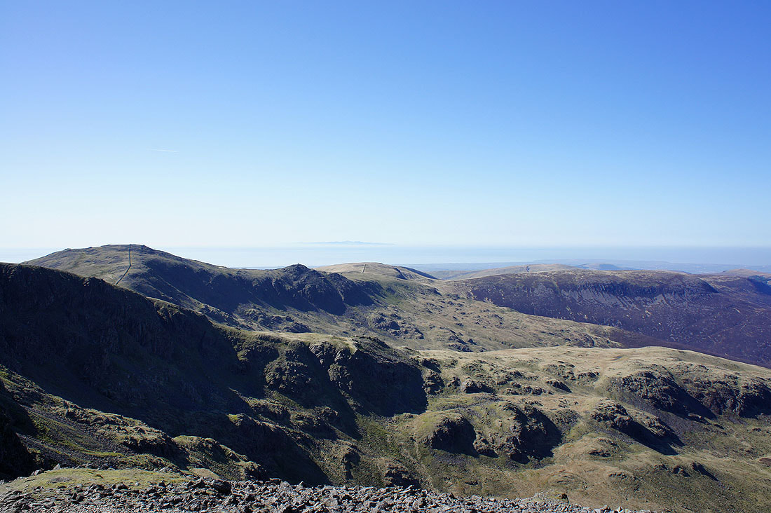
Seatallan
My route follows the wall across Little Gowder Crag, then Caw Fell before turning right for Iron Crag
Ennerdale from Little Gowder Crag
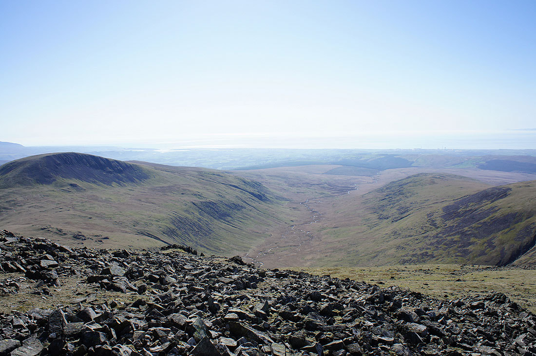
The valley of Blengdale below
Next stop Caw Fell
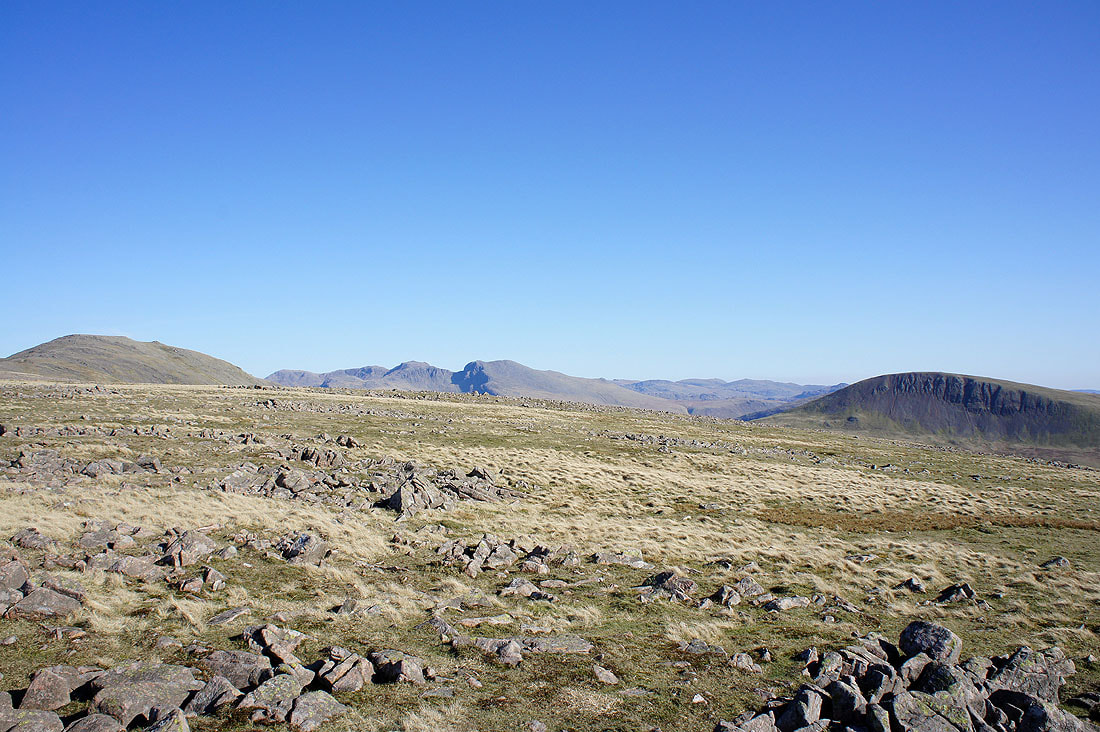
Iron Crag from Caw Fell
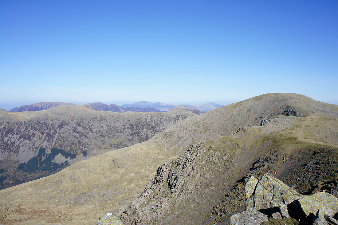
A look back at some of the tops visited so far. Little Gowder Crag, then up to Haycock and Scoat Fell.

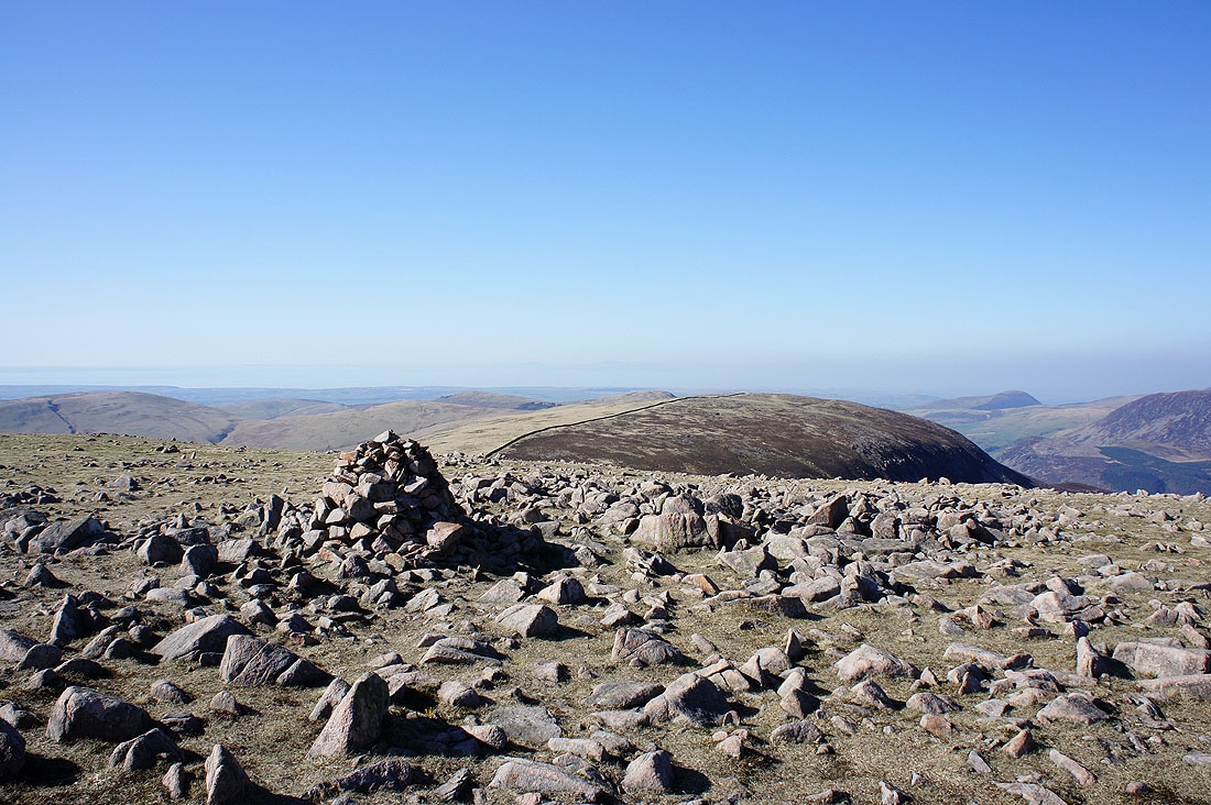
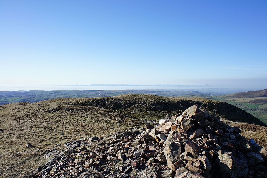
The Isle of Man. From the summit cairn I made my way west to a cairn that marks a viewpoint on the edge of the summit plateau. This is where the next few photos were taken from.
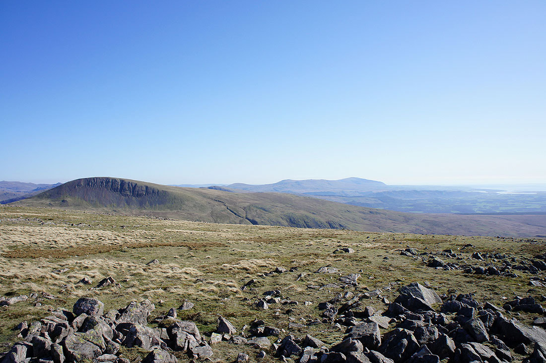
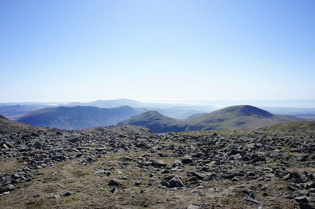
Seatallan with Black Combe in the distance
The Scafell range and Seatallan
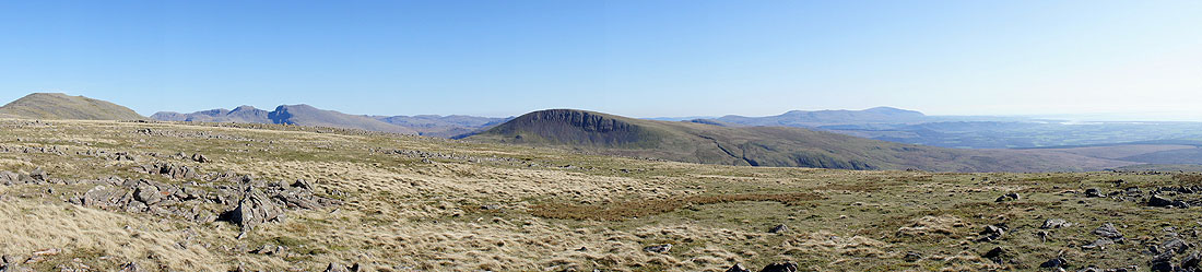
Panorama from east round to south
The summit of Iron Crag with Pillar, Scoat Fell and Haycock in the background. I didn't actually visit the summit and took this picture looking over the wall that runs across the top. There are gates at various points to allow you to get to the other side but I've been to the summit before and I need to get a move on.
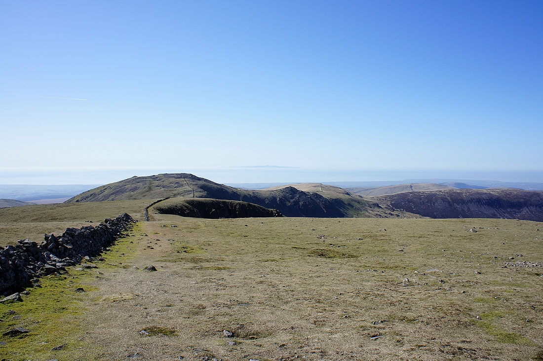
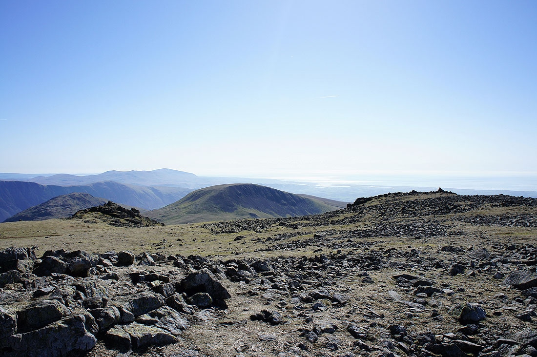
The last summit of the day ahead, Crag Fell
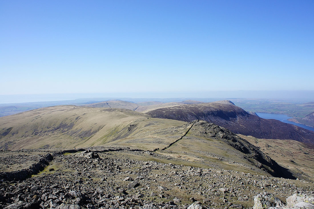
On Crag Fell and looking across the Solway Firth to the hills of Dumfriesshire
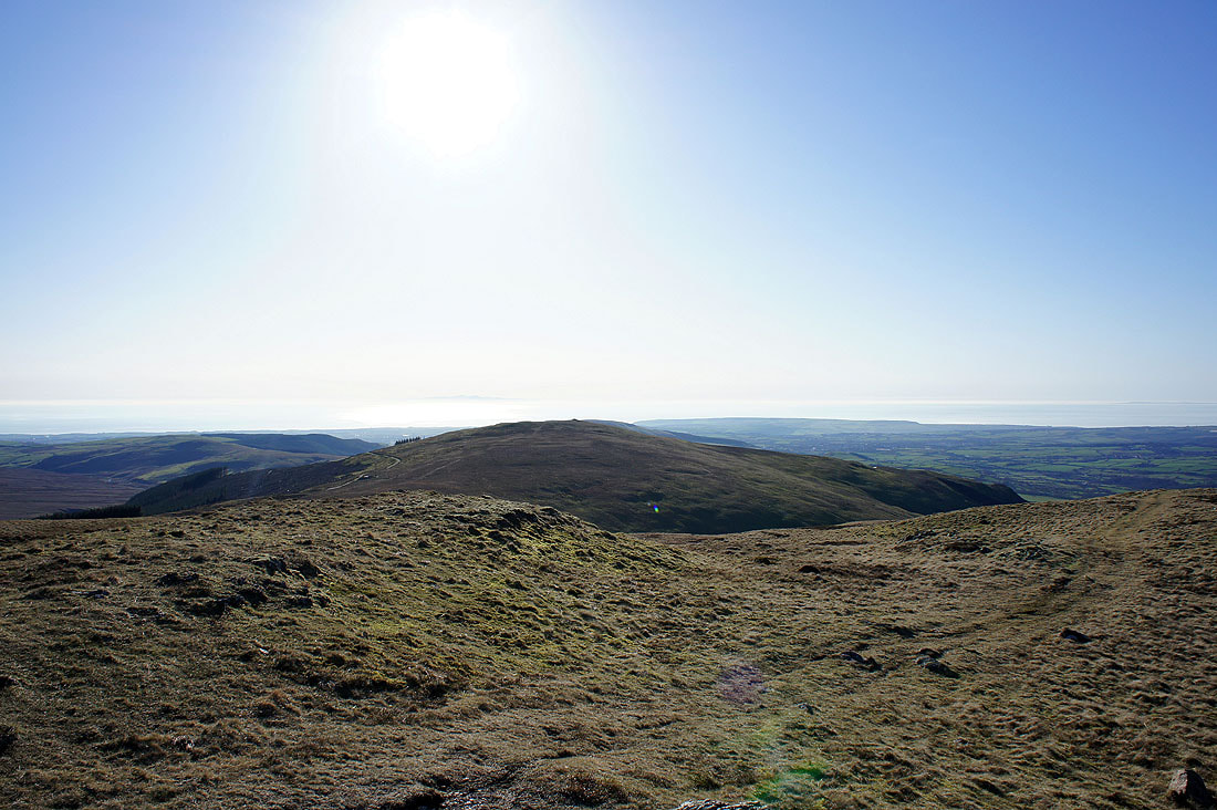
The neighbouring fell of Grike
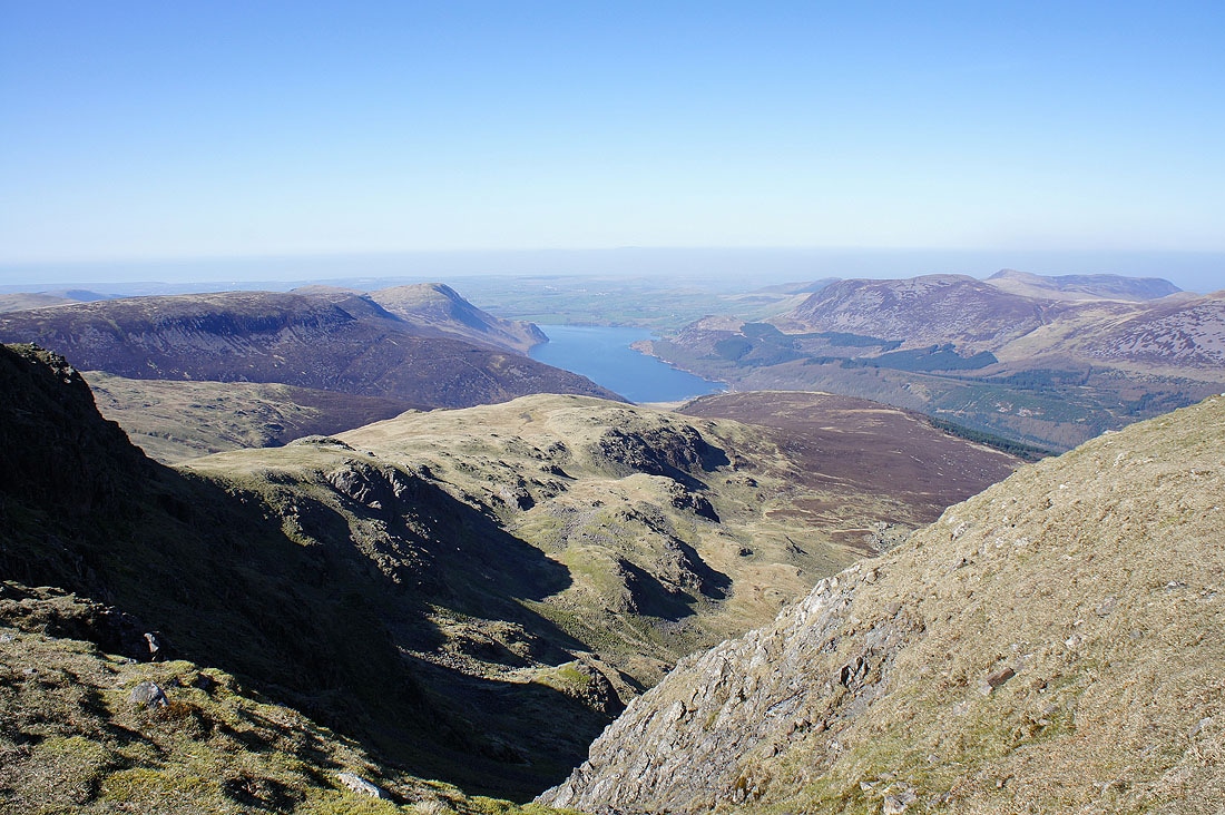
The best place to be for a view of Ennerdale
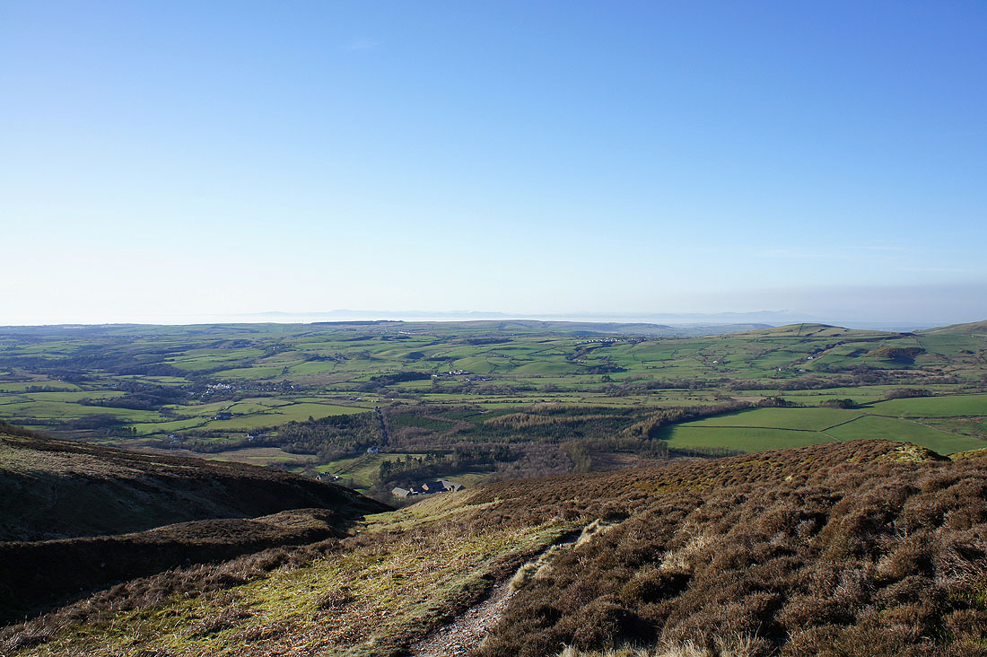
The view out across the coastal plain as I make my way down the path by Ben Gill
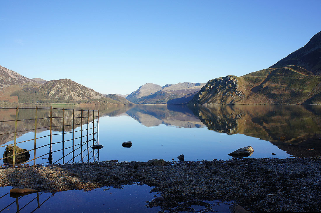
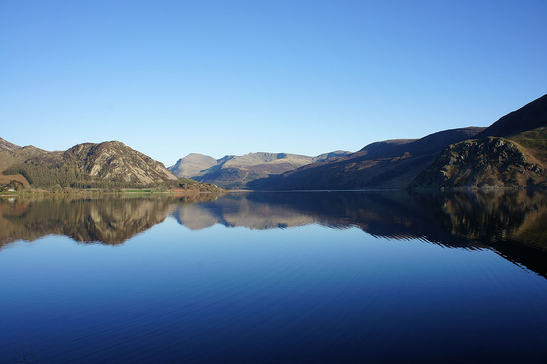
Reflecting on Ennerdale. A great day on the fells comes to a perfect end as I head round the shore of the lake and back to Bowness Point.