26th November 2016 - Fairfield via Stone Arthur
Walk Details
Distance walked: 7.7 miles
Total ascent: 3069 ft
OS map used: OL7 - The English Lakes, Southeastern area & OL5 - The English Lakes, Northeastern area
Time taken: 6.5 hrs
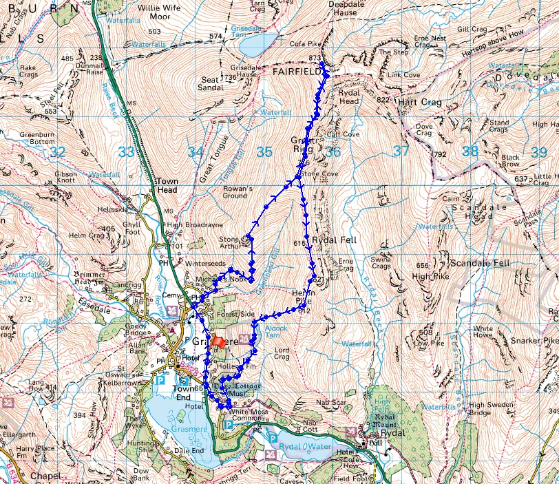
Rout description: Layby on A591 outside Grasmere-Swan Hotel-Michael's Nook-Stone Arthur-Great Rigg-Fairfield-Great Rigg-Heron Pike-Alcock Tarn-Grey Crag-Town End-Layby on A591 outside Grasmere
My walks in the Lakes are quite infrequent nowadays but when the weather is as good as it was today it's definitely worth the time and effort of driving up there. The forecast was for clear and sunny skies, superb visibility high up above the low lying mist that was trapped beneath a temperature inversion and a chance of cloud coming in from the north and east towards the end of the day. It was correct in all respects, a really great day to be on the high fells. The air was so clear I could make out the mountains in Snowdonia in the distance across the Irish Sea. I set off from outside Grasmere with it cold, frosty and not a breath of wind but as I climbed it became warmer and above Stone Arthur, windier. It was windy on the summit of Fairfield and not as cold as it looked as the cover from recent snowfall was melting and had turned soft and slushy. The Wainwright of Stone Arthur took my second round count up to 90, hopefully breaking the 100 mark isn't too far away.
From where I parked in the first layby on the A591 north of the roundabout for Grasmere I set off by walking by the main road north to the Swan Hotel. Here I turned right and followed the road uphill and round to the left to reach the public footpath to Stone Arthur and Alcock Tarn. A steep lane is taken uphill and at its top the path reaches the open fell and forks. I took the left hand one that zig-zags up the fellside to reach Stone Arthur. After taking in the view I continued uphill to the next summit Great Rigg, and from there to the high point of the day, Fairfield. Lunch had I retraced my steps back to Great Rigg and continued south down the ridge to Heron Pike, from where I had a pathless descent down the fellside to the west to reach Alcock Tarn. I then picked up the footpath by the western shores of the tarn and followed it south down into the valley to the corpse road bridleway. Here I turned right to reach the road down into Town End, the A591 and the layby where I was parked.
Total ascent: 3069 ft
OS map used: OL7 - The English Lakes, Southeastern area & OL5 - The English Lakes, Northeastern area
Time taken: 6.5 hrs
Rout description: Layby on A591 outside Grasmere-Swan Hotel-Michael's Nook-Stone Arthur-Great Rigg-Fairfield-Great Rigg-Heron Pike-Alcock Tarn-Grey Crag-Town End-Layby on A591 outside Grasmere
My walks in the Lakes are quite infrequent nowadays but when the weather is as good as it was today it's definitely worth the time and effort of driving up there. The forecast was for clear and sunny skies, superb visibility high up above the low lying mist that was trapped beneath a temperature inversion and a chance of cloud coming in from the north and east towards the end of the day. It was correct in all respects, a really great day to be on the high fells. The air was so clear I could make out the mountains in Snowdonia in the distance across the Irish Sea. I set off from outside Grasmere with it cold, frosty and not a breath of wind but as I climbed it became warmer and above Stone Arthur, windier. It was windy on the summit of Fairfield and not as cold as it looked as the cover from recent snowfall was melting and had turned soft and slushy. The Wainwright of Stone Arthur took my second round count up to 90, hopefully breaking the 100 mark isn't too far away.
From where I parked in the first layby on the A591 north of the roundabout for Grasmere I set off by walking by the main road north to the Swan Hotel. Here I turned right and followed the road uphill and round to the left to reach the public footpath to Stone Arthur and Alcock Tarn. A steep lane is taken uphill and at its top the path reaches the open fell and forks. I took the left hand one that zig-zags up the fellside to reach Stone Arthur. After taking in the view I continued uphill to the next summit Great Rigg, and from there to the high point of the day, Fairfield. Lunch had I retraced my steps back to Great Rigg and continued south down the ridge to Heron Pike, from where I had a pathless descent down the fellside to the west to reach Alcock Tarn. I then picked up the footpath by the western shores of the tarn and followed it south down into the valley to the corpse road bridleway. Here I turned right to reach the road down into Town End, the A591 and the layby where I was parked.
Route map
© Crown copyright. All rights reserved. License number PU 100034184.

Frosty fields across to Silver How..
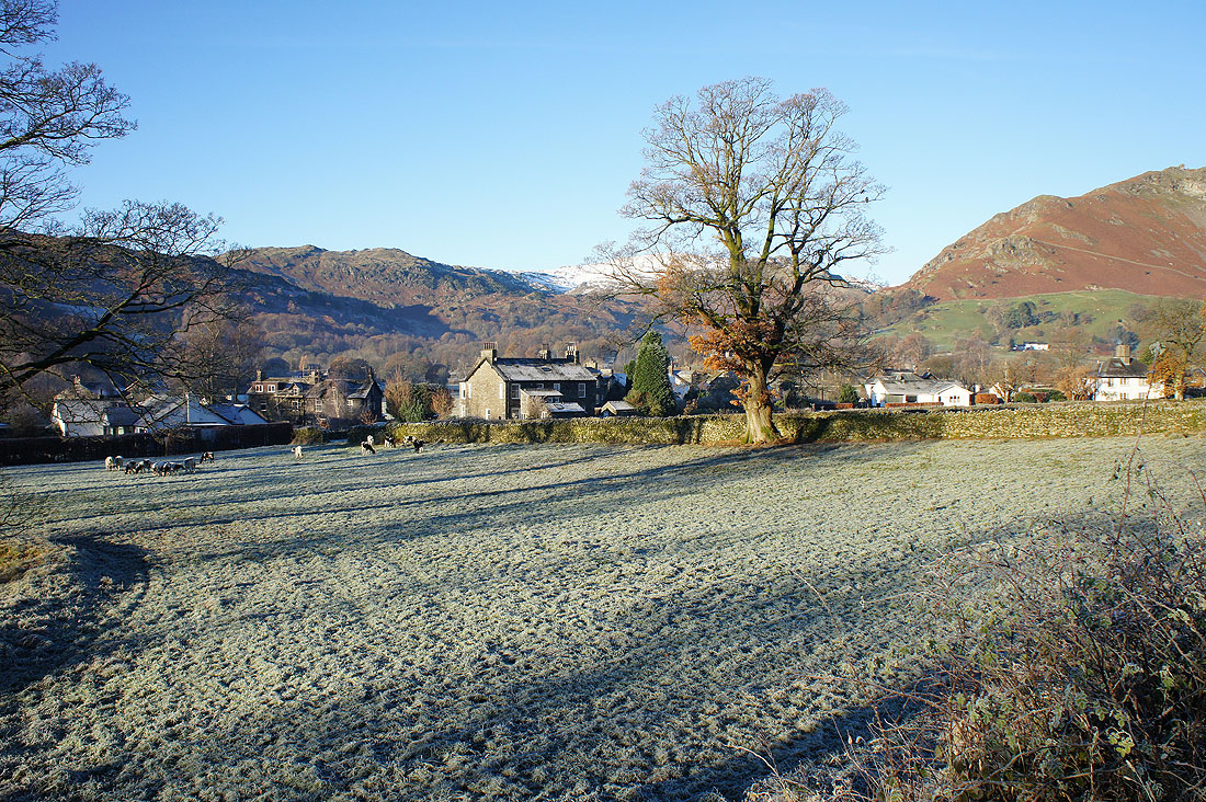
..and Grasmere as I walk north by the A591 from where I parked my car
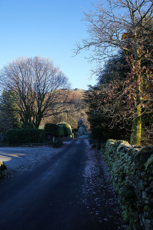
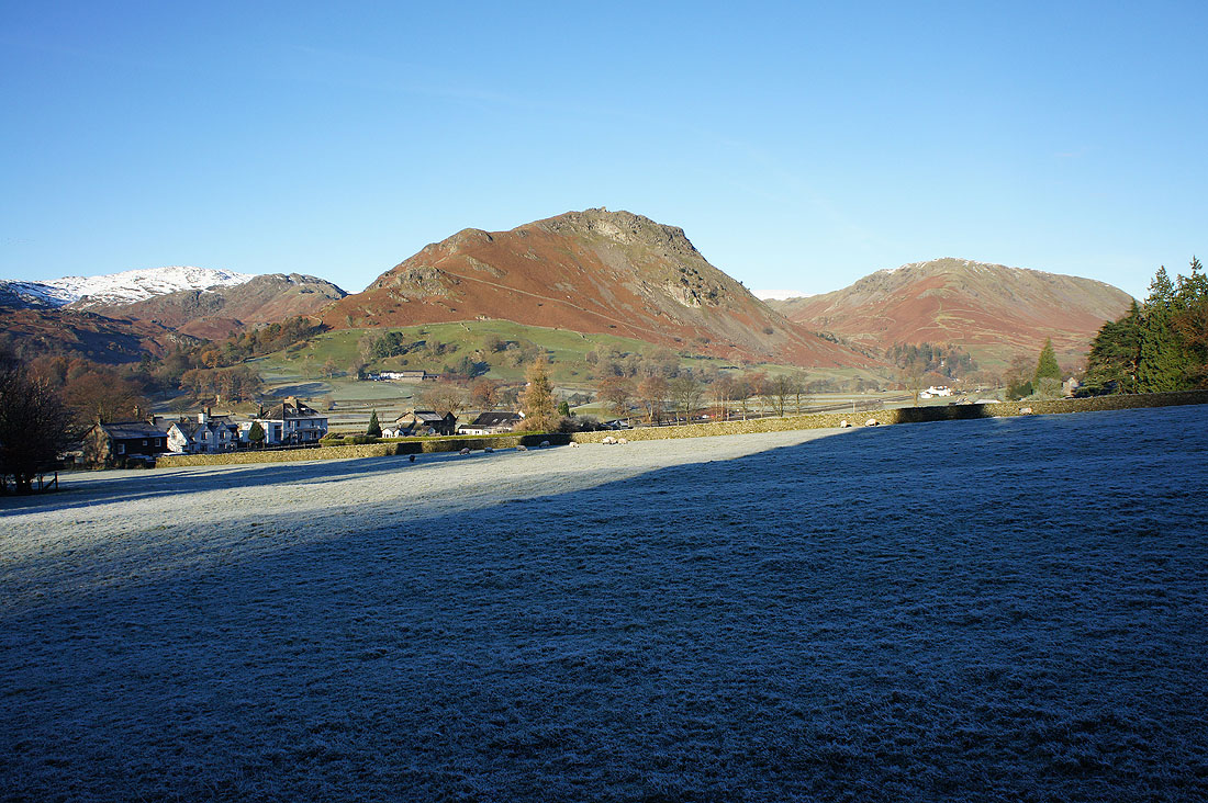
A right turn onto the lane by the Swan Hotel and I can make out the rocks of Stone Arthur on the hillside above
Helm Crag and Steel Fell
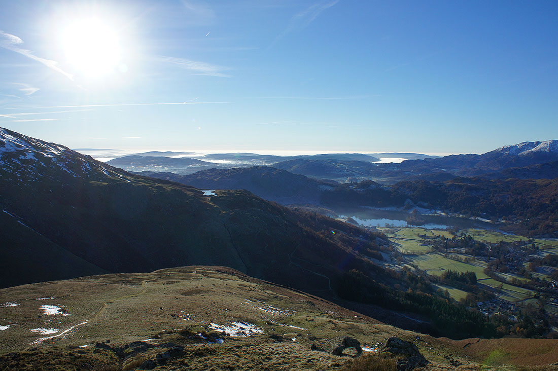
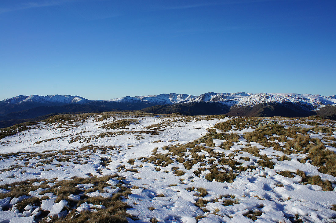
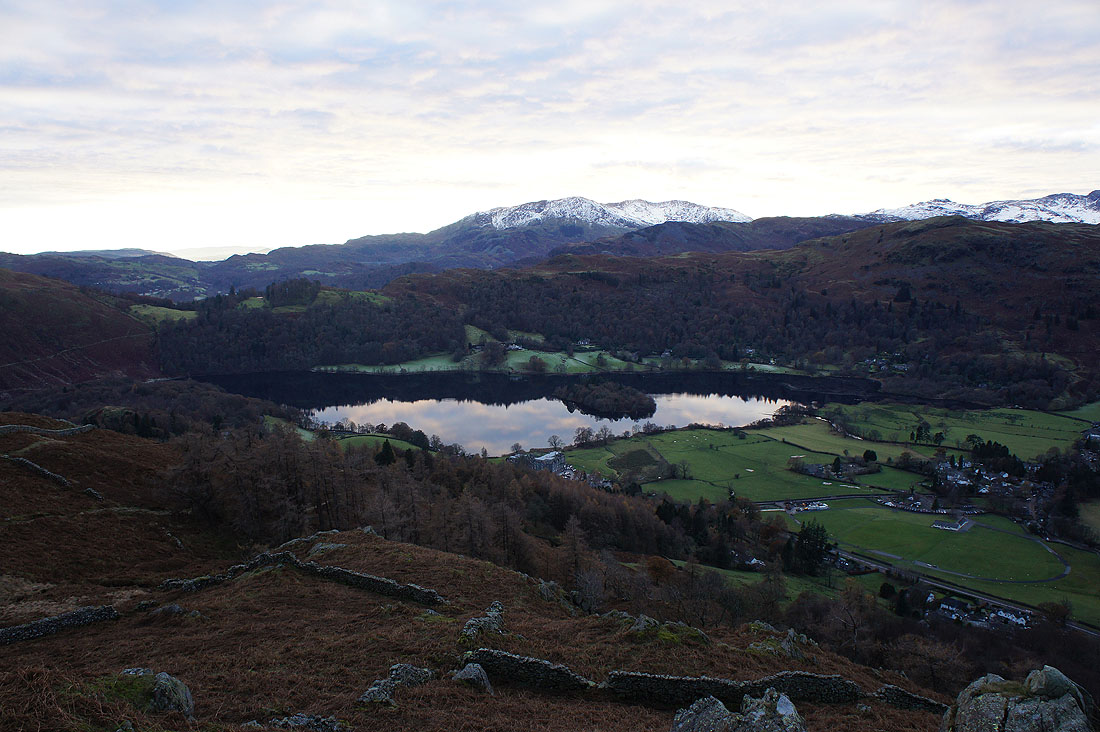
On Stone Arthur. Looking south to Alcock Tarn sat on its shelf on the side of Heron Pike.

Looking across the Vale of Grasmere to Silver How and Blea Rigg with the Coniston fells and Crinkle Crags in the distance. It's a glorious morning.
Helm Crag on the other side of the valley with snow covered Crinkle Crags, Bowfell and High Raise in the background
High Raise, Ullscarf and Steel Fell
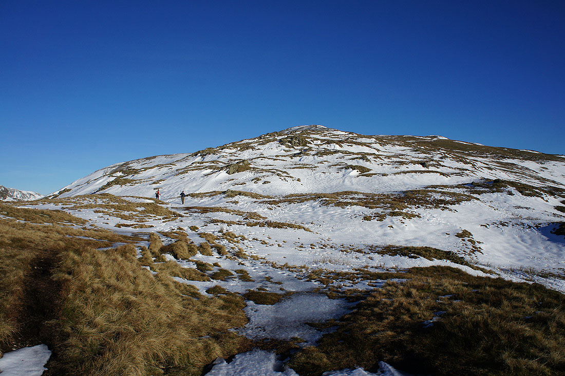
Patchy snow on the hillside up to Great Rigg. It was quite soft and I had to be careful walking through it.
Turning round as I gain height and Scafell Pike has joined the Crinkle Crags and Bowfell
as well as Great Gable, Pillar and the northwestern fells

Looking south across the top of Heron Pike. The visibility is superb today.
Seat Sandal, Grisedale Hause and Dollywagon Pike
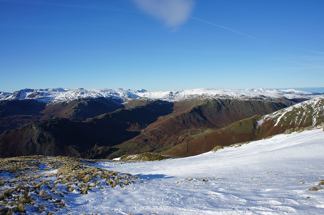
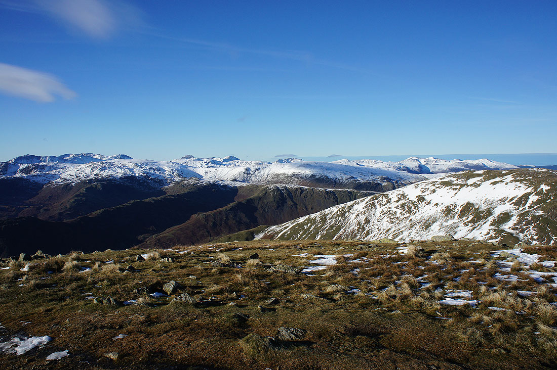
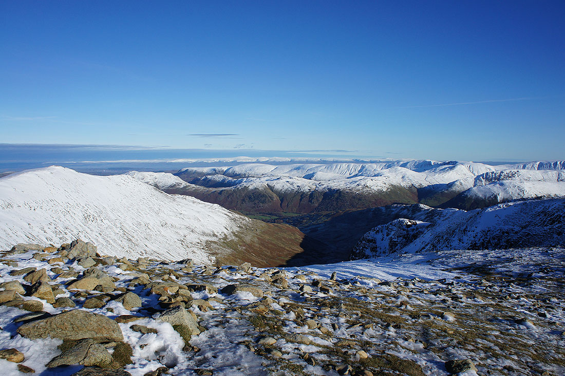
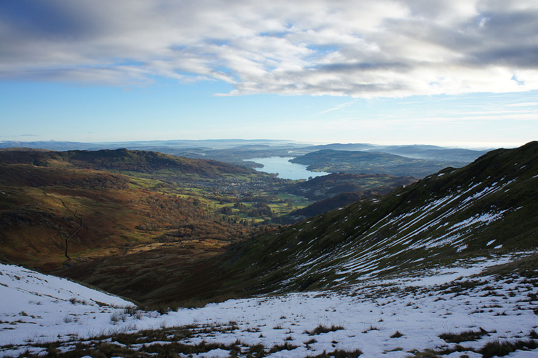
Looking south to Windermere having gained the Heron Pike to Great Rigg ridge. Stunning views today with low lying mist trapped beneath the temperature inversion there is.
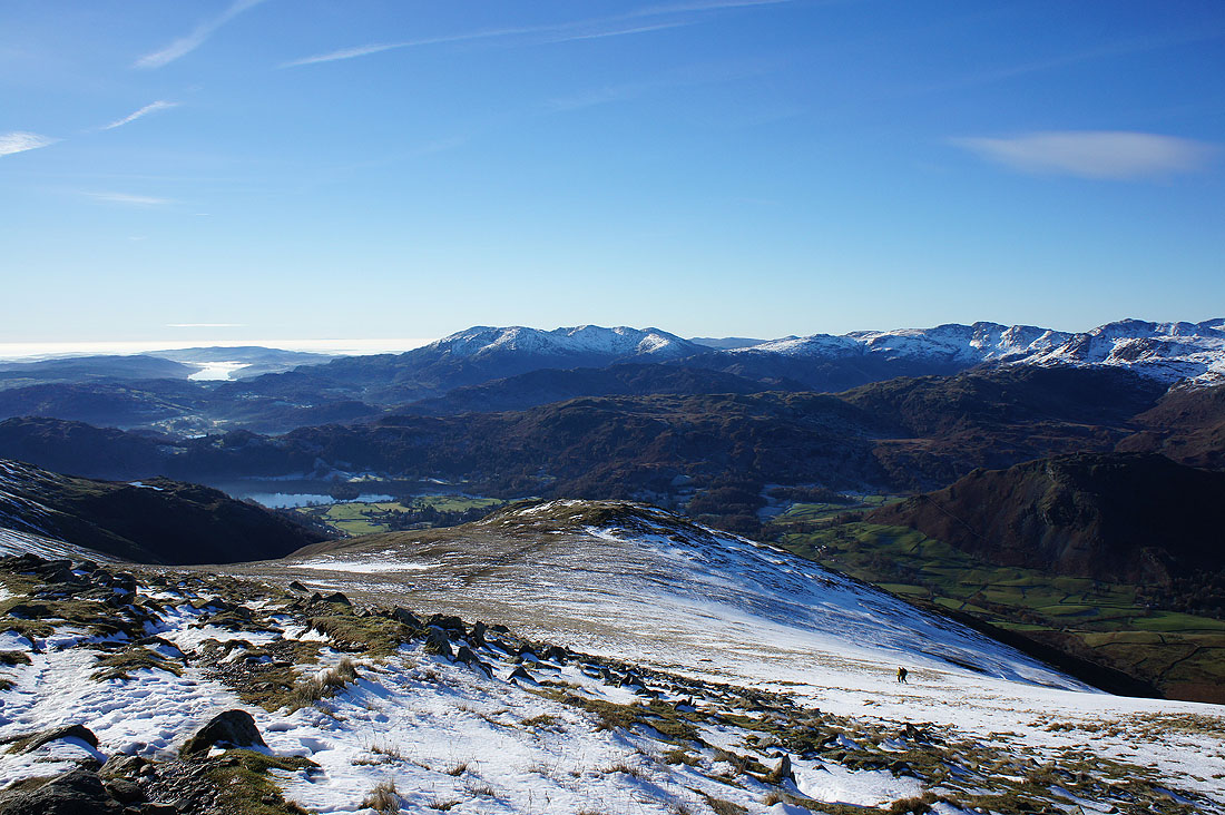
The ridge down to Stone Arthur below
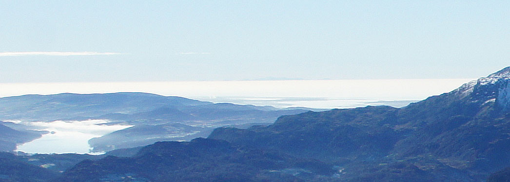
I should have zoomed in at the time but it didn't occur to me, so I've had to crop the photo above around the horizon to the right of Coniston Water to show the outline of the mountains of Snowdonia across the Irish Sea
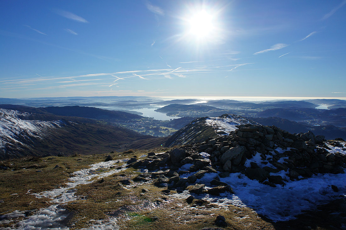
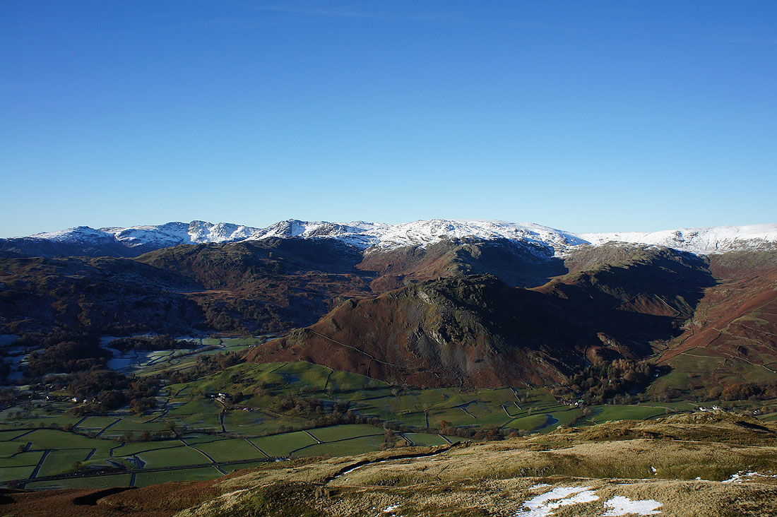
The view south to Windemere and beyond from the summit of Great Rigg
The Coniston fells, Crinkle Crags, Bowfell, Scafell Pike, Great End and Great Gable
High Raise, Great Gable, Pillar, High Stile, Ullscarf, Dale Head, Grasmoor and Grisedale Pike
Seat Sandal, Grisedale Hause and Dollywagon Pike as I head for Fairfield
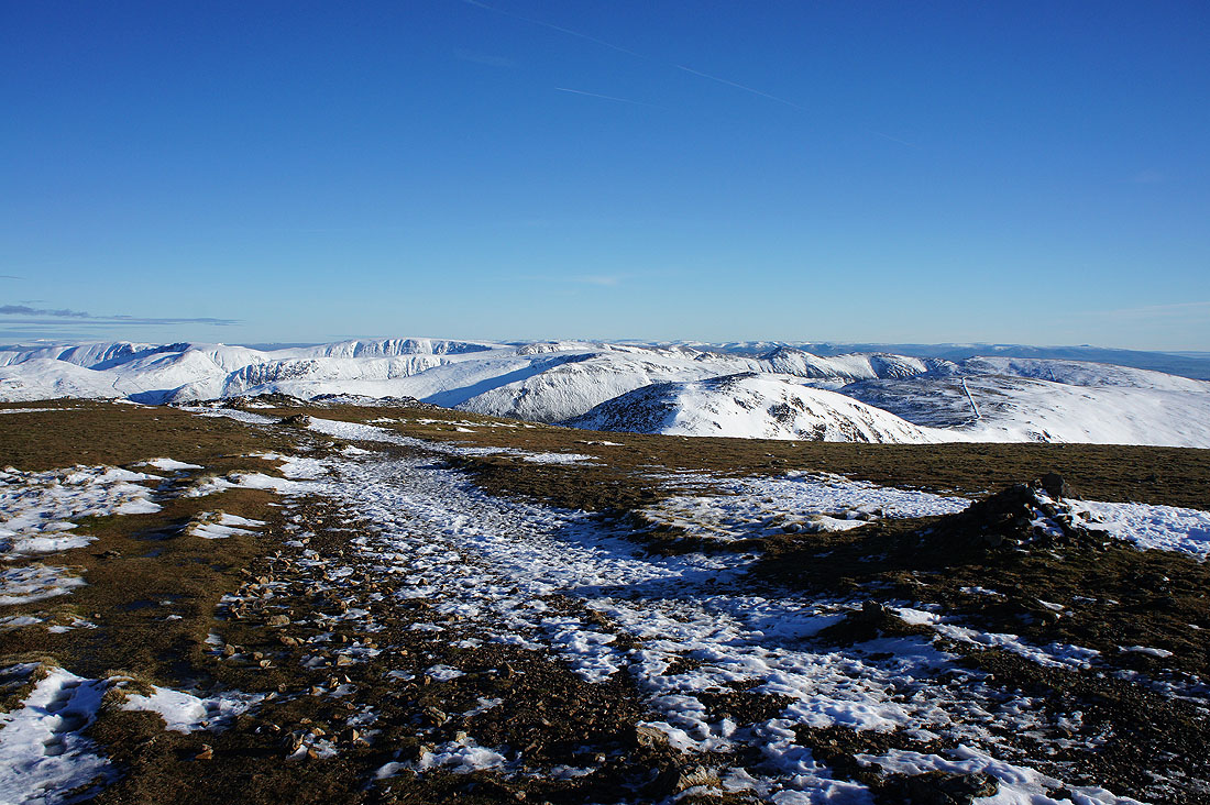
As I reach the summit plateau the far eastern fells come into view, as well as the North Pennines
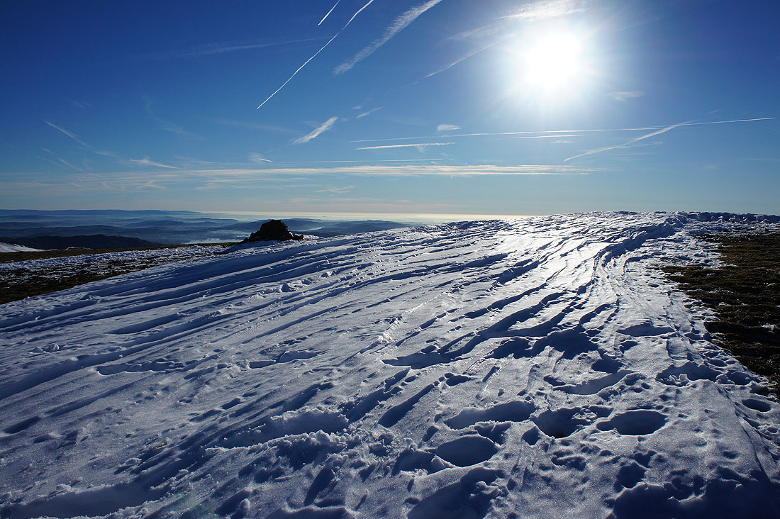
On the broad stony top that is the summit of Fairfield. It was windy but not as cold as it looks. The snow was becoming soft and slushy underfoot.
After a break for lunch I'll have a wander round and take in the view. Dollywagon Pike, Nethermost Pike and Helvellyn on the other side of a hidden Grisedale.

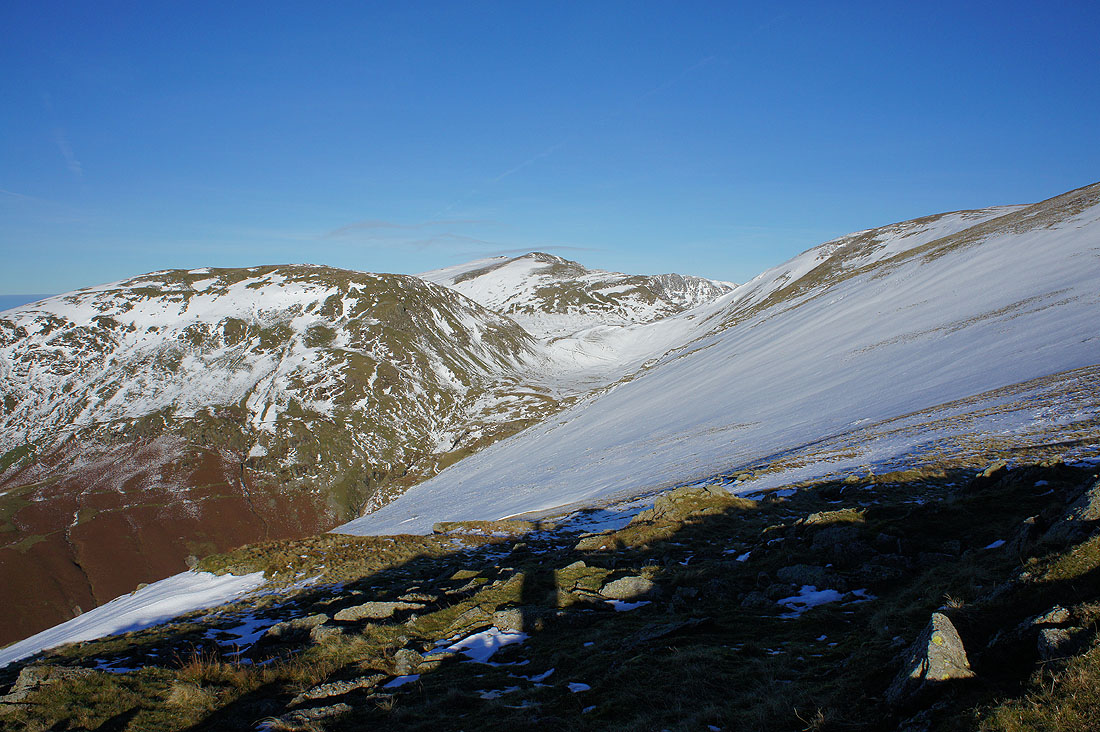
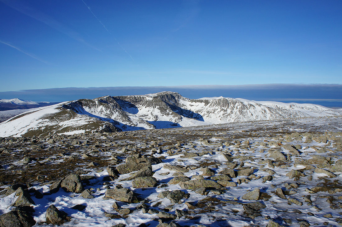
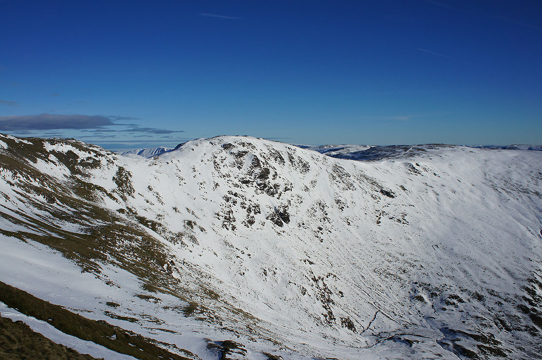
Cofa Pike and St. Sunday Crag, which seems to have more snow on it compared to where I am

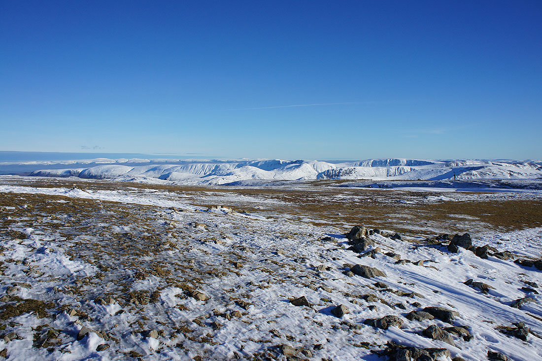
The icy crags of Greenhow End with the far eastern fells of High Raise, Rampsgill Head and High Street in the distance
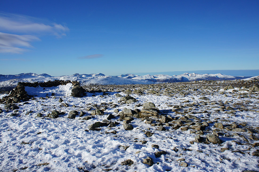
This was my favourite photo from the summit. St. Sunday Crag on the left with Cross Fell and the North Pennines in the distance beyond the far eastern fells.
High Street, Caudale Moor, Hart Crag, Ill Bell and Dove Crag. The hills way in the distance on the right are the Howgills, Whernside and Ingleborough in the Yorkshire Dales.
Deep drift!
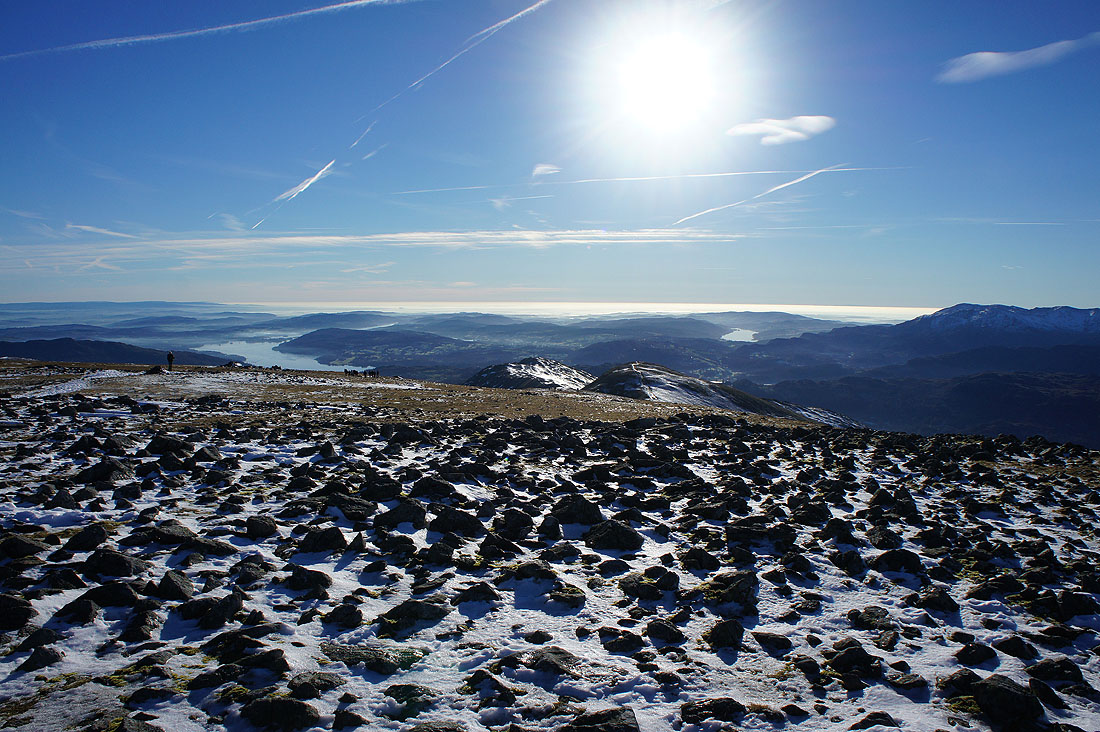
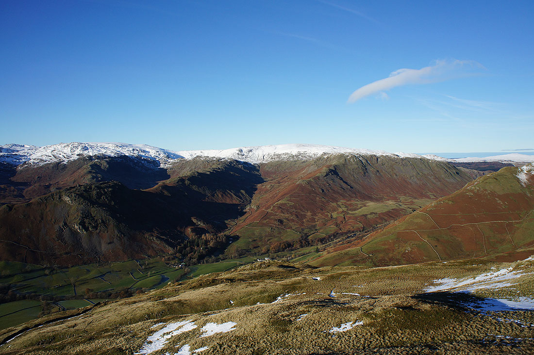
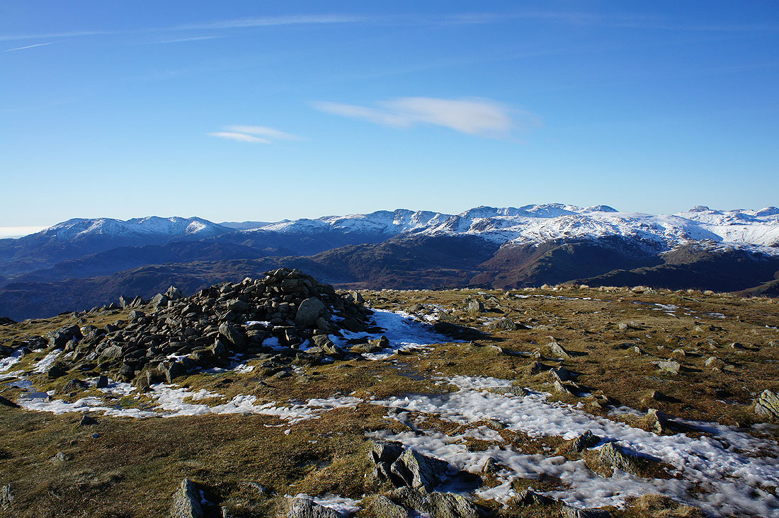
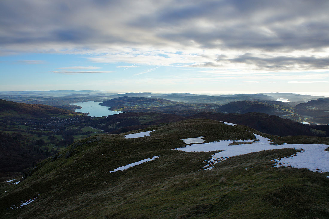
Finally, looking south to Windermere, Coniston Water and beyond
Hart Crag and Dove Crag as I head back to Great Rigg
Seat Sandal, Grisedale Hause and Dollywagon Pike again. The cloud to the north that I'd noticed on reaching Great Rigg for the first time is definitely getting closer.

Hart Crag and Dove Crag from the summit of Great Rigg
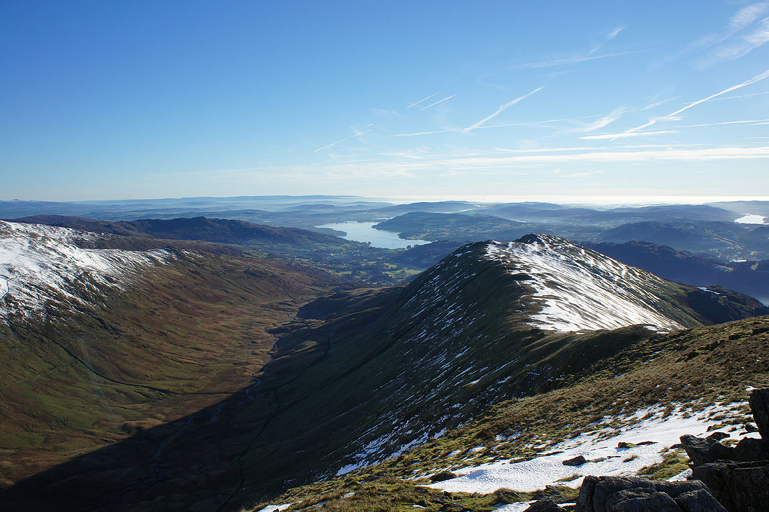
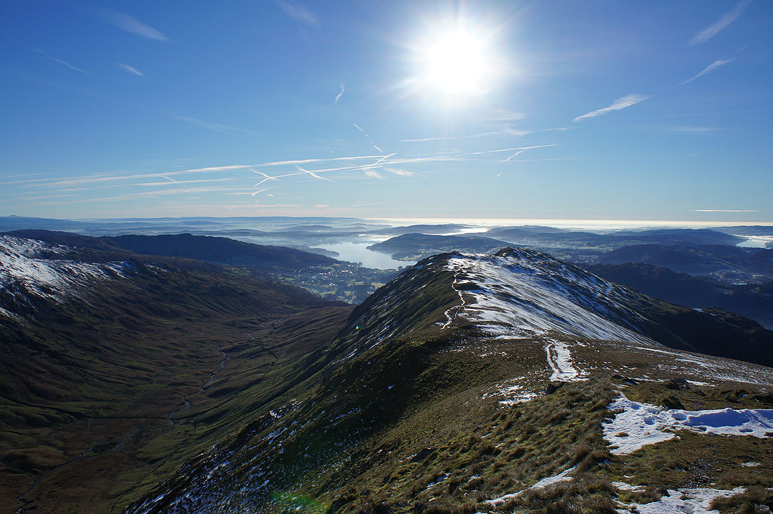
Rydal, the ridge to Heron Pike and Windermere

As I walk down to Heron Pike the cloud comes over. A really nice light develops for a time as I look across the Vale of Grasmere to Crinkle Crags, Bowfell, the Langdale Pikes and Scafell Pike.
and down to Ambleside and Windermere
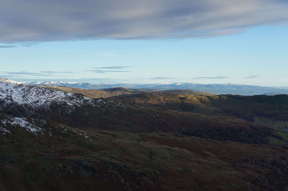
A zoom in past the nearby fells to the Howgills, Whernside and Ingleborough
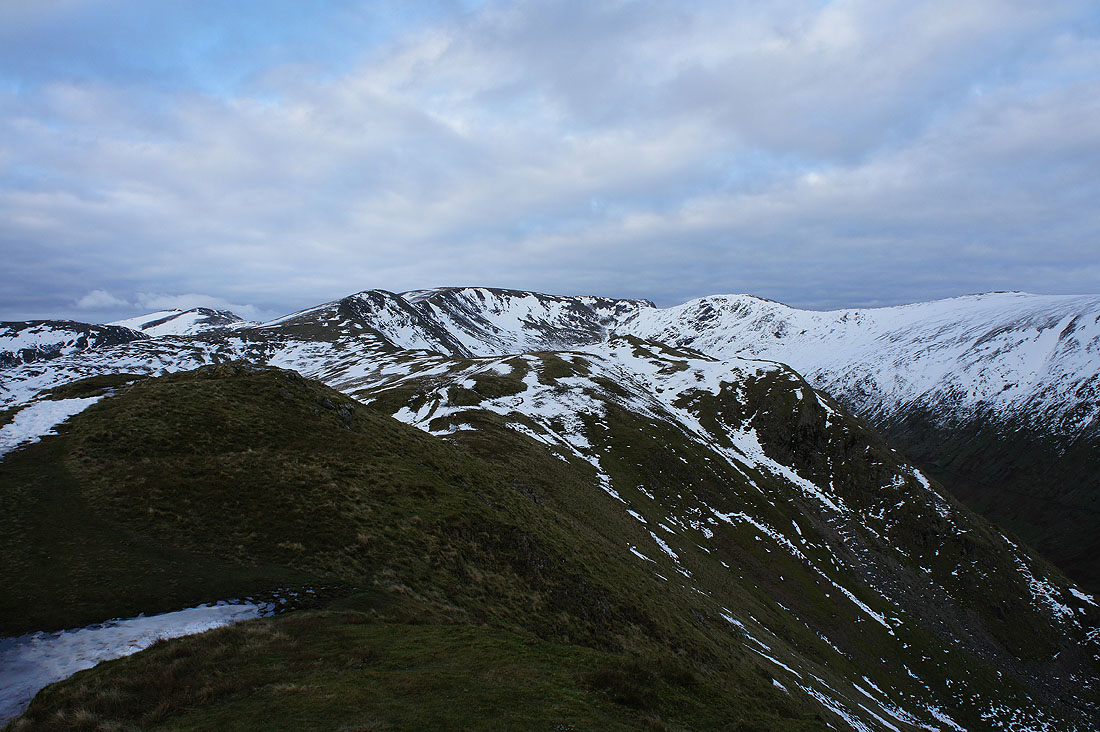
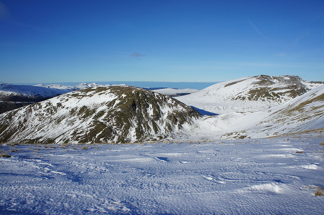
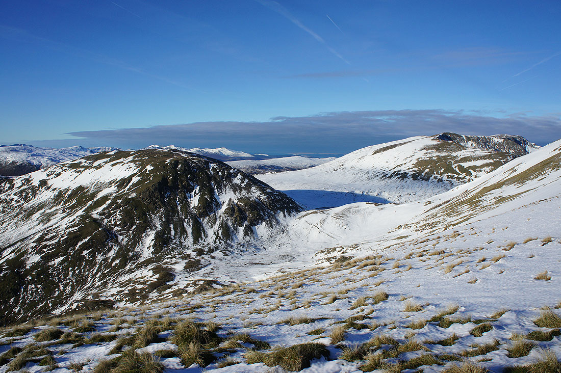
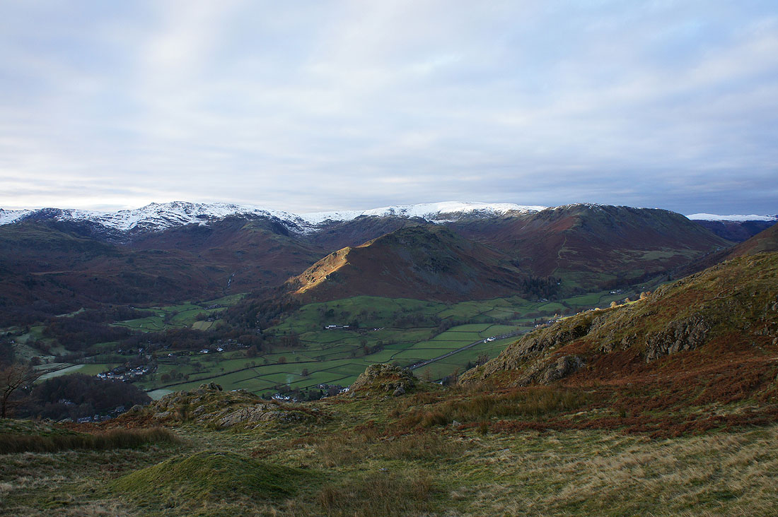
Great Rigg, Fairfield and Hart Crag from Heron Pike
Ambleside, Windermere and Coniston Water
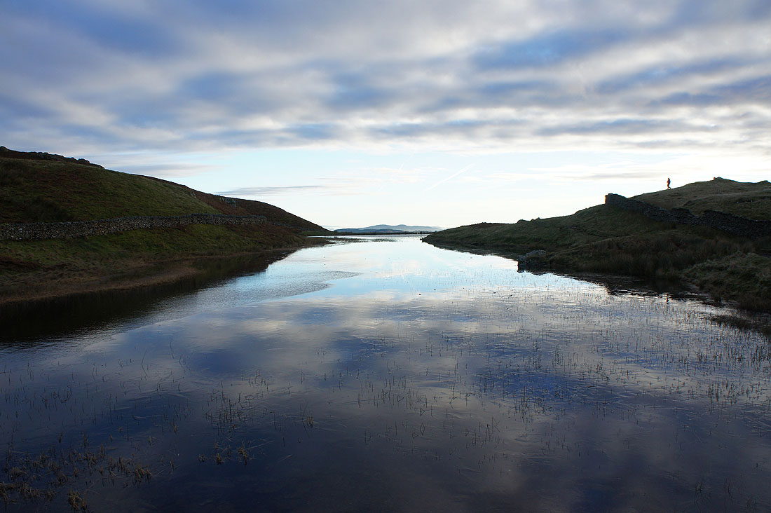
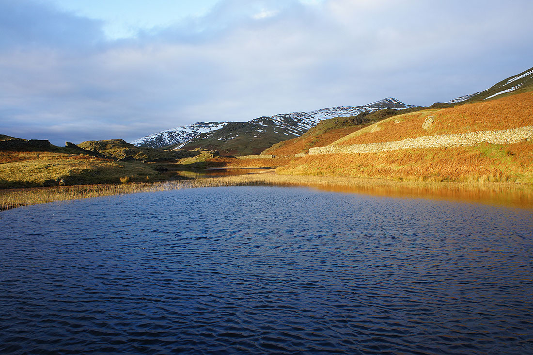
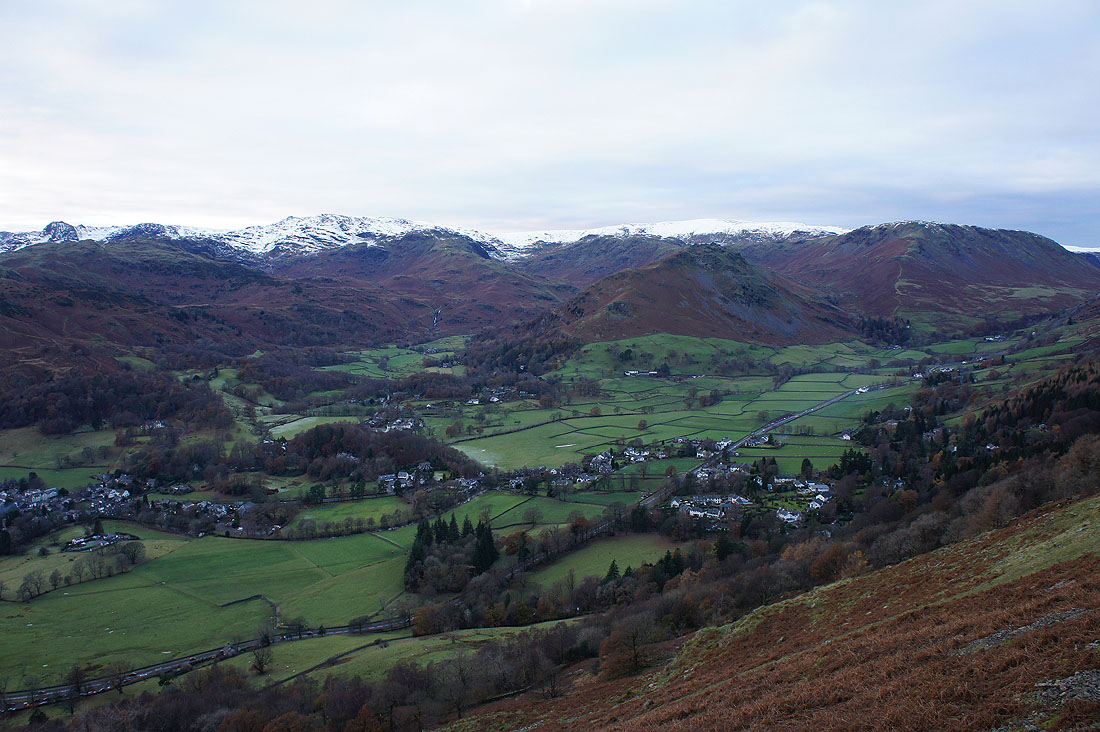
After a pathless descent, at the northern end of Alcock Tarn. It's my first time here and it's a lovely place to spend ten minutes taking it in.
Sunshine on Helm Crag as I make my way round to the other end of the tarn
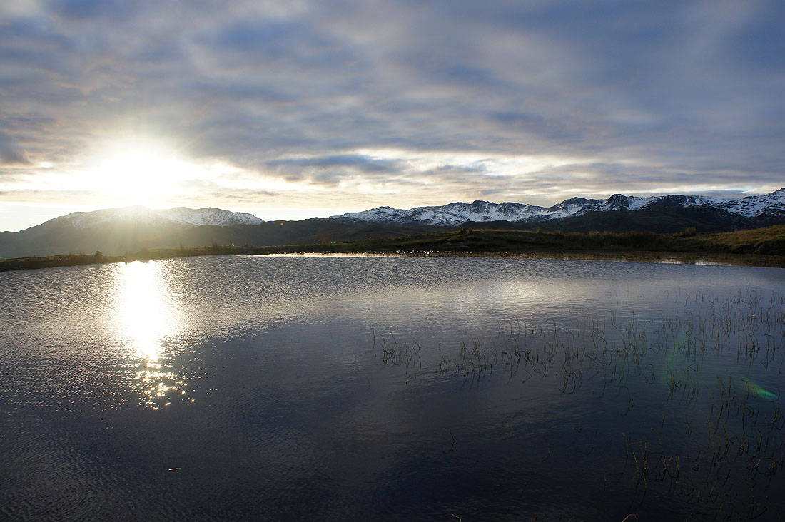
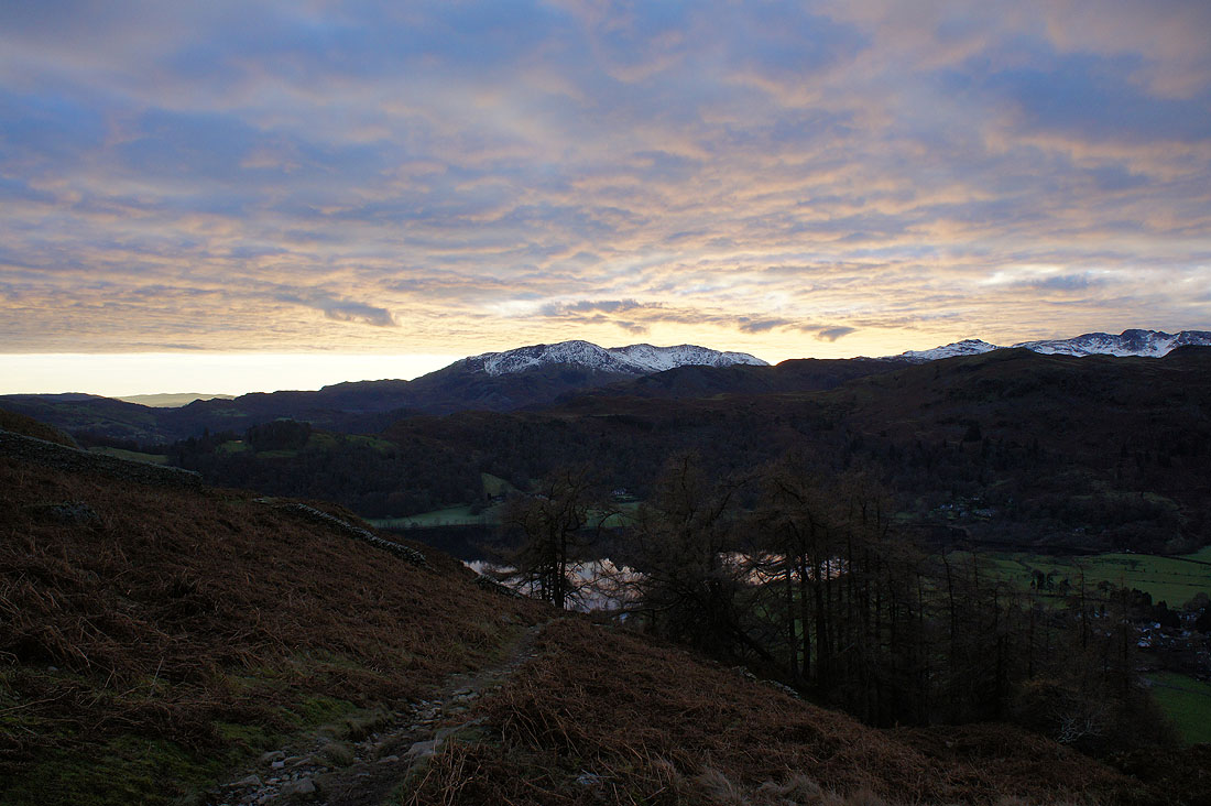
By the eastern shore of Alcock Tarn. The sun starts to set over the Coniston fells.
The last of the sun on Alcock Tarn
Grasmere the lake..
..and Grasmere the village as I head down
Great looking sky as the sun shines on the underside of the clouds above the Coniston fells
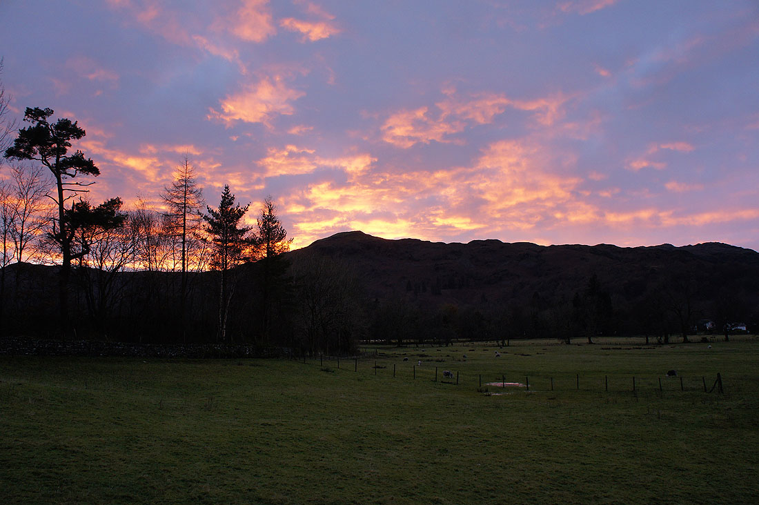
Finally, fire in the sky over Silver How as I make it back to my car