27th October 2012 - Lingmoor Fell
Walk Details
Distance walked: 7.8 miles
Total ascent: 2122 ft
OS map used: OL6 - The English Lakes, South-western area & OL7 - The English Lakes, South-eastern area
Time taken: 6.5 hrs
Route description: Elterwater-Dale End farm-Slater's Bridge-Fell Foot-Blea Tarn-Side Pike-Lingmoor Fell-Elterwater
A sunny but cold autumn day for this walk over Lingmoor Fell and there was a bitter wind blowing at times.
From Elterwater I set off along the bridleway over into Little Langdale. This brought me to Slater's Bridge, which I crossed to continue up the valley to Fell Foot farm. The next destination was Blea Tarn and then the summit of the road up from Great Langdale. I then did the ridge walk over Side Pike and Lingmoor Fell back to Elterwater.
Route map
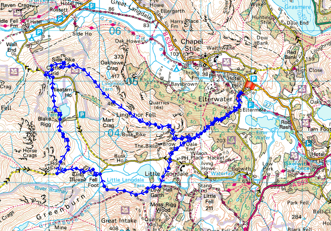
© Crown copyright. All rights reserved. License number PU 100034184.
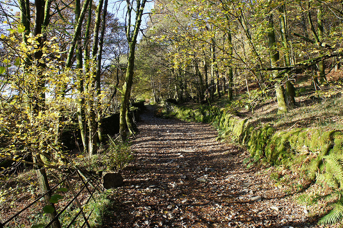
On the track to Little Langdale from Elterwater
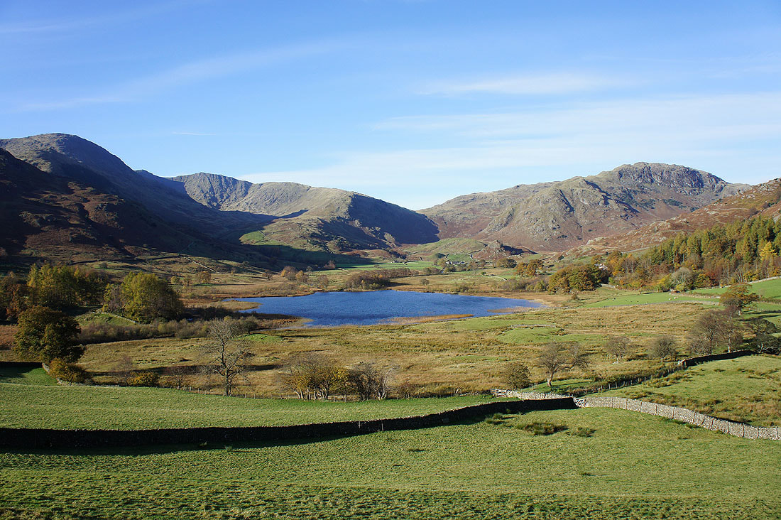
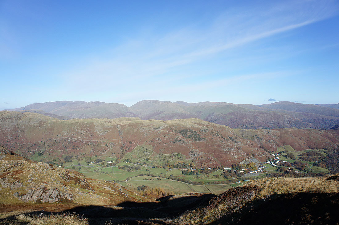
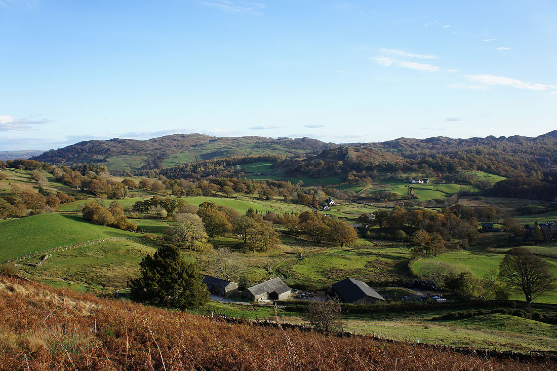
Little Langdale and Little Langdale Tarn comes into view with Wetherlam and Great Carrs on one side of the valley and Blake Rigg on the other.
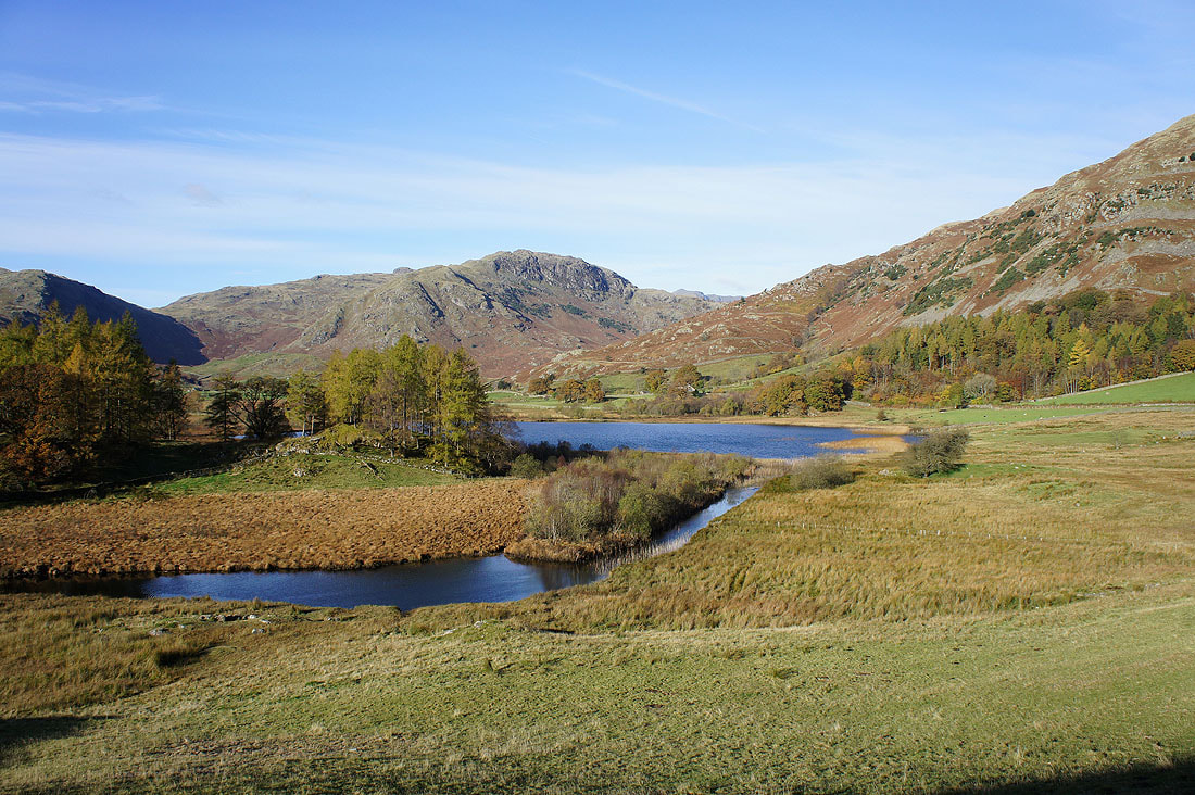
The River Brathay as it leaves Little Langdale Tarn
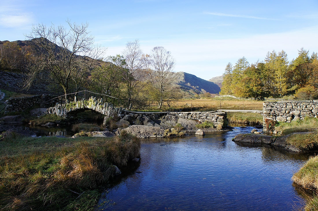
Slater's Bridge
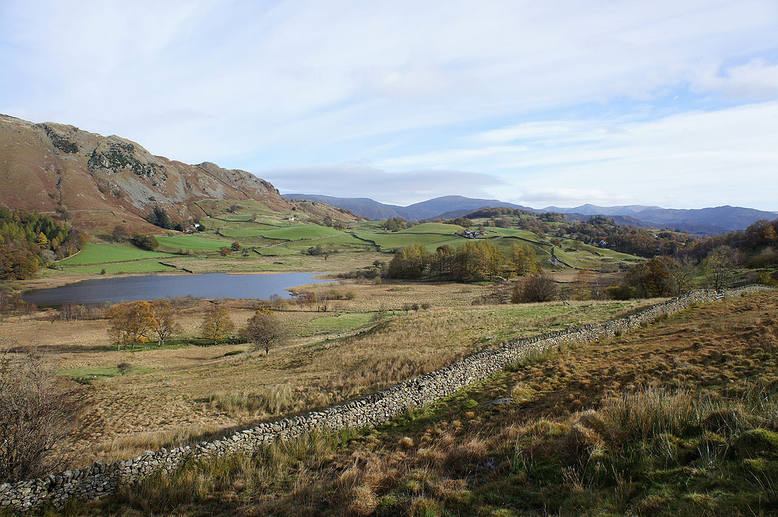
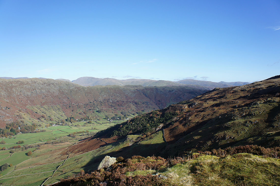
Looking back to Little Langdale Tarn as I head up the valley
Approaching Fell Foot
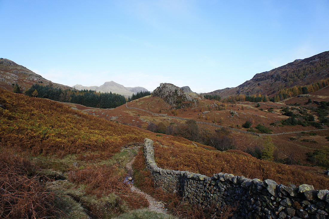
After a short time spent on the road that heads up to the Wrynose Pass I'm now on the path to Blea Tarn. Here I'm looking across Blea Moss to the rock tower of Castle Howe.
The Langdale Pikes coming into view
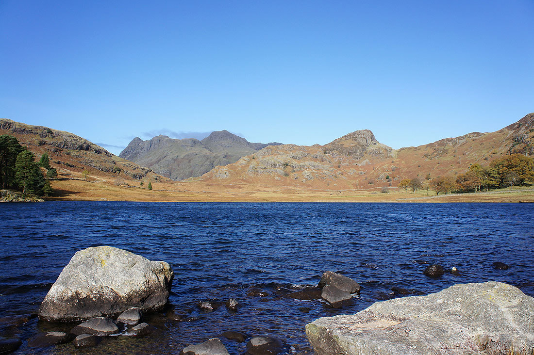
No reflections of the Langdale Pikes and Side Pike in a mirror calm Blea Tarn today. The wind that was whipping across it was bitterly cold.
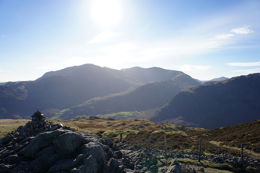
At the top of the road up from Great Langdale and my first view of the day of Crinkle Crags and Bowfell
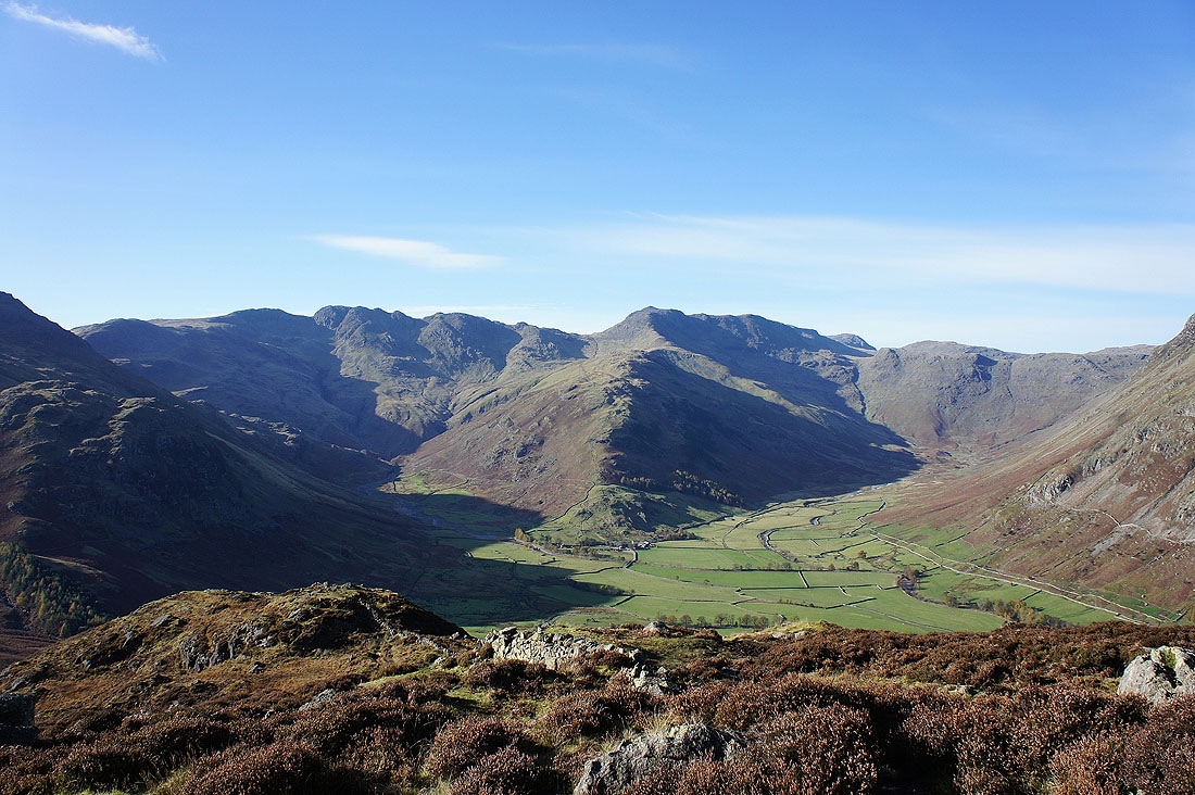
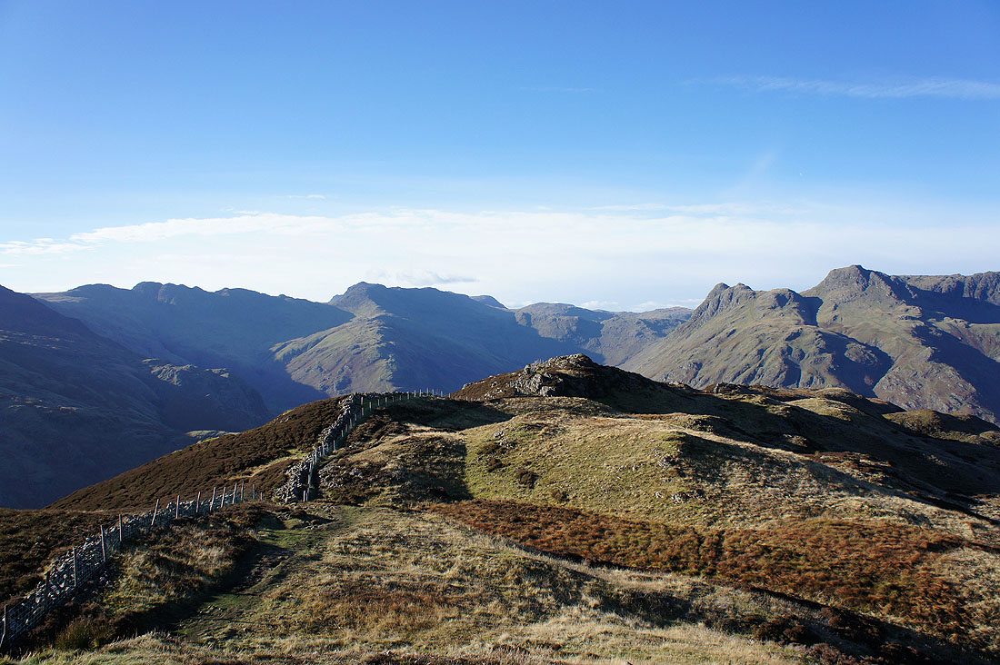
On the summit of Side Pike and there's a fantastic view across Great Langdale to the Langdale Pikes of Pike o'Stickle, Loft Crag, Harrison Stickle and Pavey Ark
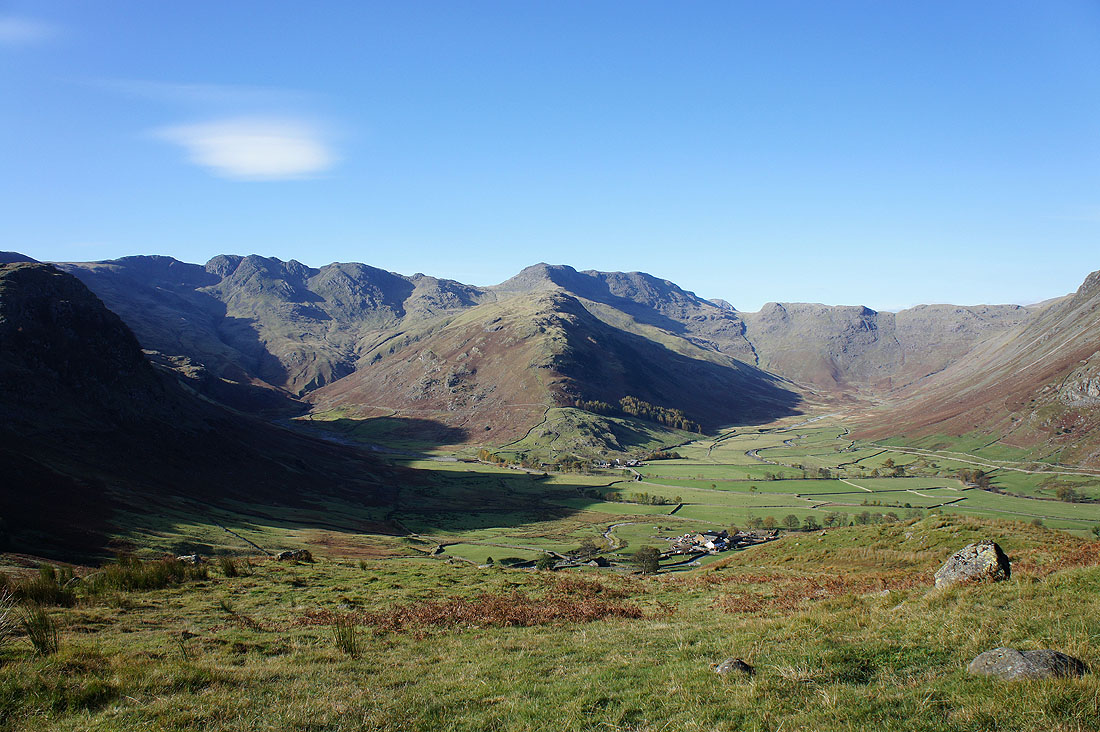
Looking down Great Langdale around the flank of Lingmoor Fell
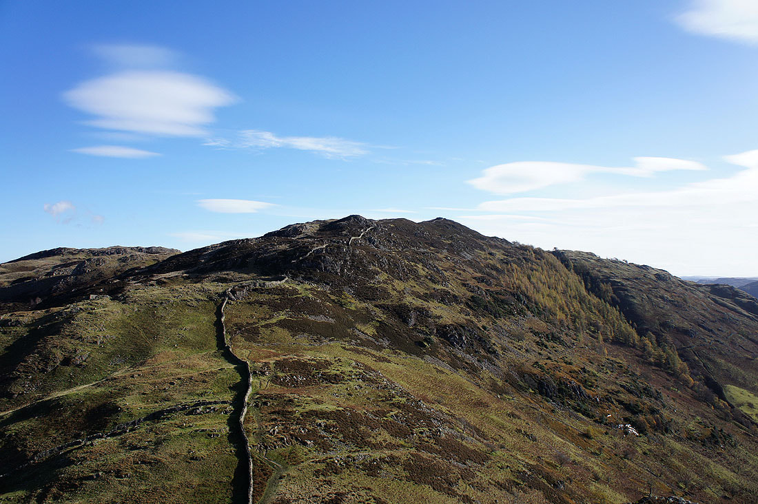
Lingmoor Fell. I won't be going by the direct route as it appears from here though. You'll see what I mean when I look back to Side Pike enroute to Lingmoor Fell.
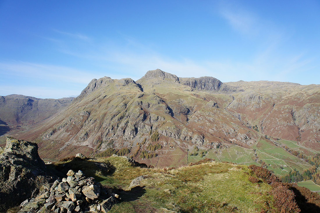
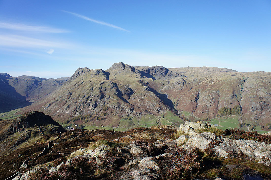
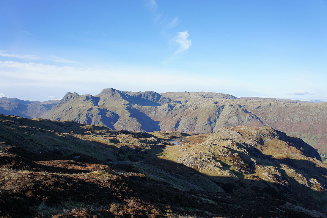
Crinkle Crags and Bowfell from Side Pike
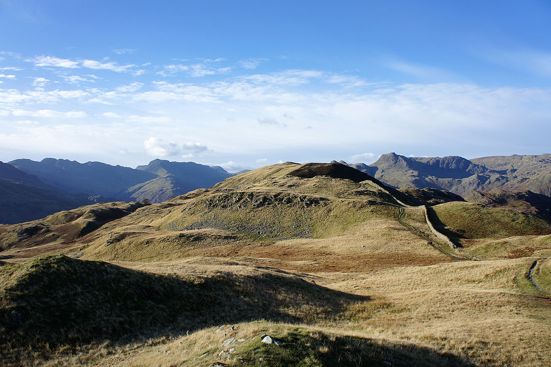
Nearing the summit of Lingmoor Fell and I had to stop to have a look back at the Langdale Pikes
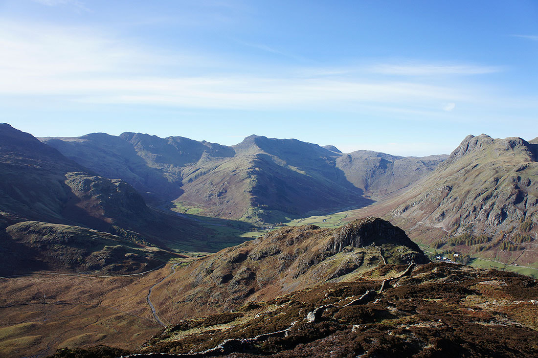
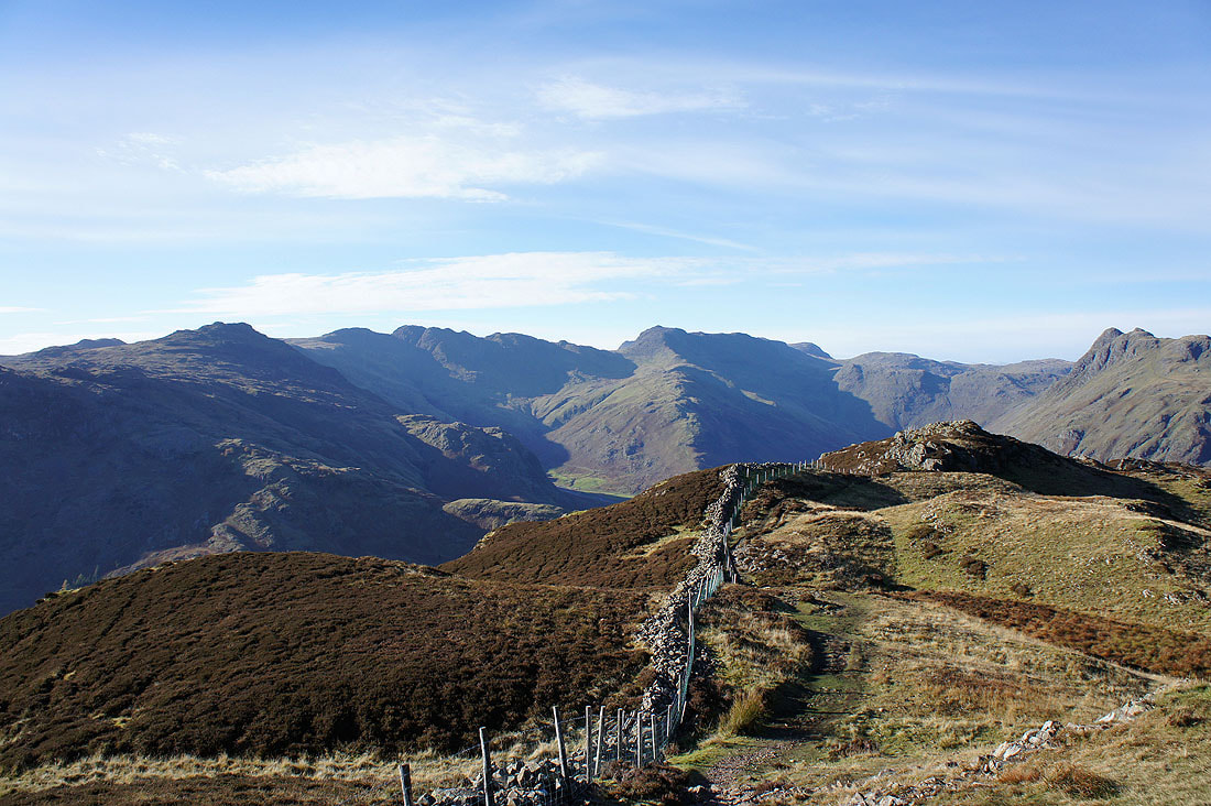
Crinkle Crags, Bowfell and there's Side Pike below with the reason for not going by the direct route clear to see. You have to backtrack and then go around its south side through a narrow gap in the rocks.
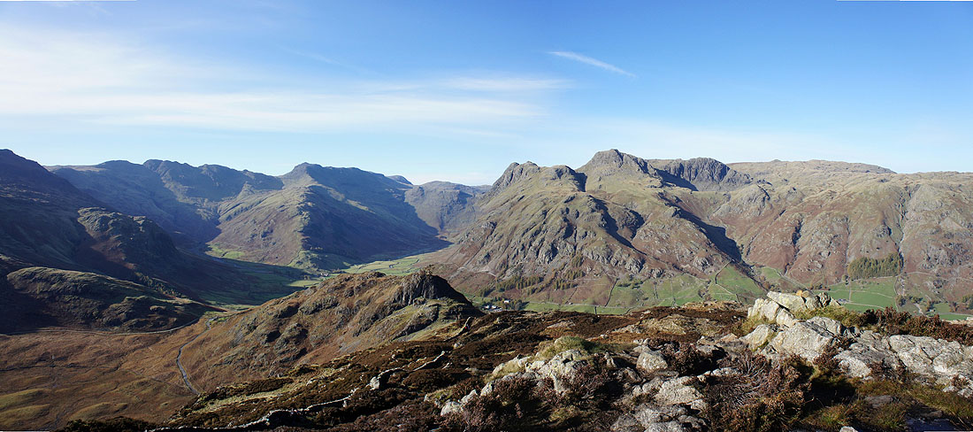
A panoramic view
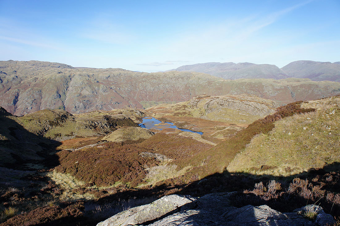
Lingmoor Tarn cradled on the northern flanks of the fell
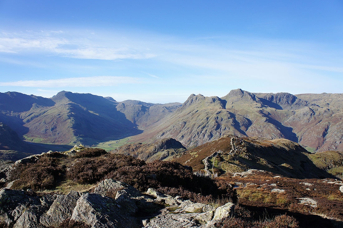
On the summit of Lingmoor Fell with great views in every direction. Bowfell and the Langdale Pikes.
A little to the left Pike o'Blisco, Crinkle Crags and Bowfell
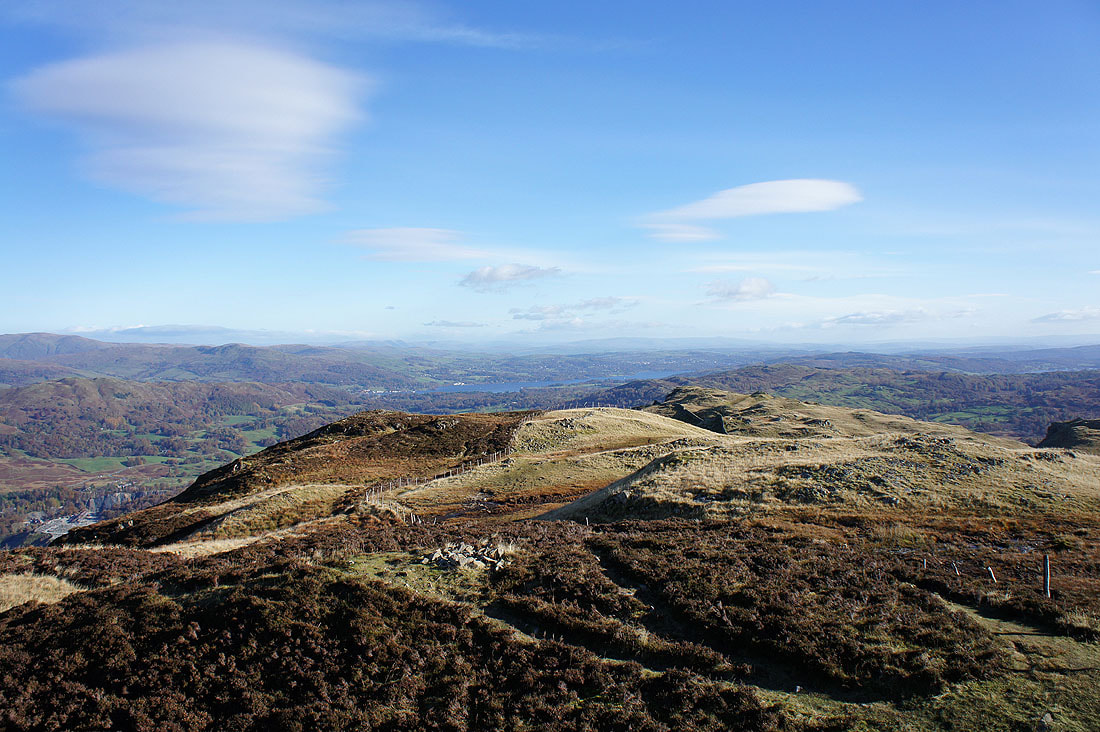
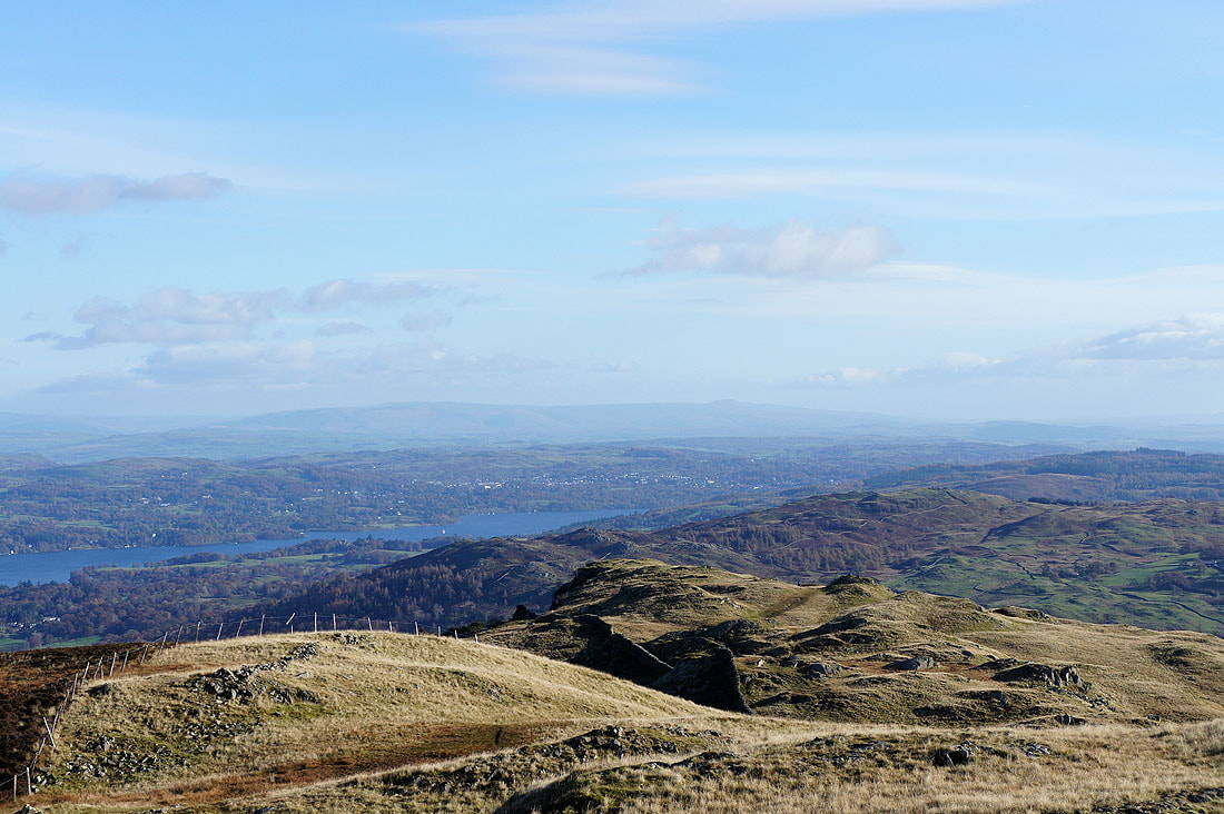
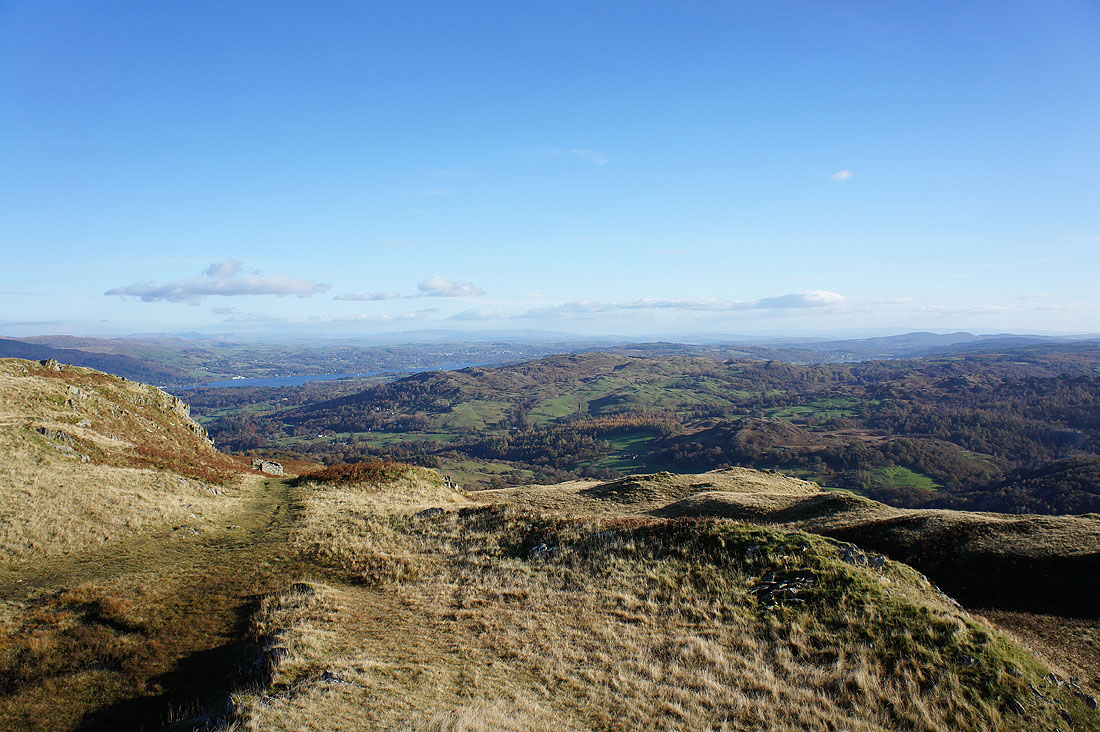
Windermere in the distance past the summit ridge
Zooming in and I can make out the distinctive ridges of the Howgills
and a little to the right, the fells of the Yorkshire Dales with the sloping flat top of Ingleborough easy to make out on the right
The Blea Rigg to Silver How ridge on the other side of Great Langdale with Helvellyn and Fairfield behind
The Coniston Fells
The Crinkle Crags, Bowfell, Pike o'Stickle and Harrison Stickle
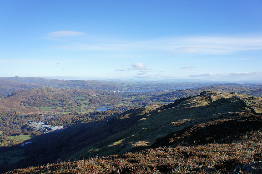
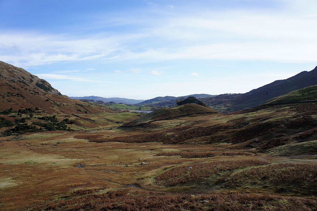
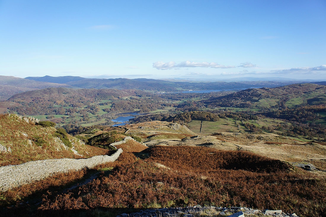
I've left the summit to head back to Elterwater. A brief stop on the Langdale side of the fell gives me a view down Great Langdale to Elter Water and Windermere. That's Elterwater Quarry down on the left.
The Langdale Pikes behind the shelf that holds Lingmoor Tarn
A look back to Lingmoor Fell's summit
Black Crag on the other side of Little Langdale
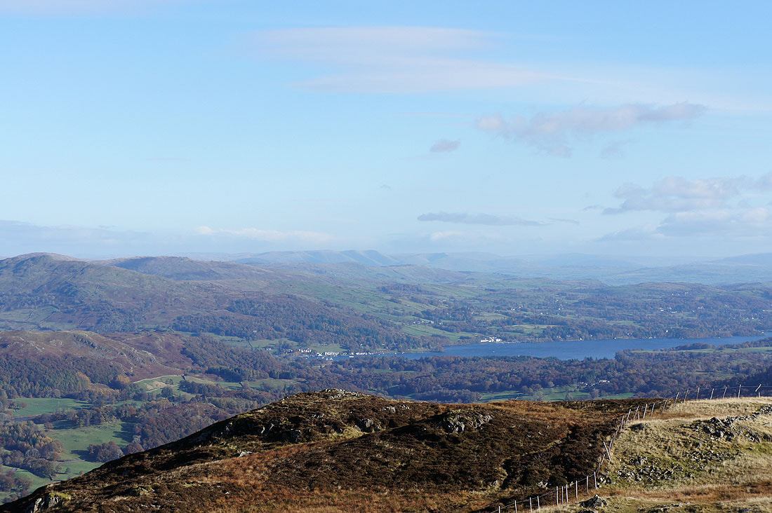
Elter Water and Windermere make a great view ahead
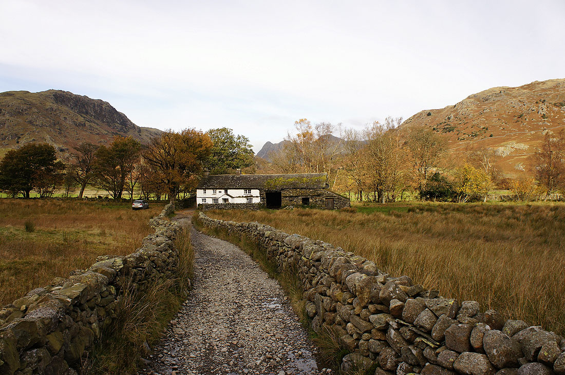
The final descent into Little Langdale. That's Dale End farm below.
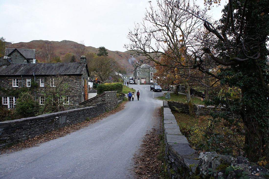
Back in Elterwater