28th February 2016 - Sheffield Pike, Raise & a few others
Walk Details
Distance walked: 10.1 miles
Total ascent: 3512 ft
OS map used: OL5 - The English Lakes, Northeastern area
Time taken: 7 hrs
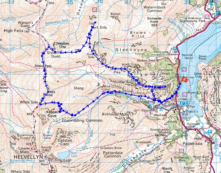
Route description: Stybarrow Crag-Glenridding-Greenside Road-The Rake-Glenridding Dodd-Sheffield Pike-Glencoyne Head-Hart Side-Green Side-Stybarrow Dodd-Sticks Pass-Raise-Keppel Cove-Greenside Road-Glenridding-Stybarrow Crag
The best day of the weekend weather-wise and I decided to head for the Lakes and do a walk in the eastern fells north of Helvellyn. My route had to include Wainwrights that would count towards my second round and all five that I visited today did. When I checked how long it had been since I was last on some of them I was surprised to discover that for Sheffield Pike and Glenridding Dodd it was October 2010, Hart Side was seven years ago. Where have the years gone to? Although I started out with sunny skies the cloud started to build up as the afternoon approached, so the second half of the walk was done under largely cloudy skies. The fantastic visibility did mean great views and I did get to walk in the snow that was left on the highest summits.
From the layby on the A592 below Stybarrow Crag I took the lake-shore path south towards Glenridding until I reached the track that traverses the hillside above the village to the Greenside Road. Almost as soon as I was on Greenside Road then I left it for the steep ascent of The Rake between Heron Pike and Glenridding Dodd and when I reached the top I turned right and made my way to the summit of Glenridding Dodd. Before moving on I paid the eastern end of the summit a visit to take in the view. After crossing back over the summit there was then a steep ascent to the boundary post on Heron Pike before reaching the summit of Sheffield Pike. Lunch was taken here. Next came a crossing of Nick Head and a walk above Glencoyne Head to arrive on the third Wainwright of the day, Hart Side. From Hart Side I made my way over Green Side (not a Wainwright) and then up to the summit of Stybarrow Dodd. I then made my way south across the Sticks Pass and up to the highest top of the day, Raise. I put my spikes on to make sure I safely made it up its snowy northern slopes. Time to head down. I continued south towards Whiteside to pick up the path that zig-zags down into Keppel Cove, there was then a long walk down Glenridding, past the youth hostel and along Greenside Road to pick up the track I used on my outbound route. Once I reached the A592 I followed the lake-shore path back north to the layby below Stybarrow Crag.
Total ascent: 3512 ft
OS map used: OL5 - The English Lakes, Northeastern area
Time taken: 7 hrs
Route description: Stybarrow Crag-Glenridding-Greenside Road-The Rake-Glenridding Dodd-Sheffield Pike-Glencoyne Head-Hart Side-Green Side-Stybarrow Dodd-Sticks Pass-Raise-Keppel Cove-Greenside Road-Glenridding-Stybarrow Crag
The best day of the weekend weather-wise and I decided to head for the Lakes and do a walk in the eastern fells north of Helvellyn. My route had to include Wainwrights that would count towards my second round and all five that I visited today did. When I checked how long it had been since I was last on some of them I was surprised to discover that for Sheffield Pike and Glenridding Dodd it was October 2010, Hart Side was seven years ago. Where have the years gone to? Although I started out with sunny skies the cloud started to build up as the afternoon approached, so the second half of the walk was done under largely cloudy skies. The fantastic visibility did mean great views and I did get to walk in the snow that was left on the highest summits.
From the layby on the A592 below Stybarrow Crag I took the lake-shore path south towards Glenridding until I reached the track that traverses the hillside above the village to the Greenside Road. Almost as soon as I was on Greenside Road then I left it for the steep ascent of The Rake between Heron Pike and Glenridding Dodd and when I reached the top I turned right and made my way to the summit of Glenridding Dodd. Before moving on I paid the eastern end of the summit a visit to take in the view. After crossing back over the summit there was then a steep ascent to the boundary post on Heron Pike before reaching the summit of Sheffield Pike. Lunch was taken here. Next came a crossing of Nick Head and a walk above Glencoyne Head to arrive on the third Wainwright of the day, Hart Side. From Hart Side I made my way over Green Side (not a Wainwright) and then up to the summit of Stybarrow Dodd. I then made my way south across the Sticks Pass and up to the highest top of the day, Raise. I put my spikes on to make sure I safely made it up its snowy northern slopes. Time to head down. I continued south towards Whiteside to pick up the path that zig-zags down into Keppel Cove, there was then a long walk down Glenridding, past the youth hostel and along Greenside Road to pick up the track I used on my outbound route. Once I reached the A592 I followed the lake-shore path back north to the layby below Stybarrow Crag.
Route map
© Crown copyright. All rights reserved. License number PU 100034184.
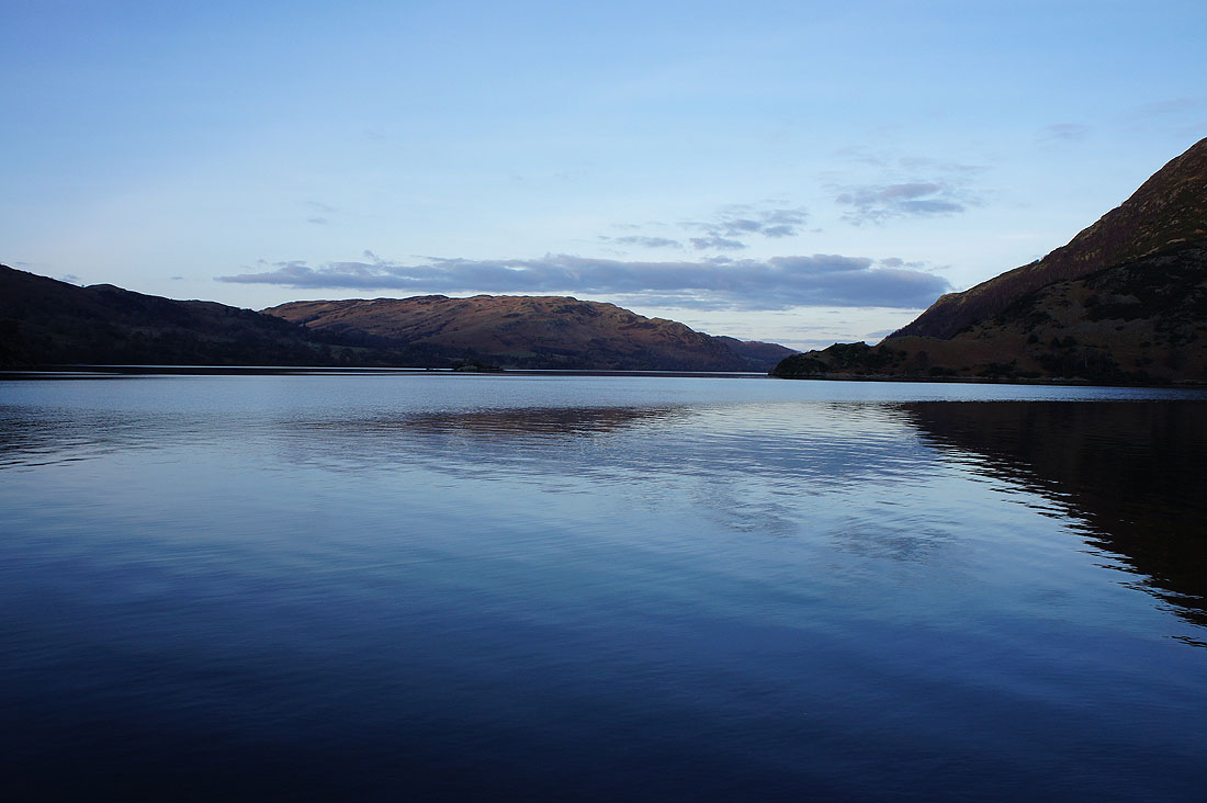
A lovely sunny start as I follow the lake-shore path towards Glenridding
Birkhouse Moor ahead from the track above Glenridding
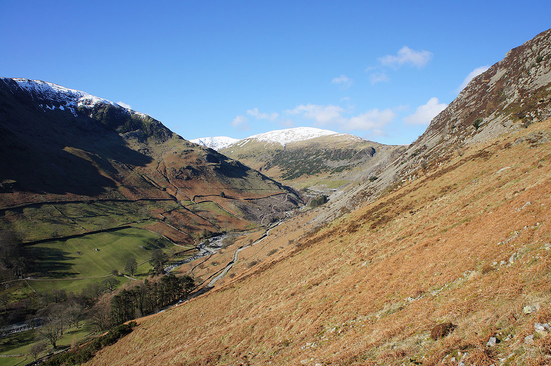
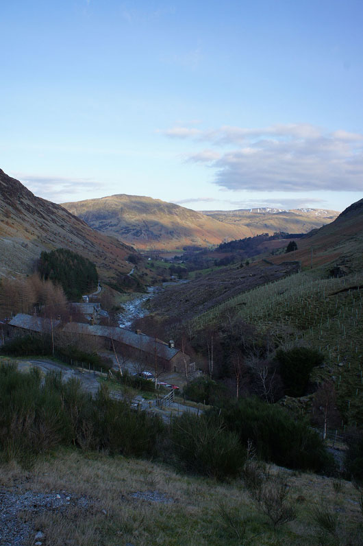
On the way up The Rake I can see up the valley to the Greenside Mine with Raise above
On the summit of Glenridding Dodd. Birkhouse Moor on the left with Catstycam, Whiteside and Raise in the background.
Gowbarrow Fell and Ullswater. I'll get a better view if I head to the eastern end of the summit.
and here it is. Worth it for the little effort required.
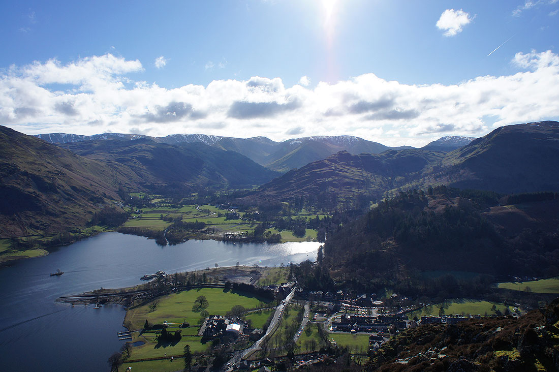
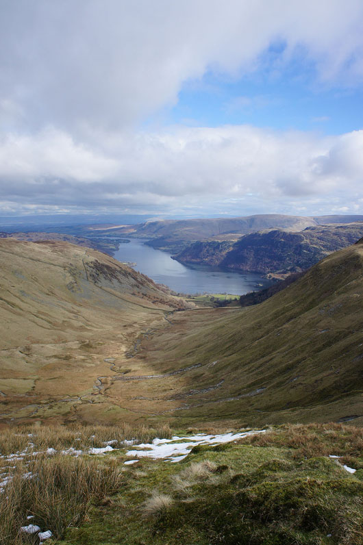
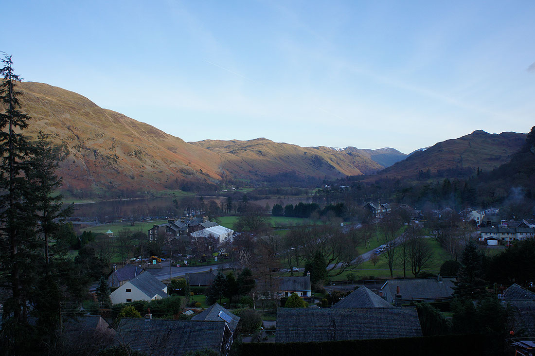
There's also a good view of Glenridding, the head of Ullswater and the fells around Patterdale.
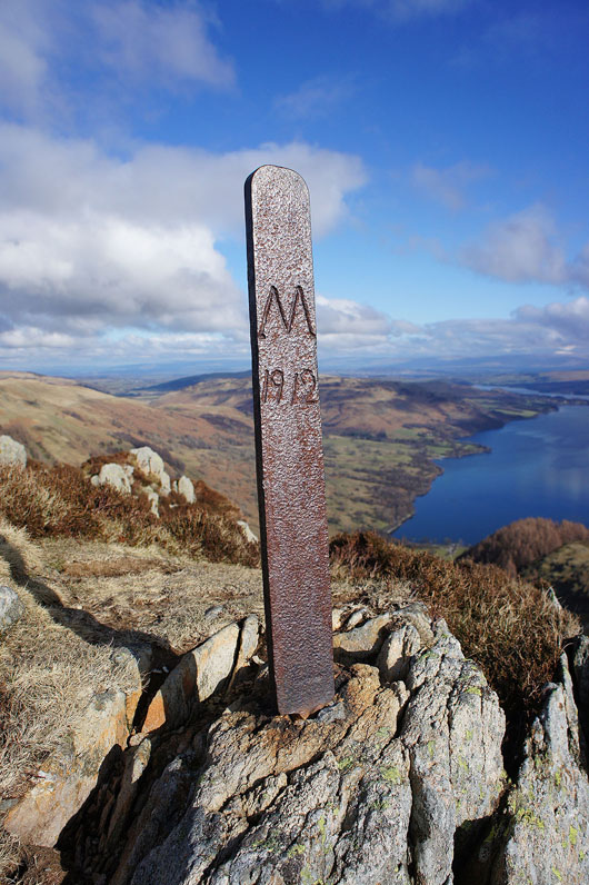
At the Heron Pike boundary post
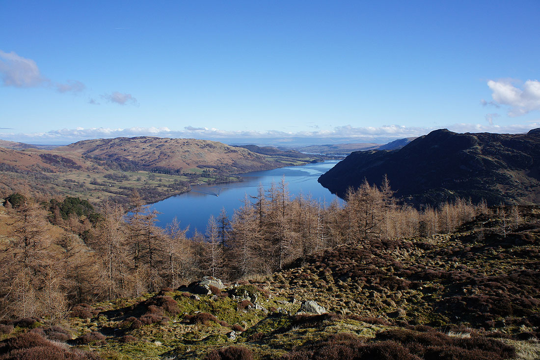
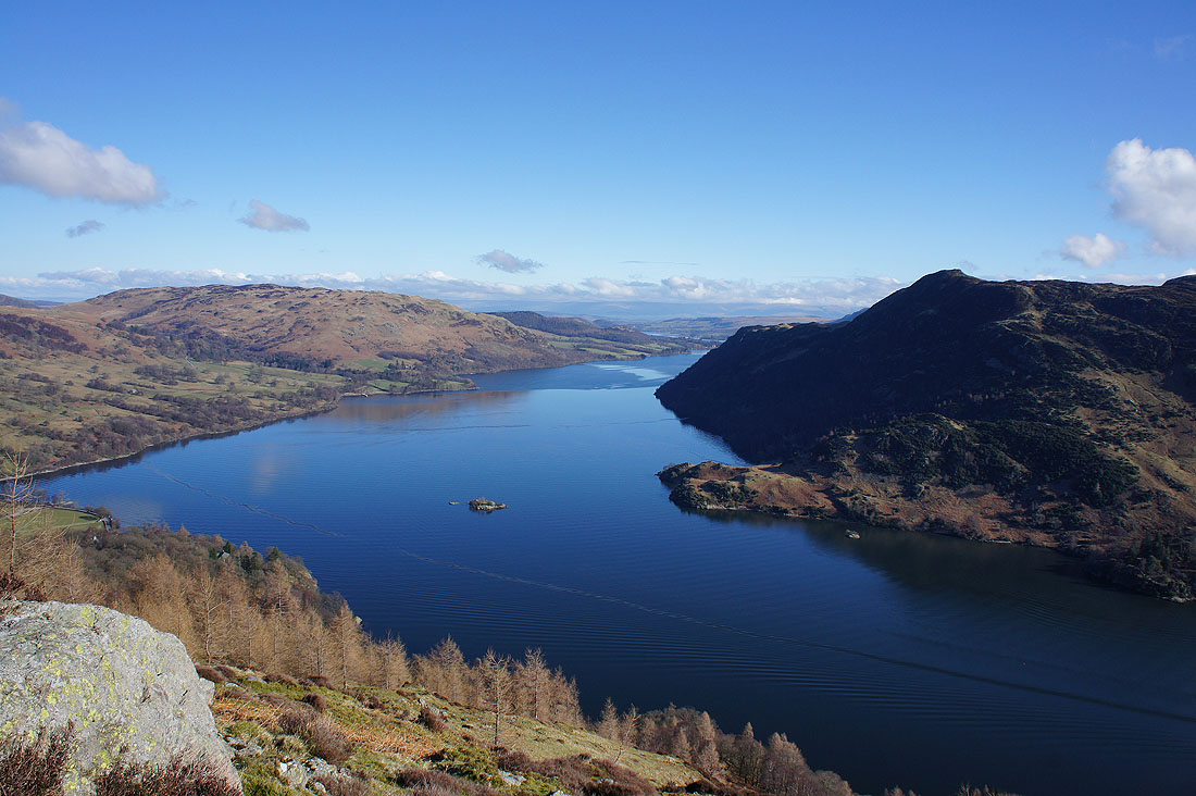
The great view of Ullswater that can be enjoyed from here
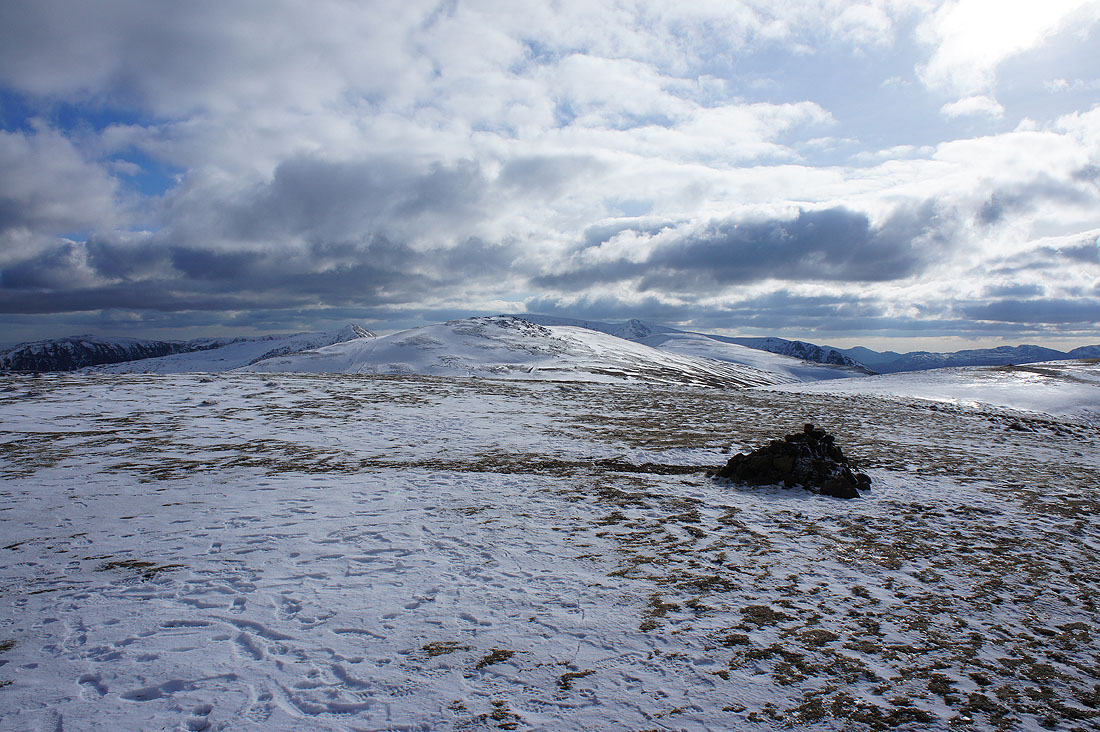
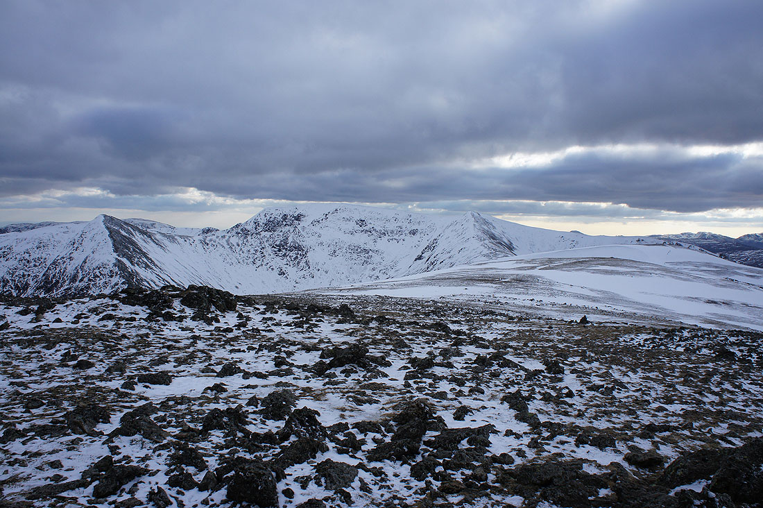
The sun is still out as I arrive on Sheffield Pike; so I took a shot of Striding Edge, Helvellyn, Catstycam, Helvellyn Lower Man and Whiteside before I sat down for a much needed break
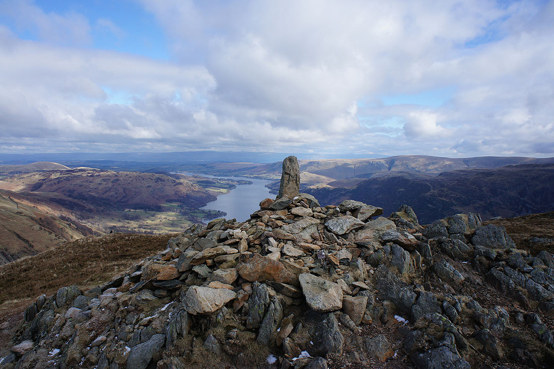
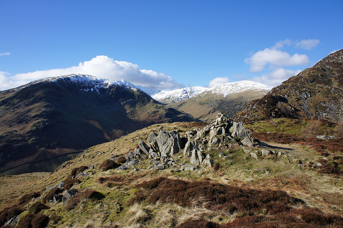
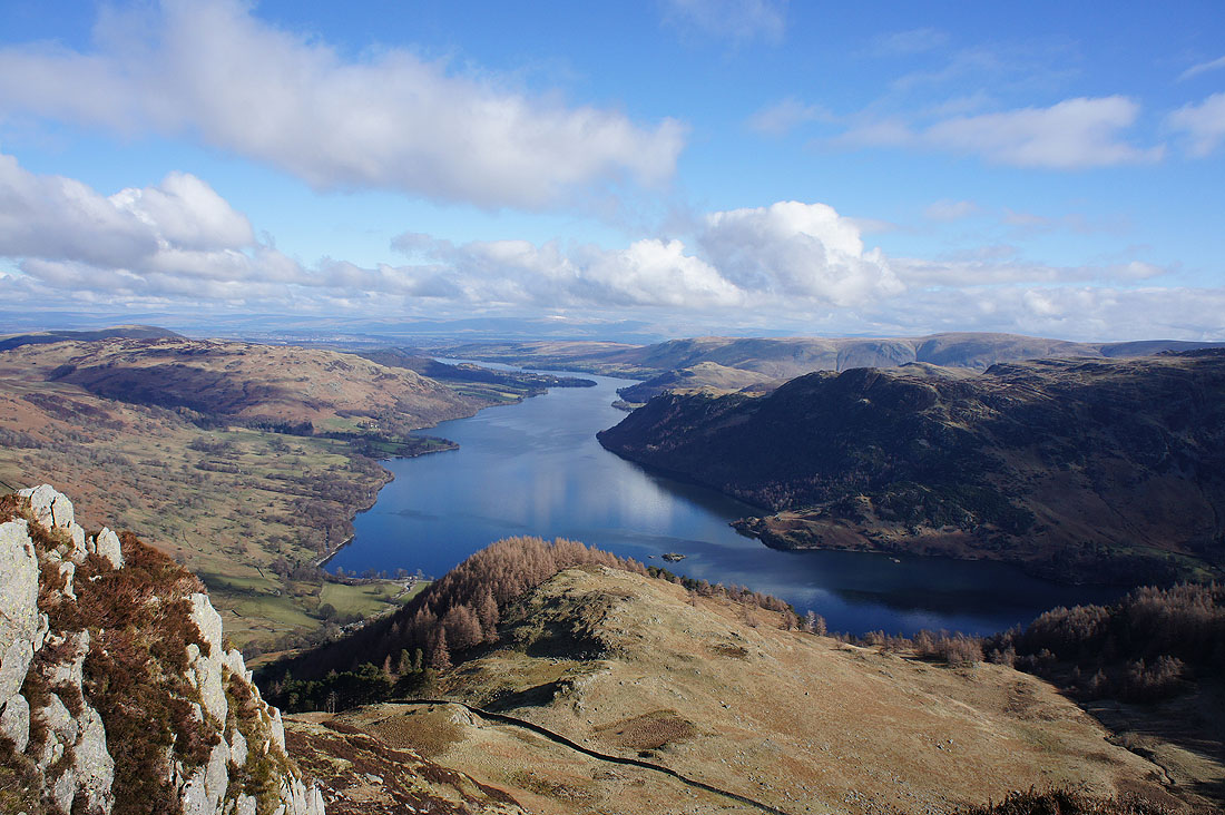
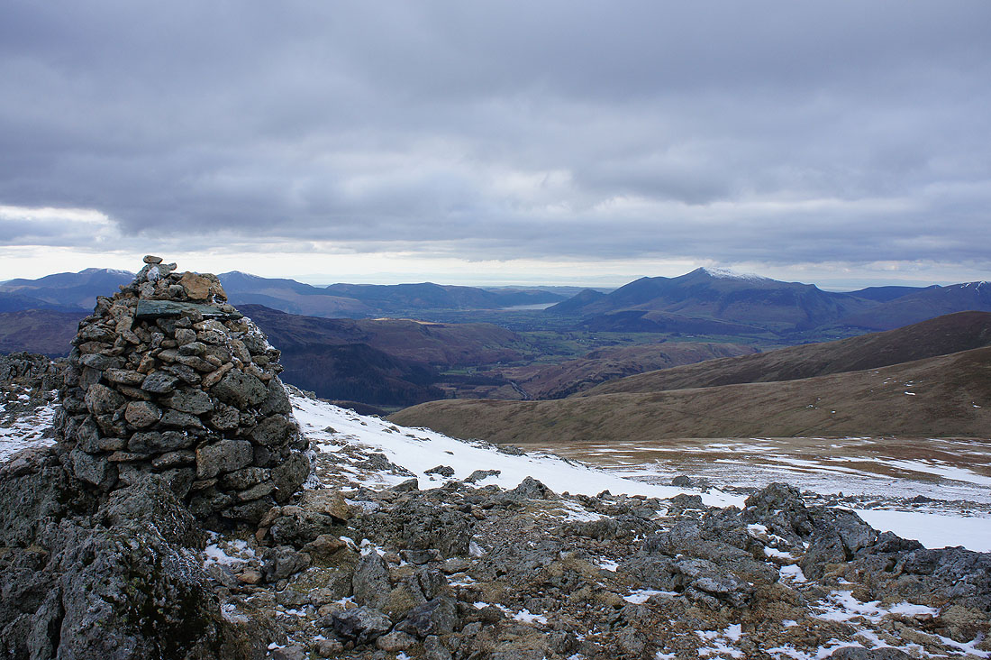
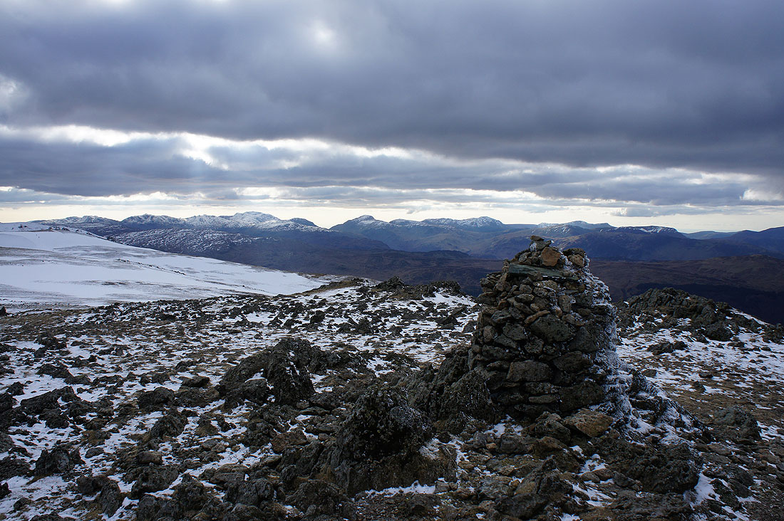
Break had but before I move on a few photos of the view. The summit cairn and Ullswater with Cross Fell and the North Pennines way in the distance.
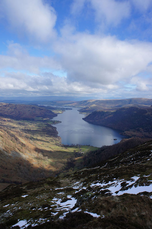
A better view of Ullswater if I head east from the summit a short distance
The far eastern fells of High Raise, Rampsgill Head, High Street, Thornthwaite Crag and Caudale Moor
The way ahead across Nick Head and up to Glencoyne Head. I'll then head north to Hart Side.
Glencoyne from Glencoyne Head
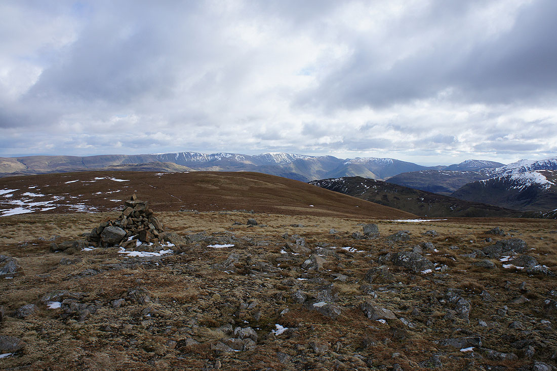
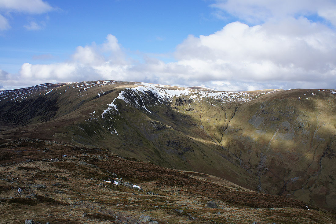
High Raise, High Street and the far eastern fells from the summit of Hart Side
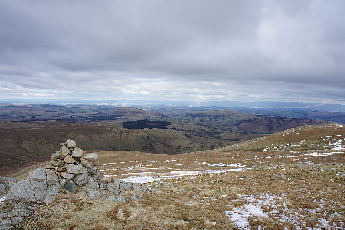
Looking northeast from a different cairn to Great and Little Mell Fells
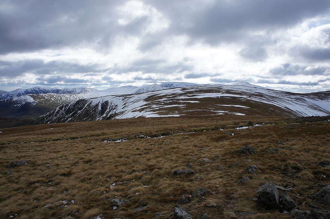
The next part of my route. I'll head up the slope to Green Side and then round to the right and up to Stybarrow Dodd which is out of sight.
Catstycam, Helvellyn and Raise from Green Side
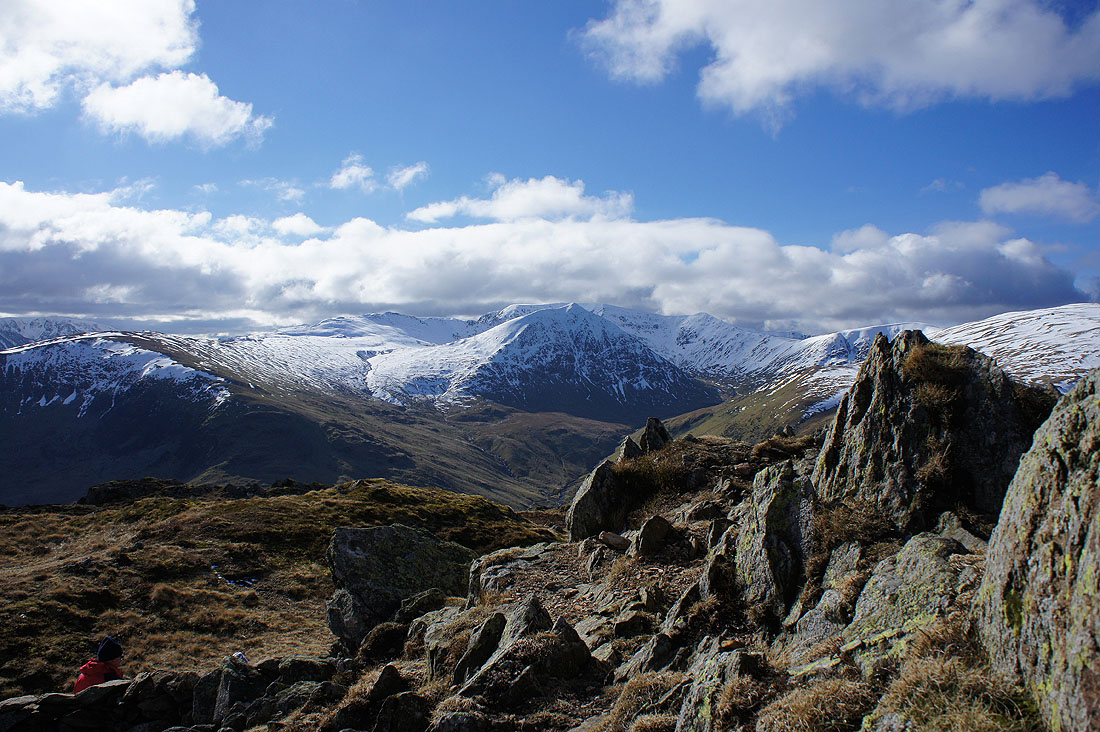
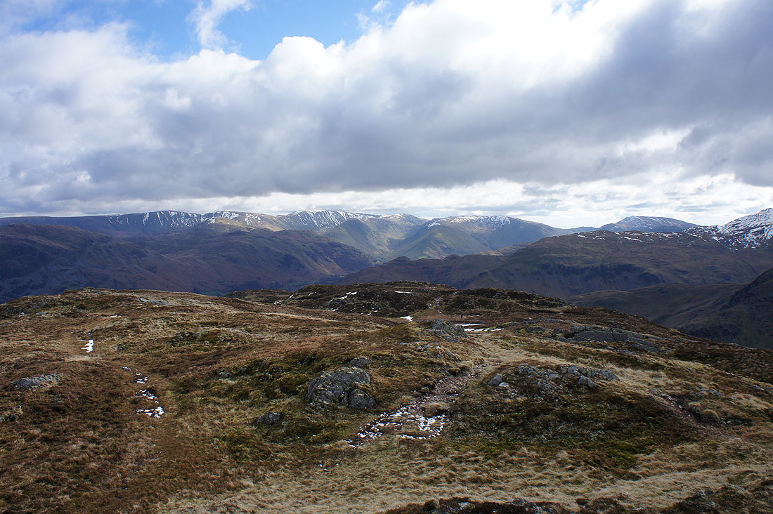
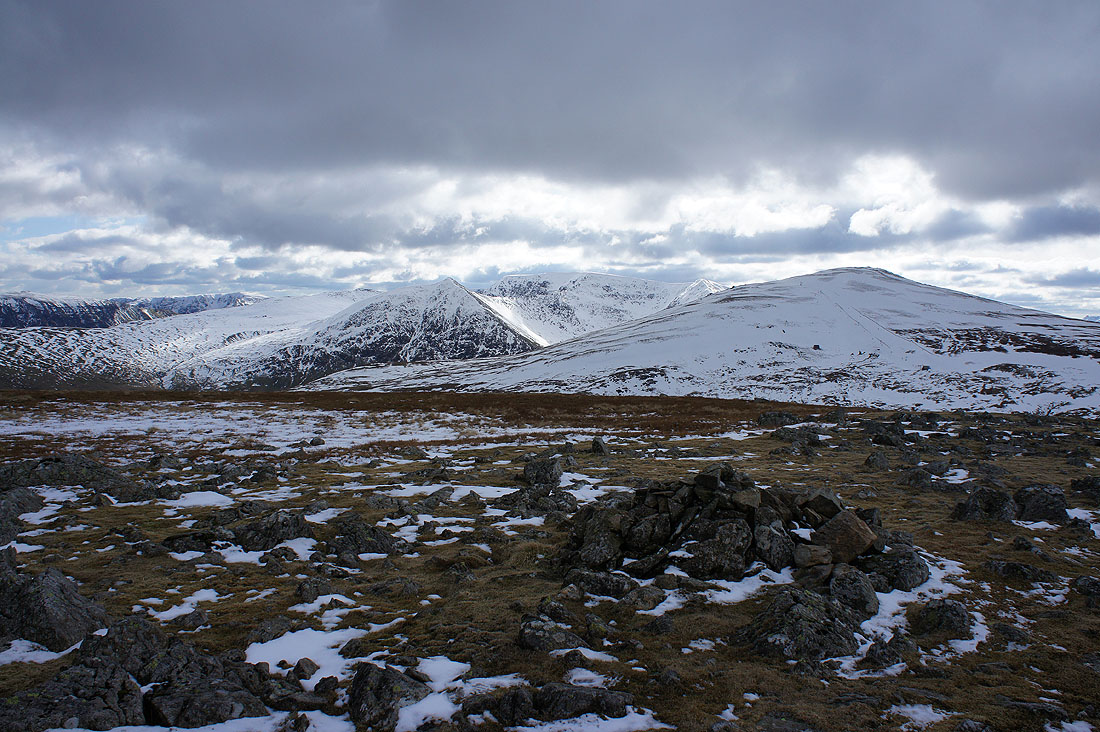
A short time later and I'm on the top of Stybarrow Dodd. There's a great all round view now, unfortunately much of the sunshine that I enjoyed earlier in the day has gone. On the skyline to the southwest; Crinkle Crags, Bowfell, Esk Pike, Scafell Pike, Lingmell, Great Gable and Pillar.
To the northwest; Grisedale Pike, the Lord's Seat fells, a little bit of Bassenthwaite Lake and Skiddaw. The air is really clear today, I can make out the hills in Scotland on the other side of the Solway Firth.
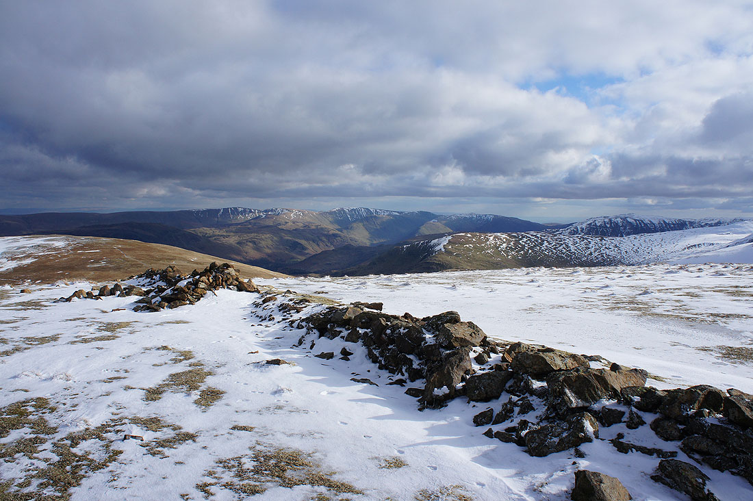
A brief appearance of the sun brightens the scene as I look over this broken wall to High Street in the distance
Raise to the south on the other side of the Sticks Pass. I'll don my spikes to tackle the snowy slope.
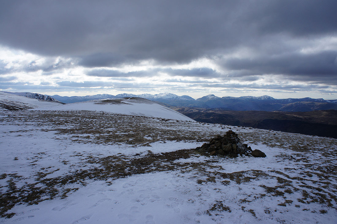
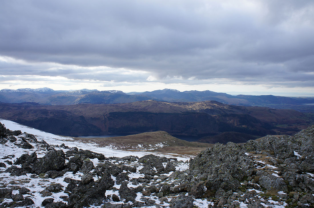
On Raise, the final summit of the day. The Vale of Keswick and Skiddaw.
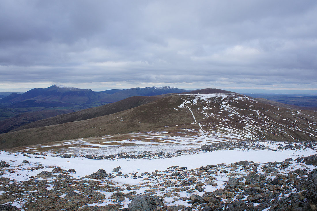
Skiddaw, Blencathra, Stybarrow Dodd and Great Dodd to the north
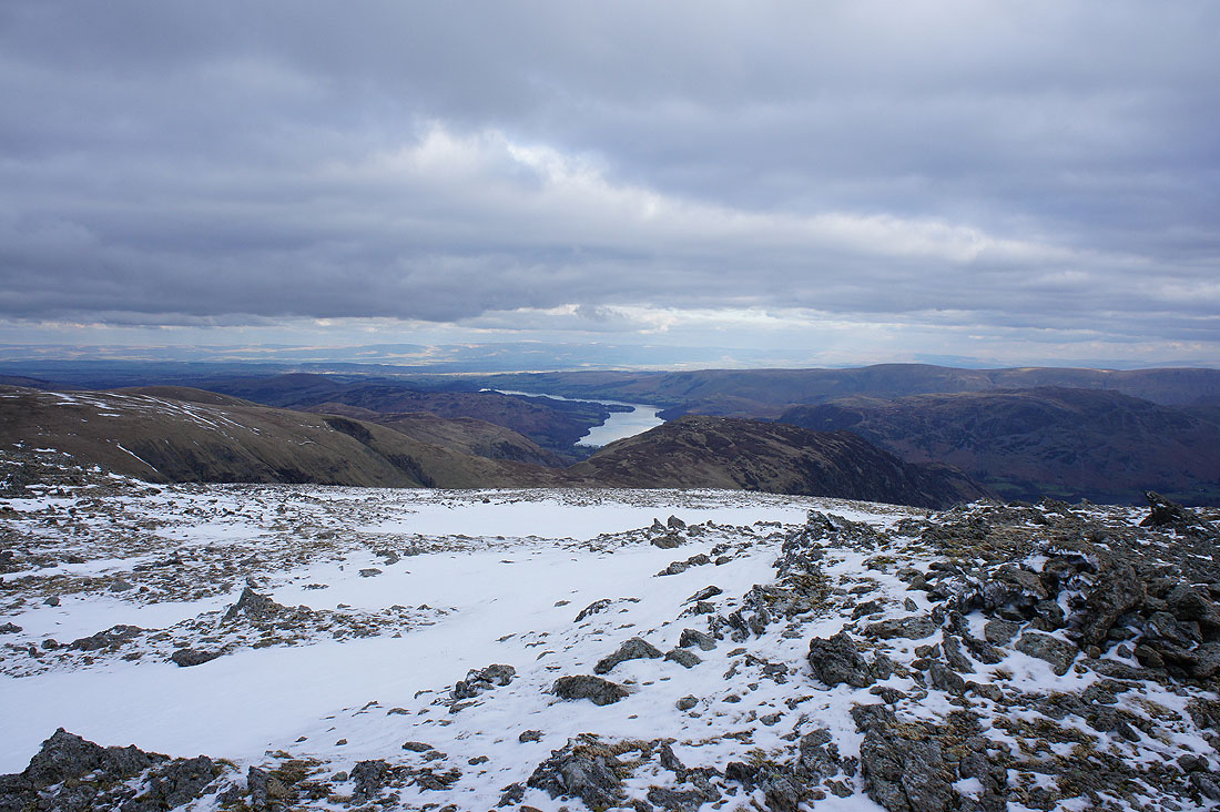
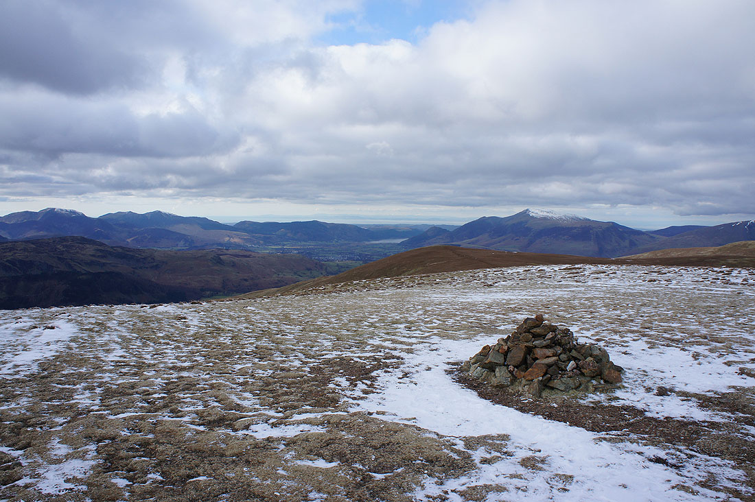
Ullswater and Sheffield Pike
Catstycam and Helvellyn
Crinkle Crags, Bowfell, Esk Pike, Scafell Pike, Lingmell, Great Gable, Pillar and the High Stile ridge in the distance
High Seat and Bleaberry Fell on the other side of Thirlmere, then the northwestern fells of Dale Head, Hindscarth, Crag Hill and Grisedale Pike in the distance
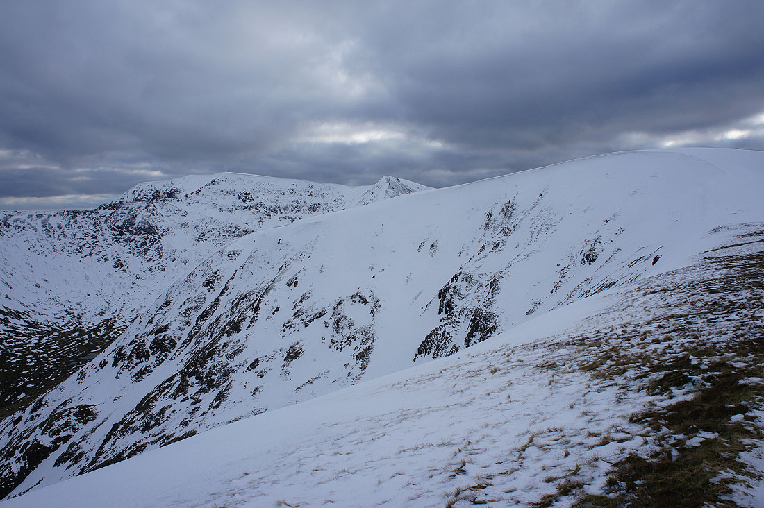
I've left Raise and I'm about to take the path down into Keppel Cove. Swirral Edge heads up to the summit of Helvellyn on the left and there's a bit of a cornice on the east face of Whiteside.

|
|
On the path down Glenridding to above the Helvellyn youth hostel
A view across Glenridding from the track I was on earlier in the day
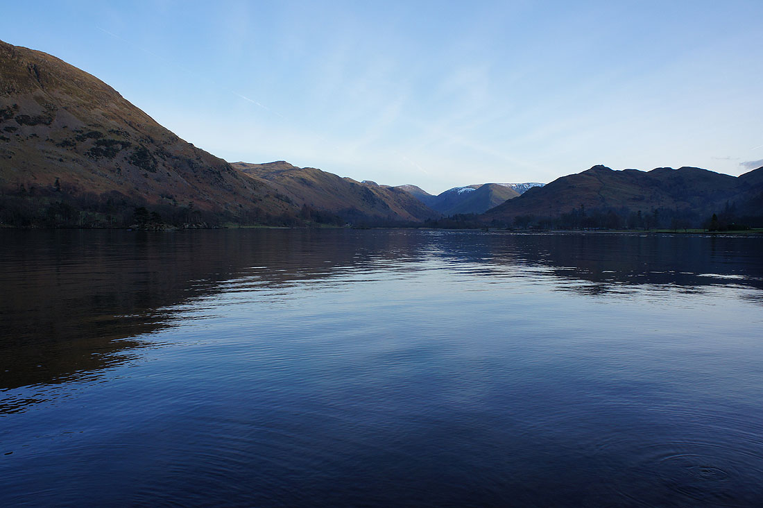
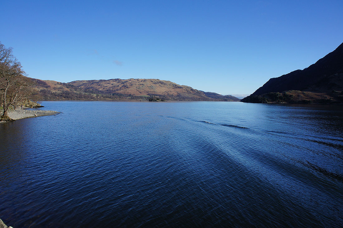
I finish by the shores of Ullswater as I make my way back to where I'm parked below Stybarrow Crag..