3rd October 2015 - The Ill Bell ridge & High Street
Walk Details
Distance walked: 13.4 miles
Total ascent: 3678 ft
OS map used: OL7 - The English Lakes, Southeastern area
Time taken: 7.5 hrs
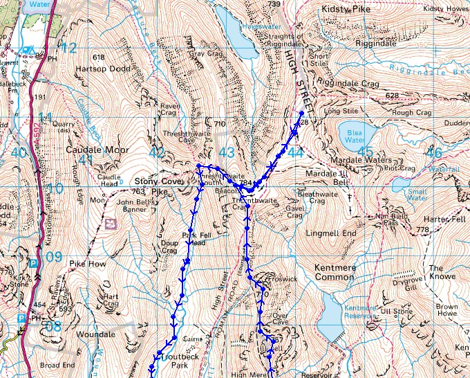
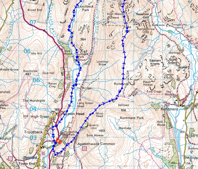
Route description: Troutbeck-Church Bridge-The Howe-Garburn Road-Garburn Pass-Yoke-Ill Bell-Froswick-Thornthwaite Crag-High Street-Thornthwaite Crag-Thresthwaite Mouth-Troutbeck Park-Hagg Bridge-Ing Bridge-Ing Lane-Troutbeck
I hadn't planned on doing a walk in the Lakes this weekend but when I saw some fantastic photos of a temperature inversion up there on Friday I starting thinking that maybe the conditions would last for one more day. The forecast seemed to suggest that they might. In the end I decided on doing the Ill Bell ridge, Thornthwaite Crag and High Street from Troutbeck. This part of the Lakes is the closest and quickest to get to from where I live, plus the three Wainwrights on the ridge would count for my second round. When I arrived in Troutbeck the sun was out and there had been fog over Windermere when I drove past it, things were looking good. However, the weather started to change on the walk up to the Garburn Pass. Low cloud started to form, the visibility deteriorated and by the time I reached the summit of Yoke I was shrouded in hill fog. I thought that was it for the day and that I'd spend the next several hours walking through the clag until I descended back to the valley but I got lucky and made it above the cloud on Thornthwaite Crag. I can still count on the fingers of one hand the number of inversions that I've seen so it still feels special whenever I'm lucky enough to experience one.
From the small car park at Church Bridge in Troutbeck I briefly walked south by the main road to reach the bridleway up past The Howe to reach the Garburn Road. I then followed this byway up to the Garburn Pass. At the top of the pass I left it for the path up the Ill Bell ridge. First port of call was Yoke, then Ill Bell, Froswick and Thornthwaite Crag. I finally had a break at the beacon on Thornthwaite Crag. After lunch I walked across to the summit of High Street to enjoy the best of the views above the cloud before returning to Thornthwaite Crag and descending to Threshthwaite Mouth. I then had a long walk following the footpath down the Trout Beck valley to Troutbeck Park. Despite recent dry weather it was still pretty wet underfoot in places. From Troutbeck Park there was easier walking with the track across Hagg Bridge, Ing Bridge and along Ing Lane to the bridleway past Town Head. My walk finished by following a footpath down across fields to reach Jesus Church on the main road and Church Bridge.
Total ascent: 3678 ft
OS map used: OL7 - The English Lakes, Southeastern area
Time taken: 7.5 hrs
Route description: Troutbeck-Church Bridge-The Howe-Garburn Road-Garburn Pass-Yoke-Ill Bell-Froswick-Thornthwaite Crag-High Street-Thornthwaite Crag-Thresthwaite Mouth-Troutbeck Park-Hagg Bridge-Ing Bridge-Ing Lane-Troutbeck
I hadn't planned on doing a walk in the Lakes this weekend but when I saw some fantastic photos of a temperature inversion up there on Friday I starting thinking that maybe the conditions would last for one more day. The forecast seemed to suggest that they might. In the end I decided on doing the Ill Bell ridge, Thornthwaite Crag and High Street from Troutbeck. This part of the Lakes is the closest and quickest to get to from where I live, plus the three Wainwrights on the ridge would count for my second round. When I arrived in Troutbeck the sun was out and there had been fog over Windermere when I drove past it, things were looking good. However, the weather started to change on the walk up to the Garburn Pass. Low cloud started to form, the visibility deteriorated and by the time I reached the summit of Yoke I was shrouded in hill fog. I thought that was it for the day and that I'd spend the next several hours walking through the clag until I descended back to the valley but I got lucky and made it above the cloud on Thornthwaite Crag. I can still count on the fingers of one hand the number of inversions that I've seen so it still feels special whenever I'm lucky enough to experience one.
From the small car park at Church Bridge in Troutbeck I briefly walked south by the main road to reach the bridleway up past The Howe to reach the Garburn Road. I then followed this byway up to the Garburn Pass. At the top of the pass I left it for the path up the Ill Bell ridge. First port of call was Yoke, then Ill Bell, Froswick and Thornthwaite Crag. I finally had a break at the beacon on Thornthwaite Crag. After lunch I walked across to the summit of High Street to enjoy the best of the views above the cloud before returning to Thornthwaite Crag and descending to Threshthwaite Mouth. I then had a long walk following the footpath down the Trout Beck valley to Troutbeck Park. Despite recent dry weather it was still pretty wet underfoot in places. From Troutbeck Park there was easier walking with the track across Hagg Bridge, Ing Bridge and along Ing Lane to the bridleway past Town Head. My walk finished by following a footpath down across fields to reach Jesus Church on the main road and Church Bridge.
Route map
© Crown copyright. All rights reserved. License number PU 100034184.
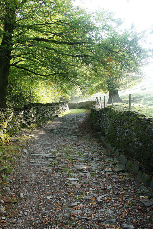
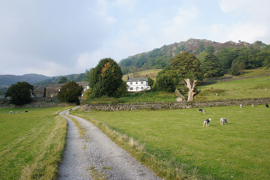
Leaving Troutbeck behind on a rough and stony track
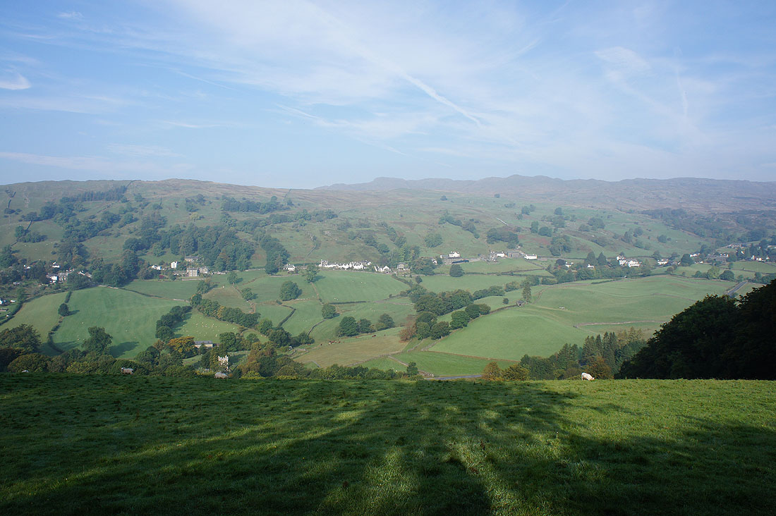
As I gain height the village of Troutbeck strung out along the valley
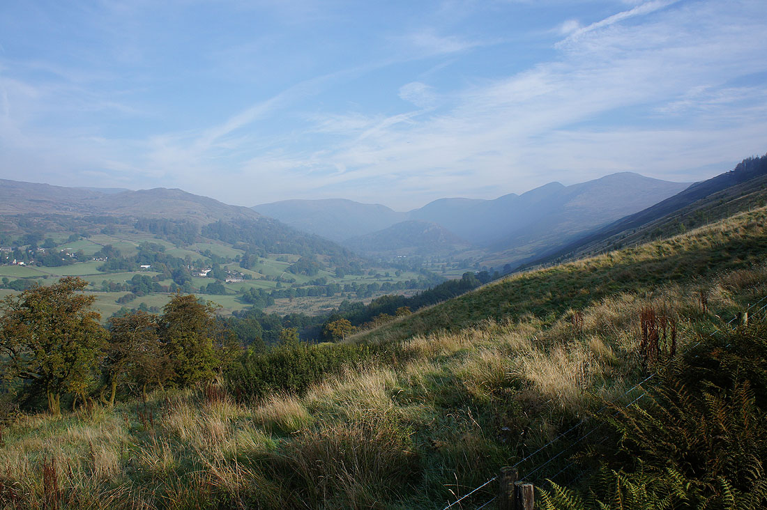
and a view up the valley of Troutbeck to Caudale Moor, Thornthwaite Crag and the Ill Bell ridge
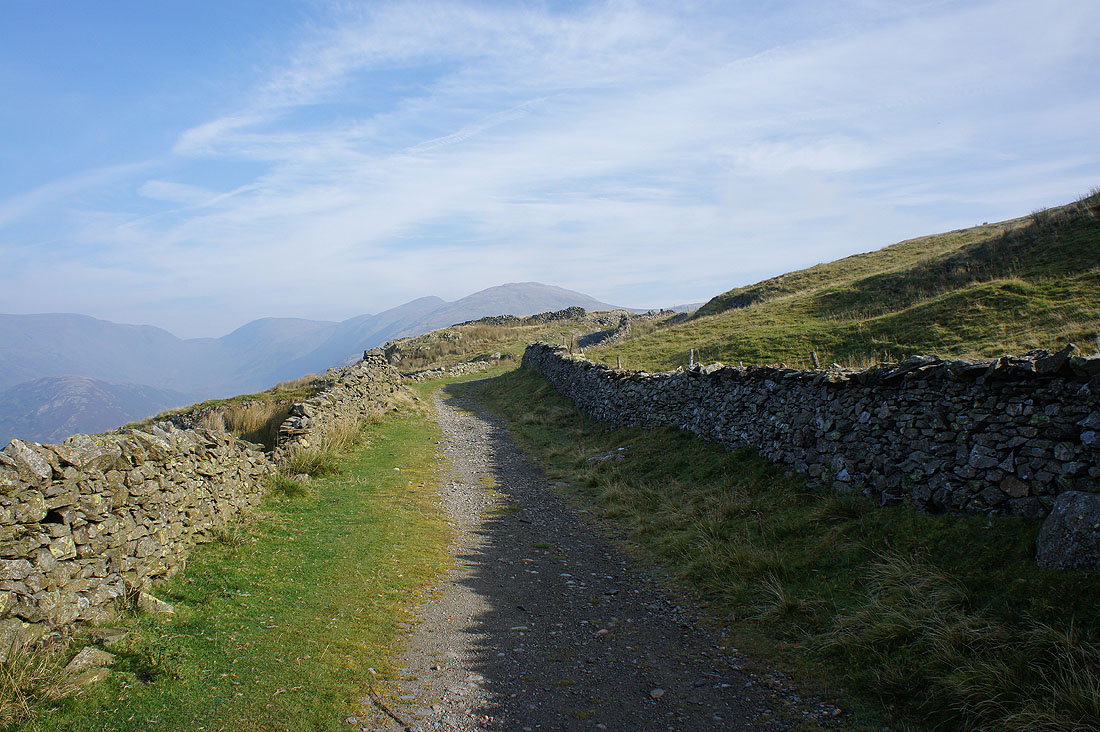
On the Garburn Road
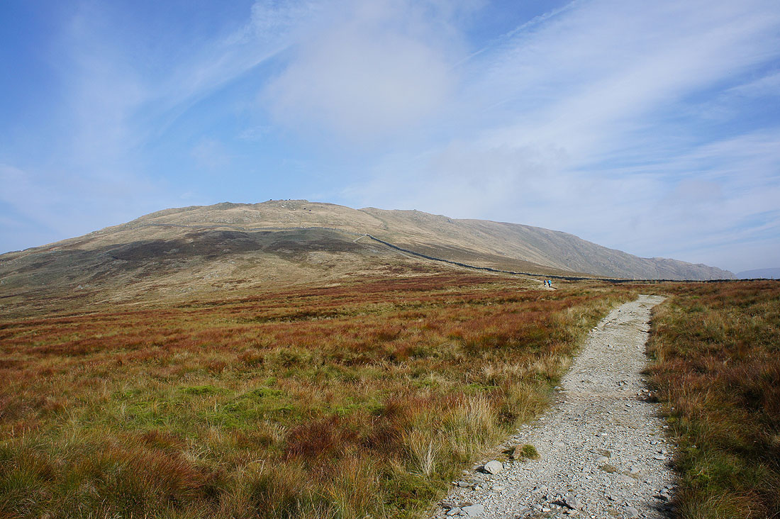
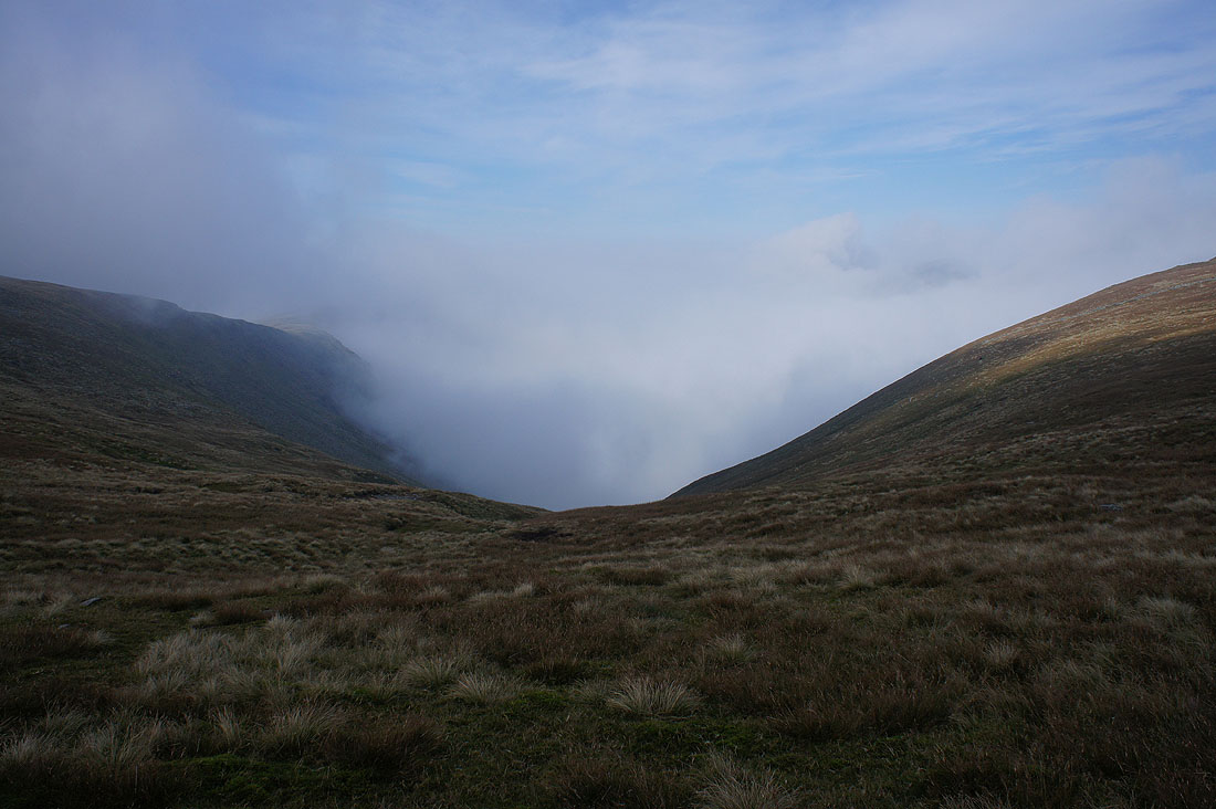
Heading for Yoke. It was at this point that I could see that the weather was changing.
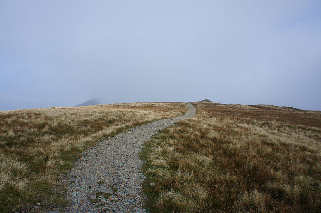
Just twenty minutes later and the cloud envelops me
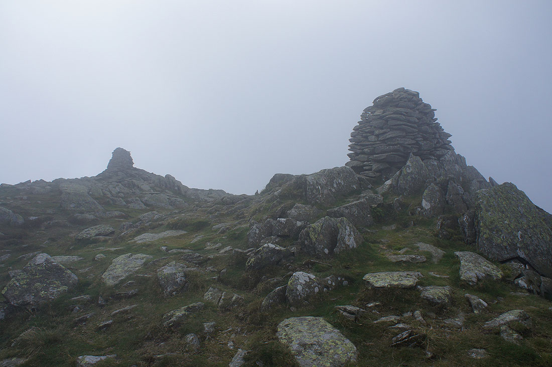
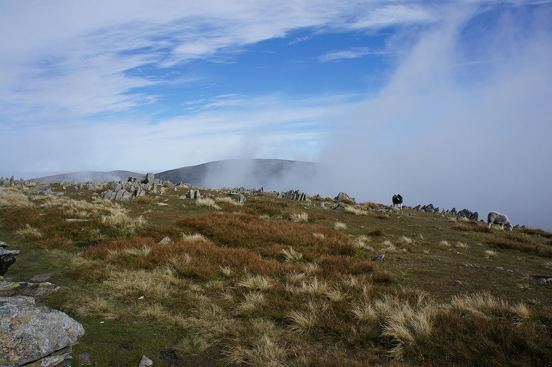
Misty cairns on Ill Bell and no view
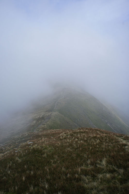
Bound for Froswick. At times it was quite bright and I could make out the sun through the top of the cloud.
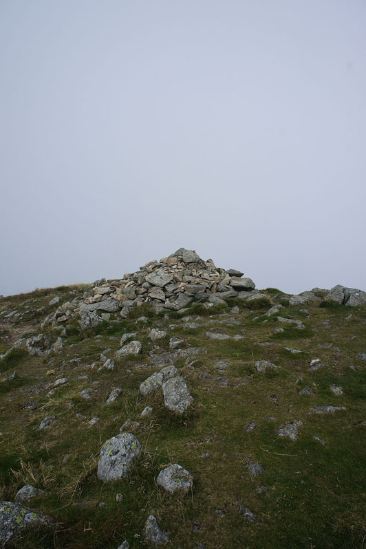
Froswick. Nothing to see here either.
On the final approach to Thornthwaite Crag and it's suddenly blue skies and sunshine as I walk up through the top of the cloud.
High Street as the cloud clears while I'm sat having my lunch
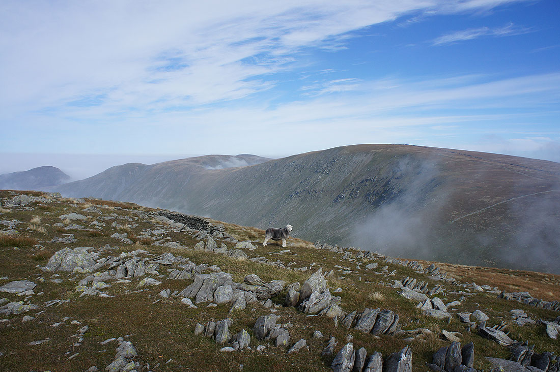
Rest Dodd, The Knott, Rampsgill Head, High Raise, High Street and an obliging herdy striking a pose
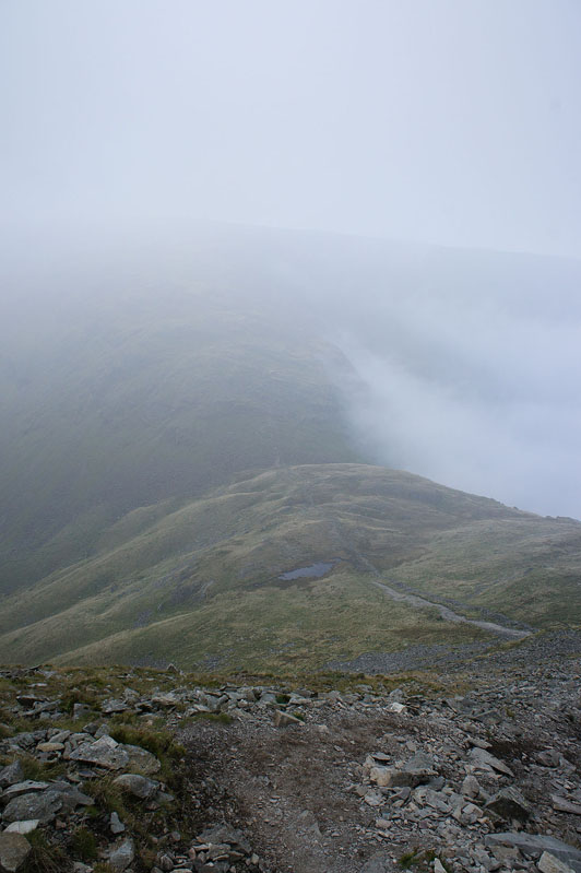
Heading up High Street and as I look back Thornthwaite Crag has been shrouded in cloud. This inversion might not last too much longer.

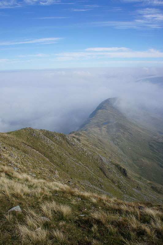
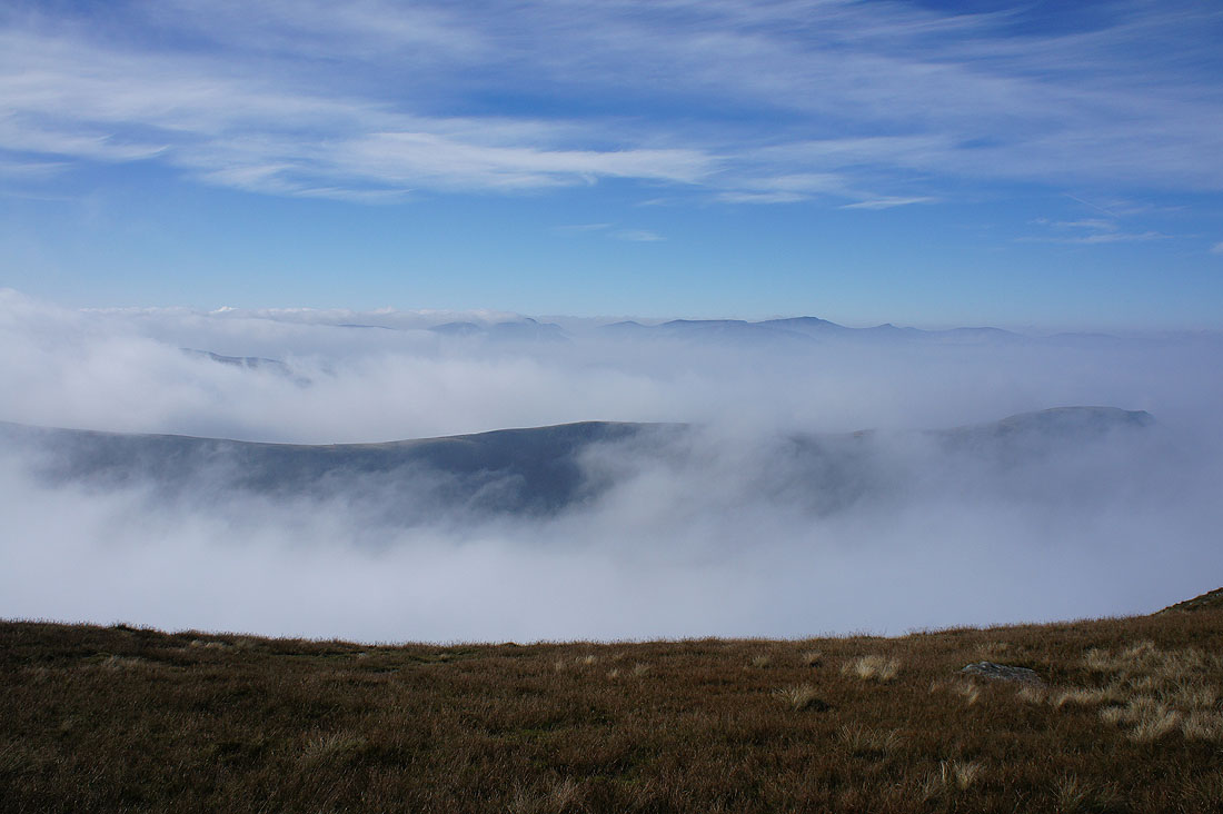
Gray Crag on the other side of the Hayeswater valley and at the moment the tops of Helvellyn and the Dodds are just about above the cloud
On the summit of High Street and it feels really warm in the sunshine
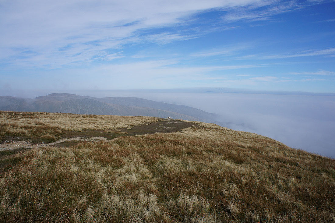
The northern part of the far eastern fells looks like it's the place to be today. I can make out the North Pennines on the other side of a cloud filled Eden valley.
Long Stile and the Rough Crag ridge
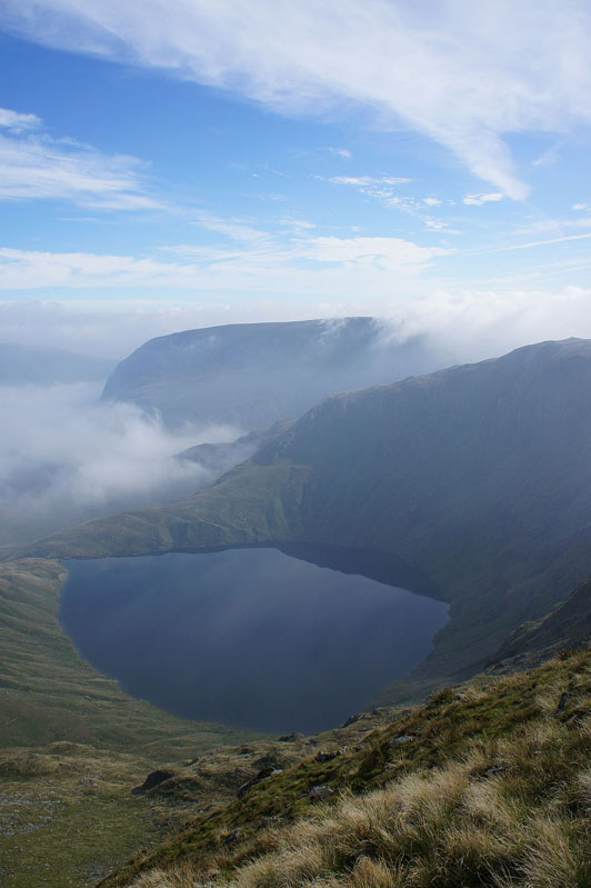
Blea Water and Harter Fell
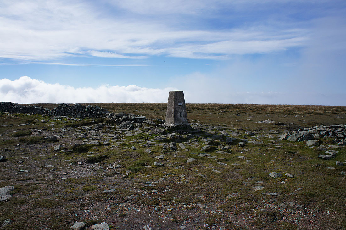
Back at the trig point. I'd better get a move on but it's hard not to linger when it's like this.
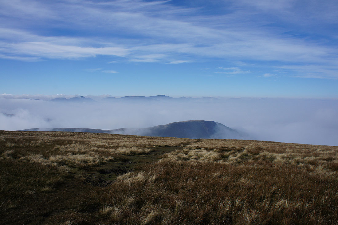
The view has improved since I first got up here. Thornthwaite Crag on the left and the northern half of Caudale Moor.
Fairfield, Dollywagon Pike, Nethermost Pike and Helvellyn with Gray Crag in the foreground
Heading back to Thornthwaite Crag
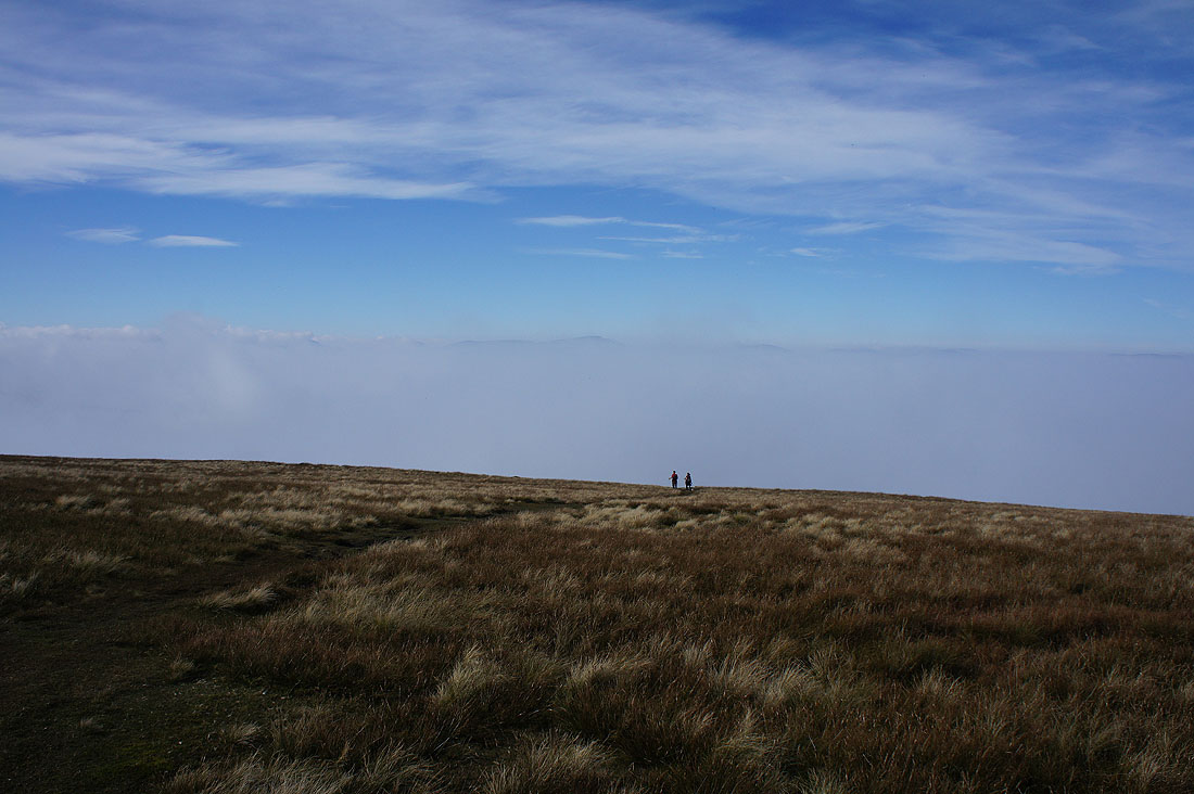
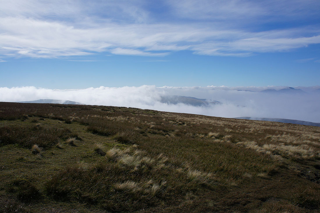
One last shot across the top of the cloud
At the top of a cloud filled Hayeswater valley
A steep and rough descent from Thornthwaite Crag to Threshthwaite Mouth
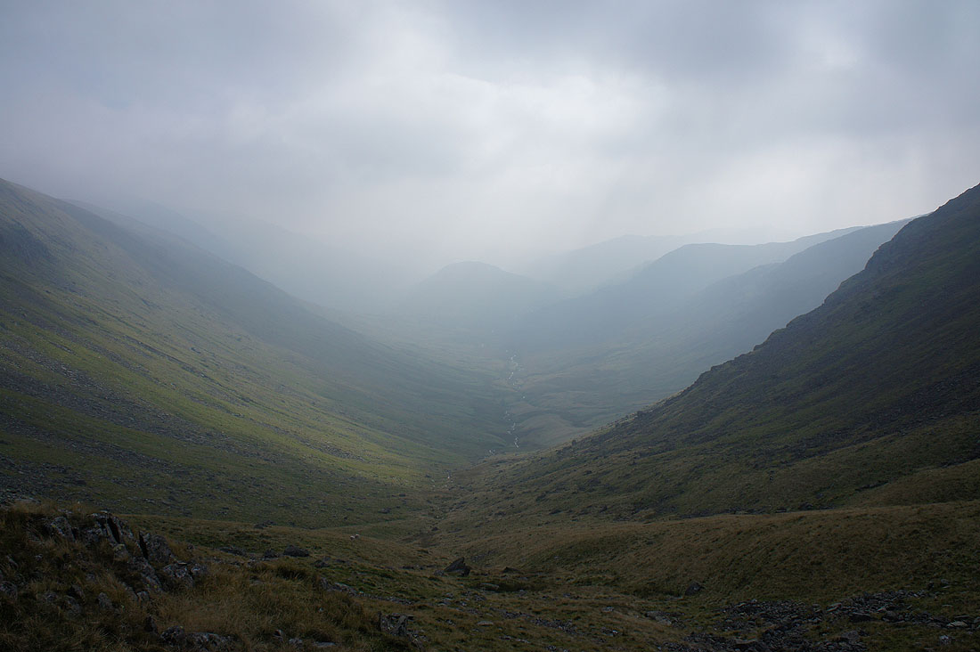
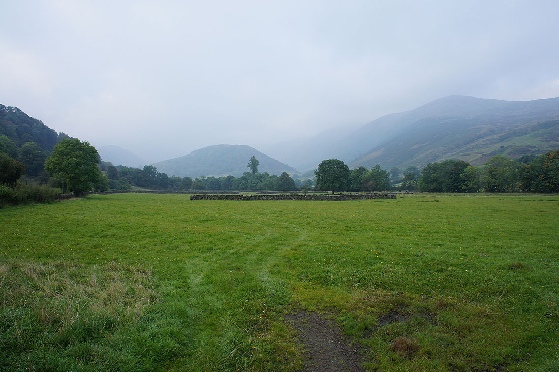
The Trout Beck valley as I reach Threshthwaite Mouth
The sun comes out as I follow the path down the valley
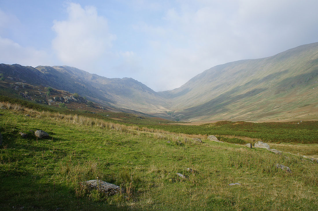
Looking back to Threshthwaite Mouth with Threshthwaite Crag on the left and Thornthwaite Crag on the right
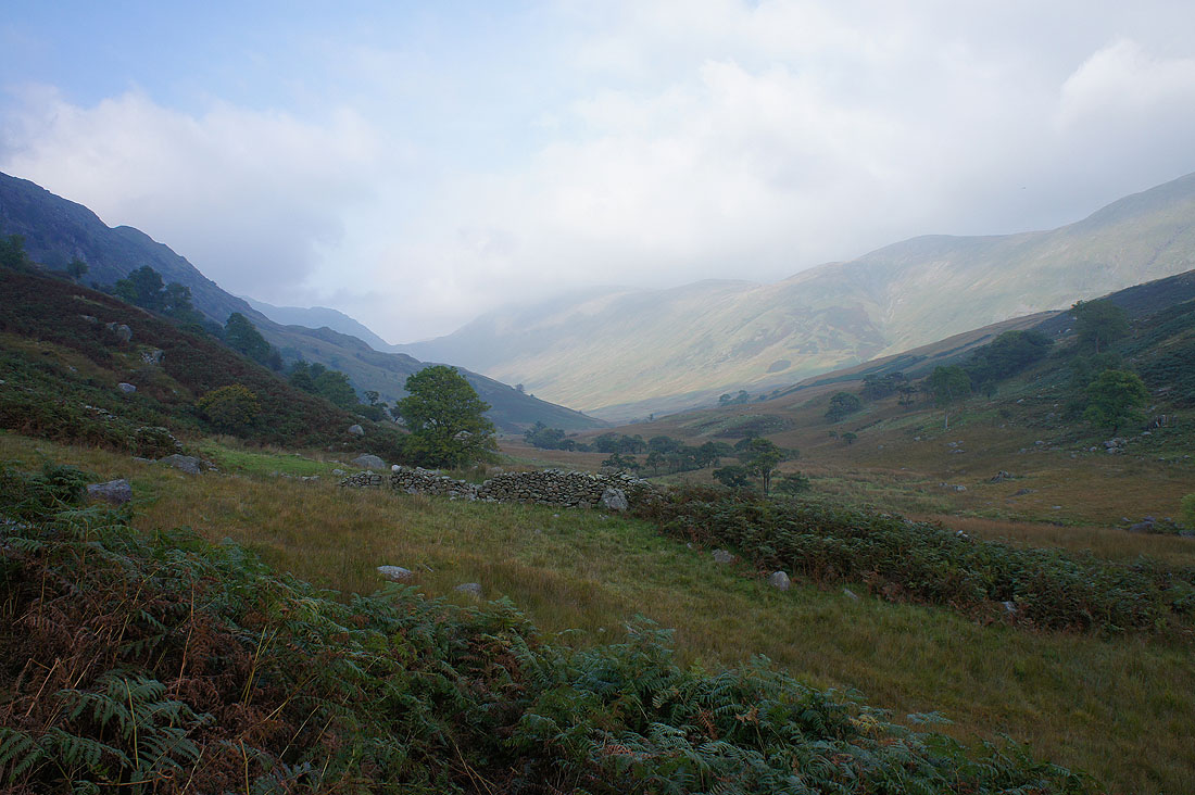
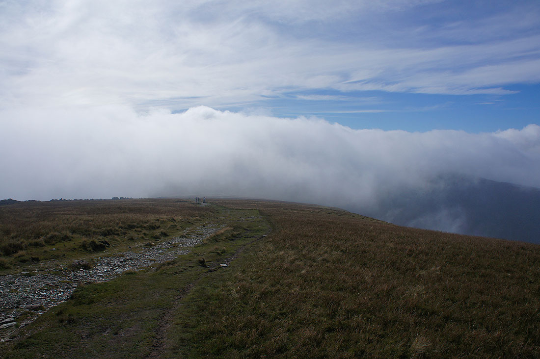
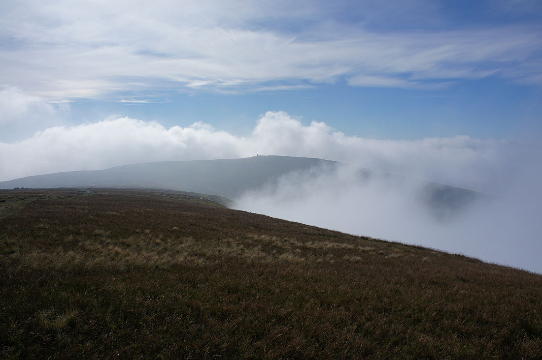
Low cloud covers the tops as I reach..
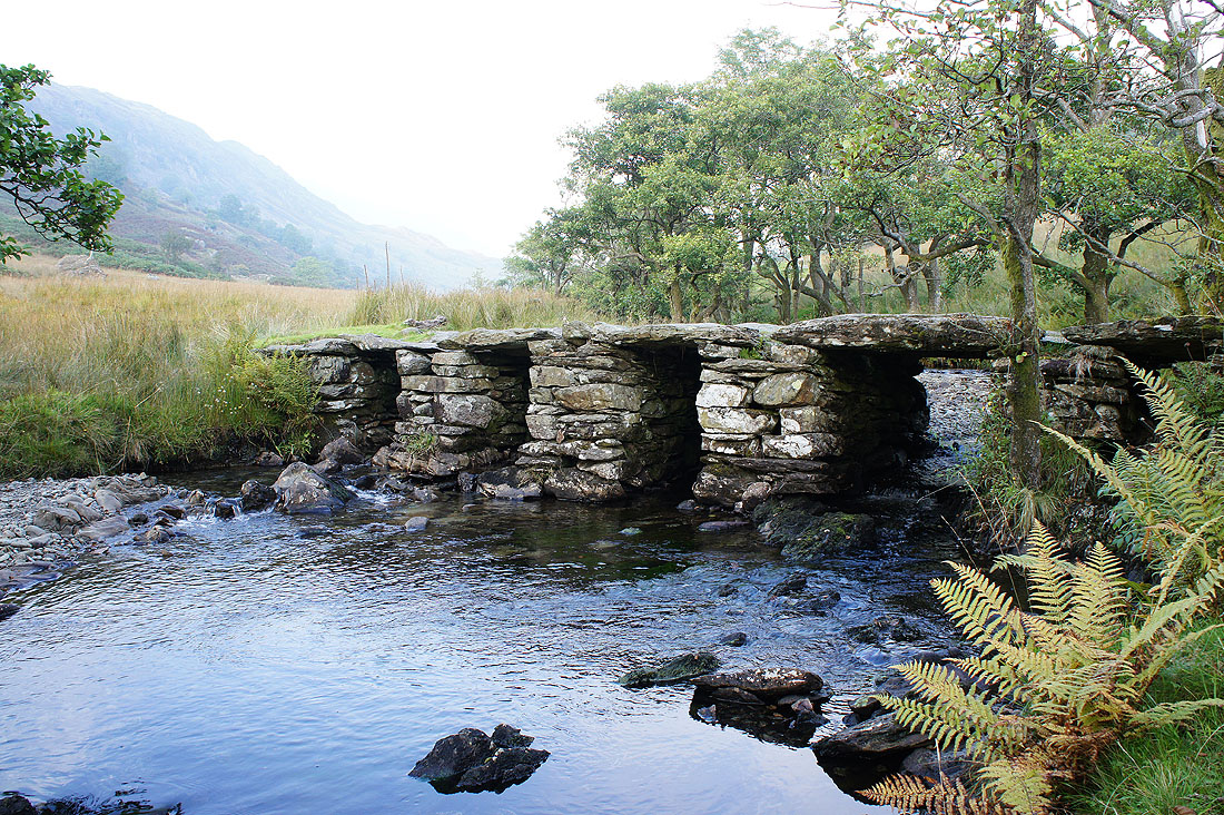
..this fantastic footbridge over Trout Beck
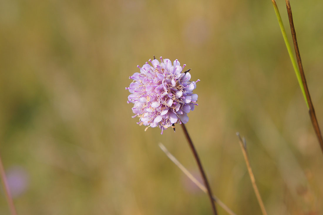
One of many Devil's-bit Scabious still in flower by the path to Troutbeck Park
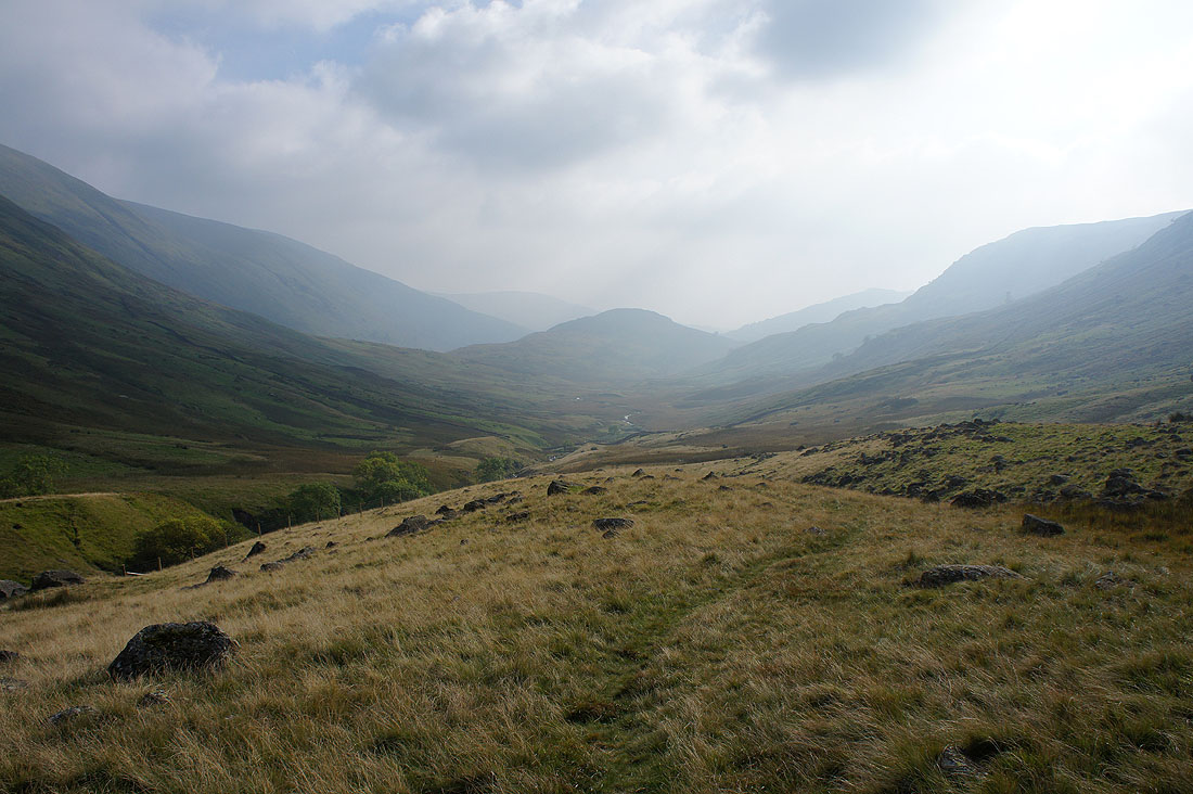
Looking back to Troutbeck Park with Troutbeck Tongue on the right
A murky end to the afternoon as I arrive back in Troutbeck