4th April 2013 - The Loweswater Fells
Walk Details
Distance walked: 6.1 miles
Total ascent: 1905 ft
OS map used: OL4 - The English Lakes, North-western area
Time taken: 4 hrs
Route description: The red phone box, Loweswater-Maggie's Bridge-High Nook Farm-High Nook Tarn-Gavel Fell-Blake Fell-High Nook Tarn-High Nook Farm-Maggie's Bridge-The red phone box, Loweswater
My first time in the Lake District this year and I've arranged to meet up with fellow Online Fellwalking Club members Roger, Ann and Jo (plus their dogs Harry, Bethan and Amber) for this walk on the Loweswater fells. It's been more years than I care to remember since my only other visit to these hills and on that day it was so hazy I could only make out the surrounding fells. The weather promises to be better today but colder as spring is still struggling to gain a foothold.
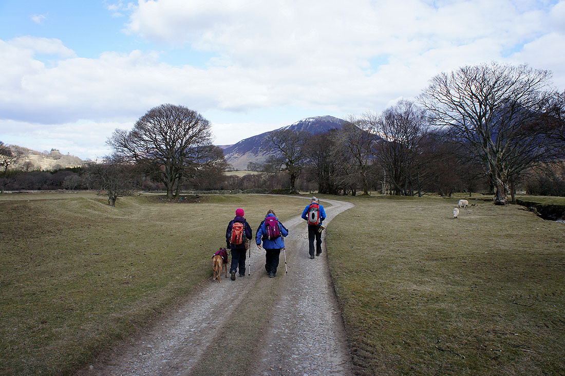
From the red phone box in Loweswater we started by walking along the lane to Maggie's Bridge. The track to High Nook Farm was followed through the farmyard and to High Nook Tarn. The ascent of Gavel Fell was done by its northeast ridge and once the summit was reached we headed across to Blake Fell. To get back to High Nook Tarn a steep descent of Blake Fell's eastern slopes was done and from the tarn we retraced our steps back to the start.
Total ascent: 1905 ft
OS map used: OL4 - The English Lakes, North-western area
Time taken: 4 hrs
Route description: The red phone box, Loweswater-Maggie's Bridge-High Nook Farm-High Nook Tarn-Gavel Fell-Blake Fell-High Nook Tarn-High Nook Farm-Maggie's Bridge-The red phone box, Loweswater
My first time in the Lake District this year and I've arranged to meet up with fellow Online Fellwalking Club members Roger, Ann and Jo (plus their dogs Harry, Bethan and Amber) for this walk on the Loweswater fells. It's been more years than I care to remember since my only other visit to these hills and on that day it was so hazy I could only make out the surrounding fells. The weather promises to be better today but colder as spring is still struggling to gain a foothold.
From the red phone box in Loweswater we started by walking along the lane to Maggie's Bridge. The track to High Nook Farm was followed through the farmyard and to High Nook Tarn. The ascent of Gavel Fell was done by its northeast ridge and once the summit was reached we headed across to Blake Fell. To get back to High Nook Tarn a steep descent of Blake Fell's eastern slopes was done and from the tarn we retraced our steps back to the start.
Route map
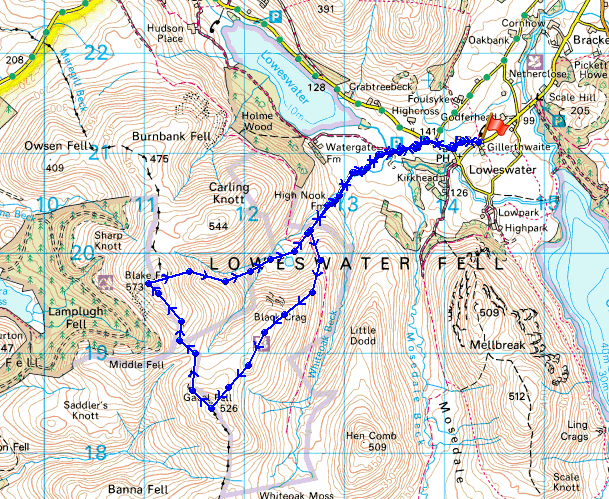
© Crown copyright. All rights reserved. License number PU 100034184.
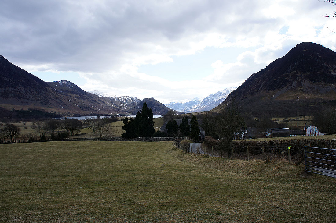
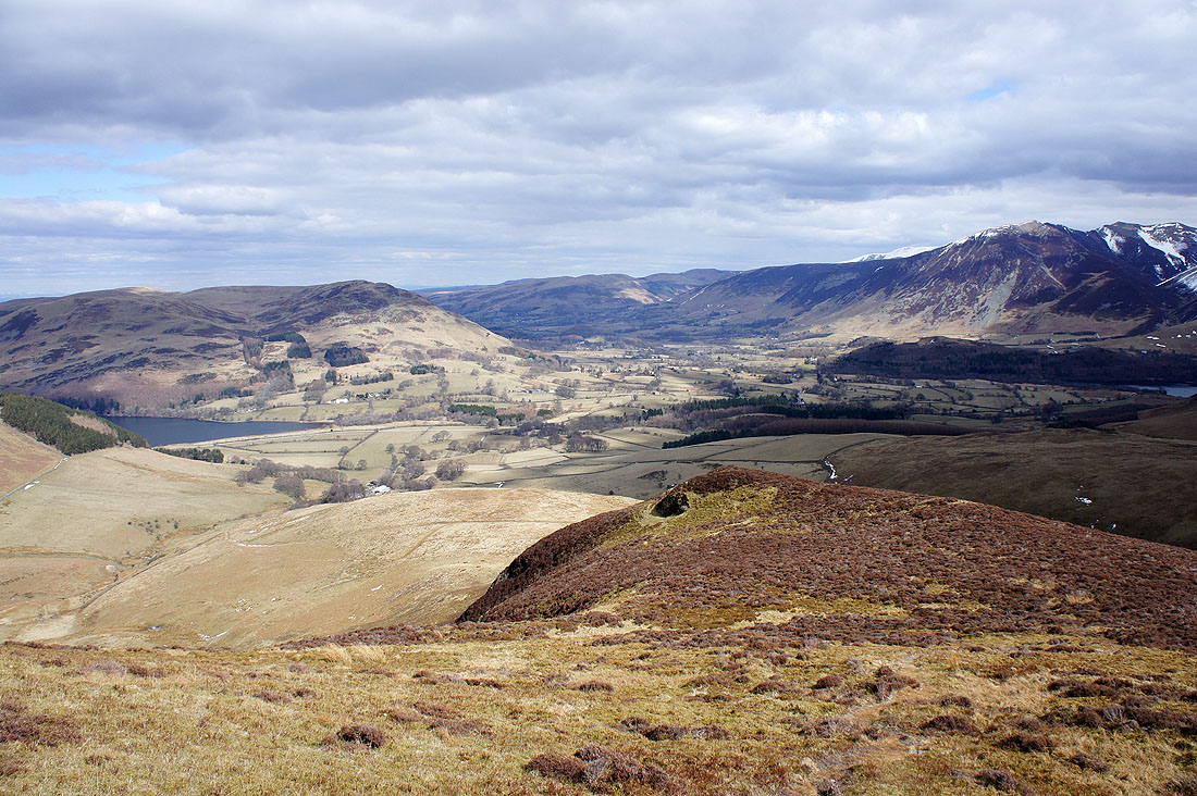
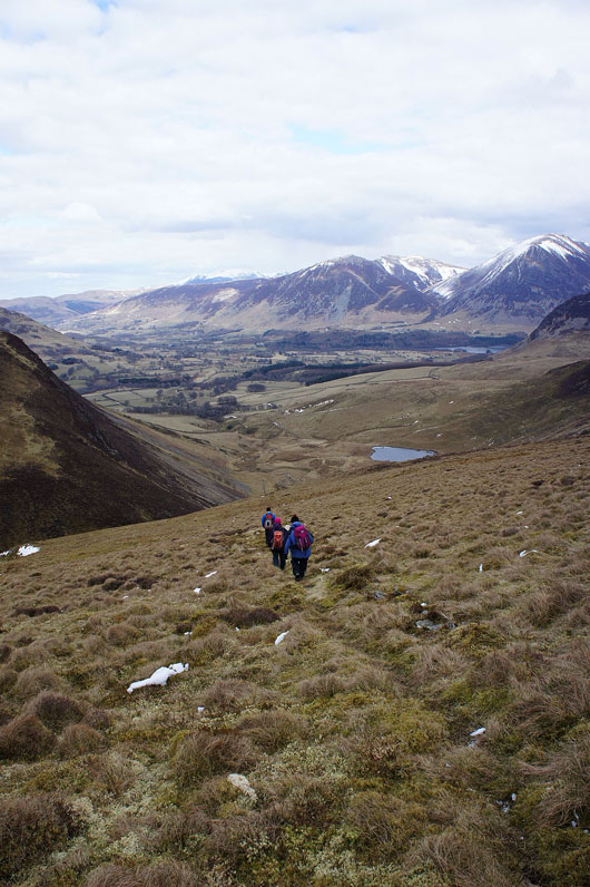
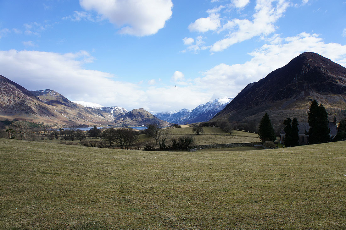
Setting off from the red phone box and there's a great view of the Buttermere valley from the lane to Maggie's Bridge
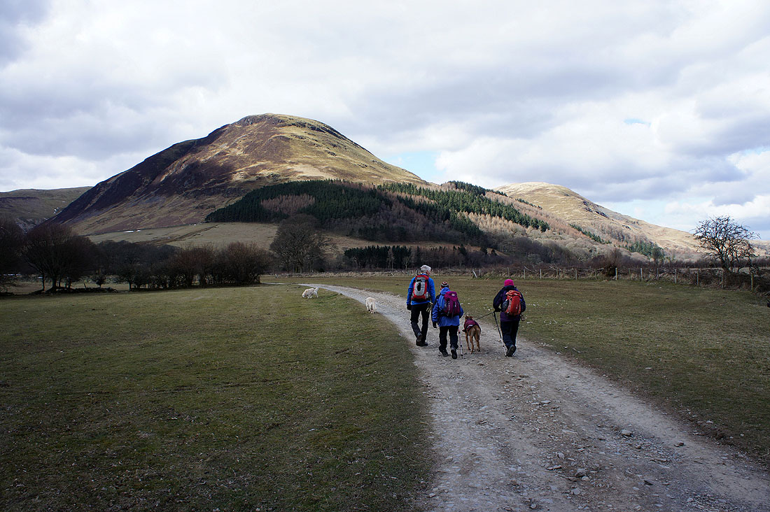
Past Maggie's Bridge and we're on the track to High Nook Farm. Carling Knott in the background.
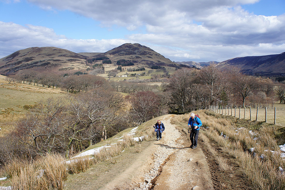
A brief pause on the track to High Nook Tarn to capture the view across to Darling Fell and Low Fell
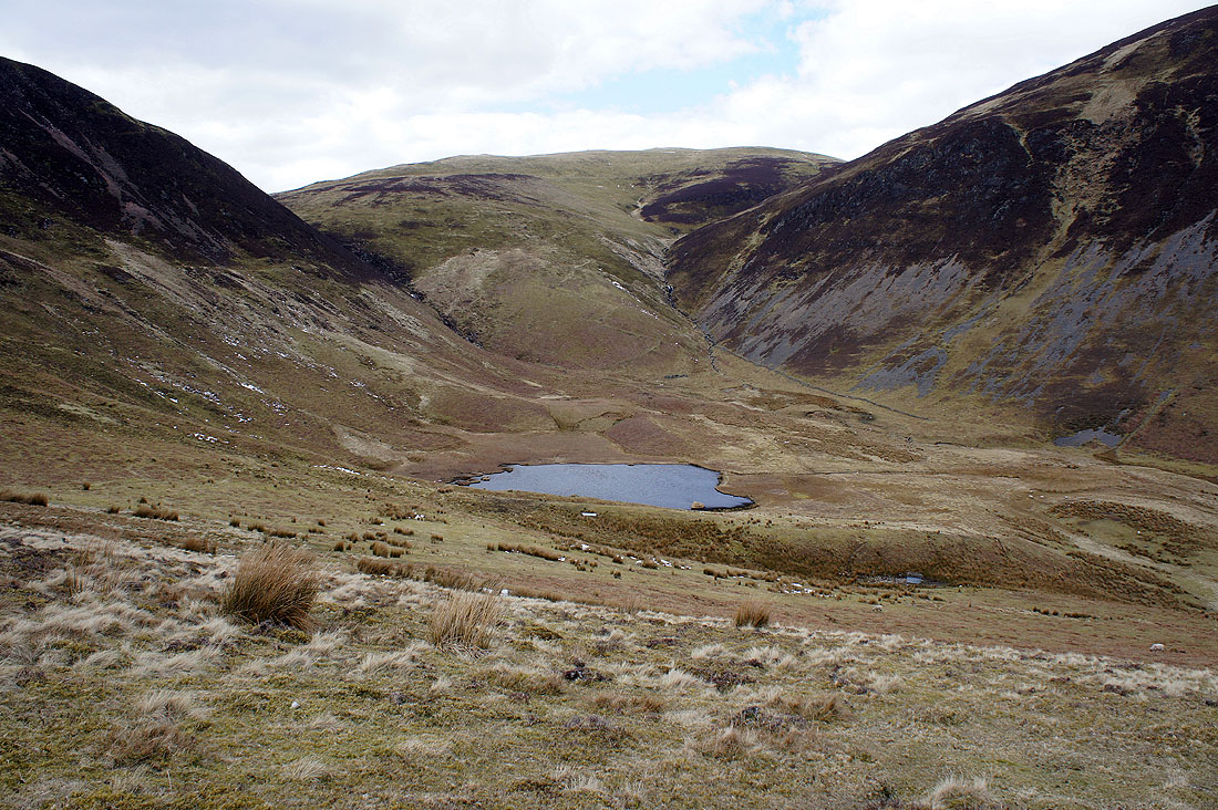
High Nook Tarn
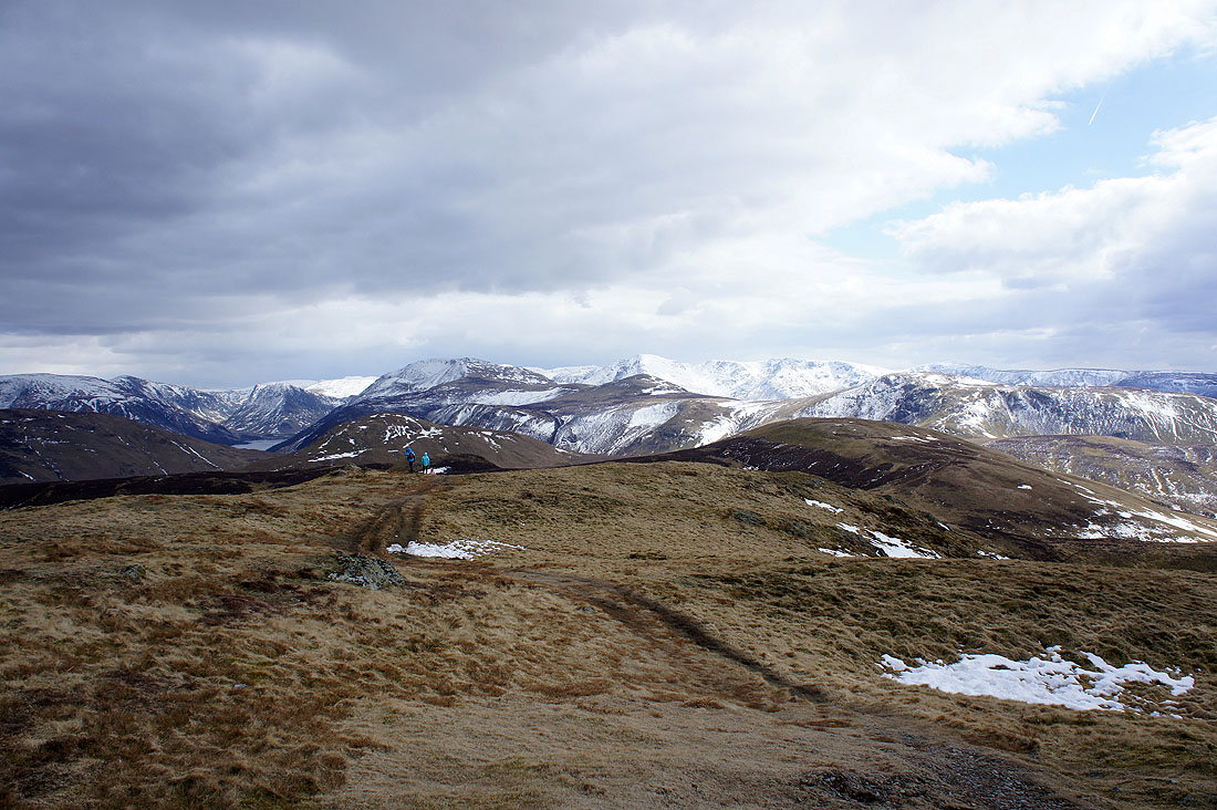
Darling Fell, Low Fell, Loweswater and the Vale of Lorton from Gavel Fell's northeast ridge
A glimpse of sunlit Fleetwith Pike taken during the climb up Gavel Fell
Whiteside, Hopegill Head, Grasmoor, Wandope and Mellbreak from Gavel Fell's subsiduary summit
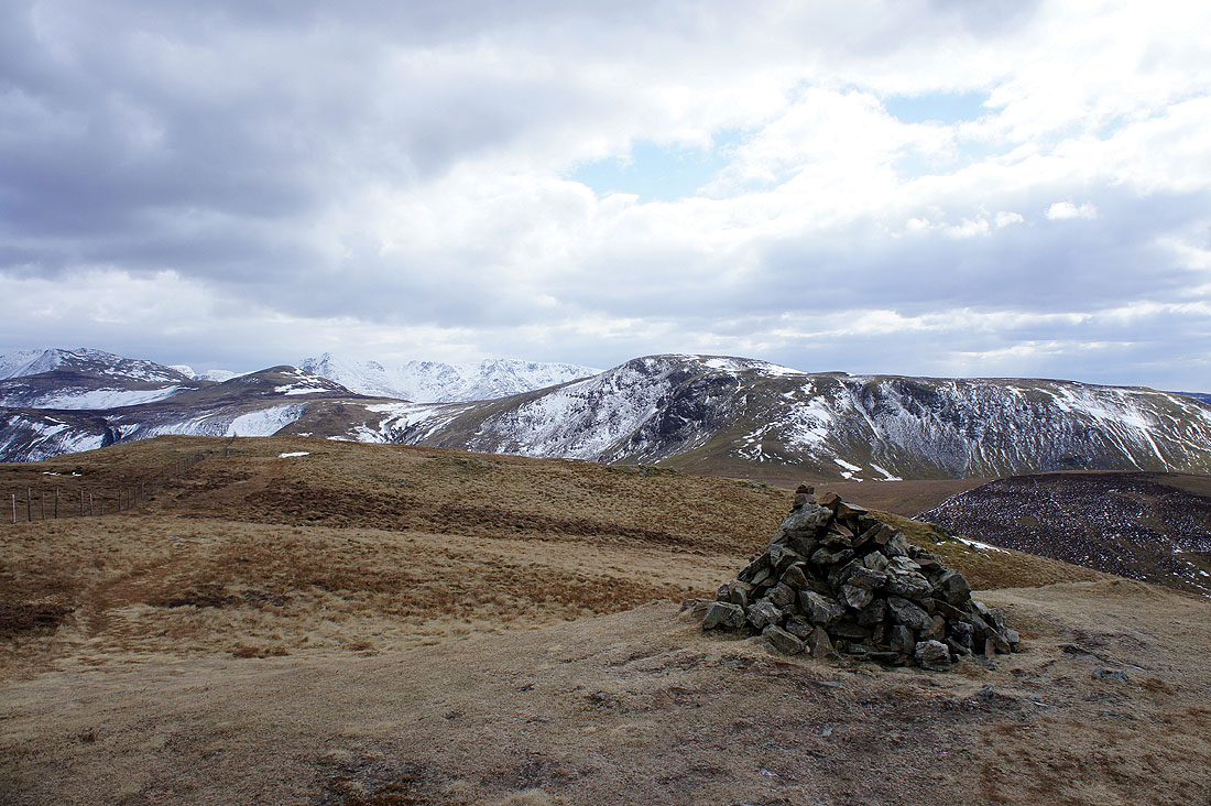
Gavel Fell's summit. Starling Dodd and Great Borne with Pillar, Black Crag and Scoat Fell in the gap between them.
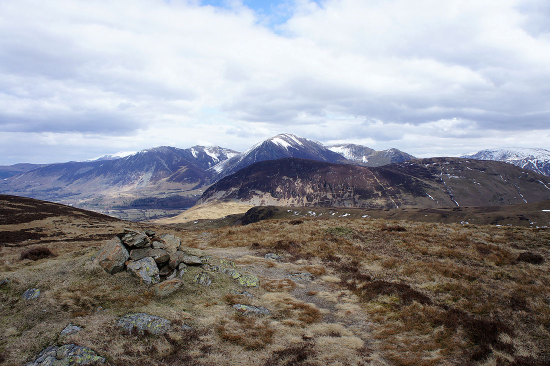
Whiteside, Hopegill Head, Grasmoor, Wandope and Mellbreak
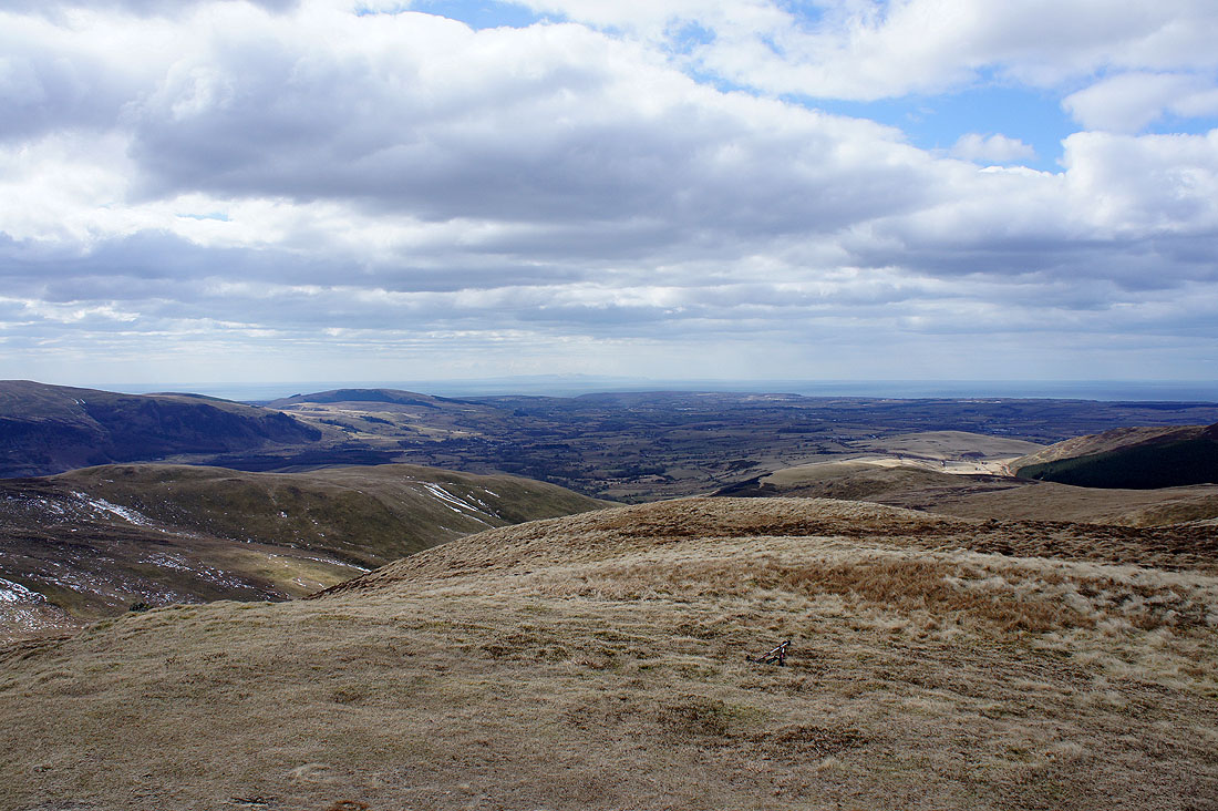
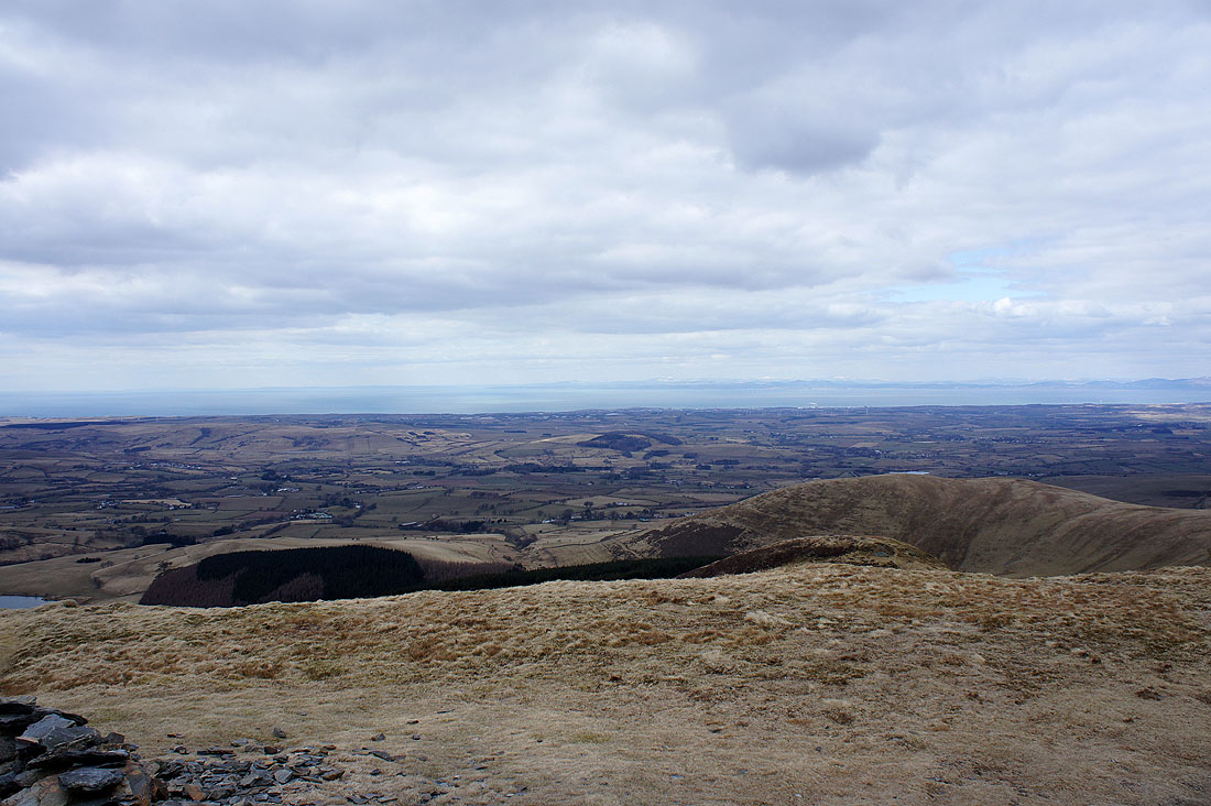
Looking out to the coast and the Irish Sea
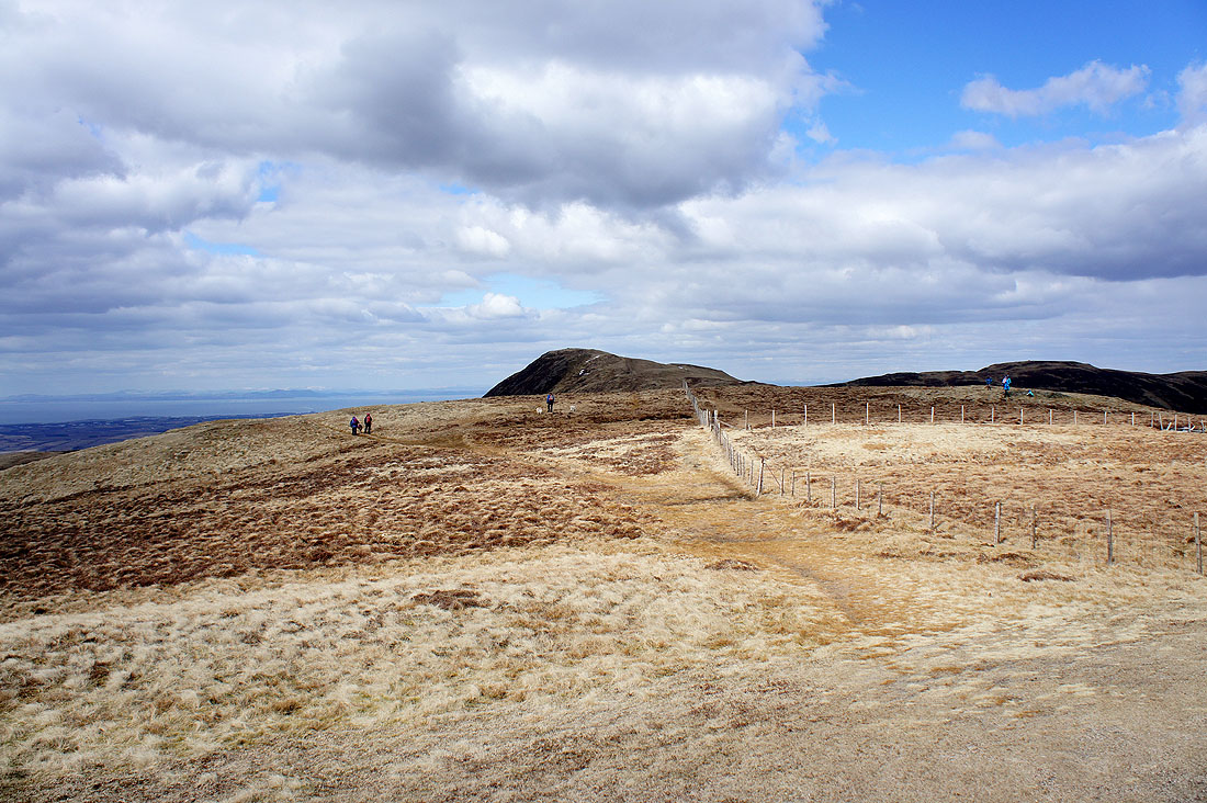
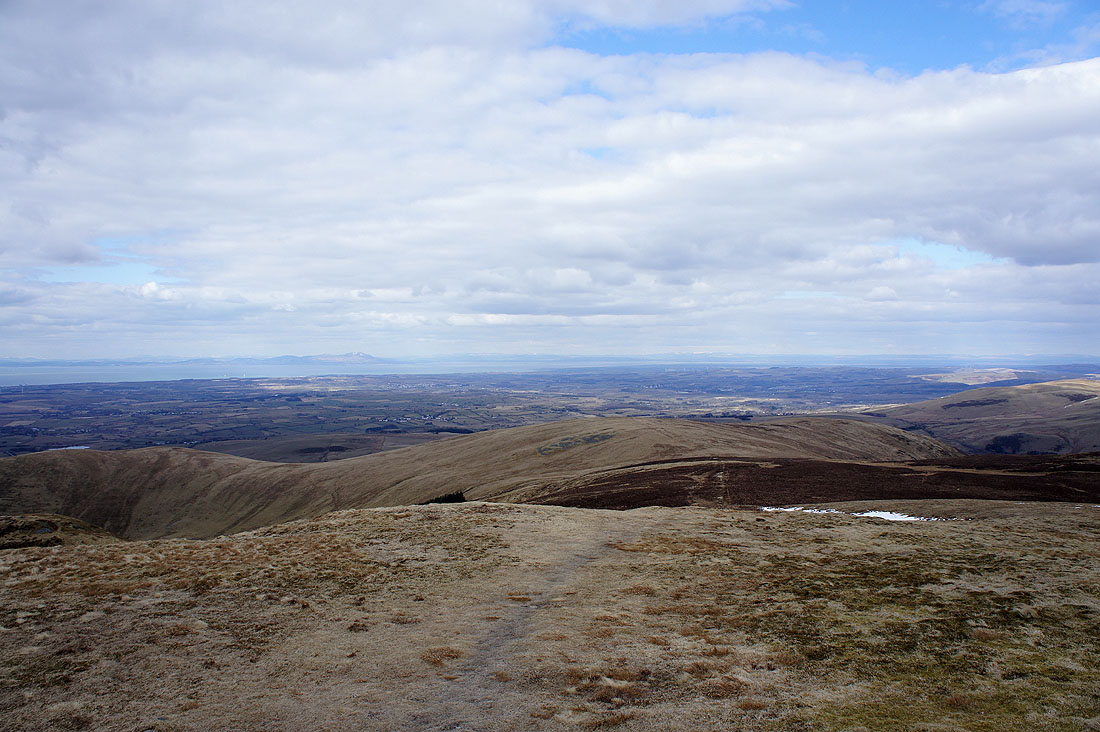
Heading for Blake Fell
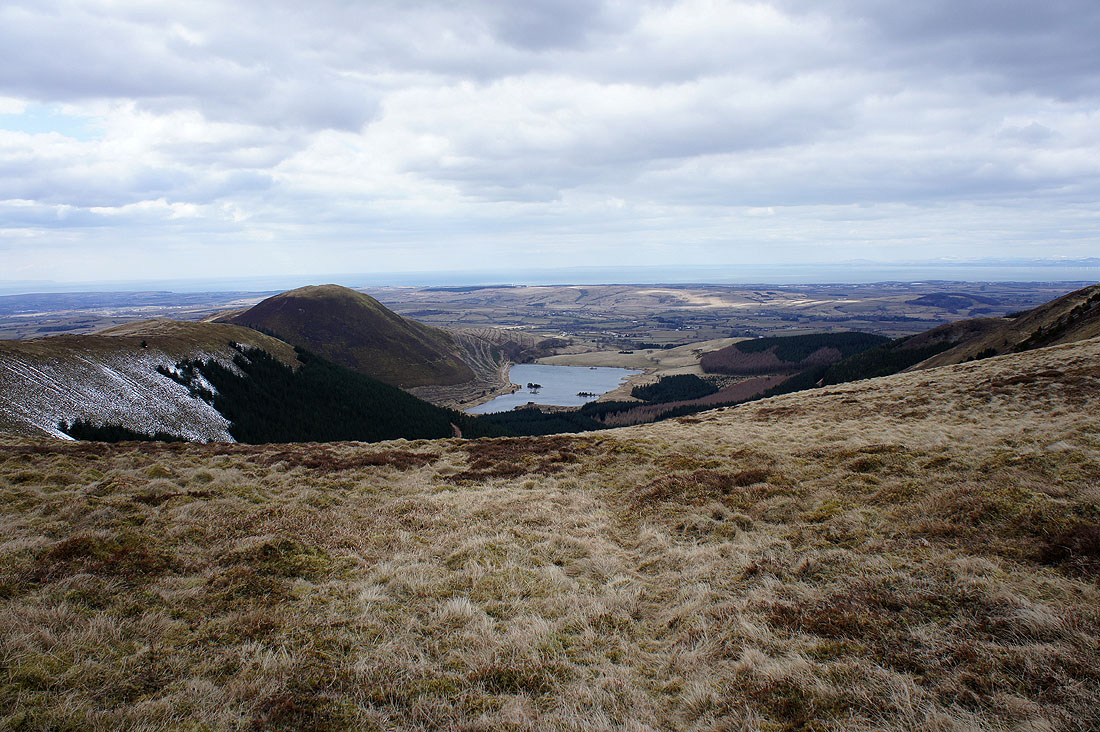
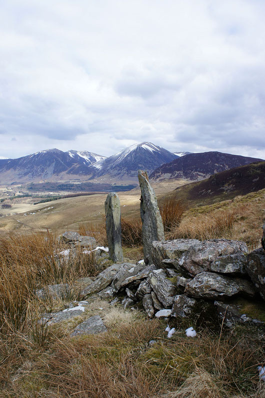
Knock Murton and Cogra Moss
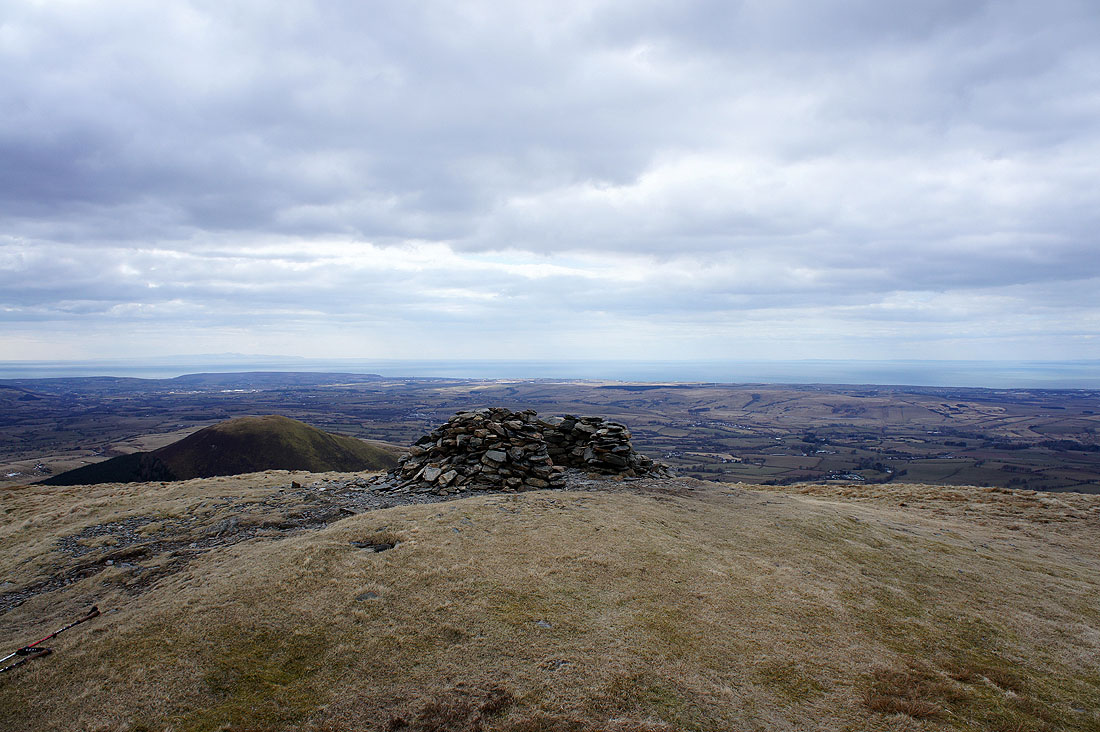
On the summit of Blake Fell. The wind shelter wasn't much use. It's facing the wrong way today.
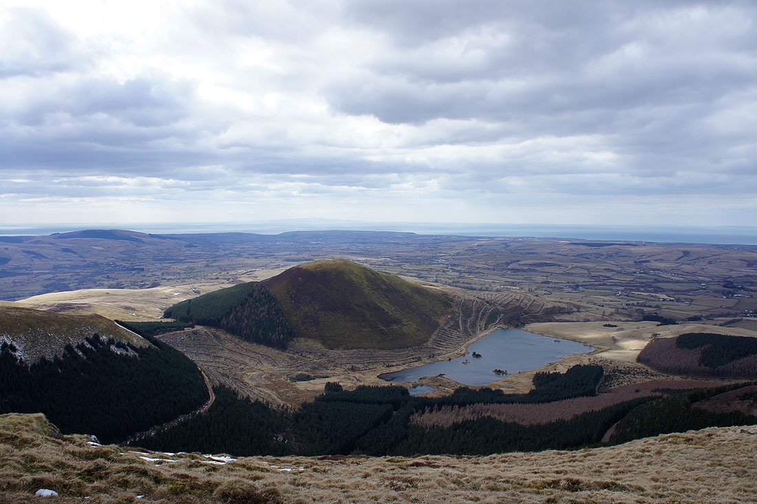
We found a relatively sheltered spot for lunch by walking a little way downhill west from the summit. I took this shot of Knock Murton and Cogra Moss from there.
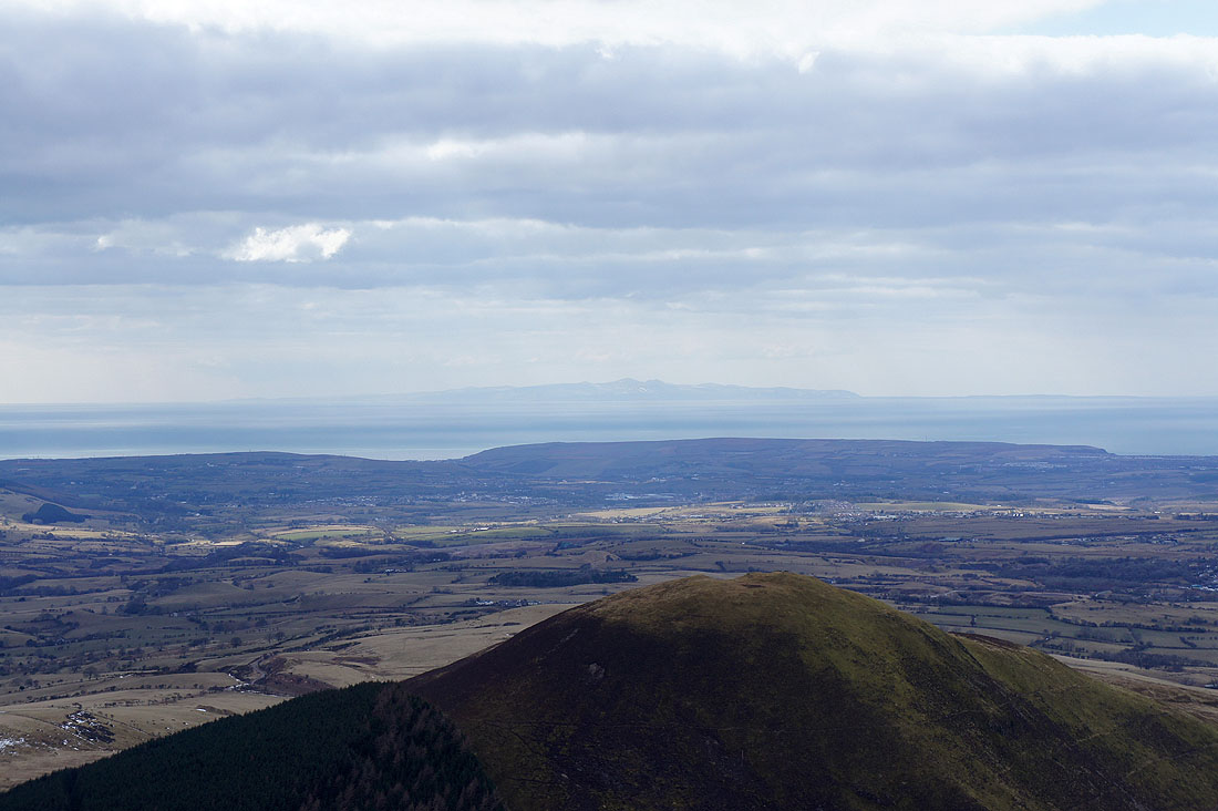
Zooming in across the top of Knock Murton to see the Isle of Man
Great views over the coastal plain and the Solway Firth to Dumfriesshire..
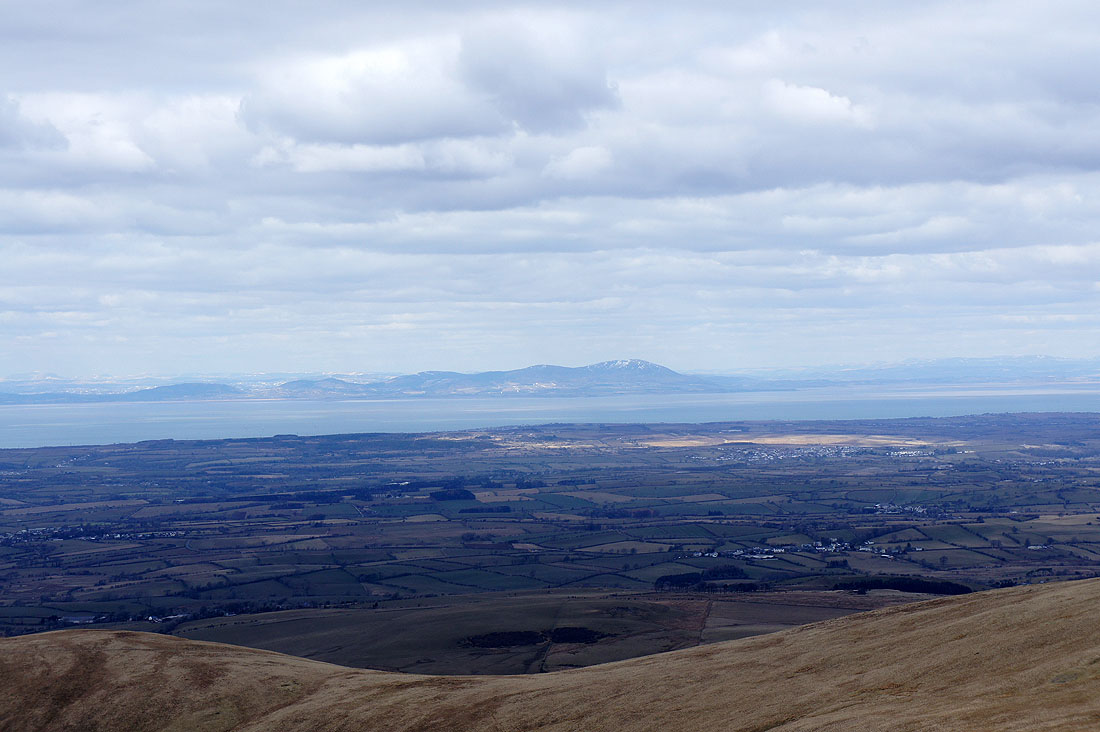
Criffel
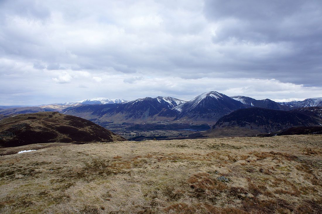
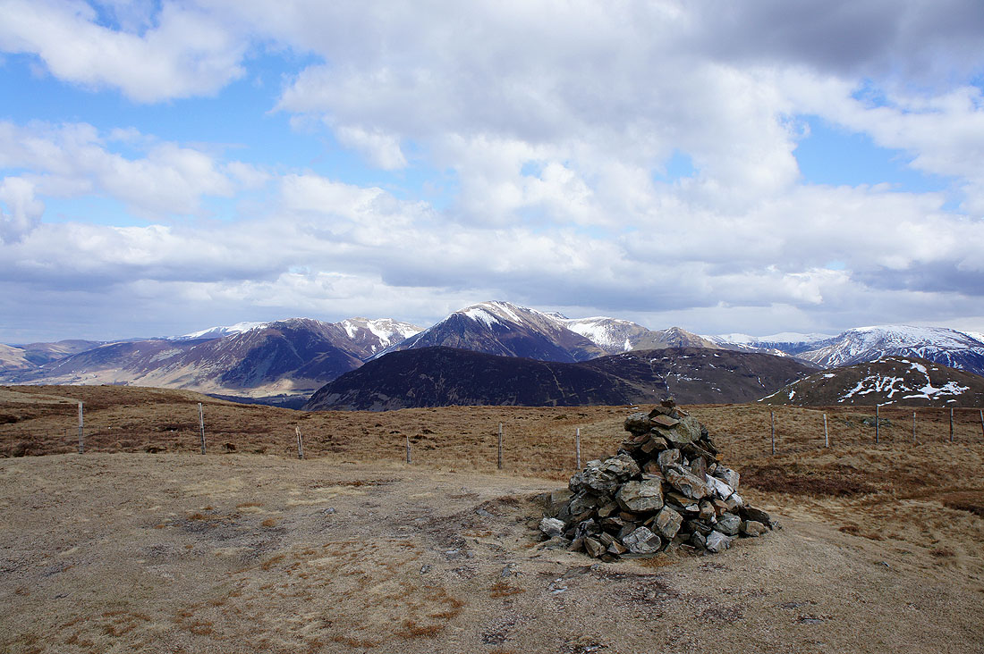
Skiddaw in the distance on the left then Whiteside, Hopegill Head, Grasmoor, Wandope, Whiteless Pike and the northern end of Mellbreak
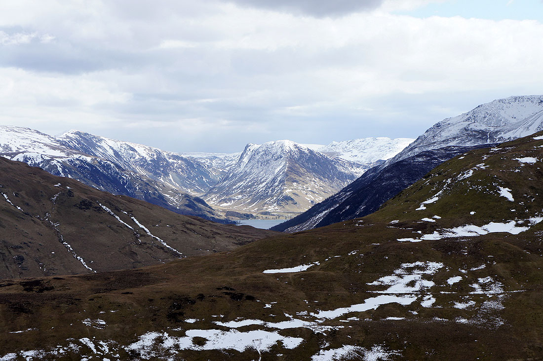
A tiny bit of Buttermere can be seen on the left with Fleetwith Pike above it. In the middle distance is the High Stile ridge with plenty of snow on Pillar and Scoat Fell behind.
|
|
The steep but quick way down to High Nook Tarn
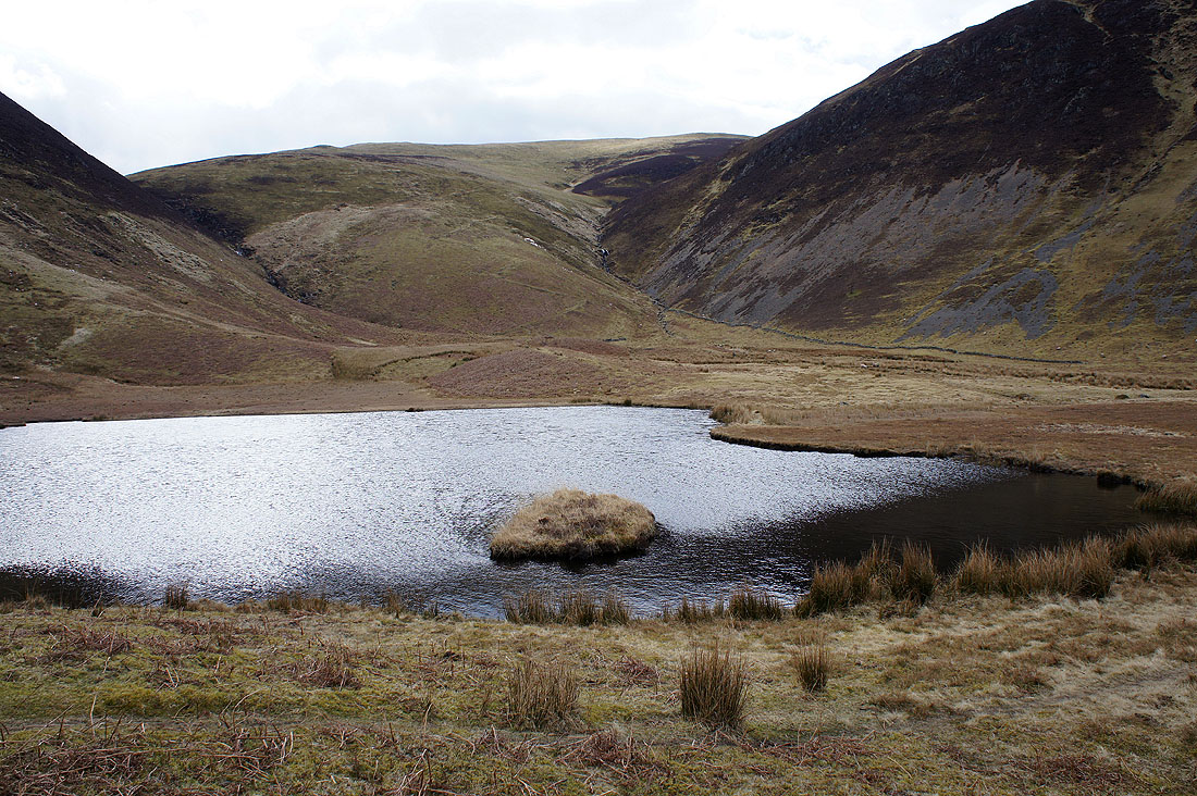
Back at High Nook Tarn
Heading for Maggie's Bridge
I was leaning over the wall by the lane back to the red phone box to take this shot of the Buttermere valley when the peace and quiet was broken. A little help from Photoshop will identify the culprit.
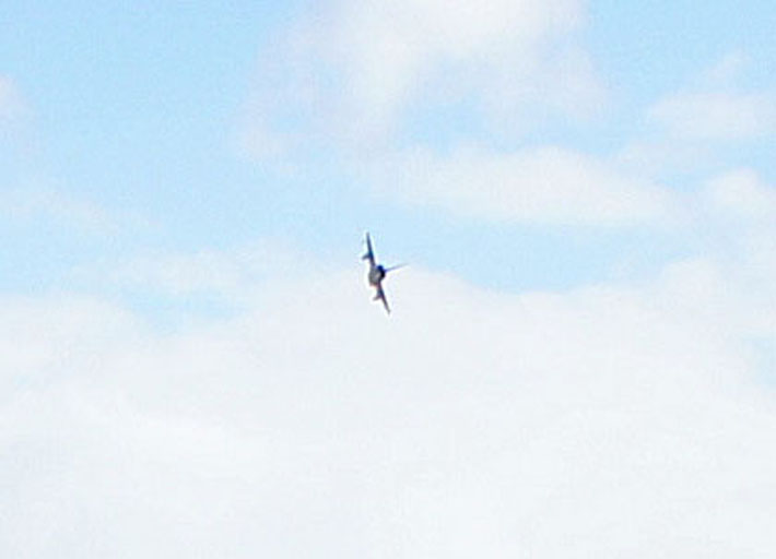
A Eurofighter typhoon
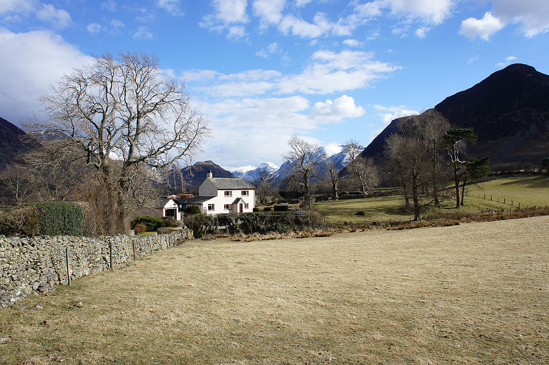
Normal service is resumed. A beautiful view to end the walk with.