4th February 2018 - A Fairfield Horseshoe
Walk Details
Distance walked: 10.4 miles
Total ascent: 3493 ft
OS map used: OL5 - The English Lakes, Northeastern area & OL7 - The English Lakes, Southeastern area
Time taken: 6.5 hrs
Route description: Ambleside-Rydal Park-Rydal-Nab Scar-Heron Pike-Erne Crag-Great Rigg-Fairfield-Hart Crag-Dove Crag-High Pike-Low Pike-Low Sweden Bridge-Nook Lane-Ambleside
Despite it being just four weeks since my last walk in the Lake District I couldn't resist heading back there again to enjoy another walk in sunshine and snow. I decided to do the Fairfield Horseshoe from Ambleside. It's a route that I've done many times and in conditions very similar to those that I experienced today, so I knew what I was letting myself in for. I went round clockwise to get the steepest climb up Nab Scar out of the way at the beginning and to leave myself with a gentle descent from Dove Crag. Once above the snow line I put on my spikes, though I could have managed without them as the snow was soft and powdery. The trickiest part of the day was in fact the descent from Low Pike. The snow there had turned soft and slushy in the afternoon sun, I nearly slipped and fell over a couple of times. Apart from some time spent in cloud on the summit of Fairfield there were sunny spells throughout the day with a strong northeasterly wind high up. It wasn't quite as cold as it was on Helvellyn in January though. Unfortunately none of the many Wainwrights visited today counted towards my second round. I'd already bagged them.
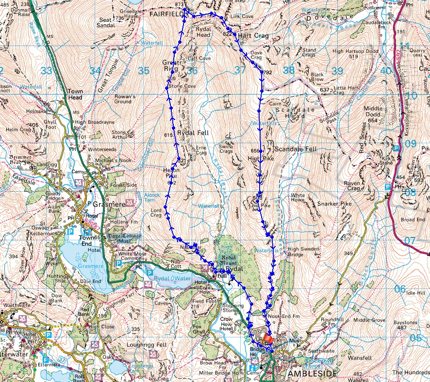
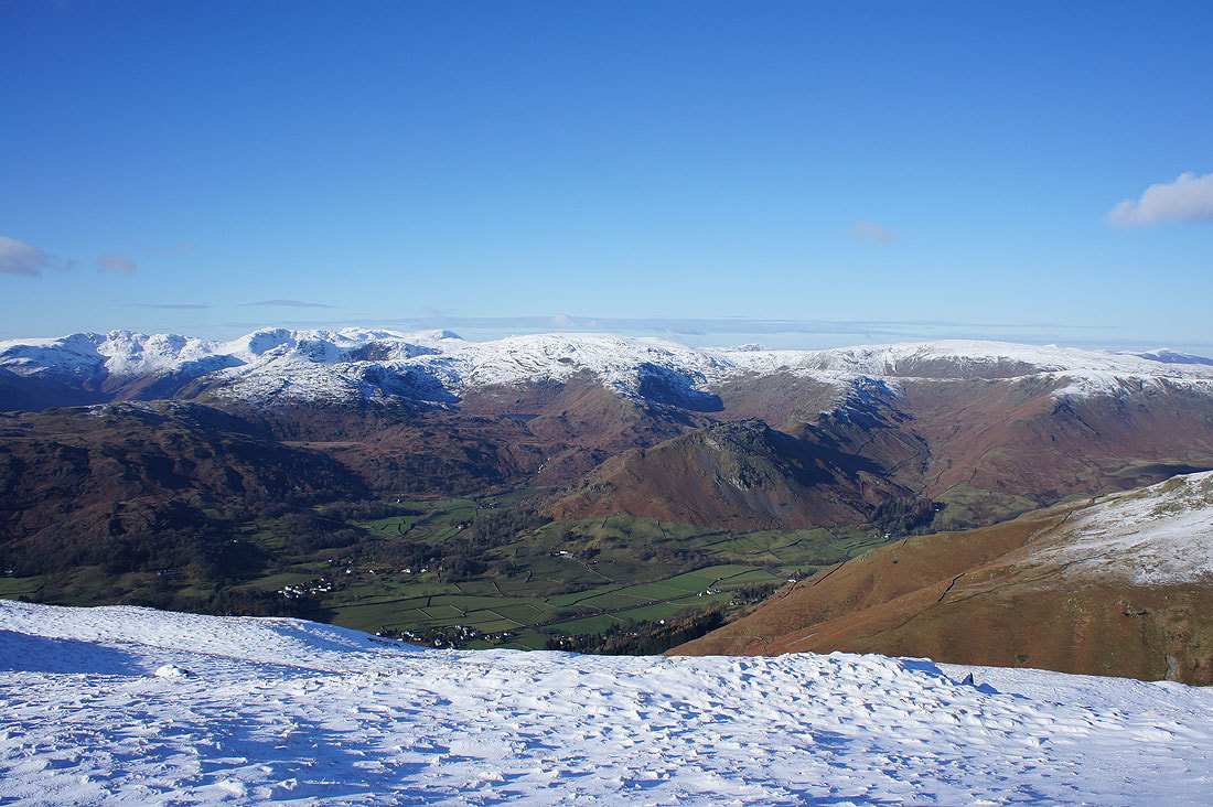
Starting from the main car park in Ambleside I walked west by the main road to Grasmere until I reached the footpath through Rydal Park to Rydal Hall. Once through the grounds of Rydal Hall I walked to the top of the lane and up the footpath to the top of Nab Scar. I then made my way up the western arm of the horseshoe, taking in Heron Pike, Erne Crag and Great Rigg to reach the summit of Fairfield. After taking a break for lunch here it was time to head down the eastern arm of the horseshoe, via Hart Crag, Dove Crag, High Pike and Low Pike to Low Sweden Bridge. I then walked down Nook Lane and back into Ambleside.
Total ascent: 3493 ft
OS map used: OL5 - The English Lakes, Northeastern area & OL7 - The English Lakes, Southeastern area
Time taken: 6.5 hrs
Route description: Ambleside-Rydal Park-Rydal-Nab Scar-Heron Pike-Erne Crag-Great Rigg-Fairfield-Hart Crag-Dove Crag-High Pike-Low Pike-Low Sweden Bridge-Nook Lane-Ambleside
Despite it being just four weeks since my last walk in the Lake District I couldn't resist heading back there again to enjoy another walk in sunshine and snow. I decided to do the Fairfield Horseshoe from Ambleside. It's a route that I've done many times and in conditions very similar to those that I experienced today, so I knew what I was letting myself in for. I went round clockwise to get the steepest climb up Nab Scar out of the way at the beginning and to leave myself with a gentle descent from Dove Crag. Once above the snow line I put on my spikes, though I could have managed without them as the snow was soft and powdery. The trickiest part of the day was in fact the descent from Low Pike. The snow there had turned soft and slushy in the afternoon sun, I nearly slipped and fell over a couple of times. Apart from some time spent in cloud on the summit of Fairfield there were sunny spells throughout the day with a strong northeasterly wind high up. It wasn't quite as cold as it was on Helvellyn in January though. Unfortunately none of the many Wainwrights visited today counted towards my second round. I'd already bagged them.
Starting from the main car park in Ambleside I walked west by the main road to Grasmere until I reached the footpath through Rydal Park to Rydal Hall. Once through the grounds of Rydal Hall I walked to the top of the lane and up the footpath to the top of Nab Scar. I then made my way up the western arm of the horseshoe, taking in Heron Pike, Erne Crag and Great Rigg to reach the summit of Fairfield. After taking a break for lunch here it was time to head down the eastern arm of the horseshoe, via Hart Crag, Dove Crag, High Pike and Low Pike to Low Sweden Bridge. I then walked down Nook Lane and back into Ambleside.
Route map
© Crown copyright. All rights reserved. License number PU 100034184.
On my way through Rydal Park. The first half of my walk is in front of me. Nab Scar, Heron Pike, Erne Crag and Great Rigg.
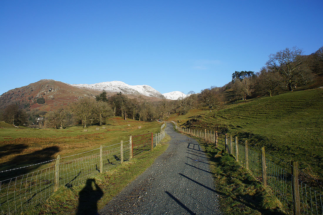
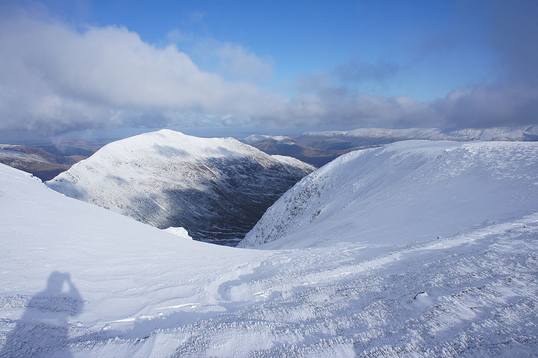
Hart Crag and a bit of cloud on Dove Crag as I make it to the top of Nab Scar
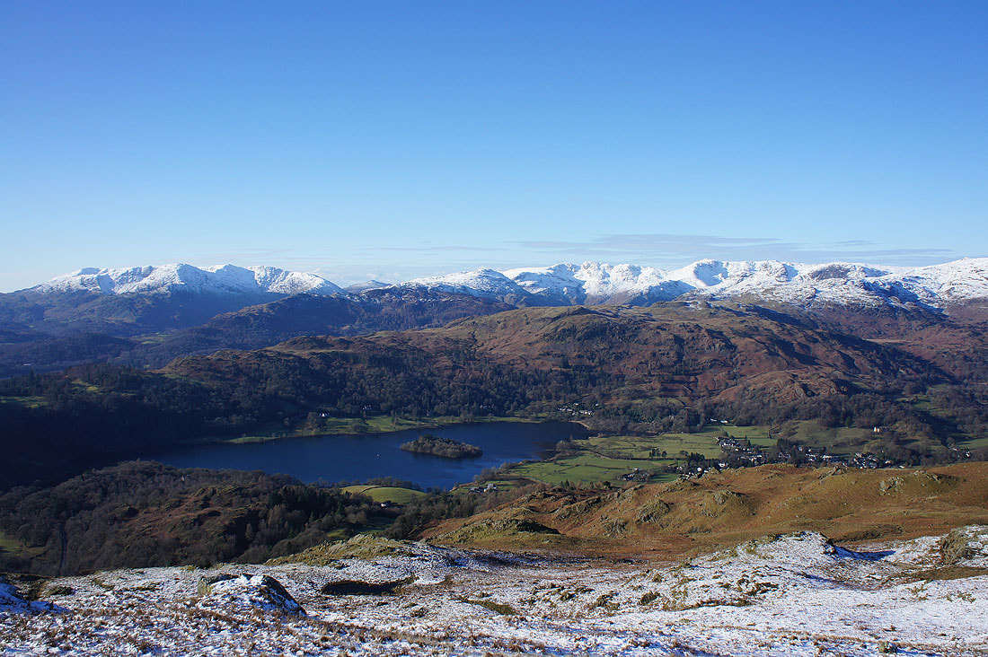
The Coniston fells, Crinkle Crags and Bowfell with Grasmere below
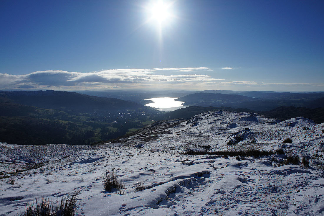
Looking back to Ambleside and Windermere as I head north along the ridge to Heron Pike
Crinkle Crags, Bowfell, Scafell Pike, Great End and High Raise
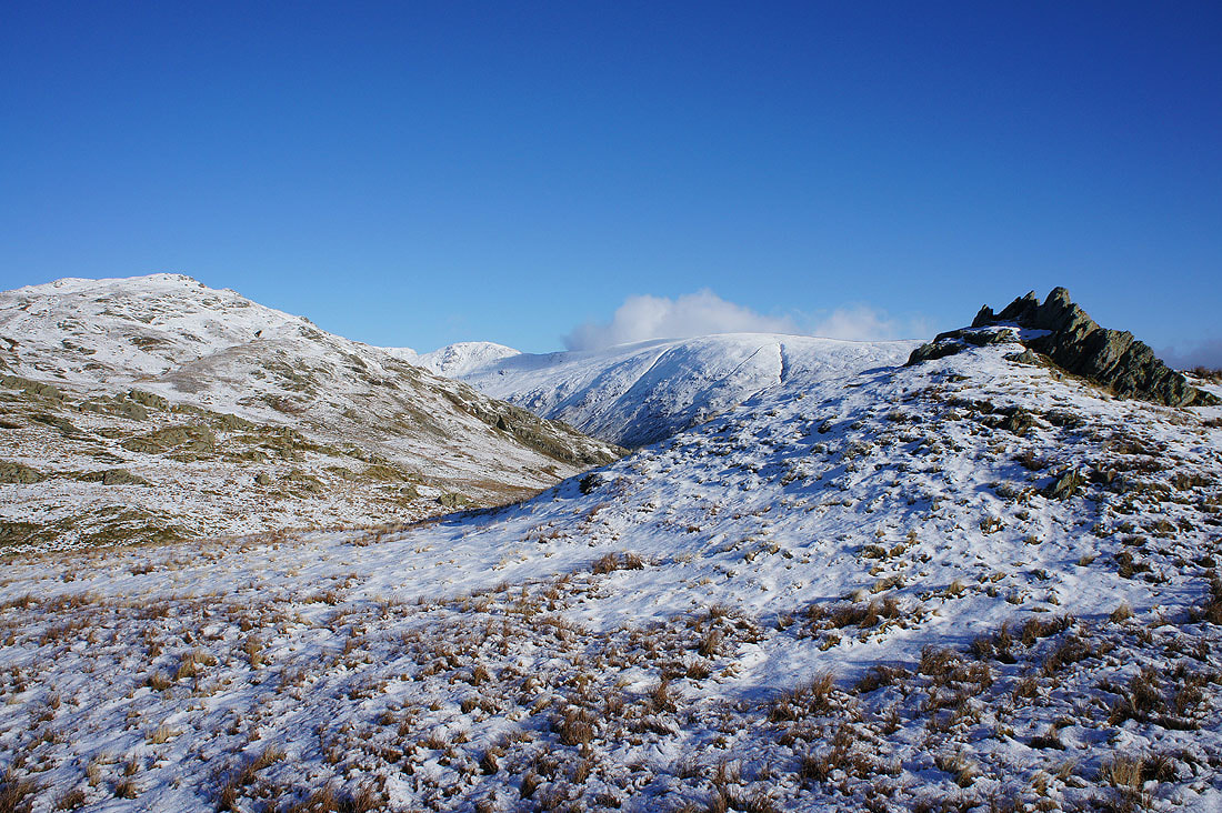
Looking across to High Pike and Red Screes. More cloud seems to be coming in on the northeasterly wind.
The Vale of Grasmere below with the ridges of Blea Rigg and Helm Crag to Calf Crag running up to High Raise and Ullscarf
On Heron Pike and heading for Erne Crag. Fairfield and Hart Crag at the head of the horseshoe are now in sight.
Looking back to Heron Pike from Erne Crag
The Coniston fells, Crinkle Crags, Bowfell, Scafell Pike and Great End
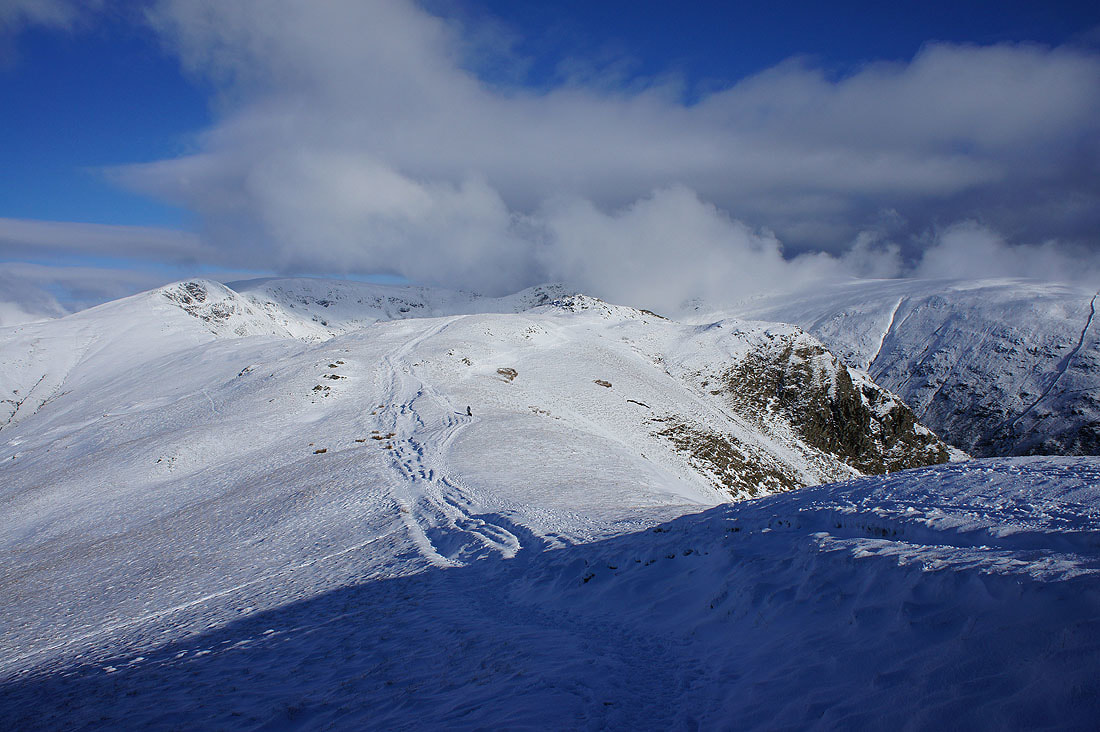
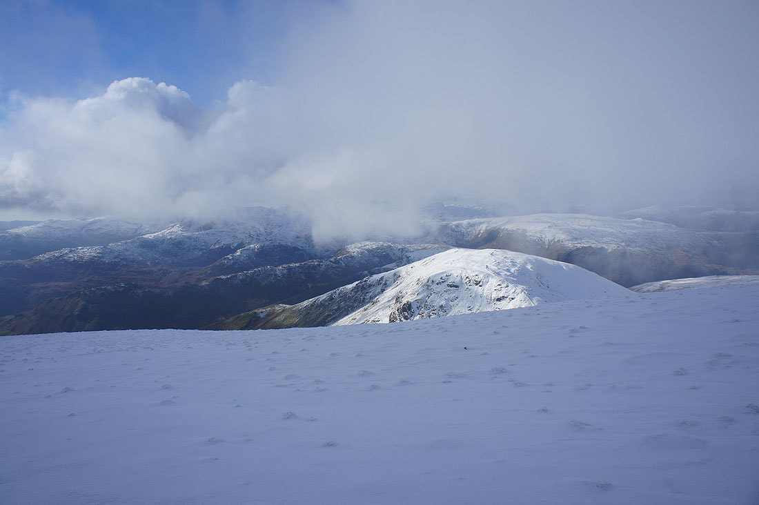
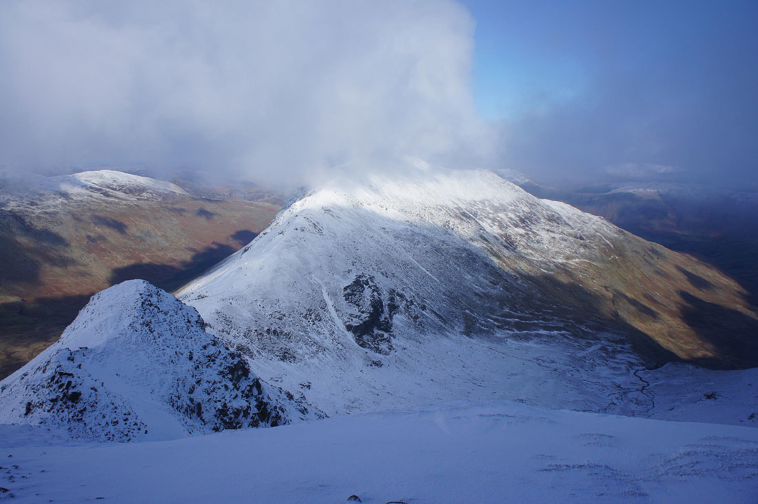
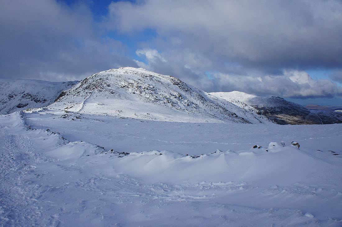
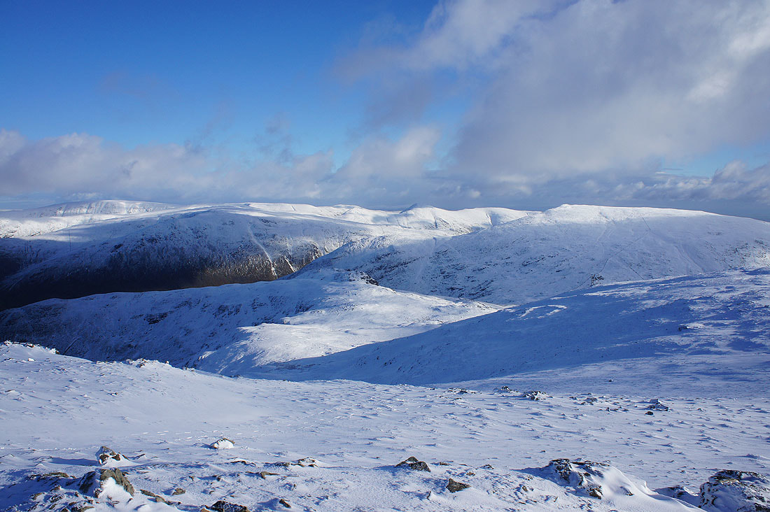
Great Rigg, Fairfield, Hart Crag and Dove Crag. The cloud certainly adds some drama, although I wouldn't mind if it was off the tops of the fells.
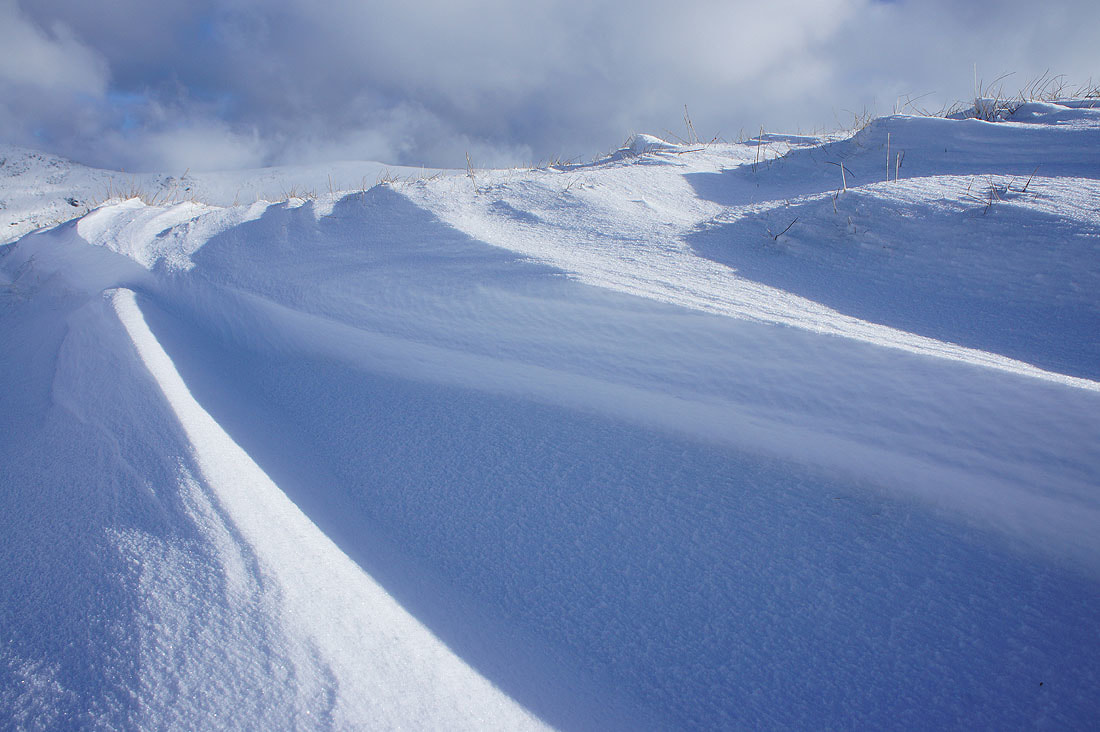
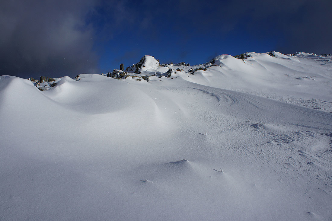
I love the way the wind sculpts the snow
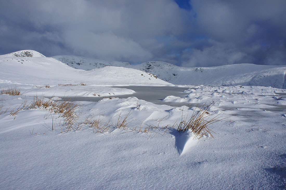
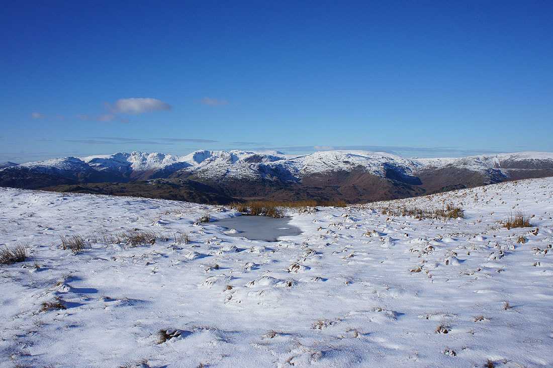
A frozen pool provides a foreground
Heading for Great Rigg
Looking west to Crinkle Crags, Bowfell, Scafell Pike, High Raise and Ullscarf. The ridge up to Great Rigg from Stone Arthur is below.
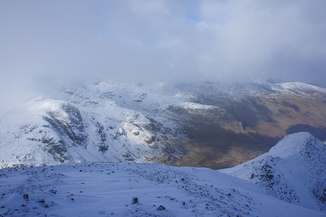
Dark clouds over Dove Crag
Looking back along the ridge to Heron Pike as I reach the point where the path up from Stone Arthur meets mine
The Vale of Grasmere and Helm Crag below with the Coniston fells, Crinkle Crags, Bowfell and Scafell Pike in the distance
I'm now high enough to see Great Gable, Pillar, High Stile and the northwestern fells
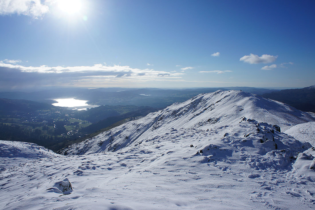
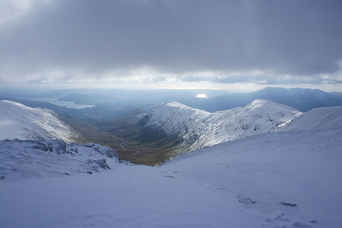
Rydal, Ambleside and Windermere from Great Rigg
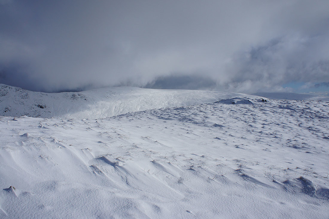
The climb up onto Fairfield to come and it looks like I'll be heading up into the cloud
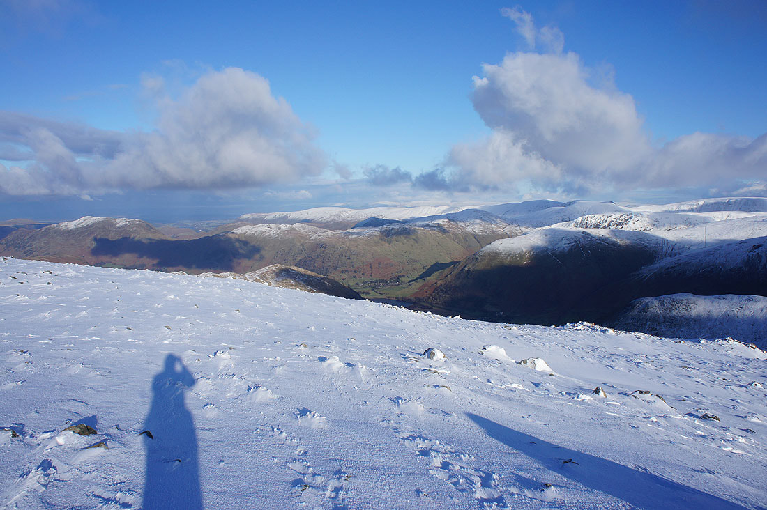
Looking down Rydal to Windermere with Great Rigg on the right
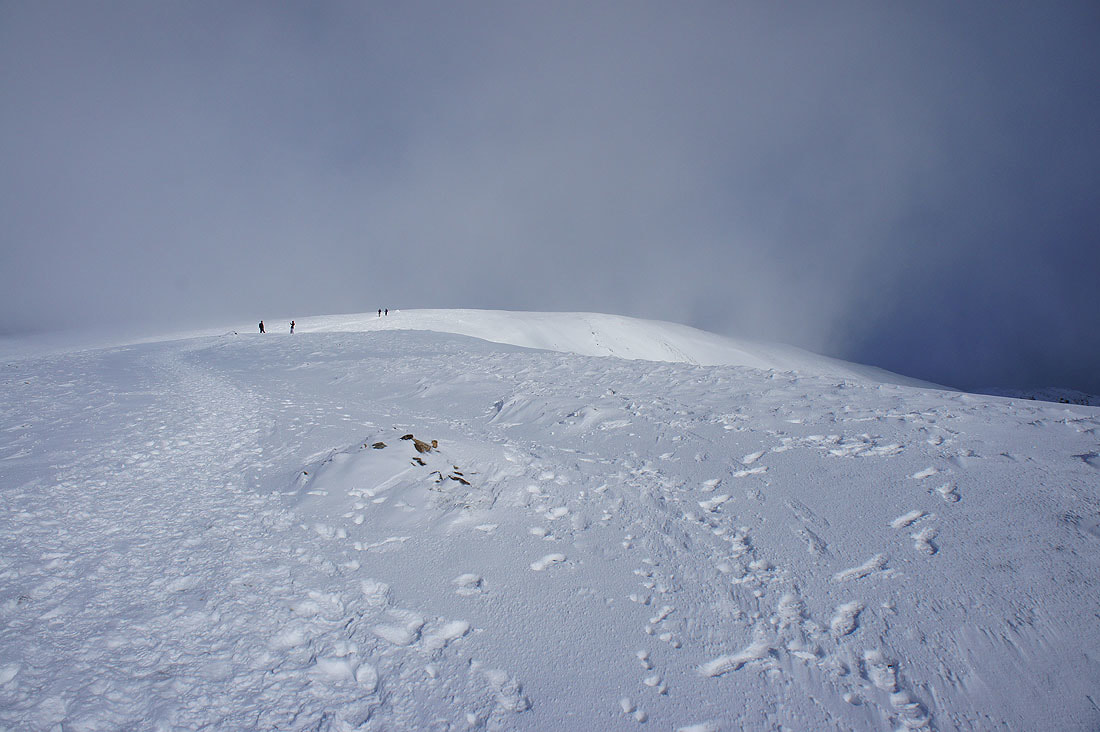
Up into the cloud on Fairfield
Just in case I don't a view from the summit, sunshine on Seat Sandal below
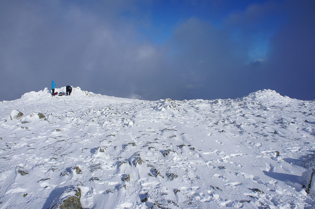
Twenty minutes later while I was sat having my lunch in one of the summit shelters and the sun breaks through the clouds
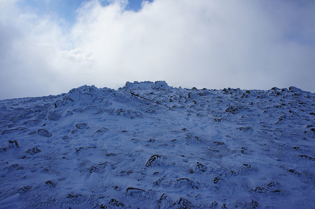
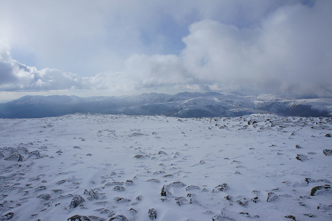
It looks very cold up here
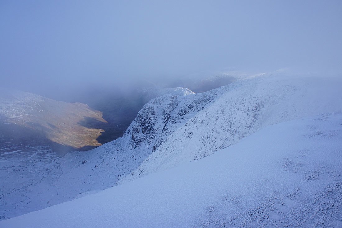
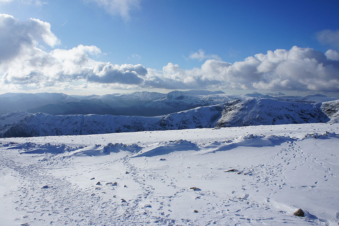
I've made my way to the northern end of the summit plateau to get a few photos of the view before I resume my walk. The clouds part every so often to give glimpses of what can be seen. The icy crags of Greenhow End above Deepdale.
Cofa Pike and St. Sunday Crag
A hidden Helvellyn range
Glimpses of the far eastern fells
Just a few minutes later and the clouds lift to give a more extensive view of them
As well as letting me see the Coniston fells, Crinkle Crags and Bowfell to the west
St. Sunday Crag
and Cofa Pike and St. Sunday Crag as I pass the top of Cawk Cove
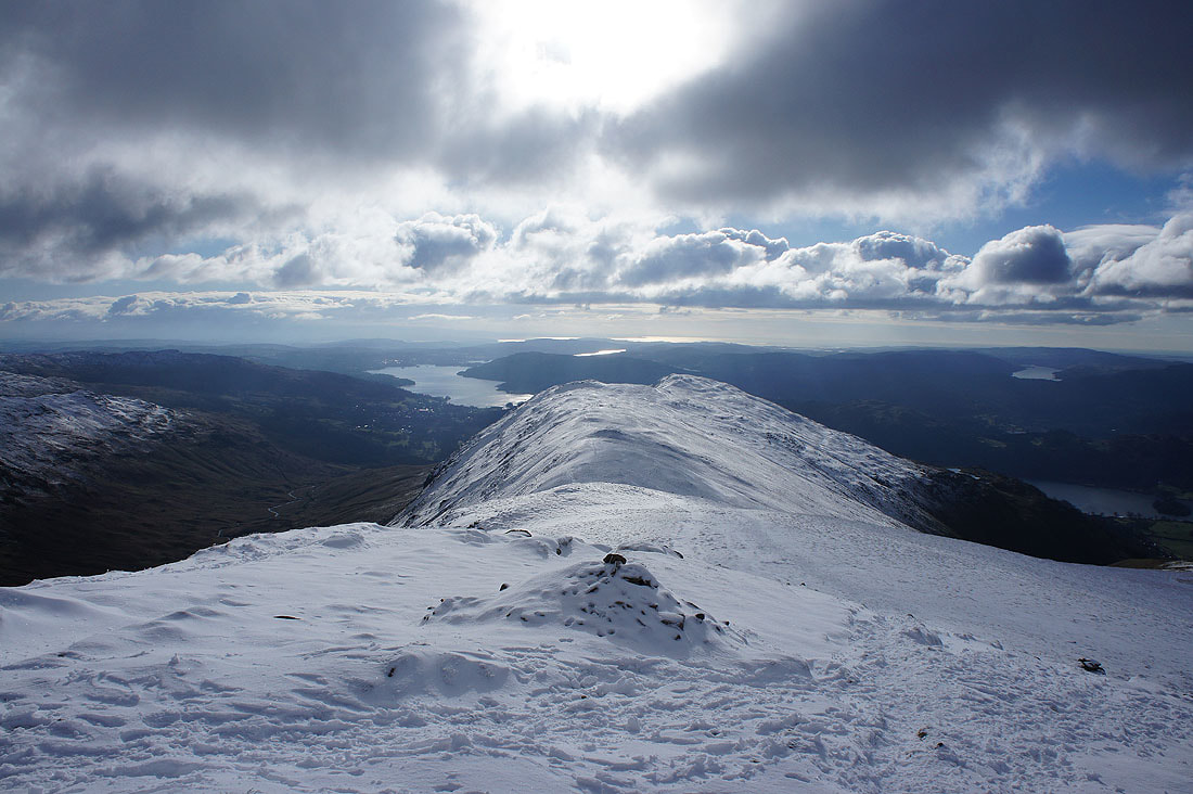
Heading for Hart Crag
Windermere, Rydal, the Heron Pike to Great Rigg ridge and Coniston Water
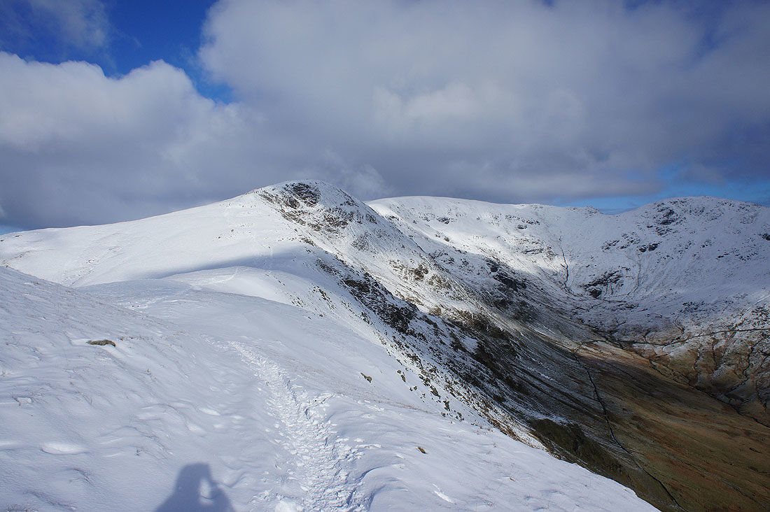
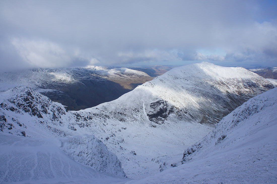
Looking back to Fairfield as I reach Hart Crag
St. Sunday Crag
The Heron Pike to Great Rigg ridge on the other side of Rydal
The Coniston fells, Crinkle Crags and Bowfell beyond Great Rigg
High Raise, High Street, Caudale Moor and other far eastern fells
Caudale Moor, the Ill Bell ridge and Red Screes
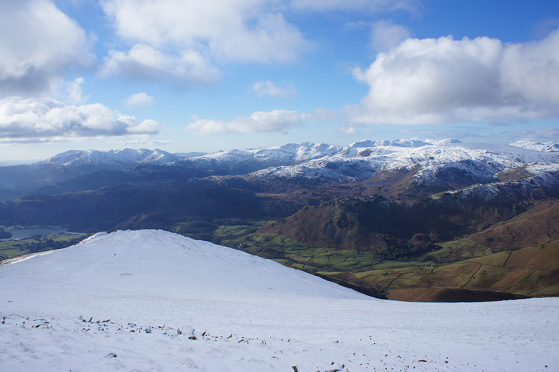
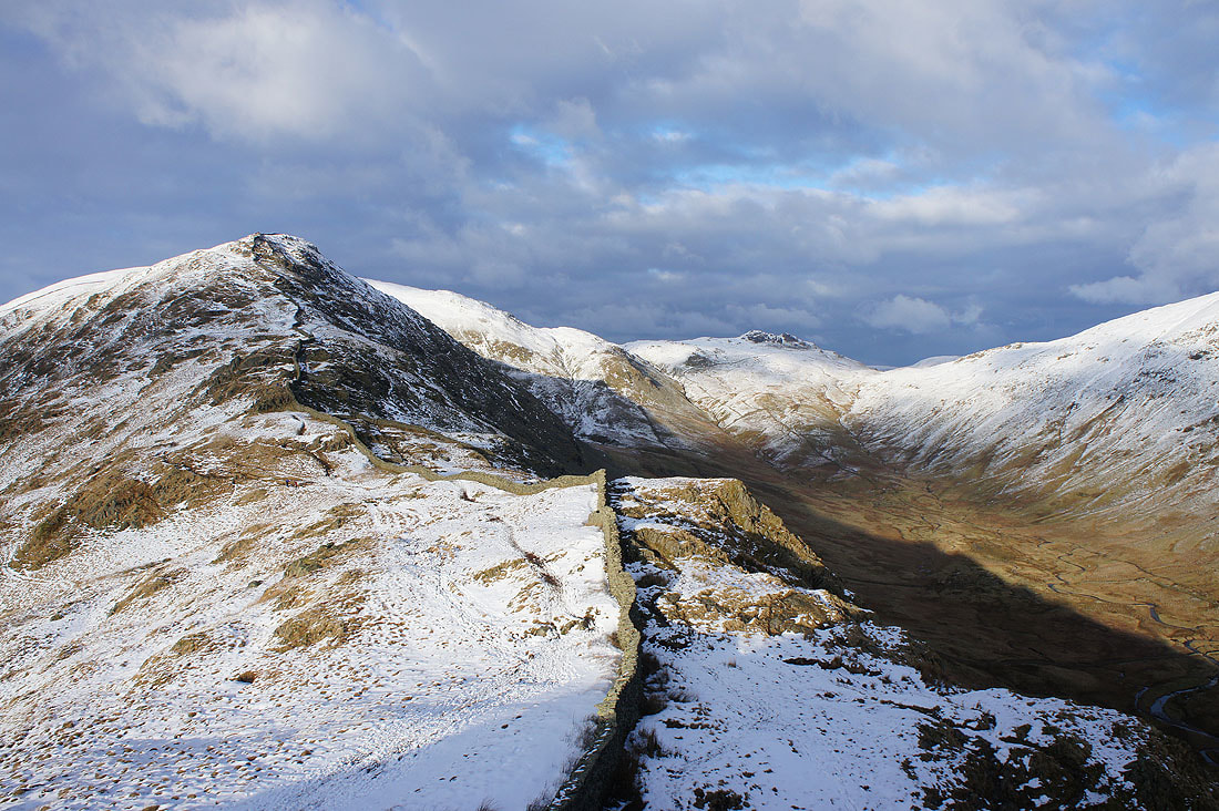
Heading for Dove Crag
and looking back to Hart Crag
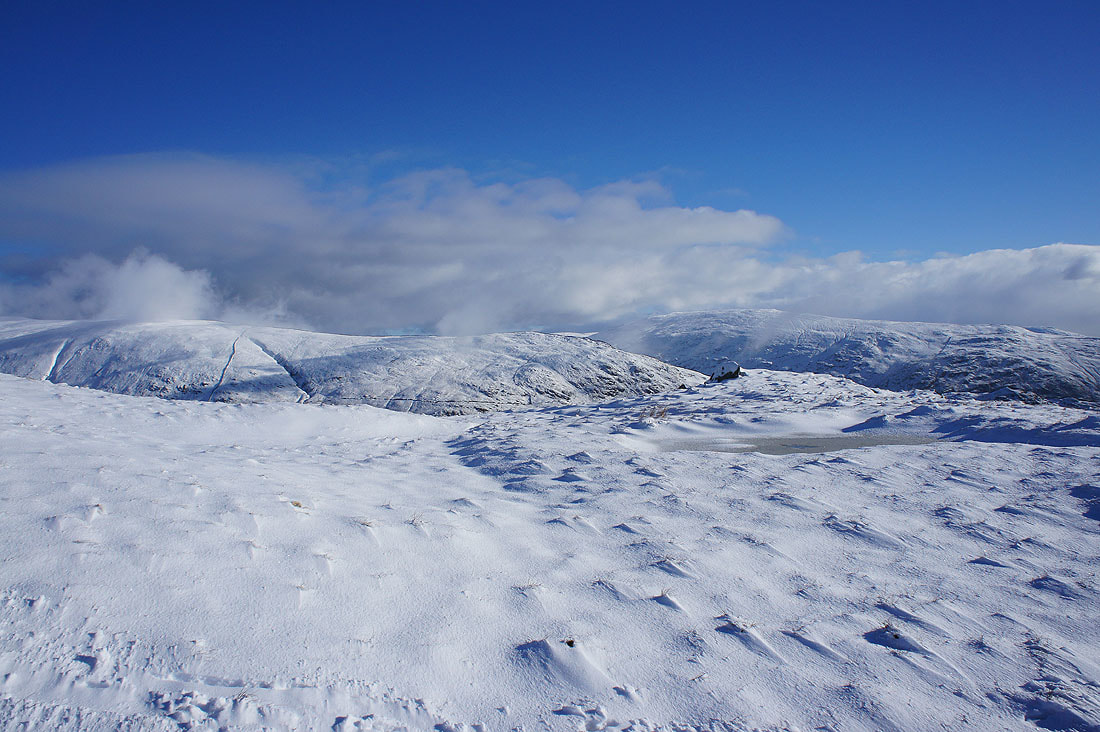
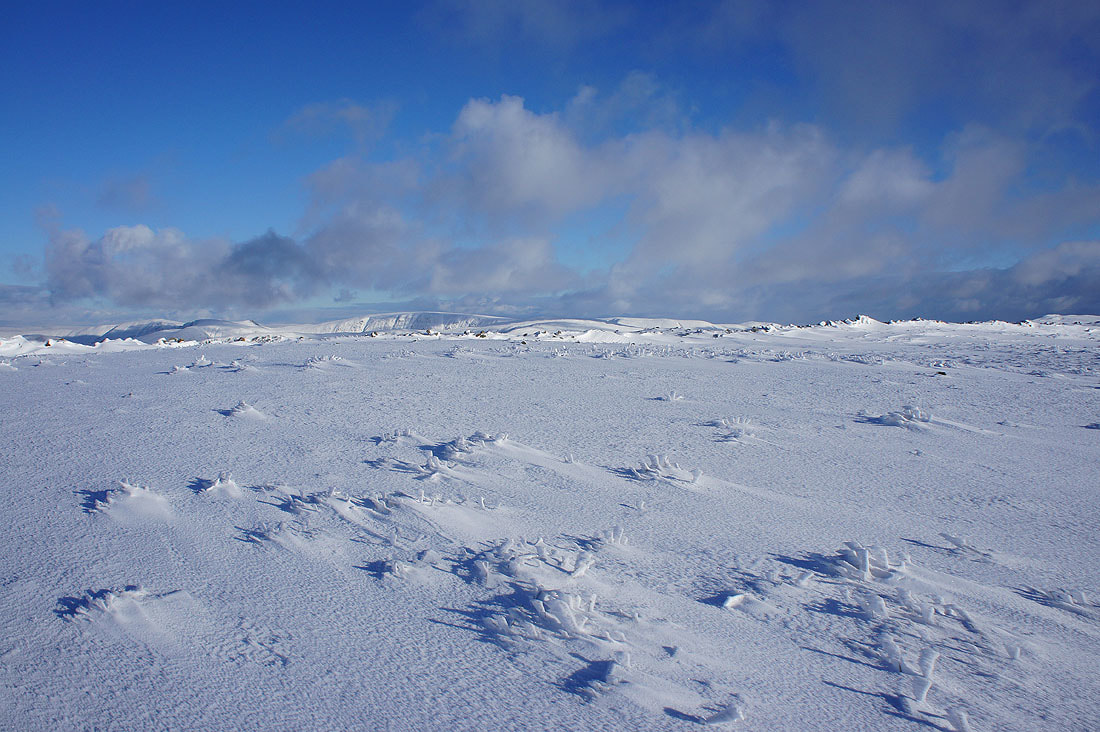
Great looking snowdrifts
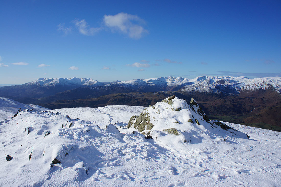
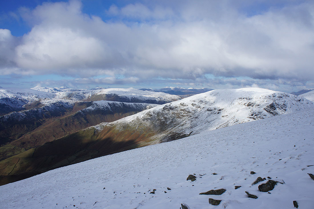
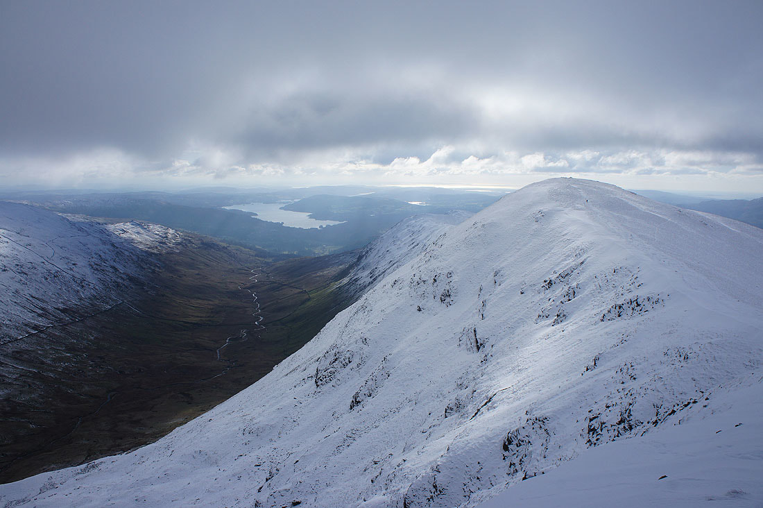
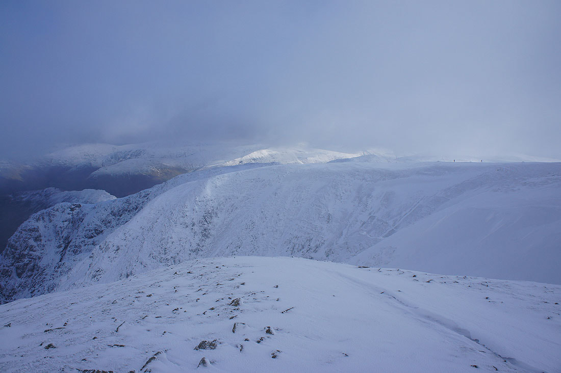
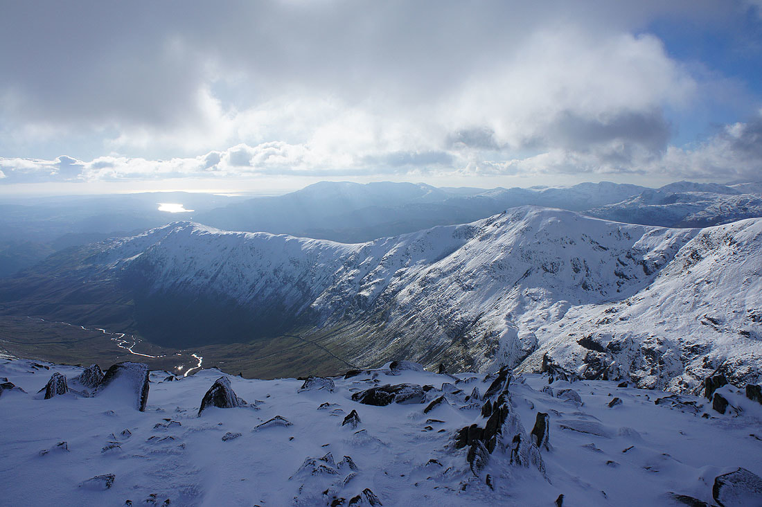
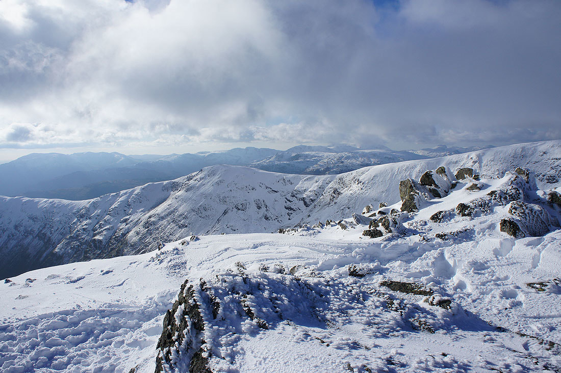
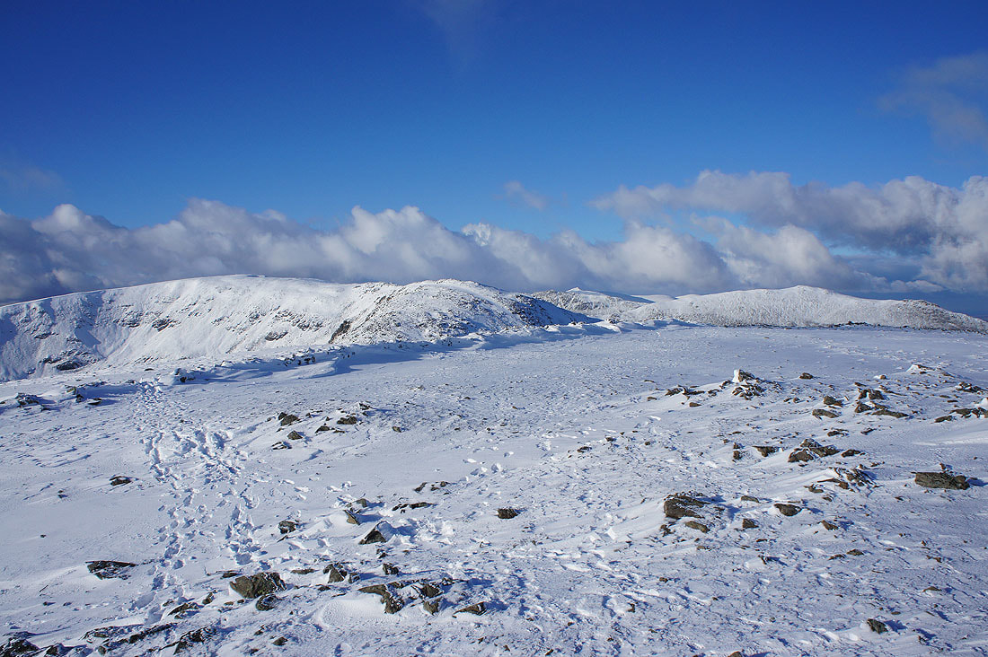
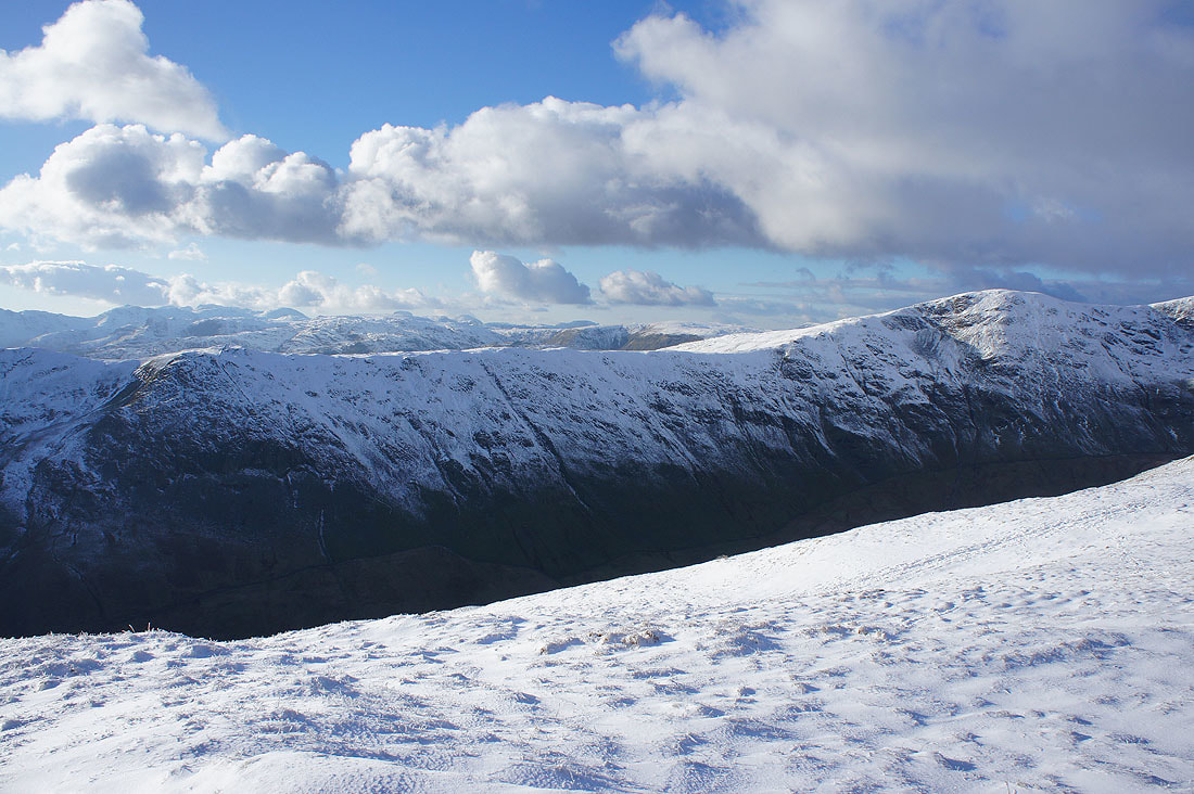
On Dove Crag. The Coniston fells, Crinkle Crags, Bowfell, Scafell Pike, Great End, Great Gable and Pillar in the distance.
Fairfield, Hart Crag and St. Sunday Crag
High Street, Caudale Moor, Thornthwaite Crag, Ill Bell and Red Screes
Place Fell and the other fells around Patterdale
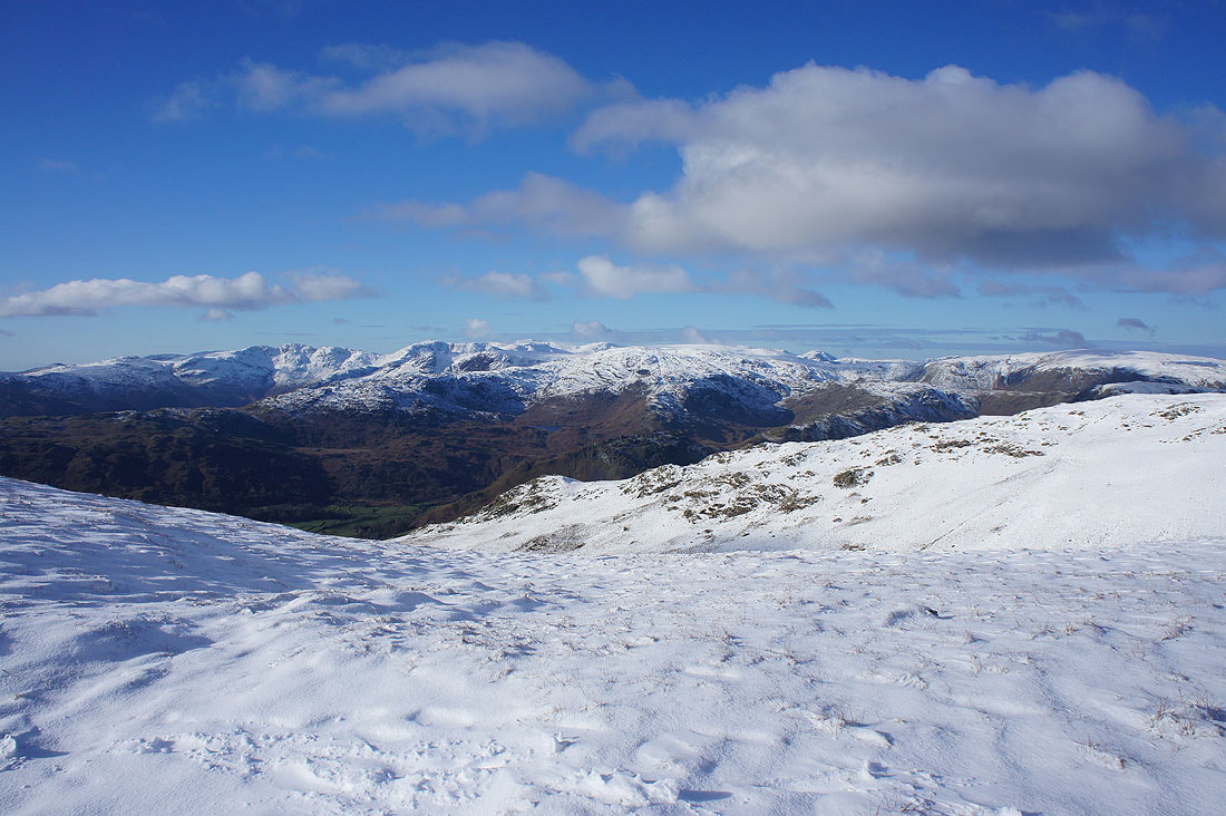
Windermere and Coniston Water to the south
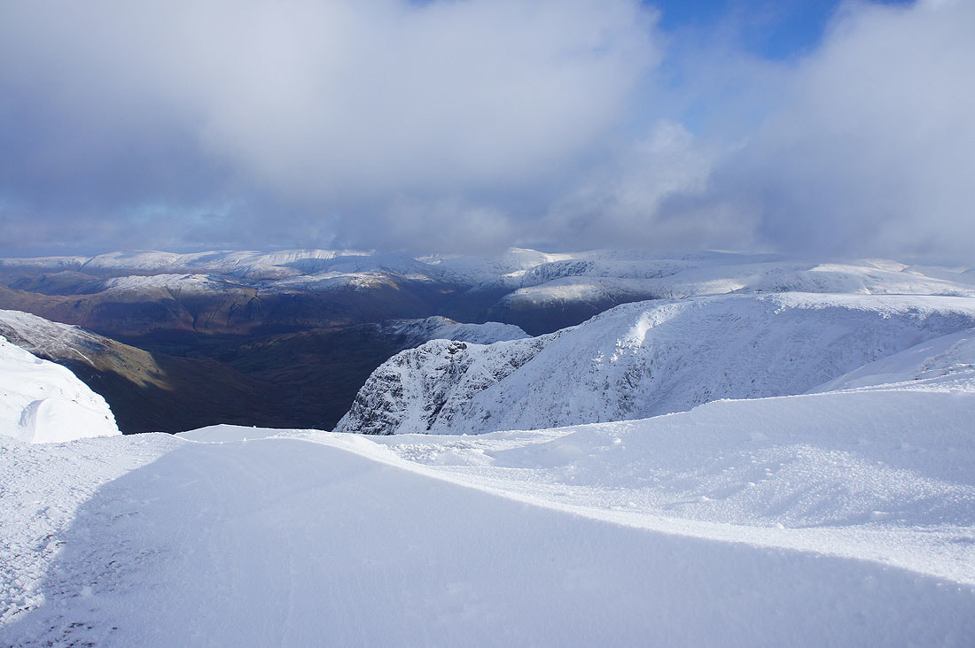
I knelt down to take this photo looking across deeply drifted snow to High Street
Great looking sky as I look back to Dove Crag
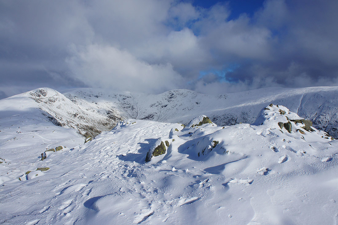
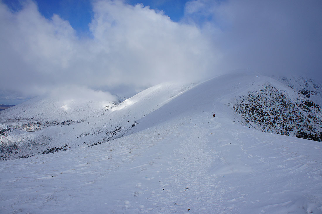
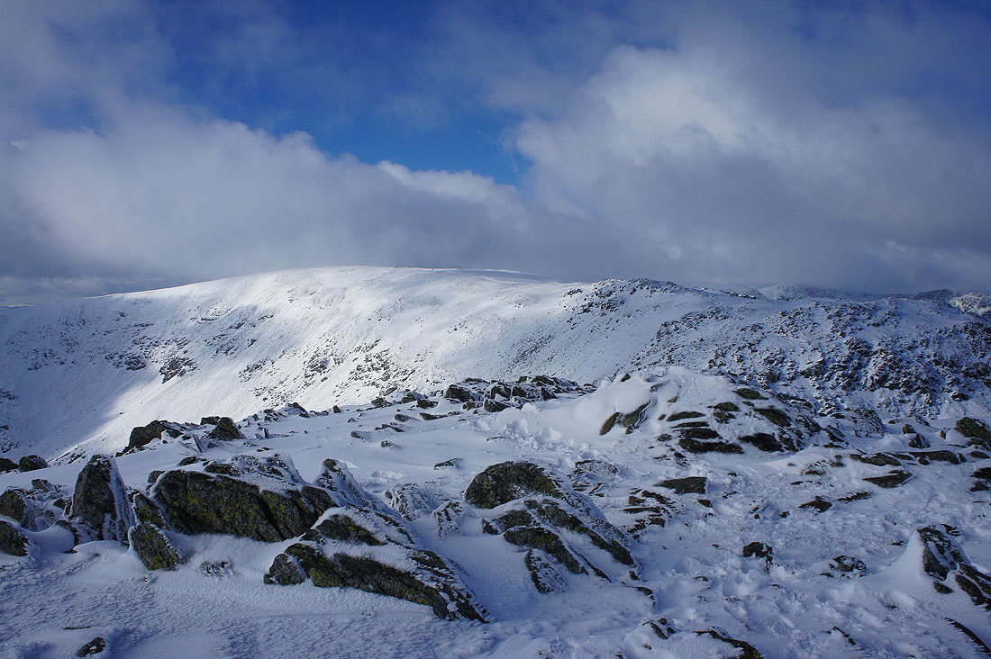
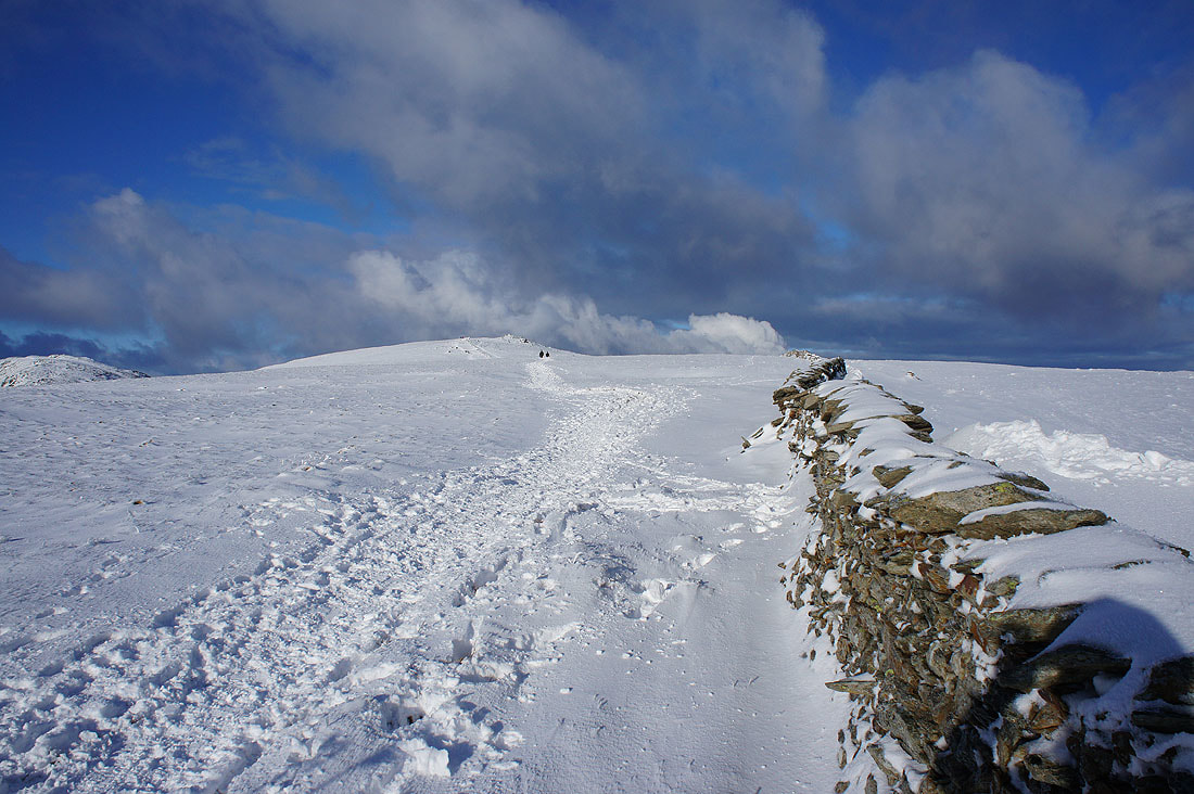
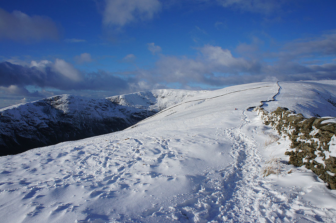
High Pike ahead
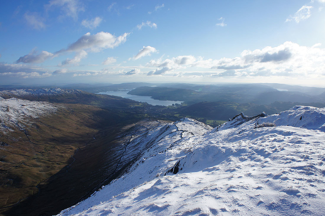
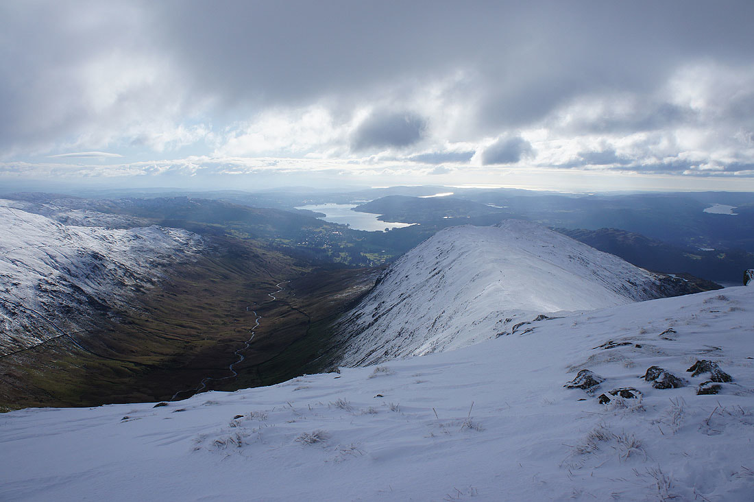
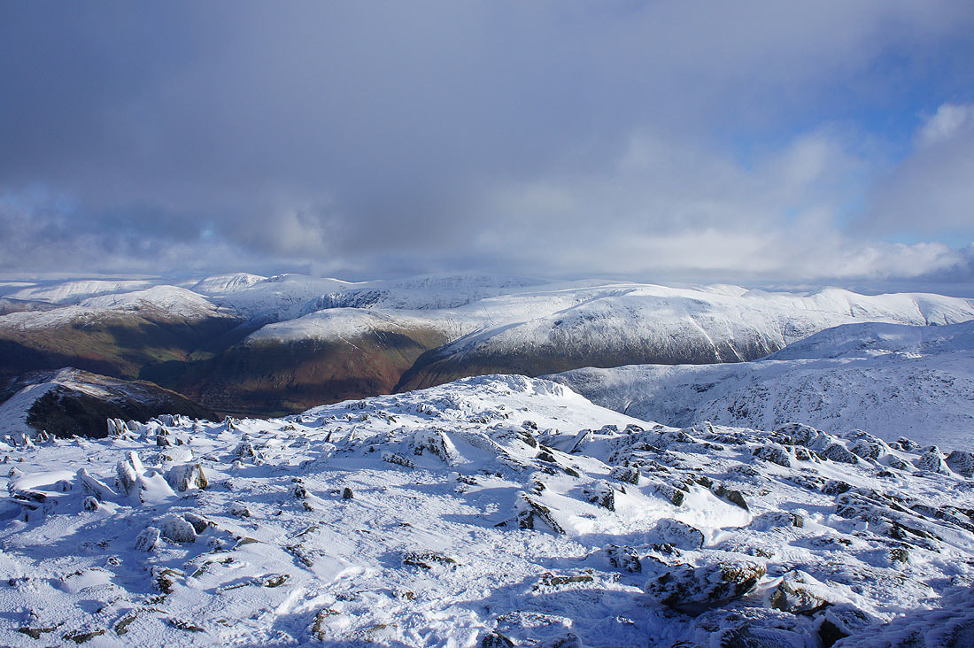
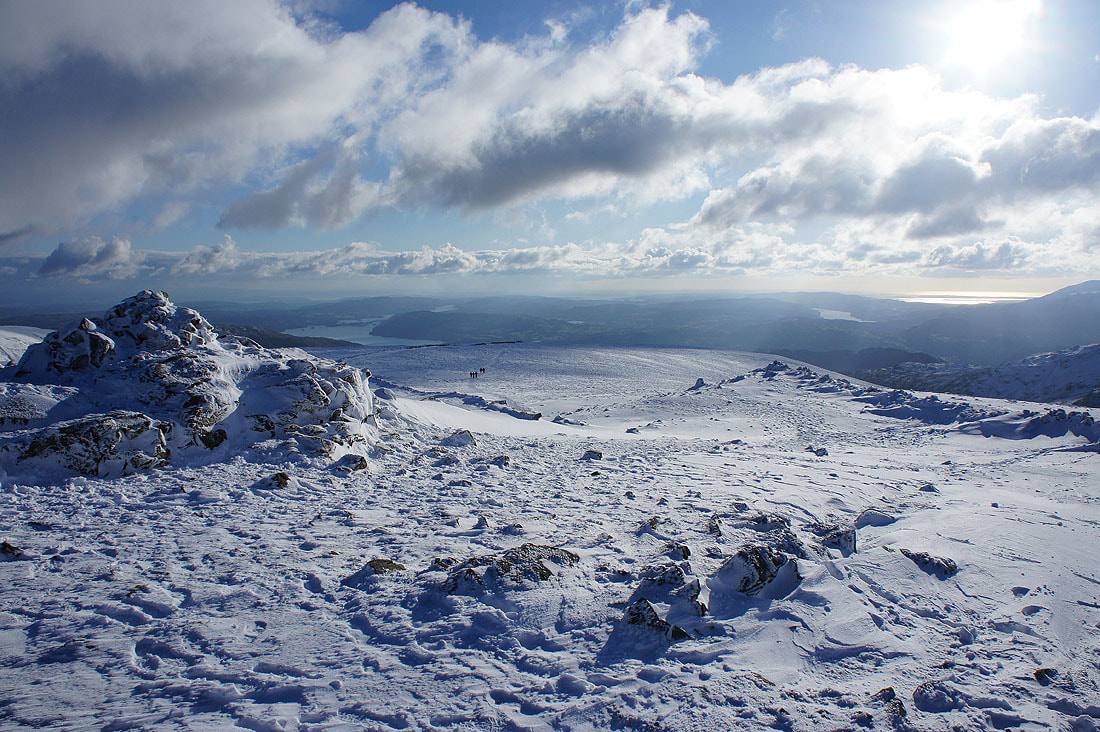
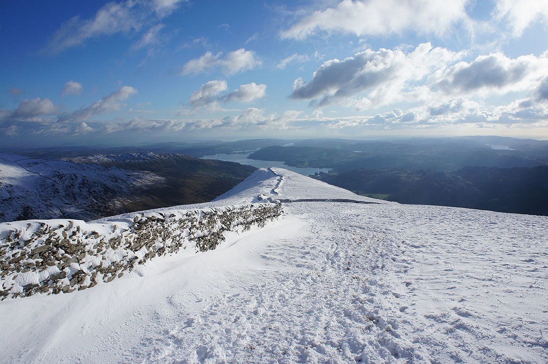
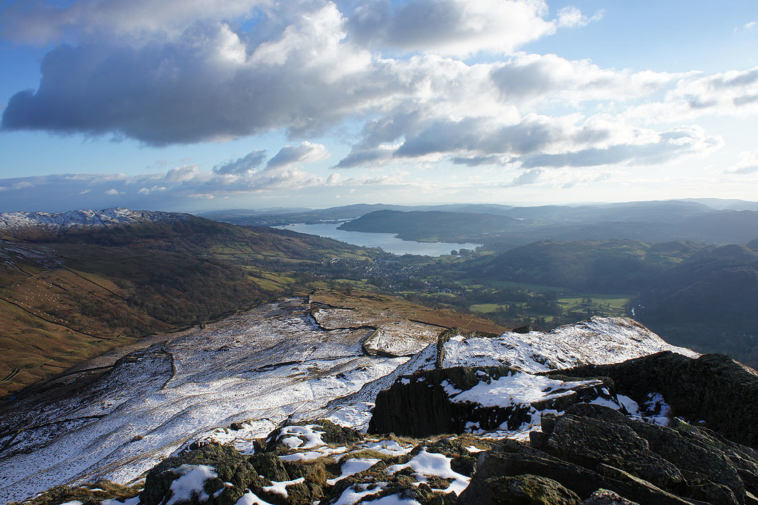
On High Pike. Ambleside and Windermere with the ridge down to Low Pike to come.
Erne Crag to Great Rigg on the other side of Rydal
Great Rigg, Fairfield and the ridge back up to Dove Crag
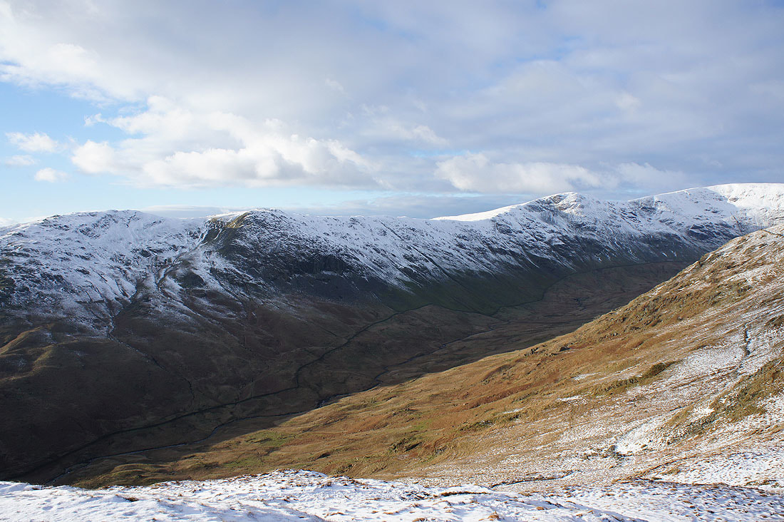
High Bakestones and Little Hart Crag
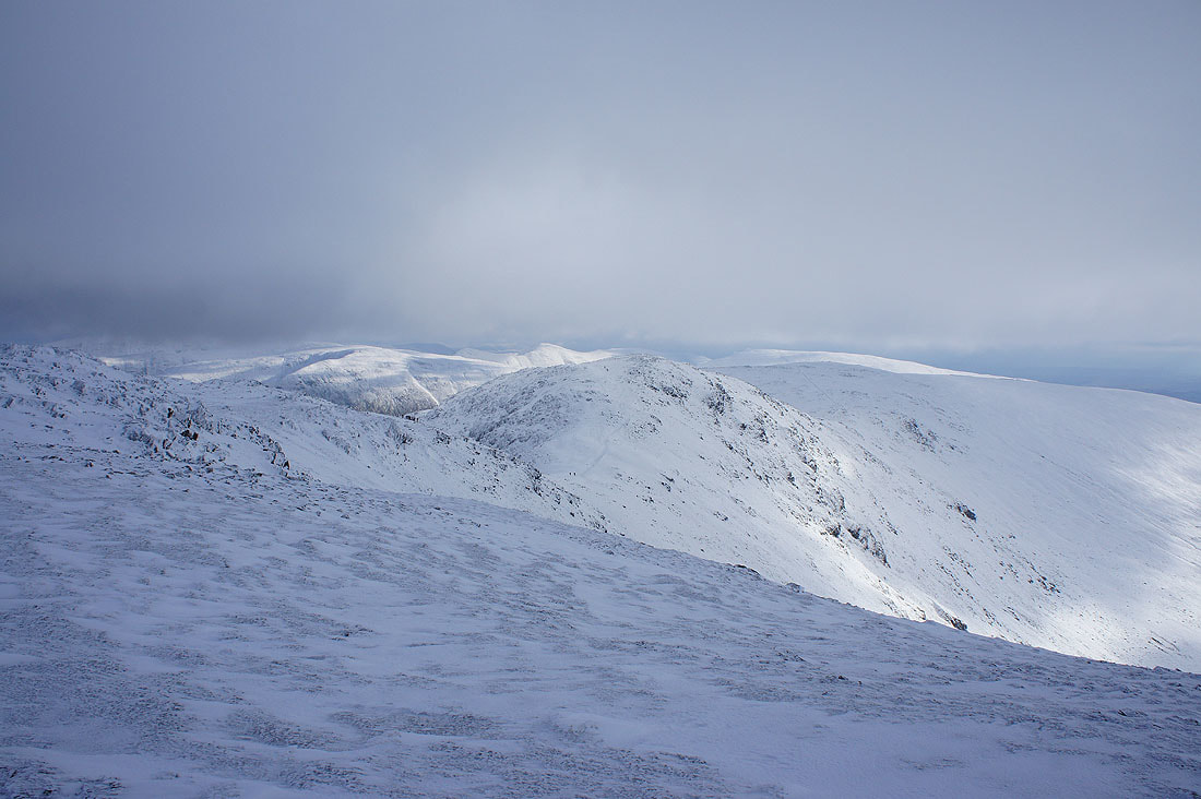
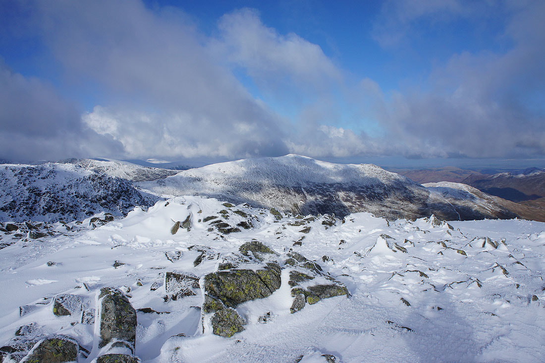
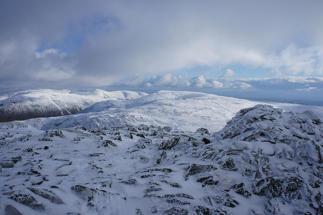
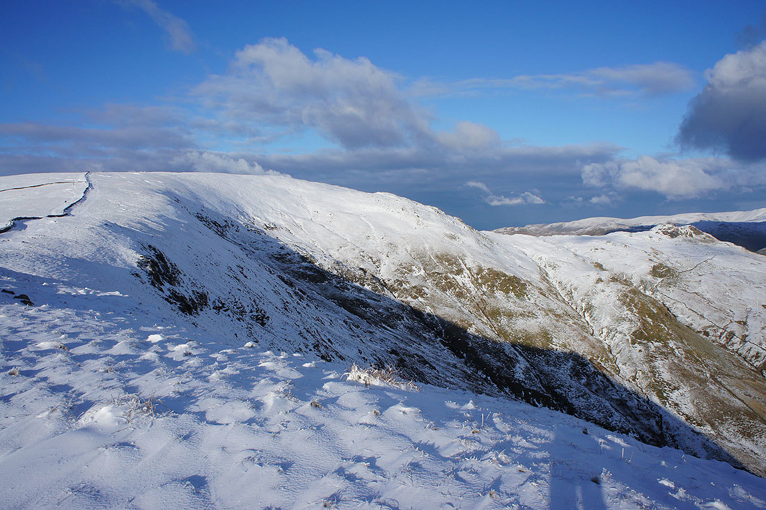
Heron Pike, Erne Crag, Great Rigg and Rydal from Low Pike
The ridge back up to High Pike, Little Hart Crag and Scandale
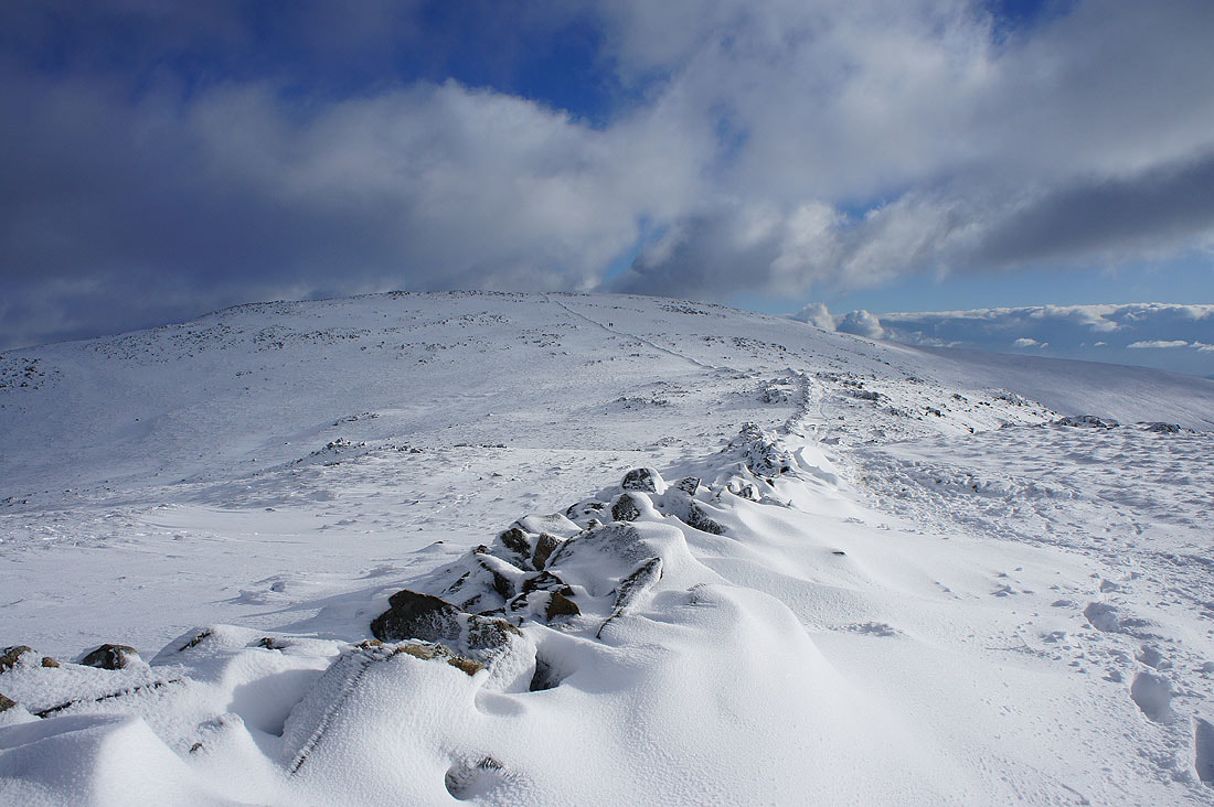
The final descent from Low Pike back to Ambleside to finish