4th November 2012 - High Street
Walk Details
Distance walked: 6.9 miles
Total ascent: 2426 ft
OS map used: OL5 - The English Lakes, North-eastern area
Time taken: 6 hrs
Route description: Mardale Head-The Rigg-Kidsty Howes-Kidsty Pike-Rampsgill Head-Straits of Riggindale-High Street-Mardale Ill Bell-Nan Bield Pass-Small Water-Mardale Head
The forecast for the weekend wasn't looking good right up to the last moment and then Sunday came up trumps with a clear and sunny day. I couldn't believe my luck that the tops of the Lakeland fells were covered in snow and I had the opportunity to take advantage of it.
The snow was deep on the tops, about a foot or more and it was hard work walking through it, even with the assistance of other walkers' tracks in it.
From the car park at Mardale Head I followed the path round the head of Haweswater to The Rigg and round into Riggindale. I crossed Riggindale Beck to climb to Kidsty Pike via Kidsty Howes. I then paid a visit to Rampsgill Head before crossing the Straits of Riggindale to High Street. My route back was over Mardale Ill Bell, down to the Nan Bield Pass and then past Small Water to Mardale Head.
Route map
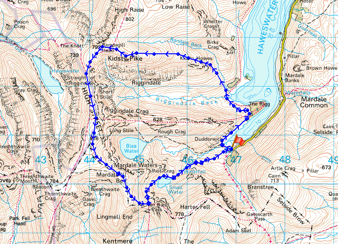
© Crown copyright. All rights reserved. License number PU 100034184.
On the drive down to Mardale Head and I had to stop and take a picture of the ridge of Rough Crag leading up to a snow covered High Street
A wintery looking Harter Fell as I follow the path to the Rigg
On the other side of the Rigg and Riggindale comes into view with my first port of call, Kidsty Pike up on the right
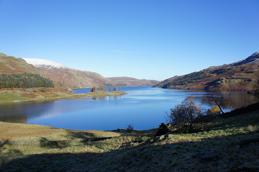
Looking down Haweswater
On my way up to Kidsty Pike and I've stopped briefly at Kidsty Howes. The view to the east starts to open up here and I can see across the Eden valley to the snow covered North Pennines.
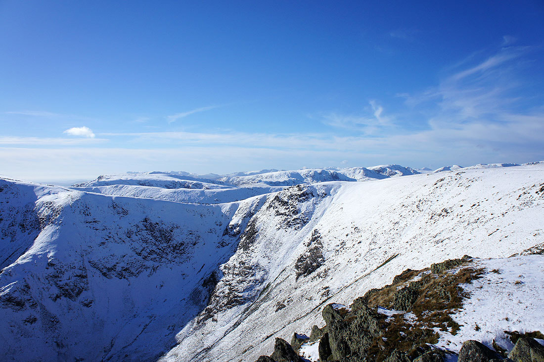
Views from the summit of Kidsty Pike. Numerous fells in view across the Straits of Riggindale.
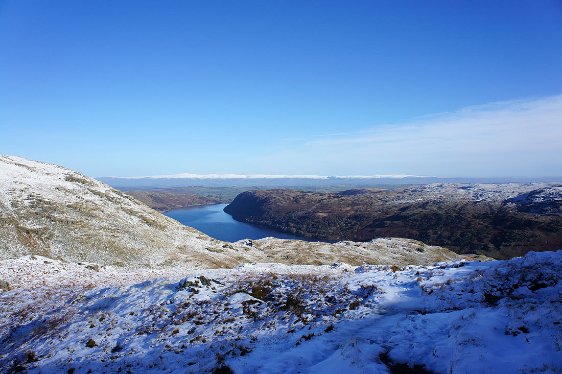
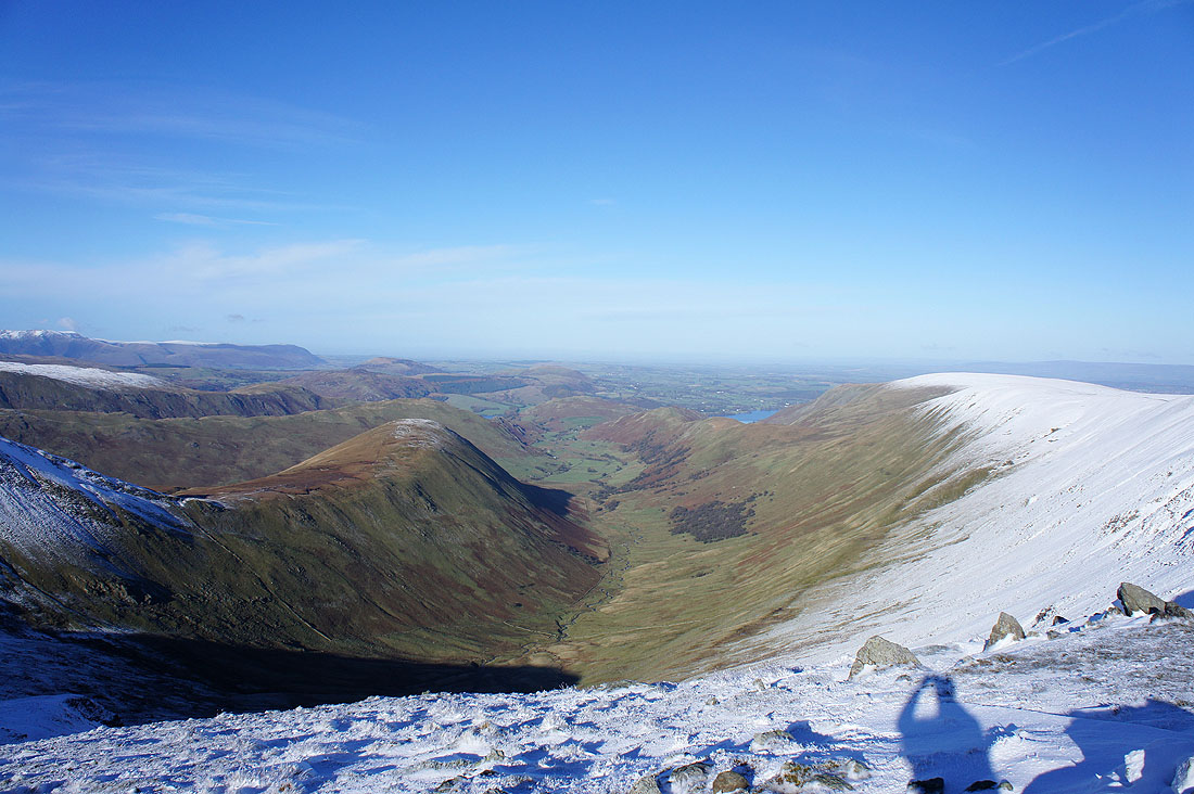
Riggindale below with the ridge of Rough Crag on the other side of the valley. Selside Pike and Branstree are on the other side of Haweswater while in the far distance the faintly snow covered hills are the Howgills.
Cross Fell and the North Pennines
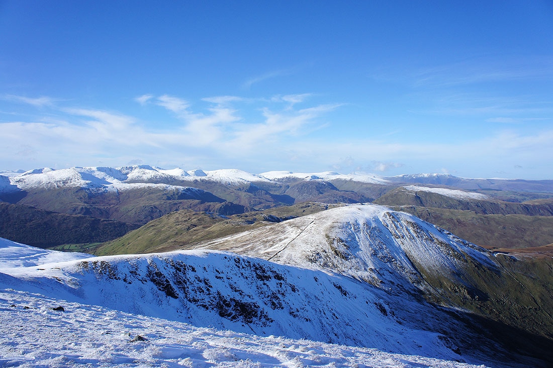
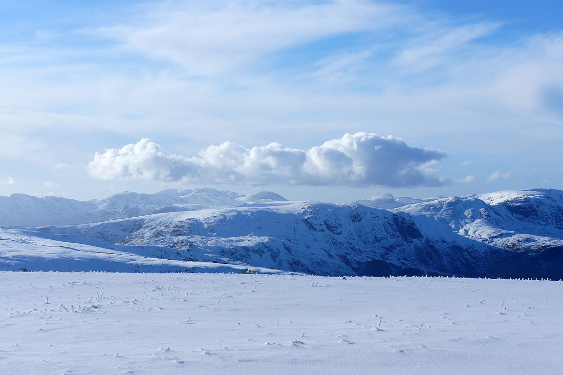
From Kidsty Pike it was an arduous journey through deep snow to Rampsgill Head. I went to the cairn at the top of Ramps Gill first. Fairfield, St. Sunday Crag, Helvellyn and the Dodds make up the view with Rest Dodd the fell in the foreground on the right.
Ramps Gill heading down to Martindale. The Nab is the fell on the left with just a little dusting of snow.
Helvellyn and the Dodds with Skiddaw and Blencathra in the distance on the right
By the cairn at the summit of Rampsgill Head. Caudale Moor, Dove Crag, Hart Crag and Fairfield in view.
Fairfield, St. Sunday Crag, Helvellyn and the Dodds
Heading for High Street across the Straits of Riggindale. Hayeswater below with Gray Crag behind.
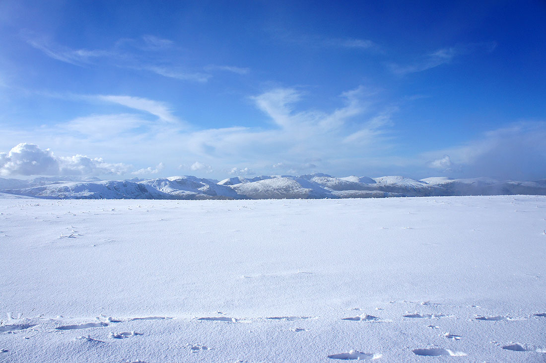
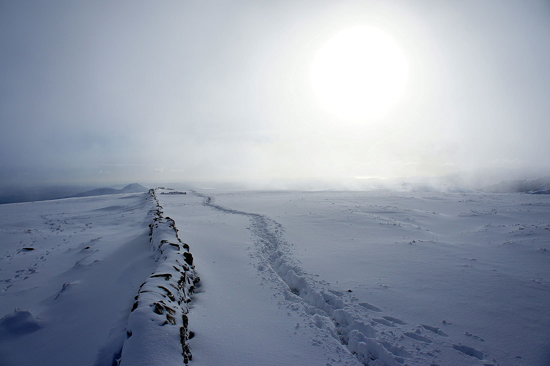
Deep snow on High Street. There were patches of mist floating across as low cloud started to form but it was clear enough for long enough to get great views and pictures.
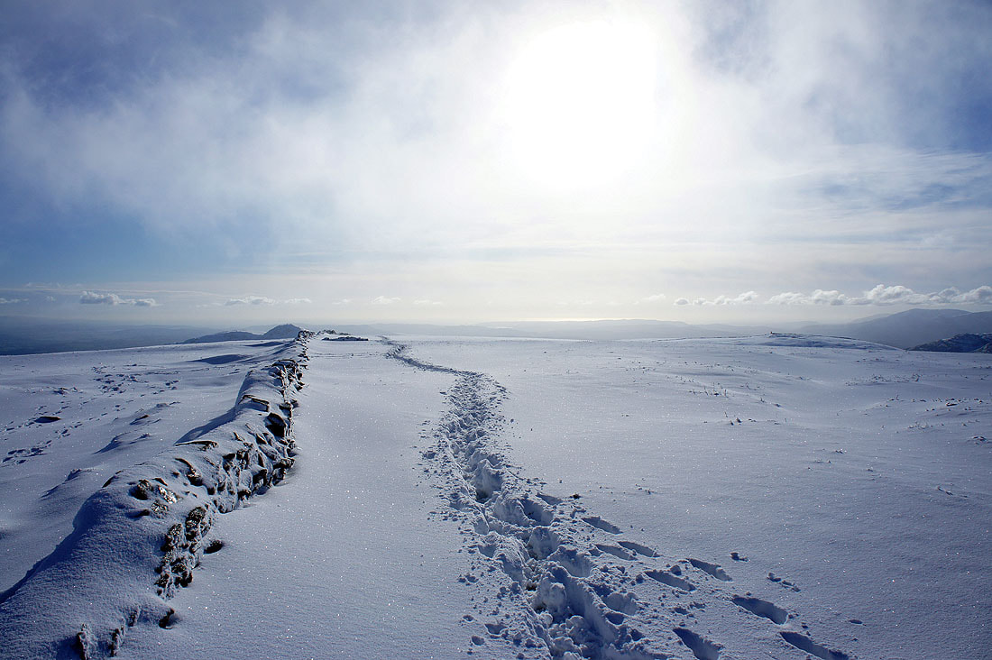
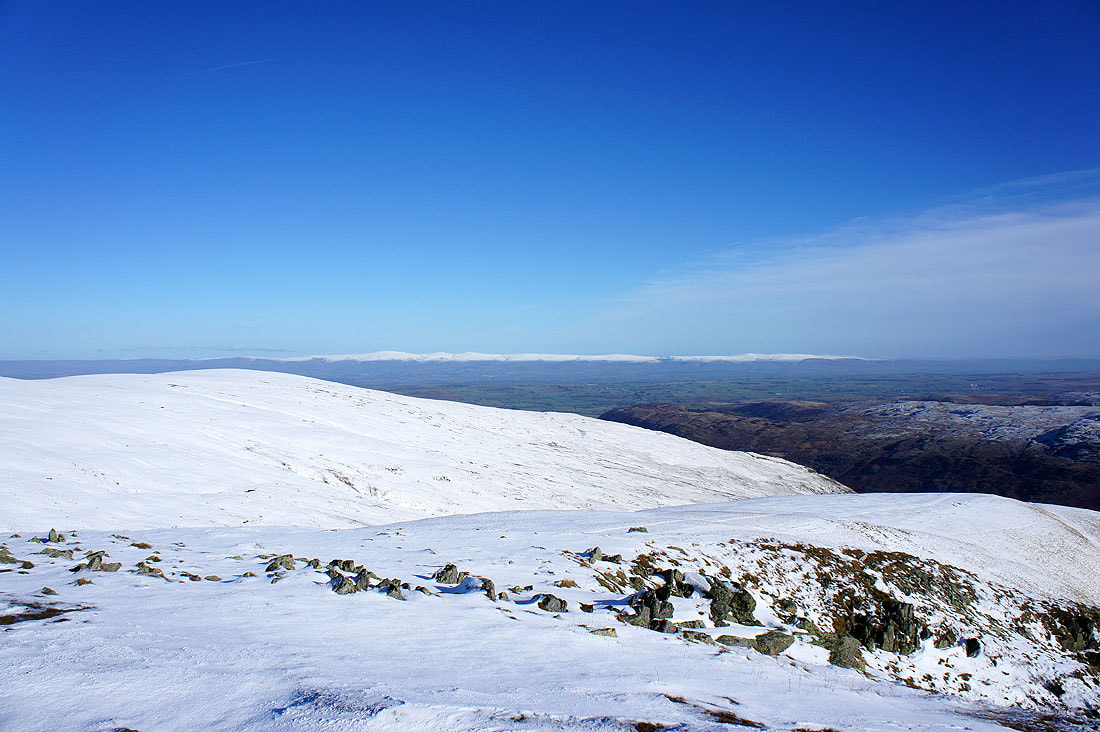
Looking south towards Morecambe Bay. If you follow the line of the wall you can see the cone of Ill Bell.
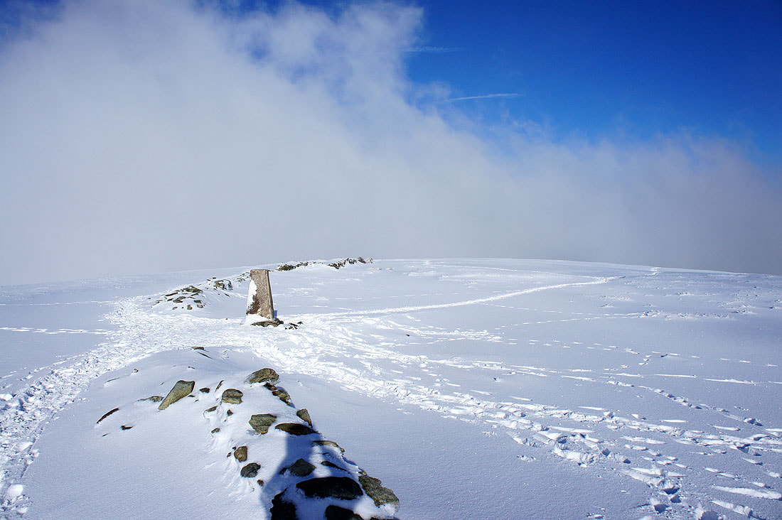
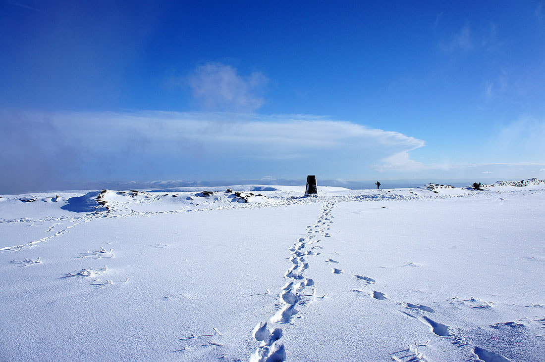
The trig point marking the summit of High Street
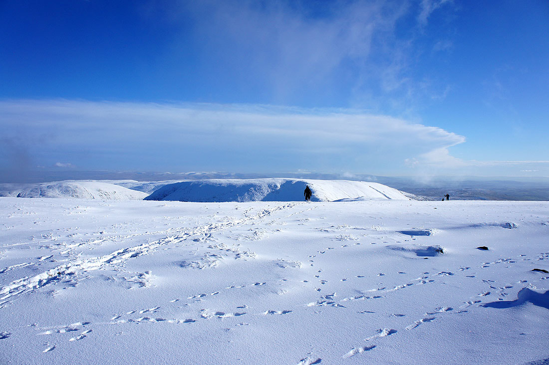
Fellow walkers heading for the summit with Harter Fell behind
You can really see how deep the snow is from how much of the wall running across the summit is covered
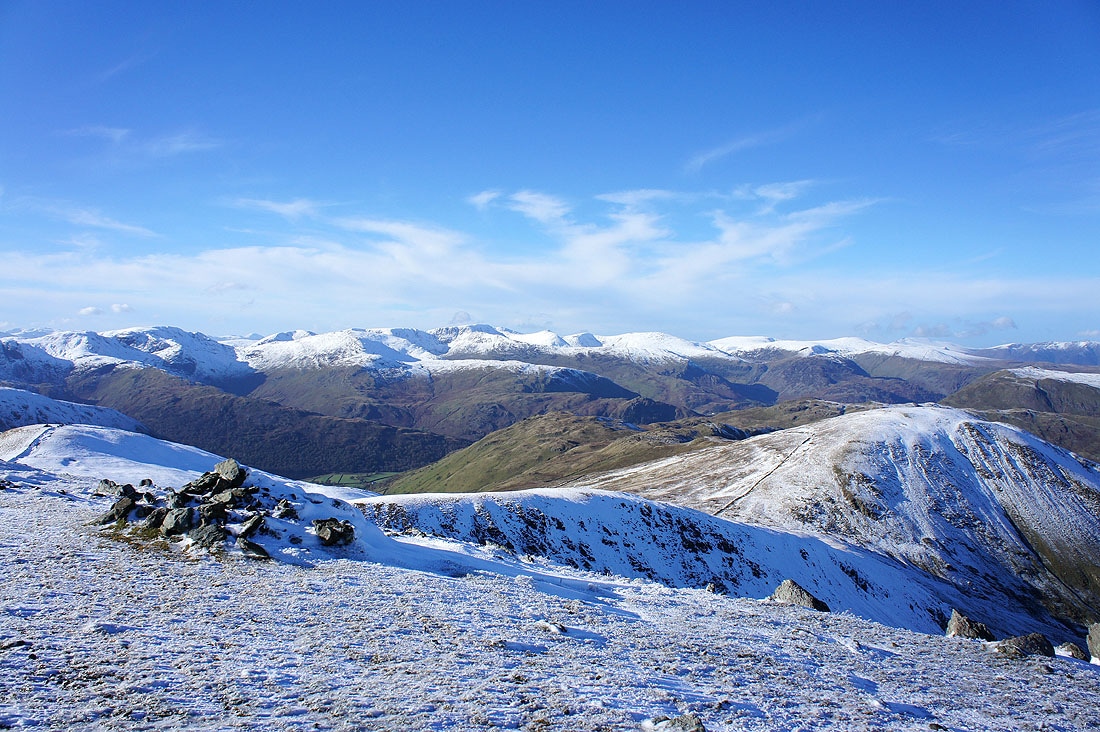
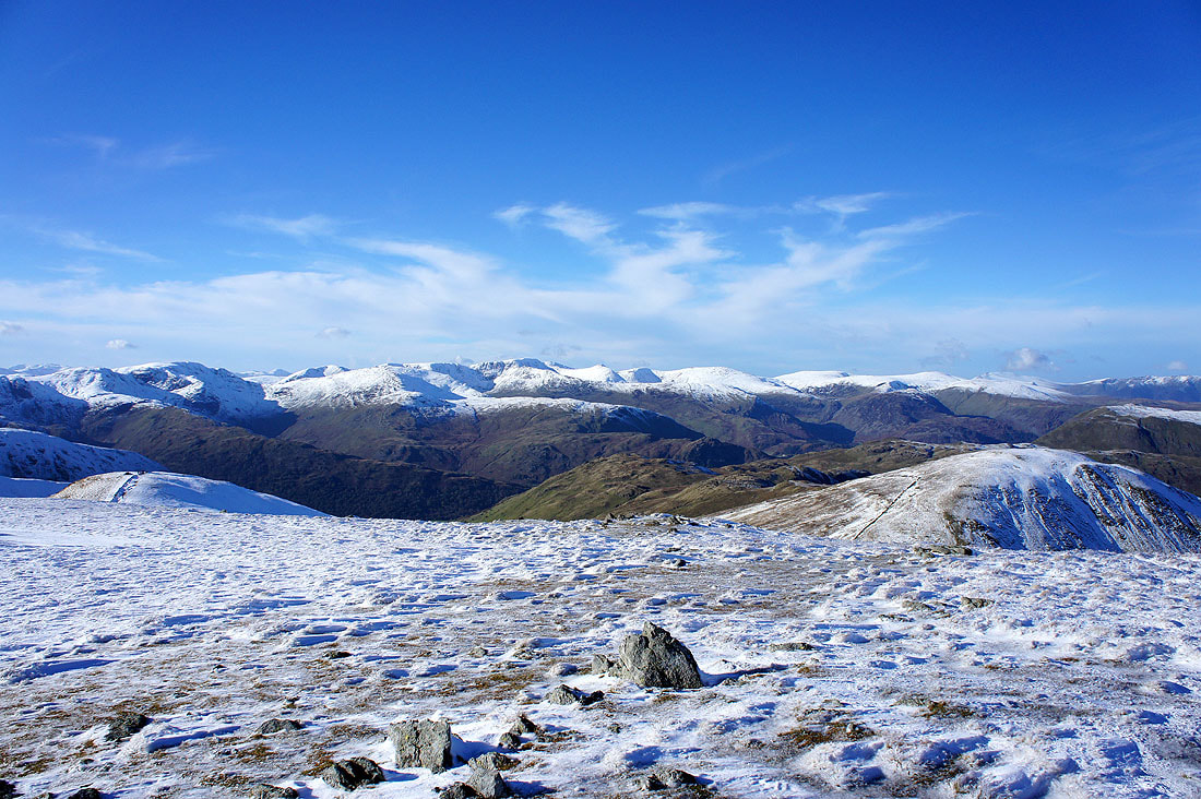
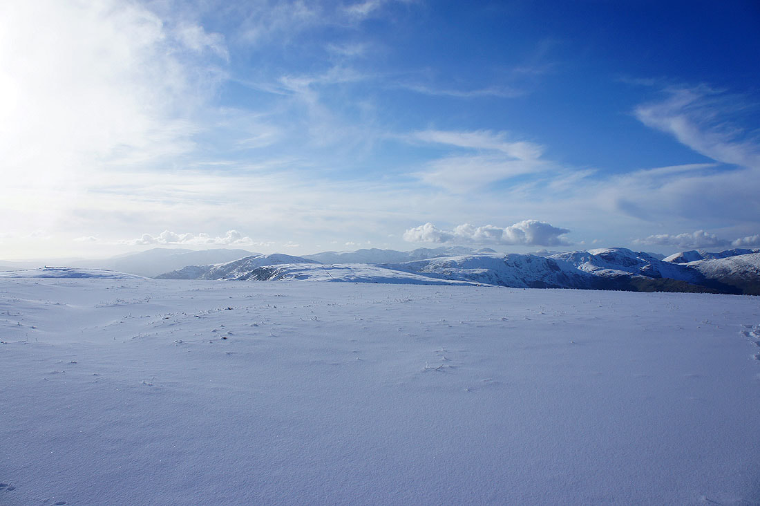
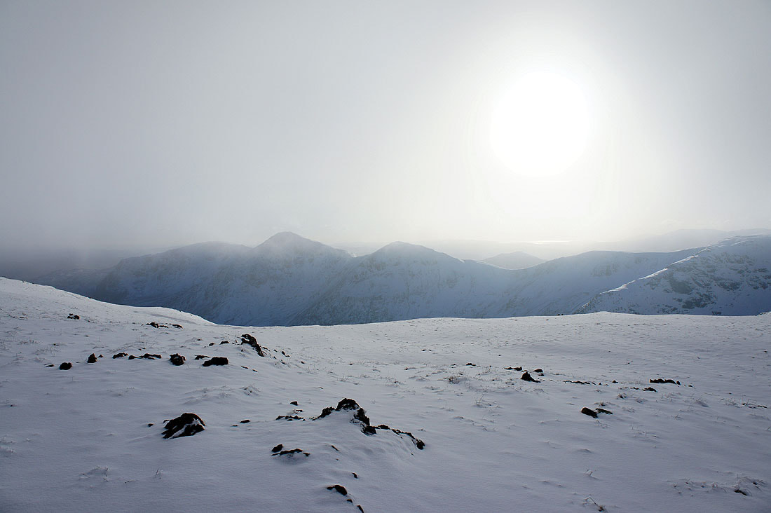
The summit plateau of High Street robs the views of depth so I've left it to take this picture of Fairfield, Helvellyn and the Dodds. In the foreground are Hartsop Dodd and Gray Crag.
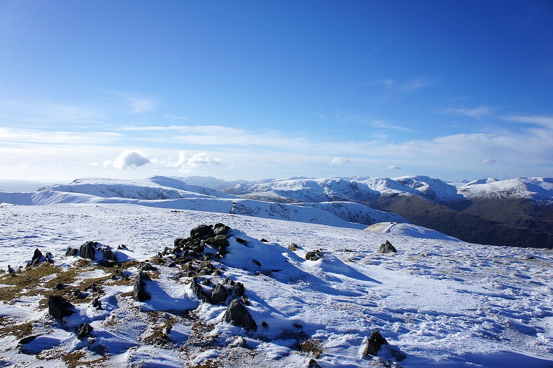
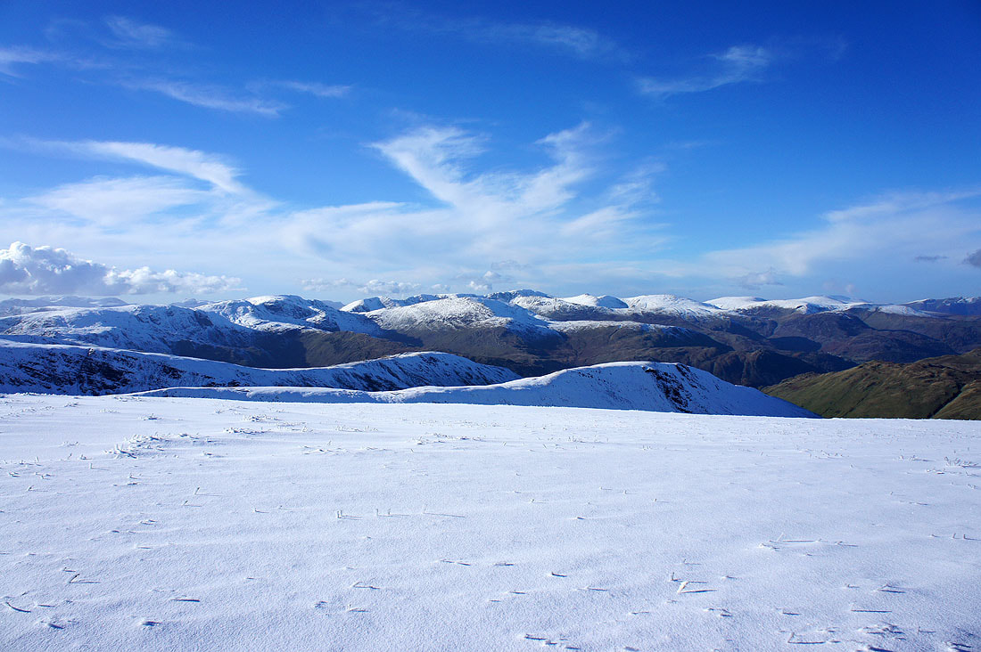
The Coniston fells, Crinkle Crags, Bowfell, the Scafells and Great Gable in the far distance with Red Screes, Caudale Moor, Dove Crag, Hart Crag and Fairfield closer at hand
Zooming in on Bowfell, Scafell, Scafell Pike, Great End and Great Gable
More mist drifting across the summit. Time to head for the Nan Bield Pass.
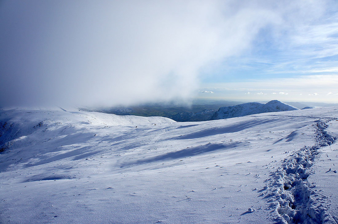
Using other peoples footprints. Low cloud was starting to cover the tops of some of the fells by this point.
Yoke, Ill Bell and Froswick
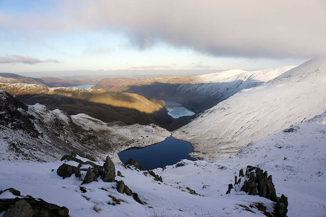
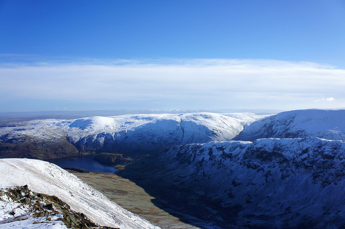
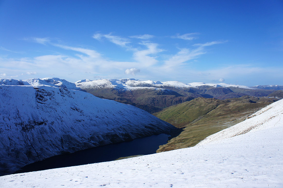
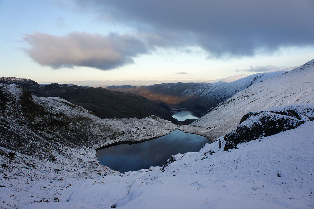
Small Water and Haweswater
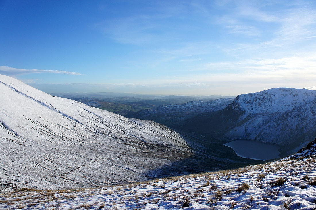
Not far to go to the Nan Bield Pass and the valley of Kentmere and Kentmere Reservoir come into view on the right
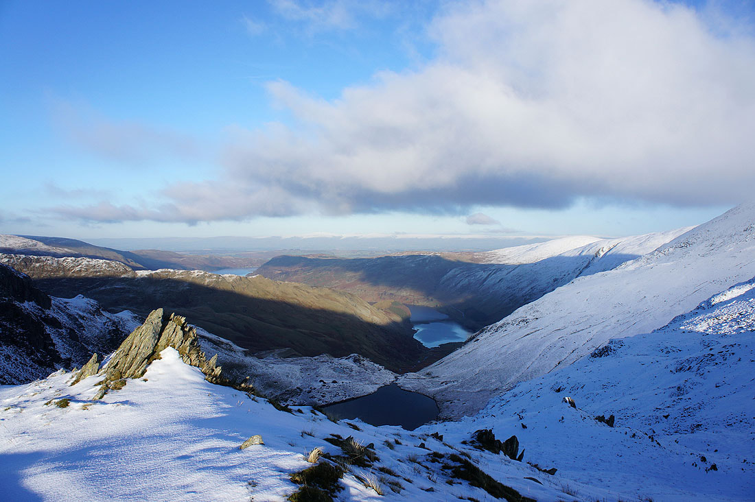
Another view across Small Water and Haweswater to the Pennines
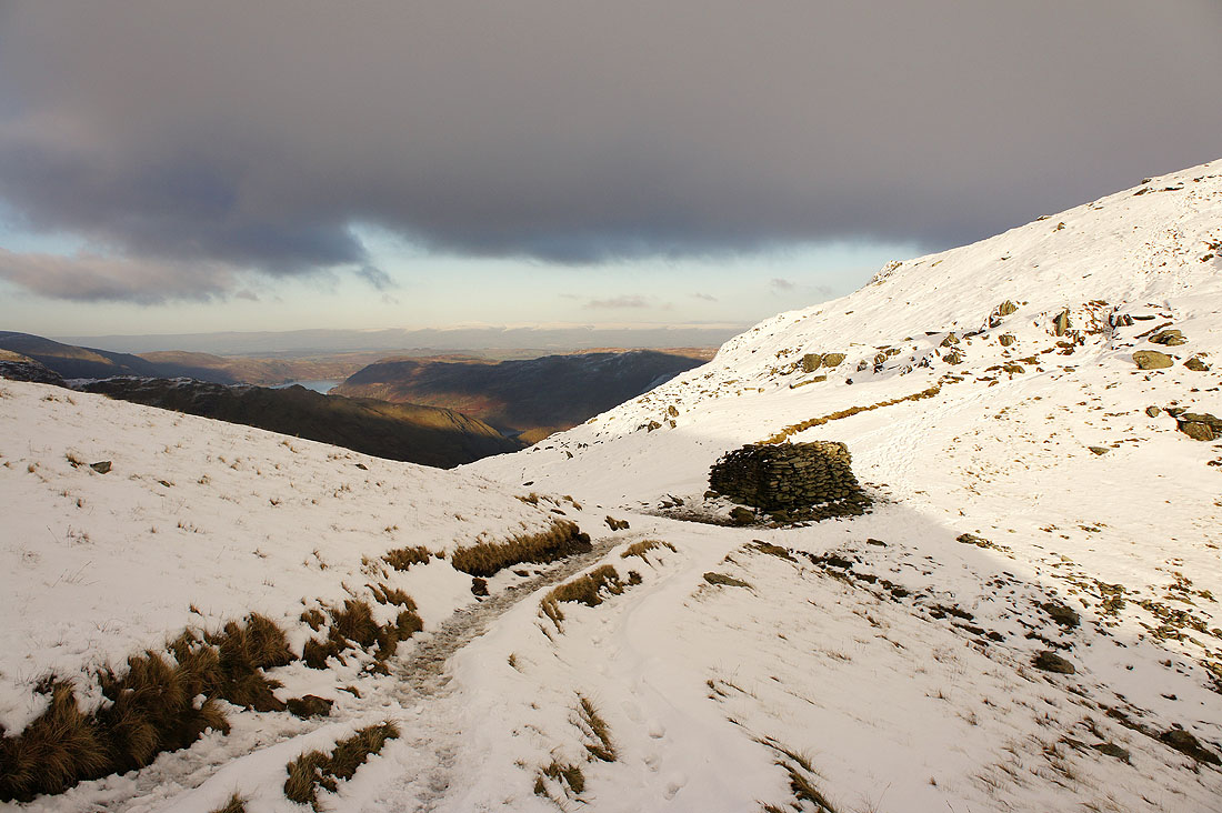
The Nan Bield Pass
Heading down to Small Water
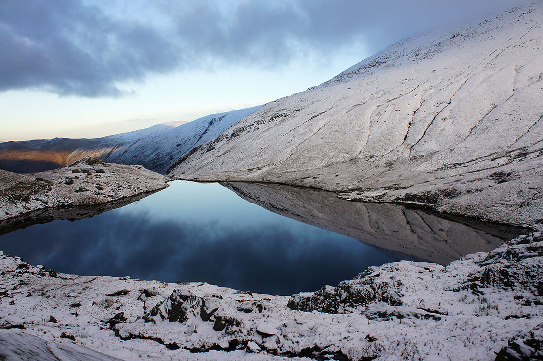
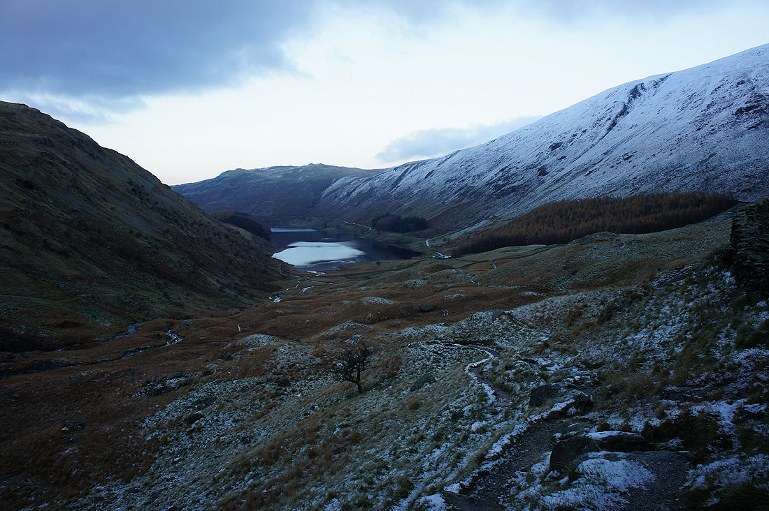
Cold reflections in Small Water
Haweswater beckons in the last of the light