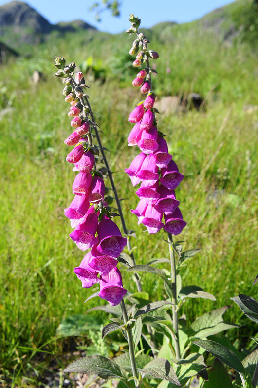
6th July 2013 - Pike o'Blisco & Great Rigg
Walk Details
Distance walked: 6.0 hrs
Total ascent: 2199 ft
OS map used: OL6 - The English Lakes, South-western area
Time taken: 7 hrs (I ended up dawdling)
Route description: Stickle Barn car park-Old Dungeon Ghyll-Stool End Farm-Oxendale-Brown Howe-Red Tarn-Pike o'Blisco-Blake Rigg-Rakerigg-NT camp site-Old Dungeon Ghyll-Stickle Barn car park
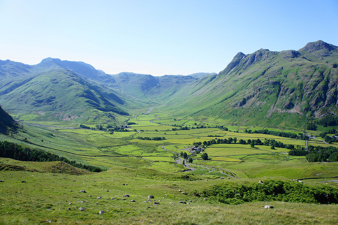
My plan today was to do the Crinkle Crags and Bowfell but the weather wasn't quite as forecast and for the first time that I can remember I wasn't prepared for it. I had no jacket, so with the Crinkles under cloud and a strong breeze blowing I opted to stay in the sunshine and head up Pike o'Blisco. Sod's law that the cloud had cleared by the time I reached the top of Pike o'Blisco. Never mind, the weather continued to improve through the afternoon and I had some great views of Great Langdale as I made my way back down.
From the NT car park at Stickle Barn I took the field path to the Old Dungeon Ghyll and then the track to Stool End Farm. I then crossed Oxendale and made my way up to Red Tarn via Brown Howe. From Red Tarn I climbed to the top of Pike o'Blisco. After enjoying the views from the top my next objective was the cairn that marks the summit of Blake Rigg. My route back took me down Rakerigg to the road from Great Langdale over to Little Langdale. I then continued downhill through the NT camp site and to the Old Dungeon Ghyll. The field path I used at the start took me back to the car park.
Total ascent: 2199 ft
OS map used: OL6 - The English Lakes, South-western area
Time taken: 7 hrs (I ended up dawdling)
Route description: Stickle Barn car park-Old Dungeon Ghyll-Stool End Farm-Oxendale-Brown Howe-Red Tarn-Pike o'Blisco-Blake Rigg-Rakerigg-NT camp site-Old Dungeon Ghyll-Stickle Barn car park
My plan today was to do the Crinkle Crags and Bowfell but the weather wasn't quite as forecast and for the first time that I can remember I wasn't prepared for it. I had no jacket, so with the Crinkles under cloud and a strong breeze blowing I opted to stay in the sunshine and head up Pike o'Blisco. Sod's law that the cloud had cleared by the time I reached the top of Pike o'Blisco. Never mind, the weather continued to improve through the afternoon and I had some great views of Great Langdale as I made my way back down.
From the NT car park at Stickle Barn I took the field path to the Old Dungeon Ghyll and then the track to Stool End Farm. I then crossed Oxendale and made my way up to Red Tarn via Brown Howe. From Red Tarn I climbed to the top of Pike o'Blisco. After enjoying the views from the top my next objective was the cairn that marks the summit of Blake Rigg. My route back took me down Rakerigg to the road from Great Langdale over to Little Langdale. I then continued downhill through the NT camp site and to the Old Dungeon Ghyll. The field path I used at the start took me back to the car park.
Route map
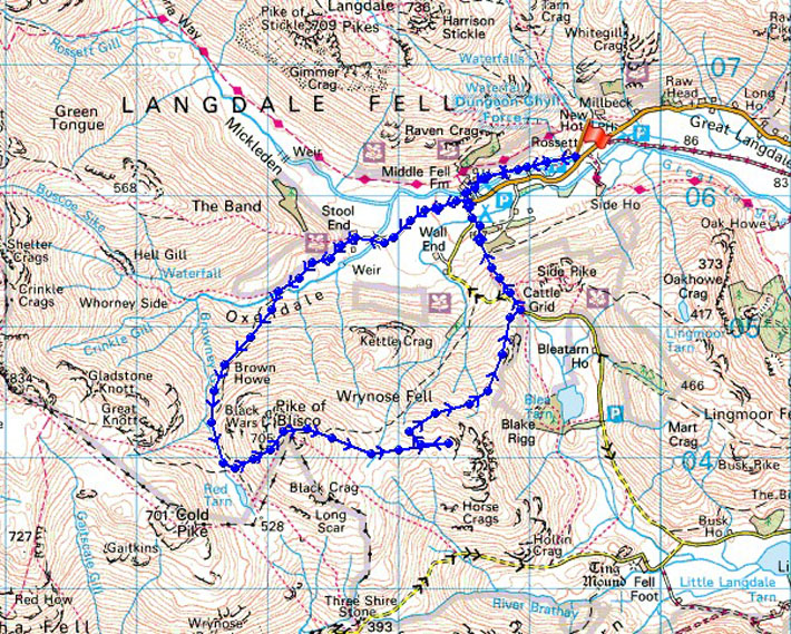
© Crown copyright. All rights reserved. License number PU 100034184.
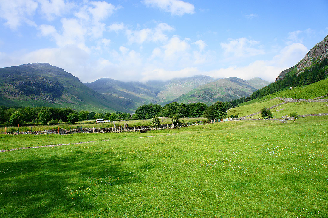
Leaving the NT Stickle Barn car park and Pike o'Blisco is clear on the left but the Crinkle Crags and Bowfell aren't
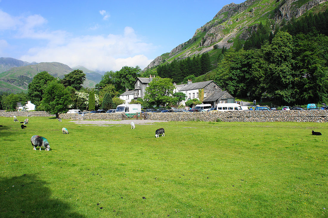
The Old Dungeon Ghyll hotel
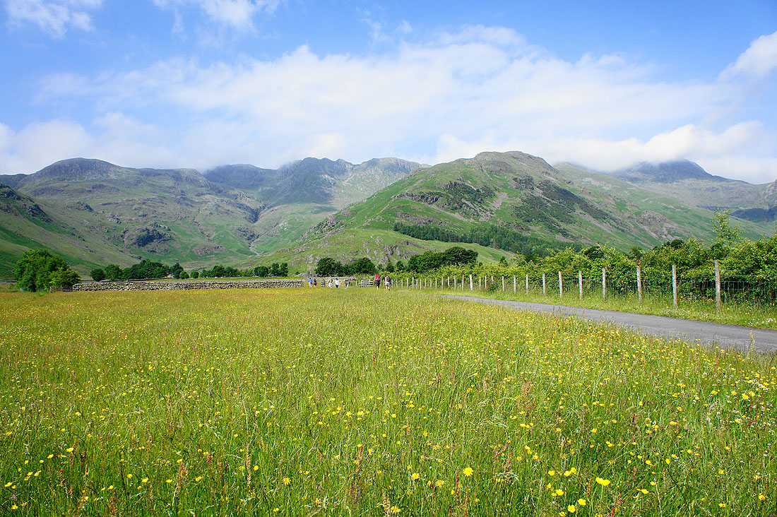
Heading for Stool End Farm. Things seem to be improving, the Crinkles are now visible.
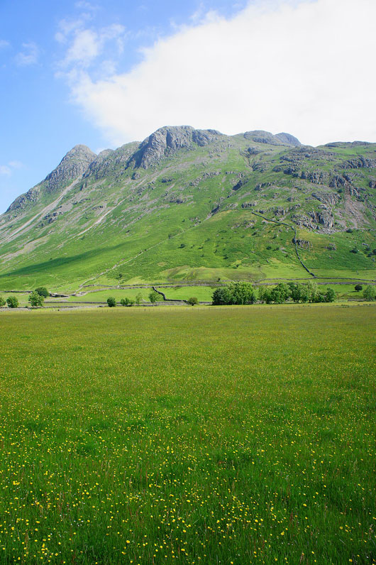
The Langdale Pikes
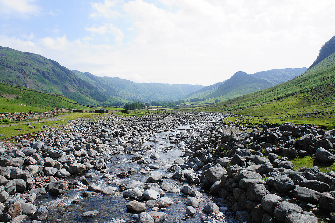
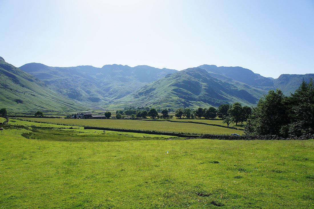
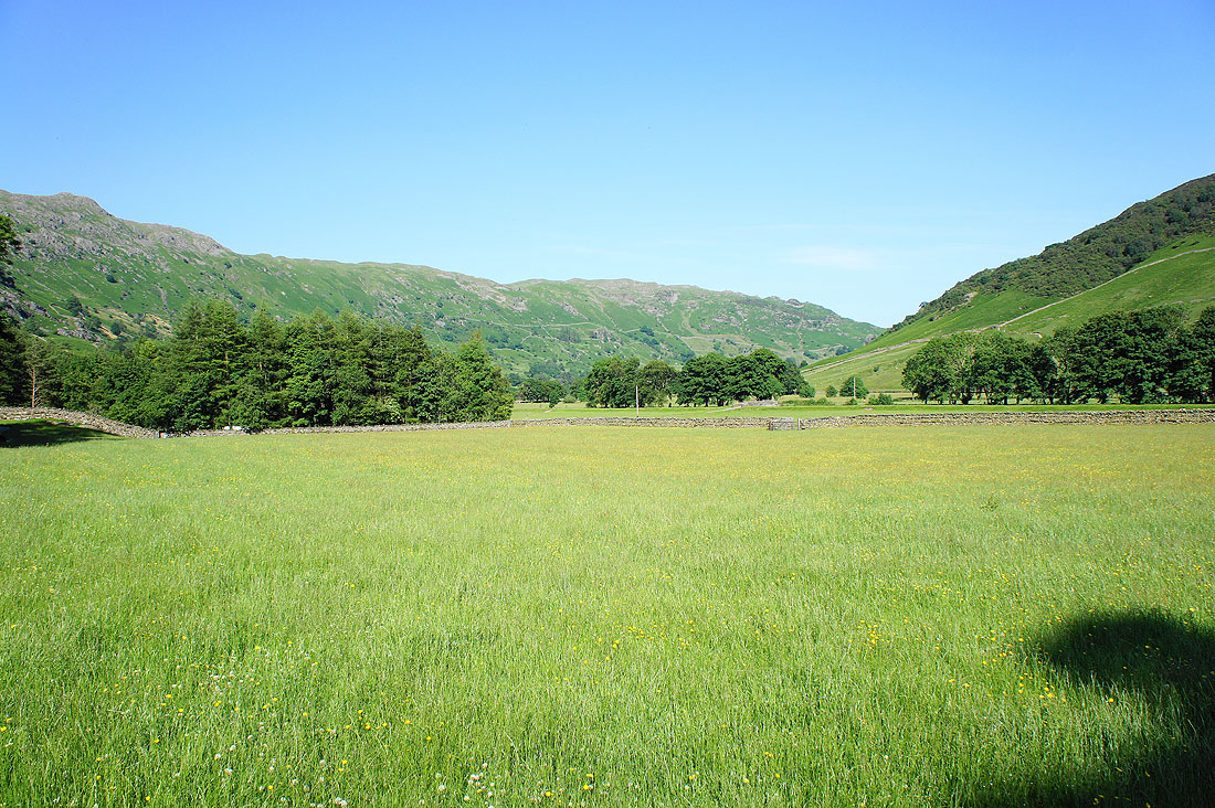
Great Langdale from the bridge over Oxendale Beck
and the Crinkle Crags which are cloud covered again
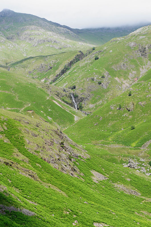
Whorneyside Force in Hell Gill
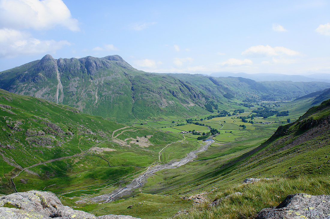
Great Langdale and the Langdale Pikes from Brown Howe
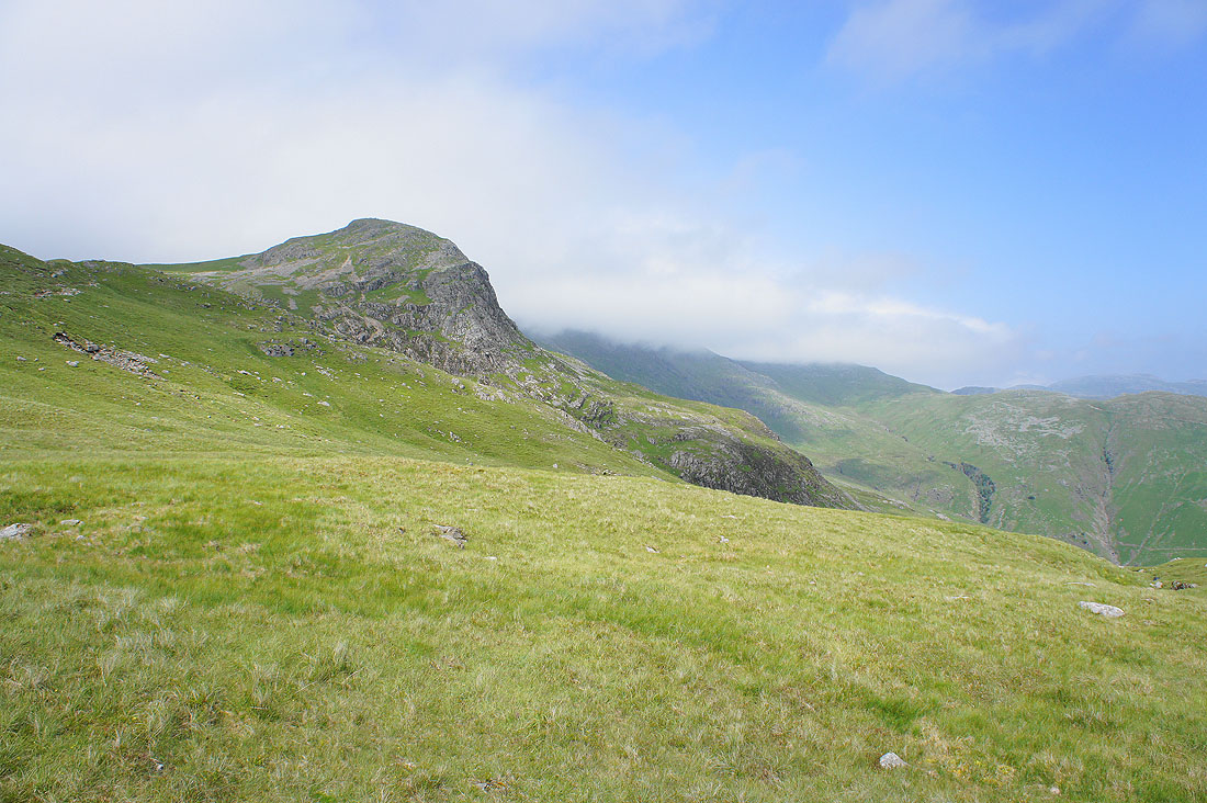
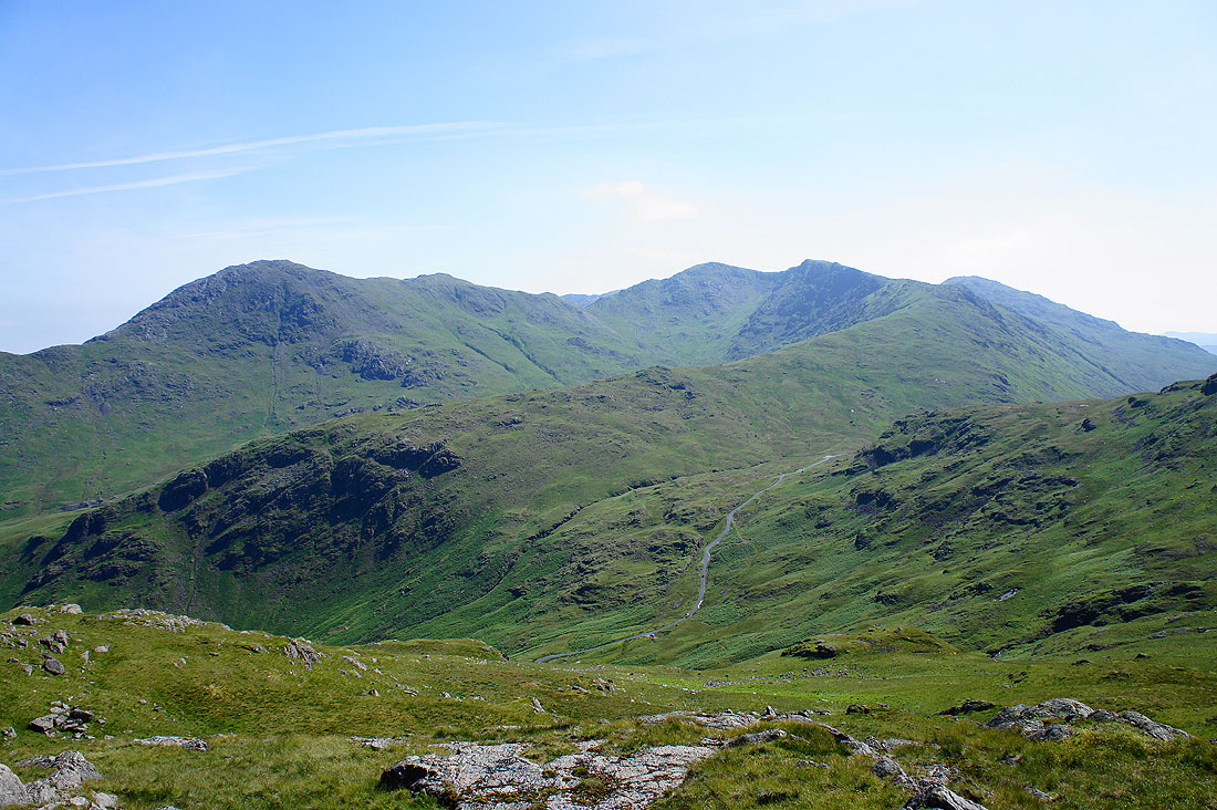
Higher up and Great Knott is clear but the cloud doesn't seem to be lifting off the Crinkles and Bowfell
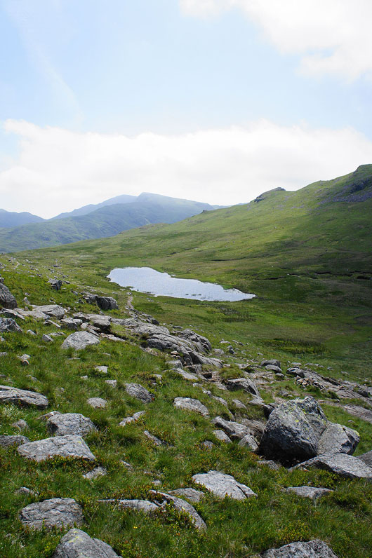
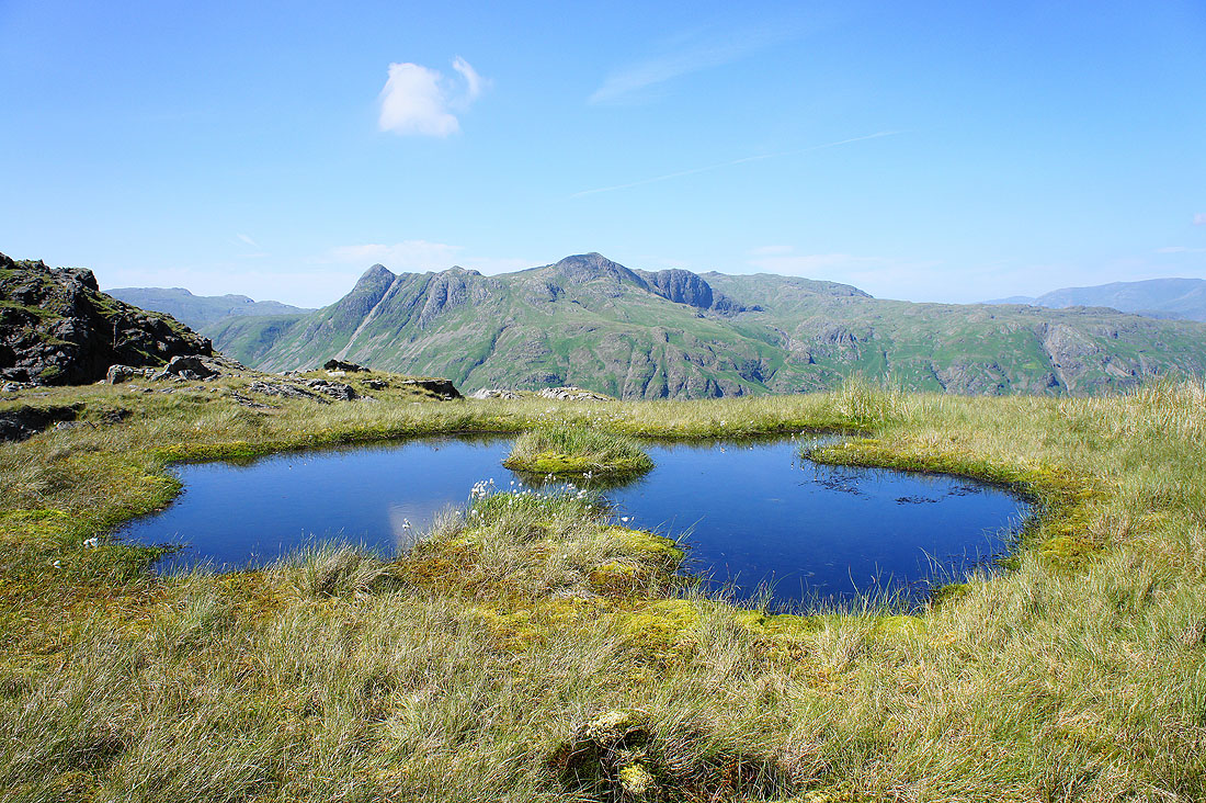
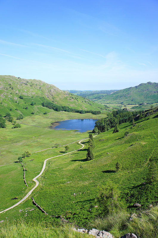
Red Tarn. I've had my lunch and I decide to head up Pike o'Blisco, it's been in the clear the whole time.
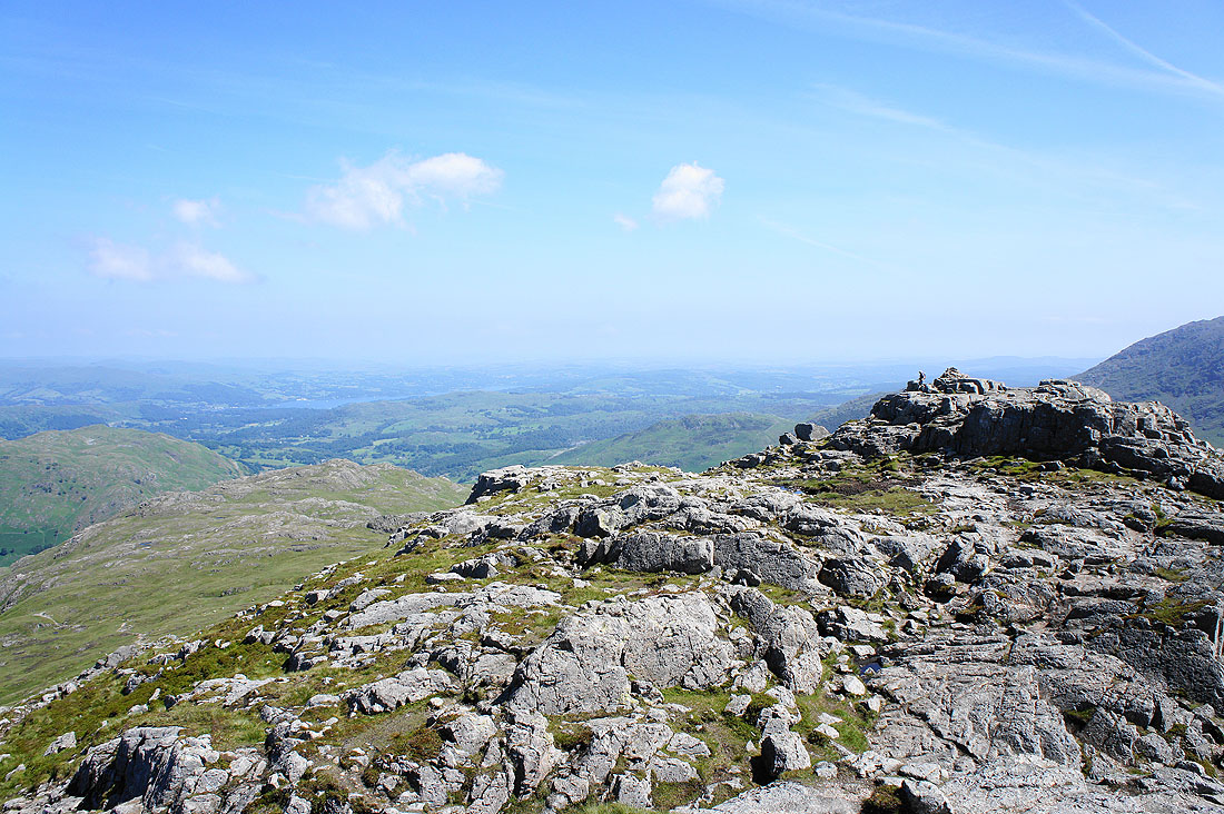
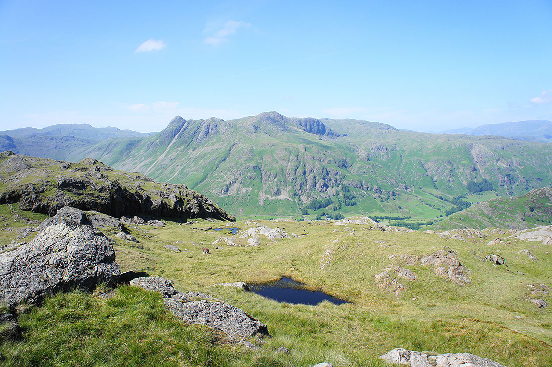
Sod's law that the cloud has cleared. I'm by the southeast cairn looking across to the northwest one and the Crinkle Crags and Bowfell.
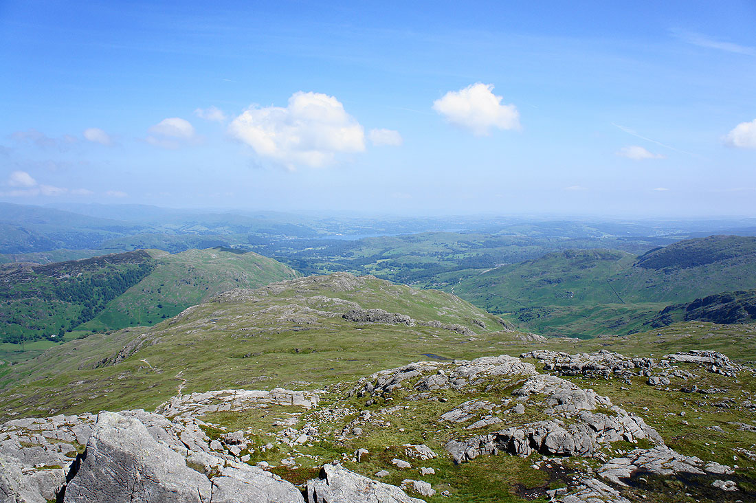
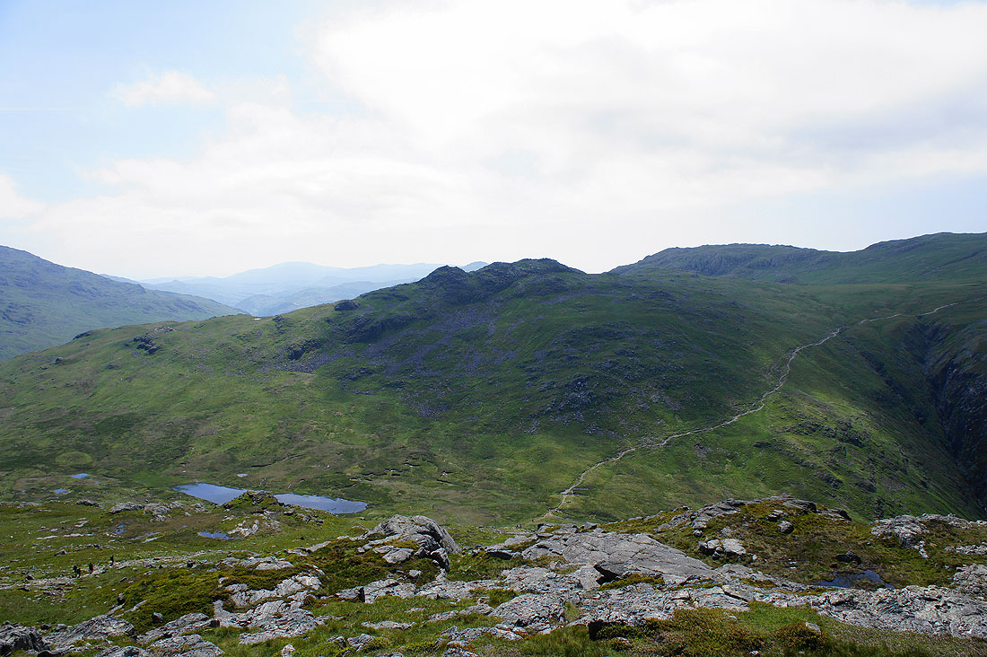
Looking past Blake Rigg to Windermere
and this time from the northwest cairn
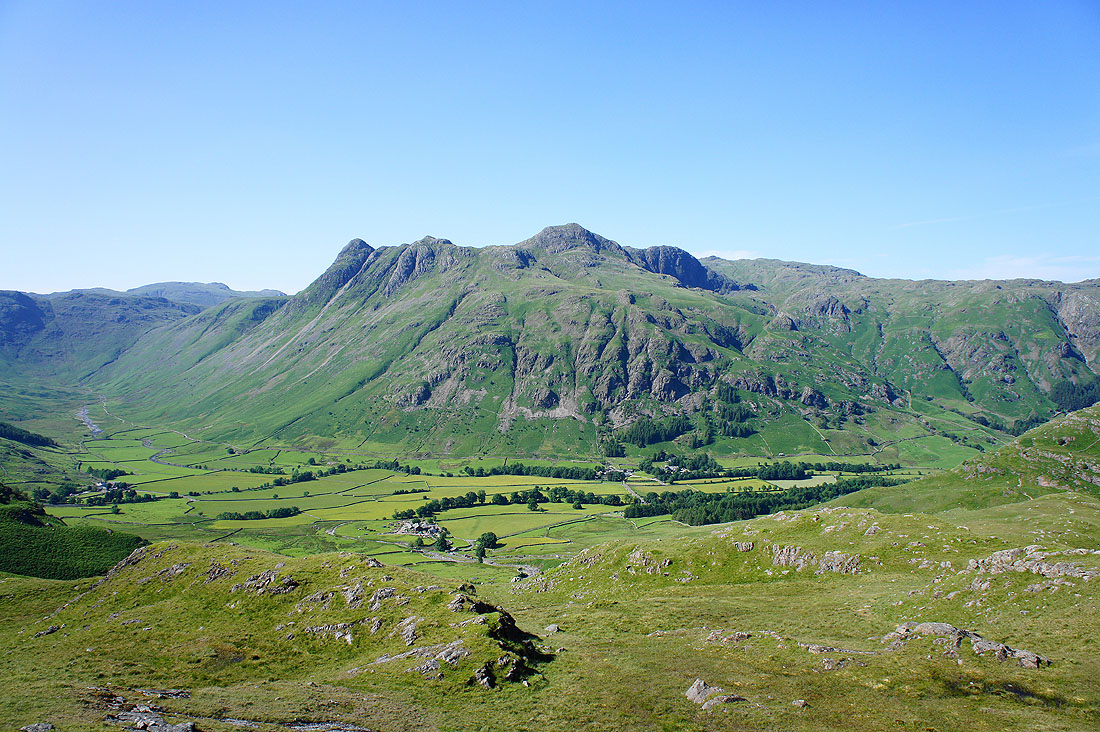
Great Langdale and the Langdale Pikes
Helvellyn and Fairfield in the distance beyond the Blea Rigg ridge
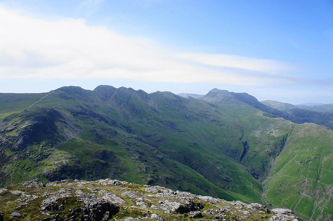
The Crinkle Crags and Bowfell
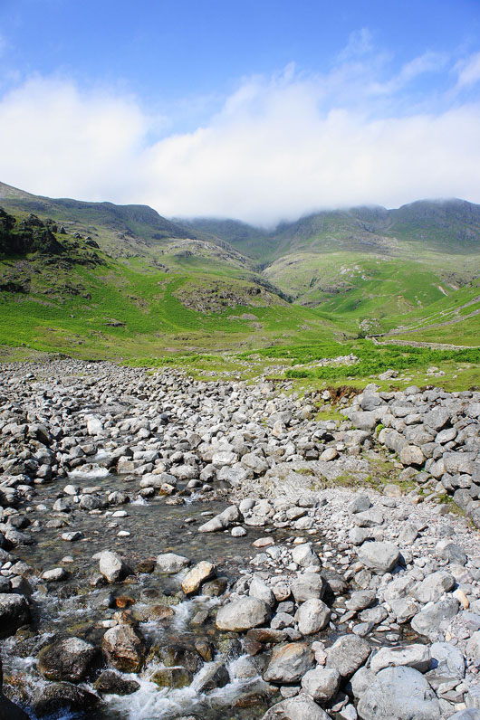
Red Tarn, Cold Pike and the very obvious path that heads for the Crinkles
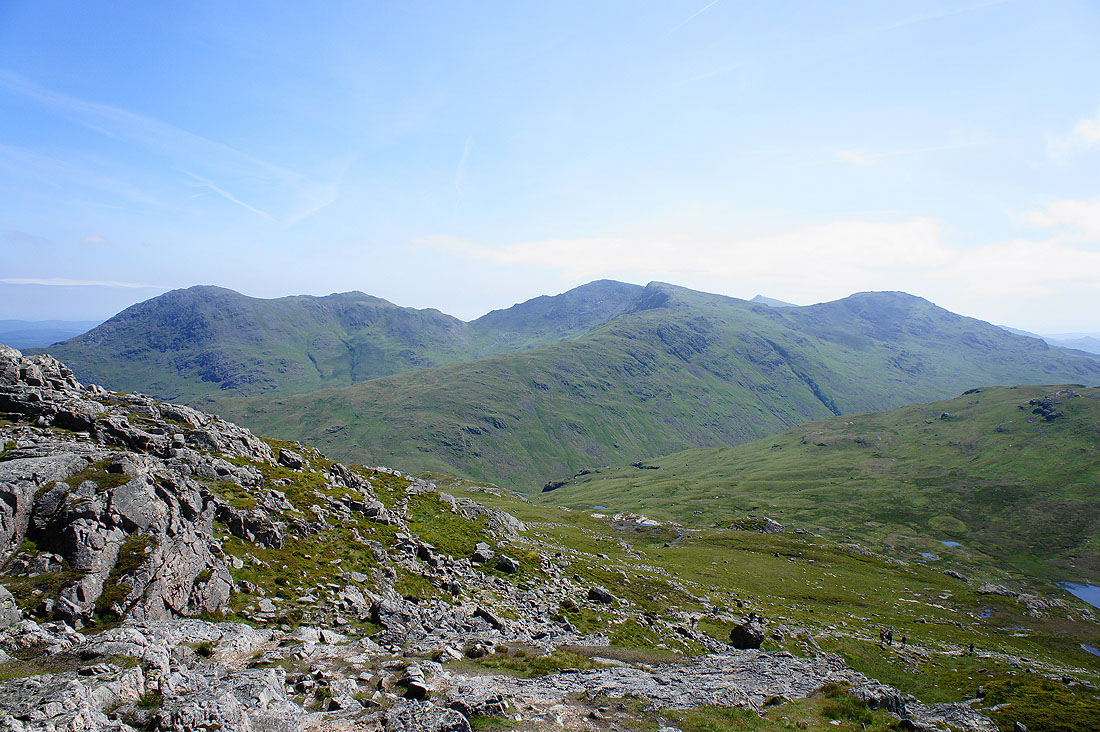
Wetherlam, Swirl How, Great Carrs, a tiny bit of Dow Crag and Grey Friar
Lots of interesting boulders to pass as I head for Blake Rigg
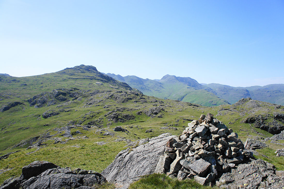
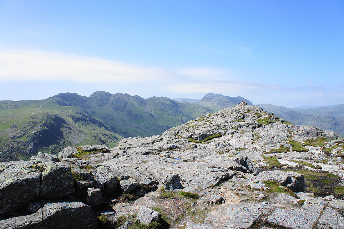
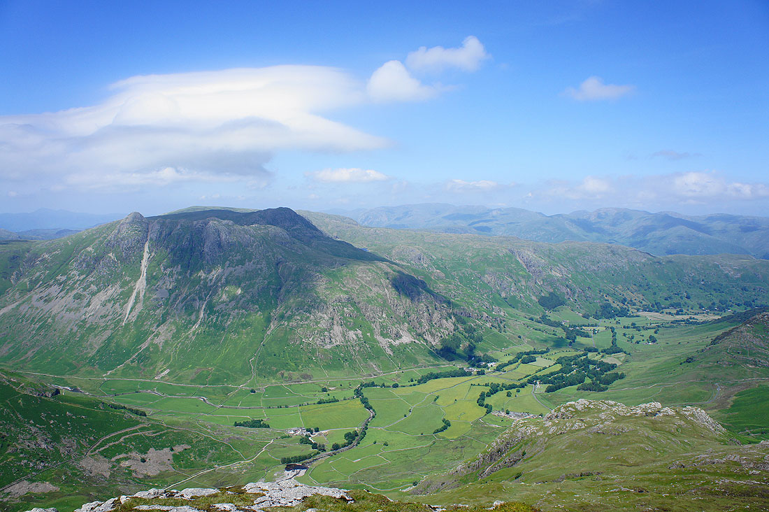
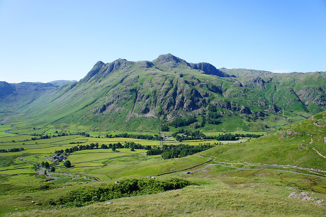
Pike o'Blisco, the Crinkle Crags and Bowfell from the cairn on Blake Rigg
The Langdale Pikes
Side Pike and Lingmoor Fell, then Blea Rigg, with Helvellyn and Fairfield in the distance
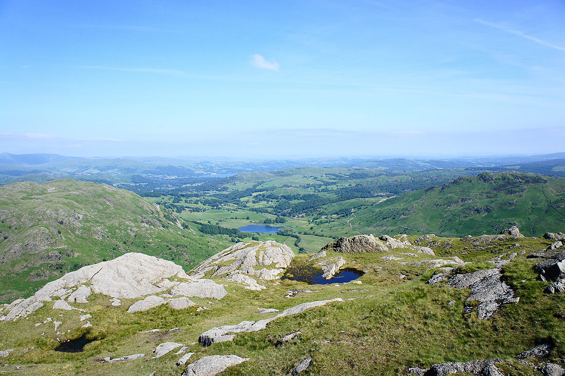
Little Langdale and Little Langdale Tarn below
Wetherlam, Swirl How, Great Carrs, Grey Friar and Wet Side Edge. The road that heads over the Wrynose Pass can be seen below.
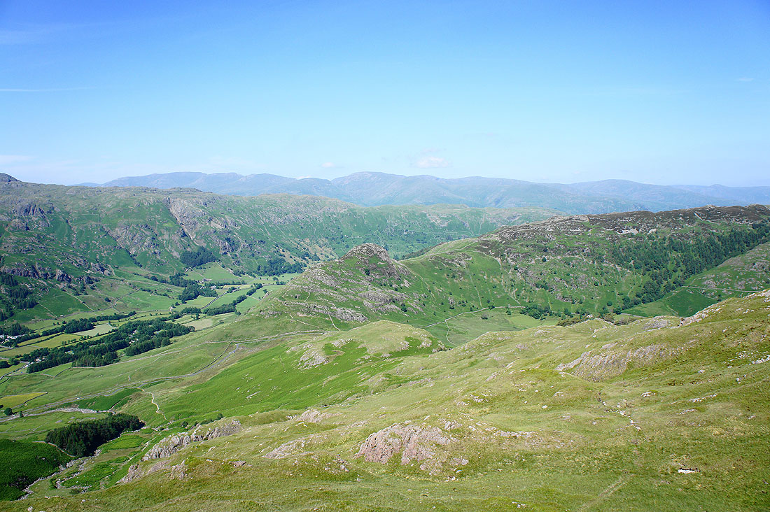
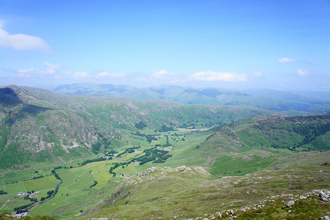
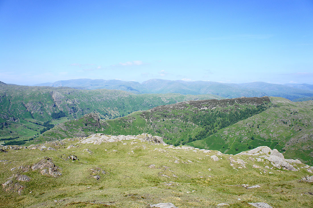
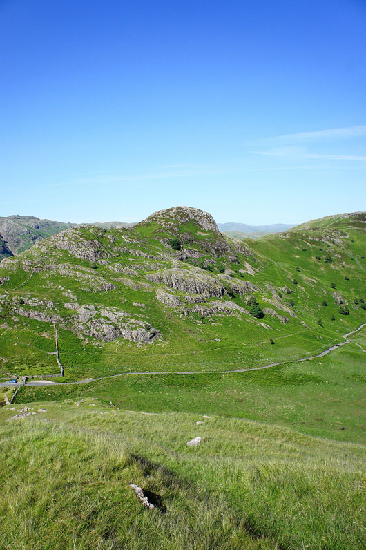
The path I'm following down isn't the main one up Pike o'Blisco, that's on the hillside below on the left. I'm heading for the little top below Side Pike on this side of the road from Great Langdale over to Little Langdale. There are great views to be had.
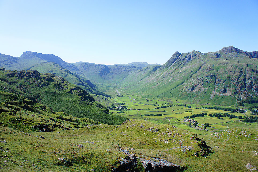
Bowfell and The Band, Mickleden and the Langdale Pikes
The Langdale Pikes of Pike o'Stickle, Loft Crag, Harrison Stickle and Pavey Ark
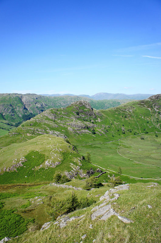
Side Pike and the rocky top below where I'm ultimately heading for
Some shots from that top. Bowfell and The Band, Mickleden and the Langdale Pikes.
Couldn't resist another one of the Langdale Pikes
Blea Tarn
The rocky knuckle of Side Pike
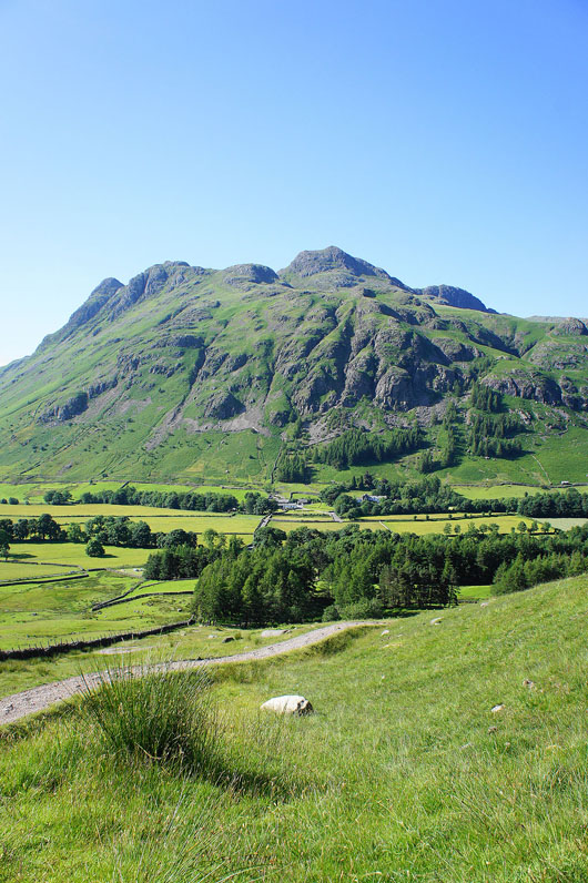
The Langdale Pikes as I head down to walk through the NT camp site
The Crinkle Crags, Bowfell and The Band
Back in Great Langdale with the car park in the trees ahead