6th May 2013 - Steel Knotts & Hallin Fell
Walk Details
Distance walked: 7.6 miles
Total ascent: 2618 ft
OS map used: OL5 - The English Lakes, North-eastern area
Time taken: 5.5 hrs
Route description: St. Peter's Church, Martindale-Steel End-Steel Knotts-St. Martin's Church, Martindale-Howstead Brow-The Lodge-Sandwick-Hallinhag Wood-Kailpot Crag-Geordie's Crag-St. Peter's Church, Martindale-Hallin Fell-St. Peter's Church, Martindale
A real mix of weather for this, my last walk of the Bank Holiday weekend. The second half of the day had the best weather with warm sunshine to enjoy for the walk along the shore of Ullswater and the walk to the top of Hallin Fell.
I started the walk by parking next to the new church of Martindale, St. Peter's, at the top of the zigzags up from Howtown. I set off on a path across the fellside towards Howtown until I reached Steel End, where I then climbed the ridge to the summit of Steel Knotts. After following the ridge down for a short while I turned right and descended into Martindale to reach the old church of St. Martin's. There was then a short walk up the valley before going up onto the ridge of Howstead Brow and Winter Crag. I followed this ridge down to reach the road into Boredale and the road to Sandwick. From the roadend at Sandwick a path took me along the shore of Ullswater and around Hallin Fell back to the start.
After dropping my racksack in my car and changing out of my boots I went to the top of Hallin Fell.
Route map
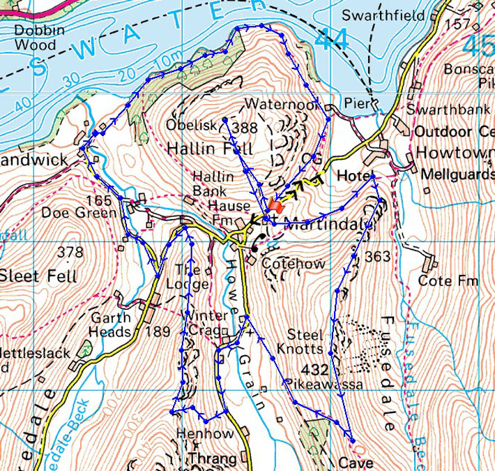
© Crown copyright. All rights reserved. License number PU 100034184.
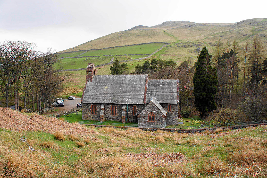
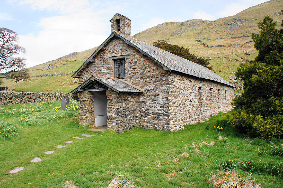
St Peter's, the new church in Martindale and my starting point
Heading up Steel End and Ullswater comes into view
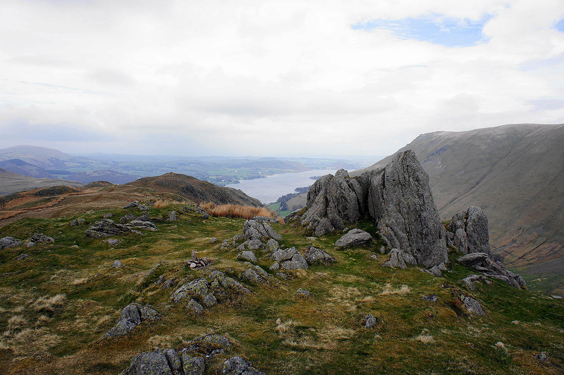
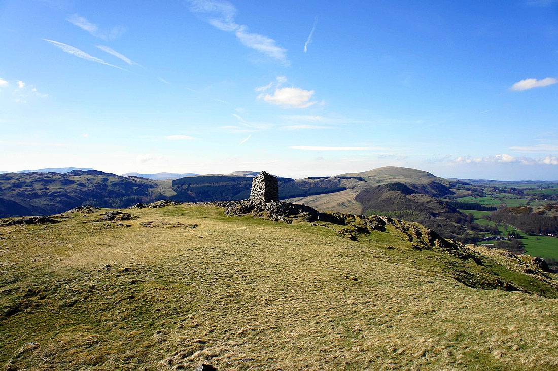
Pikeawassa, the summit of Steel Knotts
Beda Fell on the other side of the valley with Place Fell beyond
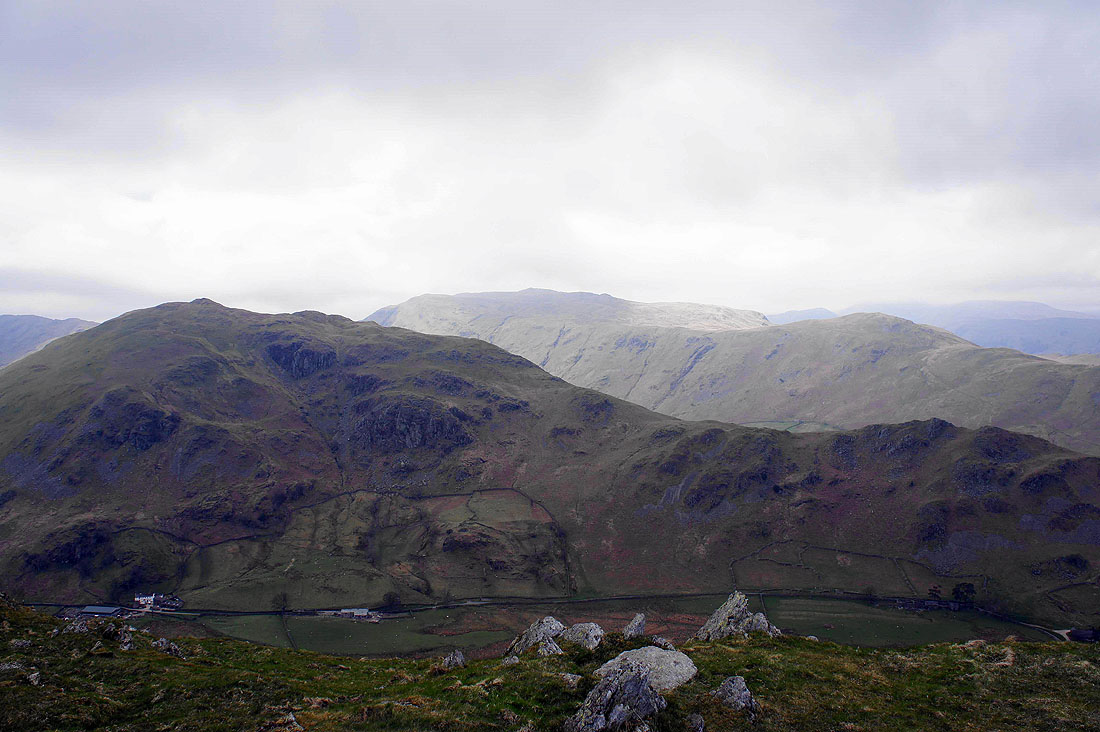
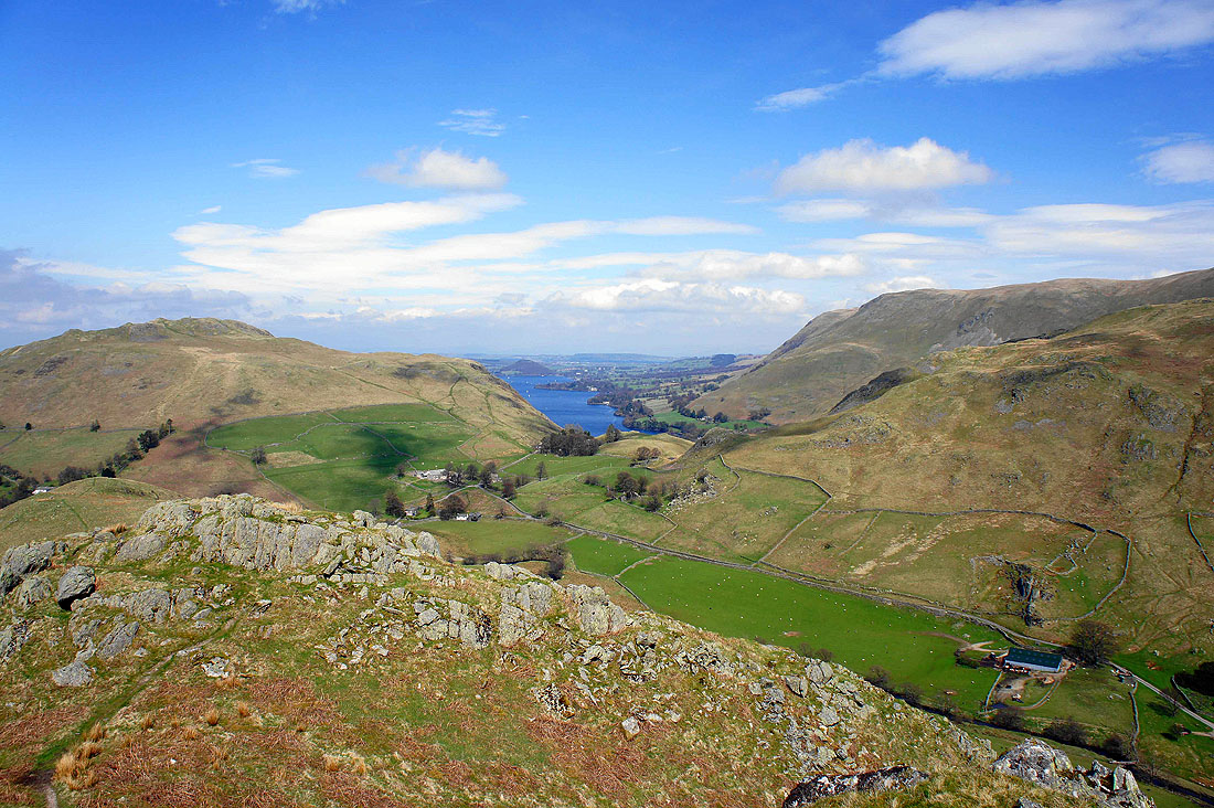
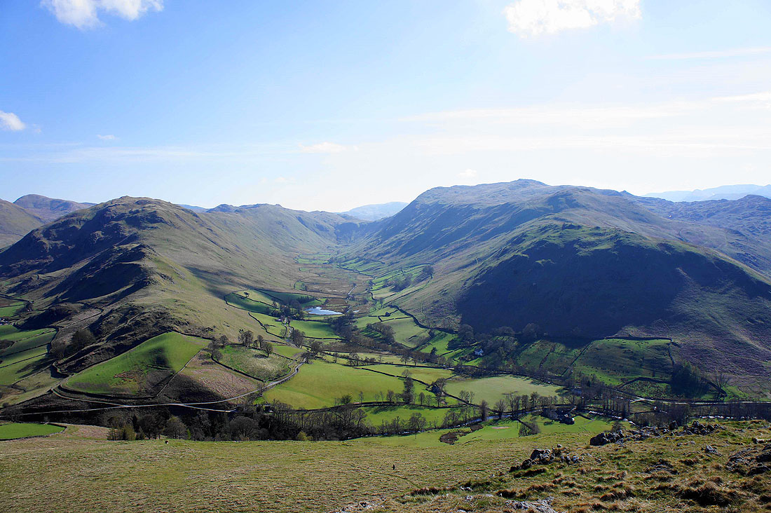
Heading off Steel Knotts with the valley of Howe Grain below. Higher up, the valley splits into Ramps Gill on the left and Bannerdale on the right with the fell of The Nab in between. The cloud is lifting off the fell tops as the weather improves.
Heading back down into Martindale
Down in the valley and the cloud has cleared the fell tops and the sun is putting in an appearance
The old church of St. Martin's
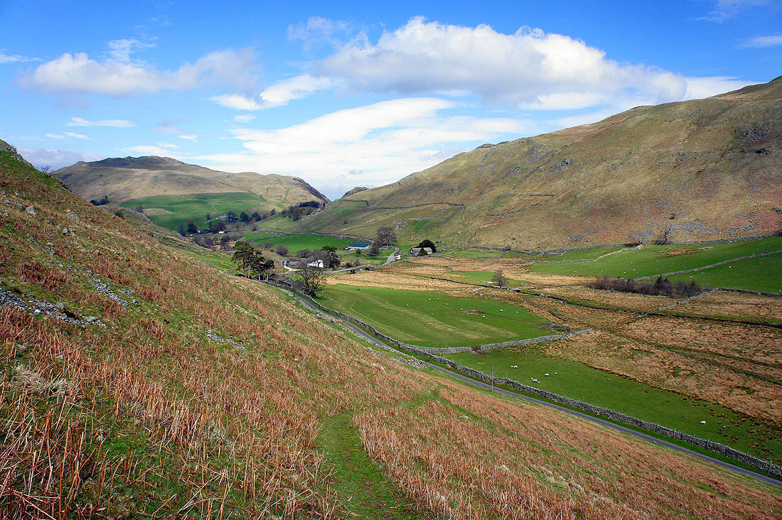
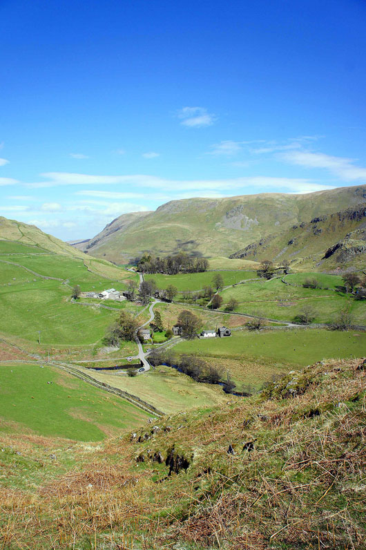
Looking back at Martindale as I head up onto the ridge of Howstead Brow
On Howstead Brow
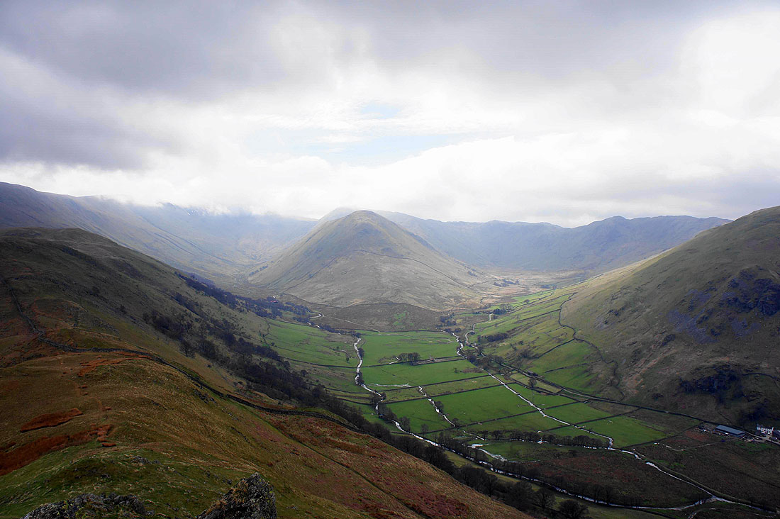
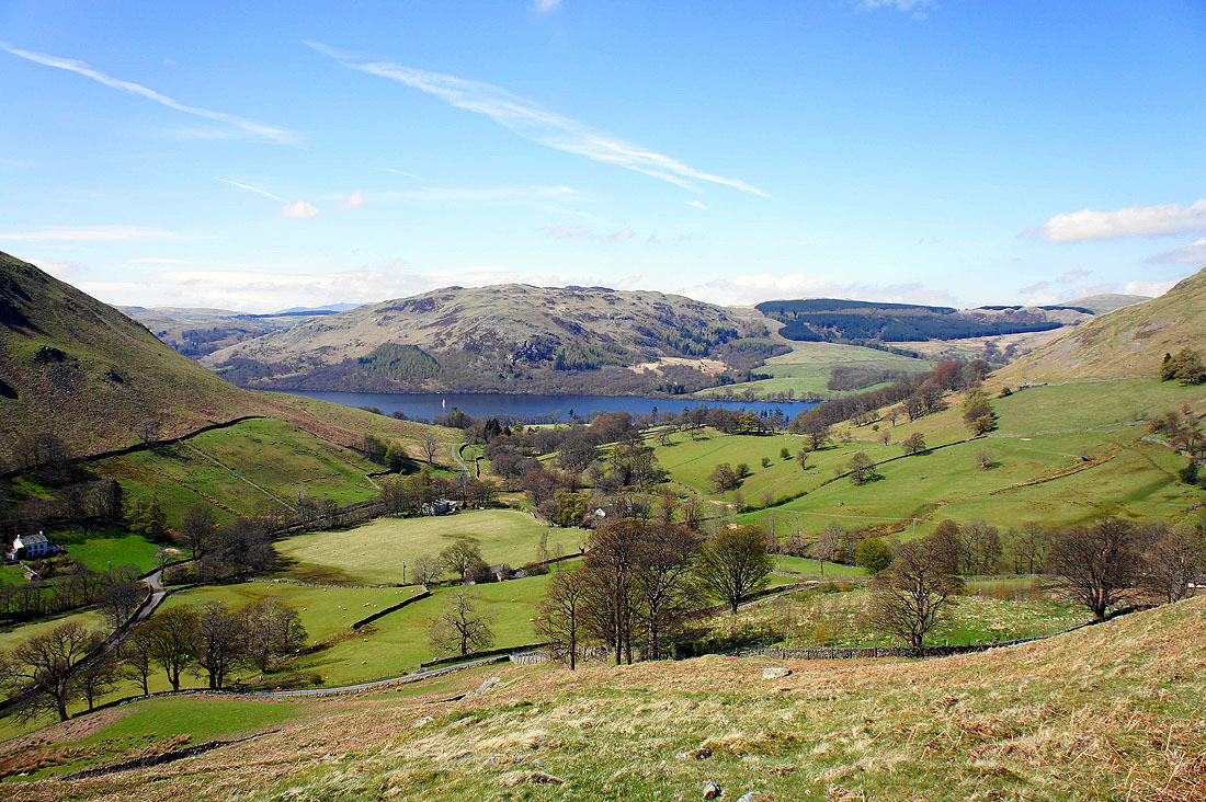
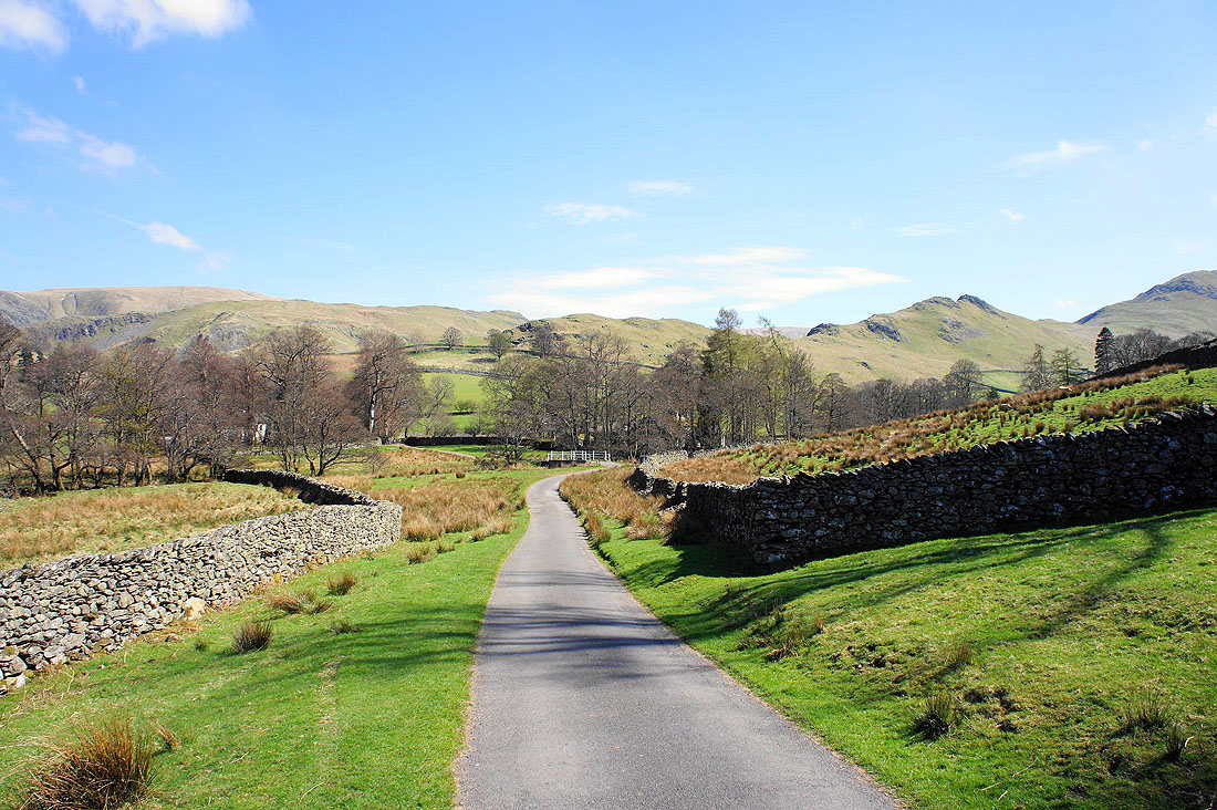
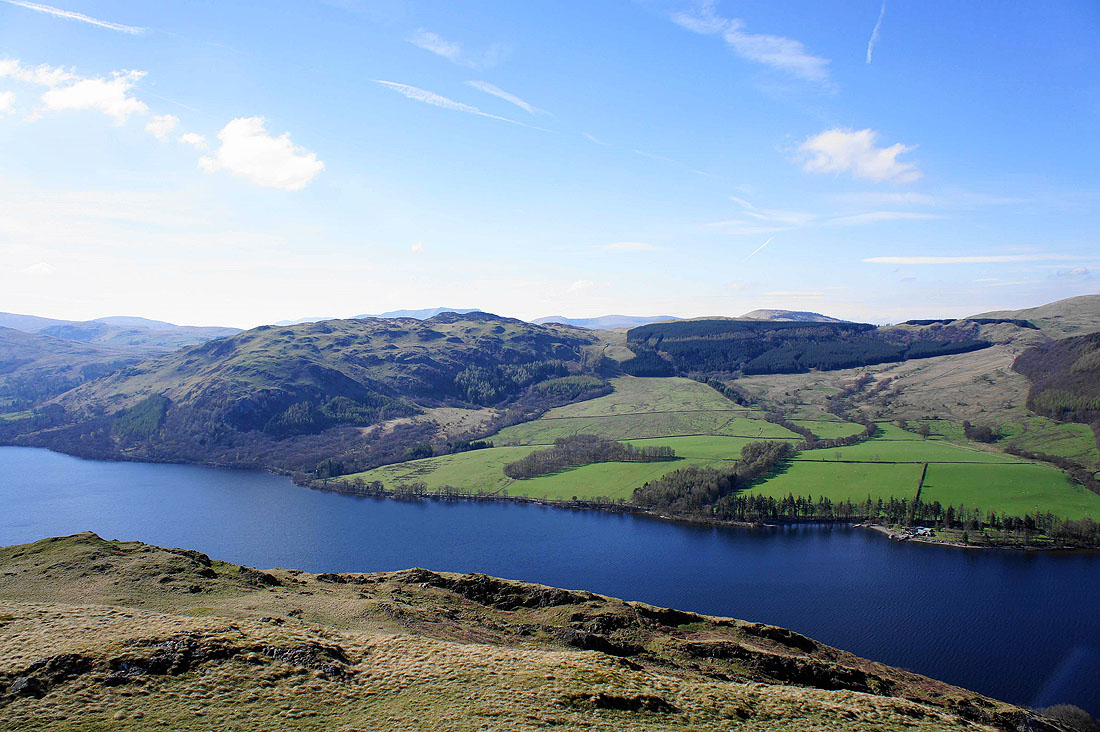
Boredale below as it heads for Sandwick
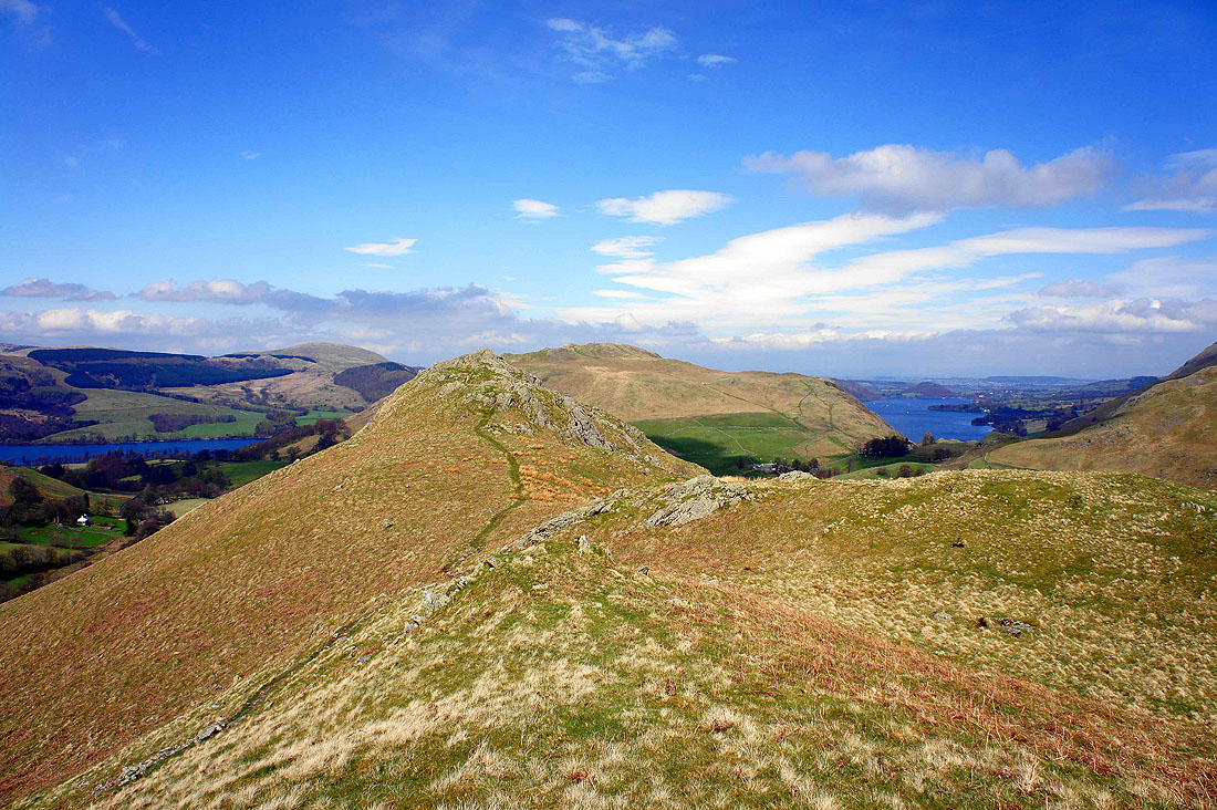
Hallin Fell on the left and Steel End on the right
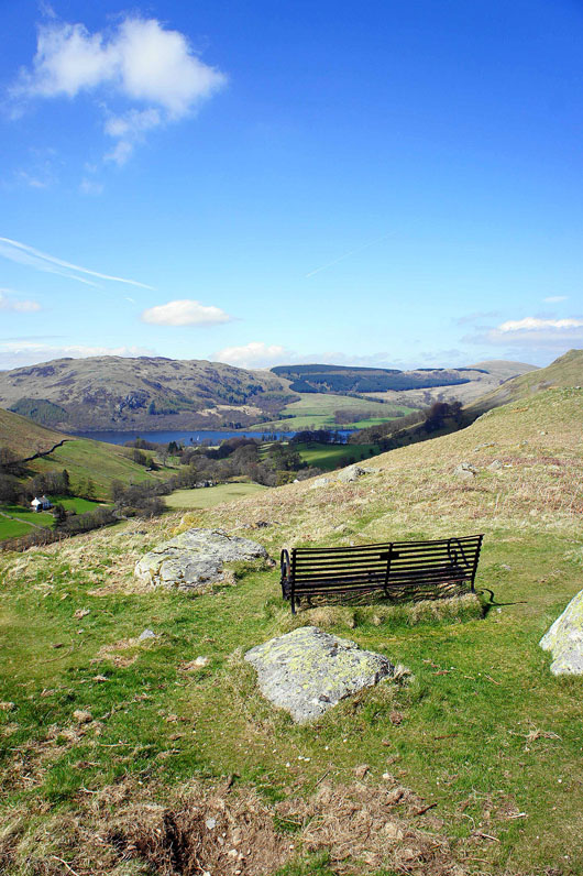
Take the weight off your feet and enjoy the view
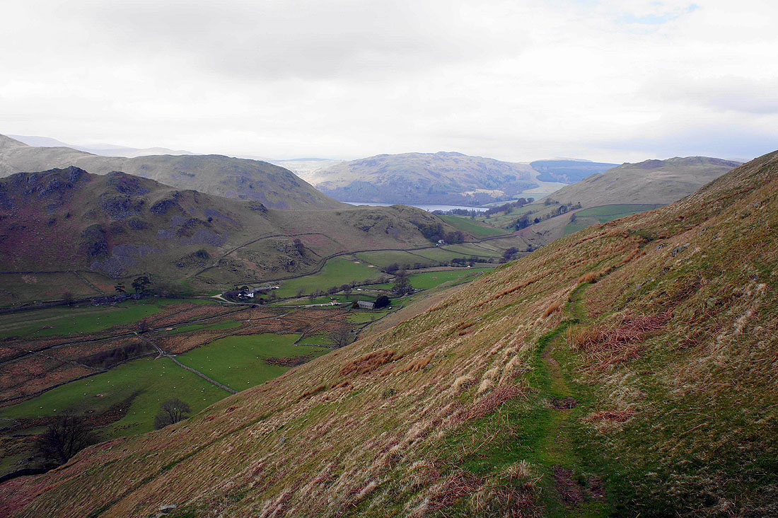
Looking across to The Hause with the fell of Bonscale Pike in the background
Heading down to Sandwick. Gowbarrow Fell is on the other side of Ullswater.
A retrospective view from the road to Sandwick. The ridge of Howstead Brow is on the right.
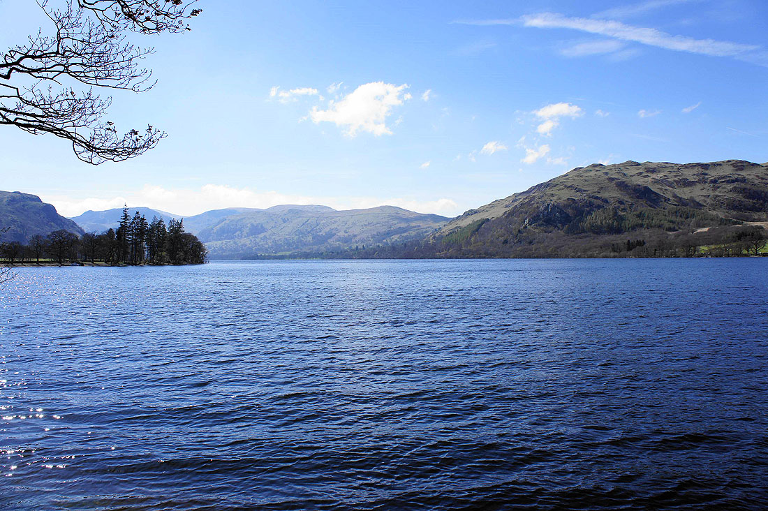
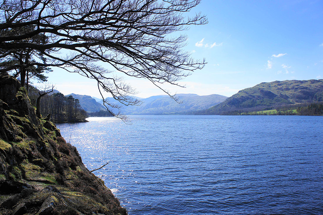
By Ullswater at Sandwick Bay..
Gowbarrow Fell across the water
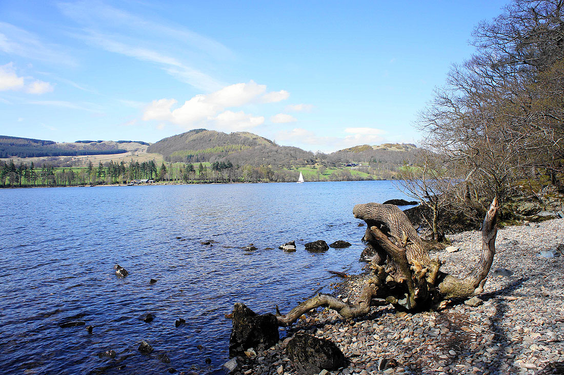
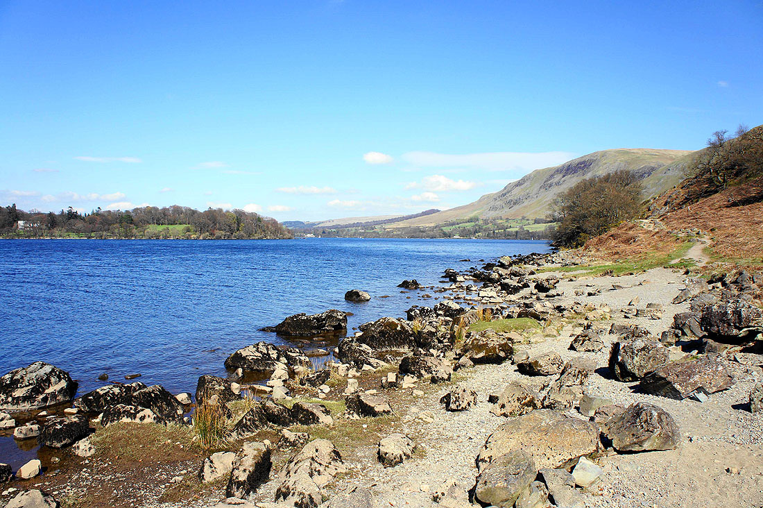
On Kailpot Crag looking up the lake..
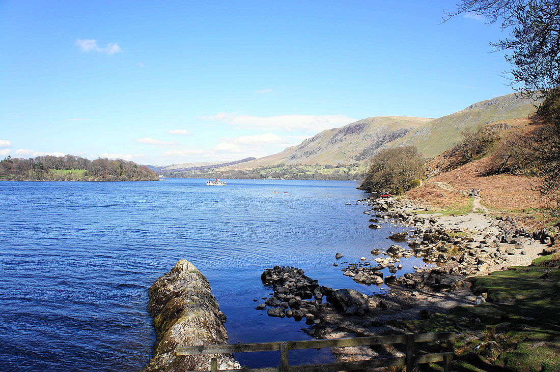
..and down with the slopes of Arthur's Pike and Bonscale Pike on the right
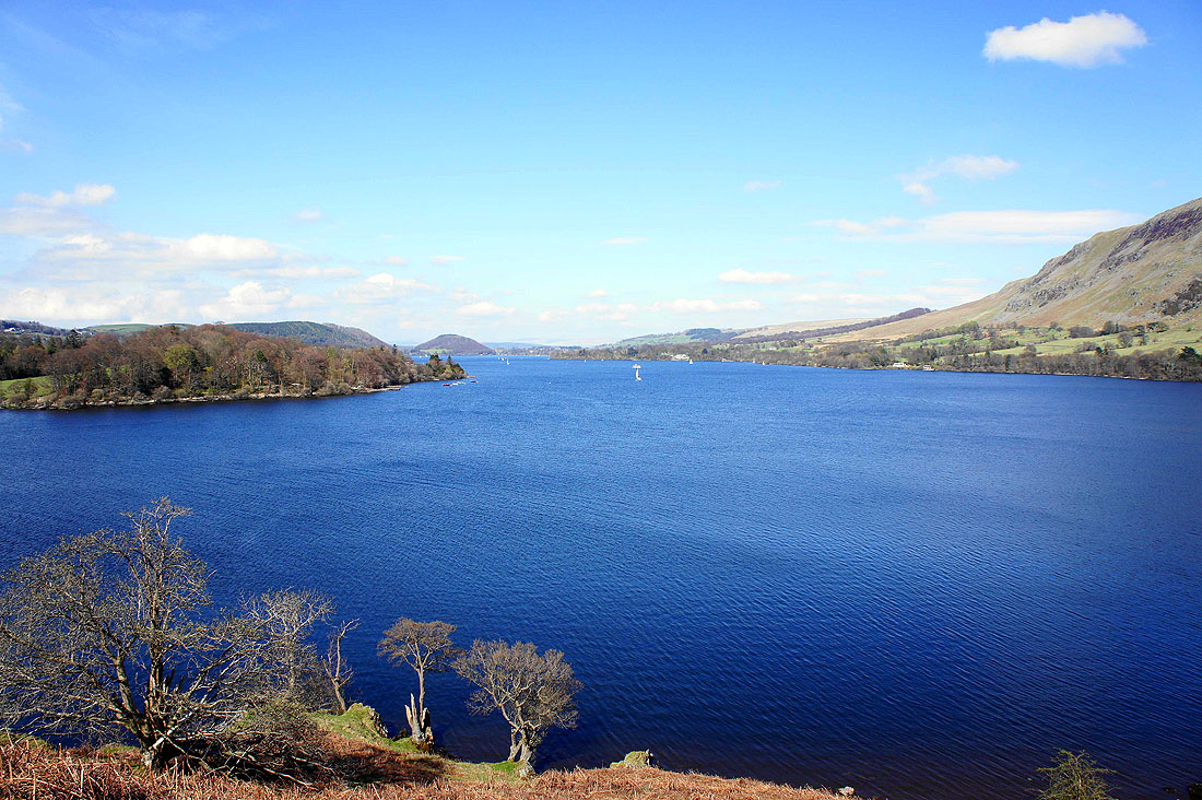
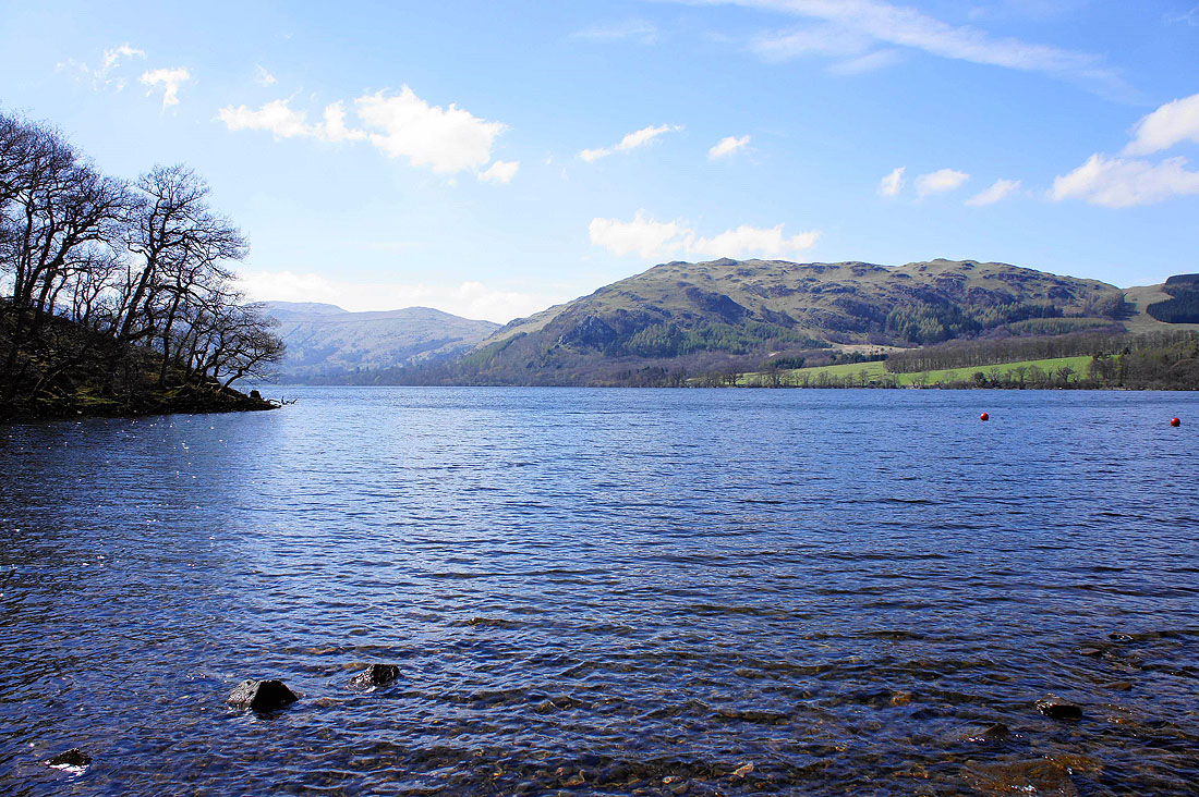
The last lakeside shot from Geordie's Crag. Dunmallard Hill can be seen at the foot of the Ullswater.
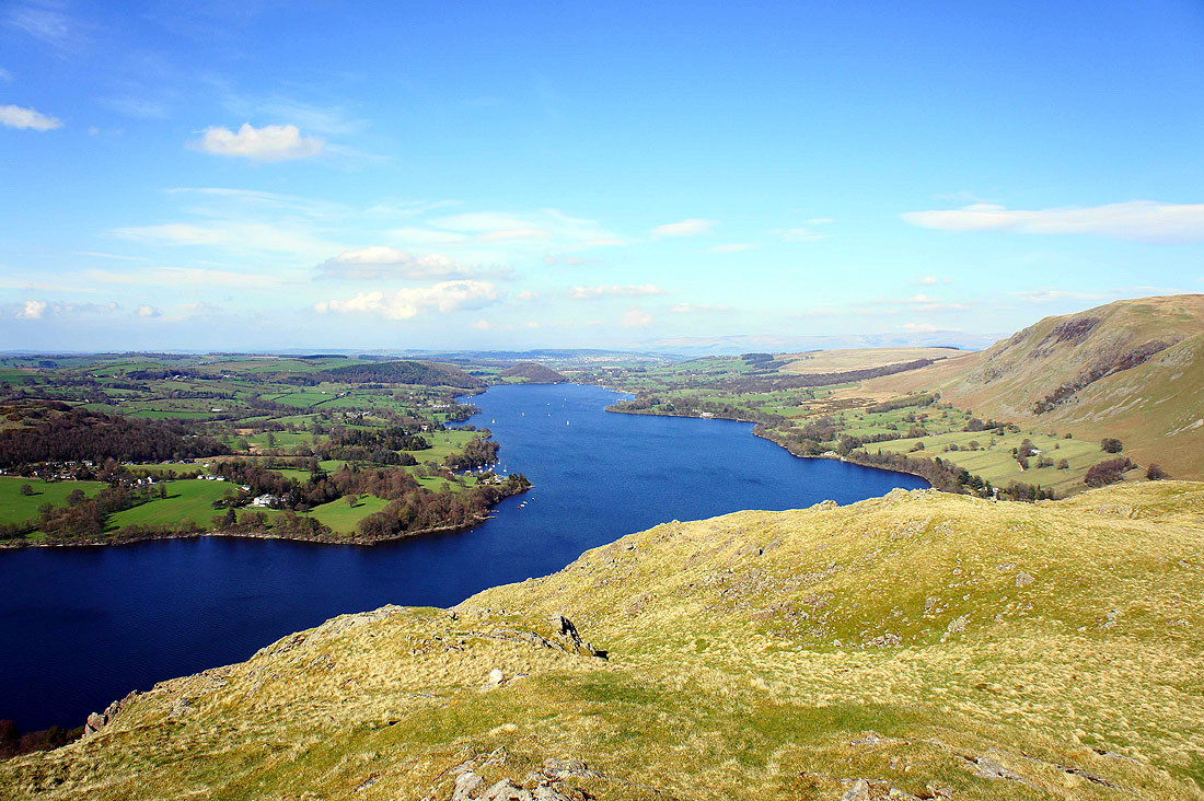
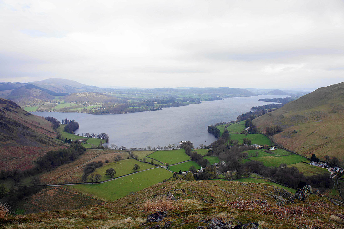
Views from the top of Hallin Fell. Looking down Ullswater towards Pooley Bridge.
Gowbarrow Fell and Swinburn's Park
Gowbarrow Fell, Swinburn's Park and Little Mell Fell behind the obelisk that marks the top of Hallin Fell
Place Fell with Helvellyn and the Dodds in the distance on the right
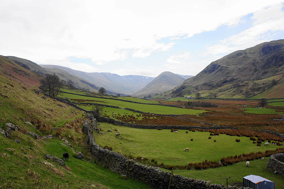
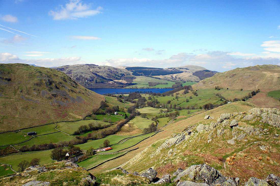
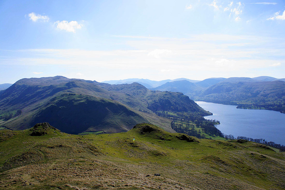
The valley of Boredale with Beda Fell on the left and Place Fell on the right
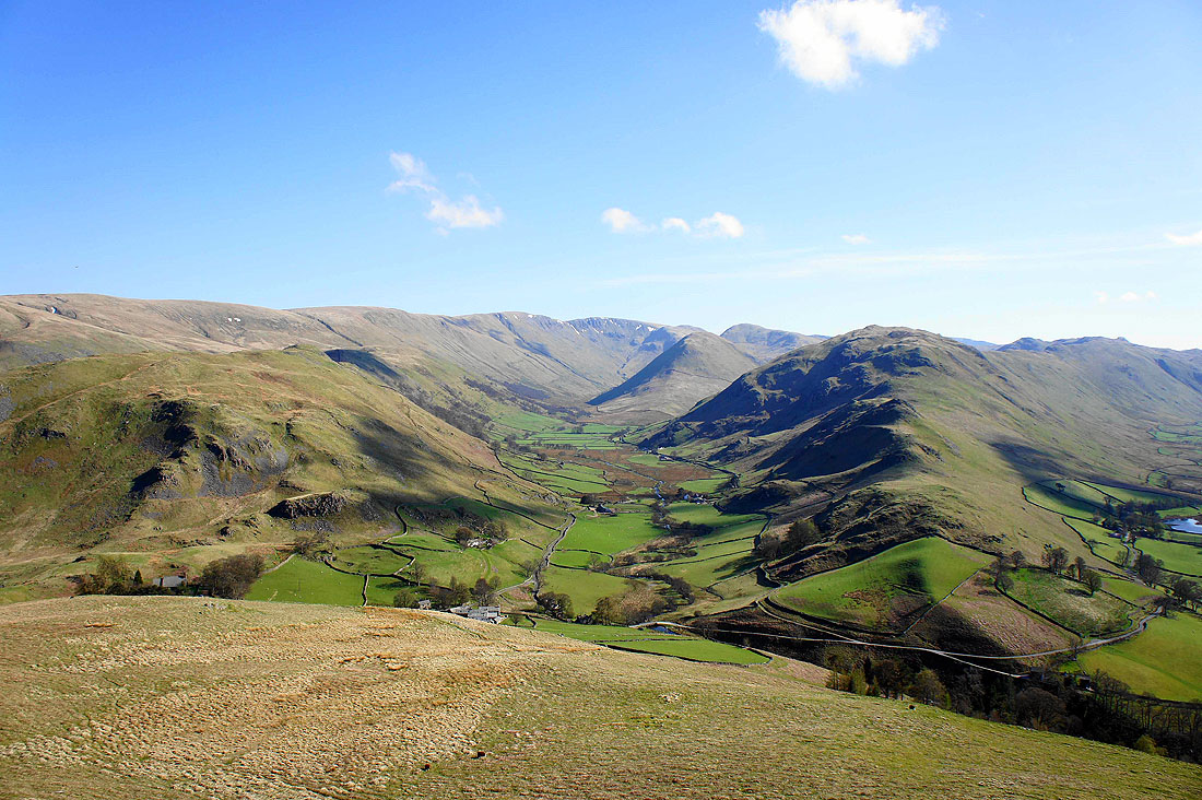
Howe Grain is the valley below. Steel Knotts on the left leads up to Wether Hill, High Raise, Rampsgill Head, The Nab and Rest Dodd at the head of the valley. Beda Fell is on the right.
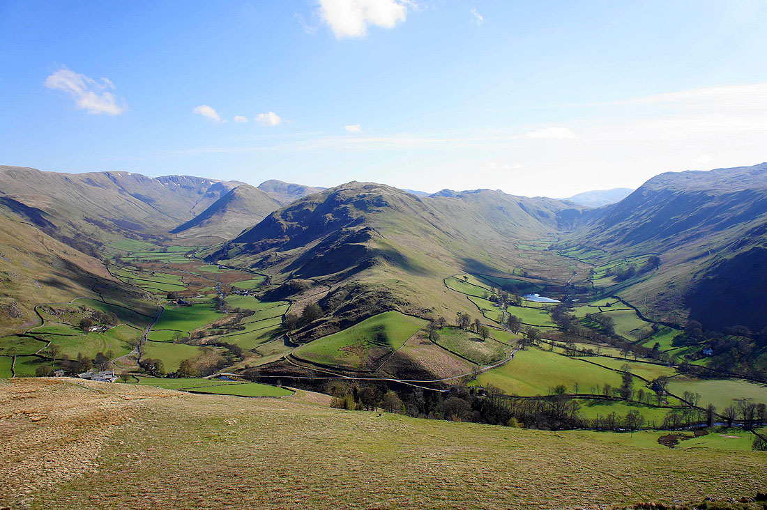
A final shot before I head down of both valleys separated by Beda Fell