7th June 2016 - Elgol & Strathaird
Walk Details
Distance walked: 11.0 miles
Total ascent: 2220 ft
OS map used: 411 - Skye, Cuillin Hills
Time taken: 6 hrs
Route description: Elgol-Cladach a Ghlinne-Camasunary-Am Mam-B8083-Kilmarie-Drinan-Glasnakille-Elgol
After yesterdays exertions I definitely needed something more relaxing today especially since the weather was still warm and humid. There was a change in the forecast overnight with some showery rain moving up the west coast of Scotland, I expected it to pass through at some point late in the morning or early in the afternoon. In the end it didn't amount to too much with just a couple of hours of grey skies and a shower that I ended up missing because I was sat in a bothy having my lunch. My walk today was a route based on combining two walks from my guide book into one that started from Elgol and visited the coast on both sides of the Strathaird peninsula. I thoroughly enjoyed it. I think I'm going to love Skye for its coastal scenery as much as for its mountains, or maybe it's the combination of both that is special.
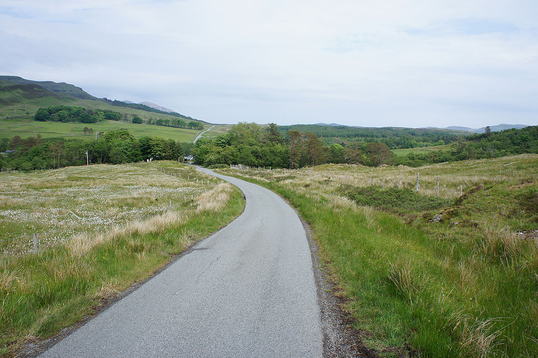
From where I'd parked in Elgol I briefly walked up the B8083 to a private road that's signposted for the path to Camasunary. At the end of the road a path strikes north along the hillside above the shoreline. It comes down to the coast at Cladach a Ghlinne before taking to the hillside again to eventually arrive at Camasunary. It's quite narrow in places and requires a bit of care. After taking lunch in the bothy at Camasunary I took the track that heads east over the moor at Am Mam and down to the B8083 Elgol road. I had a brief walk north along this before turning right to take the road past Kilmarie to the coast. The road comes to an end at a cottage and from here a clear path and at times track runs south along the hillside above the coast. It meets up with a road for a time before becoming a track again and passing through some woodland. Past the woods and the track met a road that brought me to the hamlet of Glasnakille. My walk finished with following the road west from Glasnakille across the moor and back to Elgol (with a diversion to a trig point on the way).
Total ascent: 2220 ft
OS map used: 411 - Skye, Cuillin Hills
Time taken: 6 hrs
Route description: Elgol-Cladach a Ghlinne-Camasunary-Am Mam-B8083-Kilmarie-Drinan-Glasnakille-Elgol
After yesterdays exertions I definitely needed something more relaxing today especially since the weather was still warm and humid. There was a change in the forecast overnight with some showery rain moving up the west coast of Scotland, I expected it to pass through at some point late in the morning or early in the afternoon. In the end it didn't amount to too much with just a couple of hours of grey skies and a shower that I ended up missing because I was sat in a bothy having my lunch. My walk today was a route based on combining two walks from my guide book into one that started from Elgol and visited the coast on both sides of the Strathaird peninsula. I thoroughly enjoyed it. I think I'm going to love Skye for its coastal scenery as much as for its mountains, or maybe it's the combination of both that is special.
From where I'd parked in Elgol I briefly walked up the B8083 to a private road that's signposted for the path to Camasunary. At the end of the road a path strikes north along the hillside above the shoreline. It comes down to the coast at Cladach a Ghlinne before taking to the hillside again to eventually arrive at Camasunary. It's quite narrow in places and requires a bit of care. After taking lunch in the bothy at Camasunary I took the track that heads east over the moor at Am Mam and down to the B8083 Elgol road. I had a brief walk north along this before turning right to take the road past Kilmarie to the coast. The road comes to an end at a cottage and from here a clear path and at times track runs south along the hillside above the coast. It meets up with a road for a time before becoming a track again and passing through some woodland. Past the woods and the track met a road that brought me to the hamlet of Glasnakille. My walk finished with following the road west from Glasnakille across the moor and back to Elgol (with a diversion to a trig point on the way).
Route map
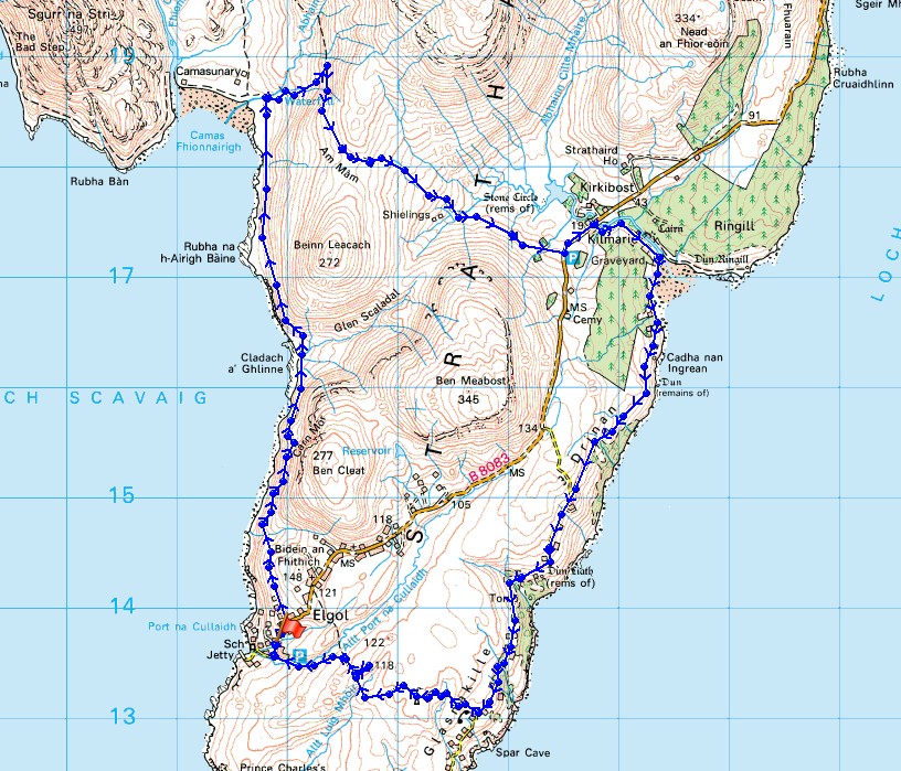
© Crown copyright. All rights reserved. License number PU 100034184.
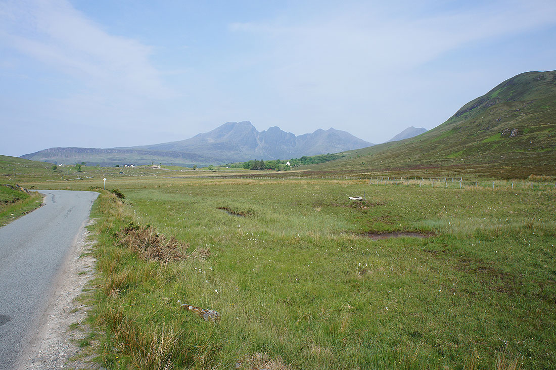
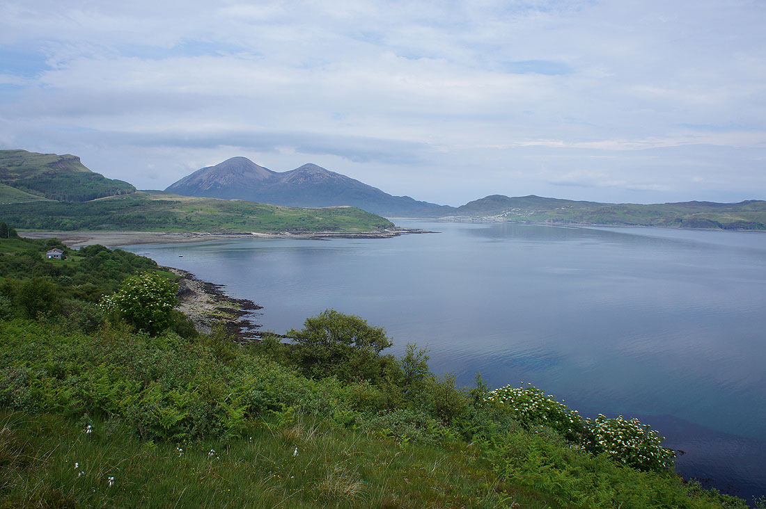
On the drive to Elgol this morning and I had to stop to take in the view of Blabheinn

I particularly liked this one across the head of Loch Slapin
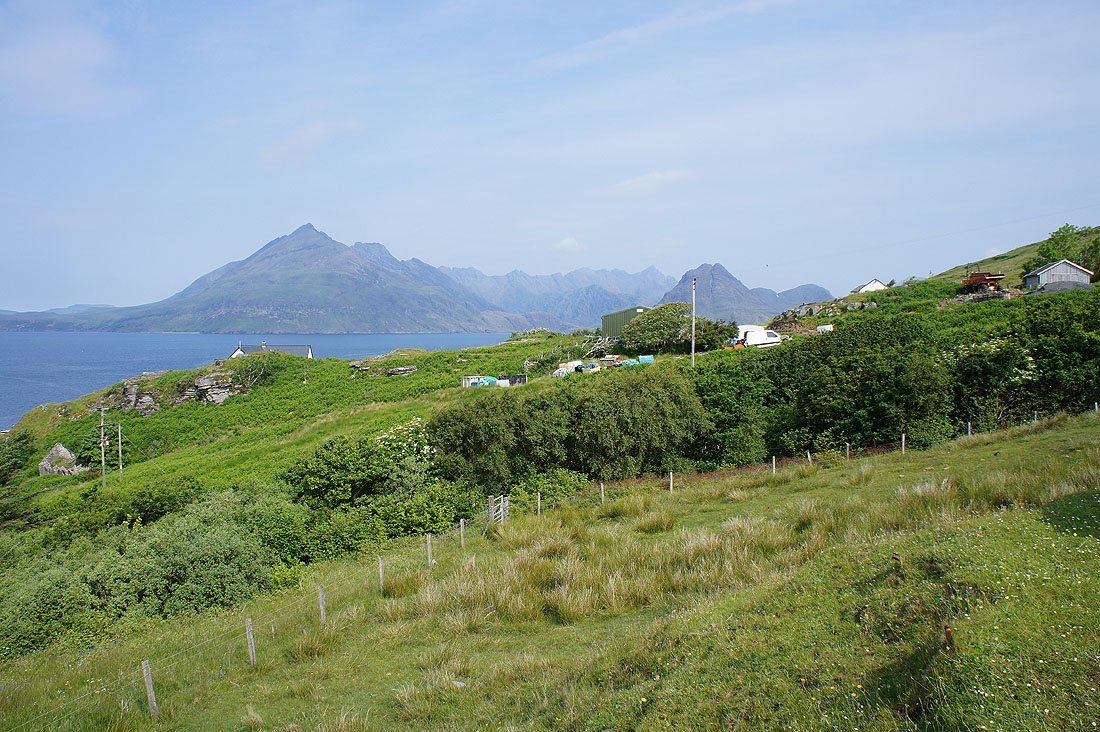
I've arrived in Elgol and this is the view of the Cuillin from where I've parked my car
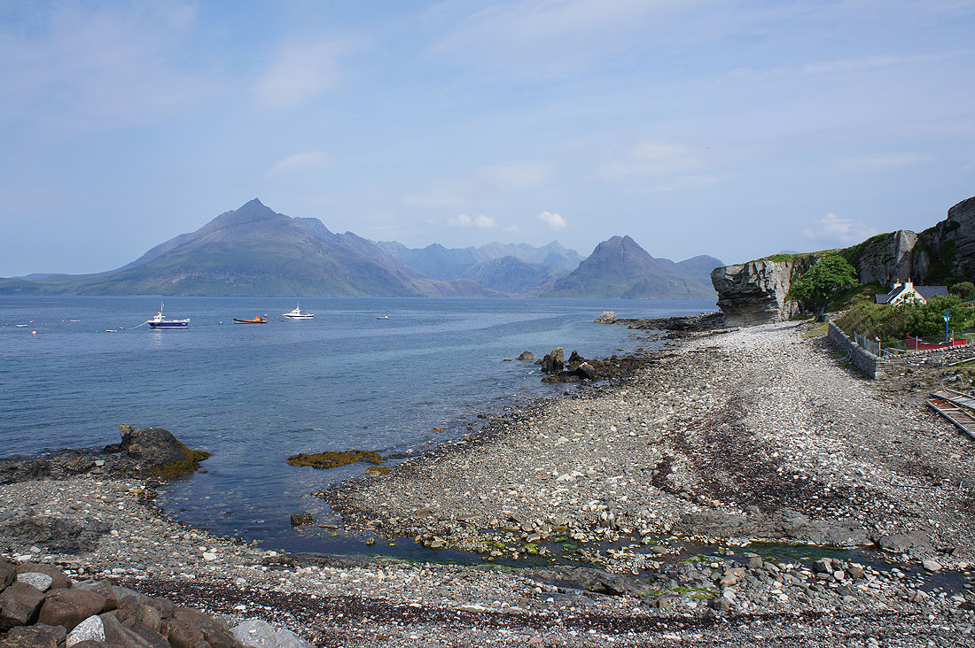
and after walking down to the end of the road at the pier it's even better
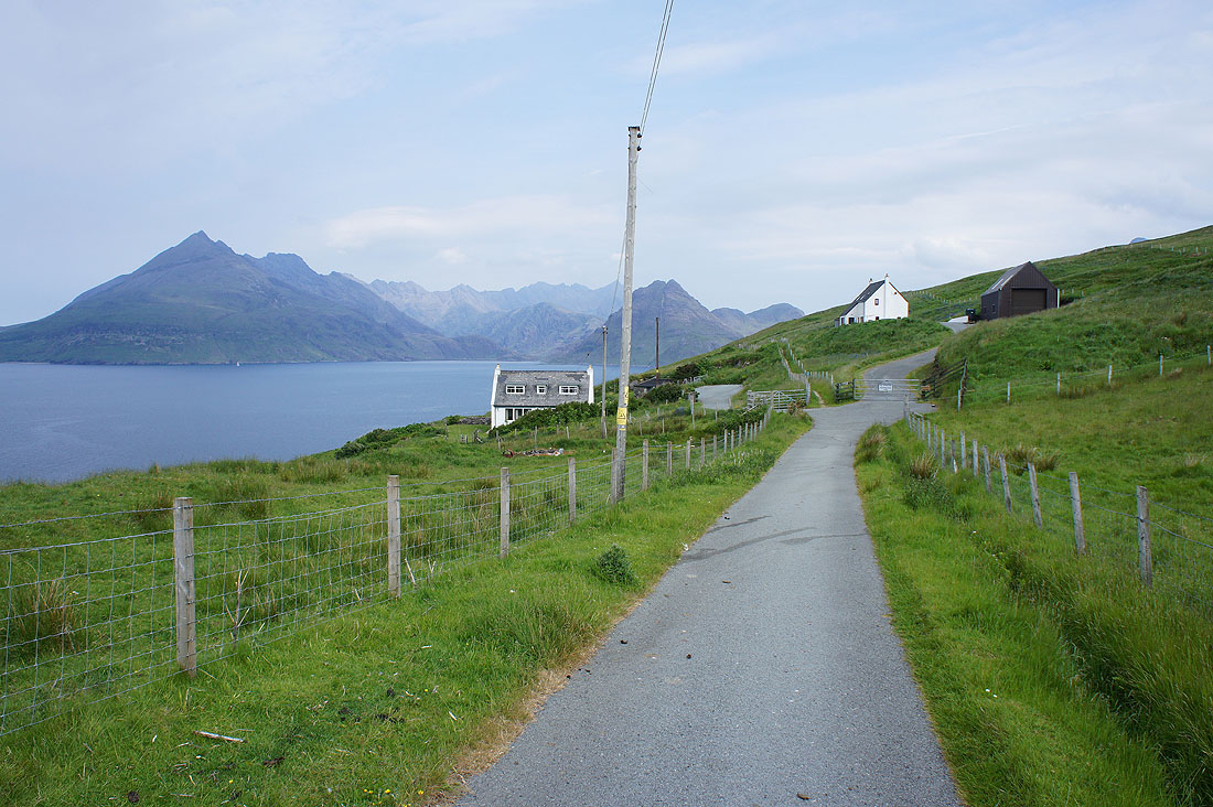
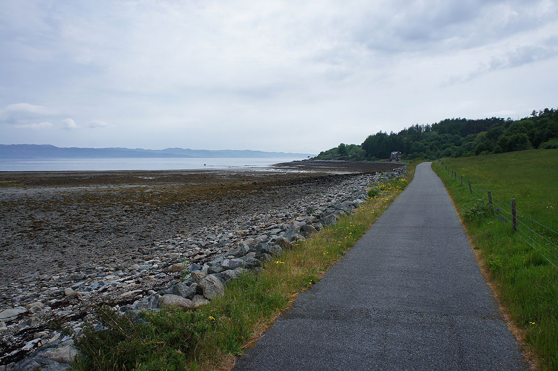
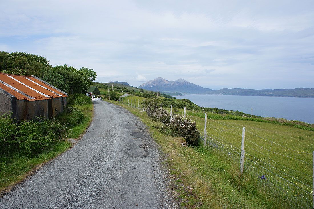
Time to get going. I'm starting with following this private road to its end and onto the path signposted for Camasunary.
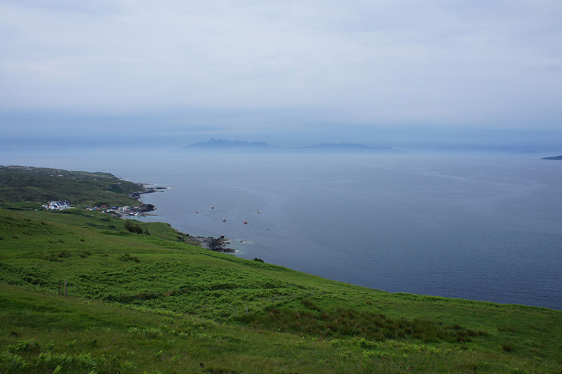
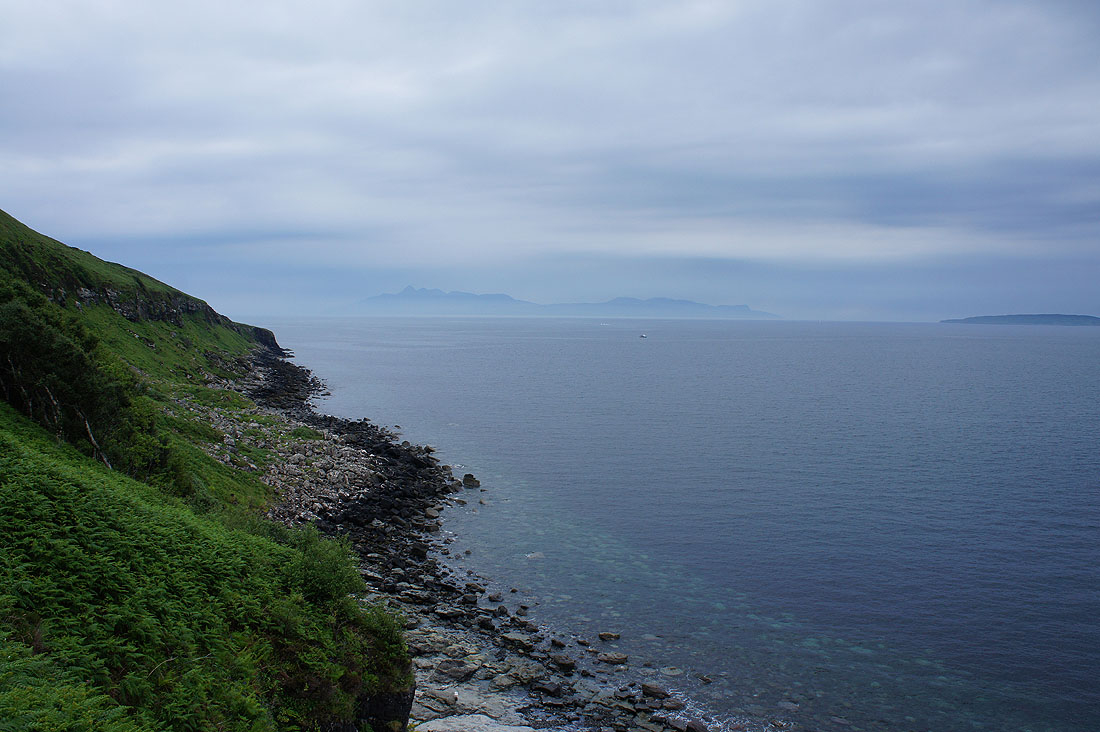
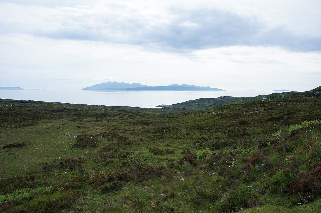
A misty Isle of Rum to the southwest. That's the pier at Elgol below on the left.
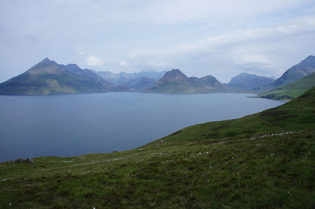
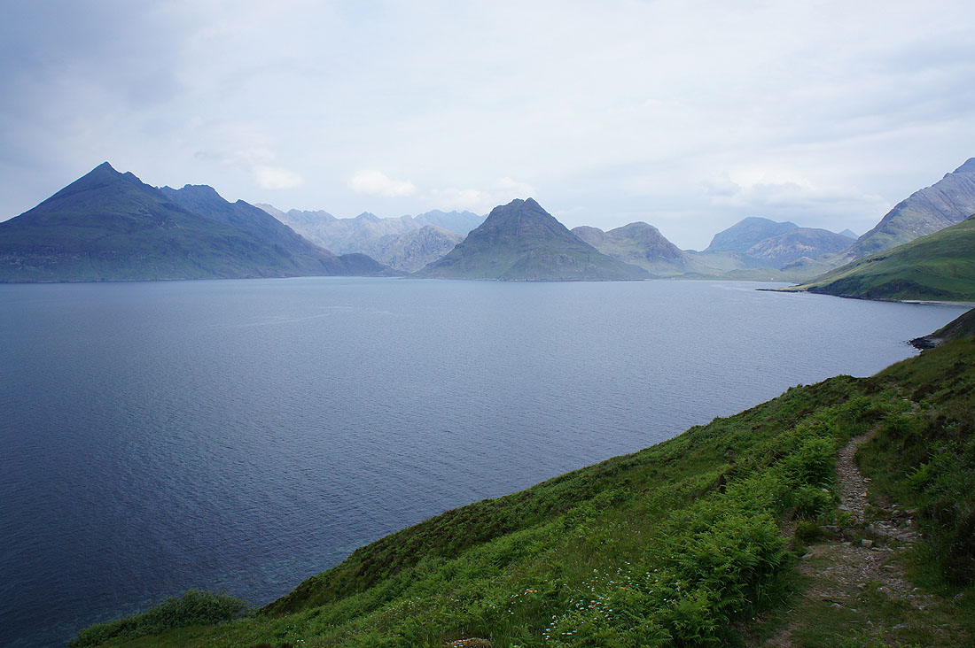
It was this view of the Cuillin across Loch Scavaig that had me transfixed though..
The weather is coming from the direction of Rum and there are certainly some dark clouds over there
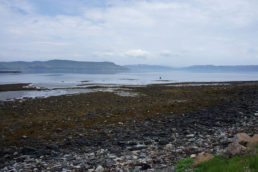
Down by the shore in Glen Scaladal..
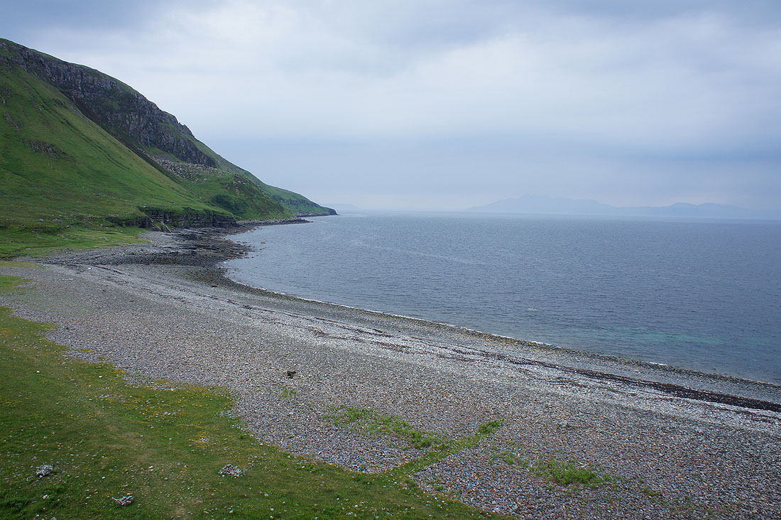
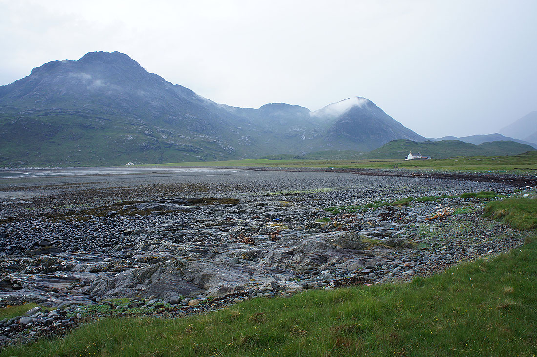
The beach of Cladach a'Ghlinne
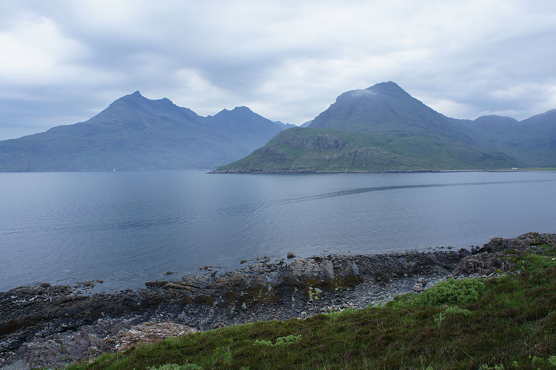
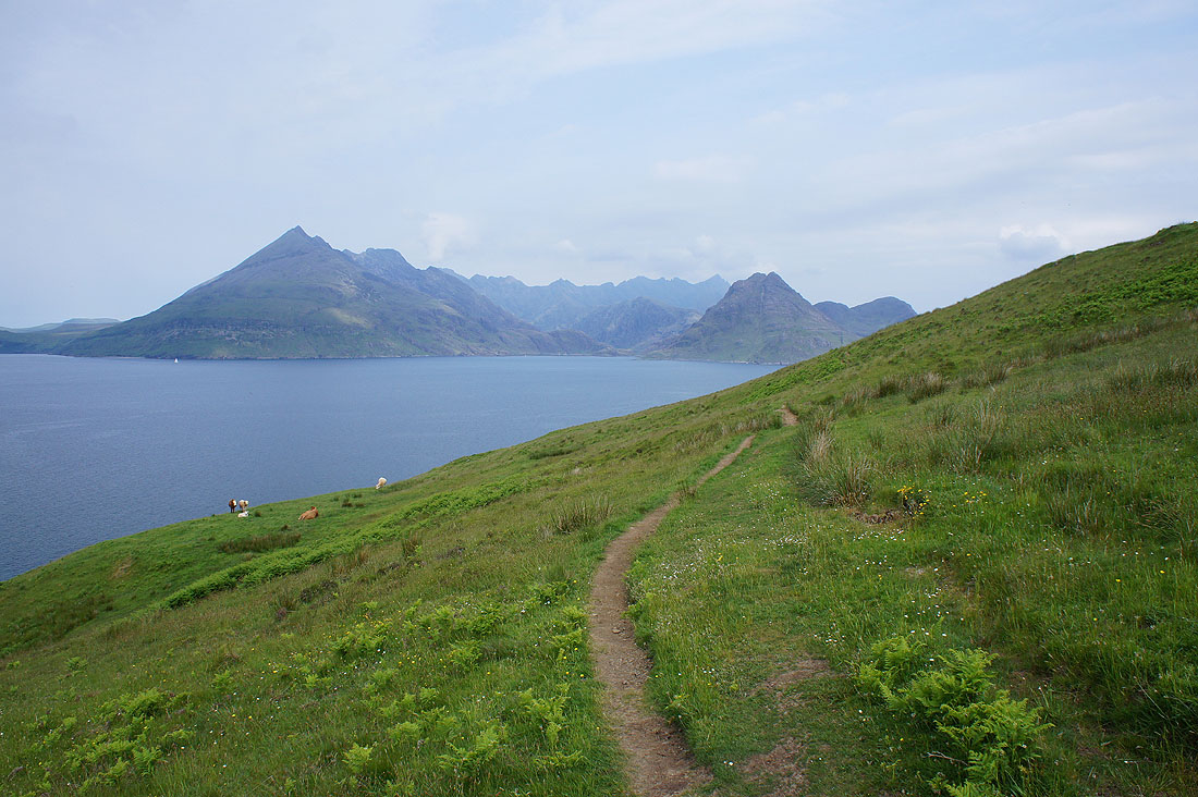
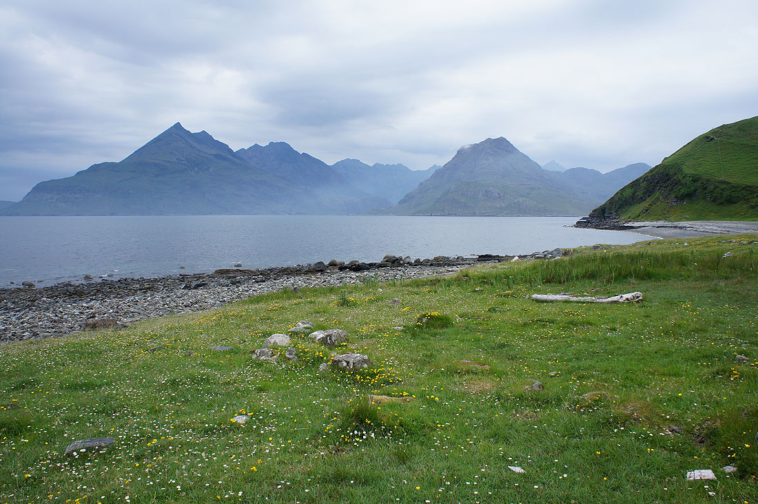
Gars-Bheinn, Sgurr a Choire Bhig and Sgurr nan Eag with Sgurr na Stri closer on the other side of Loch Scavaig
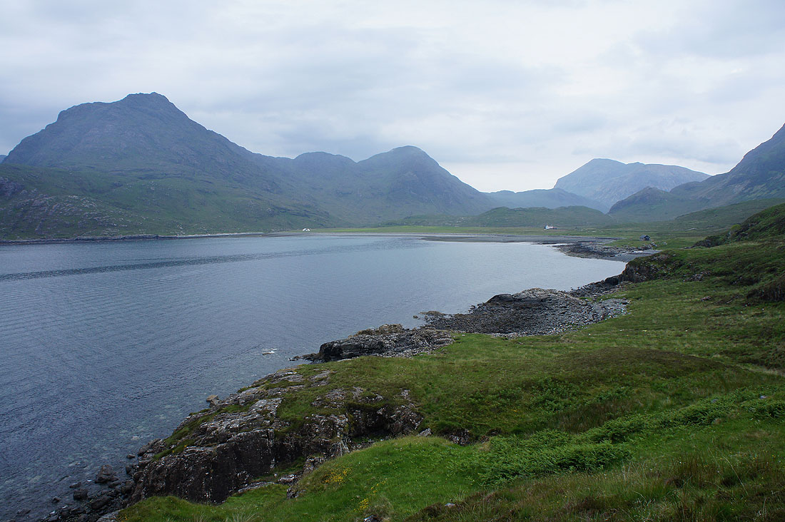
Approaching Camas Fhionnairigh and I can now make out the buildings at Camasunary
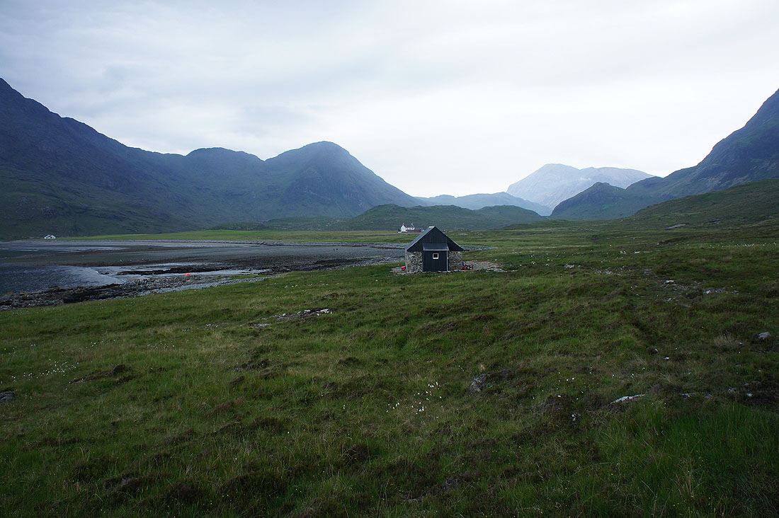
The first one I arrive at though is this bothy which provided shelter while I had my lunch. The only shower of the day passed through as I was sat inside.
Lunch had. I'll continue north to Camasunary to pick up the track I need to follow. Mist around Sgurr na Stri and Sgurr Hain.
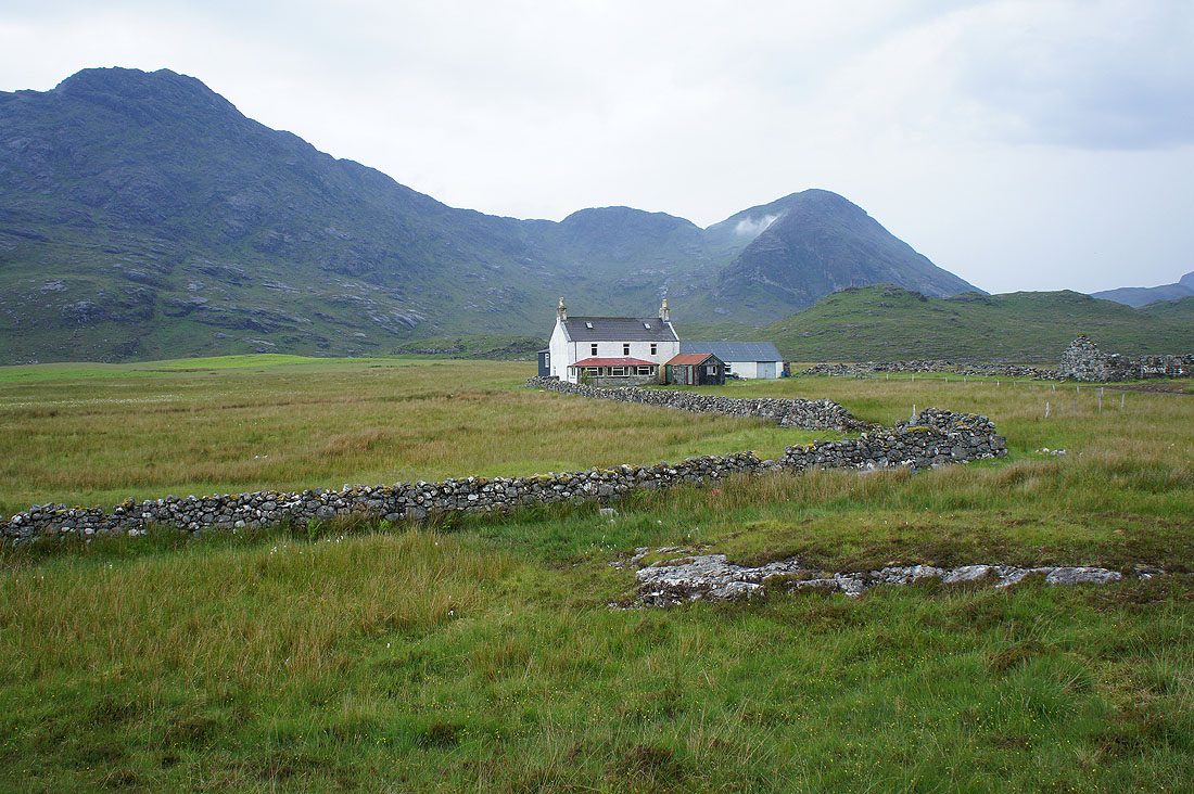
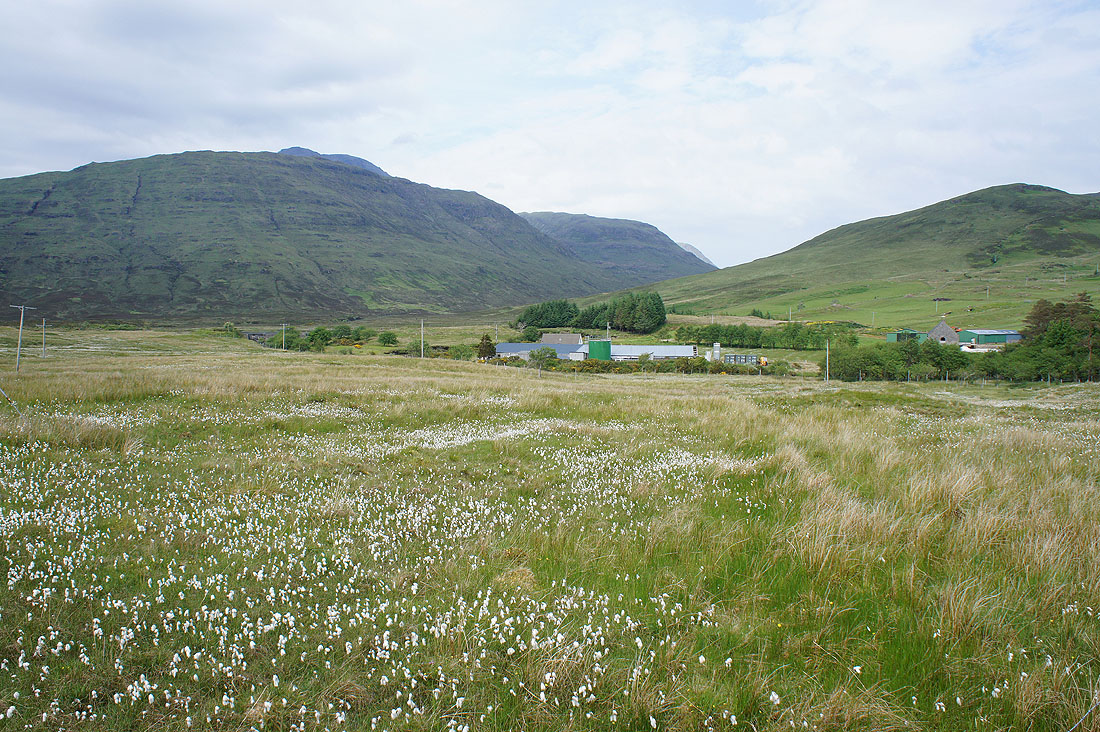
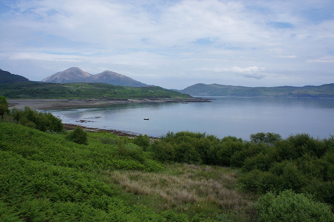
Camasunary. A remote place but what a situation.
The south ridge of Blabheinn rises to a hidden summit
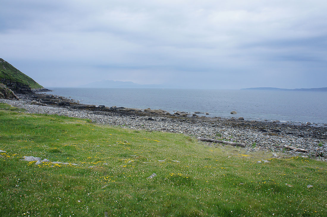
Looking south down Loch Scavaig to Eigg and Rum
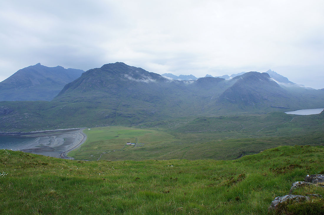
As I near the top of the track over to the other side of Strathaird; Camasunary and a bit of Loch na Creitheach on the right, Sgurr na Stri and Sgurr Hain with the Cuillin behind
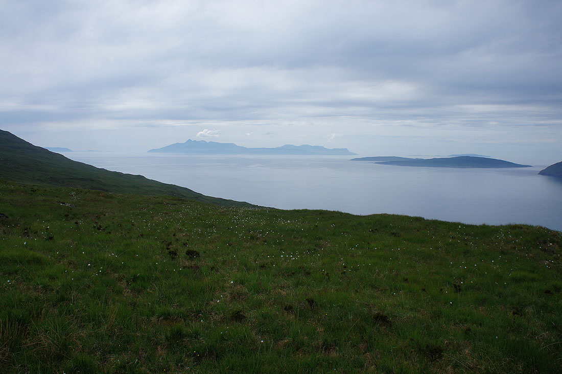
Brighter skies over Rum now. The two islands on the right are Soay just off the coast of Skye, with Canna behind it.
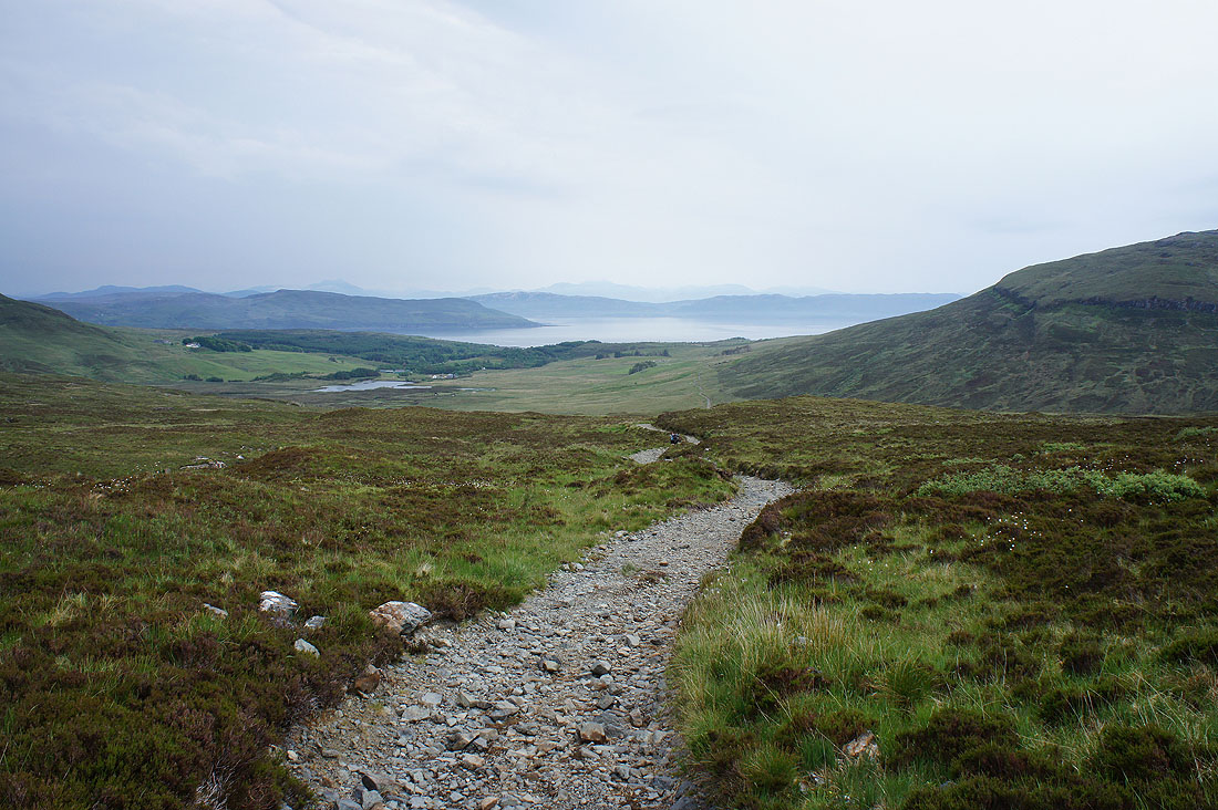
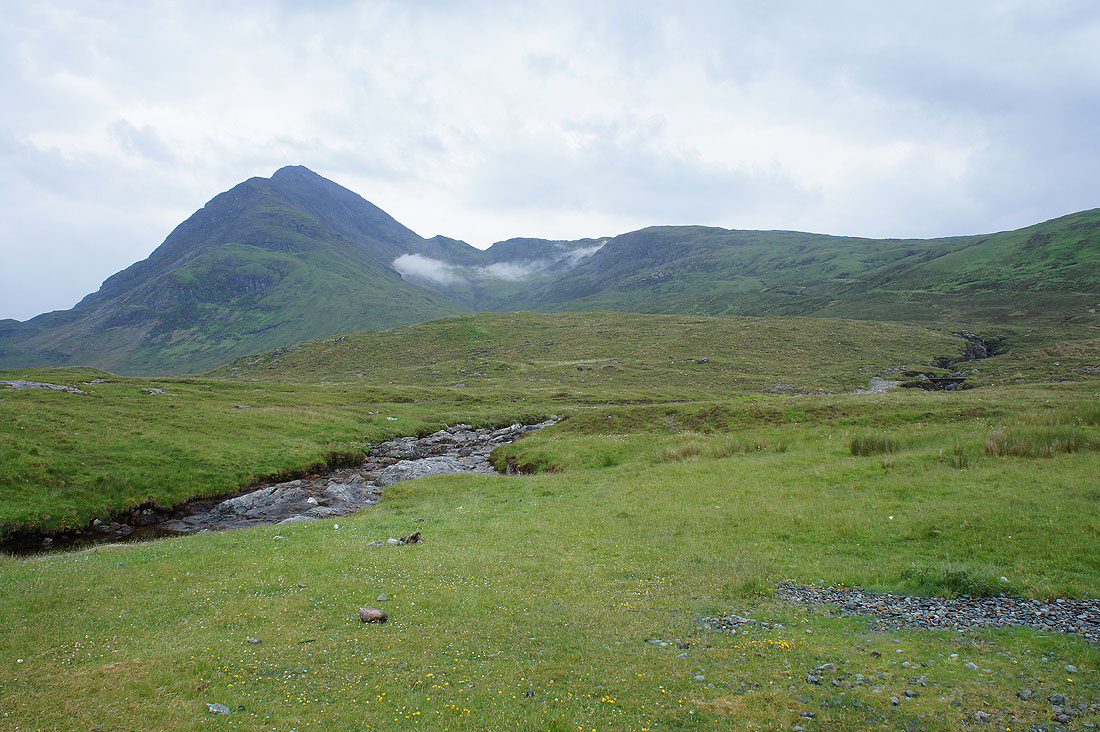
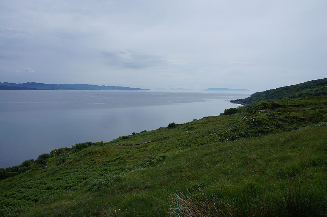
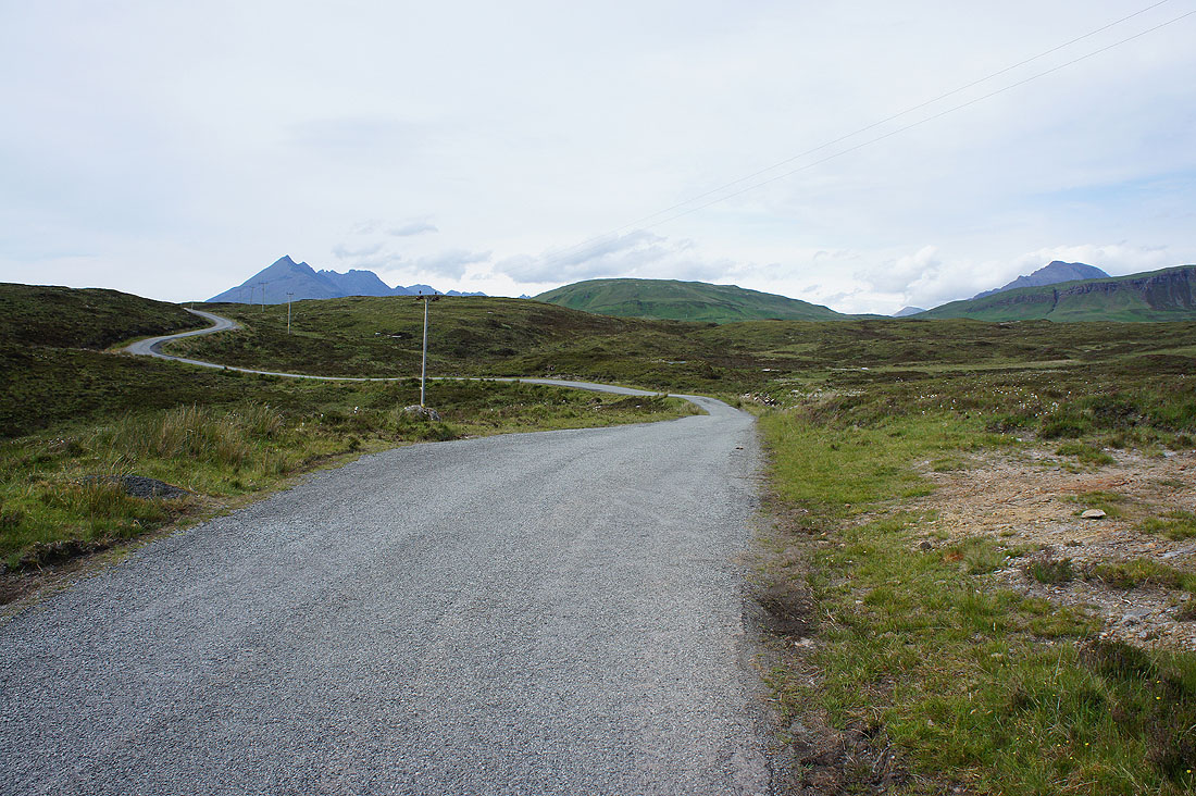
Loch Slapin now in view as I follow the track down to the Elgol road
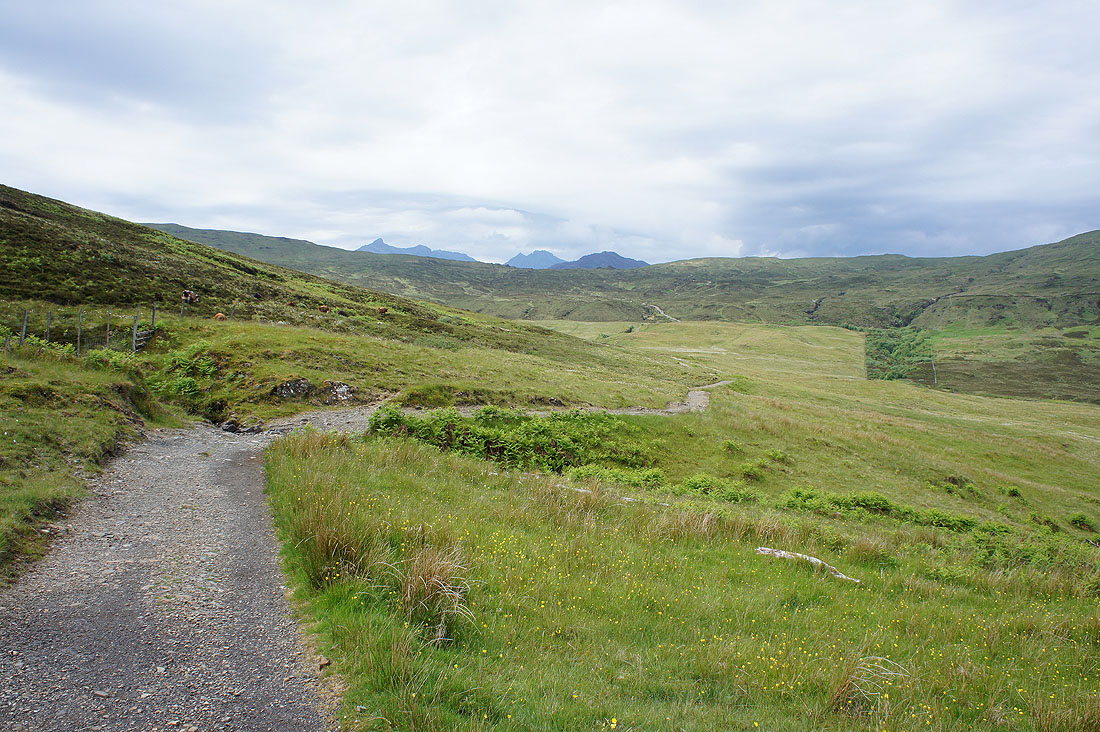
A last look back at the Cuillin peeping over the moor
On the Elgol road and I have a short walk north along it to the road past Kilmarie and to the coast
Steep slopes rise to Slat Bheinn and An Stac
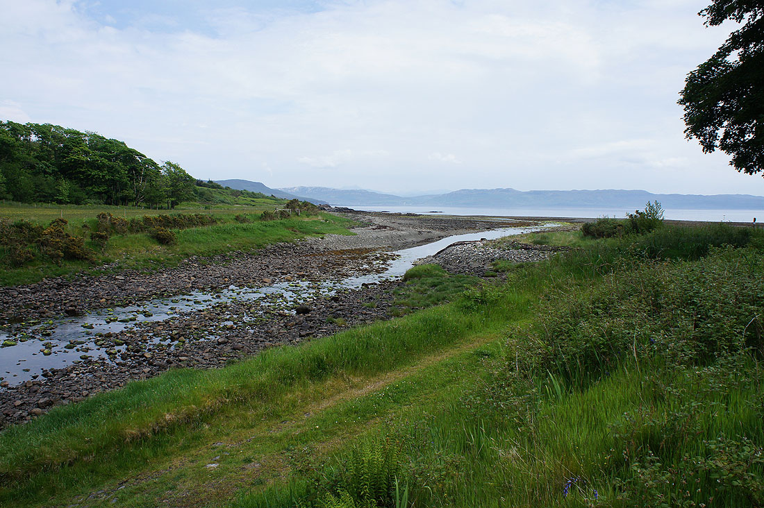
Almost by the coast as Abhainn Cille Mhaire enters Loch Slapin
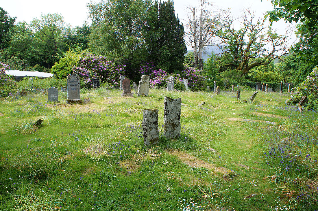
The burial ground of Cille Mhaire. Some of the headstones are recent and there are some that look very old.
As I follow the road to its end at the cottages ahead I have..
..a great view across Loch Slapin
and of Beinn Dearg Mhor (I was on that yesterday) and Beinn Dearg Bheag
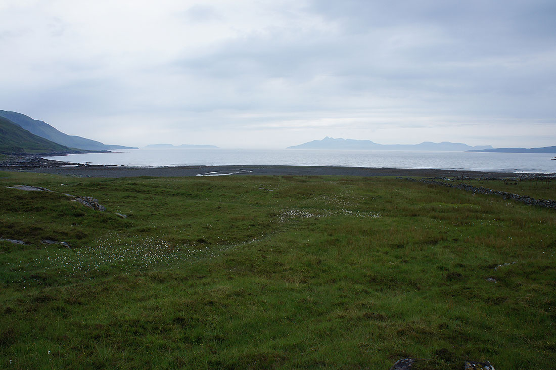
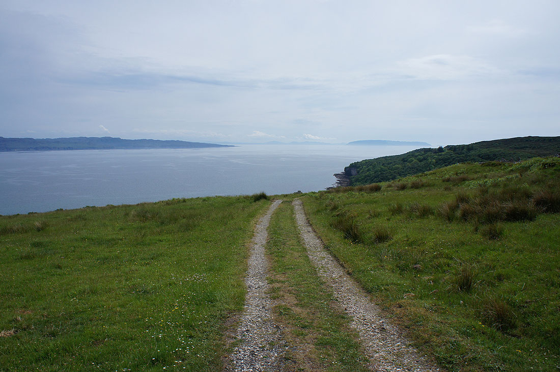
Past the last house and I can look down the coast to the Point of Sleat on the other side of the water with Eigg in the distance on the right. It's brightened up nicely and turned into a lovely afternoon.
Another look back at the view up Loch Slapin
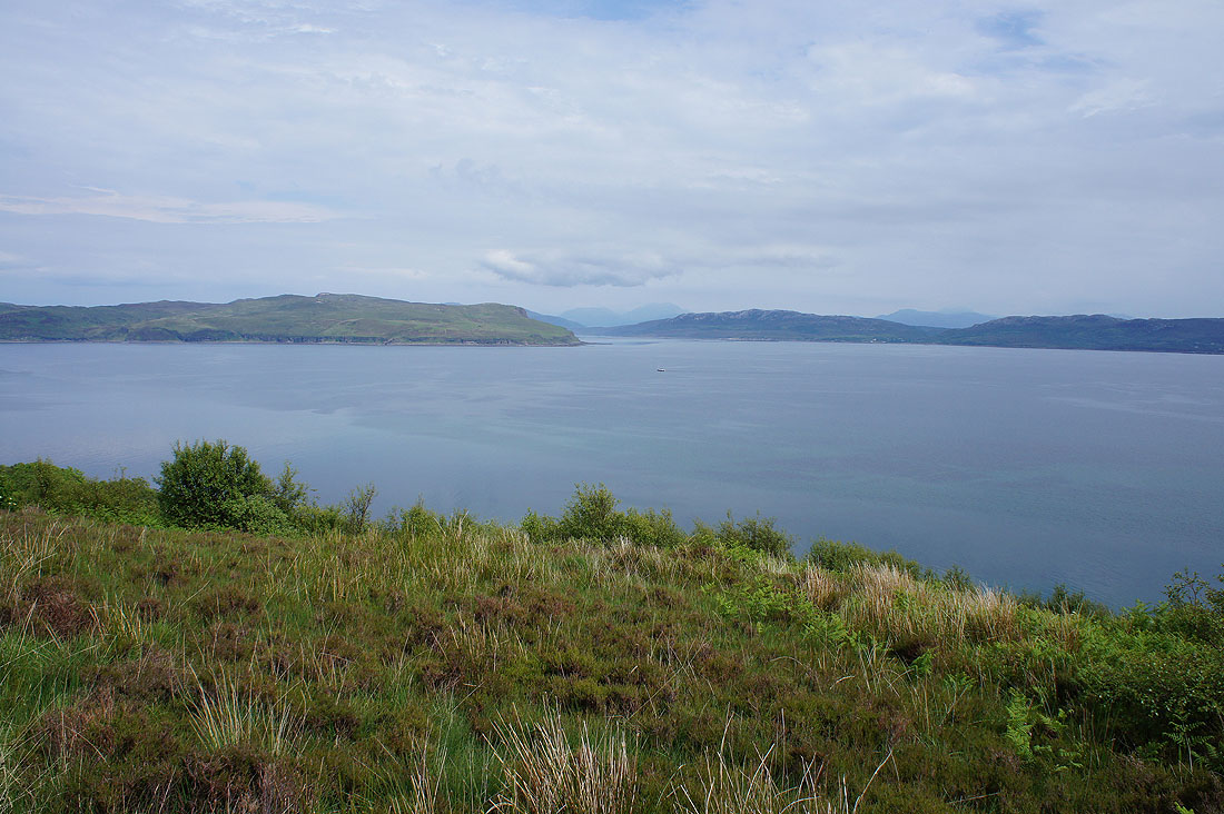
A bit further along and I can make out Loch Eishort that "separates" the peninsula of Sleat from the rest of the island
The path met up with a minor road that ended at a holiday home and then I followed this track down into woodland
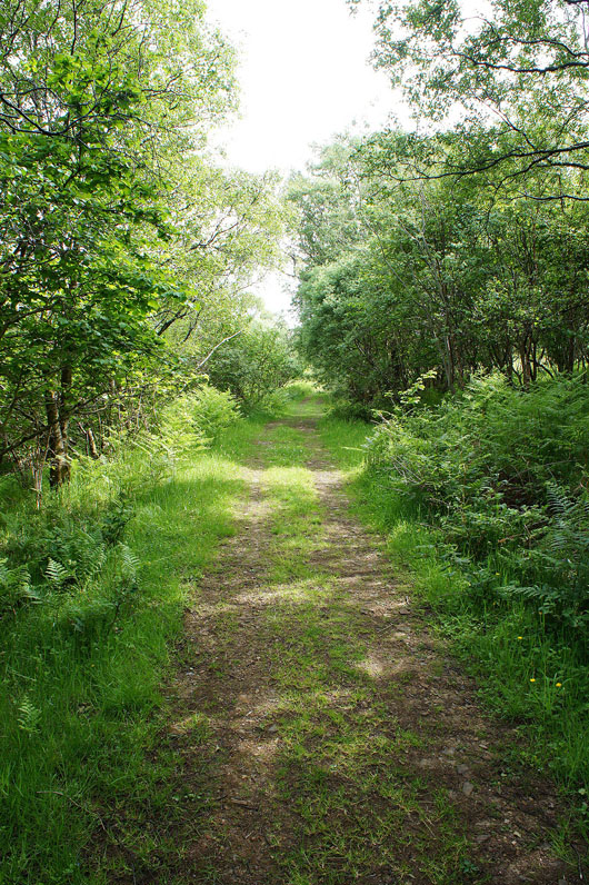
It was nice to feel cool in the shade for a while and there were some bluebells still in flower
A last look back as I finish walking south at the hamlet of Glasnakille
This road will carry me west across the moor and back to Elgol
Rum hangs in the sea to the south
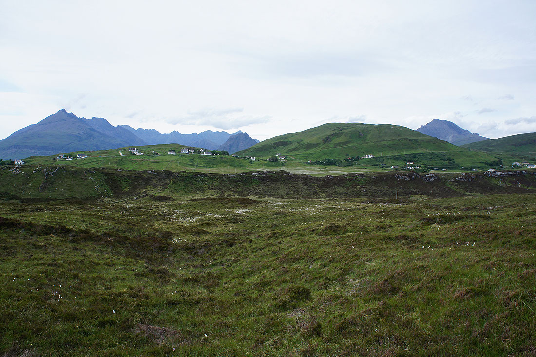
There's a trig point just off the road to its north. I couldn't pass by and not pay it a visit. The village of Elgol strung along the hillside below Ben Cleat with the Cuillin and Blabheinn in the background.
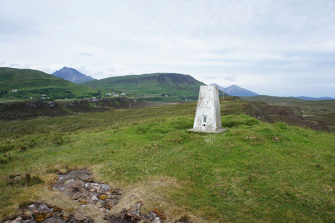
Ben Meabost behind the trig point. At 118m this could well be the lowest one that I've ever been to.
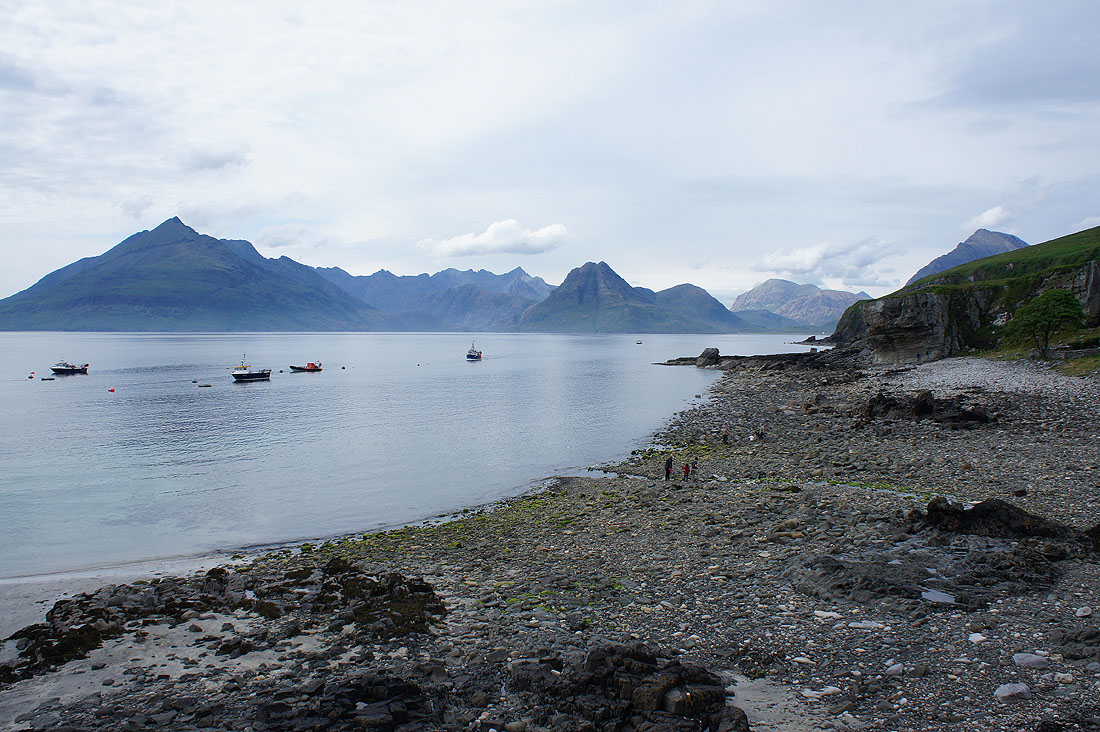
A great way to finish with another photo from the pier in Elgol