8th February 2015 - The Fairfield Horseshoe
Walk Details
Distance walked: 10.4 miles
Total ascent: 3493 ft
OS map used: OL5 - The English Lakes, Northeastern area & OL7 - The English Lakes, Southeastern area
Time taken: 7 hrs
Route description: Rydal-Nab Scar-Heron Pike-Erne Crag-Great Rigg-Fairfield-Hart Crag-Dove Crag-High Pike-Low Pike-Low Sweden Bridge-Nook Lane-Ambleside-A591-Rydal Park-Rydal
Wow! What a day! Days on the fells like this don't come around too often and they're all the more special as you don't tend to expect to have a walk in such conditions until the last moment. The last time I experienced a temperature inversion this good was when I did the Kentmere Horseshoe way back in December 2006.
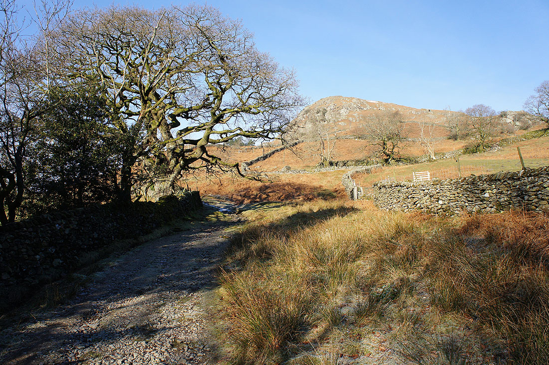
I hadn't planned on having a walk in the Lake District this weekend and what thoughts I did have of where to go involved staying closer to home. A new plan was hatched on Saturday evening however when I saw pictures posted on Facebook of the glorious weather there had been in the Lakes that day. I wondered if it would be the same tomorrow. I checked the mountain area forecasts and they suggested that there would be a temperture inversion. This would be too good to miss. Where to go? After a bit of thought I decided on the Fairfield Horseshoe. It's a good route to do in winter, I hadn't done it for three years plus Nab Scar, Heron Pike and Great Rigg would go towards completing my second round. I made sure I was up early enough on Sunday morning for a day in the Lakes and after a quick check to see how things were looking I set off. In the past I've always started this walk from Ambleside but on this occasion I didn't have the mountain of change that parking there for the day would require. So I tried the lane in Rydal between the church and Rydal Hall and I fortunately found a space left.
Starting from Rydal I walked to the top of the lane and up the footpath to the top of Nab Scar. I then made my way up the western arm of the horseshoe, taking in Heron Pike, Erne Crag and Great Rigg to reach the summit of Fairfield. After taking a break for lunch here it was time to head down the eastern arm of the horseshoe, via Hart Crag, Dove Crag, High Pike and Low Pike to Low Sweden Bridge. I then walked down Nook Lane into Ambleside, by the A591 and then through Rydal Park back to Rydal.
Total ascent: 3493 ft
OS map used: OL5 - The English Lakes, Northeastern area & OL7 - The English Lakes, Southeastern area
Time taken: 7 hrs
Route description: Rydal-Nab Scar-Heron Pike-Erne Crag-Great Rigg-Fairfield-Hart Crag-Dove Crag-High Pike-Low Pike-Low Sweden Bridge-Nook Lane-Ambleside-A591-Rydal Park-Rydal
Wow! What a day! Days on the fells like this don't come around too often and they're all the more special as you don't tend to expect to have a walk in such conditions until the last moment. The last time I experienced a temperature inversion this good was when I did the Kentmere Horseshoe way back in December 2006.
I hadn't planned on having a walk in the Lake District this weekend and what thoughts I did have of where to go involved staying closer to home. A new plan was hatched on Saturday evening however when I saw pictures posted on Facebook of the glorious weather there had been in the Lakes that day. I wondered if it would be the same tomorrow. I checked the mountain area forecasts and they suggested that there would be a temperture inversion. This would be too good to miss. Where to go? After a bit of thought I decided on the Fairfield Horseshoe. It's a good route to do in winter, I hadn't done it for three years plus Nab Scar, Heron Pike and Great Rigg would go towards completing my second round. I made sure I was up early enough on Sunday morning for a day in the Lakes and after a quick check to see how things were looking I set off. In the past I've always started this walk from Ambleside but on this occasion I didn't have the mountain of change that parking there for the day would require. So I tried the lane in Rydal between the church and Rydal Hall and I fortunately found a space left.
Starting from Rydal I walked to the top of the lane and up the footpath to the top of Nab Scar. I then made my way up the western arm of the horseshoe, taking in Heron Pike, Erne Crag and Great Rigg to reach the summit of Fairfield. After taking a break for lunch here it was time to head down the eastern arm of the horseshoe, via Hart Crag, Dove Crag, High Pike and Low Pike to Low Sweden Bridge. I then walked down Nook Lane into Ambleside, by the A591 and then through Rydal Park back to Rydal.
Route map
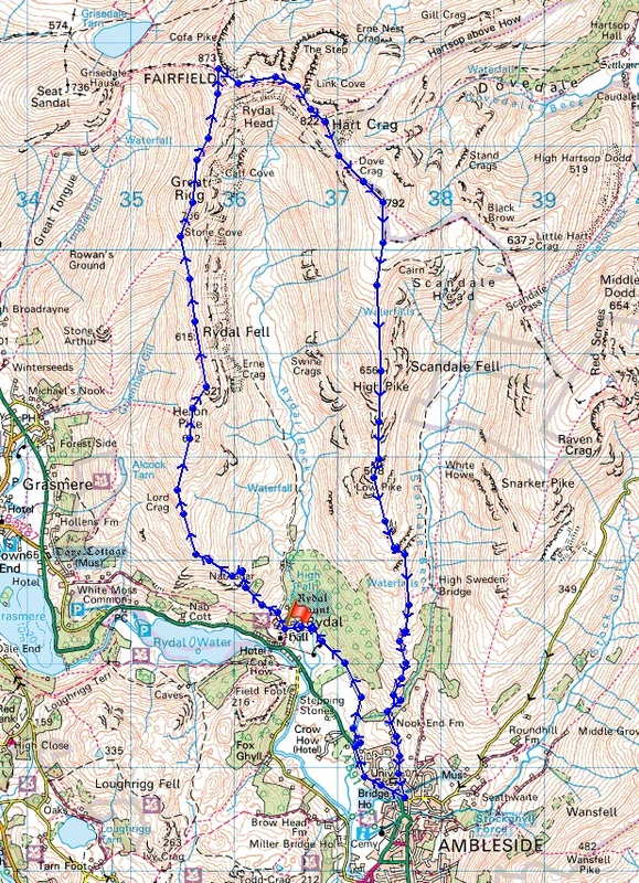
© Crown copyright. All rights reserved. License number PU 100034184.
Bright blue skies and sunshine as I head for Nab Scar
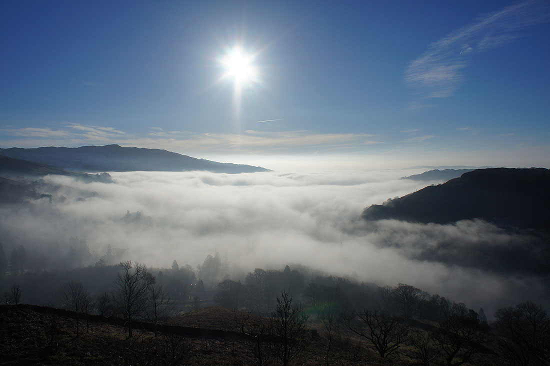
Just below me fog is shrouding Ambleside and Windermere
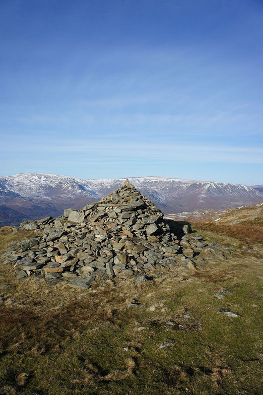
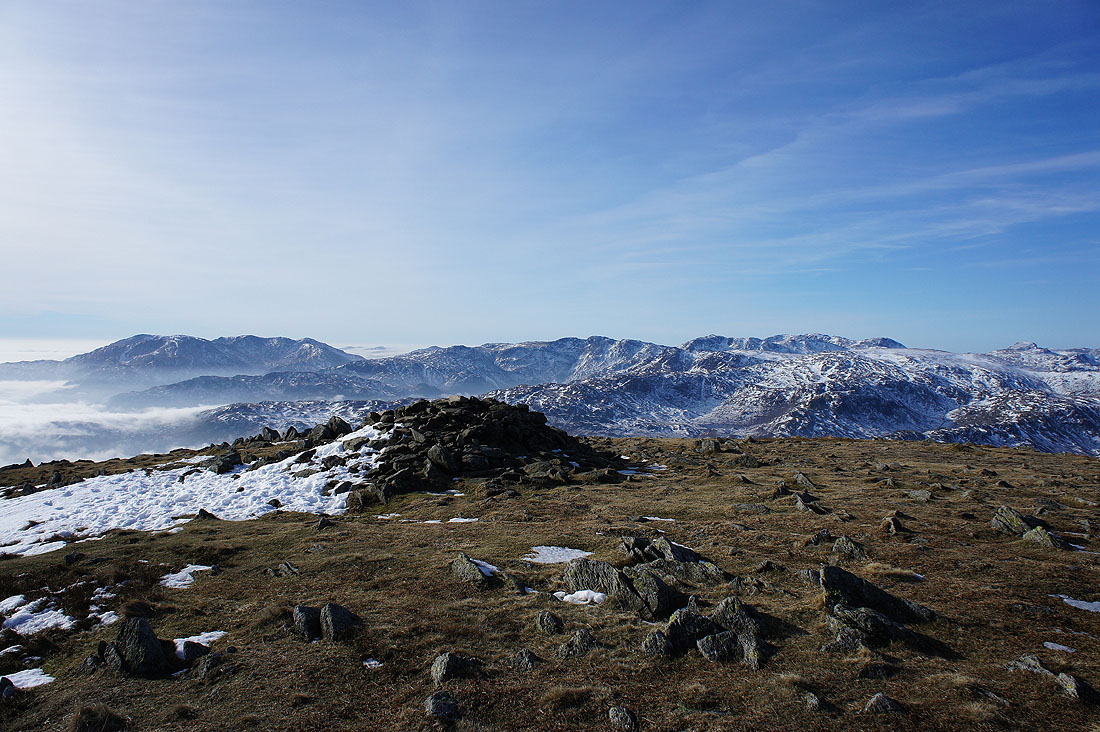
A large cairn marks the "top" of Nab Scar
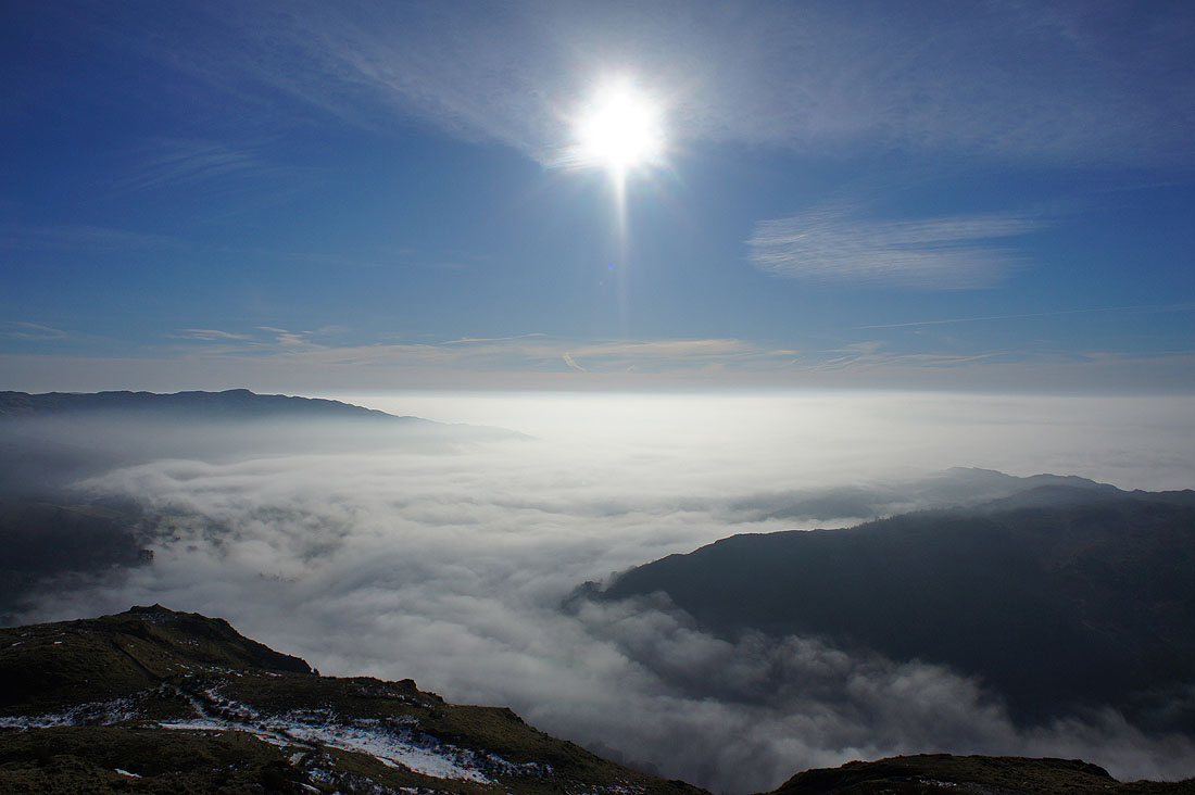
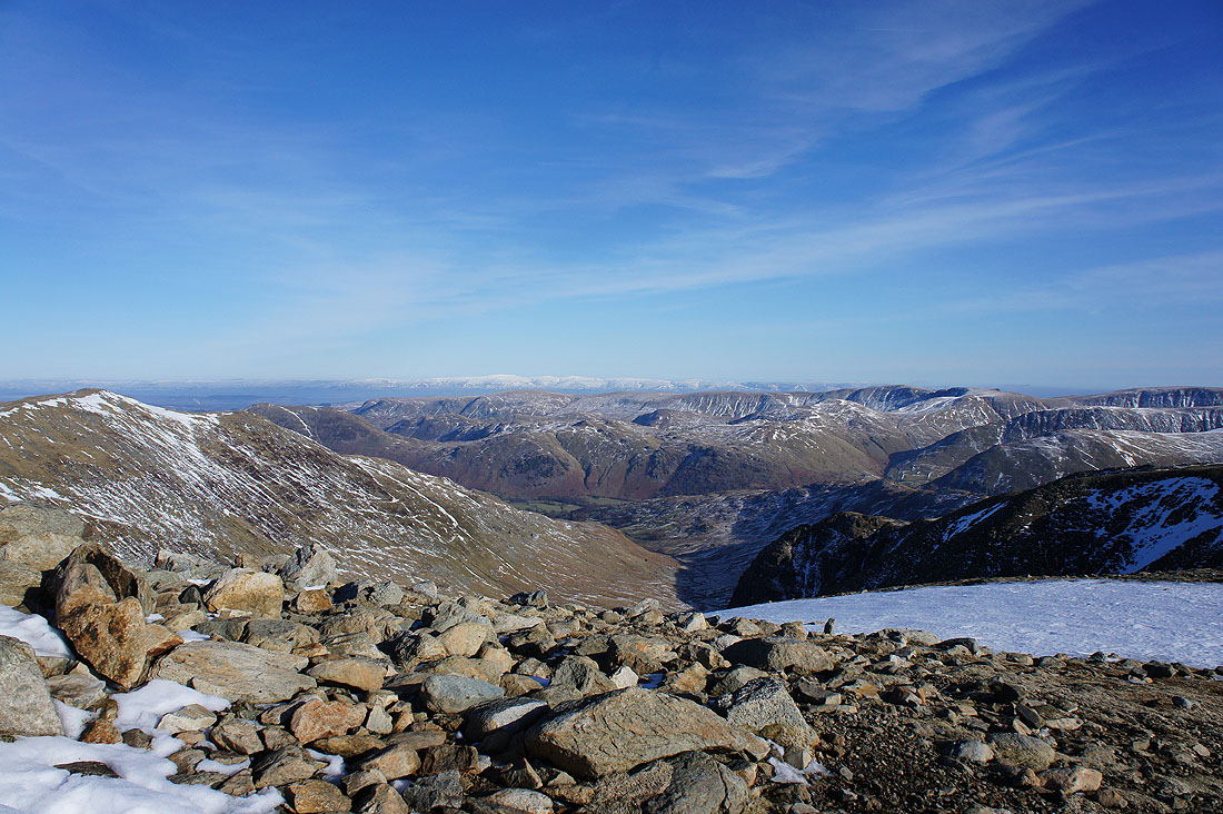
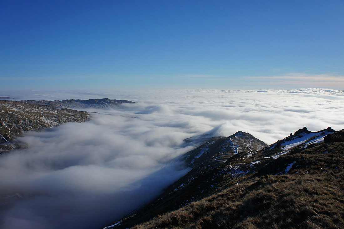
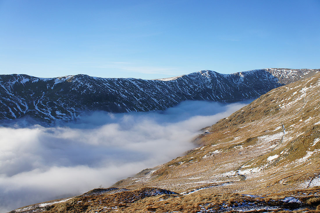
As I look down the inversion is continuing to develop. The fog is invading the valleys and lower ground, while there is a distinct line marking where the clear skies and excellent visibility over the fells begins.
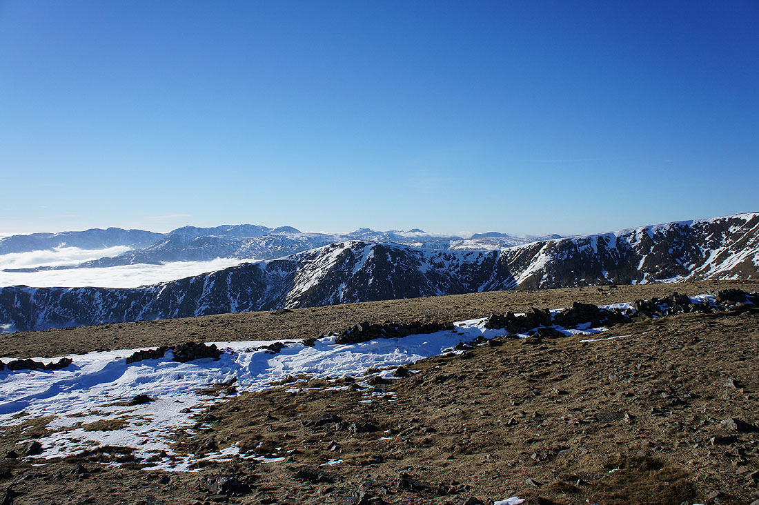
Silver How on the other side of Grasmere with the Coniston fells, Pike o'Blisco, Crinkle Crags and Bowfell beyond. The fell that can be seen through the gap of the Wrynose Pass is Harter Fell above Eskdale.
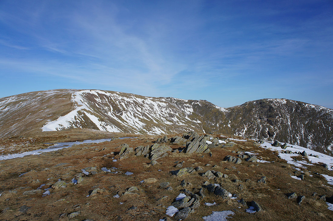
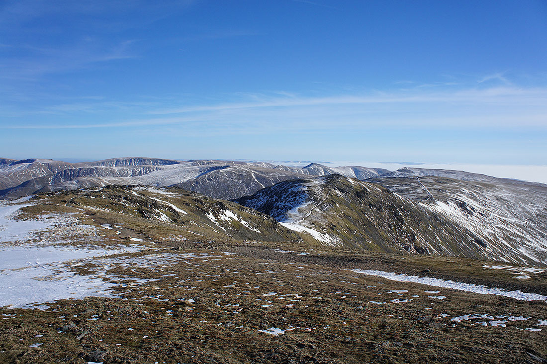
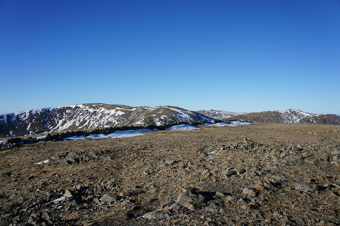
The head of the horseshoe awaits. Great Rigg, Fairfield and Hart Crag.
Looking back to the second Wainwright of the day, Heron Pike, from Erne Crag
On Great Rigg, the third Wainwright of the day
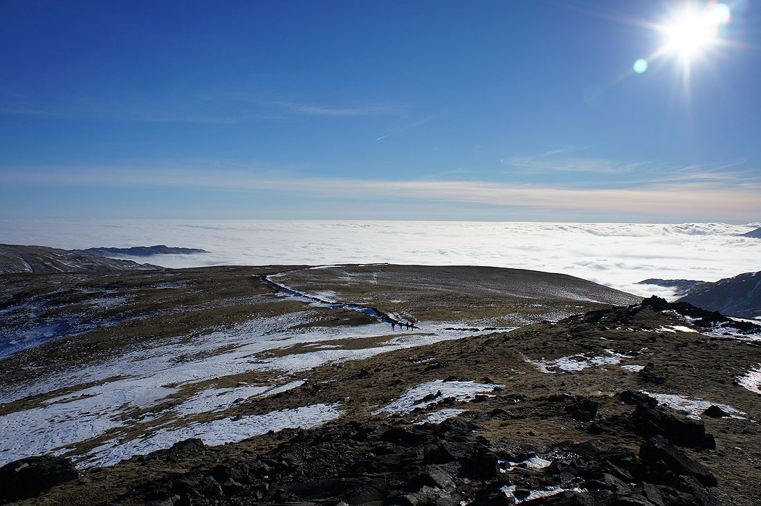
Looking back down the ridge to Heron Pike. The fog is making further inroads, creeping up Rydal on the left..
..and up the Vale of Grasmere. Stone Arthur is at the bottom of the slope below and there is a fantastic view across the ridges to the Coniston fells, Crinkle Crags, Bowfell and Scafell Pike.
Great Gable, Pillar, High Stile, Dale Head, Hindscarth, Grasmoor, Crag Hill and Grisedale Pike in the distance. The fell close by on the right is Seat Sandal.
Fairfield and Hart Crag
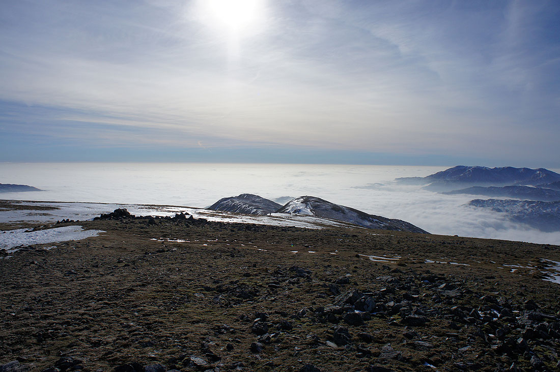
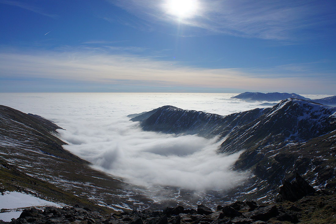
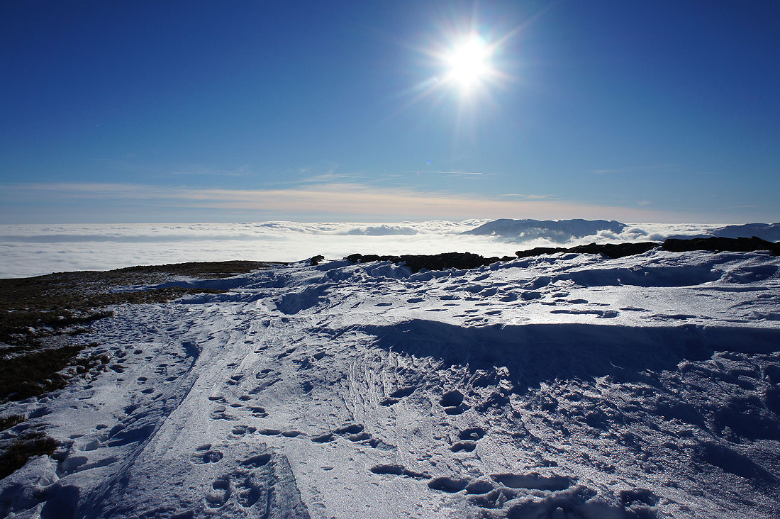
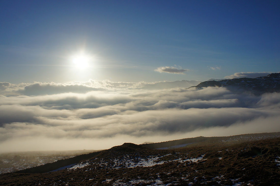
Finally made it to Fairfield's summit plateau and looking to the south the sea of fog goes all the way out into Morecambe Bay and the Irish Sea
A couple of shots before I head for the summit shelter and a much needed break. To the west, the Coniston fells, Pike o'Blisco, Crinkle Crags, Bowfell, Scafell Pike, Great End and Great Gable.
To the northwest, Great Gable, Pillar, High Stile, Dale Head, Hindscarth, Grasmoor, Crag Hill and Grisedale Pike.
I took this photo while I was sat having my sandwiches. Crystal clear views all the way to Cross Fell and the North Pennines. The snow seems to be hanging on a bit better over there.
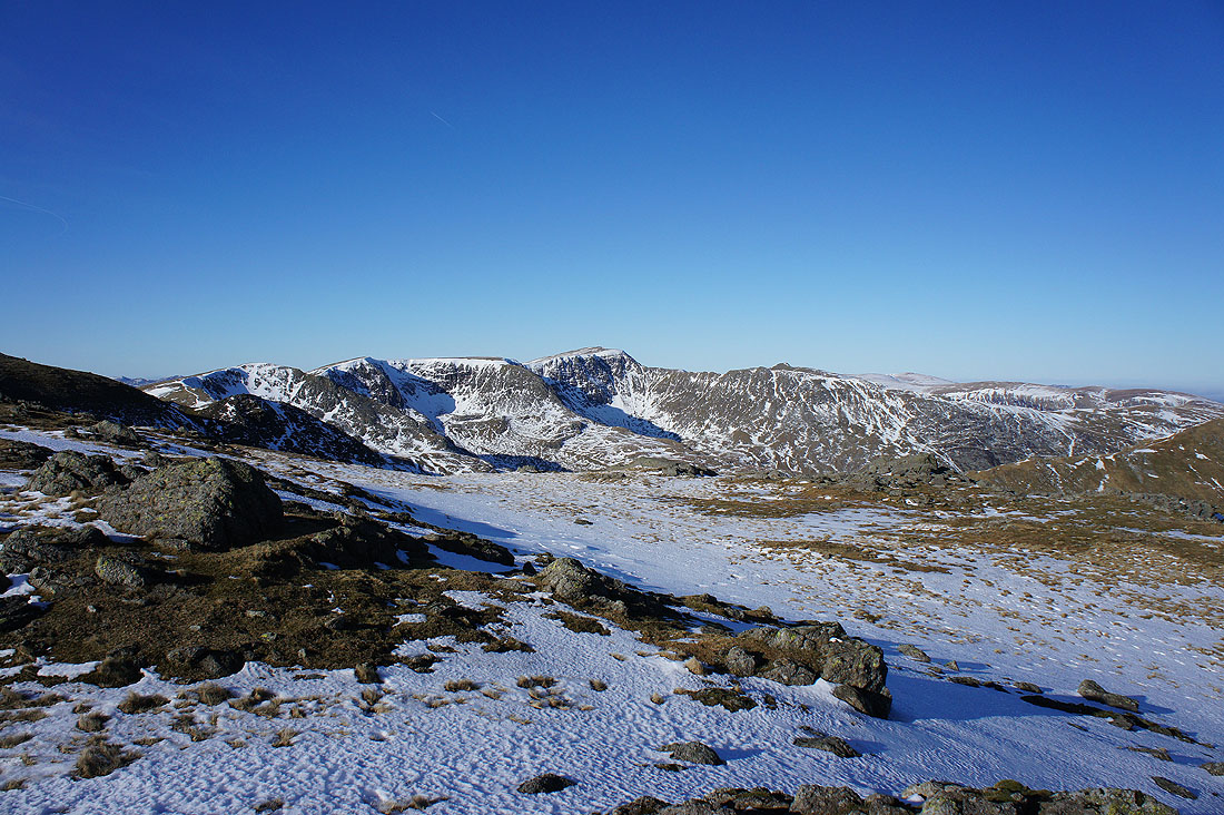
I had to put my spikes on for this and the next two photos. There was an unbroken patch of snow and ice that wouldn't have been safe to cross otherwise. Looking across Grisedale to Dollywagon Pike, Nethermost Pike and Helvellyn.
Cofa Pike and St Sunday Crag. No fog in this bit of the Lakes or the Eden valley.
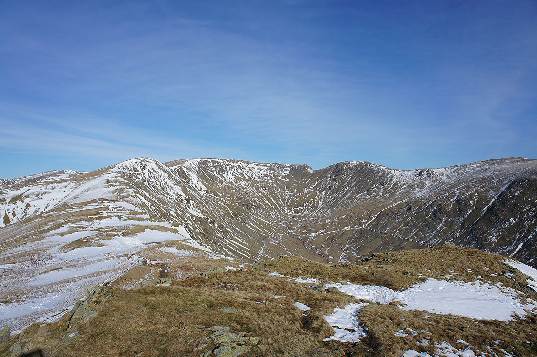
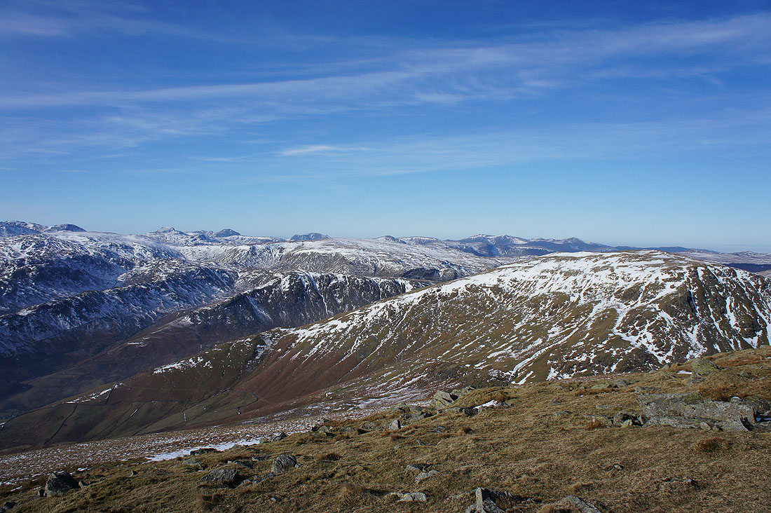
High Raise, High Street and the other far eastern fells plus the cold, icy crags of Greenhow End
It's time I was making tracks to the next summit of Hart Crag
On the way there and I thought this shot showing the coves of Nethermost Pike and Helvellyn was worth taking
Passing the head of Rydal which is continuing to fill with fog
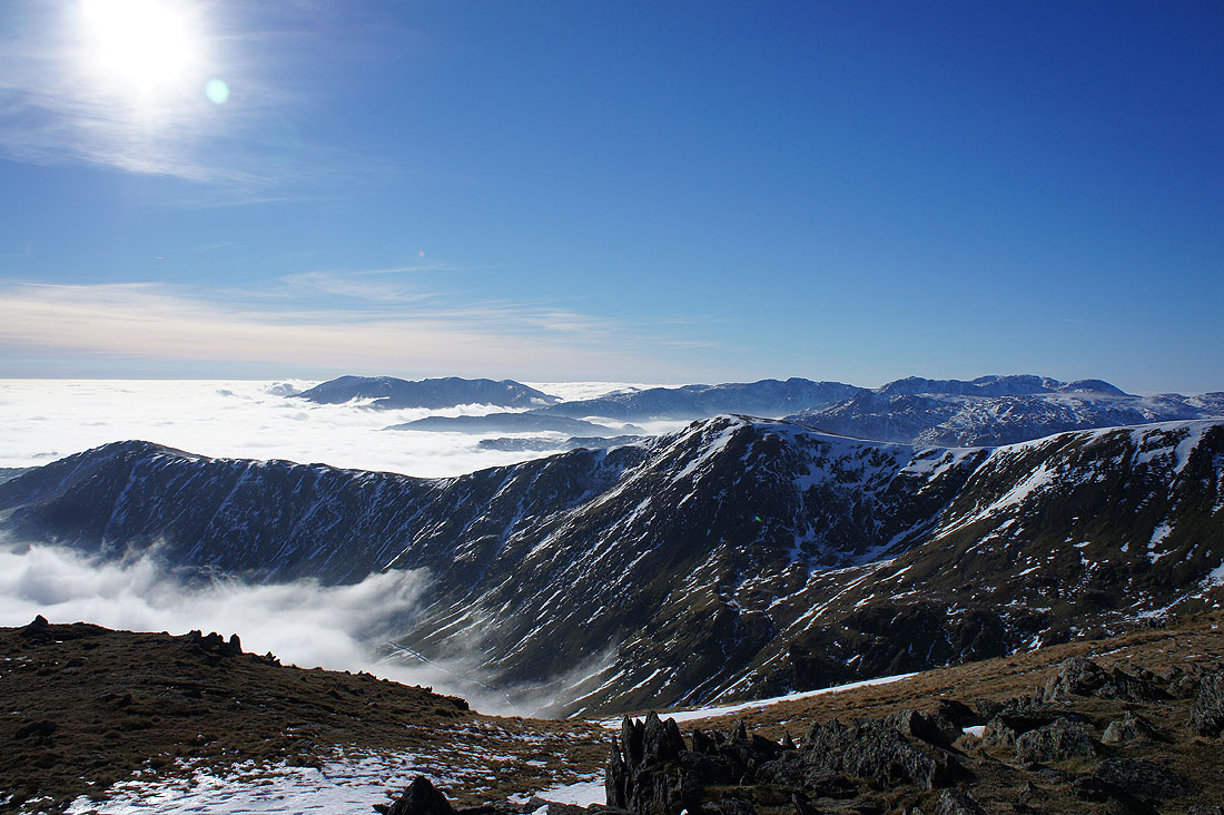
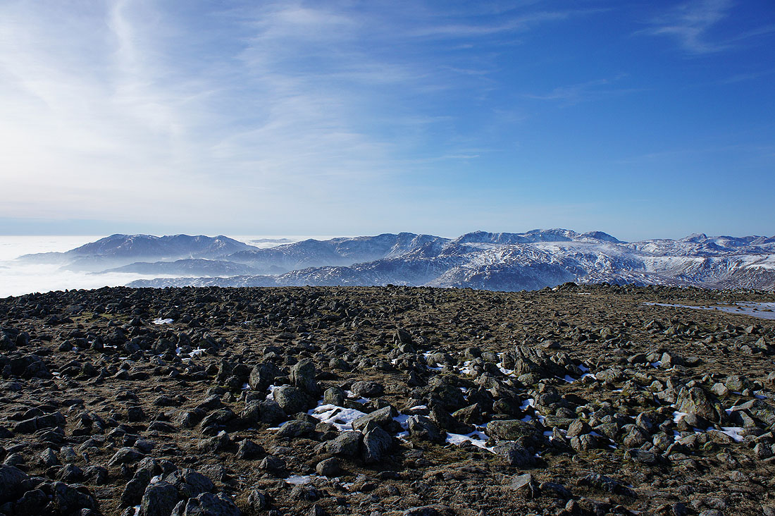
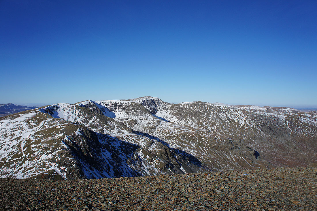
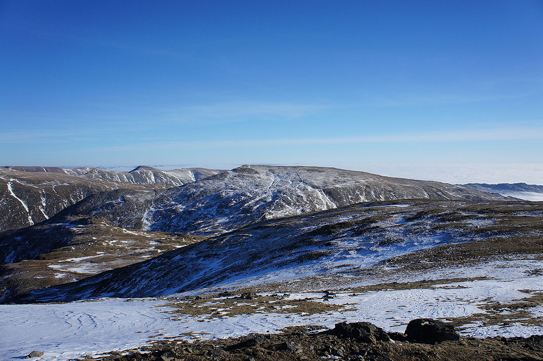
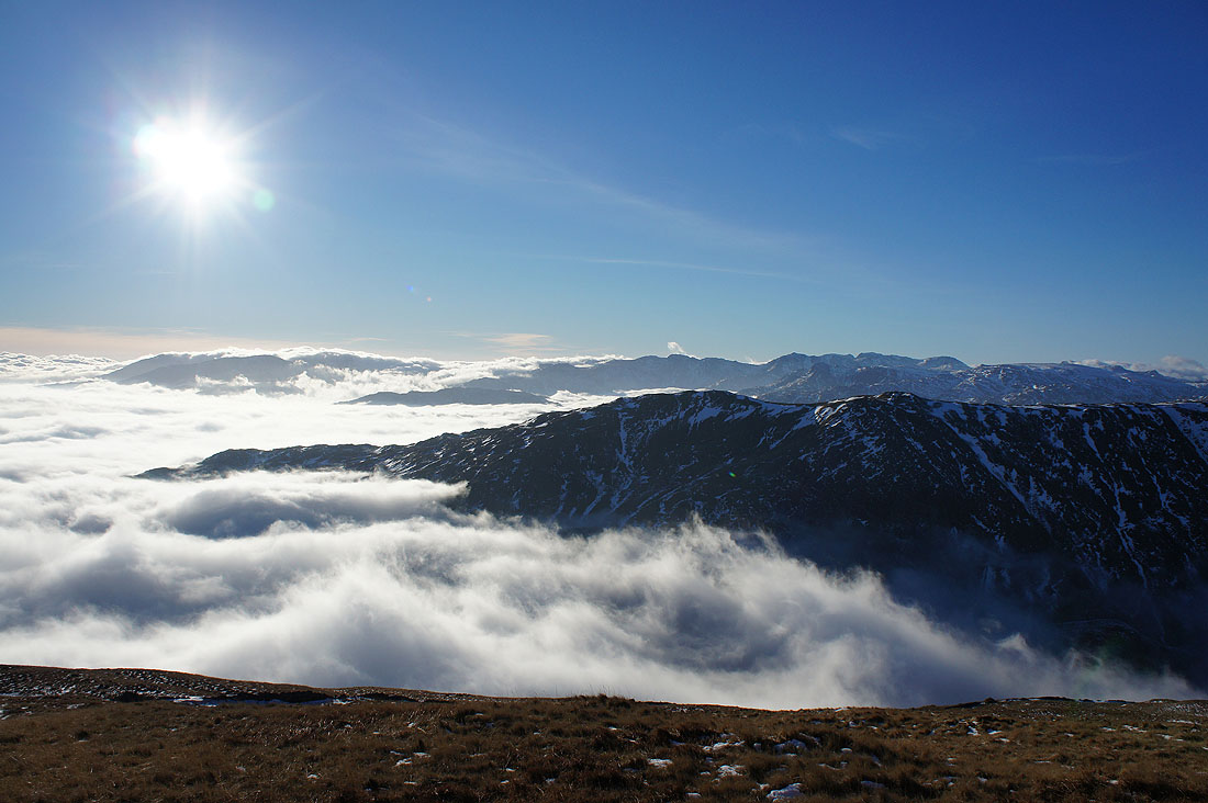
On the summit of Hart Crag and this is possibly my favourite shot of the day. A multitude of fells beyond Great Rigg and the western arm of the horseshoe.
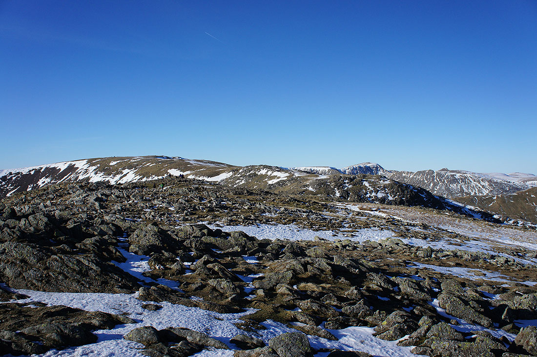
Looking back to Fairfield
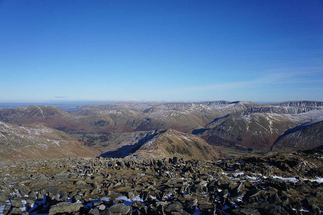
The ridge of Hartsop above How heads down into Patterdale. Place Fell, Angletarn Pikes and Brock Crags with the Loadpot Hill to High Raise ridge in the distance.
High Raise, Rampsgill Head, High Street, Thornthwaite Crag, Caudale Moor and Ill Bell
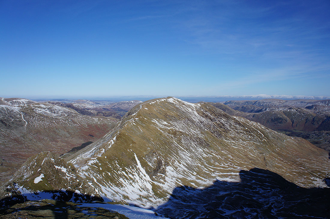
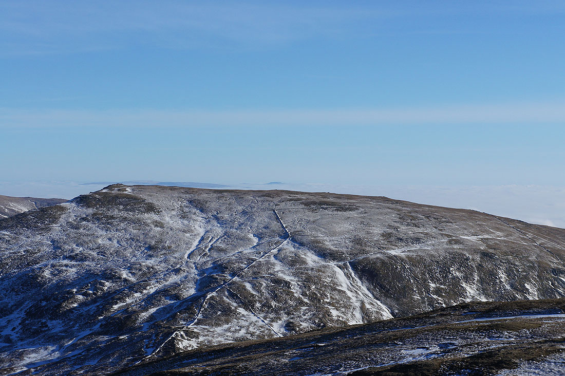
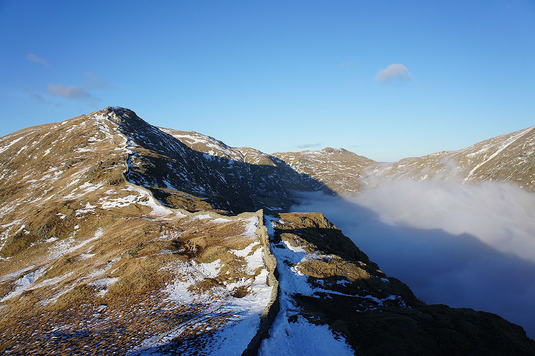
Red Screes and Dove Crag. It's time to follow the wall to its summit.
On the summit of Dove Crag. Looking back to Fairfield and Hart Crag on the left with St Sunday Crag on the right.
The Ill Bell ridge and Red Screes
A big zoom across the top of Red Screes to show the distant summits of Whernside and Ingleborough in the Yorkshire Dales
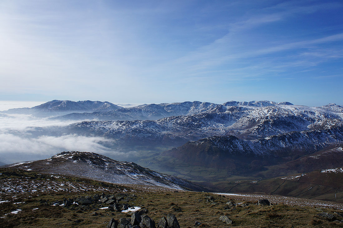
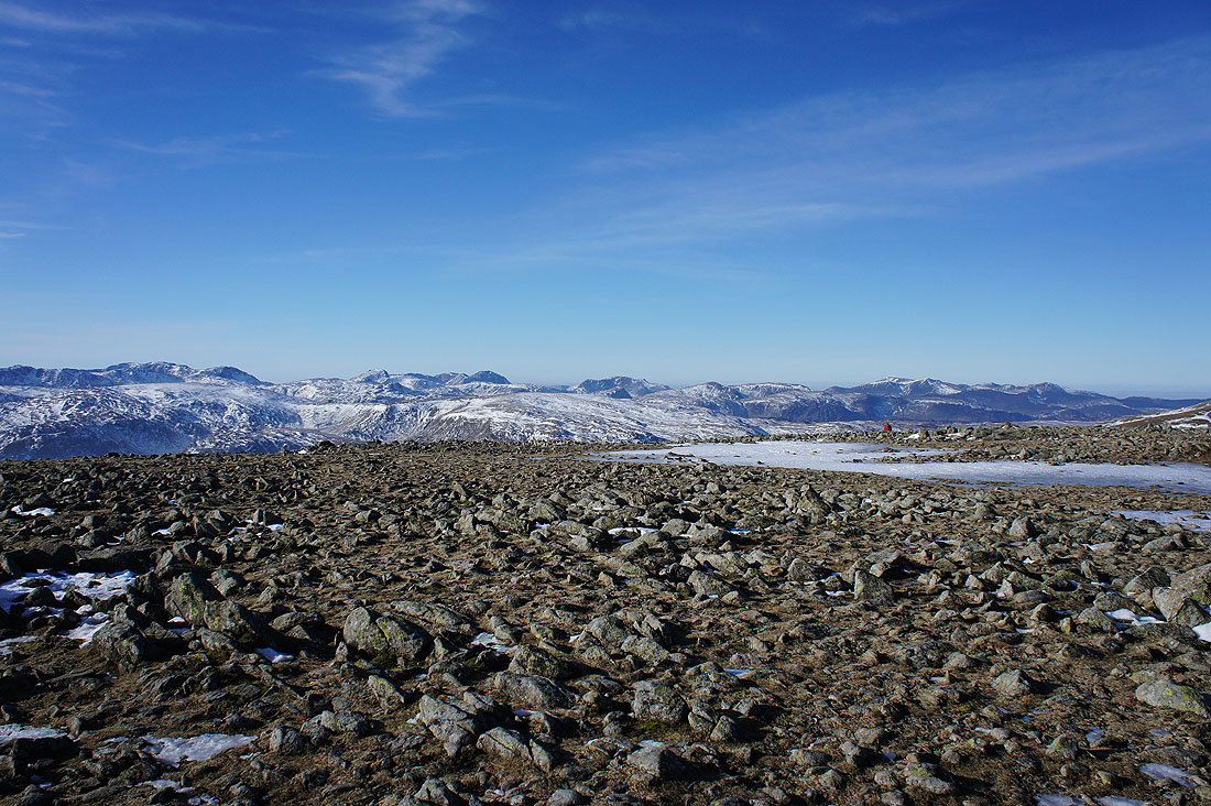
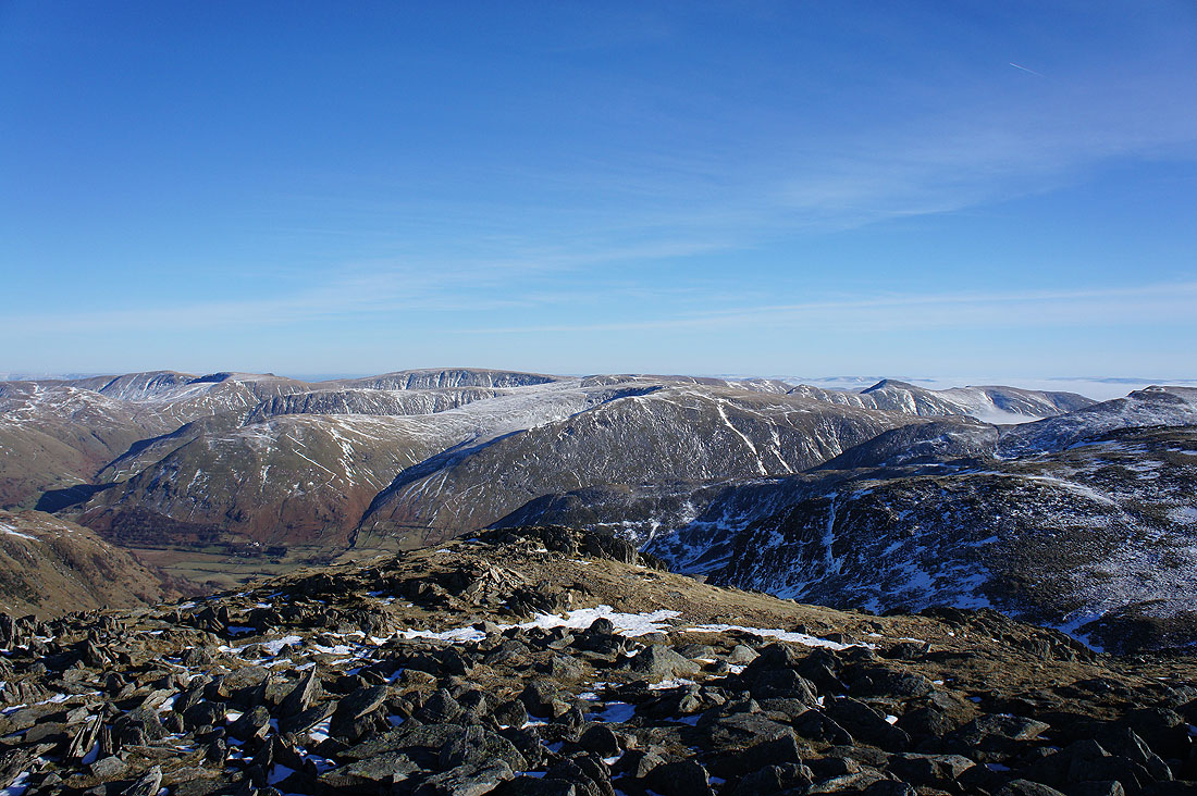
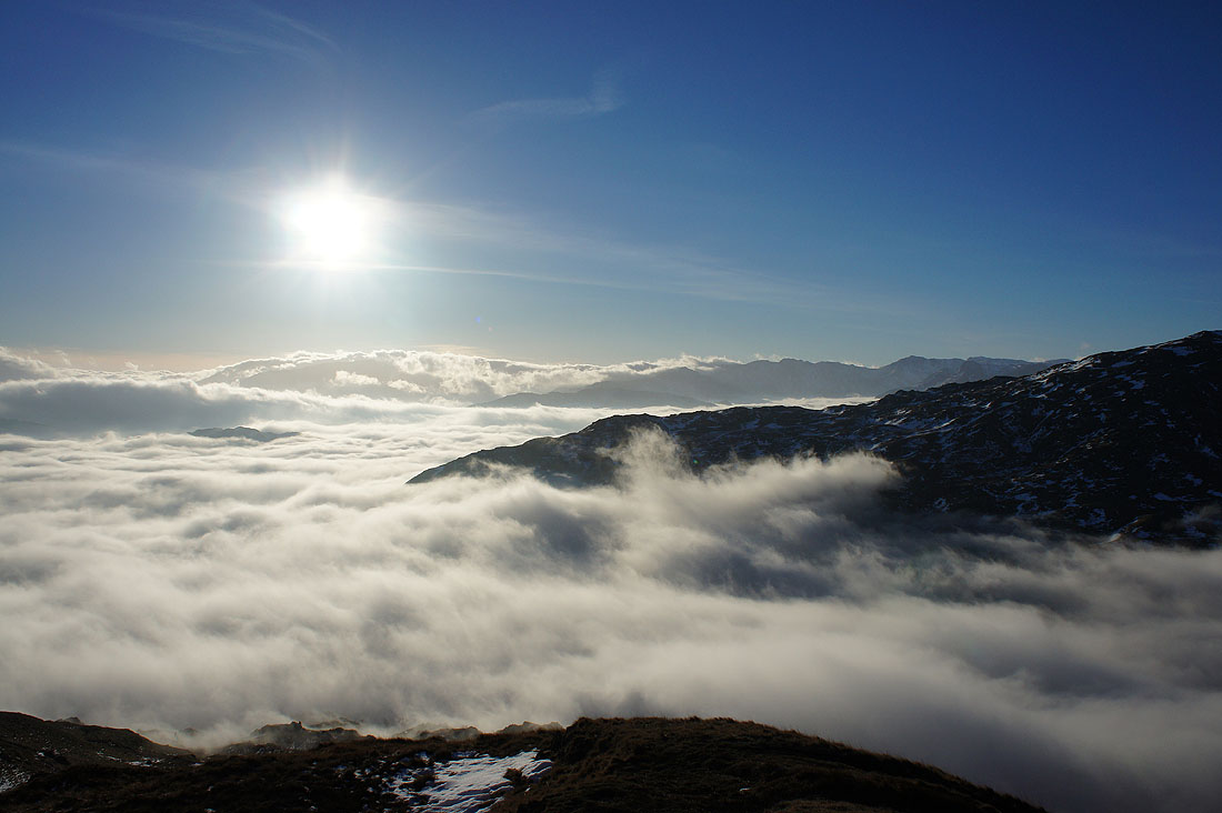
Fantastic views out to the west. The Coniston fells, Crinkle Crags, Bowfell and Scafell Pike. The top of the fog seems to be getting higher over there.
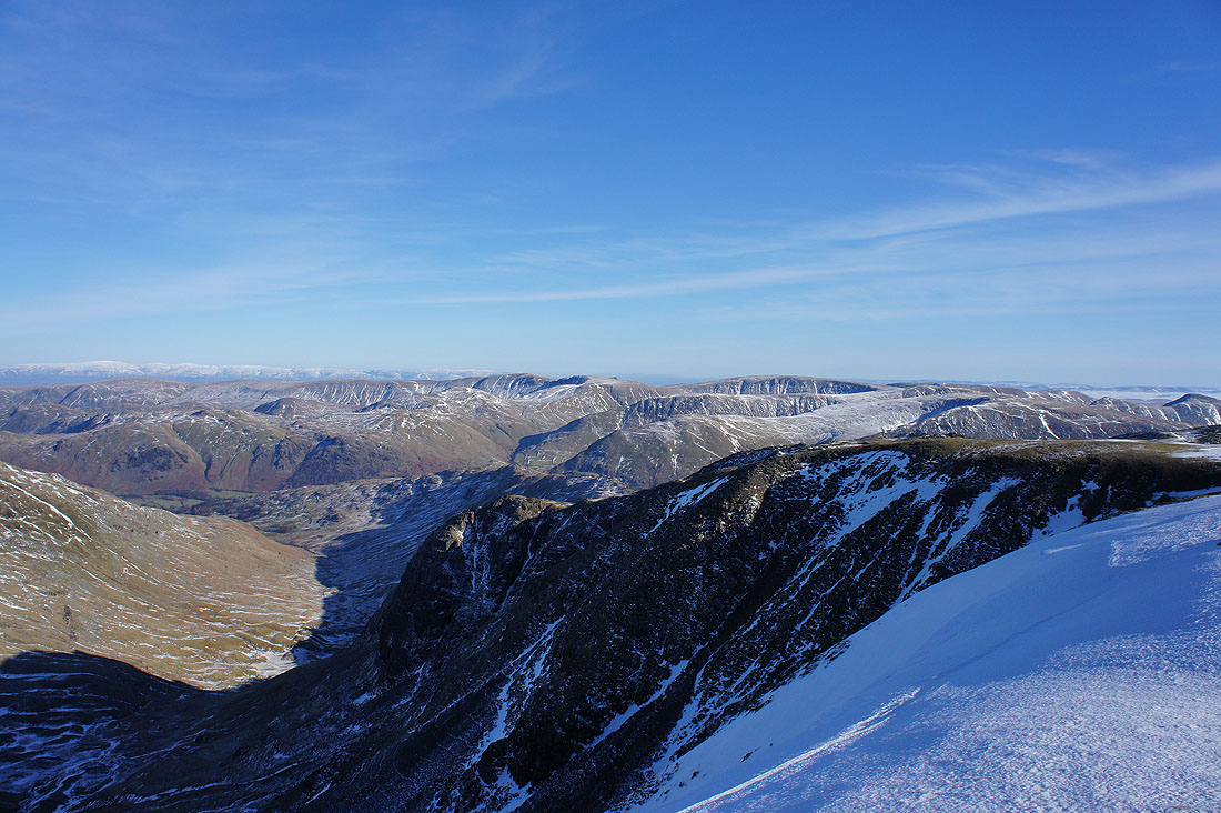
Great Rigg and the western arm of the horseshoe with Crinkle Crags, Bowfell, Scafell Pike, Great End, Great Gable, Pillar and High Stile in the distance
Time to follow the wall down to High Pike
The snow cover is patchy but in the lee of the wall that runs down the fell from Dove Crag there are still some big, deep drifts
High Pike ahead
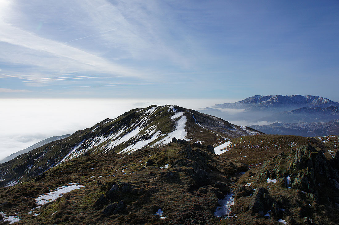
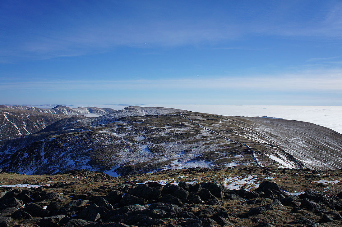
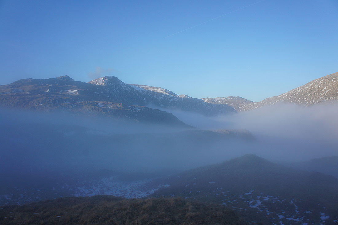
On High Pike. Scandale is hidden beneath the fog and the ridge continues down to Low Pike.
Swirling fog in Rydal. The fog has now enveloped the Coniston fells and is pouring over the Wrynose Pass.
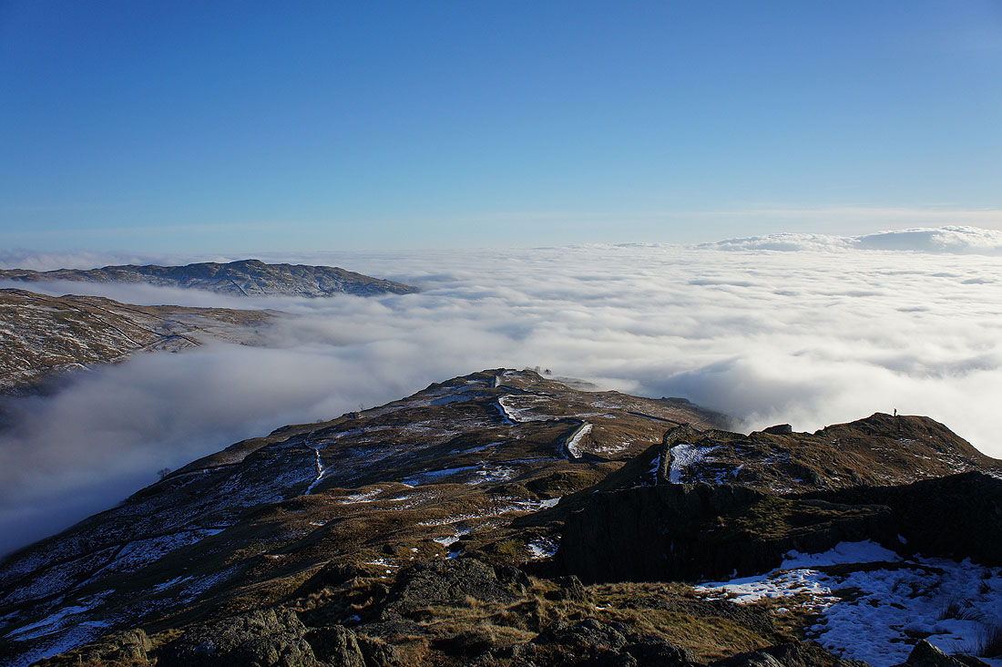
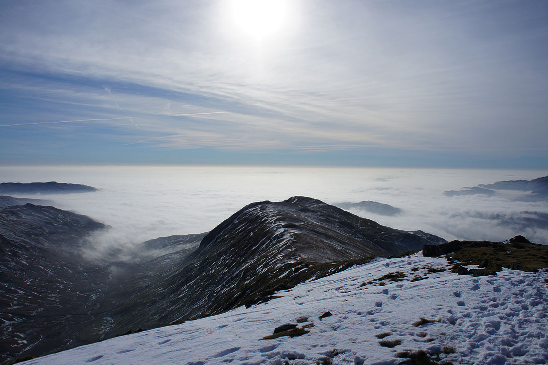
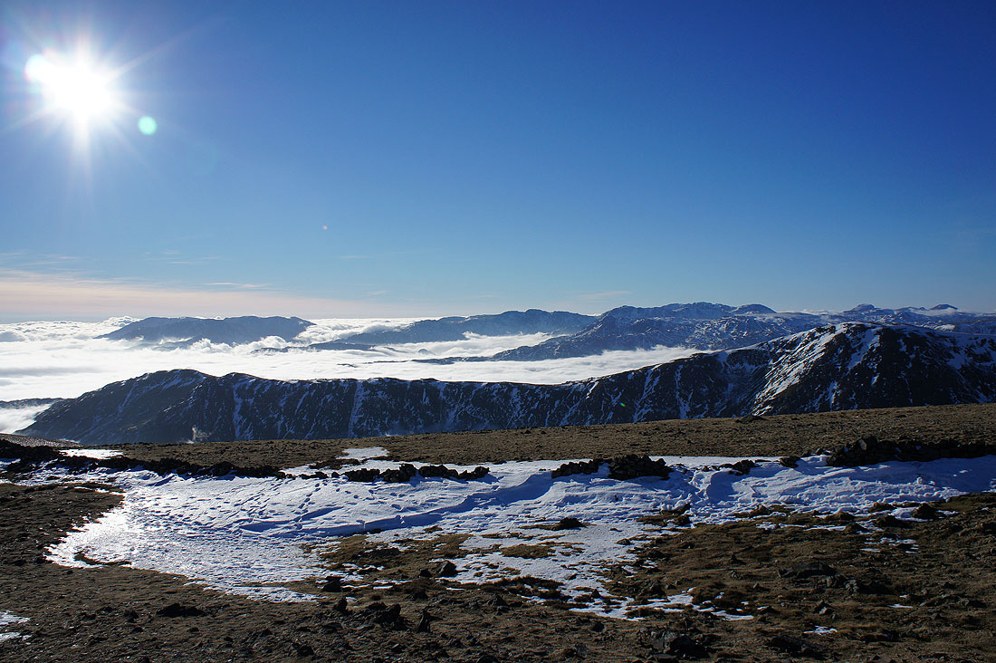
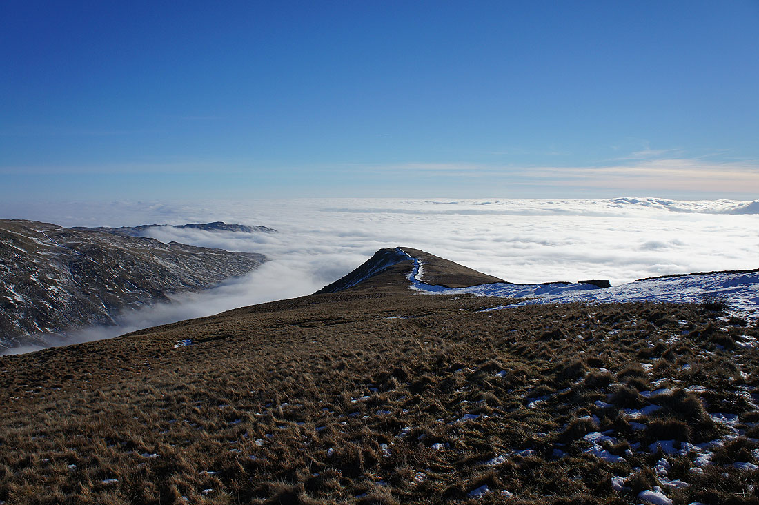
I arrived on Low Pike with a touch of sadness. It won't be long before I descend into the fog and this fabulous day comes to an end. By the way, the hill on the left is Wansfell Pike.
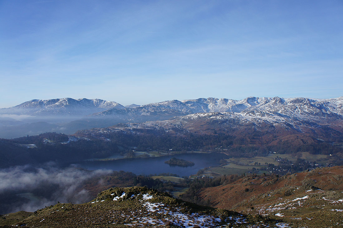
Just above the fog. On having a closer look at this photo I noticed the island of high ground on the left. It's the top of Loughrigg Fell. The view from there at that moment must have been pretty spectacular.
A fog filled Rydal
Looking back to High Pike with Scandale on the right heading up to Little Hart Crag
The fog gets ever closer as I head down until..
..it suddenly becomes cold and clammy as it rises up and envelops me
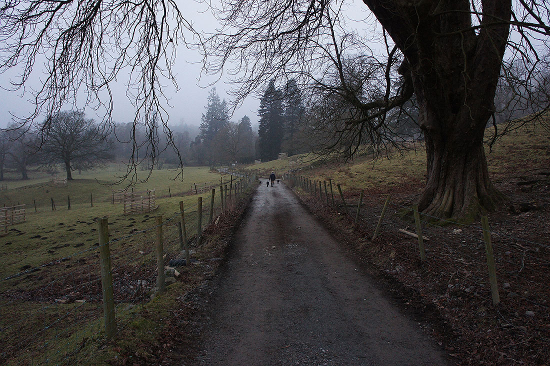
Grey and murky for the walk through Rydal Park to where I'm parked