9th June 2016 - Idrigill Point & Macleod's Maidens
Walk Details
Distance walked: 9.9 miles
Total ascent: 1837 ft
OS map used: 407 - Skye, Dunvegan
Time taken: 6 hrs
Route description: Orbost Farm-Loch Bharcasaig-Forse Burn-Brandarsaig-Idrigill Point-Rubha na Maighdeanan-Brandarsaig-Forse Burn-Loch Bharcasaig-Orbost Farm
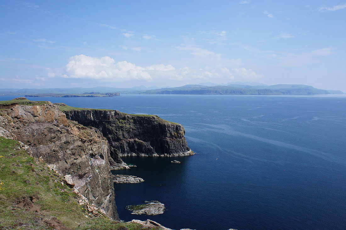
Another coastal walk today and I took this route straight out of my guide book. With hindsight this was my favourite of the walks that I did this week. There was fabulous coastal scenery from start to finish and I had perfect summer weather in which to enjoy it. Blue skies, sunshine and a gentle breeze in off the sea. The best bit of all was the view from Idrigill Point of the sea stacks of Macleod's Maidens and then being able to look northwest along the sea cliffs of Duirinish. It's a beautiful and atmospheric location. A path follows those cliffs for several miles, one for the future I think. Although the walk was a simple there and back, morning becoming afternoon changed the way the landscape looked so that I wasn't quite getting the same views twice.
From the car park at Orbost Farm I set off by taking the track signposted for Idrigill Point. This makes its way down to Loch Bharcasaig before heading up briefly through a conifer plantation. A lot of the conifers had been cleared as I followed it south to Forse Burn. After I crossed this and passed through a gate in a deer fence the path forks. I took the right hand one that heads uphill through bracken and heather. A clear path continues to head south and when it reached the bealach between Beinn na Boineid and Beinn na Moine it gradually descended into Rebel's Wood. Ruined crofts are passed at Brandarsaig above Brandarsaig Bay and at Idrigill before the path heads inland through Glac Ghealaridh, a heather clad gap between low hills. A final gate in a deer fence has to be passed through before the path ends up at the coast at the top of Geodha nan Daoine. Keeping this cove to my right, a short walk brought me to Idrigill Point and a view of the Macleod's Maidens. After a lengthy break for lunch I briefly followed the coast round to the west, to the headland of Rubha na Maighdeanan above the sea stacks, then the bay of Inbhir a' Gharraidh before picking up the path I arrived on to follow it back to Orbost Farm.
Total ascent: 1837 ft
OS map used: 407 - Skye, Dunvegan
Time taken: 6 hrs
Route description: Orbost Farm-Loch Bharcasaig-Forse Burn-Brandarsaig-Idrigill Point-Rubha na Maighdeanan-Brandarsaig-Forse Burn-Loch Bharcasaig-Orbost Farm
Another coastal walk today and I took this route straight out of my guide book. With hindsight this was my favourite of the walks that I did this week. There was fabulous coastal scenery from start to finish and I had perfect summer weather in which to enjoy it. Blue skies, sunshine and a gentle breeze in off the sea. The best bit of all was the view from Idrigill Point of the sea stacks of Macleod's Maidens and then being able to look northwest along the sea cliffs of Duirinish. It's a beautiful and atmospheric location. A path follows those cliffs for several miles, one for the future I think. Although the walk was a simple there and back, morning becoming afternoon changed the way the landscape looked so that I wasn't quite getting the same views twice.
From the car park at Orbost Farm I set off by taking the track signposted for Idrigill Point. This makes its way down to Loch Bharcasaig before heading up briefly through a conifer plantation. A lot of the conifers had been cleared as I followed it south to Forse Burn. After I crossed this and passed through a gate in a deer fence the path forks. I took the right hand one that heads uphill through bracken and heather. A clear path continues to head south and when it reached the bealach between Beinn na Boineid and Beinn na Moine it gradually descended into Rebel's Wood. Ruined crofts are passed at Brandarsaig above Brandarsaig Bay and at Idrigill before the path heads inland through Glac Ghealaridh, a heather clad gap between low hills. A final gate in a deer fence has to be passed through before the path ends up at the coast at the top of Geodha nan Daoine. Keeping this cove to my right, a short walk brought me to Idrigill Point and a view of the Macleod's Maidens. After a lengthy break for lunch I briefly followed the coast round to the west, to the headland of Rubha na Maighdeanan above the sea stacks, then the bay of Inbhir a' Gharraidh before picking up the path I arrived on to follow it back to Orbost Farm.
Route map
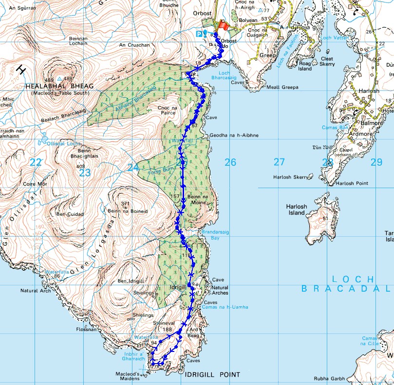
© Crown copyright. All rights reserved. License number PU 100034184.
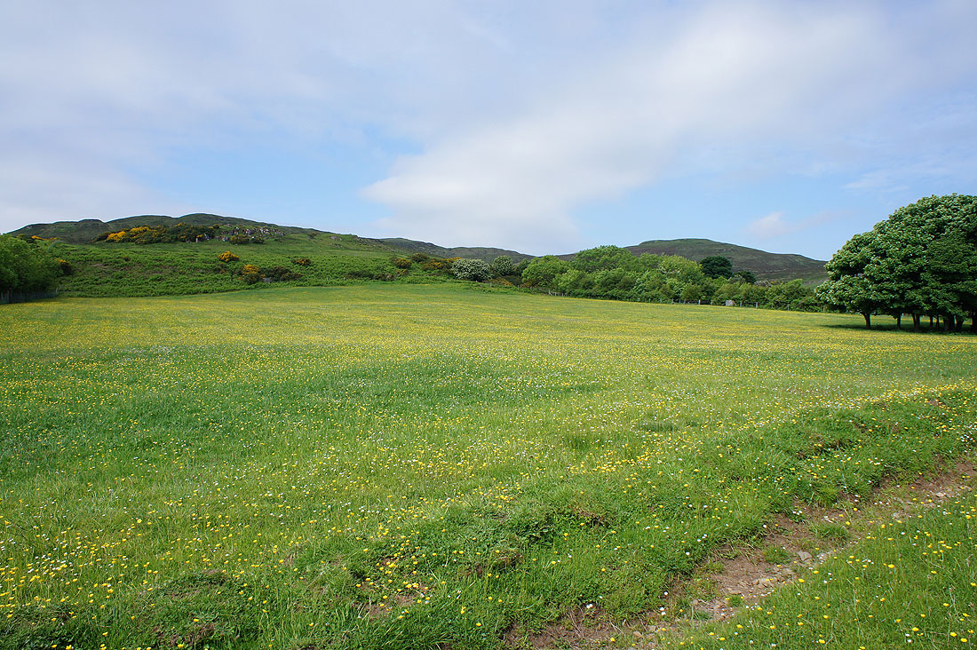
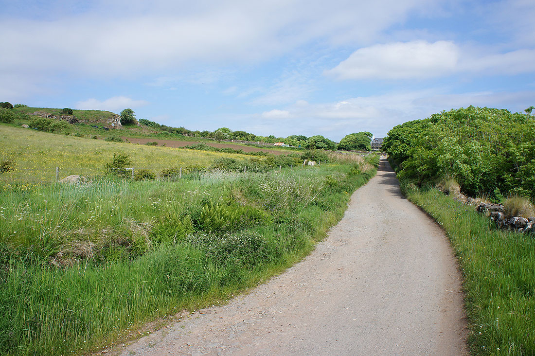
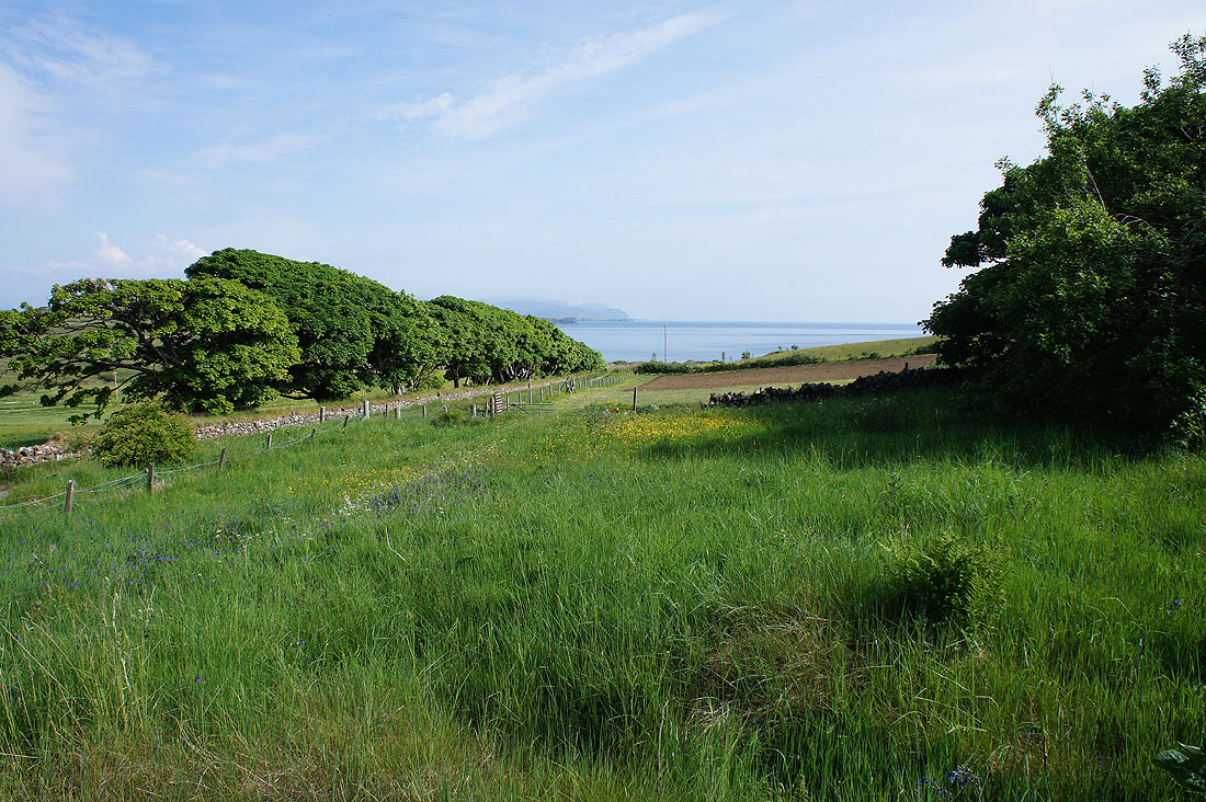
Blue skies and buttercup filled fields. It's a beautiful morning as I set off from Orbost Farm.
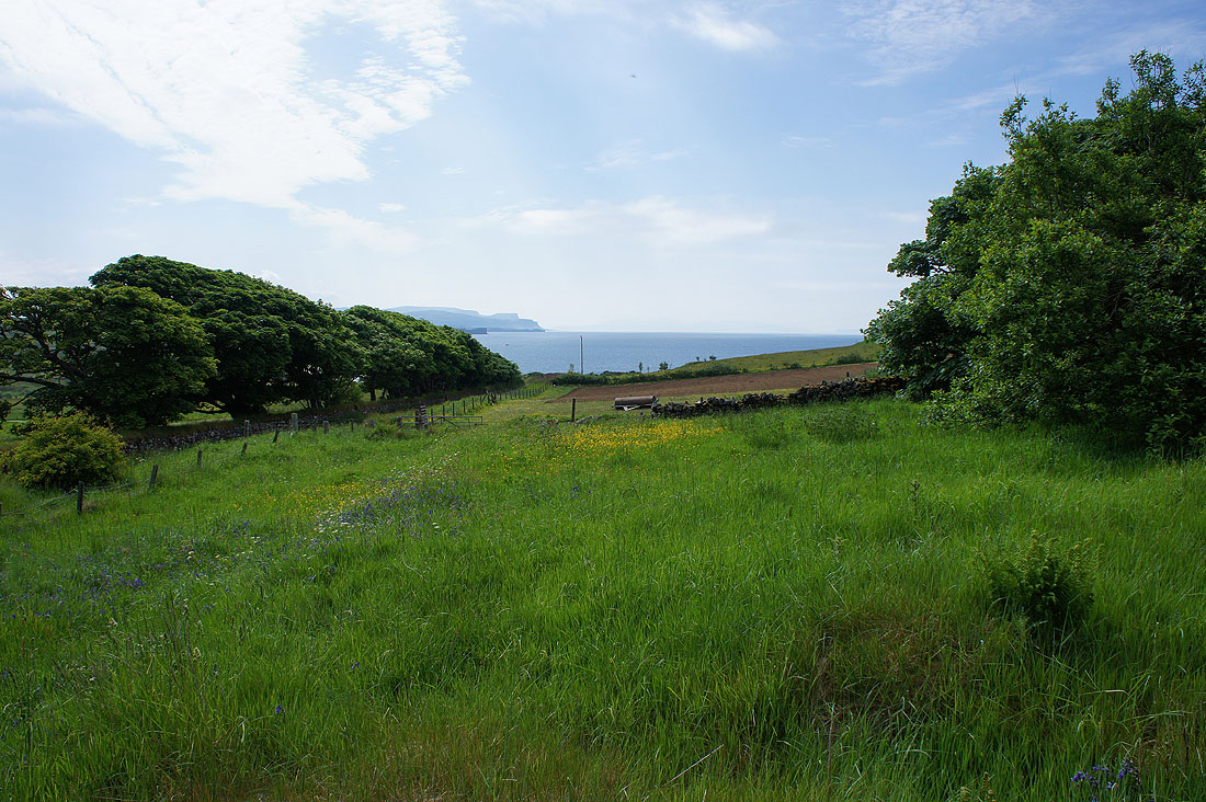
My first sight of the coast
and the track I'm on down to Loch Bharcasaig
Looking back to Orbost House
Approaching Loch Bharcasaig with the hills of Beinn na Boineid and Beinn Bhac-ghlais in the distance
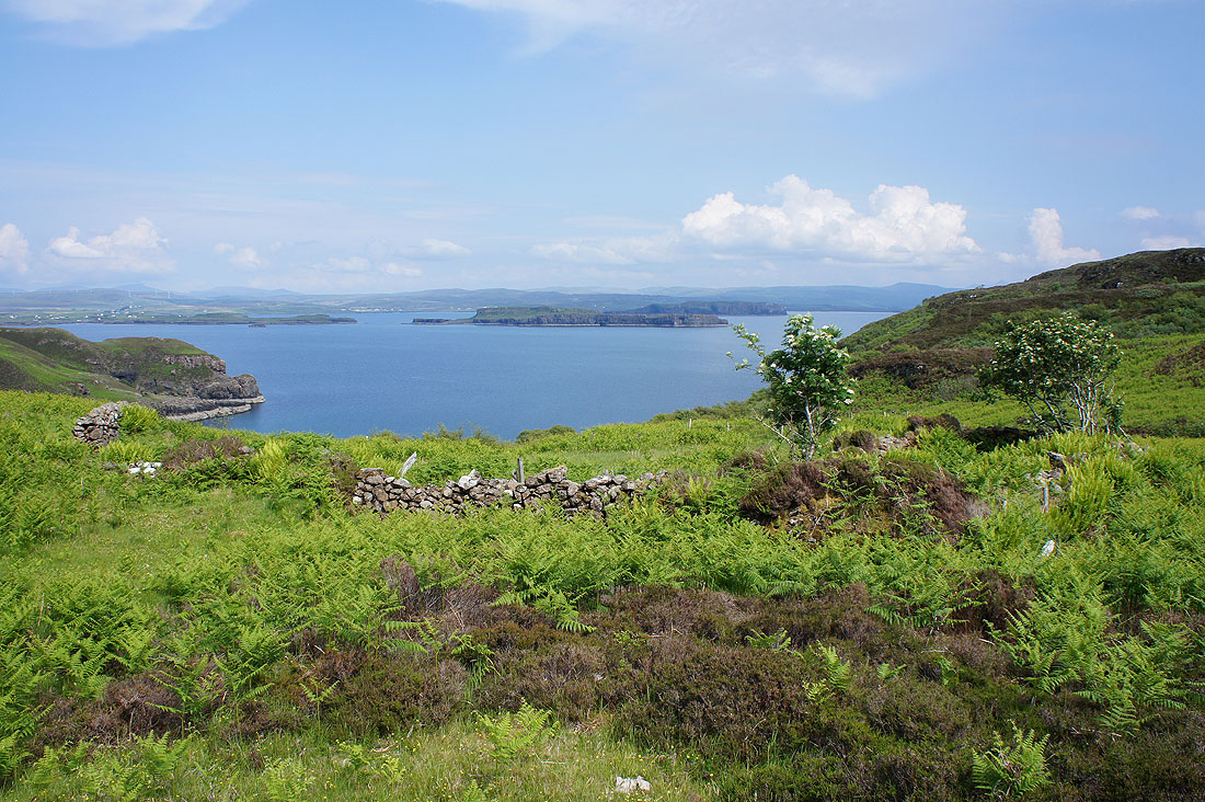
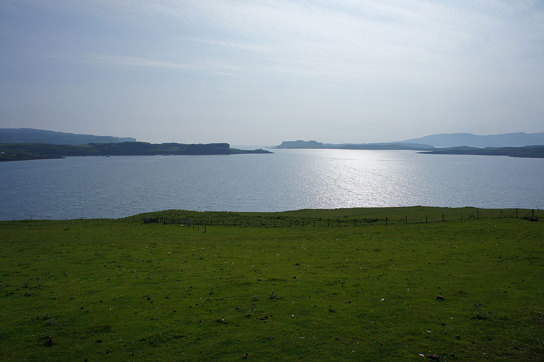
Looking south down Loch Bracadale
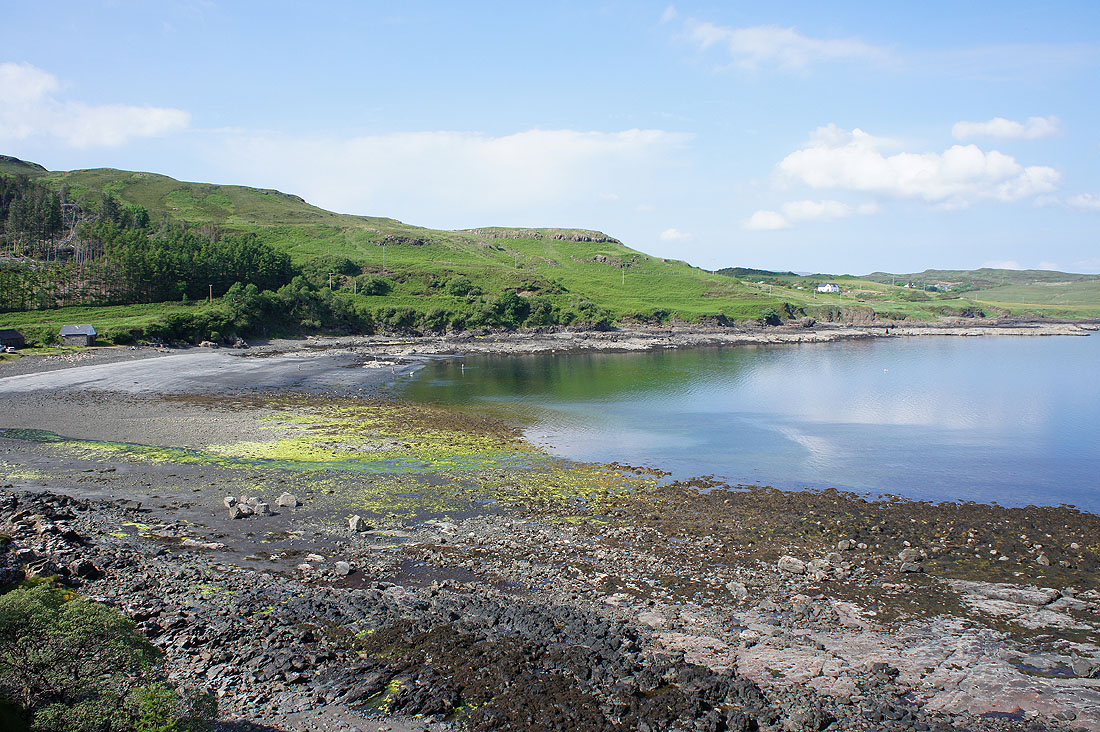
Loch Bharcasaig
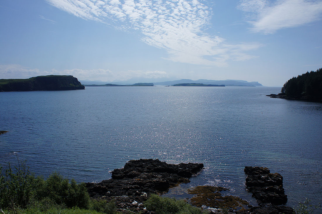
Looking out into Loch Bracadale to Harlosh Point and Harlosh Island
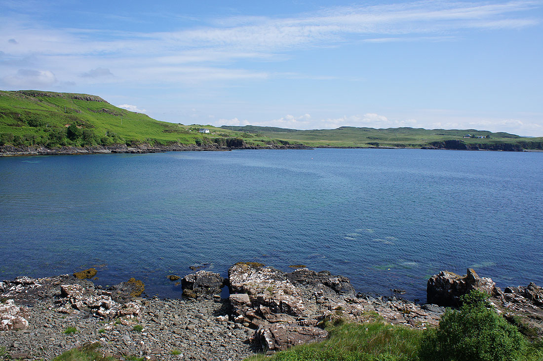
Loch Bharcasaig from its other side..
..before the track briefly goes through a conifer plantation
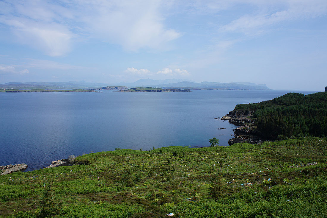
I'm soon back out into the open though. The conifers are nowhere near as extensive as they appear on the map. Great views across Loch Bracadale with the headland of Meall Greepa on the left and the hamlet of Harlosh on the peninsula in the distance.
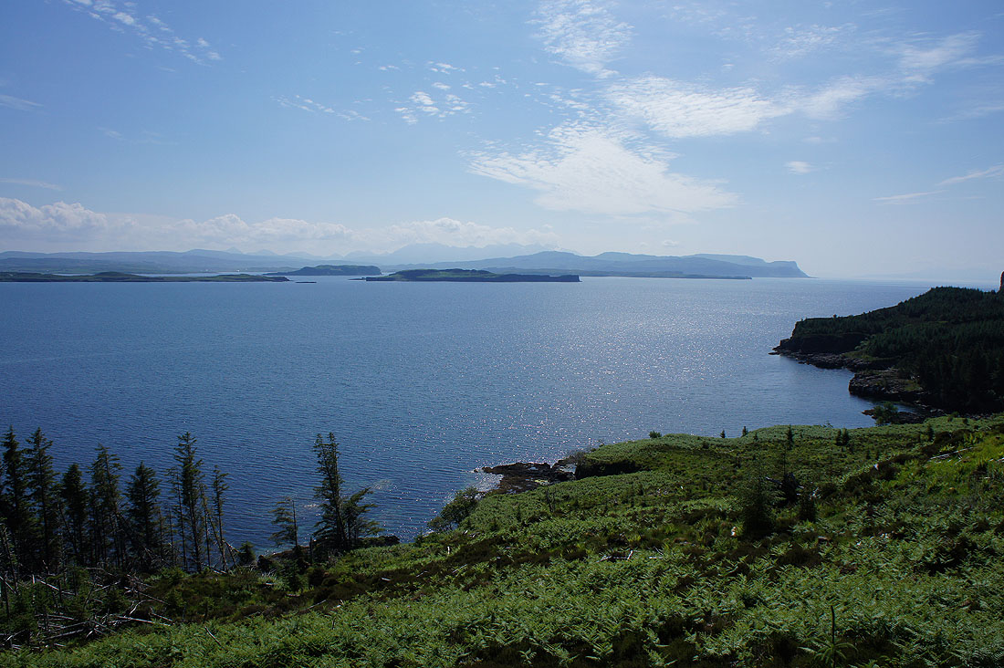
Harlosh Point, Tarner Island, Harlosh Island and the Cuillin and the coast of Minginish in the distance
|
|
The track is lined with Bird's-foot Trefoil as I approach and cross Forse Burn
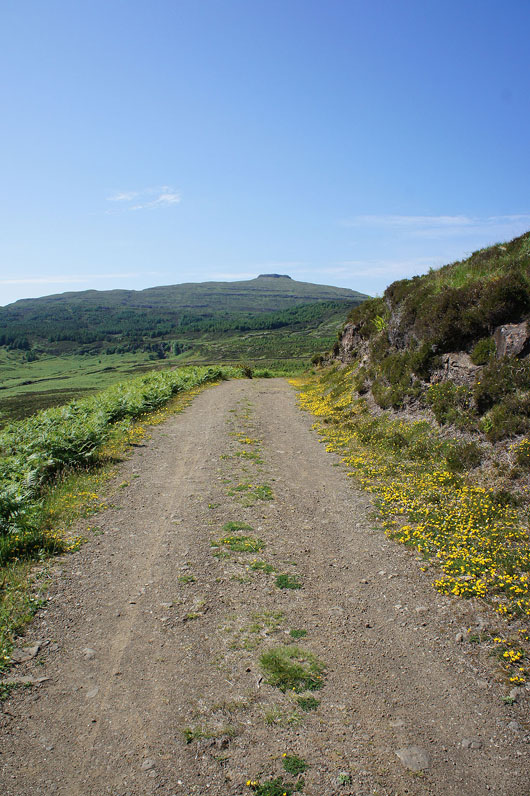
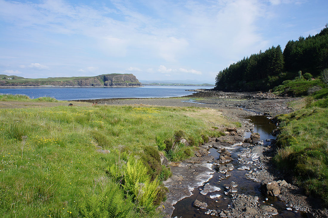
Once across Forse Burn the track became a path and after passing the hill of Beinn na Moine to my left I can now make out the coast to the south
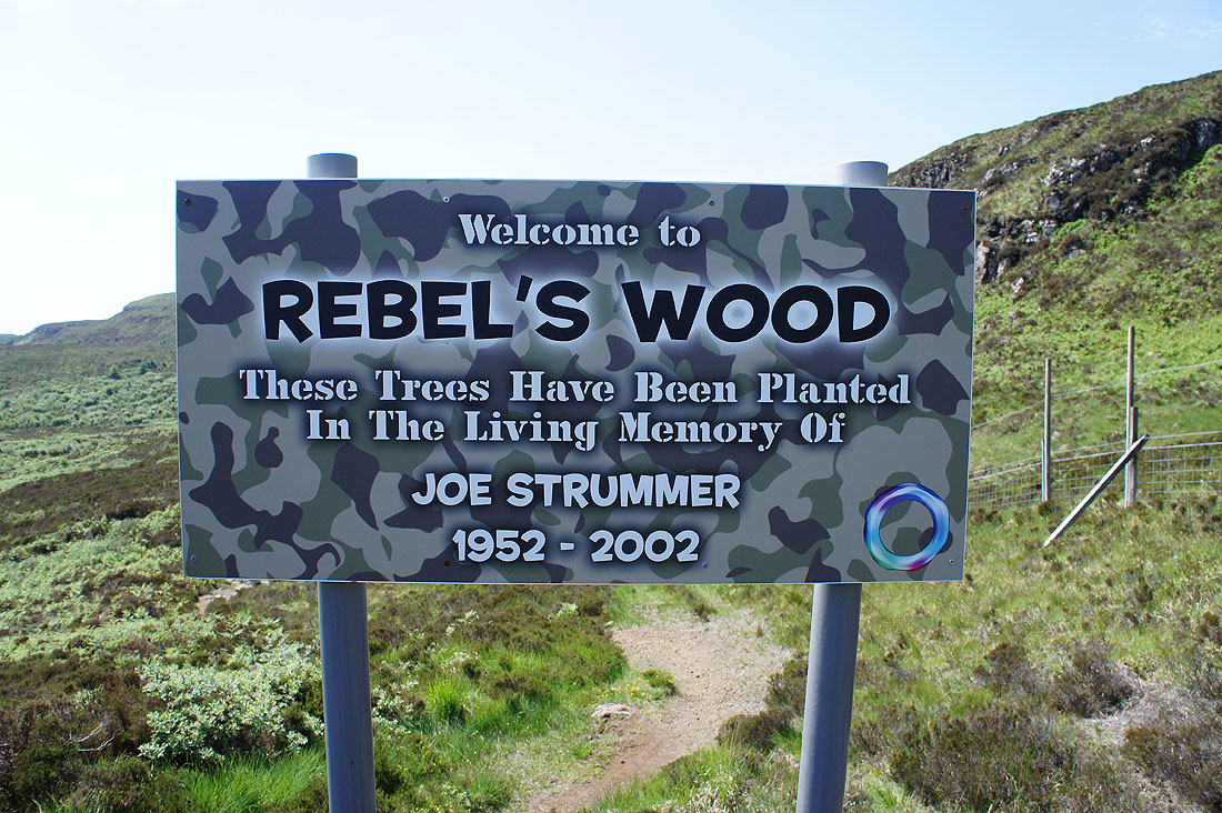
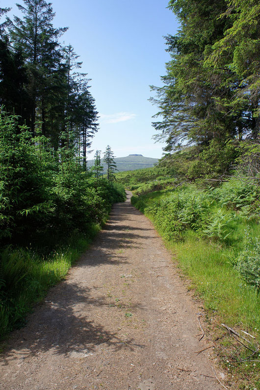
Into Rebel's Wood. New trees planted in the living memory of Joe Strummer of the punk rock band, The Clash.
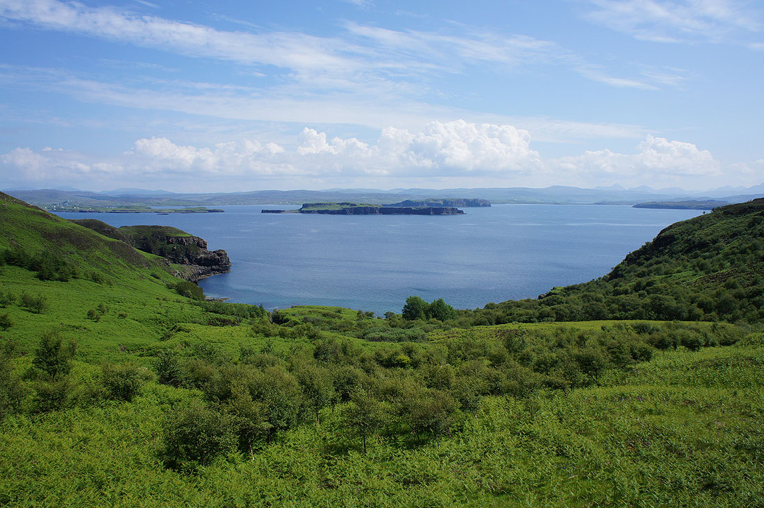
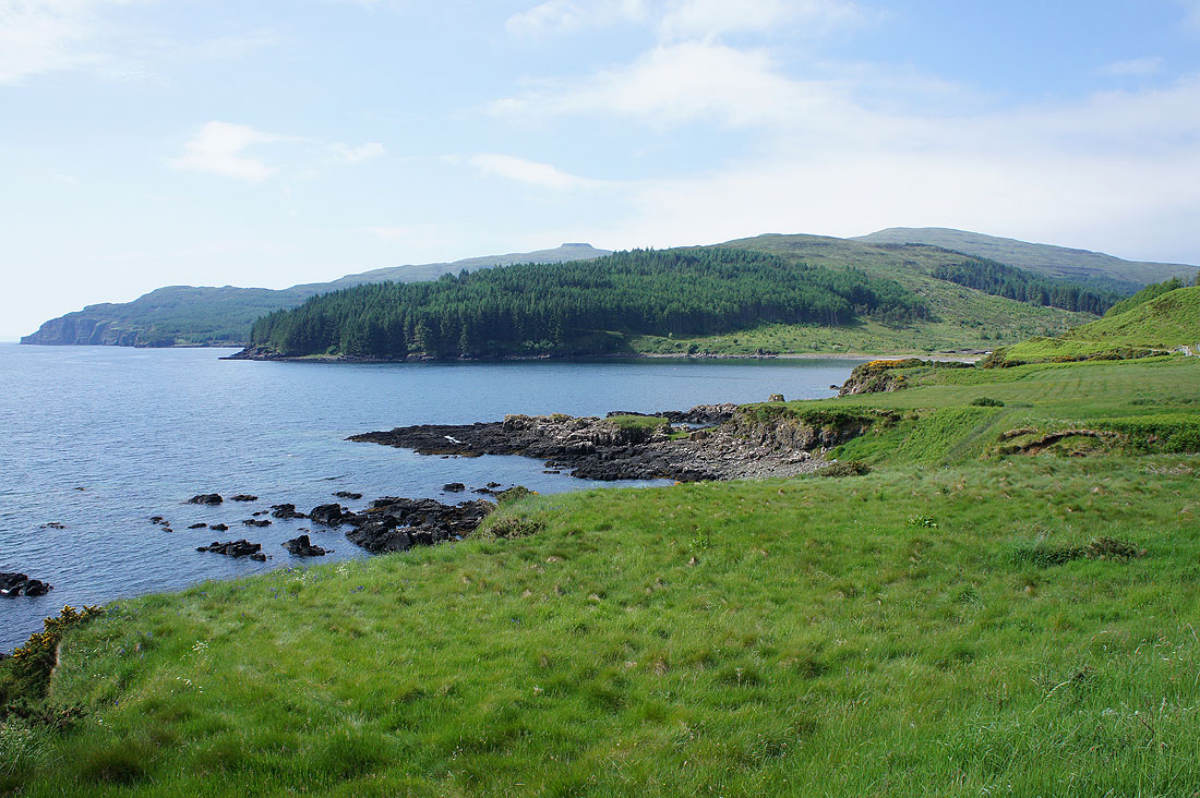
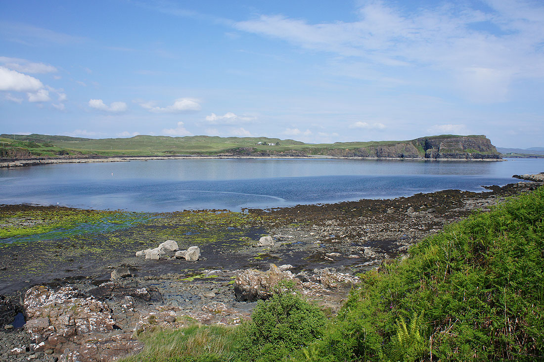
A lovely view out over Brandarsaig Bay to Harlosh Point, Harlosh Island and Tarner Island
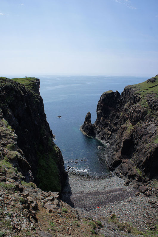
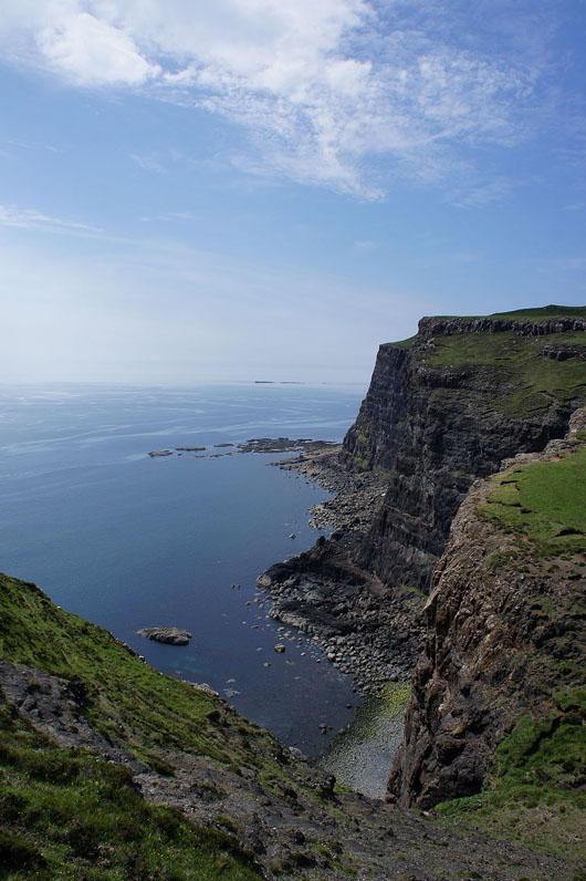
I know that I'm almost at Idrigill Point when I arrive at the top of the cove of Geodha nan Daoine
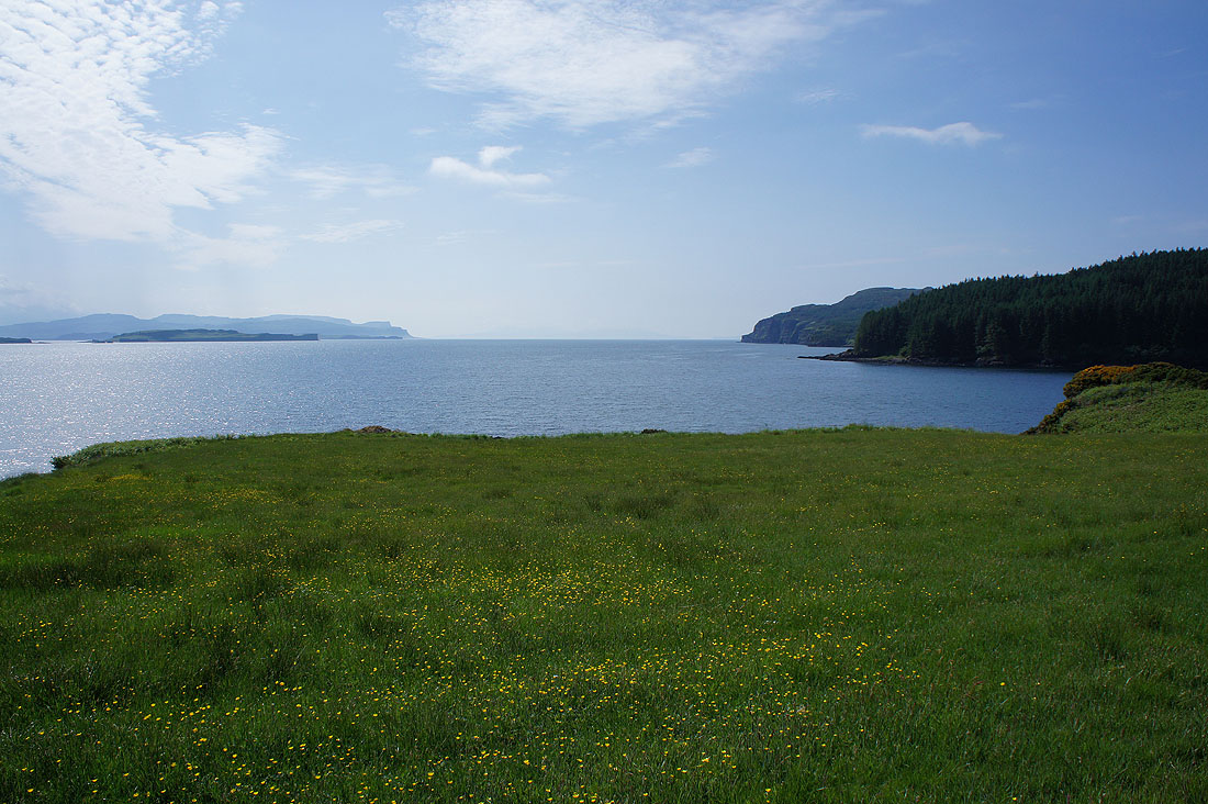
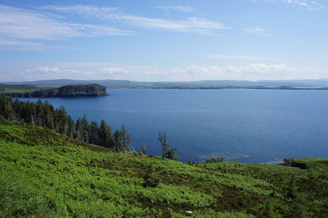
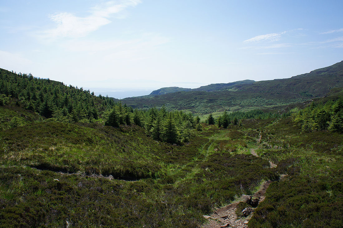
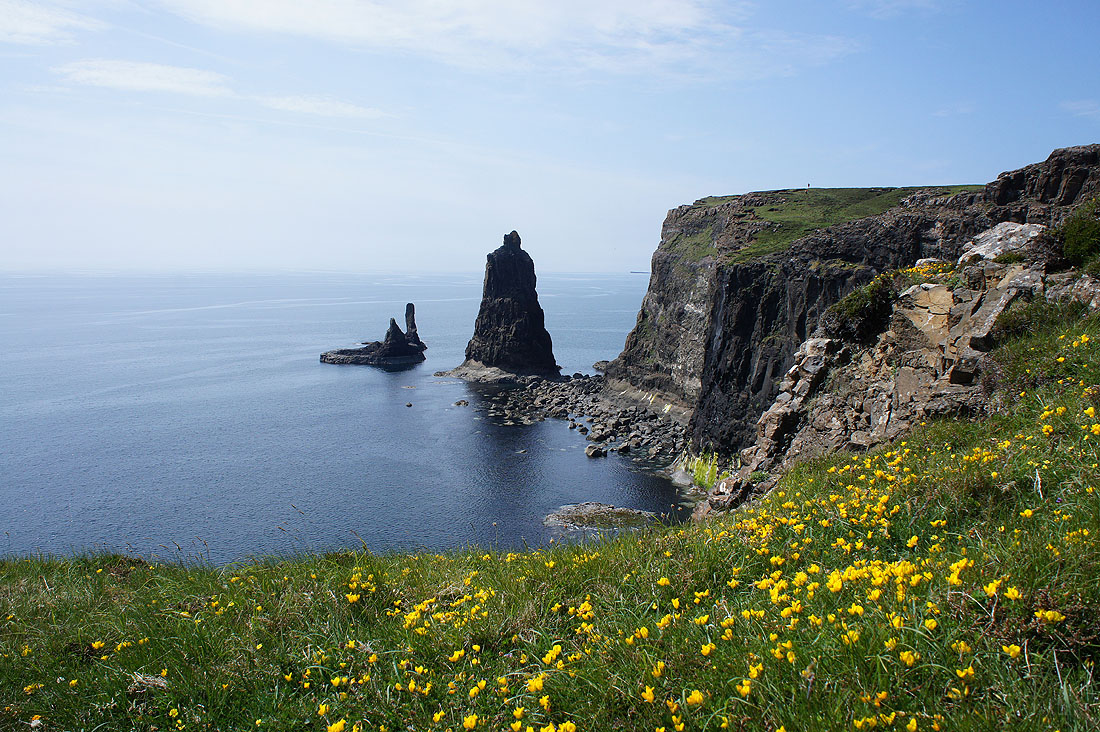
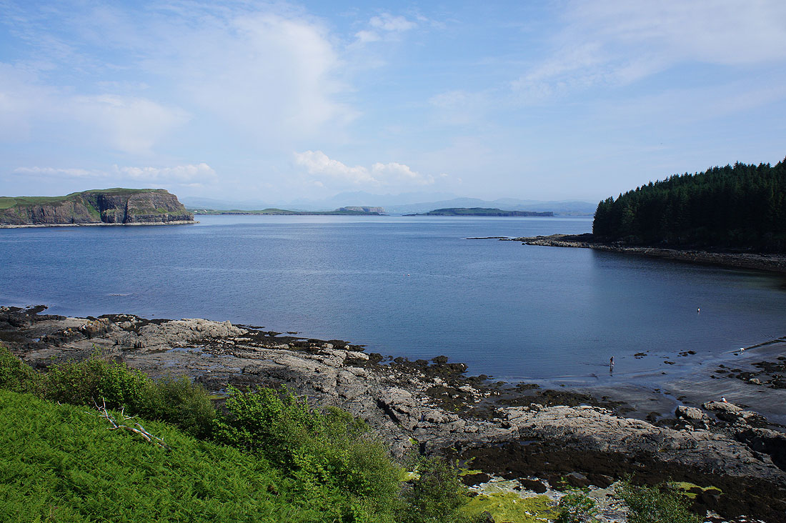
At Idrigill Point and this is where I stopped to have lunch. I spent a good hour here soaking up the atmosphere and taking in the fabulous cliff-top scenery. Looking across Loch Bracadale past the island of Wiay to Minginish and the Cuillin.
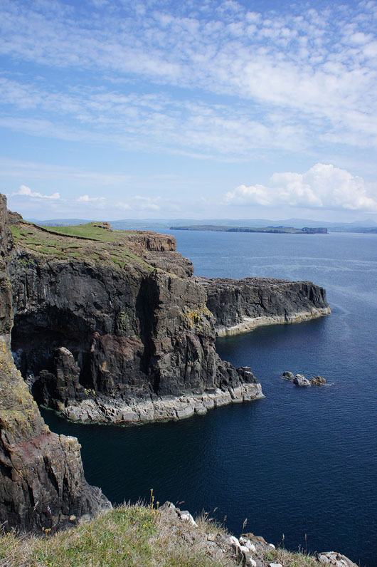
Caves and cliffs
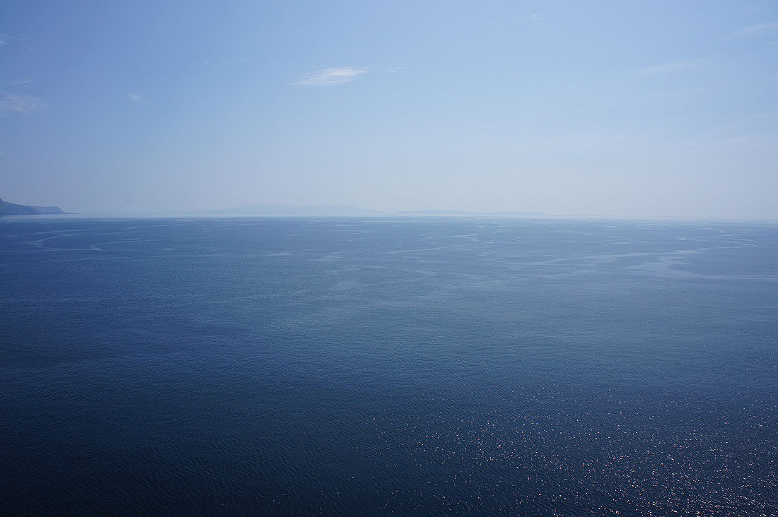
The islands of Rum and Canna across the sea to the south
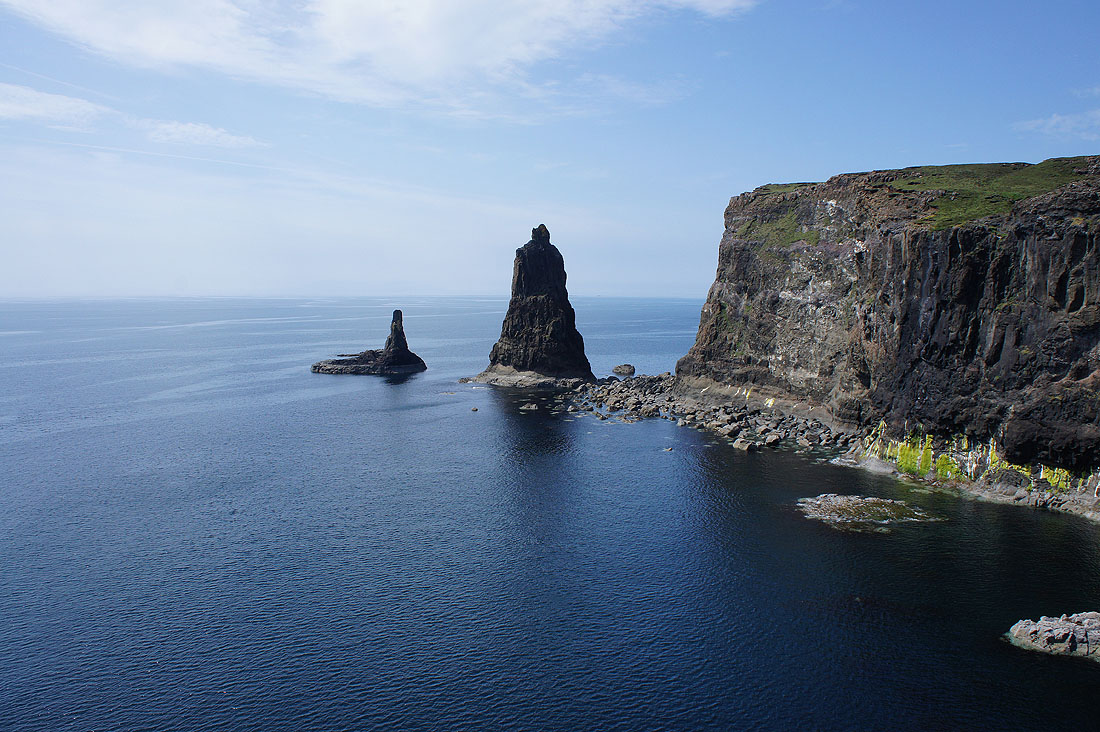
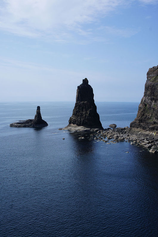
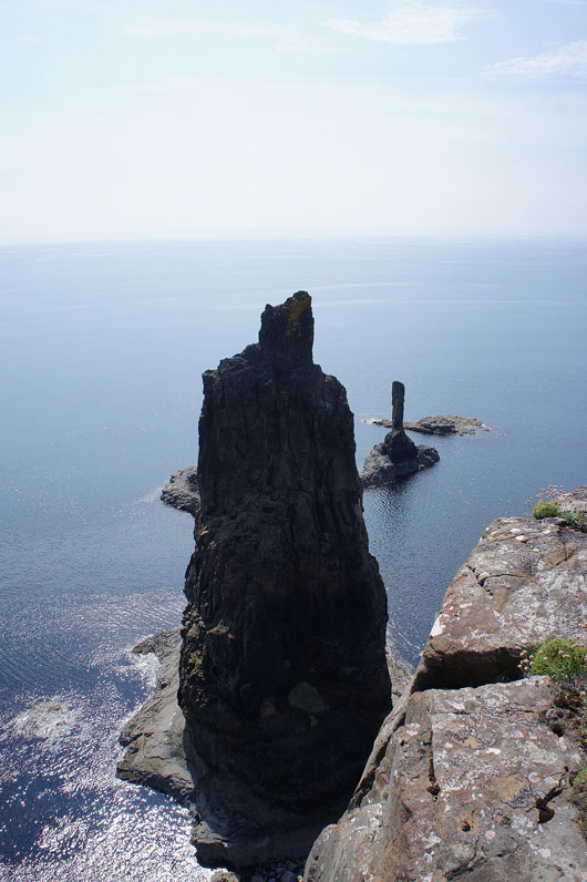
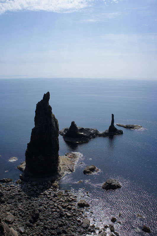
The sea stacks of Macleod's Maidens...
On the headland of Rubha na Maighdeanan looking back across to Idrigill Point
|
|
My view of the sea stacks changes as I walk round the headland so that in the right hand photo I can make out a number of kayaks below on the rock shelf of the tallest stack
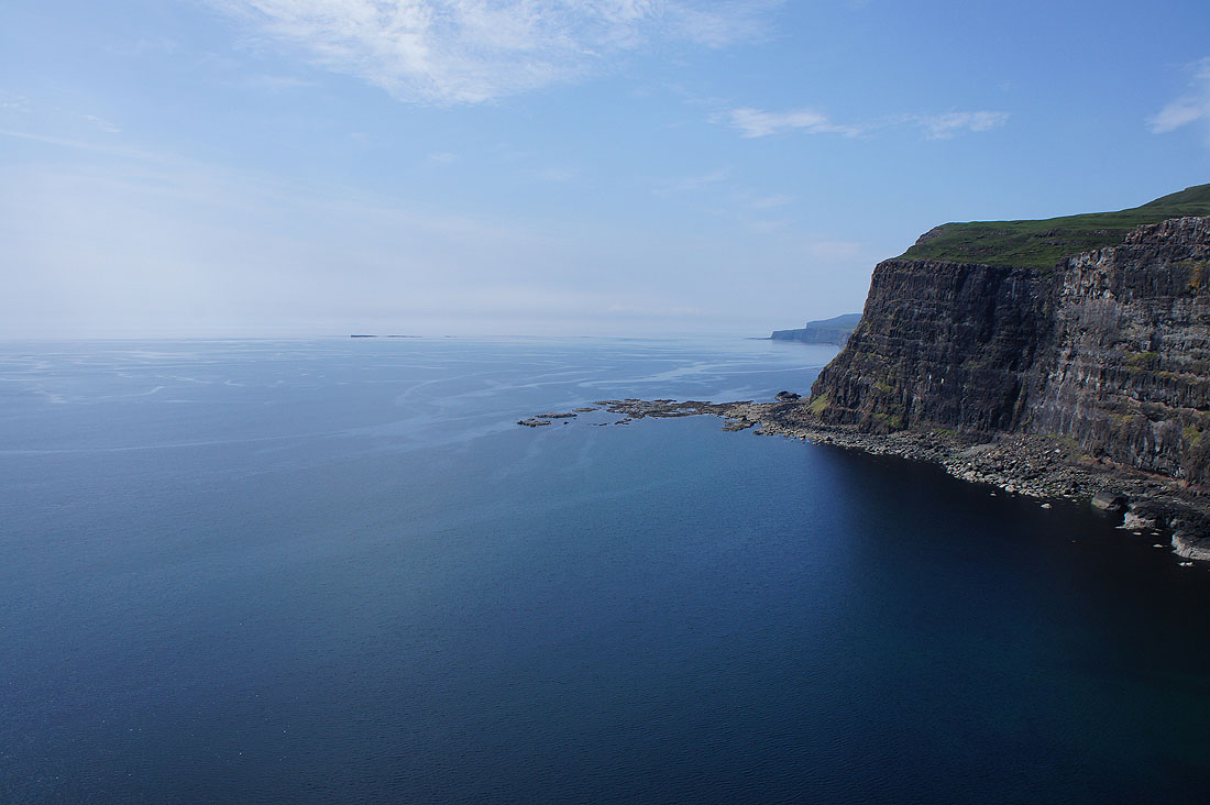
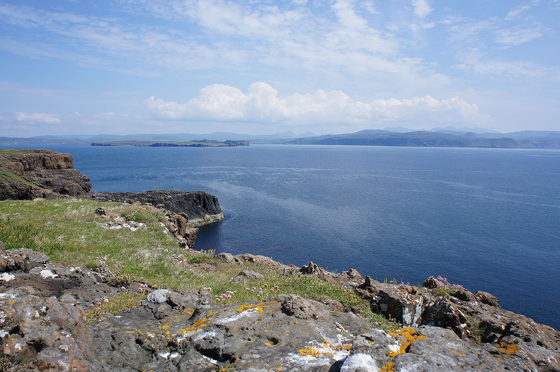
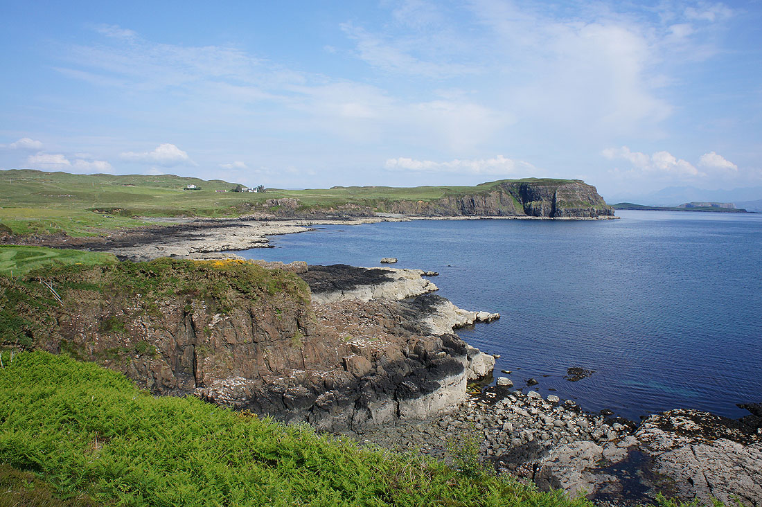
Looking northwest up the coast of Duirinish and its fabulous sea cliffs
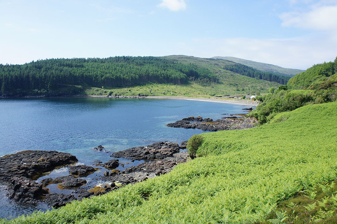
I finally leave the coast behind with a look down on the bay of Inbhir a' Gharraidh
Retracing my steps past one of the ruined crofts of Brandarsaig
and back on the path beneath Beinn na Moine to Forse Burn
I couldn't resist taking another photo of the view out across Loch Bracadale especially with the cliffs out there now illuminated by the sun moving round to the west
Back at Loch Bharcasaig and the tide had gone out since this morning..
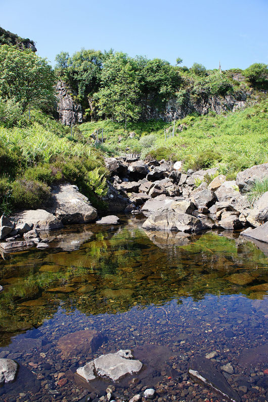
Abhainn Bharcasaig enters Loch Bharcasaig
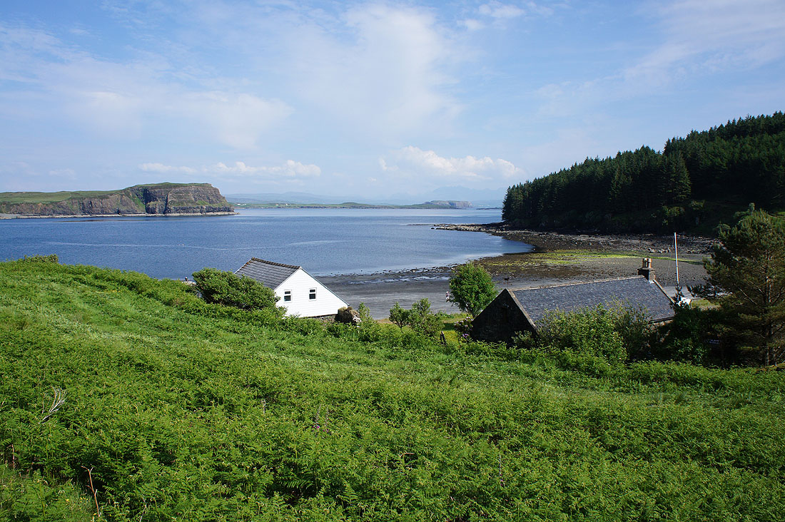
Those cottages have an enviable location looking out past the headland of Meall Greepa into Loch Bracadale..
A lovely view along the shoreline to Meall Greepa
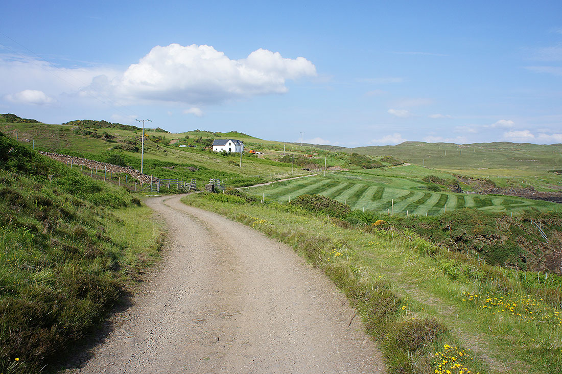
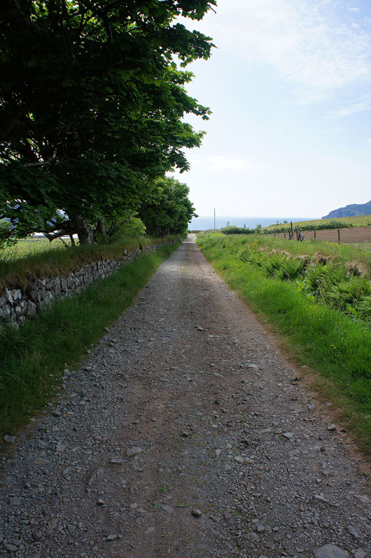
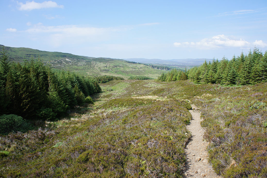
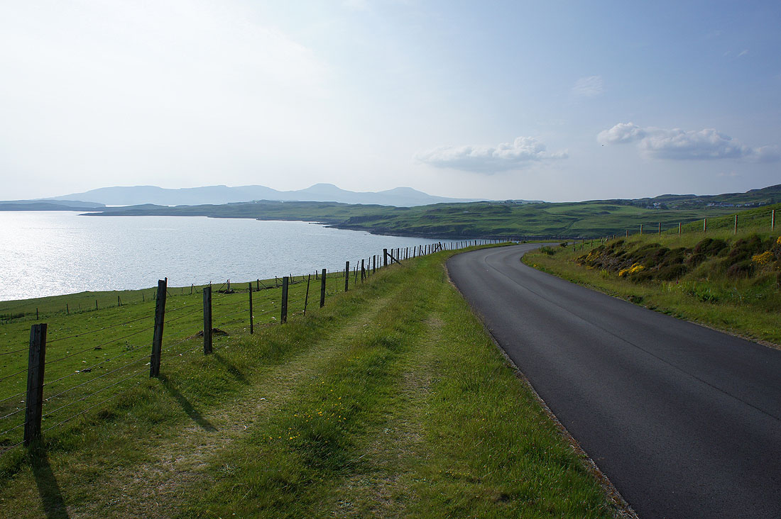
Back up the track to Orbost Farm
A last view back to the coast
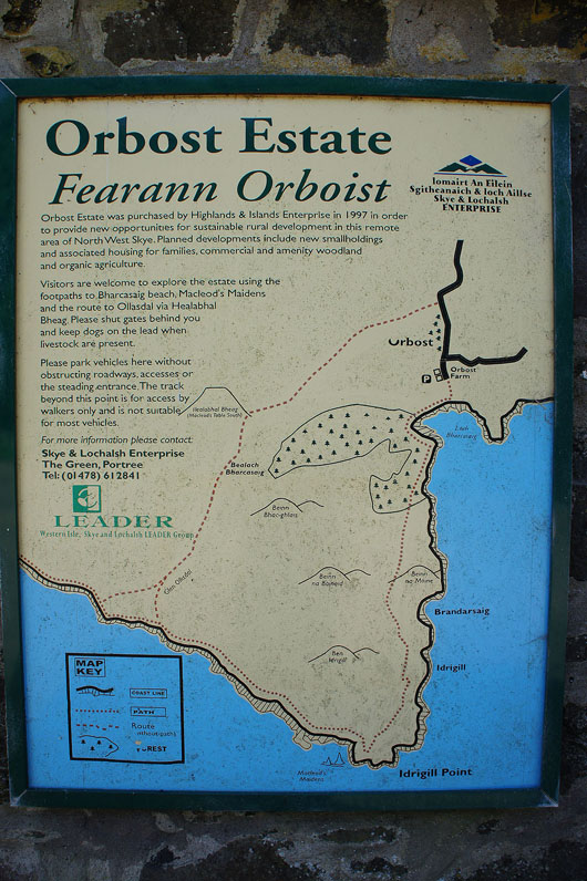
The information board at Orbost Farm as I finish the walk
I took a few more photos on the drive back to Harrapool. Just before I join the A863 at Heribost, Abhainn an Loin Mhoir enters Pool Roag.
I then stopped at a layby on the A863 signposted as a viewpoint, south of Struanmore. Looking across Gesto Bay to Cnoc Mhairtein and up Loch Harport to the Cuillin.
Looking west to Ardtreck Point, Oronsay and Ullinish Point
Finally, looking northwest to the distinctive flat topped hills of the Macleod's Tables on Duirinish